Remote Sensing Applications and Policies
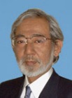
President | |
 | Haruhisa Shimoda
|
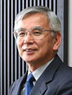
Vice-President | |
 | Yasushi Horikawa
|
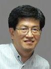
Scientific Secretary | |
 | Kohei Cho
|
Administrative Secretary | |
 | Yoshiaki Honda
|
Terms of Reference
- Forestry, vegetation, agricultural and biodiversity studies and applications;
- Hydrology, oceanography, coastal zone, snow and ice applications;
- Atmospheric and weather studies and applications;
- Geology, pedology and geomorphology studies and applications;
- Monitoring and management of land and water resources;
- Land use, human impact and ecosystem analyses;
- Disaster monitoring, mitigation and damage assessment;
- Hazardous waste and environmental pollution assessment;
- Infrastructure, transportation and communications studies and applications;
- Satellite and aerial remote sensing policies;
- Cooperation with international environmental programs and strategies;
- Earth Observation activities to support sustainable development.
WORKING GROUPS of ISPRS COMMISSION VIII
WG VIII/1 - Disaster Management
Co-Chair
T. Srinivasa Kumar
Secretary
Fabio Giulio Tonolo
WG VIII/1 Terms of Reference
- Generation of vulnerability and hazard zone maps for different type of disasters, such as forest fire, cyclone, floods, drought, volcano eruptions, earthquakes, land slides etc. and identification & assessment of potential risk zones
- Integrate remotely sensed observations and communication strategies with enhanced predictive modelling capabilities for disaster detection, early warning, monitoring, and damage assessment
- Development of disaster management plans for pre, during and post disaster situations and enhance support for early warning systems, emergency events mitigation and decision making.
- Collaborate with GEO and take part in GEO task where appropriate
WG VIII/2 Terms of Reference
- Integrate Earth observations products with enhanced predictive modelling capabilities for early warning and surveillance of environmental impacts on human health in co-operation with other international, national, and regional organizations and activities.
- Participate in the ICSU initiatives including the GeoUnions Health Group and the Science for Health and Well-being (SHWB).
- Take a leadership role in appropriate GEO health tasks in accordance with the 10-year implementation plan.
- Contribute to the ISPRS book series focusing on environmental effects on human health
- Develop a registry for human health projects and products that use Earth observations and kindred technologies
- Bridge the Earth observing communities of practice and human health communities of practice by including health professionals in ISPRS sanctioned technical sessions, workshops, and symposia
WG VIII/3 - Atmosphere, Climate and Weather
Secretary
Hideaki Nakajima
WG VIII/3 Terms of Reference
- Enhance retrieving and monitoring status and effects of clouds and aerosols.
- Enhance retrieving and monitoring status and effects of atmospheric greenhouse gases, like carbon dioxide, methane, etc.
- Enhance retrieving and monitoring capabilities of atmospheric minor constituents and aerosols both in stratosphere and troposphere.
- Enhance the monitoring capabilities of atmospheric winds.
- Increase the accuracy of atmospheric radiative forcing to contribute to the climate models.
- Increase the knowledge of atmospheric processes to improve the climate models.
- Improve the quality of remote sensing data input to numerical weather forecast system to increase the accuracy of weather forecasting and nowcasting.
- Collaborate with GEO and take part in GEO task where appropriate
Regional Coordinator
Christian D. Kummerow
WG VIII/4 Terms of Reference
- Implement remotely sensed data to monitor and investigate discharge of pollutants into water transportation and storage system for investigating sedimentation in reservoirs and contamination of water resources
- Adopt remotely sensed data for monitoring quality and quantity of water resources
- Integrate remote sensing and GIS data for rainfall runoff modelling
- Enhance the capability of monitoring global rainfall as well as snowfall
- Improve the retrieval of soil moisture and latent heat for better understanding of water and energy cycle
- Collaborate with GEO and take part in GEO task where appropriate
WG VIII/5 - Energy and Solid Earth
Co-Chair
Yoshiki Ninomiya
Co-Chair
Carlos Roberto de Souza Filho
WG VIII/5 Terms of Reference
- Adopt remote sensing data to non-renewable resource exploration, exploitation and related environmental monitoring, especially energy (hydrocarbons, geothermal and uranium) and minerals (precious, base metals and commercial minerals).
- Further the implementation and integration of higher level remote sensing products tailored for geological and geomorphological mapping, especially publicly available, continental-scale mapping opportunities.
- Help facilitate the development of geological and geomorphological product standards and related error assessment derived from remote sensing data
- Foster technology transfer through the sharing of convincing geological and geomorhological case histories derived from remote sensing data
- Help develop mechanisms that facilitate the uptake of geologic and geomorphologic remote sensing information products into Earth science applications, especially understanding the 3D and 4D (temporal) nature of the solid Earth, such as tectonic activity, hydrocarbon and minerals systems, water catchment modelling and monitoring, soil processes ( erosion, acidity, salinity and carbon), and dune systems(with Com.4/2 & 5/6)
- Collaborate with other ICSU GeoUnions; collaborate with GEO and take part in GEO task where appropriate
WG VIII/6 - Agriculture, Ecosystems and Bio-Diversity
Chair
Shibendu Shankar Ray
WG VIII/6 Terms of Reference
- Deofficer2 protocols and methodologies to efficiently and economically utilize remote sensing inputs to monitor crop production, crop vigor, and stresses for making agricultural decisions
- Development of techniques towards use of remote sensing data and GIS tools for site-specific management of agriculture
- Development of techniques towards use of remote sensing data and GIS tools for monitoring and analyzing human impacts to natural resources
- Improve the knowledge of carbon and nutrient cycles in vegetation
- Enhance the use of active sensors to evaluate and monitor biological and physical processes, which are important in agriculture ecosystems
- Improve the retrieval of crop land and grassland information from remote sensing data through advances in procedures and models for inventorying and monitoring of vegetation resources and biomass
- Study and promote vegetation bio-diversity and sustainable application with respect to the convention of bio-diversity
- Improve regional/global monitoring of mangroves using remote sensing data
- Assess climate change impact on vegetation using Earth observation data and forecasting models
- Integrate remote sensing data, in-situ and other measurements into a GIS domain to monitor and facilitate study and research of wet lands, and monitor spatial and temporal changes in the wet land and processes of wet land degradation
- Implement remote sensing and geospatial methodologies in support of sustainable development in wet lands and wet land resources assessment
- Collaborate with GEO and take part in GEO task where appropriate
Co-Chair
Ronald McRoberts
Secretary
Hirata Yasumasa
WG VIII/7 Terms of Reference
- Enhance the use of active sensors to evaluate and monitor biological and physical processes, which are important in forest ecosystems. (with Com.1/2)
- Improve the retrieval of forest information from remote sensing data through advances in procedures and models for inventorying and monitoring of forest resources, stocks and biomass.
- Apply remote sensing techniques and GIS tools to support forest management tasks. (with Com. 4/2, 4)
- Improve the knowledge of carbon cycle including NPP and NEP estimates using land remote sensing data
- Collaborate with GEO and take part in GEO task where appropriate
Co-Chair
Carsten Juergens
Co-Chair
Ryutarou Tateishi
WG VIII/8 Terms of Reference
- Improve the accuracy of land cover mapping and generate global and regional land cover maps
- Improve the accuracy of land cover change detection and generate global and regional land cover change maps
- Apply improved interpretation and mapping methods for urban, sub-urban and peri-urban land cover in transition to help for better urban planning using remote sensing data
- Monitor urban environment and land cover change for the study of urbanization structure and development processes
- Use remote sensing and GIS for infrastructure development of urban settlements
- Explore, document and monitor natural and cultural heritages (with Com 5)
- Integrate remote sensing data, in-situ measurements and other geospatial data to facilitate research, applications, and monitoring of arid lands, rangelands and soils
- Improve the monitoring of spatial and temporal environmental changes in arid environments and processes of land degradation, desertification, salinization, wind and water erosion, ecohydrology, and biogeochemical cycling
- Implement remote sensing and geospatial methodologies in support of sustainable development in arid lands, land resources assessment and management of arid and dry lands
- Collaborate with organisations such as FAO to improve land use classification schemes
- Collaborate with GEO and take part in GEO task where appropriate
Co-Chair
Samantha Lavender
WG VIII/9 Terms of Reference
- Measure, characterize, understand, and predict, the storage and transport of momentum, heat, water (salinity), and greenhouse gases in the ocean and the surface signatures (temperature, salinity, dynamic topography) of ocean response and the surface forcing (wind stress, fresh water, turbulent and radiative heat flux) from diurnal to decadal time scales, and from coastal to open oceans.
- Understand ocean's role in the changes and interaction among the biological, chemical , and energy/water cycles in the oceans and their influence on terrestrial and cryospheric changes.
- Coordinate present and future space missions related to ocean observation, and the calibration, validation, and dissemination of their data.
- Collaborate with GEO and take part in GEO task where appropriate
WG VIII/10 Terms of Reference
- Improve the retrieval of geophysical parameters relevant to the different elements of the cryosphere.
- Develop strategies and algorithms for assimilating remotely sensed data in models of polar processes.
- Develop long term records and study on-going changes in polar regions.
- Study the changes of ice sheets in Antarctic and Greenland.
- Study the trends and changes of glaciers and glacier lakes.
- Study the trends and changes of sea ice.
- Study the trends and changes of snow cover and snow albedo.
- Monitor the thaw process and changes of permafrost.
- Collaborate with GEO and take part in GEO task where appropriate