|
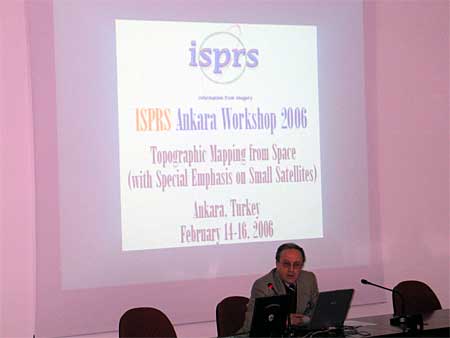
(With Special Emphasis on Small Satellites)
WG I/5 & I/6
Ankara, Turkey, February 14-16, 2006
By Ugur Murat Leloglu
 Parallel to developments in space technologies, new sensors turn out to be available to mapping community, either active sensors (SAR, InSAR) or passive sensors with increasing spatial and spectral resolution. Besides, introduction of small satellites gives new opportunities and independencies, may decrease the cost of images taken from space and can lead to daily revisit capability. In addition to new sources of data, increasing use of the Internet, automation software and the international trend of integrating space systems have an impact on how geospatial information is produced, refined and updated. There are also questions about calibration, continuity, compatibility etc. of small satellite imagery, needs to be answered to foster widespread use. Parallel to developments in space technologies, new sensors turn out to be available to mapping community, either active sensors (SAR, InSAR) or passive sensors with increasing spatial and spectral resolution. Besides, introduction of small satellites gives new opportunities and independencies, may decrease the cost of images taken from space and can lead to daily revisit capability. In addition to new sources of data, increasing use of the Internet, automation software and the international trend of integrating space systems have an impact on how geospatial information is produced, refined and updated. There are also questions about calibration, continuity, compatibility etc. of small satellite imagery, needs to be answered to foster widespread use.
In this context, an ISPRS workshop was held in Ankara Turkey, from 14 to 16 February 2006. The workshop has been organized by "WG1.5 Geometric Modelling of Optical Spaceborne Sensors and DEM Generation" and " W.G 1.6 Small Satellites".
The auditorium that workshop was held was next door to the Ground Station where BiLSAT earth observation satellite is controlled and upstairs to the clean room where RASAT earth observation satellite is being built.
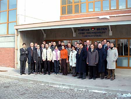 Workshop opened with the talk by General Secretary Orhan Altan and Commision I Secretary, Nicolas Paparoditis. During the workshop, 31 presentations was made in 7 sessions. Three of the presentations were keynote speeches made by John Trinder, Gottfried Konecny and Rainer Sandau. Workshop opened with the talk by General Secretary Orhan Altan and Commision I Secretary, Nicolas Paparoditis. During the workshop, 31 presentations was made in 7 sessions. Three of the presentations were keynote speeches made by John Trinder, Gottfried Konecny and Rainer Sandau.
The workshop has provided a good platform for scientists to exchange information on the following topics:
- Comparison of existing and evolving algorithms for geometrical modeling of space images under operational conditions including direct georeferencing capabilities and special conditions for 2 and 3-line sensors
- Intensified and detailed study on the accuracy and cost effectiveness of various DEM data acquisition techniques, algorithms for generating DEMs from space acquired data
- Use of high-res space images, SAR/InSAR systems and hyperspectral images in topographic mapping
- Integrated platform guidance, navigation, positioning and orientation
- Geometric quality requirements for advanced optical systems for extracting DEM
- Space system and sensor calibration
- Small satellite missions for Earth observation and system performances
- Potential and shortcomings of small satellites for topographic mapping
- Current and future sensor systems for small satellites
- Use of small satellites for topographic mapping in developing countries
On 15 February afternoon, a half-day visit was made to the Old City of Ankara and to the Museum of Anatolian Civilizations, which is the third important archeological museum after Paris-Louvre and London-British museums, with its wide collection of Paleolithic, Neolithic, Hatti and Hittite works of art.
|