Click on this
link
if you cannot read this email.

 |
| |
| |
 |
|
ISPRS e-Bulletin
Issue No 4 - 2018
|
 |
| |
|
 |
|
Quick Links
|
 |
| |
 |
|
Editorial
 |
|
The XXIVth ISPRS Congress
14-20 June 2020 in Nice, France
by Nicolas Paparoditis
Congress Director

The XXIVth ISPRS Congress (http://www.isprs2020-nice.com), which is the congress of the geospatial community every four years, will take place in 2020 in the gorgeous city of Nice, on the Mediterranean Sea, from June 14 to 20. Nice is the cosmopolitan and multicultural capital of the French Riviera and is an outstanding location between the sea and the Alps, close to the Italian border, where culture and heritage meet with the cutting edge technology of Sophia Antipolis, the French Silicon Valley. The Acropolis Congress Centre is in the heart of the city, 4 minutes walk from the old town of Nice, 10 minutes walk from the beaches, and 17 minutes by tramway from the airport.
The ISPRS 2020 congress will cover a full week. A rich program will enable participants to remain, on the one hand, at the state-of-the-art on the current trends in science, technology and business, and to meet and network with a very large number of experts, and on the other hand to cross-fertilize with colleagues coming from neighbouring fields. This Congress will gather leading specialists and technologists, engineers, researchers and students in the field of photogrammetry, remote sensing, and spatial information sciences coming from universities, research foundations, mapping and spatial agencies, public organisations and private companies, and end-users.
During the week, six parallel tracks will be science-oriented and will be devoted to the presentations of new high quality contributions in the scope of the five technical commissions of ISPRS (sensor systems, photogrammetry, remote sensing, spatial information science, education and outreach). Another scientific track will address special thematic subjects. Besides these scientific tracks, two other tracks will take place. A fora track will address the interaction between science, public organisations, industry, and decision makers on hot topics for our geospatial community (global mapping & resource monitoring, smart-cities, autonomous navigation, digital globes & geoplatforrms, open-science & open-source & open-data). An industry track will also be introduced for the first time and will be dedicated to industry presentations of new technologies and products. A Networking event, comprising a speed dating will also take place with the purpose of enabling students and professionals to meet companies.
The ISPRS 2020 congress will also hold a 3 day strong industrial exhibition with both private and public companies. This exhibition will give one the unique opportunity to get updated in the advances of new geospatial technologies and solutions (satellite systems, lidar systems, hyperspectral imaging systems, mobile mapping systems, UAVs, virtual and augmented reality devices, serious games, 3D printing, GeoBigData processing, GIS technologies, geo-data warehouses, geo-visualisation, geo-services, VGI-technologies, Spatial Data Infrastructures, etc.) and their applications (digital globes and portals, web services for geo-platforms, very high resolution mapping, UAV data acquisition and mapping, road mapping, roadworks, underground and indoor mapping, cultural heritage, geodecision making, urban planning, smart and sustainable cities, 3D city models, 3D road and street models, virtual and augmented reality geovisualisation, autonomous navigation and driving, street mobility diagnosis for disabled, etc.).
The ISPRS 2020 Congress will be hosted by SFPT (the French Society of Photogrammetry and Remote Sensing), and will be organized with the support of the major French public institutions dealing with photogrammetry, remote sensing and spatial information sciences. The ISPRS Congress Director is Nicolas Paparoditis, member of the ISPRS council and the director of research and education at IGN-France. For any specific information on the congress please send an email to: contact@isprs2020-nice.science
|
|
 |
| |
 |
|
The ISPRS Foundation (TIF) News
|
 |
|
TIF Activities 2018 - Travel Grants to Midterm Symposia I to IV

During the first 10 months of 2018, ISPRS and The ISPRS Foundation (TIF) granted 32 Travel Grants to students and young professionals from developing countries to attend the ISPRS Midterm Symposia for Technical Commissions I, II, III and IV. The early career scientists and practitioners travelled from over 19 countries to attend Symposia in Karlsruhe, Germany (TC-I), Riva del Garda, Italy (TC-II), Bejing, China (TC-III) and Delft, The Netherlands (TC-IV). Totaling approximately 20,000 USD, the ISPRS-TIF Travel Grants brought individuals from every continent, excluding Antarctica, to the foremost event of the 4-year term of each Technical Commission. Grant recipients were active participants in the Symposia, presenting posters and oral presentations, publishing in the ISPRS Archives and Annals, and joining both technical discussions and cultural exchanges. Although their experiences may sometimes lead to academic and professional opportunities, they always lead to new friendships and exposure to the latest research and advancements in geospatial sciences.
This month, ISPRS/TIF Travel Grants will be offered to selected recipients to attend the remaining Technical Commission V Symposium to be held 20-23 November in Dehradun, India.
TIF is a non-profit entity established in 2003 and managed by a Board of Trustees responding to ISPRS grant needs that are identified by the ISPRS Council. The ISPRS Foundation depends on individual donations and contributions from ISPRS and ISPRS-sponsored events. Donations to the non-profit TIF may be mailed directly to TIF Finance Officer, Marguerite Madden (Department of Geography, University of Georgia, Athens, Georgia, USA 30602, mmadden@uga.edu for details) or via the TIF PayPal donation link on the TIF website:
http://www.isprs.org/foundation/donations/make.aspx

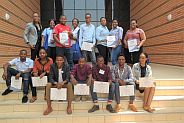
Group photo of TIF Finance Officer, Marguerite Madden with recipients of ISPRS/TIF Travel Grants at the 2018 ISPRS Technical Commission IV Symposium in Delft, The Netherlands
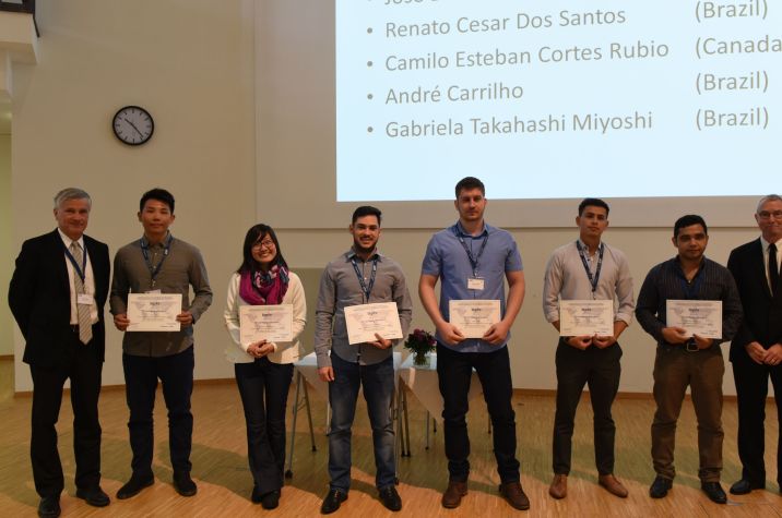
ISPRS 2nd Vice President, Charles Toth and TIF Chair, Stewart Walker with TIF Travel Grant Recipients at the Technical Commission I Symposium, in Karlsruhe, Germany
|
|
 |
| |
 |
|
Society News
|

|
|
ISPRS seeks Comments on Restructuring of Council

In recent months, Council has assessed the internal structure of the ISPRS governing body and is now suggesting some changes to be implemented at the ISPRS Nice Congress.
In preparation of these changes, ISPRS is seeking comments from the whole community and to this end has opened a blog, see http://www2.isprs.org/news/blog/detail/council-restructuring.html. May I ask you to please let us have your comments until Jan. 31, 2019 at the latest, so that we can continue the discussions and prepare an update in time to bring the issue to the General Assembly in Nice.
Thank you very much in advance and all the best.
Yours sincerely,
Christian Heipke
ISPRS President 2016-2020
|
|

|
|
ConfTool - Software for Paper and Registration Management Free of Charge for ISPRS Events

One of the important targets of ISPRS is to permanently improve quality of the science results presented at any ISPRS events. ISPRS proceedings are the main scientific result of these meetings.
For many ISPRS events, the paper management system ConfTool has been successfully employed in the recent past. Examples include big events such as the 2016 Prague Congress, but also small meetings with only a few dozen papers. ConfTool can be set up to handle all requirements of the reviewing process, both for The International Archives of the Photogrammetry, Remote Sensing and Spatial Information Sciences, and the ISPRS Annals of the Photogrammetry, Remote Sensing and Spatial Information Sciences.
In order to harmonize the submission and reviewing system for all participants of the events, Council decided to recommend ConfTool to all organisers of ISPRS events, and to cover the expenses for this tool. Note that ISPRS events are events where ISPRS is the main organiser, for events co-sponsored by ISPRS this offer is not valid.
For more information about the approval of ISPRS events, please contact ISPRS Secretary General at isprs-sg@isprs.org.
For more information about the reimbursement and its policy, please contact ISPRS Treasurer at isprs-tr@isprs.org.
Details of ConfTool can be found at https://www.conftool.net/en/index.html.
There are two types of service options: VSIS ConfTool for small events (less than 150 participants) and ConfTool Pro for events with more than 150 participants.
|
|

|
|
ISPRS International Journal of Geo-Information 2019 Travel Awards for PhD Students

The ISPRS International Journal of Geo-Information is inviting applications for two Travel Awards (800 Swiss Francs each) for PhD students to attend a conference in 2019. The nominations and applications will be assessed by an Evaluation Committee chaired by the Editor-in-Chief of ISPRS International Journal of Geo-Information: Prof. Wolfgang Kainz.
Application information can be found here…
|
|
|
|
ISPRS WG I/3 announces the Publication of the SEN1-2 Dataset for Deep Learning in SAR-Optical Data Fusion

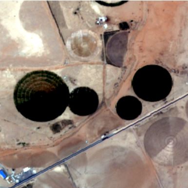
In accordance with their terms of reference (SAR big data provided by Sentinel-1, fusion of SAR and complementary data), ISPRS WG I/3 is happy to announce the publication of the SEN1-2 dataset for the fostering of deep learning approaches in SAR-optical data fusion. SEN1-2 consists of 282,384 pairs of corresponding Sentinel-1 SAR and Sentinel-2 optical image patches, collected from across the globe and throughout all meteorological seasons. It is intended to support the introduction of computer vision approaches to multi-sensor remote sensing and can be used for studies on image matching, image-to-image translation, or image colorization, to name just a few examples.
The dataset was officially released in the frame of the ISPRS TCI Mid-Term Symposium 2018 in Karlsruhe, with a corresponding paper published in the ISPRS Annals of the Photogrammetry, Remote Sensing and Spatial Information Sciences. Interested colleagues can have a look at the paper at https://www.isprs-ann-photogramm-remote-sens-spatial-inf-sci.net/IV-1/141/2018/. The dataset can be downloaded from https://mediatum.ub.tum.de/1436631 under a CC-BY license.
|
|

|
|
Postal Ballot approves new Regional Member for the Pacific

A ballot among Ordinary members approved the transfer of Regional membership for the Pacific from SPC Geoscience Division to the Pacific GIS and Remote Sensing Council (PGRSC).
The objects of PGRSC are:
- To promote the development of GIS and Remote Sensing (RS) data, technologies, methods and services for the pacific region;
- To enable collaboration and share lessons learnt across regional agencies and commercial parties;
- To discuss and establish methods in building adaptation for the Pacific environment for solutions working already well outside the region;
- To manage the distribution, publication and awareness of conference outcomes;
- To establish robust links with other GIS, RS and scientific bodies regionally and globally.
Council welcomes PGRSC to ISPRS and looks forward to continued cooperation in the Pacific Region. We also thank SPC Geoscience Division for its collaboration in the past.
Further information on PGRSC can be found at http://www.picgisrs.org/
|
|

|
|
New Sustaining Member GeoCloud Ltd.

GeoCloud Ltd. is an Israel-based company offering a software-as-a-service (SaaS) worldwide cloud-based platform, GeoCloud.work. The software covers all domains of geoinformation – geodesy, photogrammetry, mapping, cartography, remote sensing, GIS, image processing, point cloud processing and automatic object recognition.
For more information on GeoCloud Ltd., please visit http://www.geocloud.work/
ISPRS welcomes GeoCloud Ltd. and looks forward to a fruitful collaboration in the years to come.
|
|

|
|
Submissions invited for new IJGI Special Issue "State-of-the-Art in Spatial Information Science"

Deadline for submissions: 1 May, 2019
This Special Issue, as part of the preparation for the 2020 ISPRS Congress, will review and document recent developments in spatial information science with a focus on multi-dimensional (3D, 4D, 5D ...) representations, geospatial big spatial data processing and applications, in addition to research spanning the theoretical foundations of spatial information science, through computation with spatial information, to technologies for spatial information use. High-quality contributions are invited in the form of comprehensive scientific review papers and position papers that address the state-of-the-art in a particular branch of spatial information science. Papers targeting more recently developed fields or research directions are especially welcome.
For more information please visit:
http://www.mdpi.com/journal/ijgi/special_issues/ISPRS_2020_Nice
|
|

|
|
IEEE GRSS and ISPRS sign MoU to enhance Cooperation of the two Societies

ISPRS is proud to announce that on October 10, 2018, a Memorandum of Understanding was signed between IEEE GRSS President, Adriano Camps and ISPRS President, Christian Heipke. IEEE GRSS, the IEEE Geoscience and Remote Sensing Society, is an organization which deals with the theory, concepts, and techniques of science and engineering as they apply to the remote sensing of the earth, oceans, atmosphere, and space, as well as the processing, interpretation and dissemination of this information, and thus a sister society of ISPRS. For a number of years, both societies have been actively promoting remote sensing in the UN-GGIM Geospatial Societies, and since 2015, they have also commonly organised a range of very successful workshops and summer schools in South America.
The Memorandum of Understanding calls for closer collaboration between the two societies by exchanging information and carrying out common activities whenever appropriate. An example, ISPRS and IEEE GRSS will jointly organise LAGIRS, the Latin American GRSS and ISPRS Remote Sensing Conference. LAGIRS is a biennial conference, the 2020 edition will be held in Santiago de Chile in March 2020. Further common activities are being discussed to better serve the scientific and technical remote sensing community around the globe.
Christian Heipke, ISPRS President
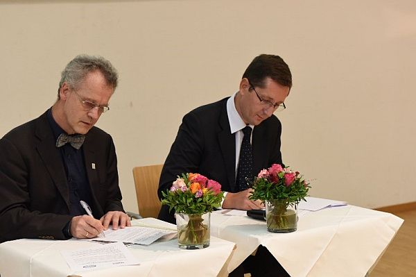
Christian Heipke (left) and Adriano Camps (right) signing the MoU
between IEEE GRSS and ISPRS on Oct. 10, 2018 in Karlsruhe, Germany.
|
|
 |
| |
 |
|
General Announcements
 |
|
2019 Series of E-learning Courses from EuroSDR

The 2019 series is now open for registration: http://www.eurosdr.net/education/course/eduserv17-2019.
Topics of four e-learning courses will be introduced during the seminar hosted by the Cartographic and Geologic Institute of Catalunya, Barcelona, Spain, from 4th to 5th March 2019. Two-week e-learning courses are scheduled from March to June 2019.
|
|
 |
| |
 |
|
Announcements of Scientific Meetings
(see also
ISPRS Calendar)
 |
|
11th EARSeL SIG Imaging Spectroscopy Workshop
6-8 February 2019
Brno, Czech Republic

The EARSeL Special Interest Group on Imaging Spectroscopy stimulates international discussion among specialists working with innovative spectral Earth Observation technologies and fosters interdisciplinary research addressing today’s key environmental and societal challenges. Imaging spectroscopy is recently expanding from traditional airborne platforms towards new ground-based, unmanned airborne and satellite systems. At the same time, novel spectral signals, such as, for instance, chlorophyll fluorescence ormid-infrared and thermal emissions, are being explored.
These technological and methodological developments are inviting for exchange of new knowledge and fruitful scientific discussions during the upcoming 11 th EARSeL SIG IS Workshop.
For more information, see here…
|
 |
|
GEO Business 2019
21 - 22 May 2019
Business Design Centre
London, UK

GEO Business is the largest geospatial event in the UK attracting over 2500 visitors from more than 50 countries. Incorporating an international trade exhibition, strategic conference, cutting edge seminars, a programme of live commercial workshops and a popular programme of social events, GEO Business is designed for everyone involved in the gathering, storing, processing and delivery of geospatial information.
For more information visit https://www.geobusinessshow.com/
Email: info@GeoBusinessShow.com
Telephone: +44(0)1453 836363.
Follow us on twitter: @GEOBusinessShow #geobiz, LinkedIn: GEO Business,
Facebook: GEOBusinessShow or Instagram: GEOBusinessShow
|
 |
|
11th International Symposium on Digital Earth
September 24-27, 2019
Florence, Italy

This symposium will celebrate the 20th anniversary of the ISDE symposium which began in Beijing in 1999.
The Call for Special sessions and abstracts is now open. For more information please visit:
http://www.digitalearth2019.eu
↑ Up
|
|
 |
| |
 |
|
Event Reports
 |
|
ISPRS Capacity Building for High-Resolution Land Cover Inter-comparison and Validation Workshops
September 1, 2018
Dar es Salaam, Tanzania (in conjunction with the FOSS4G 2018 conference)
September 3, 2018
Nairobi, Kenya

These workshops are a result of the project which started in February 2018 as one of the ISPRS Education and Capacity Building Initiatives 2018.
Read the report
here…
|
 |
|
ISPRS/RCMRD Summer School 2018 Report
Gaborone, Botswana
September 24–28, 2018

The Department of Surveys and Mapping (DMS), Botswana under the auspices of the Ministry of Land Management Water and Sanitation Services, Botswana hosted this ISPRS/RCMRD Summer School 2018 in partnership with University of Botswana (UB).
Read the report
here…
↑ Up
|
|
 |
| |
 |
|
ISPRS International Journal of Geo-Information — Open Access Journal
 |
|
New publications in the ISPRS International Journal of Geo-Information
Open Access Journal
Volume 7, Issue 8 (August 2018)
Task-Oriented Visualization Approaches for Landscape and Urban Change Analysis
Schiewe, Jochen
No: 288
A New Method for the Assessment of Spatial Accuracy and Completeness of OpenStreetMap Building Footprints
Brovelli, Maria Antonia, Zamboni, Giorgio
No: 289
Phenology Response to Climatic Dynamic across China’s Grasslands from 1985 to 2010
Wang, Jun, Zhou, Tiancai, Peng, Peihao
No: 290
Modeling Words for Qualitative Distance Based on Interval Type-2 Fuzzy Sets
Guo, Jifa, Du, Shihong
No: 291
Optimized Location-Allocation of Earthquake Relief Centers Using PSO and ACO, Complemented by GIS, Clustering, and TOPSIS
Saeidian, Bahram, Mesgari, Mohammad Saadi, Pradhan, Biswajeet, Ghodousi, Mostafa
No: 292
Shp2graph: Tools to Convert a Spatial Network into an Igraph Graph in R
Lu, Binbin, Sun, Huabo, Harris, Paul, Xu, Miaozhong, Charlton, Martin
No: 293
An Object-Based Image Analysis Workflow for Monitoring Shallow-Water Aquatic Vegetation in Multispectral Drone Imagery
Chabot, Dominique, Dillon, Christopher, Shemrock, Adam, Weissflog, Nicholas, Sager, Eric P. S.
No: 294
A High-Precision LiDAR-Based Method for Surveying and Classifying Coastal Notches
Terefenko, Paweł, Zelaya Wziątek, Dagmara, Dalyot, Sagi, Boski, Tomasz, Pinheiro Lima-Filho, Francisco
No: 295
A Recommendation System Regarding Meeting Places for Groups during Events
Asukai, Shota, Yamamoto, Kayoko
No: 296
The Negative Effects of Alcohol Establishment Size and Proximity on the Frequency of Violent and Disorder Crime across Block Groups of Victoria, British Columbia
Fitterer, Jessica L., Nelson, Trisalyn A., Stockwell, Timothy
No: 297
Grid-Based Crime Prediction Using Geographical Features
Lin, Ying-Lung, Yen, Meng-Feng, Yu, Liang-Chih
No: 298
Drift-Aware Monocular Localization Based on a Pre-Constructed Dense 3D Map in Indoor Environments
Feng, Guanyuan, Ma, Lin, Tan, Xuezhi, Qin, Danyang
No: 299
A Comparative Study of Three Non-Geostatistical Methods for Optimising Digital Elevation Model Interpolation
Salekin, Serajis, Burgess, Jack H., Morgenroth, Justin, Mason, Euan G., Meason, Dean F.
No: 300
Automatic Parametrization and Shadow Analysis of Roofs in Urban Areas from ALS Point Clouds with Solar Energy Purposes
Soilán, Mario, Riveiro, Belén, Liñares, Patricia, Padín-Beltrán, Marta
No: 301
Modeling of Macroscopic Building Evacuation Using IFC Data
Zhu, Zhenhao, Zhou, Liangchen, Zhang, Chi, Lin, Bingxian, Cui, Ying, Che, Mingliang
No: 302
Remote Sensing and Geospatial Technologies in Public Health
Faruque, Fazlay S.
No: 303
Are the Poor Digitally Left Behind? Indications of Urban Divides Based on Remote Sensing and Twitter Data
Taubenböck, Hannes, Staab, Jeroen, Zhu, Xiao Xiang, Geiß, Christian, Dech, Stefan, Wurm, Michael
No: 304
Prioritizing Abandoned Mine Lands Rehabilitation: Combining Landscape Connectivity and Pattern Indices with Scenario Analysis Using Land-Use Modeling
Zhang, Liping, Zhang, Shiwen, Huang, Yajie, Xing, An, Zhuo, Zhiqing, Sun, Zhongxiang, Li, Zhen, Cao, Meng, Huang, Yuanfang
No: 305
Satellite-Derived Bathymetry for Improving Canadian Hydrographic Service Charts
Chénier, René, Faucher, Marc-André, Ahola, Ryan
No: 306
Automation of Building Permission by Integration of BIM and Geospatial Data
Olsson, Per-Ola, Axelsson, Josefine, Hooper, Martin, Harrie, Lars
No: 307
Identifying Modes of Driving Railway Trains from GPS Trajectory Data: An Ensemble Classifier-Based Approach
Zheng, Han, Cui, Zanyang, Zhang, Xingchen
No: 308
Mapping Rural Road Networks from Global Positioning System (GPS) Trajectories of Motorcycle Taxis in Sigomre Area, Siaya County, Kenya
Oloo, Francis
No: 309
Software Systems Approach to Multi-Scale GIS-BIM Utility Infrastructure Network Integration and Resource Flow Simulation
Gilbert, Thomas, Barr, Stuart, James, Philip, Morley, Jeremy, Ji, Qingyuan
No: 310
Processing BIM and GIS Models in Practice: Experiences and Recommendations from a GeoBIM Project in The Netherlands
Arroyo Ohori, Ken, Diakité, Abdoulaye, Krijnen, Thomas, Ledoux, Hugo, Stoter, Jantien
No: 311
CS Projects Involving Geoinformatics: A Survey of Implementation Approaches
Criscuolo, Laura, Bordogna, Gloria, Carrara, Paola, Pepe, Monica
No: 312
Multidimensional Arrays for Analysing Geoscientific Data
Lu, Meng, Appel, Marius, Pebesma, Edzer
No: 313
Multi-Temporal Image Analysis for Fluvial Morphological Characterization with Application to Albanian Rivers
Spada, Daniele, Molinari, Paolo, Bertoldi, Walter, Vitti, Alfonso, Zolezzi, Guido
No: 314
Improving Tree Species Classification Using UAS Multispectral Images and Texture Measures
Gini, Rossana, Sona, Giovanna, Ronchetti, Giulia, Passoni, Daniele, Pinto, Livio
No: 315
Air Quality Context Information Model for Ubiquitous Public Access to Geographic Information
Hong, Sungchul
No: 316
Method Based on Floating Car Data and Gradient-Boosted Decision Tree Classification for the Detection of Auxiliary Through Lanes at Intersections
Li, Xiaolong, Wu, Yuzhen, Tan, Yongbin, Cheng, Penggen, Wu, Jing, Wang, Yuqian
No: 317
A Methodology for Planar Representation of Frescoed Oval Domes: Formulation and Testing on Pisa Cathedral
Piemonte, Andrea, Caroti, Gabriella, Martínez-Espejo Zaragoza, Isabel, Fantini, Filippo, Cipriani, Luca
No: 318
BIM-GIS Integration as Dedicated and Independent Course for Geoinformatics Students: Merits, Challenges, and Ways Forward
Hijazi, Ihab, Donaubauer, Andreas, Kolbe, Thomas H.
No: 319
Exploring Railway Network Dynamics in China from 2008 to 2017
Huang, Yaping, Lu, Shiwei, Yang, Xiping, Zhao, Zhiyuan
No: 320
Extracting Indoor Space Information in Complex Building Environments
Pang, Yueyong, Zhang, Chi, Zhou, Liangchen, Lin, Bingxian, Lv, Guonian
No: 321
Comparison of Communication Viewsheds Derived from High-Resolution Digital Surface Models Using Line-of-Sight, 2D Fresnel Zone, and 3D Fresnel Zone Analysis
Baek, Jieun, Choi, Yosoon
No: 322
Analyzing the Tagging Quality of the Spanish OpenStreetMap
Almendros-Jiménez, Jesús M., Becerra-Terón, Antonio
No: 323
An INS/Floor-Plan Indoor Localization System Using the Firefly Particle Filter
Chen, Jian, Ou, Gang, Peng, Ao, Zheng, Lingxiang, Shi, Jianghong
No: 324
Journey-to-Crime Distances of Residential Burglars in China Disentangled: Origin and Destination Effects
Xiao, Luzi, Liu, Lin, Song, Guangwen, Ruiter, Stijn, Zhou, Suhong
No: 325
Identification of Painted Rock-Shelter Sites Using GIS Integrated with a Decision Support System and Fuzzy Logic
Banerjee, Ruman, Srivastava, Prashant K., Pike, A. W. G., Petropoulos, George P.
No: 326
A Parallel N-Dimensional Space-Filling Curve Library and Its Application in Massive Point Cloud Management
Guan, Xuefeng, van Oosterom, Peter, Cheng, Bo
No: 327
Method for the Analysis and Visualization of Similar Flow Hotspot Patterns between Different Regional Groups
Zhang, Haiping, Zhou, Xingxing, Gu, Xin, Zhou, Lei, Ji, Genlin, Tang, Guoan
No: 328
Correction: Dawson, T.; et al. A Spatial Analysis of the Relationship between Vegetation and Poverty. Int. J. Geo-Inf. 2018, 7, 83
Dawson, Teddy, Sandoval, J. S. Onésimo, Sagan, Vasit, Crawford, Thomas
No: 329
A Segmented Processing Approach of Eigenvector Spatial Filtering Regression for Normalized Difference Vegetation Index in Central China
Yang, Jiaxin, Chen, Yumin, Chen, Meijie, Yang, Fan, Yao, Ming
No: 330
Use of Unmanned Aerial Vehicles (UAVs) for Updating Farmland Cadastral Data in Areas Subject to Landslides
Puniach, Edyta, Bieda, Agnieszka, Ćwiąkała, Paweł, Kwartnik-Pruc, Anita, Parzych, Piotr
No: 331
Using the Spatial Knowledge of Map Users to Personalize City Maps: A Case Study with Tourists in Madrid, Spain
Manrique-Sancho, María-Teresa, Avelar, Silvania, Iturrioz-Aguirre, Teresa, Manso-Callejo, Miguel-Ángel
No: 332
↑ Up

New publications in the ISPRS International Journal of Geo-Information
Open Access Journal
Volume 7, Issue 9 (September 2018)
Generating a High-Precision True Digital Orthophoto Map Based on UAV Images
Liu, Yu, Zheng, Xinqi, Ai, Gang, Zhang, Yi, Zuo, Yuqiang
No: 333
Applications of Internet of Things
Chen, Chi-Hua, Lo, Kuen-Rong
No: 334
Towards Modelling Future Trends of Quebec’s Boreal Birds’ Species Distribution under Climate Change
Gaudreau, Jonathan, Perez, Liliana, Harati, Saeed
No: 335
Susceptibility to Translational Slide-Type Landslides: Applicability of the Main Scarp Upper Edge as a Dependent Variable Representation by Reduced Chi-Square Analysis
Capitani, Marco, Ribolini, Adriano, Bini, Monica
No: 336
Using Eye Tracking to Explore Differences in Map-Based Spatial Ability between Geographers and Non-Geographers
Dong, Weihua, Zheng, Liangyu, Liu, Bing, Meng, Liqiu
No: 337
Representative Band Selection for Hyperspectral Image Classification
Xie, Fuding, Li, Fangfei, Lei, Cunkuan, Ke, Lina
No: 338
Semi-Automatic 3D City Model Generation from Large-Format Aerial Images
Buyukdemircioglu, Mehmet, Kocaman, Sultan, Isikdag, Umit
No: 339
Temporal and Spatial Analyses of the Landscape Pattern of Wuhan City Based on Remote Sensing Images
Lv, Jianjun, Ma, Teng, Dong, Zhiwen, Yao, Yao, Yuan, Zehao
No: 340
Quantifying Surface Urban Heat Island Formation in the World Heritage Tropical Mountain City of Sri Lanka
Ranagalage, Manjula, Dissanayake, DMSLB, Murayama, Yuji, Zhang, Xinmin, Estoque, Ronald C., Perera, ENC, Morimoto, Takehiro
No: 341
Accuracy Assessment of Point Clouds from LiDAR and Dense Image Matching Acquired Using the UAV Platform for DTM Creation
Salach, Adam, Bakuła, Krzysztof, Pilarska, Magdalena, Ostrowski, Wojciech, Górski, Konrad, Kurczyński, Zdzisław
No: 342
Evaluating a Fit-For-Purpose Integrated Service-Oriented Land and Climate Change Information System for Mountain Community Adaptation
Khezri, Adish, Bennett, Rohan, Zevenbergen, Jaap
No: 343
Analyzing Spatial and Temporal User Behavior in Participatory Sensing
Khoi, Ngo Manh, Casteleyn, Sven
No: 344
Shortest Paths from a Group Perspective—A Note on Selfish Routing Games with Cognitive Agents
Scholz, Johannes, Church, Richard L.
No: 345
Place and City: Toward Urban Intelligence
Acedo, Albert, Painho, Marco, Casteleyn, Sven, Roche, Stéphane
No: 346
Integration of Local and Global Support Vector Machines to Improve Urban Growth Modelling
Mirbagheri, Babak, Alimohammadi, Abbas
No: 347
Nesting Patterns of Loggerhead Sea Turtles (Caretta caretta): Development of a Multiple Regression Model Tested in North Carolina, USA
Halls, Joanne N., Randall, Alyssa L.
No: 348
Joint Alternate Small Convolution and Feature Reuse for Hyperspectral Image Classification
Gao, Hongmin, Yang, Yao, Li, Chenming, Zhou, Hui, Qu, Xiaoyu
No: 349
Close-Range Photogrammetry and Infrared Imaging for Non-Invasive Honeybee Hive Population Assessment
López-Fernández, Luis, Lagüela, Susana, Rodríguez-Gonzálvez, Pablo, Martín-Jiménez, José Antonio, González-Aguilera, Diego
No: 350
Spatially Explicit Age Segregation Index and Self-Rated Health of Older Adults in US Cities
Deng, Guangran, Mao, Liang
No: 351
Exploring the Factors Driving Changes in Farmland within the Tumen/Tuman River Basin
Kang, Cholhyok, Zhang, Yili, Paudel, Basanta, Liu, Linshan, Wang, Zhaofeng, Li, Ryongsu
No: 352
Novel Method for Virtual Restoration of Cultural Relics with Complex Geometric Structure Based on Multiscale Spatial Geometry
Hou, Miaole, Yang, Su, Hu, Yungang, Wu, Yuhua, Jiang, Lili, Zhao, Sizhong, Wei, Putong
No: 353
On the Risk Assessment of Terrorist Attacks Coupled with Multi-Source Factors
Zhang, Xun, Jin, Min, Fu, Jingying, Hao, Mengmeng, Yu, Chongchong, Xie, Xiaolan
No: 354
Achieving Complete and Near-Lossless Conversion from IFC to CityGML
Stouffs, Rudi, Tauscher, Helga, Biljecki, Filip
No: 355
Studies on Three-Dimensional (3D) Modeling of UAV Oblique Imagery with the Aid of Loop-Shooting
Li, Jia, Yao, Yongxiang, Duan, Ping, Chen, Yun, Li, Shuang, Zhang, Chi
No: 356
Space–Time Analysis of Vehicle Theft Patterns in Shanghai, China
Mao, Yuanyuan, Dai, Shenzhi, Ding, Jiajun, Zhu, Wei, Wang, Can, Ye, Xinyue
No: 357
Spatial-Temporal Analysis of Human Dynamics on Urban Land Use Patterns Using Social Media Data by Gender
Lei, Chengcheng, Zhang, An, Qi, Qingwen, Su, Huimin, Wang, Jianghao
No: 358
Capturing Flood Risk Perception via Sketch Maps
Klonner, Carolin, Usón, Tomás J., Marx, Sabrina, Mocnik, Franz-Benjamin, Höfle, Bernhard
No: 359
Share Our Cultural Heritage (SOCH): Worldwide 3D Heritage Reconstruction and Visualization via Web and Mobile GIS
Dhonju, Hari K., Xiao, Wen, Mills, Jon P., Sarhosis, Vasilis
No: 360
Automatic Seam-Line Detection in UAV Remote Sensing Image Mosaicking by Use of Graph Cuts
Li, Ming, Li, Deren, Guo, Bingxuan, Li, Lin, Wu, Teng, Zhang, Weilong
No: 361
Road Extraction from VHR Remote-Sensing Imagery via Object Segmentation Constrained by Gabor Features
Chen, Li, Zhu, Qing, Xie, Xiao, Hu, Han, Zeng, Haowei
No: 362
Cross-Domain Building Models—A Step towards Interoperability
Knoth, Laura, Scholz, Johannes, Strobl, Josef, Mittlböck, Manfred, Vockner, Bernhard, Atzl, Caroline, Rajabifard, Abbas, Atazadeh, Behnam
No: 363
Revisiting the Role of Place in Geographic Information Science
Merschdorf, Helena, Blaschke, Thomas
No: 364
Spatial Assessment of the Potential Impact of Infrastructure Development on Biodiversity Conservation in Lowland Nepal
Sharma, Roshan, Rimal, Bhagawat, Stork, Nigel, Baral, Himlal, Dhakal, Maheshwar
No: 365
Introduction to the Special Issue: “State-of-the-Art Virtual/Augmented Reality and 3D Modeling Techniques for Virtual Urban Geographic Experiments”
Liang, Jianming, Gong, Jianhua, Liu, Yu
No: 366
Single-Tree Detection in High-Resolution Remote-Sensing Images Based on a Cascade Neural Network
Tianyang, Dong, Jian, Zhang, Sibin, Gao, Ying, Shen, Jing, Fan
No: 367
Critical Review of Methods to Estimate PM2.5 Concentrations within Specified Research Region
Zhang, Guangyuan, Rui, Xiaoping, Fan, Yonglei
No: 368
GIS-Assisted Prediction and Risk Zonation of Wildlife Attacks in the Chitwan National Park in Nepal
Ruda, Aleš, Kolejka, Jaromír, Silwal, Thakur
No: 369
Raising Semantics-Awareness in Geospatial Metadata Management
Fugazza, Cristiano, Pepe, Monica, Oggioni, Alessandro, Tagliolato, Paolo, Carrara, Paola
No: 370
An Efficient Graph-Based Spatio-Temporal Indexing Method for Task-Oriented Multi-Modal Scene Data Organization
Feng, Bin, Zhu, Qing, Liu, Mingwei, Li, Yun, Zhang, Junxiao, Fu, Xiao, Zhou, Yan, Li, Maosu, He, Huagui, Yang, Weijun
No: 371
Digital Image Correlation (DIC) Analysis of the 3 December 2013 Montescaglioso Landslide (Basilicata, Southern Italy): Results from a Multi-Dataset Investigation
Caporossi, Paolo, Mazzanti, Paolo, Bozzano, Francesca
No: 372
Sino-InSpace: A Digital Simulation Platform for Virtual Space Environments
Lyu, Liang, Xu, Qing, Lan, Chaozhen, Shi, Qunshan, Lu, Wanjie, Zhou, Yang, Zhao, Yinghao
No: 373
Influences of the Shadow Inventory on a Landslide Susceptibility Model
Liu, Cheng-Chien, Luo, Wei, Chung, Hsiao-Wei, Yin, Hsiao-Yuan, Yan, Ke-Wei
No: 374
Geospatial Assessment of the Post-Earthquake Hazard of the 2017 Pohang Earthquake Considering Seismic Site Effects
Kim, Han-Saem, Sun, Chang-Guk, Cho, Hyung-Ik
No: 375
The Geography of Taste: Using Yelp to Study Urban Culture
Rahimi, Sohrab, Mottahedi, Sam, Liu, Xi
No: 376
Application of Industrial Risk Management Practices to Control Natural Hazards, Facilitating Risk Communication
Lee, Jongook, Lee, Dong Kun
No: 377
Beyond Spatial Proximity—Classifying Parks and Their Visitors in London Based on Spatiotemporal and Sentiment Analysis of Twitter Data
Kovacs-Györi, Anna, Ristea, Alina, Kolcsar, Ronald, Resch, Bernd, Crivellari, Alessandro, Blaschke, Thomas
No: 378
Feature Extraction and Selection of Sentinel-1 Dual-Pol Data for Global-Scale Local Climate Zone Classification
Hu, Jingliang, Ghamisi, Pedram, Zhu, Xiao Xiang
No: 379
Determining Optimal Video Length for the Estimation of Building Height through Radial Displacement Measurement from Space
Plowright, Andrew, Tortini, Riccardo, Coops, Nicholas C.
No: 380
Using Remote Sensing to Analyse Net Land-Use Change from Conflicting Sustainability Policies: The Case of Amsterdam
Giezen, Mendel, Balikci, Stella, Arundel, Rowan
No: 381
↑ Up
|
|
 |
| |
 |
|
ISPRS Journal of Photogrammetry and Remote Sensing
 |
|
New publications in the ISPRS Journal of
Photogrammetry and Remote Sensing Volume 143 (September 2018)
Theme Issue “Point Cloud Processing”
Editorial Board
Pages: ii
Toward better boundary preserved supervoxel segmentation for 3D point clouds
Yangbin Lin, Cheng Wang, Dawei Zhai, Wei Li, Jonathan Li
Pages: 39-47
Developing a multi-filter convolutional neural network for semantic segmentation using high-resolution aerial imagery and LiDAR data
Ying Sun, Xinchang Zhang, Qinchuan Xin, Jianfeng Huang
Pages: 3-14
Forward to the theme issue on point cloud processing
Ruisheng Wang, Bisheng Yang, Florent Lafarge, Suya Yo
Pages: 1-2
L0-regularization-based skeleton optimization from consecutive point sets of kinetic human body
Yong Zhang, Bowei Shen, Shaofan Wang, Dehui Kong, Baocai Yin
Pages: 124-133
Automatic 3D reconstruction of electrical substation scene from LiDAR point cloud
Qiaoyun Wu, Hongbin Yang, Mingqiang Wei, Oussama Remil, Bo Wang, Jun Wang
Pages: 57-71
A probabilistic graphical model for the classification of mobile LiDAR point clouds
Zhizhong Kang, Juntao Yang
Pages: 108-123
Three-dimensional building façade segmentation and opening area detection from point clouds
S.M. Iman Zolanvari, Debra F. Laefer, Atteyeh S. Natanzi
Pages: 134-149
In-situ measurements from mobile platforms: An emerging approach to address the old challenges associated with forest inventories
Xinlian Liang, Antero Kukko, Juha Hyyppä, Matti Lehtomäki, Jiri Pyörälä, Xiaowei Yu, Harri Kaartinen, Anttoni Jaakkola, Yunsheng Wang
Pages: 97-107
An analytical approach to evaluate point cloud registration error utilizing targets
Ronghua Yang, Xiaolin Meng, Yibin Yao, Bi Yu Chen, Yangsheng You, Zejun Xiang
Pages: 48-56
Refinement of LiDAR point clouds using a super voxel based approach
Minglei Li, Changming Sun
Pages: 213-221
Geometrically stable tracking for depth images based 3D reconstruction on mobile devices
Yangdong Liu, Wei Gao, Zhanyi Hu
Pages: 222-232
A multi-scale fully convolutional network for semantic labeling of 3D point clouds
Mohammed Yousefhussien, David J. Kelbe, Emmett J. Ientilucci, Carl Salvaggio
Pages: 191-204
Deep fusion of multi-view and multimodal representation of ALS point cloud for 3D terrain scene recognition
Nannan Qin, Xiangyun Hu, Hengming Dai
Pages: 205-212
Multi-scan segmentation of terrestrial laser scanning data based on normal variation analysis
Erzhuo Che, Michael J. Olsen
Pages: 233-248
Removing non-static objects from 3D laser scan data
Johannes Schauer, Andreas Nüchter
Pages: 15-38
Ancient Chinese architecture 3D preservation by merging ground and aerial point clouds
Xiang Gao, Shuhan Shen, Yang Zhou, Hainan Cui, Lingjie Zhu, Zhanyi Hu
Pages: 72-84
Prioritized multi-view stereo depth map generation using confidence prediction
Christian Mostegel, Friedrich Fraundorfer, Horst Bischof
Pages: 167-180
A simple terrain relief index for tuning slope-related parameters of LiDAR ground filtering algorithms
Peng Wan, Wuming Zhang, Andrew K. Skidmore, Jianbo Qi, Xiuliang Jin, Guangjian Yan, Tiejun Wang
Pages: 181-190
A rigorous fastener inspection approach for high-speed railway from structured light sensors
Qingzhou Mao, Hao Cui, Qingwu Hu, Xiaochun Ren
Pages: 249-267
Semantic line framework-based indoor building modeling using backpacked laser scanning point cloud
Cheng Wang, Shiwei Hou, Chenglu Wen, Zheng Gong, Qing Li, Xiaotian Sun, Jonathan Li
Pages: 150-166

New publications in the ISPRS Journal of
Photogrammetry and Remote Sensing Volume 144 (October 2018)
Editorial Board
Pages: ii
The effect of spatial resolution on radiometric and geometric performances of a UAV-mounted hyperspectral 2D imager
Lei Deng, Yanan Yan, Huili Gong, Fuzhou Duan, Ruofei Zhong
Pages: 298-314
Fusion of TanDEM-X and Cartosat-1 elevation data supported by neural network-predicted weight maps
Hossein Bagheri, Michael Schmitt, Xiao Xiang Zhu
Pages: 285-297
A new approach to selecting coherent pixels for ground-based SAR deformation monitoring
Zheng Wang, Zhenhong Li, Jon Mills
Pages: 412-422
Deep multi-task learning for a geographically-regularized semantic segmentation of aerial images
Michele Volpi, Devis Tuia
Pages: 48-60
Comprehensive accuracy assessment of MODIS daily snow cover products and gap filling methods
James Coll, Xingong Li
Pages: 435-452
Methods for quantification of systematic distance deviations under incidence angle with scanning total stations
Miriam Zámečníková, Hans Neuner
Pages: 268-284
Spherical target-based calibration of terrestrial laser scanner intensity. Application to colour information computation
Estelle Bretagne, Pascal Dassonvalle, Guillaume Caron
Pages: 14-27
Analyzing the feasibility of a space-borne sensor (SPOT-6) to estimate the height of submerged aquatic vegetation (SAV) in inland waters
Luiz Henrique S. Rotta, Deepak R. Mishra, Fernanda S.Y. Watanabe, Thanan W.P Rodrigues, Enner H. Alcântara, Nilton N. Imai
Pages: 341-356
Estimation of the directional and whole apparent clumping index (ACI) from indirect optical measurements
Hongliang Fang, Weiwei Liu, Wenjuan Li, Shanshan Wei
Pages: 1-13
High-precision co-registration of orbiter imagery and digital elevation model constrained by both geometric and photometric information
Xin Xin, Bin Liu, Kaichang Di, Mengna Jia, Jürgen Oberst
Pages: 28-37
A 3D convolutional neural network method for land cover classification using LiDAR and multi-temporal Landsat imagery
Zewei Xu, Kaiyu Guan, Nathan Casler, Bin Peng, Shaowen Wang
Pages: 423-434
Tunnel inspection using photogrammetric techniques and image processing: A review
Leanne Attard, Carl James Debono, Gianluca Valentino, Mario Di Castro
Pages: 180-188
Stand age estimation of rubber (Hevea brasiliensis) plantations using an integrated pixel- and object-based tree growth model and annual Landsat time series
Gang Chen, Jean-Claude Thill, Sutee Anantsuksomsri, Nij Tontisirin, Ran Tao
Pages: 94-104
A new algorithm predicting the end of growth at five evergreen conifer forests based on nighttime temperature and the enhanced vegetation index
Huanhuan Yuan, Chaoyang Wu, Linlin Lu, Xiaoyue Wang
Pages: 390-399
Hierarchical registration of unordered TLS point clouds based on binary shape context descriptor
Zhen Dong, Bisheng Yang, Fuxun Liang, Ronggang Huang, Sebastian Scherer
Pages: 61-79
Spectral analysis of wetlands using multi-source optical satellite imagery
Meisam Amani, Bahram Salehi, Sahel Mahdavi, Brian Brisco
Pages: 119-136
Focus model for metric depth estimation in standard plenoptic cameras
Said Pertuz, Edith Pulido-Herrera, Joni-Kristian Kamarainen
Pages: 38-47
A 30-m landsat-derived cropland extent product of Australia and China using random forest machine learning algorithm on Google Earth Engine cloud computing platform
Pardhasaradhi Teluguntla, Prasad S Thenkabail, Adam Oliphant, Jun Xiong, Murali Krishna Gumma, Russell G. Congalton, Kamini Yadav, Alfredo Huete
Pages: 325-340
Extraction of residential building instances in suburban areas from mobile LiDAR data
Shaobo Xia, Ruisheng Wang
Pages: 453-468
Assessing and refining the satellite-derived massive green macro-algal coverage in the Yellow Sea with high resolution images
T.W. Cui, X.J. Liang, J.L. Gong, C. Tong, Y.F. Xiao, R.J. Liu, X. Zhang, J. Zhang
Pages: 315-324
Estimating the leaf area of an individual tree in urban areas using terrestrial laser scanner and path length distribution model
Ronghai Hu, Elena Bournez, Shiyu Cheng, Hailan Jiang, Françoise Nerry, Tania Landes, Marc Saudreau, Pierre Kastendeuch, Georges Najjar, Jérôme Colin, Guangjian Yan
Pages: 357-368
A new method for 3D individual tree extraction using multispectral airborne LiDAR point clouds
Wenxia Dai, Bisheng Yang, Zhen Dong, Ahmed Shaker
Pages: 400-411
A practical sampling method for assessing accuracy of detected land cover/land use change: Theoretical analysis and simulation experiments
Yang Li, Jin Chen, Yuhan Rao
Pages: 379-389
A self-adaptive approach for producing clear-sky composites from VIIRS surface reflectance datasets
Jinhu Bian, Ainong Li, Chengquan Huang, Rui Zhang, Xiwu Zhan
Pages: 189-201
A new multi-resolution based method for estimating local surface roughness from point clouds
Lei Fan, Peter M. Atkinson
Pages: 369-378
Towards a polyalgorithm for land use change detection
Rishu Saxena, Layne T. Watson, Randolph H. Wynne, Evan B. Brooks, Valerie A. Thomas, Yang Zhiqiang, Robert E. Kennedy
Pages: 217-234
Projection learning with local and global consistency constraints for scene classification
Panpan Zhu, Liqiang Zhang, Yuebin Wang, Jie Mei, Guoqing Zhou, Fangyu Liu, Weiwei Liu, P. Takis Mathiopoulos
Pages: 202-216
Mapping paddy rice agriculture over China using AMSR-E time series data
Peilin Song, Lamin R. Mansaray, Jingfeng Huang, Wenjiang Huang
Pages: 469-482
Cloud/shadow detection based on spectral indices for multi/hyperspectral optical remote sensing imagery
Han Zhai, Hongyan Zhang, Liangpei Zhang, Pingxiang Li
Pages: 235-253
Message to readers
Derek D. Licht
Pages: 80
Atmospheric correction of geostationary Himawari-8 satellite data for Total Suspended Sediment mapping: A case study in the Coastal Waters of Western Australia
Passang Dorji, Peter Fearns
Pages: 81-93
Super resolution of laser range data based on image-guided fusion and dense matching
Xu Huang, Rongjun Qin, Changlin Xiao, Xiaohu Lu
Pages: 105-118
International benchmarking of terrestrial laser scanning approaches for forest inventories
Xinlian Liang, Juha Hyyppä, Harri Kaartinen, Matti Lehtomäki, Jiri Pyörälä, Norbert Pfeifer, Markus Holopainen, Gábor Brolly, Pirotti Francesco, Jan Hackenberg, Huabing Huang, Hyun-Woo Jo, Masato Katoh, Luxia Liu, Martin Mokroš, Jules Morel, Kenneth Olofsson, Jose Poveda-Lopez, Jan Trochta, Di Wang, Jinhu Wang, Zhouxi Xi, Bisheng Yang, Guang Zheng, Ville Kankare, Ville Luoma, Xiaowei Yu, Liang Chen, Mikko Vastaranta, Ninni Saarinen, Yunsheng Wang
Pages: 137-179

New publications in the ISPRS Journal of
Photogrammetry and Remote Sensing Volume 145a (November 2018)
Deep Learning RS Data
Editorial Board
Pages: ii
One-two-one networks for compression artifacts reduction in remote sensing
Baochang Zhang, Jiaxin Gu, Chen Chen, Jungong Han, Xiangbo Su, Xianbin Cao, Jianzhuang Liu
Pages: 184-196
Multi-scale object detection in remote sensing imagery with convolutional neural networks
Zhipeng Deng, Hao Sun, Shilin Zhou, Juanping Zhao, Lin Lei, Huanxin Zou
Pages: 3-22
PatternNet: A benchmark dataset for performance evaluation of remote sensing image retrieval
Weixun Zhou, Shawn Newsam, Congmin Li, Zhenfeng Shao
Pages: 197-209
Deep learning for remotely sensed data
Giorgos Mountrakis, Jun Li, Xiaoqiang Lu, Olaf Hellwic
Pages: 1-2
Building instance classification using street view images
Jian Kang, Marco Körner, Yuanyuan Wang, Hannes Taubenböck, Xiao Xiang Zhu
Pages: 44-59
MugNet: Deep learning for hyperspectral image classification using limited samples
Bin Pan, Zhenwei Shi, Xia Xu
Pages: 108-119
A semi-supervised generative framework with deep learning features for high-resolution remote sensing image scene classification
Wei Han, Ruyi Feng, Lizhe Wang, Yafan Cheng
Pages: 23-43
Pan-sharpening via deep metric learning
Yinghui Xing, Min Wang, Shuyuan Yang, Licheng Jiao
Pages: 165-183
Semantic labeling in very high resolution images via a self-cascaded convolutional neural network
Yongcheng Liu, Bin Fan, Lingfeng Wang, Jun Bai, Shiming Xiang, Chunhong Pan
Pages: 78-95
A new deep convolutional neural network for fast hyperspectral image classification
M.E. Paoletti, J.M. Haut, J. Plaza, A. Plaza
Pages: 120-147
A deep learning framework for remote sensing image registration
Shuang Wang, Dou Quan, Xuefeng Liang, Mengdan Ning, Yanhe Guo, Licheng Jiao
Pages: 148-164
Algorithms for semantic segmentation of multispectral remote sensing imagery using deep learning
Ronald Kemker, Carl Salvaggio, Christopher Kanan
Pages: 60-77

New publications in the ISPRS Journal of
Photogrammetry and Remote Sensing Volume 145b (November 2018)
SI: Latin America Issue
Editorial Board
Pages: ii
Improvements of the MODIS Gross Primary Productivity model based on a comprehensive uncertainty assessment over the Brazilian Amazonia
Catherine Torres de Almeida, Rafael Coll Delgado, Lênio Soares Galvão, Luiz Eduardo de Oliveira Cruz e Aragão, María Concepción Ramos
Pages: 268-283
Remote sensing monitoring of the impact of a major mining wastewater disaster on the turbidity of the Doce River plume off the eastern Brazilian coast
Natalia Rudorff, Conrado M. Rudorff, Milton Kampel, Gustavo Ortiz
Pages: 349-361
Spatial and temporal variation of human appropriation of net primary production in the Rio de la Plata grasslands
Santiago Baeza, José M. Paruelo
Pages: 238-249
Satellite-based view of the aerosol spatial and temporal variability in the Córdoba region (Argentina) using over ten years of high-resolution data
Lara Sofía Della Ceca, María Fernanda García Ferreyra, Alexei Lyapustin, Alexandra Chudnovsky, Lidia Otero, Hebe Carreras, Francesca Barnaba
Pages: 250-267
Early assessment of crop yield from remotely sensed water stress and solar radiation data
Mauro E. Holzman, Facundo Carmona, Raúl Rivas, Raquel Niclòs
Pages: 297-308
Seasonal and interannual assessment of cloud cover and atmospheric constituents across the Amazon (2000–2015): Insights for remote sensing and climate analysis
Vitor S. Martins, Evlyn M.L.M. Novo, Alexei Lyapustin, Luiz E.O.C. Aragão, Saulo R. Freitas, Claudio C.F. Barbosa
Pages: 309-327
Individual tree crown delineation in a highly diverse tropical forest using very high resolution satellite images
Fabien Hubert Wagner, Matheus Pinheiro Ferreira, Alber Sanchez, Mayumi C.M. Hirye, Maciel Zortea, Emanuel Gloor, Oliver L. Phillips, Carlos Roberto de Souza Filho, Yosio Edemir Shimabukuro, Luiz E.O.C. Aragão
Pages: 362-377
Coping with environmental challenges in Latin America
Cláudia M. de Almeida, Raul Q. Feitosa, Jaime Hernandez, Carlos M. Scavuzzo, Luiz E.O.C. de Aragã
Pages: 211-212
Radargrammetric approaches to the flat relief of the amazon coast using COSMO-SkyMed and TerraSAR-X datasets
Ulisses Silva Guimarães, Igor da Silva Narvaes, Maria de Lourdes Bueno Trindade Galo, Arnaldo de Queiroz da Silva, Paulo de Oliveira Camargo
Pages: 284-296
Migration monitoring of Ascia monuste (Lepidoptera) and Schistocerca cancellata (Orthoptera) in Argentina using RMA1 weather radar
Denis A. Poffo, Hernán M. Beccacece, Giorgio M. Caranti, Raúl A. Comes, María E. Drewniak, Agustín Martina, Adriana I. Zapata, Andres Rodriguez, Jorge N. Saffe
Pages: 340-348
Monitoring Andean high altitude wetlands in central Chile with seasonal optical data: A comparison between Worldview-2 and Sentinel-2 imagery
Rocío A. Araya-López, Javier Lopatin, Fabian E. Fassnacht, H. Jaime Hernández
Pages: 213-224
Monitoring thirty years of small water reservoirs proliferation in the southern Brazilian Amazon with Landsat time series
Damien Arvor, Felipe R.G. Daher, Dominique Briand, Simon Dufour, Anne-Julia Rollet, Margareth Simões, Rodrigo P.D. Ferraz
Pages: 225-237

↑ Up
|
|
 |
| |
 |
|
New Events
12-16 Nov 2018
AGSE 2018
Mother Earth: Contribution of Geospatial Science and Technology
http://applied-geomatics.org/
Windhoek, Namibia
14-21 Nov 2018
International Seminar on Standards and Techniques of Spatial Data Infrastructure
website not yet available
Wuhan & Deqing, China
29-30 Nov 2018
Drones in Finnish Agriculture and Forestry
http://drones2018.utu.fi/en/
Naantali, Finland
29 Nov - 01 Dec 2018
ANGIS 2018
GIS: Connecting Geography, History, Economics.....
Looking Beyond Where
https://sites.google.com/geo.buruniv.ac.in/angis-2018/home
Burdwan, India
01-03 Dec 2018
ICA Symposium on Early Warning and Crises Management in the Big Data Era
http://conf.fishmap.site/
Shenzhen, China
03-06 Dec 2018
SGEM Vienna Green 2018
part of SGEM Conferences on Earth & Geo Sciences 2018
http://www.sgemviennagreen.org/
Vienna, Austria
18-20 Feb 2019
International Workshop on Earth Observations for Agricultural Monitoring
followed by Tutorial on “Advances in Remote Sensing for Agriculture”
February 21 to 22, 2019
http://ncfc.gov.in/isprs/
New Delhi, India
12-14 Mar 2019
ISPRS Technical Commission III WG III/2, 10 Joint Workshop
Multidisciplinary Remote Sensing for Environmental Monitoring
http://www.jsprs-w.org/ISPRS_WS/
Kyoto, Japan
01-04 Apr 2019
SPIE Optics + Optoelectronics 2019
http://spie.org/SPIE_Optics_Optoelectronics
Prague, Czech Republic
17-18 Apr 2019
Workshop on Open Source and Multi‐level Education for Geospatial Technology 2019 Proposed Dates
http://os2018.geomatics.ncku.edu.tw/
Taipei, Taiwan
25-27 Apr 2019
TUFUAB 2019-Aksaray
Turkish National Society for Photogrammetry and Remote Sensing X
Technical Symposium
http://tufuab2019.aksaray.edu.tr/
Aksaray, Turkey
15-18 Aug 2019
15th South East Asia Survey Congress
“Collaboration, Communication and Capacity Building”
http://seasc2019darwin.com.au/
Darwin, Australia
18-20 Sep 2019
PIA19
Photogrammetric Image Analysis 2019
http://www.pia.tum.de
Munich, Germany
24-25 Sep 2019
International Workshop
Measurement, Visualisation and Processing in BIM for Design and Construction Management
http://mvpbim2019.org/
Prague, Czech Republic
24-27 Sep 2019
ISDE 11
11th International Symposium on Digital Earth
Digital Earth in a transformed Society
http://www.digitalearth2019.eu
Florence, Italy
26-27 Sep 2019
14th 3D GeoInfo 2019
http://www.3dgeoinfo2019.com
Singapore, Singapore
04-08 Nov 2019
COSPAR 2019
4th Symposium of the Committee on Space Research (COSPAR)
Small Satellites for Sustainable Science and Development
http://www.cospar2019.org/
Herzliya, Israel
» See more
|
 |
| |
 |
|
Updated Events
04-06 Jun 2019
ISPRS Workshop on Modelling and Managing Geospatial Data
In conjunction with the 40th Canadian Symposium on Remote Sensing and the NB & CIG Geomatics Atlantic 2019
https://crss-sct.ca/conferences/csrs-2019/
Fredericton, NB, Canada
10-14 Jun 2019
Geospatial Week 2019
https://www.gsw2019.org
Enschede, The Netherlands
» See more
|
 |
| |
 |
|
Job Opportunities
|
28-Sep-2018 |
PhD candidate for a 3-years research project in Hyperspectral Remote Sensing
Massey University, Palmerston North, New Zealand
|
|
17-Oct-2018 |
Master of Engineering/Sciences
Blom lnternational Operations SRL, Targoviste, Romania
|
|
22-Oct-2018 |
NASA JPL Internship: Machine learning and remote sensing data fusion
NASA/Jet Propulsion Laboratory, California Institute of Technology
|
|
1-Nov-2018 |
Post-doc position in Heterogeneous Data Fusion, 1 year
IGN, LaSTIG lab., Paris, France
Deadline: 30-Nov-2018
|
» See more
|
 |
| |
|
|
 |
You got this email as you subscribed to the ISPRS mailing list.
Officers, members and contact persons of members get it by default.
To unsubscribe from the ISPRS mailing list,
click here.
© ISPRS, 2018.
Imprint
|


