|
| |
| |
 |
|
ISPRS e-Bulletin
Issue No 1 - 2020
|
 |
| |
|
|
Quick Links
|
|
| |
|
Editorial

|
|
The ISPRS Student Consortium Youth Forum
by Sheryl Rose Reyes
In the last three years, the ISPRS Student Consortium (ISPRS SC) has actively organized a number of activities for students and young professionals, established partnerships, introduced new initiatives and strengthened the foundations of the organization. With a vision of further engaging our members and effectively integrating the youth in ISPRS, the ISPRS SC will host a series of events under the Youth Forum track in the upcoming XXIV ISPRS Congress to be held in Nice, France from June 14 – 20, 2020.
In cooperation with the Congress Director, the International Scientific Committee and the local organizers, the Youth Forum will run for three days and will include the following events: (1) technical sessions, both oral and poster presentations, which will showcase outstanding scientific papers submitted by, young scientists (2) a speed dating event that aims to connect students and young professionals to industry and academia, (3) a special session on Women in Remote Sensing, Photogrammetry and Spatial Information Science, which will be organized in collaboration with the Ladies of Landsat and also led by Dr. Marguerite Madden from the ISPRS Foundation and recipient of the ASPRS Lifetime Achievement Award, (4) a general assembly, which is a gathering of the ISPRS SC community to evaluate the past term and to welcome the new term with the incoming Board and (5) social events connecting the youth to the experts in ISPRS. In addition, prior to the ISPRS Congress, a summer school will be hosted in Nice University.
To further encourage the involvement of students and young professionals in the Consortium, two new awards had been introduced, the Excellence and Service Awards, which will be given for the first time in the upcoming ISPRS Congress. Details of these awards are available on the ISPRS SC website and deadline for nominations is on February 1, 2020.
The youth are the drivers of change and the past year has clearly demonstrated the role of the younger generation in taking a step forward in tackling the global issues and making a huge impact among stakeholders and the general public. Student organizations play a very important role in shaping future leaders of international organizations and increasing the capacities and capabilities of the youth in initiating efforts and fostering collaboration. The ISPRS SC, in the words of our current ISPRS President, believes that “the youth is our future.” Therefore, the Consortium calls on passionate and driven individuals willing to dedicate their time and energy in the mission of the organization to serve for the term 2020 – 2024. The ISPRS SC provides an amazing opportunity to connect with the international scientific community, learn from local organizers of various student activities, immerse in the diverse cultures of many countries and build lifelong friendships with fellow students and young professionals. Nominations for the ISPRS SC Board will open on March 15, 2020.
For more information and updates about the Consortium, please visit the official website of the ISPRS SC: sc.isprs.org and follow us on Twitter (@ISPRS_SC) and on Facebook
(https://www.facebook.com/groups/isprssc/).
|
|
|
| |
|
The ISPRS Foundation (TIF) News
|
 |
|
The ISPRS Foundation Brochure
The greatest reward for donating to TIF is the warm feeling one receives by helping advance the sciences and technologies from which one has benefited in their career. The financial assistance provided by The ISPRS Foundation (TIF) makes an important contribution by enabling grant recipients to better develop their expertise in the photogrammetry, remote sensing and spatial information sciences.
The vast majority of grants are provided to individuals and organizations in developing and reform countries. These include grants that support education and applications for emerging markets in many regions of the world as well as providing travel assistance for young scientists to attend ISPRS events.
The ISPRS Foundation have published a revised brochure, offering information on the organisation, which we ask you to distribute to interested parties.
Please see the brochure here, and visit the TIF web site for more information.
|
|
|
| |
|
Society News
|

|
|
Bids for Congress 2024

The following bids have been received to host the XXVth Congress in 2024, listed in alphabetical order:
- Canada – Toronto
- China – Wuhan
- India – Dehradun
- USA – Denver
Nominations for Council Positions 2020-2024
The following nominations have been received to date for Council positions (note that positions were renamed in the Statutes and Bylaws in 2019):
- President: Lena Halounová, Czech Republic
- Vice President: Nicolas Paparoditis, France
- Secretary General: Jie Jiang, China
- Treasurer: Stewart Walker, USA
- The Past President position will be filled by appointment.
Information on nominations for technical commissions will be disseminated soon.
|
|

|
|
New Editor-in-Chief for IJPRS Journal
The ISPRS Council has selected Clément Mallet as the new Editor-in-Chief of the ISPRS Journal of Photogrammetry and Remote Sensing, http://www.journals.elsevier.com/isprs-journal-of-photogrammetry-and-remote-sensing.
He will replace Derek Lichti who retires, effective Dec. 31, 2020, and will work alongside Editor-in-Chief Qihao Weng, who handles remote sensing manuscripts, to maintain and further the journal’s aim. Clément is a Senior Researcher at IGN-ENSG and Univ. Gustave Eiffel (Lastig lab.), head of the STRUDEL team, and has been an Associate Editor of the Journal for years. IJPRS is one of the top ranked remote sensing journals with an impact factor of 6.942 and a 5-year impact factor of 7.856.
On behalf of ISPRS, Council thanks Derek Lichti for the many years he has contributed to serving the Society in his role as Editor-in-Chief of the journal, and for the fabulous job he has done. It has been a pleasure to work with him.
|
|
|
|
New ISPRS Services for Members and the ISPRS Community at Large
by Christian Heipke
Since the last Congress in Prague in 2016, ISPRS Council has revised the services it offers to its members and the ISPRS community at large and has initiated a number of new opportunities to benefit from ISPRS membership. The most important ones are listed here, in the hope that as many members as possible will take advantage of these new opportunities.
Read more here ...
|
|
|
|
ISPRS Education and Capacity Building Initiatives 2020 Funding
by Songnian Li, ISPRS Treasurer
In accordance with the statutory mission and activities of ISPRS, four Education and Capacity Building Initiatives projects were selected and approved by Council for funding.
Read more here ...
|
|
|
|
ISPRS 2018-19 Biennial Report published
The ISPRS 2018-19 Biennial Report with reports from Council, Technical Commission Presidents, ISPRS Committees and other Society activities, and listing publications and events from that period can be found here….
|
|
|
| |
|
General Announcements
|
|
| |
|
Announcements of Scientific Meetings
(see also
ISPRS Calendar)
|
|
| |
|
Event Reports
 |
|
Workhop and Summer School on Evaluation and Benchmarking Sensors, Systems and Geospatial Data in Photogrammetry and Remote Sensing
Warsaw, Poland
16–20 September 2019
Read the report
here…
|
 |
|
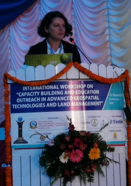
International Workshop on 'Capacity building and Education Outreach in Advanced Geospatial Technologies and Land Management’
10-11 December 2019
organized by Land Management Training centre of Nepal and co-organized by TC V/WG 7 and TC IV/WG 6 of ISPRS, Nepal Remote Sensing and Photogrammetric Society (NRSPS) and Nepal Institution of Chartered Surveyors (NICS)
Dhulikhel, Nepal
The workshop was concluded with a resolution which can be read
here…
|
|
|
| |
|
Obituaries
 |
|
In memoriam
Prof. Gabriele Fangi – Distinguished Executive Member of CIPA Heritage Documentation
It is with deep sadness and grief that the family of CIPA Heritage Documentation announces the demise of Prof. Gabriele Fangi, former Geomatics Professor at the Università Politecnica delle Marche in Ancona, Italy, and former member of CIPA Executive Board. Gabriele passed away on January 17th, 2020 after a brief illness at the age of 75.
Read the obituary
here…
|
|
|
| |
|
ISPRS International Journal of Geo-Information — Open Access Journal
 |
|
New publications in the ISPRS International Journal of Geo-Information
Open Access Journal
Volume 8, Issue 12 (December 2019)
A Spatio-Temporal Bayesian Model for Estimating the Effects of Land Use Change on Urban Heat Island
Liu, Xin, Xiao, Zuolin, Liu, Rui
No: 522
Multidimensional and Multiscale GIS
Guilbert, Eric, Boguslawski, Pawel, Isikdag, Umit
No: 523
Mapping Creative Industries: A Case Study on Supporting Geographical Information Systems in the Olomouc Region, Czech Republic
Netek, Rostislav, Burian, Tomas, Kohn, Jakub
No: 524
Automated Method for Detection of Missing Road Point Regions in Mobile Laser Scanning Data
Ma, Yang, Zheng, Yubing, Easa, Said, Hou, Mingyu, Cheng, Jianchuan
No: 525
Trip Extraction of Shared Electric Bikes Based on Multi-Rule-Constrained Homomorphic Linear Clustering Algorithm
Cheng, Xiaoqian, Li, Chengming, Du, Weibing, Shen, Jianming, Dai, Zhaoxin
No: 526
Non-Temporal Point Cloud Analysis for Surface Damage in Civil Structures
Mohammadi, Mohammad Ebrahim, Wood, Richard L., Wittich, Christine E.
No: 527
A Method of Watershed Delineation for Flat Terrain Using Sentinel-2A Imagery and DEM: A Case Study of the Taihu Basin
Li, Leilei, Yang, Jintao, Wu, Jin
No: 528
Retrieving Landmark Salience Based on Wikipedia: An Integrated Ranking Model
Binski, Noa, Natapov, Asya, Dalyot, Sagi
No: 529
Using Cartographic Documents to Provide Geoinformation on the Rights to Real Estate—Taking Poland as an Example
Ogryzek, Marek, Klimach, Anna, Niekurzak, Dominik, Pietkiewicz, Michał
No: 530
Analyzing the Relationship between Perception of Safety and Reported Crime in an Urban Neighborhood Using GIS and Sketch Maps
Ogneva-Himmelberger, Yelena, Ross, Laurie, Caywood, Thomas, Khananayev, Marina, Starr, Casey
No: 531
A Distributed Storage and Access Approach for Massive Remote Sensing Data in MongoDB
Wang, Shuang, Li, Guoqing, Yao, Xiaochuang, Zeng, Yi, Pang, Lushen, Zhang, Lianchong
No: 533
Evaluation of Uncrewed Aircraft Systems’ Lidar Data Quality
Babbel, Benjamin J., Olsen, Michael J., Che, Erzhuo, Leshchinsky, Ben A., Simpson, Chase, Dafni, Jake
No: 532
The Measurement of Mobility-Based Accessibility—The Impact of Floods on Trips of Various Length and Motivation
Borowska-Stefańska, Marta, Kowalski, Michał, Wiśniewski, Szymon
No: 534
Analysis of Bird Flyways in 3D
Tattoni, Clara, Ciolli, Marco
No: 535
LiDAR and UAV System Data to Analyse Recent Morphological Changes of a Small Drainage Basin
Borrelli, Luigi, Conforti, Massimo, Mercuri, Michele
No: 536
DEM-Based Vs30 Map and Terrain Surface Classification in Nationwide Scale—A Case Study in Iran
Karimzadeh, Sadra, Feizizadeh, Bakhtiar, Matsuoka, Masashi
No: 537
The ε-Approximation of the Time-Dependent Shortest Path Problem Solution for All Departure Times
Kolovský, František, Ježek, Jan, Kolingerová, Ivana
No: 538
Modelling and Visualizing Holographic 3D Geographical Scenes with Timely Data Based on the HoloLens
Wang, Wei, Wu, Xingxing, He, An, Chen, Zeqiang
No: 539
The Role of Geoprocessing in Mapping Crime Using Hot Streets
Tom-Jack, Quincy T., Bernstein, Jennifer M., Loyola, Laura C.
No: 540
Analysis of Spatial Wharf Pattern of the Yangtze River Delta Urban Agglomeration, China
Zhang, Penglin, Li, Hongli, Wang, Junqiang, Hong, Jiewen
No: 541
Applications of Photogrammetry for Environmental Research
Mancini, Francesco, Salvini, Riccardo
No: 542
An Improved Hybrid Segmentation Method for Remote Sensing Images
Wang, Jun, Jiang, Lili, Wang, Yongji, Qi, Qingwen
No: 543
How Is the Confidentiality of Crime Locations Affected by Parameters in Kernel Density Estimation?
Wang, Zengli, Liu, Lin, Zhou, Hanlin, Lan, Minxuan
No: 544
Parameters Derived from and/or Used with Digital Elevation Models (DEMs) for Landslide Susceptibility Mapping and Landslide Risk Assessment: A Review
Saleem, Nayyer, Huq, Md. Enamul, Twumasi, Nana Yaw Danquah, Javed, Akib, Sajjad, Asif
No: 545
Multi-Scale Validation of MODIS LAI Products Based on Crop Growth Period
Wang, Ting, Qu, Yonghua, Xia, Ziqing, Peng, Yiping, Liu, Zhenhua
No: 547
EEG & Eye Tracking User Experiments for Spatial Memory Task on Maps
Keskin, Merve, Ooms, Kristien, Dogru, Ahmet Ozgur, De Maeyer, Philippe
No: 546
Surface Reconstruction for Three-Dimensional Rockfall Volumetric Analysis
Bonneau, David, DiFrancesco, Paul-Mark, Hutchinson, D. Jean
No: 548
WeatherNet: Recognising Weather and Visual Conditions from Street-Level Images Using Deep Residual Learning
Ibrahim, Mohamed R., Haworth, James, Cheng, Tao
No: 549
Optimization of Shortest-Path Search on RDBMS-Based Graphs
Seo, Kwangwon, Ahn, Jinhyun, Im, Dong-Hyuk
No: 550
Geographic Object-Based Image Analysis for Automated Landslide Detection Using Open Source GIS Software
Knevels, Raphael, Petschko, Helene, Leopold, Philip, Brenning, Alexander
No: 551
Study of NSSDA Variability by Means of Automatic Positional Accuracy Assessment Methods
Ruiz-Lendínez, Juan José, Ariza-López, Francisco Javier, Ureña-Cámara, Manuel Antonio
No: 552
Monitoring the Water Quality of Small Water Bodies Using High-Resolution Remote Sensing Data
Yigit Avdan, Zehra, Kaplan, Gordana, Goncu, Serdar, Avdan, Ugur
No: 553
Recovering Human Motion Patterns from Passive Infrared Sensors: A Geometric-Algebra Based Generation-Template-Matching Approach
Xiao, Shengjun, Yuan, Linwang, Luo, Wen, Li, Dongshuang, Zhou, Chunye, Yu, Zhaoyuan
No: 554
Quantitative Identification of Urban Functions with Fishers’ Exact Test and POI Data Applied in Classifying Urban Districts: A Case Study within the Sixth Ring Road in Beijing
Yi, Disheng, Yang, Jing, Liu, Jingjing, Liu, Yusi, Zhang, Jing
No: 555
Geo-Tagged Photo Metadata Processing Method for Beijing Inbound Tourism Flow
Chen, Wen, Xu, Zhiyun, Zheng, Xiaoyao, Luo, Yonglong
No: 556
Data Fusion and Accuracy Analysis of Multi-Source Land Use/Land Cover Datasets along Coastal Areas of the Maritime Silk Road
Hou, Wan, Hou, Xiyong
No: 557
Types of Crime, Poverty, Population Density and Presence of Police in the Metropolitan District of Quito
Cabrera-Barona, Pablo F., Jimenez, Gualdemar, Melo, Pablo
No: 558
Visualization of Pedestrian Density Dynamics Using Data Extracted from Public Webcams
Petrasova, Anna, Hipp, J. Aaron, Mitasova, Helena
No: 559
Non-Employment Activity Type Imputation from Points of Interest and Mobility Data at an Individual Level: How Accurate Can We Get?
Bantis, Thanos, Haworth, James
No: 560
Integration of Multi-Camera Video Moving Objects and GIS
Xie, Yujia, Wang, Meizhen, Liu, Xuejun, Mao, Bo, Wang, Feiyue
No: 561
Model Ensembles of Artificial Neural Networks and Support Vector Regression for Improved Accuracy in the Prediction of Vegetation Conditions and Droughts in Four Northern Kenya Counties
Adede, Chrisgone, Oboko, Robert, Wagacha, Peter W., Atzberger, Clement
No: 562
Grey System Theory in Research into Preferences Regarding the Location of Place of Residence within a City
Gerus-Gościewska, Małgorzata, Gościewski, Dariusz, Bajerowski, Tomasz, Szczepańska, Agnieszka
No: 563
Monitoring 2.0: Update on the Halyomorpha halys Invasion of Trentino
Malek, Robert, Zapponi, Livia, Eriksson, Anna, Ciolli, Marco, Mazzoni, Valerio, Anfora, Gianfranco, Tattoni, Clara
No: 564
An Improved Mobile Mapping System to Detect Road-Killed Amphibians and Small Birds
Sousa Guedes, Diana, Ribeiro, Hélder, Sillero, Neftalí
No: 565
Using Geographic Ontologies and Geo-Characterization to Represent Geographic Scenarios
Huang, Yi, Yuan, May, Sheng, Yehua, Min, Xiangqiang, Cao, Yuwei
No: 566
Developing the Chinese Academic Map Publishing Platform
Xu, Yongming, Lewis, Benjamin, Guan, Weihe Wendy
No: 567
Assessing the Distribution of Heavy Industrial Heat Sources in India between 2012 and 2018
Ma, Caihong, Niu, Zheng, Ma, Yan, Chen, Fu, Yang, Jin, Liu, Jianbo
No: 568
Quality Control of “As Built” BIM Datasets Using the ISO 19157 Framework and a Multiple Hypothesis Testing Method Based on Proportions
Ariza-López, Francisco Javier, Rodríguez-Avi, José, Reinoso-Gordo, Juan Francisco, Ariza-López, Íñigo Antonio
No: 569
HsgNet: A Road Extraction Network Based on Global Perception of High-Order Spatial Information
Xie, Yan, Miao, Fang, Zhou, Kai, Peng, Jing
No: 571
Modeling Spatio-Temporal Evolution of Urban Crowd Flows
Qin, Kun, Xu, Yuanquan, Kang, Chaogui, Sobolevsky, Stanislav, Kwan, Mei-Po
No: 570
Designing Geovisual Analytics Environments and Displays with Humans in Mind
Çöltekin, Arzu, Christophe, Sidonie, Robinson, Anthony, Demšar, Urška
No: 572
Analysis of the Cycling Flow Between Origin and Destination for Dockless Shared Bicycles Based on Singular Value Decomposition
Cao, Min, Cai, Boqin, Ma, Shangjing, Lü, Guonian, Chen, Min
No: 573
Clustering Complex Trajectories Based on Topologic Similarity and Spatial Proximity: A Case Study of the Mesoscale Ocean Eddies in the South China Sea
Wang, Huimeng, Du, Yunyan, Sun, Yong, Liang, Fuyuan, Yi, Jiawei, Wang, Nan
No: 574
Decision Model for Predicting Social Vulnerability Using Artificial Intelligence
Abarca-Alvarez, Francisco Javier, Reinoso-Bellido, Rafael, Campos-Sánchez, Francisco Sergio
No: 575
Development of a CityGML Application Domain Extension for Simulating the Building Construction Process
Zhang, Chi, Liu, Yunping, Lin, Chen, Zhou, Liangchen, Lin, Bingxian, Che, Mingliang
No: 576
As-Built BIM for a Fifteenth-Century Chinese Brick Structure at Various LoDs
Sun, Zheng, Xie, Jiangtao, Zhang, Yingying, Cao, Yongkang
No: 577
An Experimental Research on the Use of Recurrent Neural Networks in Landslide Susceptibility Mapping
Mutlu, Begum, Nefeslioglu, Hakan A., Sezer, Ebru A., Akcayol, M. Ali, Gokceoglu, Candan
No: 578
Fire Risk Assessment in Dense Urban Areas Using Information Fusion Techniques
Masoumi, Zohreh, van L.Genderen, John, Maleki, Jamshid
No: 579
Global Mapping of GDP at 1 km2 Using VIIRS Nighttime Satellite Imagery
Wang, Xuantong, Sutton, Paul C., Qi, Bingxin
No: 580
Accumulative Errors Optimization for Visual Odometry of ORB-SLAM2 Based on RGB-D Cameras
Qin, Jiangying, Li, Ming, Liao, Xuan, Zhong, Jiageng
No: 581
A Dual-Path and Lightweight Convolutional Neural Network for High-Resolution Aerial Image Segmentation
Zhang, Gang, Lei, Tao, Cui, Yi, Jiang, Ping
No: 582
The Effects of Physical, Social, and Housing Disorder on Neighborhood Crime: A Contemporary Test of Broken Windows Theory
Konkel, Rebecca Headley, Ratkowski, Dominick, Tapp, Susannah N.
No: 583
Human-Centric Data Science for Urban Studies
Resch, Bernd, Szell, Michael
No: 584
Concrete Preliminary Damage Inspection by Classification of Terrestrial Laser Scanner Point Clouds through Systematic Threshold Definition
Hadavandsiri, Zahra, Lichti, Derek D., Jahraus, Adam, Jarron, David
No: 585
Relevance of the Cell Neighborhood Size in Landscape Metrics Evaluation and Free or Open Source Software Implementations
Zatelli, Paolo, Gobbi, Stefano, Tattoni, Clara, Cantiani, Maria Giulia, La Porta, Nicola, Rocchini, Duccio, Zorzi, Nicola, Ciolli, Marco
No: 586
An Approach for the Analysis of the Accessibility of Fire Hydrants in Urban Territories
Raškauskaitė, Raminta, Grigonis, Vytautas
No: 587
CityGML-Based Road Information Model for Route Optimization of Snow-Removal Vehicle
Park, Sang Ho, Jang, Young-Hoon, Geem, Zong Woo, Lee, Sang-Ho
No: 588
A Semantic Expansion Model for VGI Retrieval
Sun, Tao, Xia, Hui, Li, Lin, Shen, Hang, Liu, Yu
No: 589
↑ Up
New publications in the ISPRS International Journal of Geo-Information
Open Access Journal
Volume 9, Issue 1 (Janary 2020)
Integrated Hazard Modeling for Simulating Torrential Stream Response to Flash Flood Events
Munir, Bilal Ahmad, Ahmad, Sajid Rashid, Hafeez, Sidrah
No: 1
Towards Increasing Residential Market Transparency: Mapping Local Housing Prices and Dynamics
Cellmer, Radoslaw, Trojanek, Radoslaw
No: 2
An Open-Source Web Platform to Share Multisource, Multisensor Geospatial Data and Measurements of Ground Deformation in Mountain Areas
Cignetti, Martina, Guenzi, Diego, Ardizzone, Francesca, Allasia, Paolo, Giordan, Daniele
No: 4
Can Urban Street Network Characteristics Indicate Economic Development Level? Evidence from Chinese Cities
LOBsang, Tashi, Zhen, Feng, Zhang, Shanqi
No: 3
A Novel Underwater Simultaneous Localization and Mapping Online Algorithm Based on Neural Network
Hou, Guangchao, Shao, Qi, Zou, Bo, Dai, Liwen, Zhang, Zhe, Mu, Zhehan, Zhang, Yadong, Zhai, Jingsheng
No: 5
Automatic Identification of the Social Functions of Areas of Interest (AOIs) Using the Standard Hour-Day-Spectrum Approach
Zhou, Tong, Liu, Xintao, Qian, Zhen, Chen, Haoxuan, Tao, Fei
No: 7
Spoofing Detection of Civilian UAVs Using Visual Odometry
Varshosaz, Masood, Afary, Alireza, Mojaradi, Barat, Saadatseresht, Mohammad, Ghanbari Parmehr, Ebadat
No: 6
Geo-DMP: A DTN-Based Mobile Prototype for Geospatial Data Retrieval
Li, Chao, Lu, Huimei, Xiang, Yong, Gao, Rui
No: 8
What Went Wrong for Bad Solvers during Thematic Map Analysis? Lessons Learned from an Eye-Tracking Study
Havelková, Lenka, Gołębiowska, Izabela Małgorzata
No: 9
The State of Mapillary: An Exploratory Analysis
Ma, Dawei, Fan, Hongchao, Li, Wenwen, Ding, Xuan
No: 10
ACYOTB Plugin: Tool for Accurate Orthorectification in Open-Source Environments
Baiocchi, Valerio, Giannone, Francesca, Monti, Felicia, Vatore, Felicia
No: 11
A Novel Infringement Detection Method for GIS Vector Data
Tang, Zhi, Zhang, Yun, Huang, Jing, He, Hao, Ding, Yue
No: 12
The Unbalanced Analysis of Economic Urbanization—A Case Study of Typical Cities in China
Cao, Xiangyang, Zhou, Bingzhong, Shi, Yishao, Pei, Xiaowen
No: 13
UAV-Based Structural Damage Mapping: A Review
Kerle, Norman, Nex, Francesco, Gerke, Markus, Duarte, Diogo, Vetrivel, Anand
No: 14
Deep Learning-Based Named Entity Recognition and Knowledge Graph Construction for Geological Hazards
Fan, Runyu, Wang, Lizhe, Yan, Jining, Song, Weijing, Zhu, Yingqian, Chen, Xiaodao
No: 15
Visualisation of Spatial Data Uncertainty. A Case Study of a Database of Topographic Objects
Ślusarski, Marek, Jurkiewicz, Magdalena
No: 16
Automatic Geodata Processing Methods for Real-World City Visualizations in Cities: Skylines
Pinos, Jan, Vozenilek, Vit, Pavlis, Ondrej
No: 17
Extracting Building Areas from Photogrammetric DSM and DOM by Automatically Selecting Training Samples from Historical DLG Data
Chen, Siyang, Zhang, Yunsheng, Nie, Ke, Li, Xiaoming, Wang, Weixi
No: 18
Uncertainty Visualization of Transport Variance in a Time-Varying Ensemble Vector Field
Ren, Ke, Qu, Dezhan, Xu, Shaobin, Jiao, Xufeng, Tai, Liang, Zhang, Huijie
No: 19
Efficient Estimation of Biomass from Residual Agroforestry
Bascietto, Marco, Sperandio, Giulio, Bajocco, Sofia
No: 21
Spatio-Temporal Land-Use Changes and the Response in Landscape Pattern to Hemeroby in a Resource-Based City
Tian, Yu, Liu, Bingxi, Hu, Yuandong, Xu, Qing, Qu, Ming, Xu, Dawei
No: 20
Patterns of School Preference about the Local Heritage in Medium-Size Cities of Castilla-La Mancha (Spain). The Case of Ciudad Real
Rodríguez Domenech, María Ángeles, Callejas Albiñana, Ana Isabel, González-Mohino Sánchez, Miguel
No: 22
Field Geological Investigations and Stability Analysis of Duanjiagou Landslide
Wang, Xingang, Xia, Tangdai, Zhang, Longju, Gao, Min, Cheng , Kang
No: 23
Identification of Salt Deposits on Seismic Images Using Deep Learning Method for Semantic Segmentation
Milosavljević, Aleksandar
No: 24
A Vertex Concavity-Convexity Detection Method for Three-Dimensional Spatial Objects Based on Geometric Algebra
Yin, Pengcheng, Zhang, Jiyi, Sun, Xiying, Hu, Di, Shi, Zhifeng, Wu, Chengyan
No: 25
Spatial and Temporal Evolution of the Infiltration Characteristics of a Loess Landslide
Yang, Dongdong, Qiu, Haijun, Pei, Yanqian, Hu, Sheng, Ma, Shuyue, Liu, Zijing, Zhang, Yan, Cao, Mingming
No: 26
Reduction of Circular Arcs in European Cadastral Systems—The Proposal of a Solution Referring to the Recommendations of the INSPIRE Data Specification on Cadastral Parcels
Zygmunt, Mariusz, Gargula, Tadeusz, Klapa, Przemysław
No: 27
Land Suitability for Sustainable Aquaculture of Rainbow Trout (Oncorhynchus mykiss) in Molinopampa (Peru) Based on RS, GIS, and AHP
Calle Yunis, Christian Ricardo, Salas López, Rolando, Cruz, Segundo Manuel Oliva, Barboza Castillo, Elgar, Silva López, Jhonsy Omar, Iliquín Trigoso, Daniel, Briceño, Nilton B. Rojas
No: 28
Towards Supporting Collaborative Spatial Planning: Conceptualization of a Maptable Tool through User Stories
Aguilar, Rosa, Flacke, Johannes, Pfeffer, Karin
No: 29
Joint Simulation of Spatially Correlated Soil Health Indicators, Using Independent Component Analysis and Minimum/Maximum Autocorrelation Factors
Boluwade, Alaba
No: 30
Map Matching for Urban High-Sampling-Frequency GPS Trajectories
Liu, Minshi, Zhang, Ling, Ge, Junlian, Long, Yi, Che, Weitao
No: 31
Statistical Correlation between Monthly Electric Power Consumption and VIIRS Nighttime Light
Lin, Jintang, Shi, Wenzhong
No: 32
Urban Ecological Corridor Network Construction: An Integration of the Least Cost Path Model and the InVEST Model
Tang, Yuhan, Gao, Chi, Wu, Xuefei
No: 33
Procedures for Condition Mapping Using 360° Images
Barazzetti, Luigi, Previtali, Mattia, Scaioni, Marco
No: 34
Correction: Gu, Q., et al. Regionalization Analysis and Mapping for the Source and Sink of Tourist Flows. ISPRS Int. J. Geo-Inf. 2019, 8, 314
Gu, Qiushi, Zhang, Haiping, Chen, Min, Chen, Chongcheng
No: 35
A Data-Driven Framework for Walkability Measurement with Open Data: A Case Study of Triple Cities, New York
Deng, Chengbin, Dong, Xiaoyu, Wang, Huihai, Lin, Weiying, Wen, Hao, Frazier, John, Ho, Hung Chak, Holmes, Louisa
No: 36
The Role of Spatial Context Information in the Generalization of Geographic Information: Using Reducts to Indicate Relevant Attributes
Fiedukowicz, Anna
No: 37
Revealing the Correlation between Population Density and the Spatial Distribution of Urban Public Service Facilities with Mobile Phone Data
Shi, Yi, Yang, Junyan, Shen, Peiyu
No: 38
A GRID-Based Spatial Interpolation Method as a Tool Supporting Real Estate Market Analyses
Szczepańska, Agnieszka, Gościewski, Dariusz, Gerus-Gościewska, Małgorzata
No: 39
Spatial Multi-Objective Land Use Optimization toward Livability Based on Boundary-Based Genetic Algorithm: A Case Study in Singapore
Cao, Kai, Liu, Muyang, Wang, Shu, Liu, Mengqi, Zhang, Wenting, Meng, Qiang, Huang, Bo
No: 40
Assessing Emergency Shelter Demand Using POI Data and Evacuation Simulation
Chen, Wei, Fang, Yao, Zhai, Qing, Wang, Wei, Zhang, Yijie
No: 41
Where Urban Youth Work and Live: A Data-Driven Approach to Identify Urban Functional Areas at a Fine Scale
Yan, Yiming, Wang, Yuanyuan, Du, Zhenhong, Zhang, Feng, Liu, Renyi, Ye, Xinyue
No: 42
Optimization-Based Construction of Quadrilateral Table Cartograms
Inoue, Ryo, Li, Mao
No: 43
Spatio-Temporal Prediction of the Epidemic Spread of Dangerous Pathogens Using Machine Learning Methods
Hamer, Wolfgang B., Birr, Tim, Verreet, Joseph-Alexander, Duttmann, Rainer, Klink, Holger
No: 44
Differences in the Gaze Behaviours of Pedestrians Navigating between Regular and Irregular Road Patterns
Liu, Bing, Dong, Weihua, Zhan, Zhicheng, Wang, Shengkai, Meng, Liqiu
No: 45
An Efficient Staged Evacuation Planning Algorithm Applied to Multi-Exit Buildings
Han, Litao, Guo, Huan, Zhang, Haisi, Kong, Qiaoli, Zhang, Aiguo, Gong, Cheng
No: 46
Multistage Cascade Predictor of Structural Elements Movement in the Deformation Analysis of Large Objects Based on Time Series Influencing Factors
Hamzic, Adis, Avdagic, Zikrija, Besic, Ingmar
No: 47
Strengthening Participation Using Interactive Planning Support Systems: A Systematic Review
Flacke, Johannes, Shrestha, Rehana, Aguilar, Rosa
No: 49
Uncertainty Analysis of Remote Sensing Pretreatment for Biomass Estimation on Landsat OLI and Landsat ETM+
Zhang, Qi, Xu, Lihua, Zhang, Maozhen, Wang, Zhi, Gu, Zhangfeng, Wu, Yaqi, Shi, Yijun, Lu, Zhangwei
No: 48
Accuracy Improvement of Airborne Lidar Strip Adjustment by Using Height Data and Surface Feature Strength Information Derived from the Tensor Voting Algorithm
You, Rey-Jer, Lee, Chao-Liang
No: 50
Integrated Visualization Approach for Real-Time and Dynamic Assessment of Storm Surge Disasters for China’s Seas
Zhou, Lin, Hu, Wei, Jia, Zhen, Li, Xinfang, Li, Yaru, Su, Tianyun, Guo, Qingsheng
No: 51
Developing Web-Based and Mobile-Based GIS for Places of Worship Information to Support Halal Tourism: A Case Study in Bukittinggi, Indonesia
Afnarius, Surya, Akbar, Fajril, Yuliani, Fitri
No: 52
Evaluation of Augmented Reality-Based Building Diagnostics Using Third Person Perspective
Liu, Fei, Jonsson, Torsten, Seipel, Stefan
No: 53
A Spatial Analytics Framework to Investigate Electric Power-Failure Events and Their Causes
Sultan, Vivian, Hilton, Brian
No: 54
Multi-Parameter Estimation of Average Speed in Road Networks Using Fuzzy Control
Guth, Johanna, Wursthorn, Sven, Keller, Sina
No: 55
Detecting Intra-Urban Housing Market Spillover through a Spatial Markov Chain Model
Zhang, Daijun, Zhang, Xiaoqi, Zheng, Yanqiao, Ye, Xinyue, Li, Shengwen, Dai, Qiwen
No: 56
Linguistic Landscapes on Street-Level Images
Hong, Seong-Yun
No: 57
Spaces in Spatial Science and Urban Applications—State of the Art Review
Zlatanova, Sisi, Yan, Jinjin, Wang, Yijing, Diakité, Abdoulaye, Isikdag, Umit, Sithole, George, Barton, Jack
No: 58
Acknowledgement to Reviewers of IJGI in 2019
IJGI Editorial Office
No: 59
Integrative Analysis of Spatial Heterogeneity and Overdispersion of Crime with a Geographically Weighted Negative Binomial Model
Chen, Jianguo, Liu, Lin, Xiao, Luzi, Xu, Chong, Long, Dongping
No: 60
↑ Up
|
|
|
| |
|
ISPRS Journal of Photogrammetry and Remote Sensing
 |
|
New publications in the ISPRS Journal of
Photogrammetry and Remote Sensing Volume 159 (January 2020)
Editorial Board
Pages: ii
An integrated photogrammetric and photoclinometric approach for illumination-invariant pixel-resolution 3D mapping of the lunar surface
Wai Chung Liu, Bo Wu
Pages: 153-168
Significant effects of ecological context on urban trees’ cooling efficiency
Jia Wang, Weiqi Zhou, Min Jiao, Zhong Zheng, Tian Ren, Qiming Zhang
Pages: 78-89
Comparing partial least squares (PLS) discriminant analysis and sparse PLS discriminant analysis in detecting and mapping Solanum mauritianum in commercial forest plantations using image texture
Romano Trent Lottering, Mackyla Govender, Kabir Peerbhay, Shenelle Lottering
Pages: 271-280
4D objects-by-change: Spatiotemporal segmentation of geomorphic surface change from LiDAR time series
Katharina Anders, Lukas Winiwarter, Roderik Lindenbergh, Jack G. Williams, Sander E. Vos, Bernhard Höfle
Pages: 352-363
Estimation of soil surface water contents for intertidal mudflats using a near-infrared long-range terrestrial laser scanner
Kai Tan, Jin Chen, Weiguo Zhang, Kunbo Liu, Pengjie Tao, Xiaojun Cheng
Pages: 129-139
Object-specific optimization of hierarchical multiscale segmentations for high-spatial resolution remote sensing images
Xueliang Zhang, Pengfeng Xiao, Xuezhi Feng
Pages: 308-321
Comparison of multi-seasonal Landsat 8, Sentinel-2 and hyperspectral images for mapping forest alliances in Northern California
Matthew L. Clark
Pages: 26-40
Investigation of wildfire impacts on land surface phenology from MODIS time series in the western US forests
Jianmin Wang, Xiaoyang Zhang
Pages: 281-295
A systematic evaluation of influence of image selection process on remote sensing-based burn severity indices in North American boreal forest and tundra ecosystems
Dong Chen, Tatiana V. Loboda, Joanne V. Hall
Pages: 63-77
Camera orientation, calibration and inverse perspective with uncertainties: A Bayesian method applied to area estimation from diverse photographs
Grégoire Guillet, Thomas Guillet, Ludovic Ravanel
Pages: 237-255
A UAV-based panoramic oblique photogrammetry (POP) approach using spherical projection
Xujie Zhang, Pengcheng Zhao, Qingwu Hu, Mingyao Ai, Datian Hu, Jiayuan Li
Pages: 198-219
Panoramic SLAM from a multiple fisheye camera rig
Shunping Ji, Zijie Qin, Jie Shan, Meng Lu
Pages: 169-183
Mapping large-area tidal flats without the dependence on tidal elevations: A case study of Southern China
Chuanpeng Zhao, Cheng-Zhi Qin, Jiakun Teng
Pages: 256-270
A Frustum-based probabilistic framework for 3D object detection by fusion of LiDAR and camera data
Zheng Gong, Haojia Lin, Dedong Zhang, Zhipeng Luo, John Zelek, Yiping Chen, Abdul Nurunnabi, Cheng Wang, Jonathan Li
Pages: 90-100
Annual large-scale urban land mapping based on Landsat time series in Google Earth Engine and OpenStreetMap data: A case study in the middle Yangtze River basin
Dandan Liu, Nengcheng Chen, Xiang Zhang, Chao Wang, Wenying Du
Pages: 337-351
A local thresholding approach to flood water delineation using Sentinel-1 SAR imagery
Jiayong Liang, Desheng Liu
Pages: 53-62
Remote sensing algorithms for estimation of fractional vegetation cover using pure vegetation index values: A review
Lin Gao, Xiaofei Wang, Brian Alan Johnson, Qingjiu Tian, Yu Wang, Jochem Verrelst, Xihan Mu, Xingfa Gu
Pages: 364-377
Investigating the resolution capability of terrestrial laser scanners and its impact on the effective number of measurements
B. Schmitz, H. Kuhlmann, C. Holst
Pages: 41-52
Building segmentation through a gated graph convolutional neural network with deep structured feature embedding
Yilei Shi, Qingyu Li, Xiao Xiang Zhu
Pages: 184-197
Extraction of urban building damage using spectral, height and corner information from VHR satellite images and airborne LiDAR data
Xue Wang, Peijun Li
Pages: 322-336
Vehicle global 6-DoF pose estimation under traffic surveillance camera
Shanxin Zhang, Cheng Wang, Zijian He, Qing Li, Xiuhong Lin, Xin Li, Juyong Zhang, Chenhui Yang, Jonathan Li
Pages: 114-128
Evaluation of the LSA-SAF gross primary production product derived from SEVIRI/MSG data (MGPP)
B. Martínez, M.A. Gilabert, S. Sánchez-Ruiz, M. Campos-Taberner, F.J. García-Haro, C. Brümmer, A. Carrara, G. Feig, T. Grünwald, I. Mammarella, T. Tagesson
Pages: 220-236
A robust visible near-infrared index for fire severity mapping in Arctic tundra ecosystems
Yaping Chen, Mark Jason Lara, Feng Sheng Hu
Pages: 101-113
Automatic scale estimation of structure from motion based 3D models using laser scalers in underwater scenarios
Klemen Istenič, Nuno Gracias, Aurélien Arnaubec, Javier Escartín, Rafael Garcia
Pages: 13-25
Wide-area invasive species propagation mapping is possible using phenometric trends
Tobias Landmann, Olena Dubovyk, Gohar Ghazaryan, Jackson Kimani, Elfatih M. Abdel-Rahman
Pages: 1-12
Object detection in optical remote sensing images: A survey and a new benchmark
Ke Li, Gang Wan, Gong Cheng, Liqiu Meng, Junwei Han
Pages: 296-307
Superpixel-enhanced deep neural forest for remote sensing image semantic segmentation
Li Mi, Zhenzhong Chen
Pages: 140-152
New publications in the ISPRS Journal of
Photogrammetry and Remote Sensing Volume 160 (February 2020)
Editorial Board
Pages: ii
Incorporating environmental variables into a MODIS-based crop yield estimation method for United States corn and soybeans through the use of a random forest regression algorithm
Toshihiro Sakamoto
Pages: 208-228
Three-dimensional photogrammetric mapping of cotton bolls in situ based on point cloud segmentation and clustering
Shangpeng Sun, Changying Li, Peng W. Chee, Andrew H. Paterson, Yu Jiang, Rui Xu, Jon S. Robertson, Jeevan Adhikari, Tariq Shehzad
Pages: 195-207
A deep learning approach for mapping and dating burned areas using temporal sequences of satellite images
Miguel M. Pinto, Renata Libonati, Ricardo M. Trigo, Isabel F. Trigo, Carlos C. DaCamara
Pages: 260-274
A two-step approach for the correction of rolling shutter distortion in UAV photogrammetry
Yilin Zhou, Mehdi Daakir, Ewelina Rupnik, Marc Pierrot-Deseilligny
Pages: 51-66
Orientation guided anchoring for geospatial object detection from remote sensing imagery
Yongtao Yu, Haiyan Guan, Dilong Li, Tiannan Gu, E. Tang, Aixia Li
Pages: 67-82
Polarimetric calibration for the distributed Gaofen-3 product by an improved unitary zero helix framework
Lei Shi, Pingxiang Li, Jie Yang, Hanwei Sun, Lingli Zhao, Liangpei Zhang
Pages: 229-243
Estimating winter wheat yield based on a light use efficiency model and wheat variety data
Jie Dong, Haibo Lu, Yawen Wang, Tao Ye, Wenping Yuan
Pages: 18-32
A semi-empirical approach for modeling the vegetation thermal infrared directional anisotropy of canopies based on using vegetation indices
Zunjian Bian, J.-L. Roujean, J.-P. Lagouarde, Biao Cao, Hua Li, Yongming Du, Qiang Liu, Qing Xiao, Qinhuo Liu
Pages: 136-148
On the versatility of popular and recently proposed supervised evaluation metrics for segmentation quality of remotely sensed images: An experimental case study of building extraction
Shahab Jozdani, Dongmei Chen
Pages: 275-290
Automated training sample definition for seasonal burned area mapping
Lonesome Malambo, Conrad D. Heatwole
Pages: 107-123
Optimising drone flight planning for measuring horticultural tree crop structure
Yu-Hsuan Tu, Stuart Phinn, Kasper Johansen, Andrew Robson, Dan Wu
Pages: 83-96
Deep nonsmooth nonnegative matrix factorization network with semi-supervised learning for SAR image change detection
Heng-Chao Li, Gang Yang, Wen Yang, Qian Du, William J. Emery
Pages: 167-179
Assessment of bidirectional reflectance effects on desert and forest for radiometric cross-calibration of satellite sensors
Qu Zhou, Liqiao Tian, Jian Li, Wenkai Li
Pages: 180-194
Robust point cloud registration based on topological graph and Cauchy weighted lq-norm
Jiayuan Li, Pengcheng Zhao, Qingwu Hu, Mingyao Ai
Pages: 244-259
TanDEM-X DEM: Comparative performance review employing LIDAR data and DSMs
Dimitra I. Vassilaki, Athanassios A. Stamos
Pages: 33-50
Transferring deep learning models for cloud detection between Landsat-8 and Proba-V
Gonzalo Mateo-García, Valero Laparra, Dan López-Puigdollers, Luis Gómez-Chova
Pages: 1-17
Automated extraction of lane markings from mobile LiDAR point clouds based on fuzzy inference
Heidar Rastiveis, Alireza Shams, Wayne A. Sarasua, Jonathan Li
Pages: 149-166
A convolutional neural network approach for counting and geolocating citrus-trees in UAV multispectral imagery
Lucas Prado Osco, Mauro dos Santos de Arruda, José Marcato Junior, Neemias Buceli da Silva, Ana Paula Marques Ramos, Érika Akemi Saito Moryia, Nilton Nobuhiro Imai, Danillo Roberto Pereira, José Eduardo Creste, Edson Takashi Matsubara, Jonathan Li, Wesley Nunes Gonçalves
Pages: 97-106
Estimating wheat yields in Australia using climate records, satellite image time series and machine learning methods
Elisa Kamir, François Waldner, Zvi Hochman
Pages: 124-135
New publications in the ISPRS Journal of
Photogrammetry and Remote Sensing Volume 161 (March 2020)
Editorial Board
Pages: ii
Aerial image semantic segmentation using DCNN predicted distance maps
Dengfeng Chai, Shawn Newsam, Jingfeng Huang
Pages: 309-322
Corrigendum to “Annual large-scale urban land mapping based on Landsat time series in Google Earth Engine and OpenStreetMap data: A case study in the middle Yangtze River basin” [ISPRS J. Photogram. Rem. Sens. 159 (2020) 337–351]
Dandan Liu, Nengcheng Chen, Xiang Zhang, Chao Wang, Wenying D
Pages: 263
Fast regularity-constrained plane fitting
Yangbin Lin, Jialian Li, Cheng Wang, Zhonggui Chen, Zongyue Wang, Jonathan Li
Pages: 208-217
Thermal unmixing based downscaling for fine resolution diurnal land surface temperature analysis
Jiong Wang, Oliver Schmitz, Meng Lu, Derek Karssenberg
Pages: 76-89
Deep SAR-Net: Learning objects from signals
Zhongling Huang, Mihai Datcu, Zongxu Pan, Bin Lei
Pages: 179-193
Accurate derivation of stem curve and volume using backpack mobile laser scanning
Eric Hyyppä, Antero Kukko, Risto Kaijaluoto, Joanne C. White, Michael A. Wulder, Jiri Pyörälä, Xinlian Liang, Xiaowei Yu, Yunsheng Wang, Harri Kaartinen, Juho-Pekka Virtanen, Juha Hyyppä
Pages: 246-262
Object-based incremental registration of terrestrial point clouds in an urban environment
Xuming Ge, Han Hu
Pages: 218-232
An improved change detection approach using tri-temporal logic-verified change vector analysis
Peijun Du, Xin Wang, Dongmei Chen, Sicong Liu, Cong Lin, Yaping Meng
Pages: 278-293
Noise-robust transparent visualization of large-scale point clouds acquired by laser scanning
Tomomasa Uchida, Kyoko Hasegawa, Liang Li, Motoaki Adachi, Hiroshi Yamaguchi, Fadjar I. Thufail, Sugeng Riyanto, Atsushi Okamoto, Satoshi Tanaka
Pages: 124-134
The migration of training samples towards dynamic global land cover mapping
Huabing Huang, Jie Wang, Caixia Liu, Lu Liang, Congcong Li, Peng Gong
Pages: 27-36
Collaborative learning of lightweight convolutional neural network and deep clustering for hyperspectral image semi-supervised classification with limited training samples
Bei Fang, Ying Li, Haokui Zhang, Jonathan Cheung-Wai Chan
Pages: 164-178
A blended census and multiscale remote sensing approach to probabilistic cropland mapping in complex landscapes
Issamaldin Mohammed, Michael Marshall, Kees de Bie, Lyndon Estes, Andy Nelson
Pages: 233-245
Efficient match pair selection for oblique UAV images based on adaptive vocabulary tree
San Jiang, Wanshou Jiang
Pages: 61-75
3D map-guided single indoor image localization refinement
Qing Li, Jiasong Zhu, Jun Liu, Rui Cao, Hao Fu, Jonathan M. Garibaldi, Qingquan Li, Bozhi Liu, Guoping Qiu
Pages: 13-26
Extraction of sub-pixel C3/C4 emissions of solar-induced chlorophyll fluorescence (SIF) using artificial neural network
Oz Kira, Ying Sun
Pages: 135-146
Examining earliest identifiable timing of crops using all available Sentinel 1/2 imagery and Google Earth Engine
Nanshan You, Jinwei Dong
Pages: 109-123
An application-driven LOD modeling paradigm for 3D building models
Lei Tang, Shen Ying, Lin Li, Filip Biljecki, Haihong Zhu, Yi Zhu, Fan Yang, Fei Su
Pages: 194-207
Learning sequential slice representation with an attention-embedding network for 3D shape recognition and retrieval in MLS point clouds
Zhipeng Luo, Di Liu, Jonathan Li, Yiping Chen, Zhenlong Xiao, José Marcato Junior, Wesley Nunes Gonçalves, Cheng Wang
Pages: 147-163
A residual convolutional neural network for polarimetric SAR image super-resolution
Huanfeng Shen, Liupeng Lin, Jie Li, Qiangqiang Yuan, Lingli Zhao
Pages: 90-108
Global and local patterns of landscape change accuracy
Zahn Münch
Pages: 264-277
Heuristic sample learning for complex urban scenes: Application to urban functional-zone mapping with VHR images and POI data
Xiuyuan Zhang, Shihong Du, Zhijia Zheng
Pages: 1-12
All-sky longwave downward radiation from satellite measurements: General parameterizations based on LST, column water vapor and cloud top temperature
Tianxing Wang, Jiancheng Shi, Ya Ma, Husi Letu, Xingcai Li
Pages: 52-60
Development and evaluation of a new algorithm for detecting 30 m land surface phenology from VIIRS and HLS time series
Xiaoyang Zhang, Jianmin Wang, Geoffrey M. Henebry, Feng Gao
Pages: 37-51
Rotation-aware and multi-scale convolutional neural network for object detection in remote sensing images
Kun Fu, Zhonghan Chang, Yue Zhang, Guangluan Xu, Keshu Zhang, Xian Sun
Pages: 294-308
↑ Up
|
|
|
| |
|
New Events
27-29 Feb 2020
Understanding Risk in Cameroon
http://ur2020.openstreetmap.cm/
Yaounde, Cameroon
01-06 Jun 2020
7th SPLIT Remote Sensing® Professional Summer School 2020
https://splitremotesensing.com/
Zadar, Croatia
27 Jun - 06 Jul 2020
SGEM 2020 GeoConference
20th International Multidisciplinary Scientific GeoConference SGEM 2020
https://sgem.org/
Albena Resort & SPA, Bulgaria
13 Sep 2020
11th IAPR Workshop on Pattern Recognition in Remote Sensing
http://iapr‐tc7.ipb.unibonn. de/prrs2020/
Milan, Italy
20-22 Sep 2020
EuroCarto 2020
https://eurocarto2020.org
Vienna, Austria
21-24 Sep 2020
7th International Conference on Geomatics & Geospatial Technology (GGT) 2020
http://ggt2020.uitm.edu.my/
Kuala Lumpur, Malaysia
21-24 Sep 2020
SPIE Europe’s Remote Sensing symposium
in collocation with SPIE’s Security + Defence
http://spie.org/x6262.xml
Edinburgh, UK
28 Sep - 02 Oct 2020
“Smart Data, Smart Cities” 2020
http://www.udms.net
Nice, France
30 Nov - 04 Dec 2020
Climate Change and Disaster Management: Technology and resilience in a troubled world
(Gi4DM, NSW SSSI, URAP2)
http://www.gi4dm.net/2020/
Sydney, Australia
21-25 Mar 2021
ISPRS Geospatial Week 2021
https://www.gsw2021.ae/
Dubai, UAE
20-26 Jun 2021
Innsbruck Summer School of Alpine Research 2021 - Close Range Sensing Techniques in Alpine Terrain
https://www.uibk.ac.at/geographie/summerschool/
Obergurgl, Austria
» See more
|
|
| |
|
Job Opportunities
|
21-Jan-2020 |
5-Year Tenure Track NUAcT Research Fellowships
Newcastle University, School of Engineering
Deadline: 6-Mar-2020
|
|
4-Feb-2020 |
Software developer in 3D underground modelling (1 position)
Urban Analytics Lab, National University of Singapore
Deadline: 2-Mar-2020
|
|
4-Feb-2020 |
Postdoctoral research fellow in 3D underground modelling (1 position)
Urban Analytics Lab, National University of Singapore
Deadline: 2-Mar-2020
|
|
4-Feb-2020 |
Research assistant in 3D underground modelling (2 positions)
Urban Analytics Lab, National University of Singapore
Deadline: 2-Mar-2020
|
|
18-Feb-2020 |
Research Assistant or Postdoc for 3D/4D modeling of South Pacific Islands (Moorea IDEA Avatar)
ETH Zurich, Institute of Theoretical Physics, Platform for Advanced Scientific Computing
|
|
19-Feb-2020 |
PhD "Automation of urban flow simulations with 3D City Models"
3D Geoinformation research group, Delft University of Technology, The Netherlands
Deadline: 31-Mar-2020
|
|
19-Feb-2020 |
PhD position "3D city models for energy applications"
3D Geoinformation research group, Delft University of Technology, The Netherlands
Deadline: 31-Mar-2020
|
|
21-Feb-2020 |
Full Professorship (W 3) for Remote Sensing in Geo-/Environmental Sciences and GFZ Section Head position
Institute of Geosciences, together with the Institute for Environmental Science and Geography, Faculty of Science, University of Potsdam, Germany
Deadline: 31-Mar-2020
|
» See more
|
|
|
| |
|
|
 |
You got this email as you subscribed to the ISPRS mailing list.
Officers, members and contact persons of members get it by default.
To unsubscribe from the ISPRS mailing list,
click here.
© ISPRS, 2020.
Imprint
|