ISPRS e-Bulletin
Issue No 3 - 2024

Editorial


Saeed Al Mansoori Saeed Al Mansoori

Leading the Future of Geospatial Technology: GSW 2025

by Saeed Al Mansoori
Geospatial Week 2025 Director
Mohammed Bin Rashid Space Centre (MBRSC)


Photogrammetry and Remote Sensing for a Better Tomorrow

The ISPRS Geospatial Week (GSW) 2025, taking place from on 6-11 April 2025 in Dubai, is poised to revolutionize the geospatial field with its state-of-the-art workshops and activities. This biennial event unites global experts to delve into the latest progress in geospatial science and technology.

Introduction

GSW 2025, organized by the Mohammed Bin Rashid Space Centre (MBRSC), aims to foster collaboration and innovation in geospatial technologies. With workshops from over 20 ISPRS Working Groups, the event promises to be a melting pot of ideas, research, and technological advances.

Diverse Workshops and Themes

GSW 2025 covers an extensive range of topics including:

  • Smart Forests and Agriculture
  • Intelligent Uncrewed Vehicles Mapping Systems
  • AI for Spatial Data Quality and Uncertainty Modeling in Spatial Analyses
  • Remote Sensing Monitoring for Urban Environment
  • Vision Metrology and Uncertainty Assessment
  • Planetary Remote Sensing and Mapping
  • Digital Construction
  • Laser Scanning
  • 3D Sensing for Smart Cities
  • Digital Twins and Open-Source Empowered HD Maps for Smart Mobility and Autonomy
  • Earth Observation and Geospatial Artificial Intelligence for Disaster Risk Management
  • Semantic Scene Analysis and 3D Reconstruction from Images and Image Sequences
  • Applications of Open Standards, IoT, Crowdsourcing, & Intelligent Systems for Smart Cities Governance & Digital Twin Implementation
  • Resilient High-Precision Positioning, Navigation and Guidance of Autonomous Vehicles
  • Climate Change and Geospatial Research: Advanced Geospatial Research for a Sustainable Development through International Cooperation,
  • Data Management and Data Quality for Remote Sensing Scenarios

These workshops address current challenges and explore future possibilities in geospatial science.
The conference theme, “Photogrammetry and Remote Sensing for a Better Tomorrow,” resonates deeply with our collective mission. These fields are not merely scientific disciplines; they are transformative tools that enable us to view our world through new lenses, make data-driven decisions, and pave the way for a sustainable and inclusive future. By harnessing the precision of photogrammetry, the insights from remote sensing, and the encompassing knowledge of spatial sciences, we unlock the potential to understand our planet’s history, manage its present, and shape its future.

Expert-Led Sessions

Prominent researchers, professors, and industry leaders will lead sessions on a wide array of topics, including point-cloud processing, 3D data acquisition, and deep-learning applications. These sessions are designed to bridge the gap between theoretical research and practical applications, offering attendees valuable insights and cutting-edge knowledge. By focusing on the latest advances in sensor and system calibration, data fusion techniques, and the integration of geospatial technologies, these sessions provide a comprehensive understanding of the field's current state and future directions​.

Call for Tutorials

Proposals are invited for tutorials lasting a total of 3 hours, divided into two 1.5-hour segments with a 30-minute break in between. Tutorials should focus on topics related to photogrammetry, remote sensing, spatial information sciences, and related technologies, providing participants with a comprehensive understanding of the subject matter, including recent advances, methodologies, tools, and practical applications. Four tutorials will be selected for inclusion in the conference program, offering a platform to showcase cutting-edge ideas and innovations.

The following details are needed in the submitted proposals:

  1. Title of the tutorial
  2. Name(s) and affiliation(s) of the instructor(s)
  3. Brief biography of the instructor(s) (max 150 words each)
  4. Tutorial abstract (max 500 words), including:
    • Objectives and learning outcomes
    • Target audience and prerequisites
    • Detailed outline of the topics to be covered
    • Description of practical exercises (if any)
  5. Technical requirements (software, hardware, etc.)

Submission Deadline: 15 October 2024
Please submit your proposals via email to tutorials@gsw2025.ae. All proposals will be reviewed by the organizing committee, and selected tutorials will be notified by 31 October 2024.

Contact Information

For more information, please visit the website https://gsw2025.ae/


Lena Halounova Lena Halounova

President’s Message

We are in the middle of the four-year period between the Congress in Nice and the 2026 Congress in Toronto, and all of us have all gained experience since 2022.

Throughout the Society’s 114 years existence, communication has progressed considerably. Initially, only postal and in-person communication was possible for the Society’s administration and organisation of activities, together with personal contact at meetings, until, eventually, telephone communication became common. However, today’s communication, involving e-mails, internet, apps and virtual social environments have moved us to a new level of functioning; us as individuals and also as a society.

As an international organisation, ISPRS aims to serve scientists, researchers, students, professors, industry, members of governmental and non-governmental organisations and others who work in and apply photogrammetry, remote sensing and spatial information sciences.

ISPRS scientific publications and information channels such as the ISPRS eBulletin and website provide a wide range of information about ISPRS and its members, its scientific events and proceedings, and its awards. ISPRS also supports its members and the science through the Keynote Speaker Programme (providing finances to cover travel expenses of keynote speakers for events organised by the ISPRS Ordinary, Associate, Regional and Sustaining Members), through its scientific and education initiatives, through The ISPRS Foundation travel grants, and by providing financial support for summer schools anywhere in the world approved by the Student Consortium.

However, is it enough? What do you expect that ISPRS does not provide? What has disappointed you over the past years? What questions do you have?

ISPRS Council is interested in your opinion and would like to hear your critique, comments, recommendations and questions. We believe that your opinion will help us lead ISPRS into a strong position among other scientific organisations for the future.

Please send your comments to the Secretary General, Jiang Jie at isprs-sg@isprs.org.

Council thanks you in advance for your time and effort.

Lena

The ISPRS Foundation (TIF) News


The ISPRS Foundation The ISPRS Foundation

TIF Travel Grants

TC V Symposium in Manila, Philippines, 6-8 August 2024

The ISPRS Foundation (TIF) awarded travel grants to attend the ISPRS Technical Commission V on “Insight to Foresight via Geospatial Technologies” on 6-8 August 2024 in Manila, Philippines. 
The Grant Evaluation Committee reviewed all the applications submitted for the travel grant and declared the following applicants as awardees:
Ms. Elif Ozlem Yilmaz (Turkey), Dr. Shyam S. Kundu (India), Dr. Darshana Rawal (Germany) and Dr. Jonali Goswami (India). 

TC IV Symposium in Fremantle, Australia, 22-25 October 2024

The ISPRS Foundation (TIF) has announced the awardees of its travel grants to attend the ISPRS Technical Commission IV mid-term Symposium on ‘Spatial Information to Empower the Metaverse’ to be held on 22-25 October 2024 in Perth, Australia. 
The Grants Evaluation Committee reviewed all the applications submitted and found the following applicants suitable to receive the travel grants:
Mr. Agus Ambarwari (Indonesia), Ms. Surbhi Barnwal (India), Mrs. Michelle de Klerk (South Africa), Dr. Kashaf Shakoor (Pakistan), Mr. Dharshan Shylesh (India), Mr. Aditya Kumar Thakur (India), Dr. Renate Thiede (South Africa) and Dr. Ishtiaq Ahmed (India).
The awardees receive the sanctioned travel grant amount at the venue from one of the office bearers of the ISPRS Council.
TIF thanks all the travel grant applicants and congratulates the awardees.


Student Consortium News


ISPRS SC ISPRS SC

ISPRS SC Student Chapters: Call for Applications!

Student Chapters are local groups of registered people that collaborate with ISPRS SC to support activities in the fields of photogrammetry, remote sensing and spatial information science. Student Chapters benefit from virtual meetups with ISPRS experts, a dedicated webpage within the ISPRS SC website and prioritized ISPRS SC funding for relevant events (e.g. summer schools, ISPRS conferences).

Interested?

Here is what you need to get started:

  • Minimum of 12 ISPRS SC registered members
  • An official name for the Student Chapter
  • An Advisor
  • A Board, comprised of the Lead and Co-Lead
  • A 2-3 pages workplan, detailing your general objectives, proposed activities and projected timelines.

If you meet these requirements, apply by filling this form and your entry will be reviewed and evaluated. You will receive a decision within 7 weeks from submission.

We look forward to receiving your applications.
For more information, please visit: https://sc.isprs.org/members/isprs-sc-student-chapter/

Society News


Armin Gruen Armin Gruen

Call for Papers for a Special Issue of Geo-Spatial Information Science celebrating the 80th Birthday of Professor Armin Gruen

Details you will find here


U. V. Helava U. V. Helava

The U. V. Helava Award – Best Paper Volumes 195-206 (2023)

The winner of the 2023 Best Paper Award is:

 The development of a global LAI and FAPAR product using GCOM-C/SGLI data
by Toshiyuki Kobayashi, Hideki Kobayashi, Wei Yang, Hiroshi Murakami, Yoshiaki Honda, Kenlo Nishida Nasahara
published in ISPRS Journal of Photogrammetry and Remote Sensing, Volume 202, August 2023, Pages 479-498.

https://www.sciencedirect.com/science/article/abs/pii/S0924271623001855
Read the announcement here…
Congratulation to the winners!


Jack Dangermond Jack Dangermond

Jack Dangermond Award Best Paper 2023

The Best Paper 2023 for the Jack Dangermond Award has been selected by the award committee. Congratulations go to:

Deep Learning Semantic Segmentation for Land Use and Land Cover Types Using Landsat 8 Imagery.
by Boonpook W, Tan Y, Nardkulpat A, Torsri K, Torteeka P, Kamsing P, Sawangwit U, Pena J, Jainaen M.
published in ISPRS International Journal of Geo-Information. 2023; 12(1):14. https://doi.org/10.3390/ijgi12010014


ISPRS Open Journal of Photogrammetry and Remote Sensing ISPRS Open Journal of Photogrammetry and Remote Sensing

ISPRS Open Journal of Photogrammetry and Remote Sensing: now indexed in Sco-pus and two special issues coming up

The Golden Open Access ISPRS Open Journal of Photogrammetry and Remote Sensing, launched in 2021, successfully applied for indexing in Scopus. With a first CiteScore of 5.5 (2023), the journal is already ranked among the top 25% of journals in the categories Earth and Planetary Sciences (miscellaneous) and Geography, Planning and Development.
Two special issues will open soon for submission, one on Sensor Systems, edited by the leadership of ISPRS Technical Commission I, and one on Topographic Mapping from Space, edited by the organisers of the upcoming Karsten Jacobsen workshop. Authors of articles submitted by 30 December 2024 will receive a 25% discount on article publishing charges. An additional 50% discount applies to submissions to the special issues. For more information, please consult the journal’s homepage.


ISPRS Journal ISPRS Journal

ISPRS Journal of Photogrammetry and Remote Sensing Editorial

Since 2015, the number of submitted manuscripts has increased nearly 3.5 times. Published articles increased from 187 in 2015 to 278 in 2023, yielding a nearly 50 % increase. The Impact Factor (IF) has been growing steadily, from 4.188 in 2015 to 12.7 in 2022. We look forward to continuing a proactive collaboration with each of you to maintain the Journal as a flagship journal in the fields of photogrammetry, remote sensing, spatial information systems, computer vision, and related fields.

Editorial: Navigating the publishing landscape in times of revolutionary changes
https://doi.org/10.1016/j.isprsjprs.2024.07.008


Deren Li Deren Li

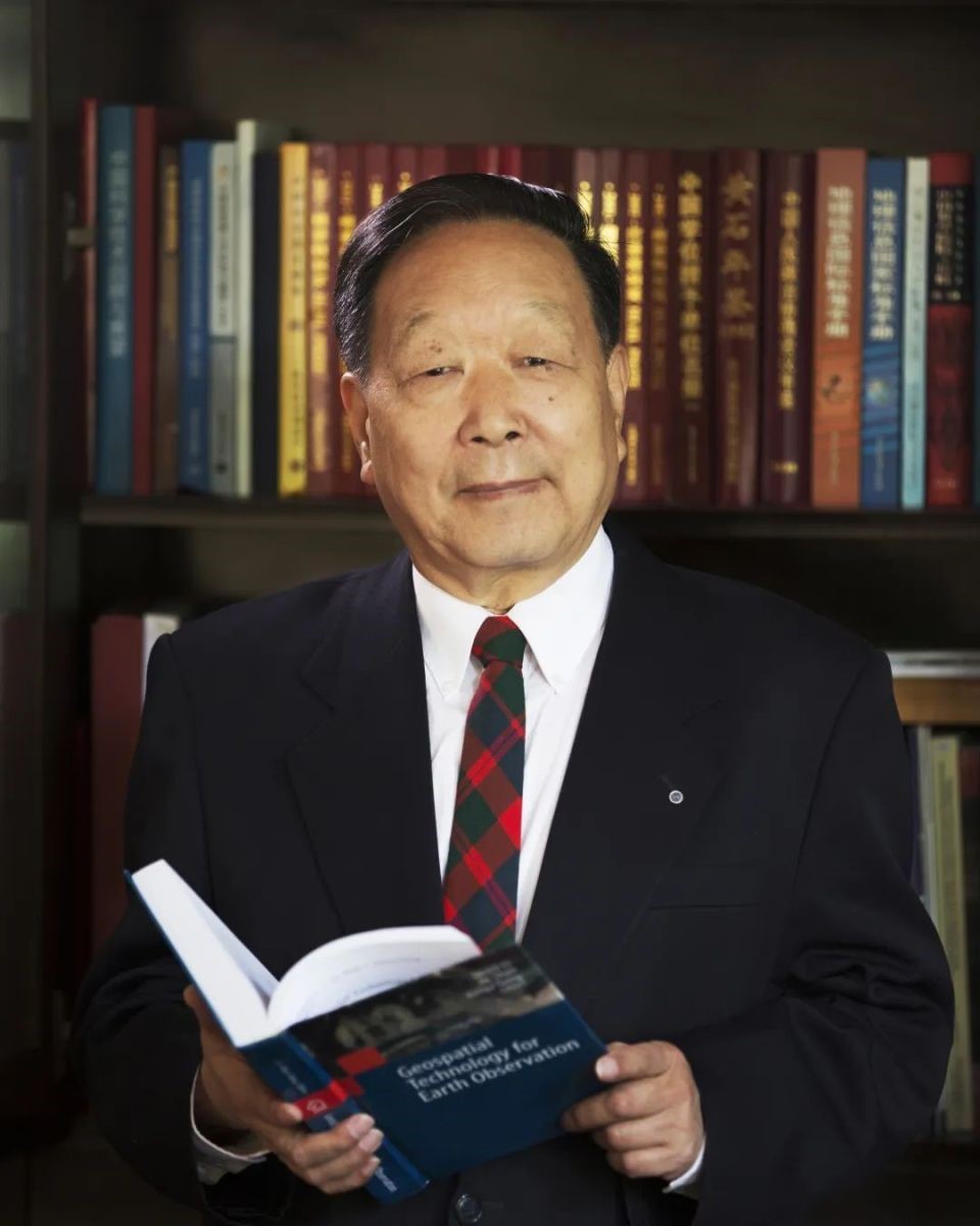
Prof. Li Deren, receives China’s top Sci-tech Award for the Year 2023

Prof. Li Deren, ISPRS Honorary Member, photogrammetry and remote sensing expert, an academician at both the Chinese Academy of Sciences (CAS) and the Chinese Academy of Engineering (CAE) from Wuhan University, won the national top sci-tech award for the year 2023 at a meeting conflating the national sci-tech conference, the national science and technology award conference, and the general assemblies of the members of the Chinese Academy of Sciences (CAS) and the Chinese Academy of Engineering (CAE) held on June 24, 2024.

Read more...


ISPRS ISPRS

Call for Proposals - ISPRS Scientific Initiatives 2025

In accordance with the statutory mission and activities of ISPRS, the Society shall provide funds to support scientific and other initiatives, which will further improve its international status in the field of the photogrammetry, remote sensing and spatial information sciences, and will therefore benefit all ISPRS members. For 2025, ISPRS Council is making up to 70,000 Swiss francs (CHF) available to support new scientific initiatives. The maximum funding assigned to any one scientific project shall be CHF 10,000 per annum. Projects should commence on January 1, 2025 and typically last up to 12 months. In exceptional cases, applications for projects lasting up to 24 months will be considered. Projects of greater than one-year duration will be subject to annual review before subsequent funding will be released.

Find more details here»


IJGI IJGI

ISPRS International Journal of Geoinformation Feature Papers from Q2 2024

  1. Comprehension of City Map Pictograms Designed for Specific Tourists’ Needs
    https://doi.org/10.3390/ijgi13040137
  2. Map Reading and Analysis with GPT-4V(ision)
    https://doi.org/10.3390/ijgi13040127
  3. Mapmaking Process Reading from Local Distortions in Historical Maps: A Geographically Weighted Bidimensional Regression Analysis of a Japanese Castle Map
    https://www.mdpi.com/2220-9964/13/4/124
  4. Exploration of an Open Vocabulary Model on Semantic Segmentation for Street Scene Imagery
    https://doi.org/10.3390/ijgi13050153
  5. Comparing Machine Learning and Time Series Approaches in Predictive Modeling of Urban Fire Incidents: A Case Study of Austin, Texas
    https://doi.org/10.3390/ijgi13040137
  6. A Sensor-Based Simulation Method for Spatiotemporal Event Detection
    https://doi.org/10.3390/ijgi13050141
  7. Towards Quality Management Procedures in 3D Cadastre
    https://doi.org/10.3390/ijgi13050160
  8. VIS-SLAM: A Real-Time Dynamic SLAM Algorithm Based on the Fusion of Visual, Inertial, and Semantic Information
    https://doi.org/10.3390/ijgi13050163
  9. Data-Driven Geofencing Design for Point-Of-Interest Notifiers Utilizing Genetic Algorithm
     https://doi.org/10.3390/ijgi13060174
  10. Improved A* Navigation Path-Planning Algorithm Based on Hexagonal Grid
    https://doi.org/10.3390/ijgi13050166
  11. Effectiveness of Adjacent and Bivariate Maps in Communicating Global Sensitivity Analysis for Geodiversity Assessment
    https://doi.org/10.3390/ijgi13060199
  12. Web Publication of Schmitt’s Map of Southern Germany (1797)—The Projection of the Map Based on Archival Documents and Geospatial Analysis
    https://doi.org/10.3390/ijgi13060207
  13. Interpretation of Hot Spots in Wuhan New Town Development and Analysis of Influencing Factors Based on Spatio-Temporal Pattern Mining
    https://doi.org/10.3390/ijgi13060186
  14. Simplifying Land Cover-Geoprocessing-Model Migration with a PAMC-LC Containerization Strategy in the Open Web Environment
    https://doi.org/10.3390/ijgi13060187
  15. A Spatial Semantic Feature Extraction Method for Urban Functional Zones Based on POIs
    https://doi.org/10.3390/ijgi13070228


General Announcements


GEOSA GEOSA

Saudi Arabia hosting the United Nations Global Geospatial Ecosystem Centre of Excellence

The Kingdom’s General Authority for Survey and Geospatial Information (GEOSA) has laid the foundation for the world’s first Geospatial Ecosystem, called the Saudi Arabian National Geospatial Ecosystem. Supporting the Integrated Geospatial Information Framework (IGIF) of the United Nations Committee of Experts on Global Geospatial Information Management (UN-GGIM), this comprehensive initiative reflects a commitment to addressing the challenges posed by socioeconomic dynamics, digital advancements, and environmental shifts.
For more information please visit the link: https://www.geoportal.sa/portal/apps/sites/#/digital-library-en


GEOSA GEOSA

Saudi Arabia established National Spatial Reference System

The Saudi Arabia National Spatial Reference System (SANSRS) is a national and unified system which allows users to precisely determine and express locations on the Earth, as well as to quantify changes of the Earth and its gravity field in space and time. SANSRS is a consistent reference system that defines Cartesian coordinates, longitude, latitude, height, scale, gravity and orientation throughout the Kingdom of Saudi Arabia. SANSRS is designed to meet national economic, social and environmental needs and is used in all applications and services for positioning in horizontal and vertical directions. Also, all existing geospatial products and services are referenced to it.


COSPAR COSPAR

COSPAR 2024 Awards

Winners of the COSPAR 2024 Awards were presented during the 45th COSPAR Scientific Assembly in Busan, South Korea.
Read more here…

Announcements of Scientific Meetings                (see also ISPRS Calendar)


Polish Society for Photogrammetry and Remote Sensing (PTFiT) Polish Society for Photogrammetry and Remote Sensing (PTFiT)

International Summer School in Photogrammetry and Remote Sensing

16-19 September 2024
Szczecin, Poland
https://ptfit.sgp.geodezja.org.pl/en/2024-international-summer-school-szczecin/

This event will be held from 16th to 18th September 2024 in Szczecin. This summer school is specifically designed for PhD and Master’s students seeking to enhance their knowledge and skills in 4 leading topics: UAV Photogrammetry, Laser Scanning, Bathymetry, Optimizing Point Cloud Processing with Neural Networks in Python. Topics are in interest of ISPRS Commision 1 and 2 and 60 young scientists from Poland, Germany and few other countries will participate in this event.

These workshops will be led by expert lecturers from renowned German and Polish universities: Prof. Ludwig Hoegner, Dr. Małgorzata Jarząbek-Rychard, Prof. Grzegorz Jóźków, Prof. Thomas P. Kersten, Prof. Wolfgang Kresse, Prof. Uwe Sörgel, Prof. Grzegorz Stępień, Dr. Arkadiusz Tomczak. Whole activity is coordinated by Dr. Tomasz Kogut and Prof. Dorota Iwaszczuk and Prof. Krzysztof Bakuła


ISPRS ISPRS

ISPRS TC III Mid-Term Symposium on Remote Sensing

4-8 November 2024
Belém, Brazil

ISPRS Technical Commission III “Remote Sensing”, hosted by Brazil and France, will organize its Mid-term Symposium in Belém (Brazil), from 4 to 8 November 2024. Approximately 200 contributions from 40 countries have been accepted. Five keynote speakers will present their views on remote sensing technologies and applications. Two prizes will be awarded:

  • the Best Young Author award will be delivered by the President of the jury, Muralikrishna Iyyanki (chairment of WG III-9)
  • the Individual Tree Segmentation Contest, awarded by Xinlian Liang on behalf of WG III-1.

The technical sessions, the keynote speeches, the panel discussions and the exhibition will give an overview on the potential and limitations of remote sensing, one year before COP30 that we take place in Belém.
The ISPRS Symposium will be held jointly with the Latin-American SELPER Symposium and with the Gi4DM Workshop on Geo-Information for Disaster Management.
Standard registration is open until September 30.
More information on the event web page: https://selperbrasil.org.br/events/belem-2024-tc3-symposium/

Keynote speakers :

Karsten Jacobsen Karsten Jacobsen

ISPRS & EARSeL & DGPF Joint Istanbul Workshop “Topographic Mapping from Space”

Dedicated to Dr. Karsten Jacobsen’s 80th Birthday

29-31 January 2025
Yıldız Technical University, Davutpaşa Congress Centre, Turkey

Find here some more information


EuroSDR EuroSDR

4th EuroSDR Workshop on Point Cloud Processing

6-7 February 2025
Stuttgart, Germany

The 4th EuroSDR Workshop on Point Cloud Processing to be held in Stuttgart, Germany on 6-7 February, 2025 will bring together experts from industry, academia and national mapping agencies to present and discuss the processing and automatic interpretation of area covering point clouds focusing on mapping purposes. As it can be seen from the preliminary list of presentations, (hier der Link) themes of the event include hardware developments, acquisition of point cloud data and its visualization, Multi-Modal data processing of LiDAR data and imagery, semantic segmentation and classification as well as applications and use-cases from practice. Since a limited number of presentation slots is still available, interested people may send a 1000 word abstract to pcp2025@ifp.uni-stuttgart.de till November 1st.

Further information on the workshop including registration, venue and program updates is available at https://pcp2025.ifp.uni-stuttgart.de/

Event Reports


BP24 BP24

Digital Building Permit Conference 2024

18-19 April 2024
Barcelona, Spain

Read the report here…


ML4RS_ISPRS ML4RS_ISPRS

2nd Workshop on Machine Learning for Remote Sensing in conjunction with the International Conference on Learning Representations (ICLR) 2024

11 May 2024
Vienna, Austria

Read the report here…


ISPRS WG IV-2 Webinar on Environmental Monitoring

4 June 2024
Pollution identification based on remote sensing from UAVs and multispectral image processing
by Konstantin Vytovtov and Elizaveta Barabanova
Institute of Control Science of Russian Academy of Science (Moscow, Russia)

Read the report here…

Obituary


Gottfried Konecny Gottfried Konecny

Obituary for Prof. Dr.-Ing. Dr. h.c. mult. Gottfried Konecny

*17.06.1930 † 25.07.2024

Prof. Gottfried Konecny, former head of the Institute of Photogrammetry and GeoInformation of Leibniz University Hannover, passed away peacefully on Thursday, 25 July 2024, at the age of 94. With his passing, photogrammetry and remote sensing has lost a brilliant scientist and science manager who was highly respected around the globe and tirelessly active, far beyond his retirement.

Gottfried Konecny was a visionary who, in the second half of the 20th century, significantly shaped his field worldwide and who is considered the European father of remote sensing. From the very beginning, his professional life was centred on the sustainable development of our environment. He was also a practitioner, a manager and a diplomat with the ability and determination to achieve his goals. The foundation of his great success was no doubt his ability to not only set his visionary goals but to also achieve them.

Gottfried Konecny was born on 17 June 1930 to German parents in Troppau, originally a small Moravian town with a diverse history and a population of around 30,000 at that time, now part of the Czech Republic. His youth in this multilingual region was characterised by the events before and during the Second World War, followed by flight and expulsion. After the war, the family found a new home in Neumarkt, Oberpfalz in Bavaria. Gottfried Konecny first became acquainted with surveying and mapping while still at school, first in 1945/46 as a surveying assistant in Troppau, then from 1946 to 1948 at the town surveying office in Neumarkt. After leaving school in 1950, he studied surveying at the Technical University Munich. Inspired by the then Professor of Photogrammetry, Richard Finsterwalder, he went to The Ohio State University in Columbus in 1954, equipped with a Fulbright Scholarship. It was in the USA that Konecny met Prof. Fred Doyle, who taught analytical photogrammetry amongst other subjects; Prof. Heiskanen was also one of his teachers. He obtained a Master of Science degree in 1956, and then returned to Munich to take his diploma examination a year later.  Prof. Finsterwalder then recruited him as a scientific assistant at the Institute of Photogrammetry and Cartography, where he completed his doctorate in 1959 with a dissertation entitled "Aerotriangulation with convergent images". Although the measurement method did not find its way into practice at the time, Konecny's description and scientific evaluation of the method attracted great interest in the photogrammetry community1. Today, convergent images obtained with penta cameras play an important role in mapping urban areas.

After completing his doctorate, Konecny moved to the University of New Brunswick (UNB) in Fredericton as an assistant professor. He was instrumental in establishing the first English-language surveying and mapping degree programme in Canada, which he headed as a full professor from 1966 onwards. By the time he left, the modest beginnings had become one of the world's most renown addresses in surveying and mapping. He returned to Germany in 1971 and took over the management of what was then the Institute of Photogrammetry and Engineering Surveys (IPI – now the Institute of Photogrammetry and GeoInformation) at the University of Hanover (now Leibniz Universität Hannover) until his retirement in 1998. He led the institute in the North American style - internationally orientated and in a rather relaxed manner based on trust, respect and tolerance towards his staff. After his retirement and into old age, he continued to devote his time to the Institute and was always available to the author of these lines as an experienced advisor.

Konecny realised early on that topographic data acquisition and updating was one of the essential prerequisites for the development of our living space, and that this could only be achieved from space, within an acceptable time and cost framework. This was the background to both Konecny's methodological fields of work - digital image processing, for example - and the instrumental developments he promoted. Shortly after his arrival in Hanover, the institute was able to purchase the first analytical plotter in Germany. The development of the digital correlator together with the Canadian, Gilbert Hobrough, should also be mentioned; this correlator was able to automatically generate digital terrain models already at the end of the 1970s. Konecny was also appointed Principal Investigator of the Metric Camera, the world's first photogrammetric space camera, which flew on the NASA Space Shuttle in 1983. With the help of this mission, he was able to experimentally demonstrate the value of space images for topographic applications. At the same time, he became the spokesman for the DFG-funded Collaborative Research Centre "Remote Sensing Methods on Coasts and Seas". Later, the institute developed the world's first digital photogrammetric workstation, which was presented at the Hanover Fair in 1987. As early as 1980, Konecny also took over the scientific supervision of the development of a digital cadastre for the entire state of Kuwait, and later worked on similar projects in Dubai and Saudi Arabia.

Another way of illustrating Gottfried Konecny's scientific work are the countless publications which bear his name. Alone during his time in Hanover, he supervised 47 dissertation and two habilitation theses, achieving major progress in science and at the same time, making a significant contribution to the transfer of knowledge into practice.

Konecny was equally successful as a science manager. He was President of the German Society for Photogrammetry and Remote Sensing (DGPF) from 1972 to 1976, and Chairman of the European Association of Remote Sensing Laboratories (EARSeL) from 1993 to 1997. The highlight of his work as a science manager was undoubtedly his role in the International Society for Photogrammetry and Remote Sensing (ISPRS): the World Congress was organised under his leadership in Hamburg in 1980, (when the addition of "and Remote Sensing", which he had favoured, was introduced), as well as his ISPRS presidency from 1984 to 1988. The basis of these successful activities was the personal relationship he harvested with colleagues and partners, based on trust, understanding for the concerns of others, and efforts to reach consensus, which was more important to him than formal issues. Over the years, these encounters resulted in an extremely strong network of relationships that opened many doors for Gottfried that remained closed to others.

Konecny also devoted himself to the field of knowledge transfer. He cultivated a large number of bilateral co-operations with universities from all over the world. A constant trail of visiting academics stayed at IPI for research and training purposes. Advanced training courses, the so-called Caravan Workshops, took groups from IPI, with Konecny at the helm, to all corners of the globe. The results of these trips were repeatedly incorporated into the courses in Hanover, which were always up-to-date and of course internationally orientated.
Prof. Konecny received a large number of high-ranking honours in recognition of his many achievements. In 1990, he was awarded the German Federal Cross of Merit First Class. He also received honorary doctorates from the National University of Tucaman (Argentina), the University of New Brunswick (Canada), Anna University (India) and the Moscow State University of Geodesy and Cartography (Russia), as well as honorary professorships from the University of Wuhan (China) and the Siberian State University of Geosystems and Technologies in Novosibirsk (Russia). Konecny has been an honorary member of ISPRS since 1992, and also of various national photogrammetric and cartographic associations, including the German Society for Photogrammetry and Remote Sensing (DGPF).

His success was possible due to his high level of intelligence, his excellent comprehension ability, his phenomenal memory and intuition, coupled with his humanity, enormous diligence, iron will and self-discipline. His visionary overview and global thinking, determination, assertiveness and persuasiveness on a large scale, and composure on a small scale, his broad curiosity about future developments, an understanding of and interest in history and traditions, together with tact, diplomacy and respect for others - and a good dose of humour - are the qualities that have characterised Gottfried Konency throughout his professional life. He found the strength for these achievements in his private life, with his wife, who passed away last year after more than 50 years of marriage, and with his children and grandchildren.
With his death, we have lost an excellent scientist and an extraordinary human being and philanthropist. Our thoughts are with his children and his family, may he rest in peace.

Christian Heipke


1 A. Schödlbauer, 2024, private communication.

ISPRS International Journal of Geo-Information — Open Access Journal


ISPRS International Journal of Geo-Information — Open Access Journal ISPRS International Journal of Geo-Information — Open Access Journal

New publications
Volume 13, Issue 6 (June 2024)

The Geospatial Crowd: Emerging Trends and Challenges in Crowdsourced Spatial Analytics
Alamri, Sultan
No: 168

Where Are Business Incubators Built? County-Level Spatial Distribution and Rationales Based on the Big Data of Chinese Yangtze River Delta Region
Jiang, Tianhe, Zhou, Zixuan
No: 169

Challenges in Geocoding: An Analysis of R Packages and Web Scraping Approaches
Pérez, Virgilio, Aybar, Cristina
No: 170

Assessing Risks in Cross-Regional Tourism Corridors: A Case Study of Tibetan Plateau Tourism
Li, Ziqiang, Ye, Sui, Xi, Jianchao
No: 171

Dynamic Perception-Based Vehicle Trajectory Prediction Using a Memory-Enhanced Spatio-Temporal Graph Network
Gui, Zhiming, Wang, Xin, Li, Wenzheng
No: 172

Evaluating School Location Based on a Territorial Spatial Planning Knowledge Graph
Xu, Xiankang, Hao, Jian, Shen, Jingwei
No: 173

A Comprehensive Overview Regarding the Impact of GIS on Property Valuation
Droj, Gabriela, Kwartnik-Pruc, Anita, Droj, Laurențiu
No: 175

Data-Driven Geofencing Design for Point-of-Interest Notifiers Utilizing Genetic Algorithm
Sasaki, Iori, Arikawa, Masatoshi, Lu, Min, Utsumi, Tomihiro, Sato, Ryo
No: 174

Detecting Road Intersections from Crowdsourced Trajectory Data Based on Improved YOLOv5 Model
Zhang, Yunfei, Tang, Gengbiao, Sun, Naisi
No: 176

Analyzing the Problems of a District-Based Administration Using Monte Carlo Simulation: The Case of Sex Offender Notifications in Korea
Kim, Hyemin, Lee, Suyun, Jun, Chulmin
No: 177

Cartography and Neural Networks: A Scientometric Analysis Based on CiteSpace
Cheng, Shiyuan, Zhang, Jianchen, Wang, Guangxia, Zhou, Zheng, Du, Jin, Wang, Lijun, Li, Ning, Wang, Jiayao
No: 178

Spatial-Temporal Evolution Characteristics Analysis of Color Steel Buildings in Lanzhou City
Wang, Wenda, Li, Xiao, Wang, Ting, Wang, Shaohua, Wang, Runqiao, Xu, Dachuan, Zhou, Junyuan
No: 179

Supplementary Dam Site Selection Using a Geospatial Approach: A Case Study of Wivenhoe Dam
Zytoon, Aseel, Gharineiat, Zahra, Alajarmeh, Omar
No: 180

Annual and Seasonal Dynamics of CO2 Emissions in Major Cities of China (2019–2022)
Zhao, Yue, Feng, Yuning, Du, Mingyi, Fraedrich, Klaus
No: 181

Exploring the Effects of Light and Dark on Crime in London
Erturk, Ezgi, Raynham, Peter, Teji, Jemima Unwin
No: 182

A New Method Based on Lattice Boltzmann Method and Unsupervised Clustering for Identification of Urban-Scale Ventilation Corridors
Li, Tianyu, Xie, Peng
No: 183

Two-Stage Path Planning for Long-Distance Off-Road Path Planning Based on Terrain Data
Zheng, Xudong, Ma, Mengyu, Zhong, Zhinong, Yang, Anran, Chen, Luo, Jing, Ning
No: 184

A Novel Rock Mass Discontinuity Detection Approach with CNNs and Multi-View Image Augmentation
Yalcin, Ilyas, Can, Recep, Gokceoglu, Candan, Kocaman, Sultan
No: 185

Interpretation of Hot Spots in Wuhan New Town Development and Analysis of Influencing Factors Based on Spatio-Temporal Pattern Mining
Zhao, Haijuan, Long, Yan, Wang, Nina, Luo, Shiqi, Liu, Xi, Luo, Tianyue, Wang, Guoen, Liu, Xuejun
No: 186

Simplifying Land Cover-Geoprocessing-Model Migration with a PAMC-LC Containerization Strategy in the Open Web Environment
Xing, Huaqiao, Wang, Haihang, Gao, Denghai, Hou, Dongyang, Wu, Huayi
No: 187

Identifying the Hierarchical Structure of Nighttime Economic Agglomerations Based on the Fusion of Multisource Data
Wan, Weijie, Chen, Hongfei, Yang, Xiping, Li, Renda, Cui, Yuzheng, Hu, Yiyang
No: 188

Research on Rural Environments’ Effects on Well-Being: The Huizhou Area in China
Ma, Xingmeng, Su, Xin, Guo, Yanlong, Zhang, Linfu
No: 189

Analysing the Spatio-Temporal Variations of Urban Street Summer Solar Radiation through Historical Street View Images: A Case Study of Shanghai, China
Wang, Lei, Zhang, Longhao, He, Jie
No: 190

Dry–Wet Changes in a Typical Agriculture and Pasture Ecotone in China between 1540 and 2019
Wang, Xiaodong, Song, Yujia, An, Yu, Liu, Xiaohui, Li, Xiaoqiang
No: 191

Research on the Geographical Pattern, Evolution Model, and Driving Mechanism of Carbon Emission Density from Urban Industrial Land in the Yangtze River Economic Belt of China
Xie, Fei, Zhang, Shuaibing, Zhang, Qipeng, Zhao, Sidong, Lai, Min
No: 192

Learning Effective Geometry Representation from Videos for Self-Supervised Monocular Depth Estimation
Zhao, Hailiang, Kong, Yongyi, Zhang, Chonghao, Zhang, Haoji, Zhao, Jiansen
No: 193

The Relationship between the Construction of Transportation Infrastructure and the Development of New Urbanization
Shen, Jia, Ren, Xiaohong, Wu, Honglin, Feng, Zhitao
No: 194

Identifying Editions of the Ptolemy of Rome Maps (1478/90–1507/08) by Copper Plates Changes
Pavo-López, Marcos F., Amaro-Mellado, José-Lázaro
No: 195

Assessing Contamination in Transitional Waters Using Geospatial Technologies: A Review
Arroyo-Ortega, Itzel, Chavarin-Pineda, Yaselda, Torres, Eduardo
No: 196

Non-Uniform Spatial Partitions and Optimized Trajectory Segments for Storage and Indexing of Massive GPS Trajectory Data
Yang, Yuqi, Zuo, Xiaoqing, Zhao, Kang, Li, Yongfa
No: 197

A Novel Approach to Urban Village Extraction and Generalization from Digital Line Graphics Using the Computational Geometric Method and the Modified Hausdorff Distance
Gao, Xiaorong, Yan, Haowen, Lu, Xiaomin, Wang, Xiaolong, Wang, Rong
No: 198

Effectiveness of Adjacent and Bivariate Maps in Communicating Global Sensitivity Analysis for Geodiversity Assessment
Jankowski, Piotr, Şalap-Ayça, Seda, Najwer, Alicja, Ligmann-Zielińska, Arika, Zwoliński, Zbigniew
No: 199

Exploring the Influence of Terrain Blockage on Spatiotemporal Variations in Land Surface Temperature from the Perspective of Heat Energy Redistribution
Gao, Hong, Dong, Yong, Zhou, Liang, Wang, Xi
No: 200

Automatic Extraction and Cluster Analysis of Natural Disaster Metadata Based on the Unified Metadata Framework
Wang, Zongmin, Shi, Xujie, Yang, Haibo, Yu, Bo, Cai, Yingchun
No: 201

Dynamic Construction of Spherical Raster Voronoi Diagrams Based on Ordered Dilation
Liu, Qingping, Zhao, Xuesheng, Duan, Yuanzheng, Qin, Mengmeng, Xie, Wenlan, Sun, Wenbin
No: 202

Generating Urban Road Networks with Conditional Diffusion Models
Gu, Xiaoyan, Zhang, Mengmeng, Lyu, Jinxin, Ge, Quansheng
No: 203

Spatiotemporal Analysis of Ecological Security Based on Landscape Patterns
Zhang, Huaidan, Nie, Ke, Wu, Xueling
No: 204

Identification of Typhoon-Vulnerable Areas and Countermeasures in High-Density Coastal Cities: The Case of Macau
Chen, Ziyi, Zhou, Long, Li, Wenrui, Tang, Binglin Martin
No: 205

Land Cover Disaggregated Fire Occurrence and Particulate Matter2.5 Relationship in the Mekong Region: A Comprehensive Study
Adaktylou, Nektaria, Stratoulias, Dimitris, Borgman, Julia, Cha, Sangwoo, Adiningrat, Devara P., Nuthammachot, Narissara
No: 206

Web Publication of Schmitt’s Map of Southern Germany (1797)—The Projection of the Map Based on Archival Documents and Geospatial Analysis
Timár, Gábor, Kiss, Eszter
No: 207

Agent-Based Modeling of COVID-19 Transmission: A Case Study of Housing Densities in Sankalitnagar, Ahmedabad
French, Molly, Patel, Amit, Qureshi, Abid, Saxena, Deepak, Sengupta, Raja
No: 208

A Type of Scale-Oriented Terrain Pattern Derived from Normalized Topographic Relief Layers and Its Interpretation
Nan, Xi, Li, Ainong, He, Zhengwei, Bian, Jinhu
No: 209

Traffic Flow Prediction Based on Federated Learning and Spatio-Temporal Graph Neural Networks
Feng, Jian, Du, Cailing, Mu, Qi
No: 210

Implementing Immersive Worlds for Metaverse-Based Participatory Design through Photogrammetry and Blockchain
Abramov, Nikolai, Lankegowda, Havana, Liu, Shunwei, Barazzetti, Luigi, Beltracchi, Carlo, Ruttico, Pierpaolo
No: 211

Trajectory Compression with Spatio-Temporal Semantic Constraints
Zhou, Yan, Zhang, Yunhan, Zhang, Fangfang, Zhang, Yeting, Wang, Xiaodi
No: 212

Shape Pattern Recognition of Building Footprints Using t-SNE Dimensionality Reduction Visualization
Li, Jingzhong, Mao, Kainan
No: 213

Identifying the Spatial Range of the Pearl River Delta Urban Agglomeration by Fusing Nighttime Light Data with Weibo Sign-In Data
Cao, Yongwang, Liu, Song, Yang, Zaigao
No: 214

Spatial and Temporal Changes and Influencing Factors of Capital Cities in Five Provinces of the Underdeveloped Regions of Northwest China
Feng, Yuanbao, Ma, Yujun, Jia, Wei, Shu, Sifa, Li, Hongda, Hu, Xiangyu
No: 215

Integration of Spatial and Co-Existence Relationships to Improve Administrative Region Target Detection in Map Images
Du, Kaixuan, Ren, Fu, Wang, Yong, Che, Xianghong, Liu, Jiping, Hou, Jiaxin, You, Zewei
No: 216


Volume 13, Issue 7 (July 2024)

A Novel Flexible Geographically Weighted Neural Network for High-Precision PM2.5 Mapping across the Contiguous United States
Wang, Dongchao, Cao, Jianfei, Zhang, Baolei, Zhang, Ye, Xie, Lei
No: 217

The Influence of Origin Attributes on the Destination Choice of Discretionary Home-Based Walk Trips
Aghidi Kheyrabadi, Salman, Mamdoohi, Amir Reza
No: 218

Study on Multiscale Virtual Environment Construction and Spatial Navigation Based on Hierarchical Structure
Chen, Chao, Li, Chaoyang, Lu, Kai, Chen, Hao, Xiao, Xin, Fang, Chaoyang
No: 219

A Spatial Semantic Feature Extraction Method for Urban Functional Zones Based on POIs
Yang, Xin, Ma, Xi’ang
No: 220

Spatiotemporal Distribution of Inscription Sites in Henan Province
Zhang, Yuhang, Gao, Jiaji, Ni, Xiaotong
No: 221

UPGAN: An Unsupervised Generative Adversarial Network Based on U-Shaped Structure for Pansharpening
Jin, Xin, Feng, Yuting, Jiang, Qian, Miao, Shengfa, Chu, Xing, Zheng, Huangqimei, Wang, Qianqian
No: 222

Characterizing Spatio-Temporal Patterns of Child Sexual Abuse in Mexico City Before, During, and After the COVID-19 Pandemic
Carrillo-Brenes, Francisco, Vilches-Blázquez, Luis M.
No: 223

Developing a Bi-Level Optimization Model for the Coupled Street Network and Land Subdivision Design Problem with Various Lot Areas in Irregular Blocks
Sahebgharani, Alireza, Wiśniewski, Szymon
No: 224

Research on the Spatial Distribution Characteristics and Influencing Factors of Educational Facilities Based on POI Data: A Case Study of the Guangdong–Hong Kong–Macao Greater Bay Area
Chen, Bowen, Zhang, Hongfeng, Wong, Cora Un In, Chen, Xiaolong, Li, Fanbo, Wei, Xiaoyu, Shen, Junxian
No: 225

Automated Geospatial Approach for Assessing SDG Indicator 11.3.1: A Multi-Level Evaluation of Urban Land Use Expansion across Africa
Cardenas-Ritzert, Orion S. E., Vogeler, Jody C., Shah Heydari, Shahriar, Fekety, Patrick A., Laituri, Melinda, McHale, Melissa
No: 226

The Application of Space Syntax to Enhance Sociability in Public Urban Spaces: A Systematic Review
Askarizad, Reza, Lamíquiz Daudén, Patxi José, Garau, Chiara
No: 227

Exploring Summer Variations of Driving Factors Affecting Land Use Zoning Based on the Surface Urban Heat Island in Chiang Mai, Thailand
Rinchumphu, Damrongsak, Srivanit, Manat, Iamchuen, Niti, Aryupong, Chuchoke
No: 228

Graph Representation Learning for Street-Level Crime Prediction
Gu, Haishuo, Sui, Jinguang, Chen, Peng
No: 229

Monitoring and Cause Analysis of Land Subsidence along the Yangtze River Utilizing Time-Series InSAR
Chen, Yuanyuan, Guo, Lin, Xu, Jia, Yang, Qiang, Wang, Hao, Zhu, Chenwei
No: 230

A Comprehensive Survey on High-Definition Map Generation and Maintenance
Asrat, Kaleab Taye, Cho, Hyung-Ju
No: 232

HBIM for Conservation of Built Heritage
Alshawabkeh, Yahya, Baik, Ahmad, Miky, Yehia
No: 231

Optimizing Station Placement for Free-Floating Electric Vehicle Sharing Systems: Leveraging Predicted User Spatial Distribution from Points of Interest
Cao, Qi, Wang, Shunchao, Wang, Bingtong, Ma, Jingfeng
No: 233

Using Knowledge Graphs to Analyze the Characteristics and Trends of Forest Carbon Storage Research at the Global Scale
Li, Jie, Wang, Jinliang, He, Suling, Liu, Chenli, Liu, Lanfang
No: 234

Performance Analysis of Random Forest Algorithm in Automatic Building Segmentation with Limited Data
Widyastuti, Ratri, Suwardhi, Deni, Meilano, Irwan, Hernandi, Andri, Putri, Nabila S. E., Saptari, Asep Yusup, Sudarman
No: 235

Multiscale Visualization of Surface Motion Point Measurements Associated with Persistent Scatterer Interferometry
Kalaitzis, Panagiotis, Foumelis, Michael, Mouratidis, Antonios, Kavroudakis, Dimitris, Soulakellis, Nikolaos
No: 236

Assessing the Impact of Land Use and Land Cover Changes on Surface Temperature Dynamics Using Google Earth Engine: A Case Study of Tlemcen Municipality, Northwestern Algeria (1989–2019)
Selka, Imene, Mokhtari, Abderahemane Medjdoub, Tabet Aoul, Kheira Anissa, Bengusmia, Djamal, Malika, Kacemi, Djebbar, Khadidja El-Bahdja
No: 237

Spatial Nonlinear Effects of Street Vitality Constrained by Construction Intensity and Functional Diversity—A Case Study from the Streets of Shenzhen
Li, Jilong, Kong, Niuniu, Lin, Shiping, Zeng, Jie, Ke, Yilin, Chen, Jiacheng
No: 238

Integrating Spatiotemporal Analysis of Land Transformation and Urban Growth in Peshawar Valley and Its Implications on Temperature in Response to Climate Change
Hussain, Muhammad Farooq, Meng, Xiaoliang, Shah, Syed Fahim, Hussain, Muhammad Asif
No: 239

Layout Optimization of Logistics and Warehouse Land Based on a Multi-Objective Genetic Algorithm—Taking Wuhan City as an Example
Li, Haijun, Zhou, Jie, Niu, Qiang, Feng, Mingxiang, Zhou, Dongming
No: 240

Using Virtual and Augmented Reality with GIS Data
Pavelka, Karel, Landa, Martin
No: 241

An Integrated Framework for Landscape Indices’ Calculation with Raster–Vector Integration and Its Application Based on QGIS
Huang, Yaqi, Zheng, Minrui, Li, Tianle, Xiao, Fei, Zheng, Xinqi
No: 242

Constraining the Geometry of NeRFs for Accurate DSM Generation from Multi-View Satellite Images
Wan, Qifeng, Guan, Yuzheng, Zhao, Qiang, Wen, Xiang, She, Jiangfeng
No: 243

Using Wi-Fi Probes to Evaluate the Spatio-Temporal Dynamics of Tourist Preferences in Historic Districts’ Public Spaces
Gao, Yichen, Liu, Sheng, Wei, Biao, Zhu, Zhenni, Wang, Shanshan
No: 244

Privacy Preserving Human Mobility Generation Using Grid-Based Data and Graph Autoencoders
Netzler, Fabian, Lienkamp, Markus
No: 245

Globally Optimal Relative Pose and Scale Estimation from Only Image Correspondences with Known Vertical Direction
Yu, Zhenbao, Ye, Shirong, Liu, Changwei, Jin, Ronghe, Xia, Pengfei, Yan, Kang
No: 246

Spatiotemporal Analysis of Nighttime Crimes in Vienna, Austria
Lee, Jiyoung, Leitner, Michael, Paulus, Gernot
No: 247

Coupling Hyperbolic GCN with Graph Generation for Spatial Community Detection and Dynamic Evolution Analysis
Liu, Huimin, Yang, Qiu, Yang, Xuexi, Tang, Jianbo, Deng, Min, Gui, Rong
No: 248

Methodology of Mosaicking and Georeferencing for Multi-Sheet Early Maps with Irregular Cuts Using the Example of the Topographic Chart of the Kingdom of Poland
Kuna, Jakub, Panecki, Tomasz, Zawadzki, Mateusz
No: 249

Renovation and Reconstruction of Urban Land Use by a Cost-Heuristic Genetic Algorithm: A Case in Shenzhen
Deng, Yufan, Tang, Zhongan, Liu, Baoju, Shi, Yan, Deng, Min, Liu, Enbo
No: 250

A Pathfinding Algorithm for Large-Scale Complex Terrain Environments in the Field
Kui, Luchao, Yu, Xianwen
No: 251

A Lightweight Multi-Label Classification Method for Urban Green Space in High-Resolution Remote Sensing Imagery
Lin, Weihua, Zhang, Dexiong, Liu, Fujiang, Guo, Yan, Chen, Shuo, Wu, Tianqi, Hou, Qiuyan
No: 252

Integrating NoSQL, Hilbert Curve, and R*-Tree to Efficiently Manage Mobile LiDAR Point Cloud Data
Yang, Yuqi, Zuo, Xiaoqing, Zhao, Kang, Li, Yongfa
No: 253

Advanced Integration of Urban Street Greenery and Pedestrian Flow: A Multidimensional Analysis in Chengdu’s Central Urban District
Ma, Qicheng, Zhang, Jiaxin, Li, Yunqin
No: 254

Bibliometric Analysis on the Research of Geoscience Knowledge Graph (GeoKG) from 2012 to 2023
Hou, Zhi-Wei, Liu, Xulong, Zhou, Shengnan, Jing, Wenlong, Yang, Ji
No: 255

Enhancing Place Emotion Analysis with Multi-View Emotion Recognition from Geo-Tagged Photos: A Global Tourist Attraction Perspective
Wang, Yu, Zhou, Shunping, Guan, Qingfeng, Fang, Fang, Yang, Ni, Li, Kanglin, Liu, Yuanyuan
No: 256

Sensing the Environmental Inequality of PM2.5 Exposure Using Fine-Scale Measurements of Social Strata and Citizenship Identity
He, Li, He, Lingfeng, Lin, Zezheng, Lu, Yao, Chen, Chen, Wang, Zhongmin, An, Ping, Liu, Min, Xu, Jie, Gao, Shurui
No: 257

Exploring Family Ties and Interpersonal Dynamics—A Geospatial Simulation Analyzing Their Influence on Evacuation Efficiency within Urban Communities
Chu, Hao, Wu, Jianping, Perez, Liliana, Huang, Yonghua
No: 258

Bridging Human Expertise with Machine Learning and GIS for Mine Type Prediction and Classification
Saliba, Adib, Tout, Kifah, Zaki, Chamseddine, Claramunt, Christophe
No: 259

Extracting Geoscientific Dataset Names from the Literature Based on the Hierarchical Temporal Memory Model
Wu, Kai, Chen, Zugang, Wu, Xinqian, Li, Guoqing, Li, Jing, Wang, Shaohua, Wang, Haodong, Feng, Hang
No: 260

A GIS-Based Framework for Synthesizing City-Scale Long-Term Individual-Level Spatial–Temporal Mobility
Yao, Yao, Jiang, Yinghong, Yu, Qing, Yuan, Jian, Li, Jiaxing, Xu, Jian, Liu, Siyuan, Zhang, Haoran
No: 261

The Influence of Perceptions of the Park Environment on the Health of the Elderly: The Mediating Role of Social Interaction
Xiong, Xiuhai, Wang, Jingjing, Wu, Hao, Peng, Zhenghong
No: 262


Volume 13, Issue 8 (August 2024)

Measuring Reliable Accessibility to High-Speed Railway Stations by Integrating the Utility-Based Model and Multimodal Space–Time Prism under Travel Time Uncertainty
Zhang, Yongsheng, Liang, Kangyu, Yao, Enjian, Gu, Mingyi
No: 263

Automatic Vehicle Trajectory Behavior Classification Based on Unmanned Aerial Vehicle-Derived Trajectories Using Machine Learning Techniques
Teo, Tee-Ann, Chang, Min-Jhen, Wen, Tsung-Han
No: 264

Building Height Extraction Based on Spatial Clustering and a Random Forest Model
Chang, Jingxin, Jiang, Yonghua, Tan, Meilin, Wang, Yunming, Wei, Shaodong
No: 265

Built Environment Effect on Metro Ridership in Metropolitan Area of Valparaíso, Chile, under Different Influence Area Approaches
Aprigliano, Vicente, Seriani, Sebastian, Toro, Catalina, Rojas, Gonzalo, Fukushi, Mitsuyoshi, Cardoso, Marcus, Silva, Marcelino Aurelio Vieira da, Cucumides, Cristo, de Oliveira, Ualison Rébula, Henríquez, Cristián, Braun, Andreas, Hochschild, Volker
No: 266

Exploring the Spatiotemporal Patterns of Passenger Flows in Expanding Urban Metros: A Case Study of Shenzhen
Lv, Sirui, Yang, Hu, Lu, Xin, Zhang, Fan, Wang, Pu
No: 267

The Spatial Equilibrium Model of Elderly Care Facilities with High Spatiotemporal Sensitivity and Its Economic Associations Study
Li, Hongyan, Li, Rui, Cai, Jing, Wang, Shunli
No: 268

Multi-Criteria Decision Analysis to Evaluate the Geographic Potential of Alternative Photovoltaic Types
Hübl, Franziska, Welscher, Franz, Scholz, Johannes
No: 269

Challenges to Viticulture in Montenegro under Climate Change
Fernandes, António, Kovač, Nataša, Fraga, Hélder, Fonseca, André, Šućur Radonjić, Sanja, Simeunović, Marko, Ratković, Kruna, Menz, Christoph, Costafreda-Aumedes, Sergi, Santos, João A.
No: 270

A Spatial Case-Based Reasoning Method for Healthy City Assessment: A Case Study of Middle Layer Super Output Areas (MSOAs) in Birmingham, England
Deng, Shuguang, Liu, Wei, Peng, Ying, Liu, Binglin
No: 271

Analysis of Road Safety Perception and Influencing Factors in a Complex Urban Environment—Taking Chaoyang District, Beijing, as an Example
Hou, Xinyu, Chen, Peng
No: 272

The Influence of Proximity on the Evolution of Urban Innovation Networks in Nanjing Metropolitan Area, China: A Comparative Analysis of Knowledge and Technological Innovations
Shi, Yu, Zhai, Wei, Yan, Yiran, Wang, Xingping
No: 273

BS-GeoEduNet 1.0: Blockchain-Assisted Serverless Framework for Geospatial Educational Information Networks
Kandpal, Meenakshi, Goswami, Veena, Pritwani, Yash, Barik, Rabindra K., Saikia, Manob Jyoti
No: 274

Factors Influencing the Efficiency of Demand-Responsive Transport Services in Rural Areas: A GIS-Based Method for Optimising and Evaluating Potential Services
Tejero-Beteta, Carlos, Moyano, Amparo, Sánchez-Cambronero, Santos
No: 275

DCPMS: A Large-Scale Raster Layer Serving Method for Custom Online Calculation and Rendering
Yang, Anbang, Zhang, Feng, Feng, Jie, Wang, Luoqi, Yue, Enjiang, Fan, Xinhua, Zhang, Jingyi, Hu, Linshu, Wu, Sensen
No: 276

Influencing Factors of Street Vitality in Historic Districts Based on Multisource Data: Evidence from China
Yu, Bing, Sun, Jing, Wang, Zhaoxing, Jin, Sanfeng
No: 277

A Maximal Multimodal Accessibility Equality Model to Optimize the Equality of Healthcare Services
Tao, Zhuolin, Zhong, Qianyu, Dang, Yinuo
No: 278

Ecological Network Construction Based on Red, Green and Blue Space: A Case Study of Dali City, China
Chen, Rong, Zhang, Shunmin, Huang, Xiaoyuan, Li, Xiang, Peng, Jiansong
No: 279

Spatio-Temporal Big Data Collaborative Storage Mechanism Based on Incremental Aggregation Subvector Commitment in On-Chain and Off-Chain Systems
Han, Mingjia, Yang, Xinyi, Su, Huachang, Zhao, Yekang, Huang, Ding, Ren, Yongjun
No: 280

Efficient and Verifiable Range Query Scheme for Encrypted Geographical Information in Untrusted Cloud Environments
Mei, Zhuolin, Zeng, Jing, Zhang, Caicai, Yao, Shimao, Zhang, Shunli, Wang, Haibin, Li, Hongbo, Shi, Jiaoli
No: 281

What Factors Revitalize the Street Vitality of Old Cities? A Case Study in Nanjing, China
Zheng, Yan, Ye, Ruhai, Hong, Xiaojun, Tao, Yiming, Li, Zherui
No: 282

City Transmission Networks: Unraveling Disease Spread Dynamics
Alrasheed, Hend, Alballa, Norah, Al-Turaiki, Isra, Almutlaq, Fahad, Alabduljabbar, Reham
No: 283

Correction: Agriesti et al. Assignment of a Synthetic Population for Activity-Based Modeling Employing Publicly Available Data. ISPRS Int. J. Geo-Inf. 2022, 11, 148
Agriesti, Serio, Roncoli, Claudio, Nahmias-Biran, Bat-hen
No: 284

Automatic Functional Classification of Buildings Supported by a POI Semantic Characterization Knowledge Graph
Su, Youneng, Xu, Qing, Zhu, Xinming, Zhang, Fubing, Liu, Yi
No: 285

Identifying the Nonlinear Impacts of Road Network Topology and Built Environment on the Potential Greenhouse Gas Emission Reduction of Dockless Bike-Sharing Trips: A Case Study of Shenzhen, China
Zhao, Jiannan, Yuan, Changwei, Mao, Xinhua, Ma, Ningyuan, Duan, Yaxin, Zhu, Jinrui, Wang, Hujun, Tian, Beisi
No: 287

Grid Density Algorithm-Based Second-Hand Housing Transaction Activity and Spatio-Temporal Characterization: The Case of Shenyang City, China
Ren, Jiaqiang, Gao, Xiaomeng
No: 286

Isochrone-Based Accessibility Analysis of Pre-Hospital Emergency Medical Facilities: A Case Study of Central Districts of Beijing
Zhao, Yuan, Zhou, Ying
No: 288

SAMPLID: A New Supervised Approach for Meaningful Place Identification Using Call Detail Records as an Alternative to Classical Unsupervised Clustering Techniques
Mendoza-Hurtado, Manuel, Romero-del-Castillo, Juan A., Ortiz-Boyer, Domingo
No: 289

Spatial Planning Data Structure Based on Blockchain Technology
Tang, Minwen, Dai, Wujiao, Yin, Changlin, Hu, Bing, Chen, Jun, Liu, Haoming
No: 290

Spatial Semantics for the Evaluation of Administrative Geospatial Ontologies
Abdelmoty, Alia I., Muhajab, Hanan, Satoti, Abdurauf
No: 291

Assessing and Predicting Nearshore Seawater Quality with Spatio-Temporal Semivariograms: The Case of Coastal Waters in Fujian Province, China
Wang, Wei, Cheng, Wenfang, Chen, Jing
No: 292

Analysis of the Impact of the Digital Economy on Carbon Emission Reduction and Its Spatial Spillover Effect—The Case of Eastern Coastal Cities in China
Zhong, Juanjuan, Duan, Ye, Sun, Caizhi, Wang, Hongye
No: 293

An Improved ANN-Based Label Placement Method Considering Surrounding Features for Schematic Metro Maps
Wu, Zhiwei, Lan, Tian, Sun, Chenzhen, Cheng, Donglin, Shi, Xing, Chen, Meisheng, Zeng, Guangjun
No: 294

Genetic Programming to Optimize 3D Trajectories
Kotze, André, Hildemann, Moritz Jan, Santos, Vítor, Granell, Carlos
No: 295

Examining Spatial Disparities in Electric Vehicle Public Charging Infrastructure Distribution Using a Multidimensional Framework in Nanjing, China
Wang, Moyan, Liang, Zhengyuan, Li, Zhiming
No: 296

Flood Susceptibility Mapping Using GIS-Based Frequency Ratio and Shannon’s Entropy Index Bivariate Statistical Models: A Case Study of Chandrapur District, India
Sharma, Asheesh, Poonia, Mandeep, Rai, Ankush, Biniwale, Rajesh B., Tügel, Franziska, Holzbecher, Ekkehard, Hinkelmann, Reinhard
No: 297


ISPRS Journal of Photogrammetry and Remote Sensing


ISPRS Journal ISPRS Journal

New publications
Volume 214 (August 2024)

Editorial Board
Pages: ii

Light4Mars: A lightweight transformer model for semantic segmentation on unstructured environment like Mars
Yonggang Xiong, Xueming Xiao, Meibao Yao, Hutao Cui, Yuegang Fu
Pages: 167-178

RFE-VCR: Reference-enhanced transformer for remote sensing video cloud removal
Xianyu Jin, Jiang He, Yi Xiao, Ziyang Lihe, Xusi Liao, Jie Li, Qiangqiang Yuan
Pages: 179-192

A novel algorithm to extrapolate ultraviolet absorption of chromophoric dissolved organic matter from remote sensing ocean color
Zhongli Liu, Shansheng Mo, Fei Liu, Gregory Korshin, Mingquan Yan
Pages: 104-118

AdaTreeFormer: Few shot domain adaptation for tree counting from a single high-resolution image
Hamed Amini Amirkolaee, Miaojing Shi, Lianghua He, Mark Mulligan
Pages: 193-208

CloudSeg: A multi-modal learning framework for robust land cover mapping under cloudy conditions
Fang Xu, Yilei Shi, Wen Yang, Gui-Song Xia, Xiao Xiang Zhu
Pages: 21-32

Polarimetric calibration of linear dual-pol SAR when corner reflectors are unavailable
Lei Shi, Weidong Sun, Jie Yang, Liangpei Zhang
Pages: 209-230

HRVQA: A Visual Question Answering benchmark for high-resolution aerial images
Kun Li, George Vosselman, Michael Ying Yang
Pages: 65-81

Towards assessing the synthetic-to-measured adversarial vulnerability of SAR ATR
Bowen Peng, Bo Peng, Jingyuan Xia, Tianpeng Liu, Yongxiang Liu, Li Liu
Pages: 119-134

Towards long-term, high-accuracy, and continuous satellite total and fine-mode aerosol records: Enhanced Land General Aerosol (e-LaGA) retrieval algorithm for VIIRS
Lunche Wang, Xin Su, Yi Wang, Mengdan Cao, Qin Lang, Huaping Li, Junyao Sun, Ming Zhang, Wenmin Qin, Lei Li, Leiku Yang
Pages: 261-281

Monitoring mangrove traits through optical Earth observation: Towards spatio-temporal scalability using cloud-based Sentinel-2 continuous time series
Nguyen {An Binh}, Leon T. Hauser, Matías Salinero-Delgado, Pham {Viet Hoa}, Giang {Thi Phuong Thao}, Jochem Verrelst
Pages: 135-152

MCTracker: Satellite video multi-object tracking considering inter-frame motion correlation and multi-scale cascaded feature enhancement
Bin Wang, Haigang Sui, Guorui Ma, Yuan Zhou
Pages: 82-103

Empowering lightweight detectors: Orientation Distillation via anti-ambiguous spatial transformation for remote sensing images
Yidan Zhang, Wenhui Zhang, Junxi Li, Xiyu Qi, Xiaonan Lu, Lei Wang, Yingyan Hou
Pages: 244-260

Simultaneous invariant normalization of waveform features from bathymetric lidar, SINWav: A Saipan case study
Jaehoon Jung, Christopher E. Parrish, Bryan Costa, Suhong Yoo
Pages: 1-20

Legged robot-aided 3D tunnel mapping via residual compensation and anomaly detection
Xing Zhang, Zhanpeng Huang, Qingquan Li, Ruisheng Wang, Baoding Zhou
Pages: 33-47

Quick calibration of massive urban outdoor surveillance cameras
Lin Shi, Xiaoji Lan, Xin Lan, Tianliang Zhang
Pages: 231-243

Mapping high spatial resolution ionospheric total electron content by integrating Time Series InSAR with International Reference Ionosphere model
Wenfei Mao, Peifeng Ma, Jun Tang
Pages: 153-166

A temporal-spatial deep learning network for winter wheat mapping using time-series Sentinel-2 imagery
Lingling Fan, Lang Xia, Jing Yang, Xiao Sun, Shangrong Wu, Bingwen Qiu, Jin Chen, Wenbin Wu, Peng Yang
Pages: 48-64


New publications
Volume 215 (September 2024)

Editorial Board
Pages: ii

Navigating the publishing landscape in times of revolutionary changes
Qihao Weng, Clement Malle
Pages: 214-215

CodeUNet: Autonomous underwater vehicle real visual enhancement via underwater codebook priors
Linling Wang, Xiaoyan Xu, Shunmin An, Bing Han, Yi Guo
Pages: 99-111

A semi-supervised multi-temporal landslide and flash flood event detection methodology for unexplored regions using massive satellite image time series
Axel A.J. Deijns, David Michéa, Aline Déprez, Jean-Philippe Malet, François Kervyn, Wim Thiery, Olivier Dewitte
Pages: 400-418

Coherence bias mitigation through regularized tapered coherence matrix for phase linking in decorrelated environments
Hongyu Liang, Lei Zhang, Xin Li, Jicang Wu
Pages: 369-382

Look at the whole scene: General point cloud place recognition by classification proxy
Yue Xie, Bing Wang, Haiping Wang, Fuxun Liang, Wenxiao Zhang, Zhen Dong, Bisheng Yang
Pages: 15-30

Global Streetscapes — A comprehensive dataset of 10 million street-level images across 688 cities for urban science and analytics
Yujun Hou, Matias Quintana, Maxim Khomiakov, Winston Yap, Jiani Ouyang, Koichi Ito, Zeyu Wang, Tianhong Zhao, Filip Biljecki
Pages: 216-238

SSG2: A new modeling paradigm for semantic segmentation
Foivos I. Diakogiannis, Suzanne Furby, Peter Caccetta, Xiaoliang Wu, Rodrigo Ibata, Ondrej Hlinka, John Taylor
Pages: 44-61

Self-organized underwater image enhancement
Hao Wang, Weibo Zhang, Peng Ren
Pages: 1-14

Incremental multi temporal InSAR analysis via recursive sequential estimator for long-term landslide deformation monitoring
Meng Ao, Lianhuan Wei, Mingsheng Liao, Lu Zhang, Jie Dong, Shanjun Liu
Pages: 313-330

PriNeRF: Prior constrained Neural Radiance Field for robust novel view synthesis of urban scenes with fewer views
Kaiqiang Chen, Bo Dong, Zhirui Wang, Peirui Cheng, Menglong Yan, Xian Sun, Michael Weinmann, Martin Weinmann
Pages: 383-399

Towards a gapless 1 km fractional snow cover via a data fusion framework
Xiongxin Xiao, Tao He, Shuang Liang, Shunlin Liang, Xinyan Liu, Yichuan Ma, Jun Wan
Pages: 419-441

ALCSF: An adaptive and anti-noise filtering method for extracting ground and top of canopy from ICESat-2 LiDAR data along single tracks
Bingtao Chang, Hao Xiong, Yuan Li, Dong Pan, Xiaodong Cui, Wuming Zhang
Pages: 80-98

A flexible trajectory estimation methodology for kinematic laser scanning
Florian Pöppl, Andreas Ullrich, Gottfried Mandlburger, Norbert Pfeifer
Pages: 62-79

Gap completion in point cloud scene occluded by vehicles using SGC-Net
Yu Feng, Yiming Xu, Yan Xia, Claus Brenner, Monika Sester
Pages: 331-350

Explaining the decisions and the functioning of a convolutional spatiotemporal land cover classifier with channel attention and redescription mining
Enzo Pelous, Nicolas Méger, Alexandre Benoit, Abdourrahmane Atto, Dino Ienco, Hermann Courteille, Christophe Lin-Kwong-Chon
Pages: 256-270

Point2Building: Reconstructing buildings from airborne LiDAR point clouds
Yujia Liu, Anton Obukhov, Jan Dirk Wegner, Konrad Schindler
Pages: 351-368

Quality control tests for automated above-water hyperspectral measurements: Radiative Transfer assessment
Masoud Moradi, Behnaz Arabi, Annelies Hommersom, Johan {van der Molen}, Cyrus Samimi
Pages: 292-312

EMET: An emergence-based thermal phenological framework for near real-time crop type mapping
Zijun Yang, Chunyuan Diao, Feng Gao, Bo Li
Pages: 271-291

Deep neural network based on dynamic attention and layer attention for meteorological data downscaling
Junkai Wang, Lianlei Lin, Zongwei Zhang, Sheng Gao, Hangyi Yu
Pages: 157-176

Robust feature aggregation network for lightweight and effective remote sensing image change detection
Zhi-Hui You, Si-Bao Chen, Jia-Xin Wang, Bin Luo
Pages: 31-43

Pano2Geo: An efficient and robust building height estimation model using street-view panoramas
Kaixuan Fan, Anqi Lin, Hao Wu, Zhenci Xu
Pages: 177-191

Deep learning with simulated laser scanning data for 3D point cloud classification
Alberto M. Esmorís, Hannah Weiser, Lukas Winiwarter, Jose C. Cabaleiro, Bernhard Höfle
Pages: 192-213

Unifying remote sensing change detection via deep probabilistic change models: From principles, models to applications
Zhuo Zheng, Yanfei Zhong, Ji Zhao, Ailong Ma, Liangpei Zhang
Pages: 239-255

Remote sensing vegetation Indices-Driven models for sugarcane evapotranspiration estimation in the semiarid Ethiopian Rift Valley
Gezahegn {W. Woldemariam}, Berhan {Gessesse Awoke}, Raian {Vargas Maretto}
Pages: 136-156

Improving PRISMA hyperspectral spatial resolution and geolocation by using Sentinel-2: development and test of an operational procedure in urban and rural areas
Giandomenico {De Luca}, Federico Carotenuto, Lorenzo Genesio, Monica Pepe, Piero Toscano, Mirco Boschetti, Franco Miglietta, Beniamino Gioli
Pages: 112-135


New publications
Volume 216 (October 2024)

Editorial Board
Pages: ii

Semi-supervised multi-class tree crown delineation using aerial multispectral imagery and lidar data
S. Dersch, A. Schöttl, P. Krzystek, M. Heurich
Pages: 154-167

Training-free thick cloud removal for Sentinel-2 imagery using value propagation interpolation
Laurens Arp, Holger Hoos, Peter {van Bodegom}, Alistair Francis, James Wheeler, Dean {van Laar}, Mitra Baratchi
Pages: 168-184

Modeling the top-of-atmosphere radiance of alpine snow with topographic effects explicitly solved
Gongxue Wang, Lingmei Jiang, Fangbo Pan, Huizhen Cui, Shuhua Zhang
Pages: 109-125

Catadioptric omnidirectional thermal odometry in dynamic environment
Yuzhen Wu, Lingxue Wang, Lian Zhang, Xudong Han, Dezhi Zheng, Shuigen Wang, Yanqiu Li, Yi Cai
Pages: 45-65

Beyond clouds: Seamless flood mapping using Harmonized Landsat and Sentinel-2 time series imagery and water occurrence data
Zhiwei Li, Shaofen Xu, Qihao Weng
Pages: 185-199

Unveiling spatiotemporal tree cover patterns in China: The first 30 m annual tree cover mapping from 1985 to 2023
Yaotong Cai, Xiaocong Xu, Peng Zhu, Sheng Nie, Cheng Wang, Yujiu Xiong, Xiaoping Liu
Pages: 240-258

From satellite-based phenological metrics to crop planting dates: Deriving field-level planting dates for corn and soybean in the U.S. Midwest
Qu Zhou, Kaiyu Guan, Sheng Wang, James Hipple, Zhangliang Chen
Pages: 259-273

In-orbit detection of the spectral smile for the Mars Mineral Spectrometer
Bing Wu, Rui Xu, Chengyu Liu, Zhiping He
Pages: 32-44

Adaptive variational decomposition for water-related optical image enhancement
Jingchun Zhou, Shuhan Chen, Dehuan Zhang, Zongxin He, Kin-Man Lam, Ferdous Sohel, Gemine Vivone
Pages: 15-31

Simulated SAR prior knowledge guided evidential deep learning for reliable few-shot SAR target recognition
Xiaoyan Zhou, Tao Tang, Qishan He, Lingjun Zhao, Gangyao Kuang, Li Liu
Pages: 1-14

Temporal-spectral-semantic-aware convolutional transformer network for multi-class tidal wetland change detection in Greater Bay Area
Siyu Qian, Zhaohui Xue, Mingming Jia, Yiping Chen, Hongjun Su
Pages: 126-141

A framework for fully automated reconstruction of semantic building model at urban-scale using textured LoD2 data
Yuefeng Wang, Wei Jiao, Hongchao Fan, Guoqing Zhou
Pages: 90-108

CropSight: Towards a large-scale operational framework for object-based crop type ground truth retrieval using street view and PlanetScope satellite imagery
Yin Liu, Chunyuan Diao, Weiye Mei, Chishan Zhang
Pages: 66-89

TSG-Seg: Temporal-selective guidance for semi-supervised semantic segmentation of 3D LiDAR point clouds
Weihao Xuan, Heli Qi, Aoran Xiao
Pages: 217-228

Fraction-dependent variations in cooling efficiency of urban trees across global cities
Wenfeng Zhan, Chunli Wang, Shasha Wang, Long Li, Yingying Ji, Huilin Du, Fan Huang, Sida Jiang, Zihan Liu, Huyan Fu
Pages: 229-239

Bark beetle pre-emergence detection using multi-temporal hyperspectral drone images: Green shoulder indices can indicate subtle tree vitality decline
Langning Huo, Niko Koivumäki, Raquel A. Oliveira, Teemu Hakala, Lauri Markelin, Roope Näsi, Juha Suomalainen, Antti Polvivaara, Samuli Junttila, Eija Honkavaara
Pages: 200-216

The importance of spatial scale and vegetation complexity in woody species diversity and its relationship with remotely sensed variables
Wendy G. Canto-Sansores, Jorge Omar López-Martínez, Edgar J. González, Jorge A. Meave, José {Luis Hernández-Stefanoni}, Pedro A. Macario-Mendoza
Pages: 142-153


New publications
Volume 217 (November 2024)

Editorial Board
Pages: ii

A spatiotemporal shape model fitting method for within-season crop phenology detection
Ruyin Cao, Luchun Li, Licong Liu, Hongyi Liang, Xiaolin Zhu, Miaogen Shen, Ji Zhou, Yuechen Li, Jin Chen
Pages: 179-198

Tracking paddy rice acreage, flooding impacts, and mitigations during El Niño flooding events using Sentinel-1/2 imagery and cloud computing
Ruoqi Liu, Jinwei Dong, Yong Ge, Hui Lin, Xianghong Che, Yuanyuan Di, Xi Chen, Shuhua Qi, Mingjun Ding, Xiangming Xiao, Geli Zhang
Pages: 165-178

Annual improved maps to understand the complete evolution of 9 thousand lakes on the Tibetan plateau in 1991–2023
Yan Zhou, Bailu Liu, Yaoping Cui, Xinxin Wang, Mengmeng Cao, Sen Zhang, Xiangming Xiao, Jinwei Dong
Pages: 134-148

Satellite remote sensing of vegetation phenology: Progress, challenges, and opportunities
Zheng Gong, Wenyan Ge, Jiaqi Guo, Jincheng Liu
Pages: 149-164

Integrating geographic knowledge into deep learning for spatiotemporal local climate zone mapping derived thermal environment exploration across Chinese climate zones
Qiqi Zhu, Longli Ran, Yunchang Zhang, Qingfeng Guan
Pages: 53-75

A novel soybean mapping index within the global optimal time window
Guilong Xiao, Jianxi Huang, Jianjian Song, Xuecao Li, Kaiqi Du, Hai Huang, Wei Su, Shuangxi Miao
Pages: 120-133

UB-FineNet: Urban building fine-grained classification network for open-access satellite images
Zhiyi He, Wei Yao, Jie Shao, Puzuo Wang
Pages: 76-90

Graph-based adaptive weighted fusion SLAM using multimodal data in complex underground spaces
Xiaohu Lin, Xin Yang, Wanqiang Yao, Xiqi Wang, Xiongwei Ma, Bolin Ma
Pages: 101-119

Towards SDG 11: Large-scale geographic and demographic characterisation of informal settlements fusing remote sensing, POI, and open geo-data
Wei Tu, Dongsheng Chen, Rui Cao, Jizhe Xia, Yatao Zhang, Qingquan Li
Pages: 199-215

Seasonally inundated area extraction based on long time-series surface water dynamics for improved flood mapping
Bingyu Zhao, Jianjun Wu, Meng Chen, Jingyu Lin, Ruohua Du
Pages: 32-52

Sub-national scale mapping of individual olive trees integrating Earth observation and deep learning
Chenxi Lin, Junxiong Zhou, Leikun Yin, Rachid Bouabid, David Mulla, Elinor Benami, Zhenong Jin
Pages: 18-31

CadastreVision: A benchmark dataset for cadastral boundary delineation from multi-resolution earth observation images
Jeroen Grift, Claudio Persello, Mila Koeva
Pages: 91-100

Coarse-to-fine semantic segmentation of satellite images
Hao Chen, Wen Yang, Li Liu, Gui-Song Xia
Pages: 1-17


New Events


29 Jul - 02 Aug 2024
EURASIP - IEEE SPS Summer School on Remote Sensing and Microscopy Image Processing
https://ssrm.mik.uni-pannon.hu/
Veszprem, Hungary
 

03-05 Sep 2024
Commercial UAV Expo
Drones in Action – Current Realities & Future Frontiers
https://www.expouav.com
Las Vegas,, USA
 

02-03 Nov 2024
Gi4DM (Geo-Information for Disaster Management):
Geospatial Intelligence: Bridging AI, Environmental Management, and Disaster Resilience
https://selperbrasil.org.br/events/gi4dm/
Belém, Brazil
 

25-29 Nov 2024
2024 Pacific GIS & Remote Sensing User Conference
Sustainable Management for Coastal Areas through Remote Sensing and GIS
https://pgrsc.org/
Suva, Fiji
 

13-17 Jan 2025
NCKU LiDAR Winter School 2025
http://lidarws2025.geomatics.ncku.edu.tw/
Tainan, Taiwan
 

06-07 Feb 2025
4th EuroSDR Workshop on Point Cloud Processing
https://pcp2025.ifp.uni-stuttgart.de/
Stuttgart, Germany
 

13-17 Apr 2025
SPIE Defense + Commercial Sensing 2025 (DCS)
https://spie.org/si_isprs
Orlando, Florida, USA
 

26-29 May 2025
44th EARSeL Symposium
https://symposium.earsel.org/44th-symposium-Prague/
Prague, Czech Republic
 

03-06 Jun 2025
Dreiländertagung 2025 der SGPF, DGPF und OVG
Trinational Conference 2025 of the Swiss, German and Austrian Societies for Photogrammetry and Remote Sensing
http://www.dlt2025.ch/
Muttenz / Basel, Switzerland
 

20-22 Jun 2025
The 13th International Conference on Mobile Mapping Technology
website not yet available
Xiamen, China
 

07-13 Sep 2025
Summer School on Earth Sensing 2025
https://www.cirgeo.unipd.it/est/earth-sensing-summer-school.html
San Vito di Cadore, Italy
 

» See more

Updated Events

29-31 Jan 2025
Topographic Mapping from Space dedicated to Dr. Karsten Jacobsen’s 80th birthday
https://isprsistanbul2025.org/
Istanbul, Türkiye
 

» See more

Job Opportunities

 
15-Aug-2024
Research Associate (m/f/d) in the field of Digital and Additive Construction, in particular on Quality Control
Institute of Geodesy and Photogrammetry, Technische Universität Braunschweig, Germany
Deadline: 30-Sep-2024
 

» See more

 
© ISPRS, 2024.
Imprint