Click on this
link
if you cannot read this email.

 |
| |
| |
 |
|
ISPRS e-Bulletin
Issue No 5 - 2017
|
 |
| |
|
|
|
Quick Links
|
|
| |
|
|
Editorial
 |
|
Invitation to join ISPRS TC II Mid-Term Symposium
“Towards Photogrammetry 2020”
June 3-7, 2018
Riva del Garda, Italy
by Fabio Remondino

In 2018, TC II mid-term Symposium will be held in Riva del Garda (Italy) on 3-7 June - http://www.isprs.org/tc2-symposium2018/. The Symposium will feature an initial day of tutorials, 4 days with plenary and parallel sessions and an exhibition of the most important business players in the photogrammetric domain.
The themes of the Symposium reflect TCII scientific activities, i.e.:
- Sensor pose estimation and autonomous navigation
- Image orientation, including direct and indirect geo-referencing
- Structure from Motion, SLAM and bundle adjustment
- Multi-image geometry
- Methods for mesh generation
- Dynamic scene understanding from image sequences
- Spatial, spectral and temporal analysis of image and range data
- Pattern analysis and machine learning methods for object detection and recognition
- Point cloud processing, classification, rendering and streaming
- Integration and fusion of multiple data sources
- Change detection and spatio-temporal 3D monitoring of environmental and man-made processes
- BIM and HBIM
- 3D city modeling
- Upscaling of photogrammetric processing methods
- Scene understanding and 3D modeling
- Image-based and range-based methods
- Vision metrology and industrial applications
- Medical systems and biomedical applications
- Heritage 3D documentation
- Underwater 3D measurements and applications
- 3D mapping and monitoring of geohazards, geomorphology and vegetation
- UAV / UAS platforms, payloads and data processing
- Methodologies and algorithms for processing planetary remote sensing data
- Evaluation of performance, reliability, computational complexity, robustness, scalability and generality of methods
There will be 4 invited speakers covering all aspects of the Photogrammetric and Geospatial fields: Jantien Stoter (3D Geoinformation group, Delft University of Technology, The Netherlands) on “Designing, developing and implementing better systems to model 3D cities, buildings and landscapes”; Davide Scaramuzza (Robotics and Perception group, University of Zurich, Switzerland) on “Autonomous, Agile, Vision-controlled Drones: from Active to Event Vision”; André Streilein (Swisstopo, Switzerland) on “National mapping agencies in a changing period”; Camillo Ressl (Department of Geodesy and Geoinformation, Photogrammetry group, Technical University Vienna, Austria) on “Investigating Dense Image Matching”.

The event will provide ample opportunities for scientific exchange and discussion. All submitted papers, which will be handled electronically using Conftool, will follow two types of submissions: (1) full papers undergoing a double-blind peer-review process (deadline: January 12th, 2018) and (2) extended abstracts undergoing a review process (deadline: January 26th, 2018). The event will be organized by FBK Trento in collaboration with ARIDA (Association for Real-time Imaging and Dynamic Analysis), JSPRS (Japanese Society of Photogrammetry and Remote Sensing) and SIFET (Italian Society of Photogrammetry and Topography).
The venue of the event is a beautiful small city on the Garda Lake, the largest lake in Italy. The mild climate of Riva del Garda favors a typically Mediterranean vegetation with lemon trees, olive trees, laurels and palm trees: a true Mediterranean island at the foot of the Dolomites. The center of Riva del Garda will fascinate you with its works of art and architecture, witnessing to ancient history and a past rich in art and culture.
On behalf of the symposium organizing committee, we are looking forward to seeing you in Riva in June 2018.
↑ Up
|
|
|
| |
|
|
The ISPRS Foundation (TIF) News
|
 |
|
TIF - IGI Africa Ambassador Award 2018
IGI - Integrated Geospatial Innovations, Kreuztal, Germany is an innovative German vendor of photogrammetric hardware, software and workflows. IGI is very pleased to continue to offer its IGI Ambassador Award via The ISPRS Foundation (TIF) to young scientists in photogrammetry and laser scanning from regionally under-represented African countries in the geospatial sciences and technology fields. The award allows for visits at IGI‘s Central Office, Kreuztal, Germany, and active participation at ISPRS Workshops, Conferences and Symposia.
It is expected that the recipients will prepare comprehensive reports about all visits funded by this award for publication in IGI and ISPRS/TIF Websites and Newsletters. Furthermore, they will become an IGI ambassador for all IGI products and workflows.
Deadline for applications to the TIF Operations Officer (j.trinder@unsw.edu.au): 1 February 2018
Applications should include the following information:
- CV comprising education and experience;
- Evidence from their employer that they are working in the field of photogrammetry or closely related areas;
- A statement of why the recipient would benefit from participating in this program;
- A statement that they would be available for approximately 2 weeks in 2018 to undertake this travel to IGI and other venues in Germany.
Bylaws: The award is funded by a donation of €2,500 from IGI. As it is focused on supporting applicants from regionally under-represented African countries in the geospatial sciences and technology fields, it is a restricted grant of TIF. It is the intention of the donor to support 1-2 young researchers per year. Deadlines for applications are 1 February 2018. Eligible candidates are chosen by the TIF IGI Grants Evaluation Committee, currently represented by Stewart Walker, John Trinder and, representing IGI, Philipp Grimm.
» See press release
TIF Travel Grants for ISPRS Symposia 2018
The deadlines for submission of applications for travel grants through the ISPRS Foundation, to attend the ISPRS Midterm Symposia in 2018, are listed in the following table. Application forms will be available 4 weeks before the deadlines.
| TC |
Term |
Place |
Application Deadline |
|
I |
October 9-12 |
Karlsruhe, Germany |
July 31 2018 |
|
II |
June 4-7 |
Riva del Garda, Italy |
March 19 2018 |
|
III |
May 7-10 |
Beijing, China |
March 19 2018 |
|
IV |
October 1-5 |
Delft, The Netherlands |
July 31 2018 |
|
V |
November 20-23 |
Dehradun, India |
Sept 30 2018 |
↑ Up
|
|
|
| |
|
|
Society News
|

|
|
The ISPRS International Journal of Geo-Information Special Issue
Dear Colleagues,
We are organizing a Special Issue entitled "Building Information Modeling and 3D GIS Integration: From the Theoretical to the Practical" in the online journal, /ISPRS International Journal of Geo-Information – IJGI/ (ISSN 2220-9964, IF 1.502, http://www.mdpi.com/journal/ijgi). We think you could make an excellent contribution and would like to invite you to contribute a paper.
Read more ...
Gunho Sohn, Claire Ellul, Bella Zhi
|
|

|
|
Student Consortium News
Summary of the Activities of the ISPRS Student Consortium Board Members in the 38th Asian Conference on Remote Sensing
October 23-27, 2017
New Delhi, India
ISPRS SC board members were able to meet key people who are involved and willing to contribute to the future of the organization at the ACRS 2017.
Read the summary here…
|
|
|
| |
|
|
General Announcements
 |
|
150th Anniversary of the notion "Photogrammetrie"
This year marks the 150th anniversary of the first publication of the notion “Photogrammetrie”! It first appeared in an article written in German by Albrecht Meydenbauer.
The article with the title "Photogrammetrie" appeared in issue 49/1867 of the "Wochenblatt des Architektenvereins zu Berlin" (from 1868 onwards entitled “Deutsche Bauzeitung”) from 6 December 1867. In this article, Meydenbauer reported about in the terrestrial photogrammetric survey of the city of Freyburg (Unstrut), Germany, conducted by himself in the summer of same year. He also referred to foundations of the said new technology laid by the French pioneers Chevallier and Laussedat.
A facsimile of this issue of the Wochenblatt can be found here
https://opus4.kobv.de/opus4-btu/files/784/db186749.pdf
Further information on the genesis of the term Photogrammetry can be found in a report by Prof. Albrecht Grimm published at Photogrammetric Week 2007 (cf.
http://www.ifp.uni-stuttgart.de/publications/phowo07/080Grimm.pdf), and a version written in German for the 1980 ISPRS Congress in Hamburg nearly 40 years earlier is available at
http://www.isprs.org/proceedings/XXIII/congress/part10/323_XXIII-B10.pdf.
Prof. Albrecht Grimm, incidentally, was recently awarded the prestigious Meydenbauer Medal of the German Society of Photogrammetry, Remote Sensing and Geoinformation (DGPF) to honor his lifetime achievement.
|
 |
|
Appointment of Mr Gilberto Câmara as the next GEO Secretariat Director
The Group on Earth Observations is pleased to announce the appointment of Gilberto Câmara as the next GEO Secretariat Director, effective 1 July 2018.
Gilberto Câmara is a leading researcher in Geoinformatics, Geographical Information Science, and Land Use Change with Brazil's National Institute for Space Research (INPE). He has been recognised internationally for promoting free access and open source software for Earth observation data.
Under his guidance, as Director for Earth observation (2001-2005) and Director General (2006-2012), INPE made significant advances in land change monitoring using remote sensing, which contributed to Brazil achieving 80% decrease in deforestation in the Amazon rainforest, supporting Brazil’s commitment made at the UNFCCC COP15. This achievement was hailed as “the biggest environmental success story in a decade” by the scientific journal Nature. In support of Brazil's pledge to the 2015 Paris Agreement, Gilberto lead a team that projected Brazil’s future emissions from land use and agriculture.
Gilberto is a co-chair of the Belmont Forum, an international consortium of the funding agencies of global environmental change research. The Forum supports international trans-disciplinary research, providing knowledge for understanding, mitigating and adapting to global environmental change.
Gilberto has been involved in GEO since its early days, and led the Brazilian delegations that helped initiated GEO and GEOSS.
ISPRS extends congratulations to Gilberto Câmara on his appointment and looks forward to future collaboration.
|
 |
|
New CIG Executive Committee announced
Mr. Brian Davies, new CIG President
ISPRS Ordinary Member, Canadian Institute of Geomatics (CIG) is pleased to announce its new President, Mr. Brian Davies, Director of Geomatics R&D for Dawson Geophysical Company in Canada and the USA, and a Certified Geomatics Manager and Technician and Registered Site Improvement Surveyor in British Columbia. Mr. Davies was sworn in at the CIG Annual General Meeting held on October 10, 2017 in Toronto, Ontario. He is joined on the CIG Executive by Vice-President Ms. Marlene McKinnon, GIS Specialist, Sault Ste. Marie Region Conservation Authority, Sault Ste. Marie, ON; Immediate Past President Dr. Rodolphe Devillers, Professor of Geography at Memorial University of Newfoundland, St. John’s, NL; Treasurer Mr. AbdulKader Hamdo, Retail Location Analytics at Canada Post, Ottawa, ON.
ISPRS would like to thank Mr. Alex Giannelia, CIG Past President, for his collaboration with the international society, and congratulates Mr. Brian Davies, along with all new committee members, on the new appointment. We look forward to continued cooperation between the two organisations.
More information is provided on the CIG website.
|
 |
|
SLICE3D – Questionnaire on the Spatial Data & Geoinformatics Domain
You are kindly invited to participate in the survey on spatial data & geoinformatics and complete the following questionnaire: https://www.1ka.si/a/147348
This survey is carried out as part of the SLICE3D project, which is an EU Horizon 2020 project (GA No 763641.) aiming to strengthen the Slovenian research and innovation capacities in the aforementioned domain through the new Centre of Excellence, namely, in the spatial data & geoinformatics domain. Slovenia is a European low research and innovation performing country. Among the objectives of the future centre, the following can be outlined: (1) To improve the talent pool that will be able to address societal challenges in Slovenia; (2) To improve research and innovation capacities in the spatial data & geoinformatics domain in Slovenia; (3) To contribute to the knowledge/technology transfer from academy to industry in Slovenia, in particular in the field of 3D/4D geodata, and (4) To develop/strengthen the cooperation with internationally recognised experts in the spatial data & geoinformatics domain.
The coordinator of the project is the University of Ljubljana (Anka Lisec, Mojca Kosmatin Fras et al.). As partners with long-standing experience in spatial data & geoinformatics domain, Fondazione Bruno Kessler from Italy (Fabio Remondino et al.), KU Leuven from Belgium (Danny Vandenbroucke, Joep Crompvoets et al.), University of Twente (George Vosselman et al.) and Valorisation (Alain le Loux et al.) from the Netherlands, and Swisstopo from Switzerland (Andre Streilein et al.) are included.
SLICE3D partners are convinced that your knowledge about the trends in the spatial data & geoinformatics domain might importantly shape the future activities of the centre SLICE3D (https://slice3D.si)
Contributed by:
AnkaLisec: Anka.Lisec@fgg.uni-lj.si
Fabio Remondino: remondino@fbk.eu
George Vosselmann: george.vosselman@utwente.nl
↑ Up
|
|
|
| |
|
|
Announcements of Scientific Meetings
(see also
ISPRS Calendar)
 |
|
Gi4DM2018 Conference Abstract submission deadline is extended to 7th of January…
On the request of many colleagues we are extending of the Abstract submission to 7th of January. With participation and presenting a paper to the Conference you will have several possibilities;
- All accepted papers will be published in ISPRS Archives... The ISPRS Archives are listed in the ISI Conference Proceedings Citation Index (CPCI) of the Web of Science, SCOPUS, and the Directory of Open Access Journals (DOAJ).
- Selected papers presented at the conference will be published in revised form at the Springer Book Series.
- your papers presented at Gi4DM can be published at the ISPRS Journal of Geo-Information which is an open access journal with an Impact Factor of 1.502 (2016).
For details please visit the Webpage of the conference: http://www.gi4dm2018.org/
Tullio Tanzi, Orhan Altan, Madhu Chandra
Conference Chairs
|
 |
|
International Conference on Geospatial Technology Applications in the Context of Climate
Change (GTACC-2018)
January 19-20, 2018
Kolkata, India
See the first circular on the conference hosted by the ISRS Kolkata Chapter here…
|
 |
|
The 5th EARSeL Joint Workshop "Urban Remote Sensing – Challenges & Solutions"
September 24-26, 2018
Bochum, Germany
The Workshop is organised by the Ruhr-University of Bochum, which will also host the event. The focus is on the topics of the four EARSeL special interest groups Urban Remote Sensing, 3D Remote Sensing, Developing Countries and Radar Remote Sensing. Well-known scientists will present key-note talks on scientific and operational matters. As with the previous Joint Workshops (2008, 2010, 2012, 2014), it is expected that a large number of researchers, professionals, and end-users from Europe but also all over the world, working in the field of remote sensing, will attend the workshop.
Please see the web site of the workshop for further details:
http://urs.earsel.org/workshop/2018-urs-ws/home/
The organizers would be very happy to motivate you and young professionals and Ph.D. candidates of your team to participate at a perfect location for scientific presentation and discussion.
On behalf of the Organising Committee
Prof. Dr. Carsten Jürgens
↑ Up
|
|
|
| |
|
|
Event Reports
") |
|
Report on 56th Photogrammetric Week (PhoWo)
Stuttgart, Germany
September 11-15, 2017
by John Trinder
The 56th Photogrammetric Week (PhoWo) was held at the University of Stuttgart in Stuttgart Germany, managed very ably by the new Head of the Institute for Photogrammetry and Remote Sensing, Professor Uwe Sörgel. Invited speakers presented papers in the morning sessions, and the ‘PhoWo partners’, comprising companies which market equipment and software for the photogrammetric, remote sensing and spatial information industries, presented workshops on their equipment and software in the afternoons. The PhoWo partners included Hexagon (Leica Geosystems), Trimble, IGI, Vexcel Imaging, Riegl, nFrames and Pix4D. The theme of the conference was Advancement in Photogrammetry, Remote Sensing and Geoinformatics'. During the conference, the Carl Pulfrich Award was presented to Franz Rottensteiner from Leibniz Hannover University.
Read the detailed report here…
|
 |
|
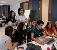
ISPRS WG V/3 and WG V/4 Geospatial Hackathon "Citizen Science"
September 22-23, 2017
Ankara, Turkey
by Dr. Berk Anbaroglu and Prof. Dr. Sultan Kocaman
Hackathons are events in which people gather together to develop a software project within, usually, 36-48 hours. Even though many hackathon projects include a “geospatial” aspect, this is usually not the focus. Those who focus on “geospatial technologies” are usually hosted by a company, limiting the technologies/data that could be relied on. With the emergence of Open Data and Open Software, the developers could initiate a project in a more independent way. In addition, we are also aware that Citizen Science is an emerging research area in the world. This was officially recognised at the ISPRS congress held in Prague, leading to the formation of the WG V/3 entitled “Promotion of Regional Collaboration in Citizen Science and Geospatial Technology”. Consequently, the first ISPRS geospatial hackathon was organised in Ankara, Turkey on 22-23 September by WG V/3 and WG V/4 with the theme of “citizen science”. We wanted to promote open technologies and share our enthusiasm on citizen science with our colleagues and students.
Read the complete report here…
|
 |
|
4th International Workshop on Geoinformation Science: GeoAdvances 2017
(ISPRS Workshop on Multi-dimensional & Multi-scale Spatial Data Modeling)
Karabuk, Turkey
October 14–15, 2017
by Ismail Rakip Karas
GeoAdvances workshop took place at Karabuk University, Safranbolu Campus, Conference Halls on October 14–15, 2017. The workshop provided a setting for discussing recent developments in a wide variety of topics including Geographical Information Systems (GIS), Spatial Data Infrastructure (SDI) Urban Planning, Architecture, Geology, Multi-dimensional & Multi-scale Spatial Data Modeling, Geostatistics, Location Based Services, Outdoor and indoor positioning, wayfinding and navigation, Smartphone-based positioning, Augmented and Virtual Reality, Building Information Modeling (BIM), Geomatics, GPS, GNSS, Remote Sensing, Pattern and Image Processing, Photogrammetry, GeoInformation for Mobile, Wearable Tecnologies and Wireless Sensor Networks, and Internet of Things technologies, and etc.
Read more ...
|
 |
|
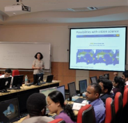
Narrative Report on ISPRS SC & WG V/3, V/5 Summer School on Geo-processing tools and technologies in citizen science
Oct 30 - Nov 3, 2017
Indian Institute of Remote Sensing (IIRS/ISRO), Dehradun, India
by Diwakar KC
Lalitpur, Nepal
The invention and use of technologies has increased rapidly over the last few decades,
which has changed the way to analyze geo information. With the advent of concept of
open data and open science, it is necessary to collaborate with general public in
scientific work in order to solve complex problems. Thus, citizen science aims to
involve public in scientific research and contribute to global investigations followed
by their solution. However, there are only few efforts, which has emphasized on
issues related to citizen science. Among such attempts are ISPRS’s summer school on
geo-processing tools and technologies in citizen science, which aimed to promote the
use of geo- processing tools to increase citizen’s participation and improve the quality of the collected data.
Read more…
|
|
|
| |
|
|
Obituaries
 |
|
In Memoriam: James Boyce Case
1928 - 2017
The long serving former Editor of Photogrammetric Engineering & Remote Sensing (PE&RS), Jim Case, died in St. George, Utah on 8th May, 2017 at the age of 88. Jim grew up in Hanford, California and studied for his first degree at Stanford University, graduating in 1950. He was awarded his doctorate in geodetic science from Ohio State University in 1958.
From 1970 until 1989, Jim Case worked for the US Defense Mapping Agency (DMA). During that time, he presented the Digital Stereo Comparator/Compiler (DSCC) to the ISPRS Commission II symposium in Ottawa in 1982.
Read the full obituary
here ...
|
|
|
| |
|
|
ISPRS International Journal of Geo-Information — Open Access Journal
 |
|
New publications in the ISPRS International Journal of Geo-Information
Open Access Journal
Volume 6, Issue 11 (November)
Spatio-Temporal Variability in a Turbid and Dynamic Tidal Estuarine Environment (Tasmania, Australia): An Assessment of MODIS Band 1 Reflectance
Fischer, Andrew M., Pang, Daniel, Kidd, Ian M., Moreno-Madriñán, Max J.
No: 320
Road2Vec: Measuring Traffic Interactions in Urban Road System from Massive Travel Routes
Liu, Kang, Gao, Song, Qiu, Peiyuan, Liu, Xiliang, Yan, Bo, Lu, Feng
No: 321
The SSP-Tree: A Method for Distributed Processing of Range Monitoring Queries in Road Networks
Jung, HaRim, Kim, Ung-Mo
No: 322
Development of a Safety Index to Identify Differences in Safety Performance by Postal Delivery Motorcyclists Based either in Different Regional Post Offices or within the Same Regional Office
Jo, Junghee, Kim, Hyunsuk
No: 324
Globally Consistent Indoor Mapping via a Decoupling Rotation and Translation Algorithm Applied to RGB-D Camera Output
Liu, Yuan, Wang, Jun, Song, Jingwei, Song, Zihui
No: 323
“Voting with Their Feet”: Delineating the Sphere of Influence Using Social Media Data
Wong, David W. S., Huang, Qunying
No: 325
Assessment of UAV and Ground-Based Structure from Motion with Multi-View Stereo Photogrammetry in a Gullied Savanna Catchment
Koci, Jack, Jarihani, Ben, Leon, Javier X., Sidle, Roy C., Wilkinson, Scott N., Bartley, Rebecca
No: 328
An Efficient Query Algorithm for Trajectory Similarity Based on Fréchet Distance Threshold
Guo, Ning, Ma, Mengyu, Xiong, Wei, Chen, Luo, Jing, Ning
No: 326
Simplifying GPS Trajectory Data with Enhanced Spatial-Temporal Constraints
Qian, Haizhong, Lu, Yongmei
No: 329
Enhanced Map-Matching Algorithm with a Hidden Markov Model for Mobile Phone Positioning
Luo, An, Chen, Shenghua, Xv, Bin
No: 327
A Feature-Based Approach of Decision Tree Classification to Map Time Series Urban Land Use and Land Cover with Landsat 5 TM and Landsat 8 OLI in a Coastal City, China
Hua, Lizhong, Zhang, Xinxin, Chen, Xi, Yin, Kai, Tang, Lina
No: 331
Surveillance Video Synopsis in GIS
Xie, Yujia, Wang, Meizhen, Liu, Xuejun, Wu, Yiguang
No: 333
Aircraft Reconstruction in High-Resolution SAR Images Using Deep Shape Prior
Dou, Fangzheng, Diao, Wenhui, Sun, Xian, Zhang, Yue, Fu, Kun
No: 330
Bibliometric Analysis of Global Remote Sensing Research during 2010–2015
Zhang, Hongyue, Huang, Mingrui, Qing, Xiuling, Li, Guoqing, Tian, Chuanzhao
No: 332
Detection of Moving Ships in Sequences of Remote Sensing Images
Yao, Shun, Chang, Xueli, Cheng, Yufeng, Jin, Shuying, Zuo, Deshan
No: 334
Spatial Analysis of Linear Structures in the Exploration of Groundwater
Dembele, Abdramane, Ye, Xiufen
No: 335
Near-Real-Time OGC Catalogue Service for Geoscience Big Data
Song, Jia, Di, Liping
No: 337
An Index Based on Joint Density of Corners and Line Segments for Built-Up Area Detection from High Resolution Satellite Imagery
Ning, Xiaogang, Lin, Xiangguo
No: 338
Mixture Statistical Distribution Based Multiple Component Model for Target Detection in High Resolution SAR Imagery
He, Chu, Tu, Mingxia, Liu, Xinlong, Xiong, Dehui, Liao, Mingsheng
No: 336
Exploring Spatiotemporal Patterns of Long-Distance Taxi Rides in Shanghai
Wu, Hangbin, Fan, Hongchao, Wu, Shengyuan
No: 339
Contributors’ Withdrawal from Online Collaborative Communities: The Case of OpenStreetMap
Bégin, Daniel, Devillers, Rodolphe, Roche, Stéphane
No: 340
Understanding the Functionality of Human Activity Hotspots from Their Scaling Pattern Using Trajectory Data
Jia, Tao, Ji, Zheng
No: 341
Beyond Maximum Independent Set: An Extended Integer Programming Formulation for Point Labeling
Haunert, Jan-Henrik, Wolff, Alexander
No: 342
Hybrid Spatial Data Model for Indoor Space: Combined Topology and Grid
Lin, Zhiyong, Xu, Zhimin, Hu, Dan, Hu, Qinwu, Li, Wenjing
No: 343
Classification of Hyperspectral Images Using Kernel Fully Constrained Least Squares
Liu, Jianjun, Wu, Zebin, Xiao, Zhiyong, Yang, Jinlong
No: 344
Historic Low Wall Detection via Topographic Parameter Images Derived from Fine-Resolution DEM
Chu, Hone-Jay, Huang, Min-Lang, Tain, Yu-Ching, Yang, Mon-Shieh, Höfle, Bernhard
No: 346
Working with Open BIM Standards to Source Legal Spaces for a 3D Cadastre
Oldfield, Jennifer, van Oosterom, Peter, Beetz, Jakob, Krijnen, Thomas F.
No: 351
Variable-Weighted Linear Combination Model for Landslide Susceptibility Mapping: Case Study in the Shennongjia Forestry District, China
Chen, Wei, Han, Hongxing, Huang, Bin, Huang, Qile, Fu, Xudong
No: 347
Quantifying Tourist Behavior Patterns by Travel Motifs and Geo-Tagged Photos from Flickr
Yang, Liu, Wu, Lun, Liu, Yu, Kang, Chaogui
No: 345
A Novel Approach to Semantic Similarity Measurement Based on a Weighted Concept Lattice: Exemplifying Geo-Information
Xiao, Jia, He, Zongyi
No: 348
GIS-Based Evaluation of Spatial Interactions by Geographic Disproportionality of Industrial Diversity
Lee, Jemyung, Hoshino, Satoshi
No: 352
WebGIS and Geospatial Technologies for Landscape Education on Personalized Learning Contexts
de Lázaro Torres, María Luisa, De Miguel González, Rafael, Morales Yago, Francisco José
No: 350
WLAN Fingerprint Indoor Positioning Strategy Based on Implicit Crowdsourcing and Semi-Supervised Learning
Song, Chunjing, Wang, Jian
No: 356
Conceptual Design of a Mobile Application for Geography Fieldwork Learning
Wang, Xiaoling, van Elzakker, Corné P. J. M., Kraak, Menno-Jan
No: 355
Relationship between MRPV Model Parameters from MISRL2 Land Surface Product and Land Covers: A Case Study within Mainland Spain
Arrogante-Funes, Patricia, Novillo, Carlos J., Romero-Calcerrada, Raúl, Vázquez-Jiménez, René, Ramos-Bernal, Rocío N.
No: 353
A Post-Rectification Approach of Depth Images of Kinect v2 for 3D Reconstruction of Indoor Scenes
Jiao, Jichao, Yuan, Libin, Tang, Weihua, Deng, Zhongliang, Wu, Qi
No: 349
Web-Scale Normalization of Geospatial Metadata Based on Semantics-Aware Data Sources
Fugazza, Cristiano, Tagliolato, Paolo, Frigerio, Luca, Carrara, Paola
No: 354
Visualization of Features in 3D Terrain
Dübel, Steve, Schumann, Heidrun
No: 357
Exploring Determinants of Housing Prices in Beijing: An Enhanced Hedonic Regression with Open Access POI Data
Xiao, Yixiong, Chen, Xiang, Li, Qiang, Yu, Xi, Chen, Jin, Guo, Jing
No: 358
A New Recursive Filtering Method of Terrestrial Laser Scanning Data to Preserve Ground Surface Information in Steep-Slope Areas
Kim, Mi-Kyeong, Kim, Sangpil, Sohn, Hong-Gyoo, Kim, Namhoon, Park, Je-Sung
No: 359
Evaluation of Empirical and Machine Learning Algorithms for Estimation of Coastal Water Quality Parameters
Nazeer, Majid, Waqas, Ahmad, Bilal, Muhammad, Shahzad, Muhammad Imran, Alsahli, Mohammad M. M.
No: 360
Ground Deformation Detection Using China’s ZY-3 Stereo Imagery in an Opencast Mining Area
Hu, Wenmin, Wu, Lixin, Zhang, Wei, Liu, Bin, Xu, Jiaxing
No: 361
A Dynamic Spatiotemporal Analysis Model for Traffic Incident Influence Prediction on Urban Road Networks
Liu, Chun, Zhang, Shuhang, Wu, Hangbin, Fu, Qiang
No: 362
A Hybrid Parallel Spatial Interpolation Algorithm for Massive LiDAR Point Clouds on Heterogeneous CPU-GPU Systems
Wang, Hongyan, Guan, Xuefeng, Wu, Huayi
No: 363
Accuracy Assessment of Landform Classification Approaches on Different Spatial Scales for the Iranian Loess Plateau
Kramm, Tanja, Hoffmeister, Dirk, Curdt, Constanze, Maleki, Sedigheh, Khormali, Farhad, Kehl, Martin
No: 366
Multiple Feature Hashing Learning for Large-Scale Remote Sensing Image Retrieval
Ye, Dongjie, Li, Yansheng, Tao, Chao, Xie, Xunwei, Wang, Xiang
No: 364
Comparison and Evolution of Extreme Rainfall-Induced Landslides in Taiwan
WU, Chunhung
No: 367
Using Visual Exploratory Data Analysis to Facilitate Collaboration and Hypothesis Generation in Cross-Disciplinary Research
Ma, Xiaogang, Hummer, Daniel, Golden, Joshua J., Fox, Peter A., Hazen, Robert M., Morrison, Shaunna M., Downs, Robert T., Madhikarmi, Bhuwan L., Wang, Chengbin, Meyer, Michael B.
No: 368
An Ensemble Model for Co-Seismic Landslide Susceptibility Using GIS and Random Forest Method
Shrestha, Suchita, Kang, Tae-Seob, Suwal, Madan Krishna
No: 365
An Integrated Spatial Clustering Analysis Method for Identifying Urban Fire Risk Locations in a Network-Constrained Environment: A Case Study in Nanjing, China
Xia, Zelong, Li, Hao, Chen, Yuehong
No: 370
Mapping and Analyzing Stream Network Changes in Watonwan River Watershed, Minnesota, USA
Yuan, Fei, Larson, Phillip, Mulvihill, Roman, Libby, Devon, Nelson, Jessica, Grupa, Tyler, Moore, Rick
No: 369
Deriving Ephemeral Gullies from VHR Image in Loess Hilly Areas through Directional Edge Detection
Yang, Xin, Dai, Wen, Tang, Guoan, Li, Min
No: 371
A Representation Method for Complex Road Networks in Virtual Geographic Environments
Zheng, Peibei, Tao, Hong, Yue, Songshan, Wu, Mingguang, Lv, Guonian, Zhou, Chuanlong
No: 372
Optimizing Cruising Routes for Taxi Drivers Using a Spatio-Temporal Trajectory Model
Wu, Liang, Hu, Sheng, Yin, Li, Wang, Yazhou, Chen, Zhanlong, Guo, Mingqiang, Chen, Hao, Xie, Zhong
No: 373
Spatio-Temporal Series Remote Sensing Image Prediction Based on Multi-Dictionary Bayesian Fusion
He, Chu, Zhang, Zhi, Xiong, Dehui, Du, Juan, Liao, Mingsheng
No: 374
An Automated Processing Algorithm for Flat Areas Resulting from DEM Filling and Interpolation
Liu, Xingwei, Wang, Ning, Shao, Jingli, Chu, Xuefeng
No: 376
A 3D Digital Cadastre for New Zealand and the International Opportunity
Gulliver, Trent, Haanen, Anselm, Goodin, Mark
No: 375
A Virtual Geographic Environment for Debris Flow Risk Analysis in Residential Areas
Yin, Lingzhi, Zhu, Jun, Li, Yi, Zeng, Chao, Zhu, Qing, Qi, Hua, Liu, Mingwei, Li, Weilian, Cao, Zhenyu, Yang, Weijun, Zhang, Pengcheng
No: 377
Geo-Environmental Estimation of Land Use Changes and Its Effects on Egyptian Temples at Luxor City
Elfadaly, Abdelaziz, Wafa, Osama, Abouarab, Mohamed A. R., Guida, Antonella, Spanu, Pier Giorgio, Lasaponara, Rosa
No: 378
↑ Up
|
|
|
| |
|
|
ISPRS Journal of Photogrammetry and Remote Sensing
 |
|
New publications in the ISPRS Journal of
Photogrammetry and Remote Sensing Volume 133 (November 2017)
A crop phenology knowledge-based approach for monthly monitoring of construction land expansion using polarimetric synthetic aperture radar imagery
Zhixin Qi, Anthony Gar-On Yeh, Xia Li
Pages: 1-17
Monitoring surface urban heat island formation in a tropical mountain city using Landsat data (1987–2015)
Ronald C. Estoque, Yuji Murayama
Pages: 18-29
Tile prediction schemes for wide area motion imagery maps in GIS
Chris J. Michael, Bruce Y. Lin
Pages: 30-36
Two-dimensional empirical wavelet transform based supervised hyperspectral image classification
T.V. Nidhin Prabhakar, P. Geetha
Pages: 37-45
Improved atmospheric correction and chlorophyll-a remote sensing models for turbid waters in a dusty environment
Maryam R. Al Shehhi, Imen Gherboudj, Jun Zhao, Hosni Ghedira
Pages: 46-60
The Naïve Overfitting Index Selection (NOIS): A new method to optimize model complexity for hyperspectral data
Alby D. Rocha, Thomas A. Groen, Andrew K. Skidmore, Roshanak Darvishzadeh, Louise Willemen
Pages: 61-74
Assessing the Three-North Shelter Forest Program in China by a novel framework for characterizing vegetation changes
Bingwen Qiu, Gong Chen, Zhenghong Tang, Difei Lu, Zhuangzhuang Wang, Chongchen Chen
Pages: 75-88
Subpixel urban impervious surface mapping: the impact of input Landsat images
Chengbin Deng, Chaojun Li, Zhe Zhu, Weiying Lin, Li Xi
Pages: 89-103
An easily implemented method to estimate impervious surface area on a large scale from MODIS time-series and improved DMSP-OLS nighttime light data
Sophak Pok, Bunkei Matsushita, Takehiko Fukushima
Pages: 104-115
Remote sensing of species diversity using Landsat 8 spectral variables
Sabelo Madonsela, Moses Azong Cho, Abel Ramoelo, Onisimo Mutanga
Pages: 116-127
Utility of remote sensing-based surface energy balance models to track water stress in rain-fed switchgrass under dry and wet conditions
Nishan Bhattarai, Pradeep Wagle, Prasanna H. Gowda, Vijaya G. Kakani
Pages: 128-141
Tree species classification using within crown localization of waveform LiDAR attributes
Rosmarie Blomley, Aarne Hovi, Martin Weinmann, Stefan Hinz, Ilkka Korpela, Boris Jutzi
Pages: 142-156
Transformation of Landsat imagery into pseudo-hyperspectral imagery by a multiple regression-based model with application to metal deposit-related minerals mapping
Nguyen Tien Hoang, Katsuaki Koike
Pages: 157-173
Nonlinear bias compensation of ZiYuan-3 satellite imagery with cubic splines
Jinshan Cao, Jianhong Fu, Xiuxiao Yuan, Jianya Gong
Pages: 174-185
Mapping the height and spatial cover of features beneath the forest canopy at small-scales using airborne scanning discrete return Lidar
Matthew Sumnall, Thomas R. Fox, Randolph H. Wynne, Valerie A. Thomas
Pages: 186-200
New publications in the ISPRS Journal of
Photogrammetry and Remote Sensing Volume 134 (December 2017)
Large-scale block adjustment without use of ground control points based on the compensation of geometric calibration for ZY-3 images
Bo Yang, Mi Wang, Wen Xu, Deren Li, Jianya Gong, Yingdong Pi
Pages: 1-14
Pairwise registration of TLS point clouds using covariance descriptors and a non-cooperative game
Dawei Zai, Jonathan Li, Yulan Guo, Ming Cheng, Pengdi Huang, Xiaofei Cao, Cheng Wang
Pages: 15-29
Breaking new ground in mapping human settlements from space – The Global Urban Footprint
Thomas Esch, Wieke Heldens, Andreas Hirner, Manfred Keil, Mattia Marconcini, Achim Roth, Julian Zeidler, Stefan Dech, Emanuele Strano
Pages: 30-42
Unmanned Aerial System (UAS)-based phenotyping of soybean using multi-sensor data fusion and extreme learning machine
Maitiniyazi Maimaitijiang, Abduwasit Ghulam, Paheding Sidike, Sean Hartling, Matthew Maimaitiyiming, Kyle Peterson, Ethan Shavers, Jack Fishman, Jim Peterson, Suhas Kadam, Joel Burken, Felix Fritschi
Pages: 43-58
Auto-calibration of GF-1 WFV images using flat terrain
Guo Zhang, Kai Xu, Wenchao Huang
Pages: 59-69
Estimation and mapping of above-ground biomass of mangrove forests and their replacement land uses in the Philippines using Sentinel imagery
Jose Alan A. Castillo, Armando A. Apan, Tek N. Maraseni, Severino G. Salmo
Pages: 70-85
Large tree diameter distribution modelling using sparse airborne laser scanning data in a subtropical forest in Nepal
Parvez Rana, Jari Vauhkonen, Virpi Junttila, Zhengyang Hou, Basanta Gautam, Fiona Cawkwell, Timo Tokola
Pages: 86-95
Band registration of tuneable frame format hyperspectral UAV imagers in complex scenes
Eija Honkavaara, Tomi Rosnell, Raquel Oliveira, Antonio Tommaselli
Pages: 96-109
Above-bottom biomass retrieval of aquatic plants with regression models and SfM data acquired by a UAV platform – A case study in Wild Duck Lake Wetland, Beijing, China
Ran Jing, Zhaoning Gong, Wenji Zhao, Ruiliang Pu, Lei Deng
Pages: 122-134
Per-pixel bias-variance decomposition of continuous errors in data-driven geospatial modeling: A case study in environmental remote sensing
Jing Gao, James E. Burt
Pages: 110-121
DEM generation from contours and a low-resolution DEM
Xinghua Li, Huanfeng Shen, Ruitao Feng, Jie Li, Liangpei Zhang
Pages: 135-147
New publications in the ISPRS Journal of
Photogrammetry and Remote Sensing Volume 135 (January 2018)
Evaluation of the S-NPP VIIRS land surface temperature product using ground data acquired by an autonomous system at a rice paddy
Raquel Niclòs, Lluís Pérez-Planells, César Coll, José A. Valiente, Enric Valor
Pages: 1-12
From Google Maps to a fine-grained catalog of street trees
Steve Branson, Jan Dirk Wegner, David Hall, Nico Lang, Konrad Schindler, Pietro Perona
Pages: 13-30
Spectral-spatial classification of hyperspectral imagery with cooperative game
Ji Zhao, Yanfei Zhong, Tianyi Jia, Xinyu Wang, Yao Xu, Hong Shu, Liangpei Zhang
Pages: 31-42
Guided color consistency optimization for image mosaicking
Renping Xie, Menghan Xia, Jian Yao, Li Li
Pages: 43-59
Aerial photography flight quality assessment with GPS/INS and DEM data
Haitao Zhao, Bing Zhang, Jiali Shang, Jiangui Liu, Dong Li, Yanyan Chen, Zhengli Zuo, Zhengchao Chen
Pages: 60-73
Analyzing the performance of PROSPECT model inversion based on different spectral information for leaf biochemical properties retrieval
Jia Sun, Shuo Shi, Jian Yang, Lin Du, Wei Gong, Biwu Chen, Shalei Song
Pages: 74-83
Bias of cylinder diameter estimation from ground-based laser scanners with different beam widths: A simulation study
Mona Forsman, Niclas Börlin, Kenneth Olofsson, Heather Reese, Johan Holmgren
Pages: 84-92
A temperature and vegetation adjusted NTL urban index for urban area mapping and analysis
Xiya Zhang, Peijun Li
Pages: 93-111
Locating and defining underground goaf caused by coal mining from space-borne SAR interferometry
Zefa Yang, Zhiwei Li, Jianjun Zhu, Huiwei Yi, Guangcai Feng, Jun Hu, Lixin Wu, Alex Preusse, Yunjia Wang, Markus Papst
Pages: 112-126
Angular difference feature extraction for urban scene classification using ZY-3 multi-angle high-resolution satellite imagery
Xin Huang, Huijun Chen, Jianya Gong
Pages: 127-141
Uniform competency-based local feature extraction for remote sensing images
Amin Sedaghat, Nazila Mohammadi
Pages: 142-157
Classification with an edge: Improving semantic image segmentation with boundary detection
D. Marmanis, K. Schindler, J.D. Wegner, S. Galliani, M. Datcu, U. Still
Pages: 158-172
A hybrid training approach for leaf area index estimation via Cubist and random forests machine-learning
Rasmus Houborg, Matthew F. McCabe
Pages: 173-188
↑ Up
|
|
|
| |
|
|
New Events
10 Jan 2018
Workshop
"SPACED: Using Earth Observations to Protect Natural Landscapes"
website not yet available
Brussels, Belgium
21-23 Mar 2018
GIS Ostrava 2018
GIS for Safety & Security Management
http://gis.vsb.cz/gisostrava/
Ostrava, Czech Republic
26-29 Mar 2018
RSCy2018
Sixth International Conference On Remote Sensing and Geo-Information of the Environment
http://www.cyprusremotesensing.com/rscy2018/
Paphos, Cyprus
27-29 Mar 2018
GRASF Conference 2018
http://www.grasf.ae/
Dubai, U.A.E.
12-14 May 2018
Understanding the Problems of Inland Waters:
Case Study for the Caspian Basin (UPCB) 2018
http://www.upcm2018.org/
Baku, Azerbaijan
27 Jun 2018 - 29 Jun 2019
UAS4Enviro 2018
Small Unmanned Aerial Systems for Environmental Research – 6th Edition
http://uas4enviro.org
Split, Croatia
09-12 Jul 2018
38th EARSeL Symposium 2018
and 3rd EARSeL SIG LU/LC and NASA LCLUC joint Workshop
http://symposium.earsel.org/38th-symposium-Chania/
Chania, Crete, Greece
19-20 Aug 2018
PRRS 2018
10th IAPR Workshop on Pattern Recognition in Remote Sensing
http://www.pf.bgu.tum.de/isprs/prrs18
Beijing, China
19-23 Aug 2018
SPIE Optics + Photonics 2018
http://spie.org/Optics_Photonics
San Diego, CA, USA
05 Sep 2018
3DV 2018
International Conference on 3D Vision
http://3dv18.uniud.it
Verona, Italy
01-05 Oct 2018
Geo Delft 2018
https://www.tudelft.nl/geodelft2018/
Delft, The Netherlands
» See more
|
|
| |
|
|
Updated Events
05 Sep 2018
3DV 2018
International Conference on 3D Vision
http://3dv18.uniud.it
Verona, Italy
20-23 Nov 2018
ISPRS TC V Mid-term Symposium
http://tc5-symposium2018.isrs-india.org/
Dehradun, India
» See more
|
|
| |
|
|
Job Opportunities
|
13-Nov-2017 |
Researcher position in the Geomatics Division – Geodesy and Navigation Department
Centre Tecnològic de Telecomunicacions de Catalunya (CTTC), in Castelldefels – Barcelona, Spain
|
|
15-Nov-2017 |
Assistant-professor 3D city modelling for urban applications (tenure track)
3D GeoInformation Group, Delft University of Technology (3d.bk.tudelft.nl), Netherlands
Deadline: 8-Jan-2018
|
|
30-Nov-2017 |
Postdoc position on “Integrating Geo and BIM"
3D GeoInformation Group, Delft University of Technology (3d.bk.tudelft.nl), The Netherlands
Deadline: 15-Jan-2018
|
|
5-Dec-2017 |
PhD in Multi-Source Remote Sensing for Enhanced Flood Modelling
The James Hutton Institute and Newcastle University, UK
Deadline: 5-Jan-2018
|
» See more
|
|
|
| |
|
|
|
You got this email as you subscribed to the ISPRS mailing list.
Officers, members and contact persons of members get it by default.
To unsubscribe from the ISPRS mailing list,
click here.
© ISPRS, 2017.
Imprint
|
