Click on this
link
if you cannot read this email.

 |
| |
| |
 |
|
ISPRS e-Bulletin
Issue No 1 - 2018
|
 |
| |
|
|
|
Quick Links
|
|
| |
|
|
Editorial
 |
|

by Sisi Zlatanova

A highlight of the ISPRS Technical Commission IV Spatial Information Science is the upcoming Symposium, 3D Spatial Information: The Engine of Change, aiming to provide a forum where researchers and practitioners can come together and share their work and ideas in the spatial information sciences and propose new developments for this important field for the progress of humanity.
The world's population is on the rise, to reach 7.5 billion in 2018, and by 2050 it is predicted that it will be 9.7 billion. Managing the social and economic changes brought on by this increasing population will require new ideas and spatial information decision making tools. Moreover, the pressures placed on the usage of spaces that people live and work in will necessitate decisions that are based on 3D and higher dimension spatial data. 3D and higher dimensions pose significant challenges to researchers, data holders, software developers and stakeholders. Besides research and development, much more collaboration and cooperation is required between disciplines, researchers and practitioners, industry and academics to support the progress on spatial information.

.
During the symposium researchers will examine and evaluate state-of-the art in all aspects of 3D spatial information and modelling through the work of the Commission's 10 working groups:
WG 1: Multi-dimensional Modelling;
WG 2: Ontologies, Semantics, and Knowledge Representation for Geospatial Information;
WG 3: Spatial Data Analysis, Statistics and Uncertainty Modelling;
WG 4: Collaborative Crowdsourced Cloud Mapping;
WG 5: Indoor/Outdoor Seamless Modelling, LBS and Mobility;
WG 6: SDI: Internet of Things and Spatial Decision Support;
WG 7: Geo-Data Management;
WG 8: GeoComputation and GeoSimulation;
WG 9: Geovisualization, Augmented and Virtual Reality;
WG 10: Advanced Geospatial Applications for Smart Cities and Regions;
ICWG IV/III: Global Mapping: Updating Verification and Interoperability.
Several keynote speakers will elaborate on different aspects of 3D spatial information. Prof. Dr. Ruizhi Chen, Director of LIESMARS, will discuss Smartphone Positioning and 3D Mapping Indoors. According to him “Indoor positioning is one of the core technologies of artificial intelligence (AI) and will play a pivotal role in the upcoming era of AI”. Dr. Rod Thomson will share his vision for the future of 3D cadastre and Dr. Claus Nagel will demonstrate current applications of 3D City Models.

The ISPRS symposium will be hosted at Delft University of Technology and will be a part of Geo Delft 2018 joint event, which will host 3D Geoinfo, 3Dcadatsres and SDSC conferences. Relevant information about the symposium can be found at the symposium web site. More information about all conferences within Geo Delft 2018 can be found at the conference web site.
We warmly welcome you to take part in the Symposium.
↑ Up
|
|
|
| |
|
|
The ISPRS Foundation (TIF) News
|
 |
|
The ISPRS Foundation (TIF) seeks volunteers for its Fund-Raising Committee
The ISPRS Foundation (TIF) is a public charity formed to administer an extensive and broadly-based international program that, through the raising of funds, shall provide grants, scholarships, awards, training supplies and other forms of scientific assistance to qualified individuals and organisations who are pursuing and/or applying knowledge for advancing the sciences and technologies associated with the disciplines embodied by the ISPRS, especially to support those in developing countries and regions. See http://www.isprs.org/foundation/foundation/default.aspx for more details.
The biggest challenge for most non-profits is to raise sufficient funds to accomplish their goals. TIF wants to grow so that it can offer assistance to more individuals and organizations from more countries. In order to address this effectively and directly, TIF is making changes to its committee structure and is forming a Fund-Raising Committee. We are looking for volunteers to join this committee! You need to be excited by what ISPRS is doing and must identify enthusiastically with TIF’s goals. You should have a large network of contacts, including people at high levels in organizations who may be willing to give funds to TIF, if they are approached in a suitable and informative fashion. You should be energetic, imaginative, and willing to engage with potential donors as an ambassador of TIF. You must be able to bounce back if an organization is reluctant! We are looking for committee members from all over the world. If you are interested, please contact Stewart Walker, Chair of the Board of Trustees, at foundationchair@isprs.org.
Thank you.
TIF Travel Grants for ISPRS Symposia 2018
| TC |
Term |
Place |
Application Deadline |
|
I |
October 9-12 |
Karlsruhe, Germany |
July 31 2018 |
|
II |
June 4-7 |
Riva del Garda, Italy |
March 19 2018 |
|
III |
May 7-10 |
Beijing, China |
March 19 2018 |
|
IV |
October 1-5 |
Delft, The Netherlands |
July 31 2018 |
|
V |
November 20-23 |
Dehradun, India |
Sept 30 2018 |
Interested persons should complete the
online application form
TIF News

|
TIF ExCom
Stewart Walker, Chair, Board of Trustees
John Trinder, Operations Officer
Marguerite Madden, Finance Officer
|

|
Integrated Geospatial Innovations (IGI) and the Executive Committee of The ISPRS Foundation (TIF) are delighted to announce that
Vincent Mate Imala wins the IGI Africa Ambassador Award 2018
Mr. Imala is employed by the Directorate of Resource Surveys and Remote Sensing, Ministry of Mining, Kenya.
IGI offers its IGI Ambassador Award via The ISPRS Foundation (TIF) to young scientists in photogrammetry and laser scanning from regionally under-represented African countries in the geospatial sciences and technology fields. The award is funded by a donation of €2500 from IGI. The award allows Mr. Imala to visit IGI‘s offices in Kreuztal, Germany, and actively participate at ISPRS Workshops, Conferences, and Symposia. He will prepare reports about visits funded by the award for publication in IGI and ISPRS/TIF ebsites and newsletters. In addition, he will become an IGI ambassador for all IGI products and workflows.
Applications for the Award are adjudicated by the TIF IGI Grants Evaluation Committee, currently represented by Stewart Walker, John Trinder and Philipp Grimm.

|
TIF ExCom
Stewart Walker, Chair, Board of Trustees
John Trinder, Operations Officer
Marguerite Madden, Finance Officer
|
|
The Executive Committee of The ISPRS Foundation (TIF) is pleased to announce the Brilliant Remote Sensing Labs Offer of Free Online Video Courses
The ISPRS Foundation is pleased to announce that Brilliant Remote Sensing Labs is offering through the ISPRS Foundation an educational grant from the online courses of Brilliant Remote Sensing Labs. The courses, which are each valued at $200 to $300, are offered TO ALL ISPRS MEMBERS FREE OF CHARGE (with no limitations on the count of applicants and no hidden costs). The courses do not require any Remote Sensing Software. Each applicant can select to study one online course from the following three courses:
- Space Science and Satellites Overview for General Managers & Supervisors
- Remote Sensing Fundamentals
- Satellite Images Visual Interpretation
Details of the courses and free video lecture samples can be found on www.remote-sensing-portal.com. Each course includes an online exam (optional) and a certificate. To apply now and start learning, click the following link: https://remote-sensing-portal.com/account/freecourseregisteration/
All courses are in the form of short video lectures. Each course will be valid for 20 days from the application date. An email including the studying and exam instructions will be sent to each applicant immediately after the application is submitted. The link will be valid for two months from the 5th March 2018.
The ISPRS Foundation
March 2018
↑ Up
|
|
|
| |
|
|
Society News
|

|
|
Education and Capacity Building Initiatives 2018
In accordance with the statutory mission and activities of ISPRS, the Society will provide funds to support scientific and other initiatives, which will further improve its international status in the field of the photogrammetry, remote sensing and spatial information sciences, and will therefore benefit all ISPRS members. For 2018, the following seven Education and Capacity Building Initiatives projects were selected and approved by the Council for funding.
| Title |
Project Team |
TC/WG |
| GeoInformation Science Pedagogical Outreach Pilot Program: 3S-4-Schools |
Timo Balz, Stephen C. McClure, Norman J. Meres, Jianya Gong, Jinsong Tao, Jingjin Wang |
TC I |
| Camera Calibration and Performance Database |
Mark R. Shortis |
TC II |
| Spreading out the Knowledge from ISPRS Educational Events using a Dissemination Internet Platform |
Marco Scaioni, Roderik Lindenbergh, Francesco Pirotti, Martin Rutzinger, Bernhard Hofle |
WG III/5,WG II/10,WG III/10 |
| Capacity Building for High-Resolution Land Cover Inter-comparison and Validation |
Maria Brovelli, Hao Wu, Marco Minighini, Xinyan Chen, Msilikale Msilanga, Mark Iliffe, Maria D'Urso, Sisi, Zlatanova, Phoebe Oduor, George Sithole |
ICWG IV/III, WG IV/4 |
Establishing an Open Repository and Catalogue for Geospatial Educational Resources |
Victoria Rautenbach, Serena Coetzee, Arzu Coltekin, Chris Pettit, Marguerite Madden, Sidonie Christophe, Ochiroo Lkhamjav |
WG IV/6, WG IV/9, ICA |
Education and Training Resources on Digital Photogrammetry |
Grazia Tucci, Anjana Vyas, Vikram Sorathia, Satwant Rihal |
TC V |
MOTIVATE Learning: Making Opportunities to Initiate Valuable Alliance through Experiential Learning |
Sheryl Rose Reyes, Tanita Suepa, Krzystof Sterenczak |
SC, WG V/5, GISTDA |
For a brief summary of the above-awarded projects together with the information of their principle investigator(s) and co-investigator(s) see here….
|
|

|
|
New Irish Ordinary Member - Ordnance Survey Ireland
A postal ballot of Ordinary members has approved the application from Ordnance Survey Ireland for Irish Ordinary membership of ISPRS.
Council welcomes the new Irish Member and looks forward to future collaboration.
Information on the Ordnance Survey Ireland can be found at
http://www.osi.ie
|
|
|
|
ISPRS Sustaining Member Category Changes
Reflecting the growing number of employees within their organisations, Sustaining Members, Trimble, based in USA, have now upgraded their membership category from D to category B, and RACURS from the Russian Federation, have upgraded from D to category C.
ISPRS areas of research and the resulting achievements can be found in many applications used day-to-day by millions of users. These impressive scientific achievements are implemented by many industrial players who apply the technology in areas such as economy, land management, disaster risk reduction, navigation, and integrated in various personal apps. ISPRS is pleased to see the growing interest of companies dealing with the development of such products.
Further information on Sustaining Membership categories can be found at:
http://www.isprs.org/structure/finances.aspx |
|

|
|
New Executives elected at Geoinformation Society of Nigeria
We are pleased to inform you that ISPRS Ordinary member, Geoinformation Society of Nigeria (GEOSON) has elected new executives at the end of 2017.
ISPRS congratulates Dr. Matthew O. Adepoju as new president, wishing him and his new team all the best for their term of office. Dr. Adepoju is also the Head of the Cadastral Mapping & Urban Space Applications Division, National Space Research and Development Agency at Obasanjo Space Center.
The Nigerian Society promotes and facilitates geospatial information development, integration, research, knowledge and innovation amongst its members and institutions in Nigeria and beyond.
Visit www.geoson.org for more information. |
|

|
|
ISPRS Journal Editor-in-Chief, Qihao Weng named fellow by Institute of Electrical and Electronics Engineers
Indiana State University Professor and ISPRS Journal of Photogrammetry and Remote Sensing Editor-in-Chief, Qihao Weng has been named a Fellow of the Institute of Electrical and Electronics Engineers (IEEE).
Recognized by the IEEE "for contributions to urban remote sensing," Weng has been pioneering urban remote sensing research over the past decades and is instrumental in shaping it as a field. Through a series of creative and cutting-edge works, Weng invents new algorithms and techniques and has discovered new methods and theories for urban remote sensing. Read more here... |
|
|
|
TC IV President, Sisi Zlatanova leads UNSW’s Faculty of the Built Environment
Sisi Zlatanova, previously of the Delft University in The Netherlands and a world-renowned expert in 3D mapping of public space, has taken up the position of head of the Geospatial Information Centre at the Faculty of the Built Environment, University of New South Wales, in Sydney, Australia. ISPRS is proud to have such world-renowned professionals within its ranks and congratulates Sisi on her new position.
https://www.spatialsource.com.au/gis-data/unsw-launches-geospatial-information-centre |

|
|
ISPRS International Journal of Geo-Information Special Issue now open for submission
"Data Acquisition and Processing in Cultural Heritage" (ISSN 2220-9964)
This special issue aims to present and promote innovative concepts, technologies, methods, and tools in the acquisition and processing of metric and semantic data for Cultural Heritage applications, facilitating the dialogue in the Geomatics scientific community, and in relation to other related research fields, such as computer graphics, conservation, restoration and management of Cultural Heritage.
Topics:
- Innovative techniques for range-based and image-based data acquisition and processing
- New developments in sensors and special devices for Cultural Heritage surveying and monitoring
- Advances in 3D modeling pipeline
- Device calibration for 3D data acquisition
- Automation of processes in sensor and multi-resolution data fusion
- Semantic classification of cloud points
- Innovative platforms for HBIM
- Database organization for HBIM
- Change detection procedures for Cultural Heritage
- Heritage monitoring by advanced remote sensed methods
- Quality evaluation and standards in Cultural Heritage recording and documentation
- Virtual and Augmented Reality for Cultural Heritage
Special Issue Editors: Prof. Gabriele Bitelli, Prof. Fulvio Rinaudo, Prof. Diego Gonzalez-Aguilera, Prof. Pierre Grussenmeyer
For more information please visit:
http://www.mdpi.com/journal/ijgi/special_issues/Cultural_Heritage_IJGI
|
|
|
| |
|
|
General Announcements
 |
|
WDS Data Stewardship Award 2018
Promoting Early Career Researchers
The World Data System (WDS) of the International Council for Science (ICSU) has announced the WDS Data Stewardship Award, initiated to highlight exceptional contributions to the improvement of scientific data stewardship by early career researchers through their engagement with the community, academic achievements and innovations.
The Award will be given each year and will be presented at the subsequent SciDataCon Conference. The 2018 WDS Data Stewardship Award will thus be presented at SciDataCon 2018 (part of International Data Week, 5–8 November in Gaborone, Botswana).
For further information and requirements for nomination, read
here…
|
 |
|
IAMAS Resolution Regarding Earth Observation
The following resolution was approved by the Executive Committee of IAMAS, and endorsed by the IUGG Bureau, in November 2017:
The International Association of Meteorology and Atmospheric Sciences (IAMAS) of the International Union of Geodesy and Geophysics (IUGG) stresses the importance of the collection of data that supports an understanding of the Earth System, including its changes and evolution. We all depend on the Earth. Increasingly we rely on weather forecasts as well as predictions of high impact events such as hurricanes to both benefit our lifestyle and avoid catastrophe. Without the gathering of data, improvements to our ability to predict these events could not occur. We are concerned about current propositions within the United States of America to shut down a variety of efforts to gather data in support of understanding and maintaining our records of the atmosphere, the oceans, and other elements of the Earth system that enable improvements in our ability to predict and project future conditions on Earth. The economic benefits of improved weather prediction are well established, and we are just learning how to improve predictions on longer time scales. The cancellation of current satellite missions will cause great harm to these improvements and thereby can only lead to great economic as well as human harm. We urge the Congress of the United States to continue to stand by the scientific community that is working towards improvements of our livelihood by continuing to support these important satellite missions.
Whereas the development and maintenance of scientific data records regarding atmospheric, oceanic and earth sciences provides a great economic advantage to the world’s people, we urge the United States to maintain and improve these records through its continued support of Earth observing systems (including scientific satellite missions).
Read more here…
|
 |
|
Tech4Culture – Calls for Applications for a new Doctoral Program on Technologies on Cultural Heritage
The University of Torino, with the support of the European Commission and the banking foundation Compagnia di San Paolo, is going to launch “PhD Technology Driven Sciences: Technologies for Cultural Heritage (Tech4Culture)”, a new doctoral programme in “Heritage Sciences” specifically focused on technologies applied to Cultural Heritage. Tech4Culture is funded under the H2020‐MSCA‐ COFUND‐2016 scheme (Grant agreement N. 754511).
Tech4Culture aims to create experts able to develop technological solutions for the restoration, the diagnostics, the use and promotion of cultural heritage, with a direct impact on both regional and national research systems. The project pays particular attention at involving key sectors and companies in the non‐academic field and at providing excellent training to Ph.D. students for the acquisition of transferable skills. .
Please visit https://tech4culture.unito.it/calls-for-application/.
|
 |
|
Leading Integrated Research for Agenda 2030 in Africa
five-year programme of the International Council for Science (ICSU), implemented in partnership with the Network of African Science Academies (NASAC) and the International Social Science Council (ISSC), that aims to generate solutions-oriented knowledge required to address complex sustainability challenges in Africa and to increase participation of the African scientific community in the global research programmes Future Earth, Integrated Research on Disaster Risk, and Health and Wellbeing in the Changing Urban Environment.
Call for pre-proposals: Pathways towards Sustainable African Urban Development
Deadline: 14 May 2018 (18:00 CET)
Submission via
http://bit.ly/2GWhl6N
ICSU in partnership with NASAC and the ISSC has opened a call for pre-proposals to identify collaborative research projects across Africa that explore integrated approaches for sustainable urban development in Africa. 35 pre-proposals will be selected to attend a training event on inter- and trans-disciplinary research, which will take place on 3-7 September 2018 (place tbc). Participants of the training will then be given about two and half months to submit full proposals. In February 2019 up to eleven collaborative research projects across Africa will be funded to the value of up to 90,000 Euro each over two years.
» Read more…
↑ Up
|
|
|
| |
|
|
Announcements of Scientific Meetings
(see also
ISPRS Calendar)
 |
|
Workshop on Information Extraction from Laser Scanning Data
organized together with the ISPRS WG III/5 at RSCy2018
ʽSixth International Conference on Remote Sensing and Geoinformation of Environment’
March 26-29, 2018
Paphos, Cyprus
The aim of this session is to present research carried out using Laser Scanning data at different scales for either terrestrial or aerial applications. The contributions may consider the use of Laser Scanning data in integration with other geo-spatial information or optical imagery. The application domains could be (but not limited to) surveying, monitoring and mapping at a territorial and/or urban scale.
The event is open and free to all registered participants of RSCy2018.
For further information visit: http://www.cyprusremotesensing.com/rscy2018/ |
 |
|
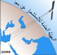
The Role of Remote Sensing and Supporting Systems in the Reconstruction Conference
April 23-25, 2018
Dama Rose Hotel, Damascus, Syria
Important dates:
Deadline for acceptance of the scientific paper: 15/3/2018.
Deadline for notification of acceptance of the scientific paper: 30/3/2018.
Deadline for confirmation of participation: 15/4/2018.
E-mail: Syria-rebuild18@hotmail.com
www.gors-sy.org
E-mail: Gors@mail.sy
See here the flyer
|
|
|
|
WG V/3 Workshop on Lessons Learned from Volunteers’ Interactions with Geographic Citizen Science Applications
April 27, 2018
London, U.K.
Contact information: Sultan Kocaman, sultankocaman@hacettepe.edu.tr
Coordinates of the venue (latitude & longitude): University College London (51°31'28.41"N, 0° 8'2.54"W, https://goo.gl/maps/YPBhBLGCD712)
For more information, see here…
|
|
|
|
ISPRS TC III Symposium Developments, Technologies and Applications in Remote Sensing
May 7-10, 2018
Beijing, China
The symposium will include plenary sessions, technical sessions, social activities, exhibitions, etc. Over 500 participants from around the world are expected, and you are welcome to meet old friends and create new contacts. For detailed information and registration, please visit the Symposium Website at: http://www.isprs-tc3.tianditu.com/
|
|
|
|
ISPRS TC II Symposium Towards Photogrammetry 2020
June 4-7, 2018
Riva del Garda, Italy
The Symposium will feature 4 days with plenary and parallel sessions, oral and poster presentations as well as keynote speakers from research and commercial domains and an exhibition of the most important business players in the photogrammetric and geospatial domain. More info and details are available in the event website: http://www.isprs.org/tc2-symposium2018/
|
 |
|
Data Analytics & Visualization Summer School
July 3-6, 2018
York University, Toronto, Canada
The application deadline is March 26, 2018. All talented undergraduate students in Geomatics Science & Engineering are welcome!
See more here …
|
 |
|
CALL FOR PAPERS - 3DV 2018
International Conference on 3D Vision (3DV 2018)
September 5-8, 2018
Verona, Italy
www.3dv.org
Important Dates:
Paper submission deadline: May 25, 2018
Acceptance notification: July 17, 2018
Camera ready paper: July 30, 2018
|
 |
|
Laboratory of Place 2018 - History, Survey, Evolution - Summer School: Surveying Cultural Heritage
July 23 to August 1, 2018
Domodossola, Italy
The mission of “Laboratory of Places” is to combine geomatics techniques and restoration for interdisciplinary knowledge and the preservation of historical and architectural heritage. The main topic of the school is the survey techniques designed for three-dimensional modeling of ancient buildings and the extraction of all metric information useful in planning reconstruction restoration, maintenance, and conservation of cultural heritage.
During this VII edition, the case of study will be some buildings of the Sacred Mount Calvary of Domodossola.
The course is open to students of architecture, archaeology, and engineering, as well as professionals in Cultural Heritage and the Historic Preservation sector. The Laboratory of Places can be a valuable source for those interested in deepening their own personal understanding of the latest survey and representation methods as well as its utilization in a contemporary business practice.
For more information visit:
http://www2.isprs.org/commissions/comm2/wg8/events/laboratory-of-the-place-2018.html
or see the flyer
Contacts:
Francesco Fassi - francesco.fassi@polimi.it
Cristiana Achille - cristiana.achille@polimi.it
|
 |
|
The 5th Joint Workshop Urban Remote Sensing – Challenges & Solutions of the EARSeL Special Interest Groups Urban Remote Sensing, 3D Remote Sensing, Developing Countries and Radar Remote Sensing
September 24-26, 2018
Bochum, Germany
This ESA sponsored workshop will be held at Ruhr-University Bochum and its excellent facilities. For more information please have a look at the workshop website:
http://urs.earsel.org/workshop/2018-urs-ws/home/
|
|
|
|
ISPRS TC V Midterm Symposium – Geospatial Technology – Pixel to People
November 20-23, 2018
Dehradun, India
Important dates for Papers for Archives - based on abstract review
• Deadline for submission of abstracts - June 1, 2018
• Notification to authors of acceptance of abstracts - August 15, 2018
• Deadline for submission of camera ready manuscript of full papers - September 30, 2018
Important dates for Papers for Annals - based on double-blinded peer-review ISPRS Annals
• Deadline for submission of full papers - June 1, 2018
• Notification to authors of acceptance of paper - August 31, 2018
• Deadline for submission of camera ready manuscript of full papers - September 30, 2018
For further information visit http://tc5-symposium2018.isrs-india.org/index.php
↑ Up
|
|
|
| |
|
|
Event Reports
 |
|
The 2017 Pacific Islands GIS and RS User Conference
Suva, Fiji
27 November – 1 December, 2017
by Petra Helmholz
This year’s annual conference attracted approximately 160 attendances per day with the major group coming from the Pacific region, Australia and New Zealand. During the workshop a total of 66 talks were given subdivided in 4 sessions per day and 16 groups of interest (4 institutional, 20 data, 1 costal, 4 disaster, 1 DTM, 4 forest, 4 environment, 1 geology, 4 utility, 9 maritime, 1 agriculture, 1 GNS, 1 software, 4 UAV, 1 student and 4 discussion).
Read the detailed report
here…
|
 |
|
ASPRS 2018 Annual Meeting
The ASPRS Annual Conference and International LiDAR Mapping Forum jointly held in Denver, Colorado February 4-7, 2017, was a huge success and exceeded all expectations with 1,500+ registrations. This was the first time that ASPRS joined ILMF under the banner: We Were Better Together! The ASPRS program featured 13 Workshops, Society Meetings, Keynotes, 4 parallel Technical Sessions, Award Ceremonies, and the induction of new officers; Anne Hillyer has advanced to President of ASPRS, and Jeff Lovin has become Vice-President. ILMF provided a two-track technical program and organized an outstanding exhibition with 95 booths, one of them was ISPRS.
↑ Up
|
|
|
| |
|
|
ISPRS International Journal of Geo-Information — Open Access Journal
|
|
|
New publications in the ISPRS International Journal of Geo-Information
Open Access Journal
Volume 6, Issue 12 (December 2017)
An Improved Identification Code for City Components Based on Discrete Global Grid System
Qi, Kun, Cheng, Chengqi, Hu, Yi’na, Fang, Huaqiang, Ji, Yan, Chen, Bo
No: 381
Neighborhood Characteristics, Alcohol Outlet Density, and Alcohol-Related Calls-for-Service: A Spatiotemporal Analysis in a Wet Drinking Country
Marco, Miriam, Freisthler, Bridget, Gracia, Enrique, López-Quílez, Antonio, Lila, Marisol
No: 380
Reconstruction of River Boundaries at Sub-Pixel Resolution: Estimation and Spatial Allocation of Water Fractions
Niroumand-Jadidi, Milad, Vitti, Alfonso
No: 383
Recent Advances of Structures Monitoring and Evaluation Using GPS-Time Series Monitoring Systems: A Review
Kaloop, Mosbeh R., Elbeltagi, Emad, Hu, Jong Wan, Elrefai, Ahmed
No: 382
Supporting Indoor Navigation Using Access Rights to Spaces Based on Combined Use of IndoorGML and LADM Models
Alattas, Abdullah, Zlatanova, Sisi, Van Oosterom, Peter, Chatzinikolaou, Efstathia, Lemmen, Christiaan, Li, Ki-Joune
No: 384
Experiences with Citizen-Sourced VGI in Challenging Circumstances
Hameed, Mustafa, Fairbairn, David, Speak, Suzanne
No: 385
Benchmarking the Applicability of Ontology in Geographic Object-Based Image Analysis
Rajbhandari, Sachit, Aryal, Jagannath, Osborn, Jon, Musk, Rob, Lucieer, Arko
No: 386
Machine Learning Techniques for Modelling Short Term Land-Use Change
Samardžić-Petrović, Mileva, Kovačević, Miloš, Bajat, Branislav, Dragićević, Suzana
No: 387
Hierarchical Model for the Similarity Measurement of a Complex Holed-Region Entity Scene
Chen, Zhanlong, Zhu, Rongrong, Xie, Zhong, Wu, Liang
No: 388
A Review of Urban Air Pollution Monitoring and Exposure Assessment Methods
Xie, Xingzhe, Semanjski, Ivana, Gautama, Sidharta, Tsiligianni, Evaggelia, Deligiannis, Nikos, Rajan, Raj Thilak, Pasveer, Frank, Philips, Wilfried
No: 389
Implementing Data-Dependent Triangulations with Higher Order Delaunay Triangulations
Rodríguez, Natalia, Silveira, Rodrigo I.
No: 390
Inferring Social Functions Available in the Metro Station Area from Passengers’ Staying Activities in Smart Card Data
Zhou, Yang, Fang, Zhixiang, Zhan, Qingming, Huang, Yaping, Fu, Xiongwu
No: 394
Land-Use Suitability in Northeast Iran: Application of AHP-GIS Hybrid Model
Memarbashi, Elnaz, Azadi, Hossein, Barati, Ali Akbar, Mohajeri, Fatemeh, Passel, Steven Van, Witlox, Frank
No: 396
Species Distribution Modeling: Comparison of Fixed and Mixed Effects Models Using INLA
Dutra Silva, Lara, Brito de Azevedo, Eduardo, Bento Elias, Rui, Silva, Luís
No: 391
The Use of Nadir and Oblique UAV Images for Building Knowledge
Vacca, Giuseppina, Dessì, Andrea, Sacco, Alessandro
No: 393
Transdisciplinary Foundations of Geospatial Data Science
Xie, Yiqun, Eftelioglu, Emre, Ali, Reem Y., Tang, Xun, Li, Yan, Doshi, Ruhi, Shekhar, Shashi
No: 395
An Automatic K-Means Clustering Algorithm of GPS Data Combining a Novel Niche Genetic Algorithm with Noise and Density
Zhou, Xiangbing, Gu, Jianggang, Shen, Shaopeng, Ma, Hongjiang, Miao, Fang, Zhang, Hua, Gong, Huaming
No: 392
Trends and Opportunities of BIM-GIS Integration in the Architecture, Engineering and Construction Industry: A Review from a Spatio-Temporal Statistical Perspective
Song, Yongze, Wang, Xiangyu, Tan, Yi, Wu, Peng, Sutrisna, Monty, Cheng, Jack C. P., Hampson, Keith
No: 397
Development of a Change Detection Method with Low-Performance Point Cloud Data for Updating Three-Dimensional Road Maps
Fuse, Takashi, Yokozawa, Naoto
No: 398
A Polygon and Point-Based Approach to Matching Geospatial Features
Ruiz-Lendínez, Juan J., Ureña-Cámara, Manuel A., Ariza-López, Francisco J.
No: 399
Exploratory Data Analysis of Synthetic Aperture Radar (SAR) Measurements to Distinguish the Sea Surface Expressions of Naturally-Occurring Oil Seeps from Human-Related Oil Spills in Campeche Bay (Gulf of Mexico)
Carvalho, Gustavo de Araújo, Minnett, Peter J., de Miranda, Fernando Pellon, Landau, Luiz, Paes, Eduardo Tavares
No: 379
An Automatic Road Network Construction Method Using Massive GPS Trajectory Data
Zhang, Yongchuan, Liu, Jiping, Qian, Xinlin, Qiu, Agen, Zhang, Fuhao
No: 400
Extraction of Road Intersections from GPS Traces Based on the Dominant Orientations of Roads
Li, Lin, Li, Daigang, Xing, Xiaoyu, Yang, Fan, Rong, Wei, Zhu, Haihong
No: 403
A Remote Sensing Approach to Environmental Monitoring in a Reclaimed Mine Area
Padmanaban, Rajchandar, Bhowmik, Avit K., Cabral, Pedro
No: 401
Towards Sustainable Urban Planning Through Transit-Oriented Development (A Case Study: Tehran)
Motieyan, Hamid, Mesgari, Mohammad Saadi
No: 402
Guided Image Filtering-Based Pan-Sharpening Method: A Case Study of GaoFen-2 Imagery
Zheng, Yalan, Dai, Qinling, Tu, Zhigang, Wang, Leiguang
No: 404
Virtual Geographic Simulation of Light Distribution within Three-Dimensional Plant Canopy Models
Tang, Liyu, Yin, Dan, Chen, Shuwei, Chen, Chongcheng, Huang, Hongyu, Lin, Ding
No: 405
The Hypothesis Platform: An Online Tool for Experimental Research into Work with Maps and Behavior in Electronic Environments
Šašinka, Čeněk, Morong, Kamil, Stachoň, Zdeněk
No: 407
Analysis of Users and Uses of DEMs in Spain
Mesa-Mingorance, José Luis, Chicaiza, Elena Gabriela, Buenaño, Xavier, Cai, Jianhong, Rodríguez-Pascual, Antonio Federico, Ariza-López, Francisco Javier
No: 406
New publications in the ISPRS International Journal of Geo-Information
Open Access Journal
Volume 7, Issue 1 (January 2018)
Analyzing and Predicting Micro-Location Patterns of Software Firms
Kinne, Jan, Resch, Bernd
No: 1
A Hydrological Sensor Web Ontology Based on the SSN Ontology: A Case Study for a Flood
Wang, Chao, Chen, Nengcheng, Wang, Wei, Chen, Zeqiang
No: 2
Exploring the Impact of Seasonality on Urban Land-Cover Mapping Using Multi-Season Sentinel-1A and GF-1 WFV Images in a Subtropical Monsoon-Climate Region
Zhou, Tao, Zhao, Meifang, Sun, Chuanliang, Pan, Jianjun
No: 3
Study of a Gray Genetic BP Neural Network Model in Fault Monitoring and a Diagnosis System for Dam Safety
Liu, Hai-Feng, Ren, Chao, Zheng, Zhong-Tian, Liang, Yue-Ji, Lu, Xian-Jian
No: 4
Roadblocks Hindering the Reuse of Open Geodata in Colombia and Spain: A Data User’s Perspective
Benitez-Paez, Fernando, Degbelo, Auriol, Trilles, Sergio, Huerta, Joaquin
No: 6
Morphological Features-Based Descriptive Index System for Lunar Impact Craters
Chen, Min, Lei, Mengling, Liu, Danyang, Zhou, Yi, Zhao, Hao, Qian, Kejian
No: 5
Cartographic Redundancy in Reducing Change Blindness in Detecting Extreme Values in Spatio-Temporal Maps
Cybulski, Paweł, Medyńska-Gulij, Beata
No: 8
Exploring Spatiotemporal Dynamics of Urban Fires: A Case of Nanjing, China
Zhang, Xiaoxiang, Yao, Jing, Sila-Nowicka, Katarzyna
No: 7
A New Geographical Cluster View on Passenger Vehicle Purchasing in Chinese Cities
Liu, Daqian, Song, Wei, Lu, Jia, Xie, Chunyan, Wen, Xin
No: 9
Spatial Data Structure and Functionalities for 3D Land Management System Implementation: Israel Case Study
Jaljolie, Ruba, van Oosterom, Peter, Dalyot, Sagi
No: 10
Space-Ruled Ecological Processes: Introduction to the Special Issue on Spatial Ecology
Rocchini, Duccio
No: 11
Multilevel Visualization of Travelogue Trajectory Data
Ma, Yongsai, Wang, Yang, Xu, Guangluan, Tai, Xianqing
No: 12
Using Monte Carlo Simulation to Improve the Performance of Semivariograms for Choosing the Remote Sensing Imagery Resolution for Natural Resource Surveys: Case Study on Three Counties in East, Central, and West China
Wang, Juanle, Zhu, Junxiang, Han, Xuehua
No: 13
Are We in Boswash Yet? A Multi-Source Geodata Approach to Spatially Delimit Urban Corridors
Georg, Isabel, Blaschke, Thomas, Taubenböck, Hannes
No: 15
A Geometric Framework for Detection of Critical Points in a Trajectory Using Convex Hulls
Hosseinpoor Milaghardan, Amin, Ali Abbaspour, Rahim, Claramunt, Christophe
No: 14
Assessment of Sustainable Livelihood and Geographic Detection of Settlement Sites in Ethnically Contiguous Poverty-Stricken Areas in the Aba Prefecture, China
Liu, Yanguo, Huang, Chengmin, Wang, Qing, Luan, Junwei, Ding, Mingtao
No: 16
Geographically Weighted Regression in the Analysis of Unemployment in Poland
Lewandowska-Gwarda, Karolina
No: 17
Graph-Optimization-Based ZUPT/UWB Fusion Algorithm
Wang, Yan, Li, Xin
No: 18
Higher Order Support Vector Random Fields for Hyperspectral Image Classification
Yang, Junli, Jiang, Zhiguo, Hao, Shuang, Zhang, Haopeng
No: 19
Geo-Information Tools, Governance, and Wicked Policy Problems
Georgiadou, Yola, Reckien, Diana
No: 21
Application of Geospatial Techniques for Groundwater Quality and Availability Assessment: A Case Study in Jaffna Peninsula, Sri Lanka
Gunaalan, Kuddithamby, Ranagalage, Manjula, Gunarathna, M. H. J. P., Kumari, M. K. N., Vithanage, Meththika, Srivaratharasan, Tharmalingam, Saravanan, Suntharalingam, Warnasuriya, T.W.S.
No: 20
Inverse Parametrization of a Regional Groundwater Flow Model with the Aid of Modelling and GIS: Test and Application of Different Approaches
Usman, Muhammad, Reimann, Thomas, Liedl, Rudolf, Abbas, Azhar, Conrad, Christopher, Saleem, Shoaib
No: 22
Acknowledgement to Reviewers of IJGI in 2017
IJGI Editorial Office,
No: 24
Spatial Analysis of Clustering of Foreclosures in the Poorest-Quality Housing Urban Areas: Evidence from Catalan Cities
Gutiérrez, Aaron, Arauzo-Carod, Josep-Maria
No: 23
Detecting Anomalous Trajectories and Behavior Patterns Using Hierarchical Clustering from Taxi GPS Data
Wang, Yulong, Qin, Kun, Chen, Yixiang, Zhao, Pengxiang
No: 25
Approach to Accelerating Dissolved Vector Buffer Generation in Distributed In-Memory Cluster Architecture
Shen, Jinxin, Chen, Luo, Wu, Ye, Jing, Ning
No: 26
Developing an Agent-Based Simulation System for Post-Earthquake Operations in Uncertainty Conditions: A Proposed Method for Collaboration among Agents
Hooshangi, Navid, Alesheikh, Ali Asghar
No: 27
A Knowledge Base for Automatic Feature Recognition from Point Clouds in an Urban Scene
Xing, Xu-Feng, Mostafavi, Mir-Abolfazl, Chavoshi, Seyed Hossein
No: 28
Assessment of Tangible Direct Flood Damage Using a Spatial Analysis Approach under the Effects of Climate Change: Case Study in an Urban Watershed in Hanoi, Vietnam
Kefi, Mohamed, Mishra, Binaya Kumar, Kumar, Pankaj, Masago, Yoshifumi, Fukushi, Kensuke
No: 29
Comparison of Split Window Algorithms for Retrieving Measurements of Sea Surface Temperature from MODIS Data in Near-Land Coastal Waters
Cavalli, Rosa Maria
No: 30
A Hybrid Approach Combining the Multi-Temporal Scale Spatio-Temporal Network with the Continuous Triangular Model for Exploring Dynamic Interactions in Movement Data: A Case Study of Football
Zhang, Pengdong, Beernaerts, Jasper, Van de Weghe, Nico
No: 31
Uncertainty in Upscaling In Situ Soil Moisture Observations to Multiscale Pixel Estimations with Kriging at the Field Level
Zhang, Xiaohu, Zuo, Wenjun, Zhao, Shengli, Jiang, Li, Chen, Linhai, Zhu, Yan
No: 33
Real-Time Location-Based Rendering of Urban Underground Pipelines
Li, Wei, Han, Yong, Liu, Yu, Zhu, Chenrong, Ren, Yibin, Wang, Yanjie, Chen, Ge
No: 32
Short-Range Prediction of the Zone of Moving Vehicles in Arterial Networks
Forouzandeh Jonaghani, Rouzbeh, Honarparvar, Sepehr, Khademi, Navid
No: 35
Traffic Command Gesture Recognition for Virtual Urban Scenes Based on a Spatiotemporal Convolution Neural Network
Ma, Chunyong, Zhang, Yu, Wang, Anni, Wang, Yuan, Chen, Ge
No: 37
Framework for Virtual Cognitive Experiment in Virtual Geographic Environments
Zhang, Fan, Hu, Mingyuan, Che, Weitao, Lin, Hui, Fang, Chaoyang
No: 36
Mapping Lithologic Components of Ophiolitic Mélanges Based on ASTER Spectral Analysis: A Case Study from the Bangong-Nujiang Suture Zone (Tibet, China)
Zhang, Ruisi, Zeng, Min
No: 34
New publications in the ISPRS International Journal of Geo-Information
Open Access Journal
Volume 7, Issue 2 (February 2018)
Studying the Association between Green Space Characteristics and Land Surface Temperature for Sustainable Urban Environments: An Analysis of Beijing and Islamabad
Naeem, Shahid, Cao, Chunxiang, Qazi, Waqas Ahmed, Zamani, Mehdi, Wei, Chen, Acharya, Bipin Kumar, Rehman, Asid Ur
No: 38
Extraction of Pluvial Flood Relevant Volunteered Geographic Information (VGI) by Deep Learning from User Generated Texts and Photos
Feng, Yu, Sester, Monika
No: 39
A Space-Time Periodic Task Model for Recommendation of Remote Sensing Images
Zhang, Xiuhong, Chen, Di, Liu, Jiping
No: 40
A New Approach to Line Simplification Based on Image Processing: A Case Study of Water Area Boundaries
Shen, Yilang, Ai, Tinghua, He, Yakun
No: 41
Incrementally Detecting Change Types of Spatial Area Object: A Hierarchical Matching Method Considering Change Process
Wang, Yanhui, Zhang, Qisheng, Guan, Hongliang
No: 42
Estimating the Spatial Distribution of Crime Events around a Football Stadium from Georeferenced Tweets
Ristea, Alina, Kurland, Justin, Resch, Bernd, Leitner, Michael, Langford, Chad
No: 43
The Ordered Capacitated Multi-Objective Location-Allocation Problem for Fire Stations Using Spatial Optimization
Bolouri, Samira, Vafaeinejad, Alireza, Alesheikh, Ali Asghar, Aghamohammadi, Hossein
No: 44
3D Visualization of Trees Based on a Sphere-Board Model
She, Jiangfeng, Guo, Xingchen, Tan, Xin, Liu, Jianlong
No: 45
Survey on Urban Warfare Augmented Reality
You, Xiong, Zhang, Weiwei, Ma, Meng, Deng, Chen, Yang, Jian
No: 46
Strategic Actions for Increasing the Submission of Digital Cadastral Data by the Surveying Industry Based on Lessons Learned from Victoria, Australia
Olfat, Hamed, Shojaei, Davood, Briffa, Mark, Maley, Susannah, Rajabifard, Abbas
No: 47
A Case Study of the Forced Invariance Approach for Soil Salinity Estimation in Vegetation-Covered Terrain Using Airborne Hyperspectral Imagery
Liu, Lanfa, Ji, Min, Buchroithner, Manfred
No: 48
A Spatial Information System (SIS) for the Architectural and Cultural Heritage of Sardinia (Italy)
Vacca, Giuseppina, Fiorino, Donatella Rita, Pili, Davide
No: 49
Analysis of Hydrological Sensitivity for Flood Risk Assessment
Sharma, Sanjay Kumar, Kwak, Young-Joo, Kumar, Rakesh, Sarma, Bibhash
No: 51
The Application of the Analytic Hierarchy Process and a New Correlation Algorithm to Urban Construction and Supervision Using Multi-Source Government Data in Tianjin
Wang, Shaoyi, Sheng, Zhongjie, Xi, Yuliang, Ma, Xiangyuan, Zhang, Huihui, Kang, Mengjun, Ren, Fu, Du, Qingyun, Hu, Ke, Han, Zhenbiao
No: 50
Expansion Analysis of Yangtze River Delta Urban Agglomeration Using DMSP/OLS Nighttime Light Imagery for 1993 to 2012
Lu, Huimin, Zhang, Meiliang, Sun, Weiwei, Li, Weiyue
No: 52
An Effective Privacy Architecture to Preserve User Trajectories in Reward-Based LBS Applications
Hasan, A S M Touhidul, Qu, Qiang, Li, Chengming, Chen, Lifei, Jiang, Qingshan
No: 53
A Heterogeneous Distributed Virtual Geographic Environment—Potential Application in Spatiotemporal Behavior Experiments
Shen, Shen, Gong, Jianhua, Liang, Jianming, Li, Wenhang, Zhang, Dong, Huang, Lin, Zhang, Guoyong
No: 54
Characterizing 3D City Modeling Projects: Towards a Harmonized Interoperable System
Julin, Arttu, Jaalama, Kaisa, Virtanen, Juho-Pekka, Pouke, Matti, Ylipulli, Johanna, Vaaja, Matti, Hyyppä, Juha, Hyyppä, Hannu
No: 55
Examining the Association of Economic Development with Intercity Multimodal Transport Demand in China: A Focus on Spatial Autoregressive Analysis
Zhao, Jinbao, Guo, Dong, Wang, Jian, Yang, Zhao, Zhang, Hefang
No: 56
Changes in Gross Primary Production (GPP) over the Past Two Decades Due to Land Use Conversion in a Tourism City
Nuarsa, I Wayan, As-syakur, Abd. Rahman, Gunadi, I Gusti Alit, Sukewijaya, I Made
No: 57
Interpreting the Fuzzy Semantics of Natural-Language Spatial Relation Terms with the Fuzzy Random Forest Algorithm
Wang, Xiaonan, Du, Shihong, Feng, Chen-Chieh, Zhang, Xueying, Zhang, Xiuyuan
No: 58
Introduction to the Special Issue: “Research and Development Progress in 3D Cadastral Systems”
van Oosterom, Peter, Dimopoulou, Efi
No: 59
Holo3DGIS: Leveraging Microsoft HoloLens in 3D Geographic Information
Wang, Wei, Wu, Xingxing, Chen, Guanchen, Chen, Zeqiang
No: 60
Spatial Analysis of Digital Imagery of Weeds in a Maize Crop
San Martín, Carolina, Milne, Alice E., Webster, Richard, Storkey, Jonathan, Andújar, Dionisio, Fernández-Quintanilla, Cesar, Dorado, José
No: 61
A Smart Web-Based Geospatial Data Discovery System with Oceanographic Data as an Example
Jiang, Yongyao, Li, Yun, Yang, Chaowei, Hu, Fei, Armstrong, Edward M., Huang, Thomas, Moroni, David, McGibbney, Lewis J., Greguska, Frank, Finch, Christopher J.
No: 62
A Knowledge-Informed and Pareto-Based Artificial Bee Colony Optimization Algorithm for Multi-Objective Land-Use Allocation
Yang, Lina, Zhu, Axing, Shao, Jing, Chi, Tianhe
No: 63
Accounting for and Predicting the Influence of Spatial Autocorrelation in Water Quality Modeling
Miralha, Lorrayne, Kim, Daehyun
No: 64
Visually-Enabled Active Deep Learning for (Geo) Text and Image Classification: A Review
Yang, Liping, MacEachren, Alan M., Mitra, Prasenjit, Onorati, Teresa
No: 65
A Critical Review of the Integration of Geographic Information System and Building Information Modelling at the Data Level
Zhu, Junxiang, Wright, Graeme, Wang, Jun, Wang, Xiangyu
No: 66
An Automatic User Grouping Model for a Group Recommender System in Location-Based Social Networks
Khazaei, Elahe, Alimohammadi, Abbas
No: 67
Integrated Participatory and Collaborative Risk Mapping for Enhancing Disaster Resilience
Liu, Wei, Dugar, Sumit, McCallum, Ian, Thapa, Gaurav, See, Linda, Khadka, Prakash, Budhathoki, Nama, Brown, Sarah, Mechler, Reinhard, Fritz, Steffen, Shakya, Puja
No: 68
Roughness Spectra Derived from Multi-Scale LiDAR Point Clouds of a Gravel Surface: A Comparison and Sensitivity Analysis
Milenković, Milutin, Ressl, Camillo, Karel, Wilfried, Mandlburger, Gottfried, Pfeifer, Norbert
No: 69
Evaluating and Optimizing Urban Green Spaces for Compact Urban Areas: Cukurova District in Adana, Turkey
Unal, Muge, Uslu, Cengiz
No: 70
Spatial Footprints of Human Perceptual Experience in Geo-Social Media
Lee, Jun, Ogawa, Hirotaka, Kwon, YongJin, Kim, Kyoung-Sook
No: 71
Adaptive Component Selection-Based Discriminative Model for Object Detection in High-Resolution SAR Imagery
He, Chu, Tu, Mingxia, Xiong, Dehui, Tu, Feng, Liao, Mingsheng
No: 72
Forecasting Transplanted Rice Yield at the Farm Scale Using Moderate-Resolution Satellite Imagery and the AquaCrop Model: A Case Study of a Rice Seed Production Community in Thailand
Prathumchai, Kulapramote, Nagai, Masahiko, Tripathi, Nitin K., Sasaki, Nophea
No: 73
Classification of PolSAR Images by Stacked Random Forests
Hänsch, Ronny, Hellwich, Olaf
No: 74
An Open-Boundary Locally Weighted Dynamic Time Warping Method for Cropland Mapping
Guan, Xudong, Liu, Gaohuan, Huang, Chong, Meng, Xuelian, Liu, Qingsheng, Wu, Chunsheng, Ablat, Xarapat, Chen, Zhuoran, Wang, Qiang
No: 75
The Rural Development Policy in Extremadura (SW Spain): Spatial Location Analysis of Leader Projects
Nieto Masot, Ana, Cárdenas Alonso, Gema
No: 76
Deriving Animal Movement Behaviors Using Movement Parameters Extracted from Location Data
Teimouri, Maryam, Indahl, Ulf Geir, Sickel, Hanne, Tveite, Håvard
No: 78
Social Force Model-Based Group Behavior Simulation in Virtual Geographic Environments
Huang, Lin, Gong, Jianhua, Li, Wenhang, Xu, Tao, Shen, Shen, Liang, Jianming, Feng, Quanlong, Zhang, Dong, Sun, Jun
No: 79
Reliable Rescue Routing Optimization for Urban Emergency Logistics under Travel Time Uncertainty
Li, Qiuping, Tu, Wei, Zhuo, Li
No: 77
↑ Up
|
|
|
| |
|
|
ISPRS Journal of Photogrammetry and Remote Sensing
 |
|
New publications in the ISPRS Journal of
Photogrammetry and Remote Sensing Volume 136 (February 2018)
Comparing the performance of flat and hierarchical Habitat/Land-Cover classification models in a NATURA 2000 site
Yoni Gavish, Jerome O'Connell, Charles J. Marsh, Cristina Tarantino, Palma Blonda, Valeria Tomaselli, William E. Kunin
Pages: 1-12
Large off-nadir scan angle of airborne LiDAR can severely affect the estimates of forest structure metrics
Jing Liu, Andrew K. Skidmore, Simon Jones, Tiejun Wang, Marco Heurich, Xi Zhu, Yifang Shi
Pages: 13-25
Recognition of building group patterns in topographic maps based on graph partitioning and random forest
Xianjin He, Xinchang Zhang, Qinchuan Xin
Pages: 26-40
Automatic registration of panoramic image sequence and mobile laser scanning data using semantic features
Jianping Li, Bisheng Yang, Chi Chen, Ronggang Huang, Zhen Dong, Wen Xiao
Pages: 41-57
Effects of illumination differences on photometric stereo shape-and-albedo-from-shading for precision lunar surface reconstruction
Wai Chung Liu, Bo Wu, Christian Wöhler
Pages: 58-72
Hyperspectral sensing of heavy metals in soil and vegetation: Feasibility and challenges
Fenghe Wang, Jay Gao, Yong Zha
Pages: 73-84
Object-based detection of vehicles using combined optical and elevation data
Hendrik Schilling, Dimitri Bulatov, Wolfgang Middelmann
Pages: 85-105
Predicting temperate forest stand types using only structural profiles from discrete return airborne lidar
Melissa Fedrigo, Glenn J. Newnham, Nicholas C. Coops, Darius S. Culvenor, Douglas K. Bolton, Craig R. Nitschke
Pages: 106-119
Automatic relative RPC image model bias compensation through hierarchical image matching for improving DEM quality
Myoung-Jong Noh, Ian M. Howat
Pages: 120-133
Monitoring rubber plantation expansion using Landsat data time series and a Shapelet-based approach
Su Ye, John Rogan, Florencia Sangermano
Pages: 134-143
An approach for flood monitoring by the combined use of Landsat 8 optical imagery and COSMO-SkyMed radar imagery
Xiaohua Tong, Xin Luo, Shuguang Liu, Huan Xie, Wei Chao, Shuang Liu, Shijie Liu, A.N. Makhinov, A.F. Makhinova, Yuying Jiang
Pages: 144-153
New publications in the ISPRS Journal of
Photogrammetry and Remote Sensing Volume 137 (March 2018)
A novel approach for epipolar resampling of cross-track linear pushbroom imagery using orbital parameters model
Mojtaba Jannati, Mohammad Javad Valadan Zoej, Mehdi Mokhtarzade
Pages: 1-14
Comparison of hyperspectral transformation accuracies of multispectral Landsat TM, ETM+, OLI and EO-1 ALI images for detecting minerals in a geothermal prospect area
Nguyen Tien Hoang, Katsuaki Koike
Pages: 15-28
Harmonic regression of Landsat time series for modeling attributes from national forest inventory data
Barry T. Wilson, Joseph F. Knight, Ronald E. McRoberts
Pages: 29-46
Robust and adaptive band-to-band image transform of UAS miniature multi-lens multispectral camera
Jyun-Ping Jhan, Jiann-Yeou Rau, Norbert Haala
Pages: 47-60
Radargrammetric DSM generation in mountainous areas through adaptive-window least squares matching constrained by enhanced epipolar geometry
Yuting Dong, Lu Zhang, Timo Balz, Heng Luo, Mingsheng Liao
Pages: 61-72
3D micro-mapping: Towards assessing the quality of crowdsourcing to support 3D point cloud analysis
Benjamin Herfort, Bernhard Höfle, Carolin Klonner
Pages: 73-83
Influence of conversion on the location of points and lines: The change of location entropy and the probability of a vector point inside the converted grid point
Nan Chen
Pages: 84-96
Predicting forest height using the GOST, Landsat 7 ETM+, and airborne LiDAR for sloping terrains in the Greater Khingan Mountains of China
Chengyan Gu, Jan G.P.W. Clevers, Xiao Liu, Xin Tian, Zhouyuan Li, Zengyuan Li
Pages: 97-111
An efficient global energy optimization approach for robust 3D plane segmentation of point clouds
Zhen Dong, Bisheng Yang, Pingbo Hu, Sebastian Scherer
Pages: 112-133
Understanding the temporal dimension of the red-edge spectral region for forest decline detection using high-resolution hyperspectral and Sentinel-2a imagery
P.J. Zarco-Tejada, A. Hornero, R. Hernández-Clemente, P.S.A. Beck
Pages: 134-148
Estimation of daily maximum and minimum air temperatures in urban landscapes using MODIS time series satellite data
Cheolhee Yoo, Jungho Im, Seonyoung Park, Lindi J. Quackenbush
Pages: 149-162
Important LiDAR metrics for discriminating forest tree species in Central Europe
Yifang Shi, Tiejun Wang, Andrew K. Skidmore, Marco Heurich
Pages: 163-174
↑ Up
|
|
|
| |
|
|
New Events
26-29 Mar 2018
Sixth International Conference on Remote Sensing and Geoinformation of Environment
http://www.cyprusremotesensing.com/rscy2018/Workshop
Paphos, Cyprus
10 Apr 2018
Close and Long Range Sensing of Environment
(Session at EGU 2018)
http://meetingorganizer.copernicus.org/EGU2018/session/28813
Vienna, Austria
27 Apr 2018
Workshop on lessons learned from volunteers’ interactions with geographic citizen science applications
https://uclexcites.wordpress.com/2017/12/12/workshop-on-lessons-learned-from-volunteers-interactions-with-geographic-citizen-science-applications-27-april-2018-london/
London, UK
02-10 May 2018
International Seminar on Construction and Application of Spatial Data Infrastructure
http://www.isprs-tc3.tianditu.com/
Beijing, China
03-06 May 2018
ISPRS SC and TC III Summer School 2018
http://www.isprs-tc3.tianditu.com
Beijing, China
20-21 Jun 2018
UNISPACE+50
Fifty years since the first United Nations Conference on the Exploration and Peaceful Uses of Outer Space (1968 - 2018)
http://www.unoosa.org/oosa/en/ourwork/unispaceplus50/index.html
Vienna, Austria
03-06 Jul 2018
Data Analytics & Visualization Summer School
http://lassondecreatedav.ca
Toronto, Canada
23 Jul - 01 Aug 2018
Laboratory of Places 2018 History, Survey, Evolution
Summer School: Surveying Cultural Heritage
7th Edition
http://www2.isprs.org/commissions/comm2/wg8/events/laboratory-of-the-place-2018.html
Mount Calvary of Domodossola, Italy
04-07 Sep 2018
Eurasian GIS 2018
http://eurasiangis2018.selcuk.edu.tr/
Baku, Azerbeijan
12-16 Sep 2018
CHCD2018
The International Symposium on Cultural Heritage Conservation and Digitization
http://www.chcds.org
Tsinghua University, China
13-14 Sep 2018
10th Summit on Earth Observation Business
(part of the World Satellite Business Week)
http://www.earth-observation-business.com/
Paris, France
24-26 Sep 2018
5th Joint Workshop “Urban Remote Sensing – Challenges & Solutions”
http://urs.earsel.org/workshop/2018-urs-ws/home/
Bochum, Germany
10-11 Oct 2018
GeoAdvances 2018
5th International Conference on Geoinformation Science
http://rhinane.sirecom-maroc.com/
Casablanca, Morocco
15-19 Oct 2018
ACRS 2018
39th Asian Conference on Remote Sensing
Remote Sensing Enabling Prosperity
http://acrs2018.mrsa.gov.my/
Kuala Lumpur, Malaysia
04-07 Jun 2019
UAV-g 2019
http://www.uav-g.com/
Enschede, The Netherlands
» See more
|
|
| |
|
|
Updated Events
18-21 Mar 2018
Gi4DM
Geo-information for Disaster Management
http://www.gi4dm2018.org
Istanbul, Turkey
10-11 Oct 2018
GeoAdvances 2018
5th International Conference on Geoinformation Science
http://rhinane.sirecom-maroc.com/
Casablanca, Morocco
18-19 Nov 2018
GRASF Conference 2018
http://www.grasf.ae/
Dubai, U.A.E.
» See more
|
|
| |
|
|
Job Opportunities
|
30-Jan-2018 |
PhD position in the Geomatics Division – Remote Sensing Department
Geomatics Division of the Centre Tecnològic de Telecomunicacions de Catalunya (CTTC), in Castelldefels – Barcelona, Spain
Deadline: 30-Apr-2018
|
|
26-Feb-2018 |
Assistant Professor Indoor and mobile mapping (fulltime)
Department of Earth Observation Science (EOS) of the Faculty of Geo-Information Science and Earth Observation (ITC), University of Twente in Enschede, the Netherlands
Deadline: 1-Apr-2018
|
|
26-Feb-2018 |
Assistant Professor Spatio-temporal Statistics (fulltime)
Department of Earth Observation Science (EOS) of the Faculty of Geo-Information Science and Earth Observation (ITC), University of Twente in Enschede, the Netherlands
Deadline: 1-Apr-2018
|
|
2-Mar-2018 |
Assistant Professor of Environmental Geospatial Science
Department of Natural Resources and the Environment in the College of Agriculture, Health, and Natural Resources at the University of Connecticut, USA
Deadline: 30-Mar-2018
|
|
6-Mar-2018 |
Full-time PhD / Postdoc Position in Geographic 3D Point Cloud Analysis
3DGeo Research Group, Heidelberg University, Germany
Deadline: 1-Apr-2018
|
» See more
|
|
|
| |
|
|
|
You got this email as you subscribed to the ISPRS mailing list.
Officers, members and contact persons of members get it by default.
To unsubscribe from the ISPRS mailing list,
click here.
© ISPRS, 2018.
Imprint
|