ISPRS e-Bulletin: October 2020


ISPRS e-Bulletin
Issue No 5 - 2020


Quick Links

•  ISPRS Homepage
•  Editorial
•  General Announcements
•  Reports
•  The ISPRS Foundation
•  Scientific Meetings
•  Journal of Geo-Information
•  Student Consortium
•  ISPRS Calendar
•  Society News
•  ISPRS Journal
•  New Events
 

Editorial

Charles Toth      

ISPRS Launches New Open Access Journal

by Charles Toth

The ISPRS Council is pleased to announce the introduction of a new Golden Open Access journal, the ISPRS Open Journal of Photogrammetry and Remote Sensing (IOJPRS), starting on January 1, 2021 and published by Elsevier. As an independent third journal of ISPRS, IOJPRS will offer additional possibilities for authors to publish their latest results in a high-quality peer reviewed scientific outlet under the umbrella of ISPRS.

The decision to start this new journal followed a careful assessment of its pros and cons over the past 18 months. The most important point was the global development in the direction of open science in general and open access in particular, reflected e.g. in new regulations and initiatives within the European Union such as the so called Plan S. Equally important, the two existing ISPRS journals have been experiencing a rapid increase in the number of submissions and published papers, demonstrating the growth of our field; the two Editor-in-Chiefs of the highly-ranked ISPRS Journal of Photogrammetry and Remote Sensing (IJPRS) currently work with 19 Associate Editors to handle 1,500+ submissions a year, while the open access ISPRS International Journal of Geo-Information (IJ-GI) has been publishing up to 100 articles per month as it approaches its 10th year of existence.  The ISPRS Council, in cooperation with all journal Editors-in-Chiefs and Elsevier, conducted a survey to seek the opinion of the community at large and analyzed the findings before reaching the conclusion that the benefits of adding a new Golden Open Access journal would be significant.

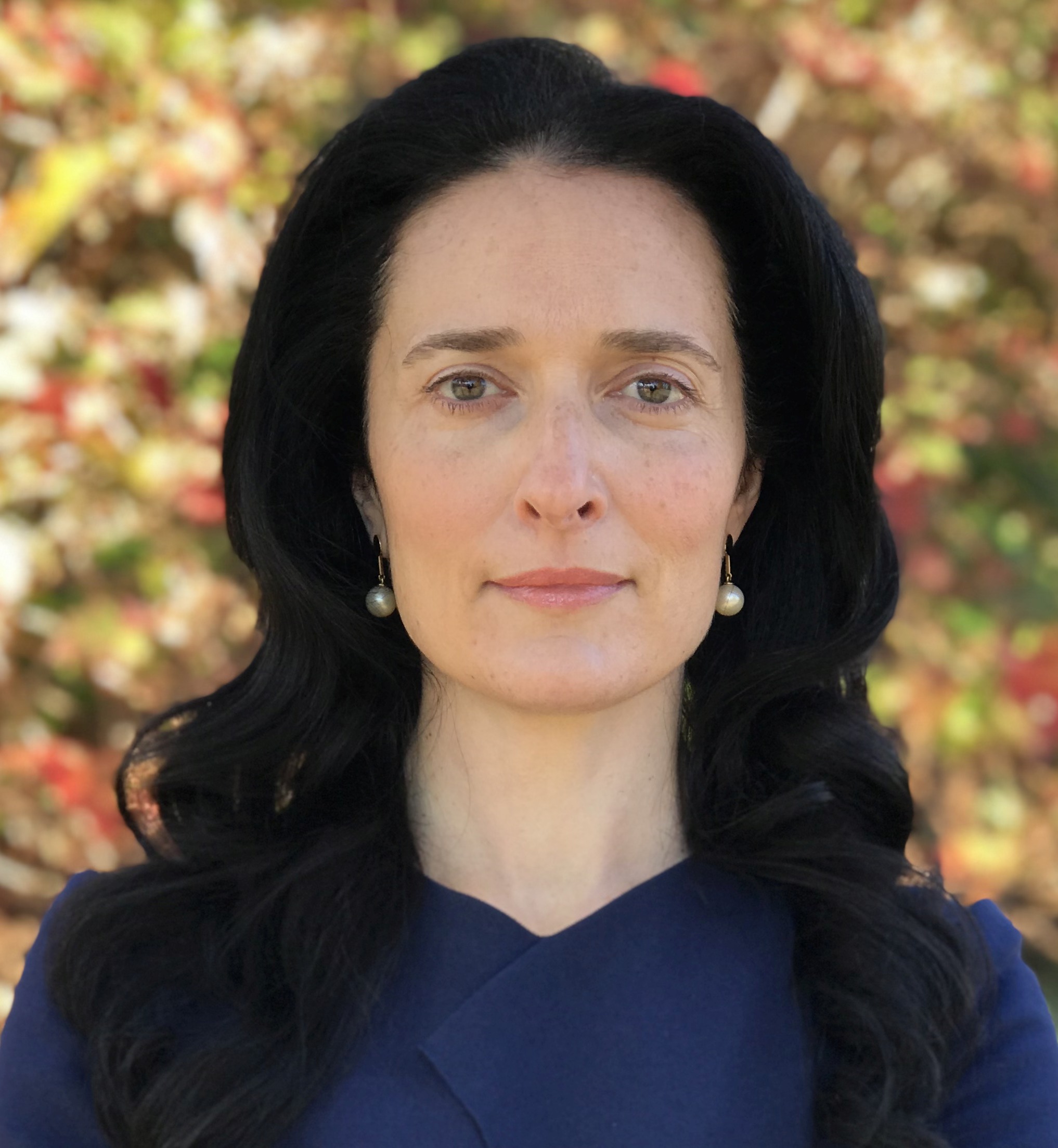
The ISPRS Council is delighted to share the news with our community that George Vosselman, PhD, former Editor-in-Chief of IJPRS, has accepted our offer to serve as the first Editor-in-Chief of the new ISPRS Open Journal of Photogrammetry and Remote Sensing.

George Vosselman is professor in Geo-Information Extraction with Sensor Systems at the University of Twente, the Netherlands. After graduating in Geodetic Engineering from the Delft University of Technology in 1986, he worked at the University of Stuttgart, Germany, until 1992. In 1991, he obtained his PhD degree with honours from the University of Bonn, Germany. He was appointed professor of Photogrammetry and Remote Sensing at the Delft University of Technology in 1993. In 2004 he joined ITC, now a faculty of the University of Twente.

George has been instrumental in adapting ISPRS to the rise of laser scanning, including roles as WG chair (2000-2004) on reconstruction from airborne LiDAR and InSAR, WG co-chair (2008-2012) on point processing, and editor of a well-known standard book (with Hans-Gerd Maas). Moreover, he has made a massive contribution to scientific standards, quality control, and reviewing: he was editor-in-chief of the ISPRS Journal of Photogrammetry and Remote Sensing (2004-2012), a member of the International Science Advisory Committee (ISAC), and chair of the International Program Committee for the ISPRS Congress 2016. He has over 250 publications to his name, many of which have been cited numerous times. He was also the Director of the very successful ISPRS Geospatial Week, organised in Enschede in 2019.


ISPRS Congress Nice 2021


The ISPRS 2021 Congress is approaching

The abstract submission for the 2021 edition will open on 4 January 2021.

For further key dates see: http://www.isprs2020-nice.com/index.php/program/#keydates


The ISPRS Foundation (TIF) News

The ISPRS Foundation


Advanced Notice of Opening of The ISPRS Foundation (TIF) Travel Grant Applications

The ISPRS Foundation expects to open applications on the TIF web site by 1 February 2021, for travel grants to attend the postponed ISPRS Congress in Nice France, scheduled for 4-10 July 2021. 

Please review the significant dates on the ISPRS Congress web site.


Sisi Zlatanova
  Sandra Maria Fonseca da Costa


New Members of the TIF Fund-Raising Committee

The ISPRS Foundation (TIF) is pleased to announce that Prof. Dr. Sisi Zlatanova, University of New South Wales, Australia, and Prof. Dr. Sandra Maria Fonseca da Costa, adjunct professor at the University of Vale do Paraíba (UNIVAP) in São José dos Campos, Brazil, have joined the Fund-Raising Committee. Dr. Fonseca da Costa has recently joined TIF’s Board of Trustees. Dr. Zlatanova is well known in ISPRS and currently serves as the President of Technical Commission IV, Spatial Information Science.

Sisi Zlatanova will represent the Committee in the region of Australia and New Zealand. Sandra Maria Fonseca da Costa will represent the Committee in Latin America. Thus, the Committee is now well posed in Australia, New Zealand and Latin America as well as Europe.

The current membership of the Committee is:

Michael Gruber (chair) Austria TIF Trustee
Ron Bisio USA TIF Trustee
Sandra Maria Fonseca da Costa Brazil TIF Trustee
Lawrie Jordan USA TIF Trustee
Paul Marshall UK  
Fabio Menna Italy  
Marko Pasko Slovak Republic  
Miguel Pelaz Spain  
Sisi Zlatanova Australia ISPRS TC IV President


The Committee is now working on the next phase, to identify points of contact and attract possible donors. This will enable TIF to support more young researchers to contribute to the conferences of the coming year and beyond by awarding more travel grants and to stimulate youth and public interest and participation in the photogrammetry, remote sensing and spatial information sciences, technologies, and applications. The Committee is still open to welcome new members to pursue the worthwhile goal of expanding TIF’s activities. If you are interested – or know someone who may be interested – please contact Michael Gruber at TIF-fundraising@isprs.org. Thank you.

For more information about the Fund-Raising Committee (including Terms of Reference) please follow the link https://www.isprs.org/foundation/committees/fund-raising_committee.aspx.


Qihao Weng


New Member of the TIF Audit Committee

TIF’s Audit Committee is perhaps less well known that its other committees, though it has its own web page, https://www.isprs.org/foundation/committees/audit_committee.aspx. Its terms of reference are quite extensive, but its most important role by far is the annual review of the TIF accounts prepared by TIF Finance Officer Marguerite Madden. TIF is delighted that a new member has joined the Audit Committee, Prof. Dr. Qihao Weng, professor of geography, Indiana State University, USA. Qihao will join Laurent Polidori (France) and John Trinder (Australia) in supporting the Audit Committee chair, Shailesh Nayak (India). Welcome, Qihao.


ISPRS Student Consortium News

The ISPRS Foundation


ISPRS Student Consortium News – Past Event Reports and Upcoming Activities of the ISPRS Student Consortium

by Sheryl Rose Reyes

The ISPRS Student Consortium continued with its activities in the second half of 2020, amidst the continuing global health crisis to support the youth across the globe. In the last months, the Consortium participated in a conference and organized a summer school.

Read the full report here…


Society News

ISPRS Logo


XXIV ISPRS Congress Awards Booklet published
bar

A digital version of the Awards Booklet for the XXIV ISPRS Congress, with the winners of all categories which are not decided at Congress, has now been published. On behalf of the Society, ISPRS Council once again congratulates all winners for their outstanding contributions and looks forward to personally presenting the awards in Nice in July 2021.


General Announcements

Yana Gevorgyan      

ICORSE Chair, Yana Gevorgyan named new GEO Secretariat Director
bar

ISPRS congratulates Yana Gevorgyan on her recently announced position as the new director of the Group on Earth Observations (GEO) Secretariat. Gevorgyan is an award-winning international relations specialist at NOAA's Satellite and Information Service (NESDIS). She also holds the position as Chair of ICORSE since early 2020.


Our World Heritage


Call for Letters of Intention

Our World Heritage (https://www.ourworldheritage.org)  invites you to submit a Letter of Intention under A Global Initiative: Heritage in the 21st Century to a global competition to highlight transformational uses of technology that increase community engagement in the monitoring, interpretation, and presentation of World Heritage Sites called TRANSFORMATIONAL IMPACTS OF INFORMATION TECHNOLOGY.

Deadline of Letter of Intent is 29 January 2021 at 11:59 PM CET.

Details of the call can be found at https://www.ourworldheritage.org/it_loi/


Announcements of Scientific Meetings                (see also ISPRS Calendar)

ISRSE-39      

ISRSE-39 Postponed to Spring 2022

bar

VNSC and VAST officially announce that due to the corona virus crisis, the ISRSE-39 Conference, due to be held in Hanoi 18-22nd October 2021 has been postponed. It is the desire of VNSC and ICORSE that the conference will be rescheduled to the Spring of 2022, at the same venue, the National Convention Centre, Hanoi, Vietnam. Final dates are being determined.

For more information read here...


Reports


Geo-information for Disaster Management (Gi4DM)

30 November – 4 December 2020

Read the report here…


ISPRS International Journal of Geo-Information — Open Access Journal

ISPRS International Journal of Geo-Information — Open Access Journal      

New publications in the ISPRS International Journal of Geo-Information
Open Access Journal
Volume 9, Issue 11 (November 2020)

UrbanWater: Integrating EPANET 2 in a PostgreSQL/PostGIS-Based Geospatial Database Management System
Martinho, Nuno, Almeida, José-Paulo de, Simões, Nuno E., Sá-Marques, Alfeu
No: 613

Spatial Knowledge Acquisition with Mobile Maps: Effects of Map Size on Users’ Wayfinding Performance with Interactive Interfaces
Chen, Chien-Hsiung, Li, Xiao
No: 614

How Urban Factors Affect the Spatiotemporal Distribution of Infectious Diseases in Addition to Intercity Population Movement in China
Niu, Xinyi, Yue, Yufeng, Zhou, Xingang, Zhang, Xiaohu
No: 615

Workflow of Digital Field Mapping and Drone-Aided Survey for the Identification and Characterization of Capable Faults: The Case of a Normal Fault System in the Monte Nerone Area (Northern Apennines, Italy)
De Donatis, Mauro, Alberti, Mauro, Cipicchia, Mattia, Guerrero, Nelson Muñoz, Pappafico, Giulio F., Susini, Sara
No: 616

A New Urban Vitality Analysis and Evaluation Framework Based on Human Activity Modeling Using Multi-Source Big Data
Liu, Shaojun, Zhang, Ling, Long, Yi, Long, Yao, Xu, Mianhao
No: 617

A Flexible Framework for Covering and Partitioning Problems in Indoor Spaces
Kim, Sung-Hwan, Li, Ki-Joune, Cho, Hwan-Gue
No: 618

LionVu 2.0 Usability Assessment for Pennsylvania, United States
Geyer, Nathaniel R., Kessler, Fritz C., Lengerich, Eugene J.
No: 619

Bag of Geomorphological Words: A Framework for Integrating Terrain Features and Semantics to Support Landform Object Recognition from High-Resolution Digital Elevation Models
Zhou, Xiran, Xie, Xiao, Xue, Yong, Xue, Bing, Qin, Kai, Dai, Weijiang
No: 620

Generation of Spatiotemporally Resolved Power Production Data of PV Systems in Germany
Lehneis, Reinhold, Manske, David, Thrän, Daniela
No: 621

Retrieval of Leaf Area Index Using Sentinel-2 Imagery in a Mixed Mediterranean Forest Area
Chrysafis, Irene, Korakis, Georgios, Kyriazopoulos, Apostolos P., Mallinis, Giorgos
No: 622

Three-Dimensional (3D) Parametric Modeling and Organization for Web-Based Visualization of City-Scale Pipe Network
Hu, Zihe, Guo, Jing, Zhang, Xuequan
No: 623

Investigating the Relationship between the Built Environment and Relative Risk of COVID-19 in Hong Kong
Huang, Jianwei, Kwan, Mei-Po, Kan, Zihan, Wong, Man Sing, Kwok, Coco Yin Tung, Yu, Xinyu
No: 624

An Efficient Row Key Encoding Method with ASCII Code for Storing Geospatial Big Data in HBase
Xiong, Quan, Zhang, Xiaodong, Liu, Wei, Ye, Sijing, Du, Zhenbo, Liu, Diyou, Zhu, Dehai, Liu, Zhe, Yao, Xiaochuang
No: 625

Spatio-Temporal Research Data Infrastructure in the Context of Autonomous Driving
Fischer, Colin, Sester, Monika, Schön, Steffen
No: 626

Indoor Positioning Method Using WiFi RTT Based on LOS Identification and Range Calibration
Cao, Hongji, Wang, Yunjia, Bi, Jingxue, Xu, Shenglei, Si, Minghao, Qi, Hongxia
No: 627

Geo-Informatics in Resource Management
Mesas-Carrascosa, Francisco Javier
No: 628

What Influences Customer Flows in Shopping Malls: Perspective from Indoor Positioning Data
Pei, Tao, Liu, Yaxi, Shu, Hua, Ou, Yang, Wang, Meng, Xu, Lianming
No: 629

Scale Optimization in Topographic and Hydrographic Feature Mapping Using Fractal Analysis
Karydas, Christos, Jiang, Bin
No: 631

Research Progress and Development Trend of Social Media Big Data (SMBD): Knowledge Mapping Analysis Based on CiteSpace
Wang, Ziyi, Ma, Debin, Pang, Ru, Xie, Fan, Zhang, Jingxiang, Sun, Dongqi
No: 632

A Novel Rapid Method for Viewshed Computation on DEM through Max-Pooling and Min-Expected Height
Pan, Zhibin, Tang, Jin, Tjahjadi, Tardi, Wu, Zhihu, Xiao, Xiaoming
No: 633

Methodology of Sub-Catchment Division Considering Land Uses and Flow Directions
Li, Chengming, Fan, Zixian, Wu, Zheng, Dai, Zhaoxin, Liu, Li, Zhang, Chengcheng
No: 634

What Is Urban after All? A Critical Review of Measuring and Mapping Urban Typologies in Portugal
Henriques, Cristina, Domingues, Alexandre, Pereira, Margarida
No: 630

Bidirectional Gated Recurrent Unit Neural Network for Chinese Address Element Segmentation
Li, Pengpeng, Luo, An, Liu, Jiping, Wang, Yong, Zhu, Jun, Deng, Yue, Zhang, Junjie
No: 635

A Feasibility Study of Map-Based Dashboard for Spatiotemporal Knowledge Acquisition and Analysis
Zuo, Chenyu, Ding, Linfang, Meng, Liqiu
No: 636

Multiple Global Population Datasets: Differences and Spatial Distribution Characteristics
Chen, Ruxia, Yan, Huimin, Liu, Fang, Du, Wenpeng, Yang, Yanzhao
No: 637

Machine Learning Framework for the Estimation of Average Speed in Rural Road Networks with OpenStreetMap Data
Keller, Sina, Gabriel, Raoul, Guth, Johanna
No: 638

Mapping Spatiotemporal Diffusion of COVID-19 in Lombardy (Italy) on the Base of Emergency Medical Services Activities
Gianquintieri, Lorenzo, Brovelli, Maria Antonia, Pagliosa, Andrea, Dassi, Gabriele, Brambilla, Piero Maria, Bonora, Rodolfo, Sechi, Giuseppe Maria, Caiani, Enrico Gianluca
No: 639

Time-Series of Vegetation Indices (VNIR/SWIR) Derived from Sentinel-2 (A/B) to Assess Turgor Pressure in Kiwifruit
Jopia, Alberto, Zambrano, Francisco, Pérez-Martínez, Waldo, Vidal-Páez, Paulina, Molina, Julio, de la Hoz Mardones, Felipe
No: 641

Spatiotemporal Patterns and Driving Factors on Crime Changing During Black Lives Matter Protests
Zhang, Zhiran, Sha, Dexuan, Dong, Beidi, Ruan, Shiyang, Qiu, Agen, Li, Yun, Liu, Jiping, Yang, Chaowei
No: 640

Urban Water Demand Simulation in Residential and Non-Residential Buildings Based on a CityGML Data Model
Bao, Keyu, Padsala, Rushikesh, Thrän, Daniela, Schröter, Bastian
No: 642

Detecting Destroyed Communities in Remote Areas with Personal Electronic Device Data: A Case Study of the 2017 Puebla Earthquake
Marx, Andrew, Poynor, Mia, Kim, Young-Kyung, Oberreiter, Lauren
No: 643

Seeing Climate Change: A Framework for Understanding Visualizations for Climate Adaptation
Goudine, Alexei, Newell, Robert, Bone, Christopher
No: 644

Predicting Spatial Crime Occurrences through an Efficient Ensemble-Learning Model
Lamari, Yasmine, Freskura, Bartol, Abdessamad, Anass, Eichberg, Sarah, de Bonviller, Simon
No: 645

Using Flickr Geotagged Photos to Estimate Visitor Trajectories in World Heritage Cities
Domènech, Antoni, Mohino, Inmaculada, Moya-Gómez, Borja
No: 646

Large Common Plansets-4-Points Congruent Sets for Point Cloud Registration
Fotsing, Cedrique, Nziengam, Nafissetou, Bobda, Christophe
No: 647

Personalized Legibility of an Indoor Environment for People with Motor Disabilities: A New Framework
Afghantoloee, Ali, Mostafavi, Mir Abolfazl, Edwards, Geoffrey, Gharebaghi, Amin
No: 649

An Unsupervised Crop Classification Method Based on Principal Components Isometric Binning
Ma, Zhe, Liu, Zhe, Zhao, Yuanyuan, Zhang, Lin, Liu, Diyou, Ren, Tianwei, Zhang, Xiaodong, Li, Shaoming
No: 648

ELiT, Multifunctional Web-Software for Feature Extraction from 3D LiDAR Point Clouds
Kostrikov, Sergiy, Pudlo, Rostyslav, Bubnov, Dmytro, Vasiliev, Vladimir
No: 650

Exploring Travel Patterns during the Holiday Season—A Case Study of Shenzhen Metro System During the Chinese Spring Festival
Liu, Jianxiao, Shi, Wenzhong, Chen, Pengfei
No: 651

Traffic Control Recognition with Speed-Profiles: A Deep Learning Approach
Cheng, Hao, Zourlidou, Stefania, Sester, Monika
No: 652

Urban Population Distribution Mapping with Multisource Geospatial Data Based on Zonal Strategy
Zhao, Guanwei, Yang, Muzhuang
No: 654

A CUDA-Based Parallel Geographically Weighted Regression for Large-Scale Geographic Data
Wang, Dongchao, Yang, Yi, Qiu, Agen, Kang, Xiaochen, Han, Jiakuan, Chai, Zhengyuan
No: 653

Experts and Gamers on Immersion into Reconstructed Strongholds
Medyńska-Gulij, Beata, Zagata, Krzysztof
No: 655

Impact of UAV Surveying Parameters on Mixed Urban Landuse Surface Modelling
Chaudhry, Muhammad Hamid, Ahmad, Anuar, Gulzar, Qudsia
No: 656

A Continuous, Semi-Automated Workflow: From 3D City Models with Geometric Optimization and CFD Simulations to Visualization of Wind in an Urban Environment
Deininger, Martina E., von der Grün, Maximilian, Piepereit, Raul, Schneider, Sven, Santhanavanich, Thunyathep, Coors, Volker, Voß, Ursula
No: 657

Orinoco: Retrieving a River Delta Network with the Fast Marching Method and Python
Marshak, Charlie, Simard, Marc, Denbina, Michael, Nilsson, Johan, Van der Stocken, Tom
No: 658

Comparison of Post-fire Patterns in Brazilian Savanna and Tropical Forest from Remote Sensing Time Series
Santana, Níckolas Castro, Júnior, Osmar Abílio de Carvalho, Gomes, Roberto Arnaldo Trancoso, Fontes Guimarães, Renato
No: 659

A Novel Indoor Structure Extraction Based on Dense Point Cloud
Shi, Pengcheng, Ye, Qin, Zeng, Lingwen
No: 660

Visitor Flows at a Large-Scale Cultural Event: GPS Tracking at Dutch Design Week
Dane, Gamze, Borgers, Aloys, Kaya, Deniz Ikiz, Feng, Tao
No: 661

Effectiveness of School Site Decisions on Land Use Policy in the Planning Process
Baser, Volkan
No: 662

Soil Mapping Based on Globally Optimal Decision Trees and Digital Imitations of Traditional Approaches
Zhogolev, Arseniy, Savin, Igor
No: 664

Combination of Landsat 8 OLI and Sentinel-1 SAR Time-Series Data for Mapping Paddy Fields in Parts of West and Central Java Provinces, Indonesia
Arjasakusuma, Sanjiwana, Swahyu Kusuma, Sandiaga, Rafif, Raihan, Saringatin, Siti, Wicaksono, Pramaditya
No: 663

A Framework of Spatio-Temporal Fusion Algorithm Selection for Landsat NDVI Time Series Construction
Guo, Yangnan, Wang, Cangjiao, Lei, Shaogang, Yang, Junzhe, Zhao, Yibo
No: 665

Understanding Individual Mobility Pattern and Portrait Depiction Based on Mobile Phone Data
Li, Chengming, Hu, Jiaxi, Dai, Zhaoxin, Fan, Zixian, Wu, Zheng
No: 666

Spatial Assessment of the Effects of Land Cover Change on Soil Erosion in Hungary from 1990 to 2018
Waltner, István, Saeidi, Sahar, Grósz, János, Centeri, Csaba, Laborczi, Annamária, Pásztor, László
No: 667

A Three-Dimensional Visualization Framework for Underground Geohazard Recognition on Urban Road-Facing GPR Data
Wang, Zhenwu, Wan, Benting, Han, Mengjie
No: 668

Rural–Urban Transition of Hanoi (Vietnam): Using Landsat Imagery to Map Its Recent Peri-Urbanization
Mauro, Giovanni
No: 669

Spatiotemporal Exploration of Chinese Spring Festival Population Flow Patterns and Their Determinants Based on Spatial Interaction Model
Zhou, Tao, Huang, Bo, Liu, Xiaoqian, He, Guangqin, Gou, Qiang, Huang, Zhihui, Xie, Cheng
No: 670

BITOUR: A Business Intelligence Platform for Tourism Analysis
Bustamante, Alexander, Sebastia, Laura, Onaindia, Eva
No: 671

Fractal-Based Modeling and Spatial Analysis of Urban Form and Growth: A Case Study of Shenzhen in China
Man, Xiaoming, Chen, Yanguang
No: 672

Improved Graph Neural Networks for Spatial Networks Using Structure-Aware Sampling
Iddianozie, Chidubem, McArdle, Gavin
No: 674

Land Suitability for Coffee (Coffea arabica) Growing in Amazonas, Peru: Integrated Use of AHP, GIS and RS
Salas López, Rolando, Gómez Fernández, Darwin, Silva López, Jhonsy O., Rojas Briceño, Nilton B., Oliva, Manuel, Terrones Murga, Renzo E., Iliquín Trigoso, Daniel, Barboza Castillo, Elgar, Barrena Gurbillón, Miguel Ángel
No: 673

Time-Series Clustering for Home Dwell Time during COVID-19: What Can We Learn from It?
Huang, Xiao, Li, Zhenlong, Lu, Junyu, Wang, Sicheng, Wei, Hanxue, Chen, Baixu
No: 675

Forecasting of Short-Term Daily Tourist Flow Based on Seasonal Clustering Method and PSO-LSSVM
Li, Keqing, Liang, Changyong, Lu, Wenxing, Li, Chu, Zhao, Shuping, Wang, Binyou
No: 676

Living Structure as an Empirical Measurement of City Morphology
de Rijke, Chris A., Macassa, Gloria, Sandberg, Mats, Jiang, Bin
No: 677

Building Change Detection Using a Shape Context Similarity Model for LiDAR Data
Lyu, Xuzhe, Hao, Ming, Shi, Wenzhong
No: 678

VisWebDrone: A Web Application for UAV Photogrammetry Based on Open-Source Software
Guimarães, Nathalie, Pádua, Luís, Adão, Telmo, Hruška, Jonáš, Peres, Emanuel, Sousa, Joaquim J.
No: 679

Evaluating Geo-Tagged Twitter Data to Analyze Tourist Flows in Styria, Austria
Scholz, Johannes, Jeznik, Janja
No: 681

Base Point Split Algorithm for Generating Polygon Skeleton Lines on the Example of Lakes
Lewandowicz, Elżbieta, Flisek, Paweł
No: 680

Stratified Data Reconstruction and Spatial Pattern Analyses of Soil Bulk Density in the Northern Grasslands of China
Qiao, Yuxin, Zhu, Huazhong, Zhong, Huaping, Li, Yuzhe
No: 682

Unfolding Spatial-Temporal Patterns of Taxi Trip based on an Improved Network Kernel Density Estimation
Shen, Boxi, Xu, Xiang, Li, Jun, Plaza, Antonio, Huang, Qunying
No: 683

Influence of Quality of Remote Sensing Data on Vegetation Passability by Terrain Vehicles
Rada, Josef, Rybansky, Marian, Dohnal, Filip
No: 684

Worldwide Detection of Informal Settlements via Topological Analysis of Crowdsourced Digital Maps
Soman, Satej, Beukes, Anni, Nederhood, Cooper, Marchio, Nicholas, Bettencourt, Luís M. A.
No: 685

Density-Based Spatial Clustering and Ordering Points Approach for Characterizations of Tourist Behaviour
Rodríguez-Echeverría, Jorge, Semanjski, Ivana, Van Gheluwe, Casper, Ochoa, Daniel, IJben, Harm, Gautama, Sidharta
No: 686

Multi-View Instance Matching with Learned Geometric Soft-Constraints
Nassar, Ahmed Samy, Lefèvre, Sébastien, Wegner, Jan Dirk
No: 687

Using Climate-Sensitive 3D City Modeling to Analyze Outdoor Thermal Comfort in Urban Areas
HosseiniHaghighi, SeyedehRabeeh, Izadi, Fatemeh, Padsala, Rushikesh, Eicker, Ursula
No: 688

Developing the Raster Big Data Benchmark: A Comparison of Raster Analysis on Big Data Platforms
Haynes, David, Mitchell, Philip, Shook, Eric
No: 690

Panoramic Mapping with Information Technologies for Supporting Engineering Education: A Preliminary Exploration
Lai, Jhe-Syuan, Peng, Yu-Chi, Chang, Min-Jhen, Huang, Jun-Yi
No: 689

Blind Digital Watermarking Algorithm against Projection Transformation for Vector Geographic Data
Zhou, Qifei, Ren, Na, Zhu, Changqing, Zhu, A-Xing
No: 692

Station-Free Bike Rebalancing Analysis: Scale, Modeling, and Computational Challenges
Jin, Xueting, Tong, Daoqin
No: 691

Generalization of Soundings across Scales: From DTM to Harbour and Approach Nautical Charts
Skopeliti, Andriani, Stamou, Leda, Tsoulos, Lysandros, Pe’eri, Shachak
No: 693

Continuous k Nearest Neighbor Queries over Large-Scale Spatial–Textual Data Streams
Yang, Rong, Niu, Baoning
No: 694

Mapping Landslide Hazard Risk Using Random Forest Algorithm in Guixi, Jiangxi, China
Zhang, Yang, Wu, Weicheng, Qin, Yaozu, Lin, Ziyu, Zhang, Guiliang, Chen, Renxiang, Song, Yong, Lang, Tao, Zhou, Xiaoting, Huangfu, Wenchao, Ou, Penghui, Xie, Lifeng, Huang, Xiaolan, Peng, Shanling, Shao, Chongjian
No: 695

↑ Up


ISPRS Journal of Photogrammetry and Remote Sensing

ISPRS Journal of Photogrammetry and Remote Sensing      

New publications in the ISPRS Journal of Photogrammetry and Remote Sensing Volume 169 (November 2020)

Editorial Board
Pages: ii

An optimal sampling method for multi-temporal land surface temperature validation over heterogeneous surfaces
Jing Li, Hua Wu, Zhao-Liang Li
Pages: 29-43

Oriented objects as pairs of middle lines
Haoran Wei, Yue Zhang, Zhonghan Chang, Hao Li, Hongqi Wang, Xian Sun
Pages: 268-279

Comparison of land surface phenology in the Northern Hemisphere based on AVHRR GIMMS3g and MODIS datasets
Jing Zhang, Jianjun Zhao, Yeqiao Wang, Hongyan Zhang, Zhengxiang Zhang, Xiaoyi Guo
Pages: 1-16

Mapping plastic materials in an urban area: Development of the normalized difference plastic index using WorldView-3 superspectral data
Xiaoye Guo, Peijun Li
Pages: 214-226

Delineation of built-up land change from SAR stack by analysing the coefficient of variation
Mi Jiang, Andy Hooper, Xin Tian, Jia Xu, Sai-Nan Chen, Zhang-Feng Ma, Xiao Cheng
Pages: 93-108

Effects of radiometric correction on cover type and spatial resolution for modeling plot level forest attributes using multispectral airborne LiDAR data
Wai Yeung Yan, Karin {van Ewijk}, Paul Treitz, Ahmed Shaker
Pages: 152-165

Flood severity mapping from Volunteered Geographic Information by interpreting water level from images containing people: A case study of Hurricane Harvey
Yu Feng, Claus Brenner, Monika Sester
Pages: 301-319

A generic framework for improving the geopositioning accuracy of multi-source optical and SAR imagery
Niangang Jiao, Feng Wang, Hongjian You, Jiayin Liu, Xiaolan Qiu
Pages: 377-388

Identifying and mapping individual plants in a highly diverse high-elevation ecosystem using UAV imagery and deep learning
Ce Zhang, Peter M. Atkinson, Charles George, Zhaofei Wen, Mauricio Diazgranados, France Gerard
Pages: 280-291

Active and incremental learning for semantic ALS point cloud segmentation
Yaping Lin, George Vosselman, Yanpeng Cao, Michael Ying Yang
Pages: 73-92

Unsupervised scene adaptation for semantic segmentation of urban mobile laser scanning point clouds
Haifeng Luo, Kourosh Khoshelham, Lina Fang, Chongcheng Chen
Pages: 253-267

Using hyperspectral plant traits linked to photosynthetic efficiency to assess N and P partition
Michael S. Watt, Henning Buddenbaum, Ellen Mae C. Leonardo, Honey Jane C. Estarija, Horacio E. Bown, Mireia Gomez-Gallego, Robin Hartley, Peter Massam, Liam Wright, Pablo J. Zarco-Tejada
Pages: 406-420

A framework for multiscale intertidal sandflat mapping: A case study in the Whangateau estuary
Mihailo Azhar, Stefano Schenone, Arabella Anderson, Trevor Gee, James Cooper, Wannes {van der Mark}, Jenny R. Hillman, Kaiwen Yang, Simon F. Thrush, Patrice Delmas
Pages: 242-252

Developing a machine learning based cotton yield estimation framework using multi-temporal UAS data
Akash Ashapure, Jinha Jung, Anjin Chang, Sungchan Oh, Junho Yeom, Murilo Maeda, Andrea Maeda, Nothabo Dube, Juan Landivar, Steve Hague, Wayne Smith
Pages: 180-194

Integrating spectral variability and spatial distribution for object-based image analysis using curve matching approaches
Yunwei Tang, Fang Qiu, Linhai Jing, Fan Shi, Xiao Li
Pages: 320-336

Wild animal survey using UAS imagery and deep learning: modified Faster R-CNN for kiang detection in Tibetan Plateau
Jinbang Peng, Dongliang Wang, Xiaohan Liao, Quanqin Shao, Zhigang Sun, Huanyin Yue, Huping Ye
Pages: 364-376

Time series of remote sensing and water deficit to predict the occurrence of soil water repellency in New Zealand pastures
Mohamed Bayad, Henry Wai Chau, Stephen Trolove, Karin Müller, Leo Condron, Jim Moir, Li Yi
Pages: 292-300

Empirical validation of photon recollision probability in single crowns of tree seedlings
Aarne Hovi, Petri Forsström, Giulia Ghielmetti, Michael E. Schaepman, Miina Rautiainen
Pages: 57-72

Environmental sustainability with remote sensing in Africa
Onisimo Mutanga, Elfatih Mohamed Abdel-Rahman, Lalit Kumar, Qihao Wen
Pages: 212-213

Novel clustering schemes for full and compact polarimetric SAR data: An application for rice phenology characterization
Subhadip Dey, Avik Bhattacharya, Debanshu Ratha, Dipankar Mandal, Heather McNairn, Juan M. Lopez-Sanchez, Y.S. Rao
Pages: 135-151

A deep learning framework for matching of SAR and optical imagery
Lloyd Haydn Hughes, Diego Marcos, Sylvain Lobry, Devis Tuia, Michael Schmitt
Pages: 166-179

Retrieving snow wetness based on surface and volume scattering simulation
Wei Ma, Pengfeng Xiao, Xueliang Zhang, Yina Song, Tengyao Ma, Lizao Ye
Pages: 17-28

Detection of banana plants and their major diseases through aerial images and machine learning methods: A case study in DR Congo and Republic of Benin
Michael {Gomez Selvaraj}, Alejandro Vergara, Frank Montenegro, Henry {Alonso Ruiz}, Nancy Safari, Dries Raymaekers, Walter Ocimati, Jules Ntamwira, Laurent Tits, Aman Bonaventure Omondi, Guy Blomme
Pages: 110-124

MLRSNet: A multi-label high spatial resolution remote sensing dataset for semantic scene understanding
Xiaoman Qi, Panpan Zhu, Yuebin Wang, Liqiang Zhang, Junhuan Peng, Mengfan Wu, Jialong Chen, Xudong Zhao, Ning Zang, P. Takis Mathiopoulos
Pages: 337-350

10-m-resolution mangrove maps of China derived from multi-source and multi-temporal satellite observations
Chuanpeng Zhao, Cheng-Zhi Qin
Pages: 389-405

Thanks to outgoing Associate Editor
Derek D. Lichti, Qihao Wen
Pages: 109

Combined geometric-radiometric and neural network approach to shallow bathymetric mapping with UAS imagery
Richard K. Slocum, Christopher E. Parrish, Chase H. Simpson
Pages: 351-363

Fusion of public DEMs based on sparse representation and adaptive regularization variation model
Liyi Guan, Jun Hu, Hongbo Pan, Wenqing Wu, Qian Sun, Siyang Chen, Haisheng Fan
Pages: 125-134

Self-attention for raw optical Satellite Time Series Classification
Marc Rußwurm, Marco Körner
Pages: 421-435

Global comparison of diverse scaling factors and regression models for downscaling Landsat-8 thermal data
Pan Dong, Lun Gao, Wenfeng Zhan, Zihan Liu, Jiufeng Li, Jiameng Lai, Hua Li, Fan Huang, Sagar K. Tamang, Limin Zhao
Pages: 44-56

Low rank and collaborative representation for hyperspectral anomaly detection via robust dictionary construction
Hongjun Su, Zhaoyue Wu, A-Xing Zhu, Qian Du
Pages: 195-211

Is field-measured tree height as reliable as believed – Part II, A comparison study of tree height estimates from conventional field measurement and low-cost close-range remote sensing in a deciduous forest
Luka Jurjević, Xinlian Liang, Mateo Gašparović, Ivan Balenović
Pages: 227-241

bar

New publications in the ISPRS Journal of Photogrammetry and Remote Sensing Volume 170 (December 2020)

Editorial Board
Pages: ii

An end-to-end shape modeling framework for vectorized building outline generation from aerial images
Qi Chen, Lei Wang, Steven L. Waslander, Xiuguo Liu
Pages: 114-126

Jointly optimizing global and local color consistency for multiple image mosaicking
Li Li, Menghan Xia, Chi Liu, Liang Li, Hanyun Wang, Jian Yao
Pages: 45-56

SAR analysis of wetland ecosystems: Effects of band frequency, polarization mode and acquisition dates
Sébastien Rapinel, Julie Betbeder, Julien Denize, Elodie Fabre, Éric Pottier, Laurence Hubert-Moy
Pages: 103-113

Training CNNs on speckled optical dataset for edge detection in SAR images
Chenguang Liu, Florence Tupin, Yann Gousseau
Pages: 88-102

Robust 3D reconstruction of building surfaces from point clouds based on structural and closed constraints
Senyuan Wang, Guorong Cai, Ming Cheng, José {Marcato Junior}, Shangfeng Huang, Zongyue Wang, Songzhi Su, Jonathan Li
Pages: 29-44

Parsing very high resolution urban scene images by learning deep ConvNets with edge-aware loss
Xianwei Zheng, Linxi Huan, Gui-Song Xia, Jianya Gong
Pages: 15-28

Characterizing spatiotemporal patterns of crop phenology across North America during 2000–2016 using satellite imagery and agricultural survey data
Yanjun Yang, Wei Ren, Bo Tao, Lei Ji, Liang Liang, Alex C. Ruane, Joshua B. Fisher, Jiangui Liu, Michael Sama, Zhe Li, Qingjiu Tian
Pages: 156-173

Mapping of diffuse attenuation coefficient in optically complex waters of amazon floodplain lakes
Daniel Andrade Maciel, Claudio Clemente Faria Barbosa, Evlyn Márcia Leão de Moraes Novo, Nagur Cherukuru, Vitor Souza Martins, Rogério {Flores Júnior}, Daniel Schaffer Jorge, Lino Augusto {Sander de Carvalho}, Felipe Menino Carlos
Pages: 72-87

Understanding the synergies of deep learning and data fusion of multispectral and panchromatic high resolution commercial satellite imagery for automated ice-wedge polygon detection
Chandi Witharana, Md Abul Ehsan Bhuiyan, Anna K. Liljedahl, Mikhail Kanevskiy, Howard E. Epstein, Benjamin M. Jones, Ronald Daanen, Claire G. Griffin, Kelcy Kent, Melissa K. {Ward Jones}
Pages: 174-191

Multistrategy ensemble regression for mapping of built-up density and height with Sentinel-2 data
Christian Geiß, Henrik Schrade, Patrick {Aravena Pelizari}, Hannes Taubenböck
Pages: 57-71

Monitoring the spatial distribution and changes in permafrost with passive microwave remote sensing
Huiran Gao, Ning Nie, Wanchang Zhang, Hao Chen
Pages: 142-155

Urban 3D imaging using airborne TomoSAR: Contextual information-based approach in the statistical way
Zekun Jiao, Chibiao Ding, Xiaolan Qiu, Liangjiang Zhou, Longyong Chen, Dong Han, Jiayi Guo
Pages: 127-141

Automatic registration of a single SAR image and GIS building footprints in a large-scale urban area
Yao Sun, Sina Montazeri, Yuanyuan Wang, Xiao Xiang Zhu
Pages: 1-14

Mapping forest tree species in high resolution UAV-based RGB-imagery by means of convolutional neural networks
Felix Schiefer, Teja Kattenborn, Annett Frick, Julian Frey, Peter Schall, Barbara Koch, Sebastian Schmidtlein
Pages: 205-215

Water clarity changes in 64 large alpine lakes on the Tibetan Plateau and the potential responses to lake expansion
Xuehui Pi, Lian Feng, Weifeng Li, Dan Zhao, Xingxing Kuang, Junsheng Li
Pages: 192-204

bar

↑ Up


New Events

17-19 Mar 2021
GIS Ostrava 2021
Advances in Localization and Navigation
https://gis.vsb.cz/gisostrava/
Ostrava, Czech Republic, on-line conference
 

» See more


Job Opportunities

3-Nov-2020 Four Positions of Research Assistant Professors (Urban Informatics and Smart Cities)
Department of Land Surveying and Geo-Informatics, The Hong Kong Polytechnic University, Hong Kong
2-Dec-2020 Lecturer / Associate Professor in Marine Geospatial Science (Ref: 1873401)
Department of Civil, Environmental & Geomatic Engineering, University College London
Deadline: 10-Jan-2021
11-Dec-2020 EPSRC Centre for Doctoral Training in Geospatial Systems - 10x fully-funded, four-year PhD studentships
Newcastle University and the University of Nottingham, UK
Deadline: 7-Feb-2021
14-Dec-2020 Post-Doctoral Research Fellow
State Key Laboratory of Information Engineering in Surveying, Mapping and Remote Sensing (LIESMARS), Wuhan University, China
Deadline: 15-Feb-2021
17-Dec-2020 Research Assistant – Fusion of SAR and Multispectral imagery – 80%
Department of Civil and Environmental Engineering Sciences Remote Sensing and Image Analysis, Technical University of Darmstadt, Germany
Deadline: 22-Jan-2021

» See more


You got this email as you subscribed to the ISPRS mailing list.
Officers, members and contact persons of members get it by default.
 
To unsubscribe from the ISPRS mailing list, click here.
© ISPRS, 2020.
Imprint