|
ISPRS TECHNICAL COMMISSION IV GEO-DATABASES AND DIGITAL MAPPING President: Dr. Shailesh Nayak, India Secretary:Dr. Subhan Khan Pathan, India Web Master: Dr. Shibendu Shankar Ray, India
Terms of References · Development, access and management of spatio-temporal databases; · Spatial data infrastructures; · Image-based geo-spatial databases; · Data libraries, data clearinghouses, data warehouses, distributed archives and access to remote data sources, including metadata and digital data standards; · Web based access, retrieval and dissemination of spatial data, including web-based location-based services; · Integration of spatial information systems and image analysis for database-driven change detection, data capture and updating; · Dynamic spatial information systems, spatial data revision and versioning; · Interfacing 3D models with facility management systems; · Database generation for digital topographic and thematic mapping (including Ortho-images and digital terrain models); · Digital landscape modelling and visualization, and large scale urban models; · Global environmental databases and mapping; · Extraterrestrial mapping and spatial information systems; · Analysis of systems and their components for automated and semi-automated digital mapping and geo-information systems; · Analysis of industry needs and design of systems for production and update of Geo-information. 1. State of Science and Technology The developments made in Spatial Data Infrastructure vary in different countries. Datasets on variety of themes have been produced; however, updating them is a major issue. Data harmonization, establishment of framework, establishment of GIS portals are some of the hot topics related to SDI implementation. Increasing efforts are paid to develop application and service of SDI. Content-based indexing, querying, data mining, and information retrieval in image- and video-based geospatial databases, and large spatiotemporal imagery database management and organization have witnessed increased interest. A primary reason for this is the critical need for efficient spatiotemporal analysis primarily in the areas of emergency response and homeland security. The research for capturing of 3D objects is being carried out by many scientific groups. The new digital sensors have become of interest for automatic image interpretation and object extraction research. The issues related to technical, methodical and psychological aspects for representing multi-dimensional geospatial data (with an emphasis on remotely sensed data) on various end user devices (including mobile telephones and PDAs), and for exploring additional knowledge from those visual representations need to be addressed. Open Geospatial Consortium's Web Map Service (WMS) Implementation Specification has been approved as International Organization for Standardization (ISO) Standard. Grid computing continues to be an active research subject in Web GIS because it helps manage massive distributed computing/storage resources, provide high-performance, and facilitate "collaborative" virtual computers/organizations. Fast, efficient, reliable technology for data acquisition capable of providing data in the first hours to first several days and especially their integration with existing data and efficient organization have been addressed. The 3D for emergency response is being discussed in various fora. 2. Accomplishments of Commission
During the year 2006 the activities of Technical Commission IV were concentrated in the organisation of the midterm symposium. ISPRS TC IV has organised an International Symposium on 'GEOSPATIAL DATABASES FOR SUSTAINABLE DEVELOPMENT' during September 27-30, 2006.
Dr. R. R. Navalgund , Director, Space Applications Centre, Ahmedabad, welcomed the guest and delegates. Dr. Shailesh Nayak, President, ISPRS TC-IV and Director, INCOIS, Govt. of India, Hyderabad presented the activities of ISPRS TC-IV. Dr. K. Radhakrishnan, President, Indian Society of Remote Sensing (ISRS) and Director, National Remote Sensing Agency (NRSA), Hyderabad gave an account of ISRS activities in the country. Prof. John Trinder, the First Vice President, ISPRS talked about restructuring of ISPRS commissions in 2002 has brought the applications of digital databases under the purview of TC-IV. Dr. S. K. Pathan, Organizing Secretary proposed vote of thanks.
The welcome dinner was organized on the cruise and was very well appreciated by delegates. The concluding session was chaired by Prof. Ian Dowman, President, ISPRS and started the proceeding highlighting the efforts put by ISPRS TC-IV conducting this international symposium. He gave proses for best oral and poster presentations. Prof. Orhan Altan presented the activities of ISPRS and gave an account of various programmes. Dr. Shailesh Nayak extended thanks to ISPRS and ISRS for giving an opportunity to hold the symposium at Goa and for their sincere co-operation in conducting the symposium without any flaw. Dr. S.K. Pathan gave an account of the Symposium. Ms. Jie Jiang, China presented the details of forthcoming "ISPRS Congress - 2008" to be held at Beijing and welcomed the delegates for the participation in the ISPRS Congress. Dr. S.K. Saha, Secretary, ISPRS proposed the vote of thanks. A popular Vikram Sarabhai Memorial lecture on "Mission to Moon, Chandrayan-1" was organized on 27th September, 2006 and was delivered by Dr. J.N. Goswami, Director, Physical Research Laboratory, Ahmedabad. A two day symposium on 'Remote Sensing and GIS Techniques for Monitoring and Prediction of Disasters'', 2nd in the series of Geo-information for Disaster Management (Gi4DM)' was organized with ISRS, ISPRS TC IV, UNOOSA, FIG, ICA and Tudelft during September 25-26, 2006 for monitoring and prediction of disasters. The symposium was attended by about 60 participants. The symposium was inaugurated by Dr. Irvin Itzkovitch, Assistant Deputy Minister, Earth Sciences Sector, Natural Resources Canada,. Dr. Shailesh Nayak, President, ISPRS TC-IV delivered the keynote address. In all 60 delegates from various countries participated in the symposium and a number of papers were presented discussing on different disasters and their management using geospatial technologies. A one day ISRO-ISPRS-IEEE-GEOSS Workshop was organized on 26th September, 2006 addressing applications i) The User and the GEOSS Architecture VI and ii) Applications in 'Public Health for the Indian Ocean Region'. About 40 delegated participated in the symposium and held round table discussions on various aspects GEOSS architecture and its application in public health for the Indian Ocean Region. A two-day tutorial on "Urban Planning and Infrastructure Development" was conducted during September 25-26, 2006 addressing RS and GIS concepts as well as application of Geospatial data for urban planning. 18 candidates (lecturers, professors, research scholars and students) A one day tutorial on "Extraction features from High Resolution data" was also organized on September 26, 2006 emphasing the need of high-resolution data for grass root level applications. 10 students attended the tutorials. The ISPRS TC-IV symposium with all above mentioned activities concluded on September 30, 2006 with the distribution of prizes to all best presentations in both 'Oral' and 'Poster' by Prof. Ian Dowman, President, ISPRS.
Web related activities The technical commission IV has its own website www.commission4.isprs.org. It is regularly updated and following information is available on the website. • Officials • Activities • Annual Reports • Events (ISPRS Symposium and other related events) • Working Groups • Resources and Links • Search Engine · Mid-term Symposium • Information related to Gi4DM
3. Working Group Activities
a. WG IV/1: Spatial Data Infrastructure Chair: Jie Jiang, China Co-Chair: Gabor Remetey-Fulopp, Hungary Secretary: Gang Han, China WG website: http://isprs-wg41.nsdi.gov.cn State of Science and Technology Spatial data infrastructure (SDI) is generally defined as the technologies, policies, and people necessary to promote sharing of geospatial data throughout all levels of government, the private and non-profit sectors, and the academic community. Goal of SDI is to reduce duplication of effort among agencies, improve quality and reduce costs related to geographic information, to make geographic data more accessible to the public, to increase the benefits of using available data, and to establish key partnerships with states, counties, cities, tribal nations, academia and the private sector to increase data availability. In recent years, significant developments have been made in Spatial Data Infrastructure. Datasets of various types have been produced at national, regional and global levels. Efforts have also been made at city level. Currently the development of SDI is not well balanced in different countries and regions. Data updating, data harmonization, establishment of framework, establishment of GIS portals are some of the hot topics related to SDI implementation. With the further development of SDI, increasing attention is paid to the application and service of SDI. More efforts should be undertaken to study application-related issues of SDI. Accomplishment of Working Group WG Chair Dr. JIANG Jie provided a half-day tutorial on "Service and Application of SDI" in the morning of October 30 in City of Tshwane (Pretoria), South Africa, before the Africa GIS 2005 Conference held during October 31 to November 4. Tutorial CDs and Hangzhou workshop CDs were distributed during the tutorial. Technical discussion on SDI was carried out after the tutorial between Dr. Jiang and the participants. The WG organized two technical sessions in the Com.IV Symposium, Sept.25-30, 2006 in Goa, India. She delivered a talk on "SDI for information service" during a special session. Cooperation with other groups and organizations: WG Chair JIANG Jie was appointed as ISPRS representative to GEO work plan task AR-06-06 and DA-06-04. Task AR-06-06 aims at facilitate interoperability among Digital Elevation Model (DEM) data sets with the goal of producing a global, coordinated and integrated DEM. The task begins in 2006 and to be further developed in 2007. This task may enhance to develop more interoperability guidance for other generic data sets (e.g., NDVI, Hot Spot, SST, etc). Task DA-06-04 aims at facilitate the development, availability and harmonization of data, metadata, and products commonly required across diverse societal benefit areas, including base maps, land-cover data sets, and common socio-economic data. Activities Attended: WG Chair JIANG Jie visited National Land Survey of Finland in June 2006, talked with Finnish INSPIRE experts, learnt INSPIRE strategy and discussed some technical details on SDI construction and service. Ms. JI Xiaoyan, on behalf of ISPRS WG IV/1, went to attend the GSDI conference held in Chile in November 2006. Working Group News 2007: WG IV/1 will organize the ISPRS Workshop on Updating Geo-spatial Databases with Imagery & The 5th International Workshop on DMGISs during August 28-29, 2007 in Urumchi, Xingjiang, China. The workshop will be co-organized by WG IV/3, WG VII/4, WG VII/5, WG VII/6, ICWG II/IV and is approved by ISPRS. The Workshop venue has been booked and the 1st announcement will be distributed before the ISPTRS IT-IV Symposium. 2008: Organize technical sessions in 21 Congress in Beijing, China b. WG IV/2: Image-based Geospatial Information Management Chair: Peggy Agouris, USA Co-Chair: Matt Duckham, Australia Secretary: Arie Croitoru, USA WG website: http://www.commission4.isprs.org/wg2/
State of Science and Technology Over the last year we have continued to witness an increased interest in the area of geospatial information management and analysis in geo-sensor networks. This includes both image based (primarily video) and non-image based sensors. We believe that the reason for this increased interest in geo-sensor networks stems not only from the great potential of this new paradigm to revolutionize the way by which data is collected, but also from the emergence of more mature algorithms for the management and harvesting of geo-sensor networks. As a result of that we have noticed an increasing number of publications on applications that geo-sensor incorporate geo-sensor technologies, primarily for habitat monitoring and earth observation systems (in particular oceanography). Following this trend, we are also witnessing an increased interest in image-based spatiotemporal data processing and analysis. In particular, this includes content-based indexing, querying, data mining, and information retrieval in image- and video-based geospatial databases, and large spatiotemporal imagery database management and organization. A primary reason for this is the increased need for efficient spatiotemporal analysis primarily in the areas of emergency response and homeland security. Accomplishment of Working Group During the past year the WG has been working on a special issue of the ISPRS Journal of Photogrammetry and Remote Sensing. The theme of this special issue is "From Sensors to Systems: Advances in Distributed Geoinformatics". The overall response to the call for papers was very good and a total of 10 papers have been submitted. The papers cover a variety of topics within the special issue theme. Following the paper submissions we have established a review process and invited reviewers. We expect that the review process will be completed shortly. As one of the local chairs of COSIT`07, to be held in Melbourne, Australia, Dr. Matt Duckham has been strongly involved in the preparation for this conference. An ISPRS workshop is being planned to be held in conjunction with COSIT 07. Dr. Matt Duckham and Dr. Arie Croitoru have held a WG meeting during ACM-GIS`05. In this meeting they have discussed several issues and plans related to the management of the WG and the special theme issue. Members of the WG have presented two papers in the Spatial Data Handling 2006 conference that was held in Vienna Austria. The papers addressed visualization and spatio-temporal analysis issues. Members of the WG have presented two papers in the Spatial Data Handling 2006 conference that was held in Vienna Austria. The papers addressed visualization and spatio-temporal analysis issues. Dr. Matt Duckham presented two papers in the GIScience 2006 conference. Working Group News 2007: Dr. Matt Duckham is one of the organizers of COSIT 2007 to be held in Melbourne. Consequently, we are planning to hold a WG meeting in September 2007 in conjunction with this event. . c. WG IV/3: Automated geo-spatial Data Acquisition and Mapping Chair: Christian Heipke, Germany Co-Chair: Peter Woodsford, UK Secretary: Markus Gerke, Germany
WG website: http://www.commission4.isprs.org/wg3/ State of Science and Technology There are many scientific groups doing research in automatic geo-spatial feature acquisition. One focus is on capturing of 3D objects. The use of sensors like laser scanners is of increasing importance, especially in combination with imaging sensors. The new digital sensors have become of interest for automatic image interpretation and object extraction research. Presently, the appropriate way to incorporate automatic image analysis into operational systems is by semi-automation, which is reflected by recent developments. The emphasize is clearly shifting from pure data acquisition and linear flow lines to updating existing databases. Therefore, data models now have an important role in updating. Nevertheless, in certain cases there remains a requirement for near-real time mapping. Quality control and improvement are key concerns. There has been significant progress in managing topological change in geo-spatial databases, although full 3D topology is not yet solved. Positional accuracy improvement as an aspect of update is becoming an outstanding concern. Data models are becoming more complex, for instance update procedures need to maintain unique identifiers. Digital photogrammetric workstations are increasingly integrated with GIS data management, so covering the complete process from data capture to data management, analysis, visualisation and dissemination. At present they are incorporating database and visualization functionalities, partly in 3D. Accomplishments of Working Group - Special issue of ISPRS-Journal: Digital Aerial Cameras, to appear as Vol. 60, No. 6. - Preparation of sessions for the Symposium in Goa, 09/2006 - Preparations for the Hannover 2007-Workshop (May 29th to June 1st) - Adaption of the webpages to the ISPRS-template
Working Group News Continuation of collaboration with ICA: Incremental Updating & Versioning of Spatial Data Bases (A. Peled and T. Cooper) 2007: ISPRS Hannover Workshop High Resolution Earth Imaging for Geospatial Information, Hannover, Germany, May 29-June 1. Participating WGs : I.2, I.5, I.6, IV.3 ISPRS Workshop updating geospatial databases with imagery Urumchi, China, August 28/29 Participating WGs: IV.1, IV.3, IV.4, IV.5, IV.6, IC WG II/IV 2008: ISPRS Congress, Beijing 2008, Preparation of sessions 2008: Xinjiang: Workshop on Continuous Updating, still vague
c. WG IV/4: Landscape Modelling and Visualisation Chair: Jochen Schiewe, Germany Co-Chair: Marguerite Madden, USA Secretary: Thomas Jordan, Germany WG website: http://www.commission4.isprs.org/wg4/
State of Science and Technology Accomplishments of Working Group The efforts and activities primarily involved the organization of Workshops and the promotion of the goals of ISPRS in general and the Working Group in particular. In 2006 the co-organization of two scientific conferences in Salzburg (Austria) and Goa (India) as well as planning of a joined ISPRS Workshop in 2007 were in the focus of the Working Group Officers. 1st International Conference on Object-based Image Analysis (OBIA), Salzburg (Austria), 2006 The ISPRS WG IV/4 officers were involved in the promotion and the planning of the technical program of this conference, which was subtitled "Bridging Remote Sensing and GIS" and took place July 4-5, 2006 in Salzburg (Austria). The thematic focus of this conference was the research in the context of high resolution remotely sensed data and associated object-based processing methods. Over 80 participants from approximately 20 countries attended this high-level event. Jochen Schiewe and Marguerite Madden attended the conference and participated as presenters and session chairs. Papers have been published on a CD-ROM, in addition it is planned to have a book proposal with selected papers (probably by Springer) and to develop educational material. A Wikipedia website has already been implemented (http://wiki.ucalgary.ca/page/OBiA). ISPRS Commission IV Symposium, Goa (India) Marguerite Madden attended the ISPRS Commission IV Symposium, "Geospatial Databases for Sustainable Development" held September 27-30, 2006 in Goa, India. She presented a paper entitled, "Analysis and Geovisualization of Dynamic Landscapes: Tools for Sustainable Development" in a special session on Geo-databases for Sustainable Development and an-other paper entitled, "Segmentation, Modeling and Geovisualization of Cultural and Natural Landscapes" in Working Group IV/4 session on Landscape Modeling and Visualization. WG IV/4 held two full sessions of oral presentations at the Symposium for a total of 13 papers. These papers were of high quality with several focused on urban visualizations, 3D terrain modelling using Lidar, optimizing landscape visibility analysis and the use of the stereo Indian satellite data from Cartosat-1 for landscape modelling. Throughout the Symposium, Madden was extremely impressed by the volume and quality of Indian remote sensing image data that are available today for analysis and applications. Indeed, India is a large country/continent facing tremendous environmental and social challenges that require the use of remote sensing, Photogrammetry and spatial modeling/analysis. She was equally impressed by the Indian researchers who are using advanced geospatial tools and techniques to address current environmental problems, assess human impacts, model climate changes, respond to disasters and reach out with the latest technology to people located in remote areas of India. Website: In 2006 the Working Group website has been significantly updated, including the insertion of several links to ISPRS activities.Part of the Working Group IV/4 website
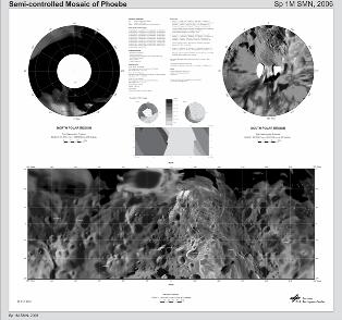
Working Group News A publication of special issue of ISPRS journal on 'Landscape Modelling, Analysis and Visualization.' has been planned. 2007: Joint Workshop "Visualization and Exploration of Geospatial Data", tuttgart, 2007. WG IV/4 is the leading institution for the upcoming workshop which will be jointly held by four ISPRS Working Groups, the Commission on "Visualization and Virtual Environments" of the International Cartographic Association (ICA) and the Commission on "Cartography and Remote Sensing" of the German Cartographic Society (DGfK). The Workshop will address the wide-ranging technical, methodical and psychological aspects for representing multi-dimensional geospatial data (with an emphasis on remotely sensed data) on various end user devices (including mobile telephones and PDAs), and for exploring additional knowledge from those visual representations. Further information for this event, which will be held from June 27-29, 2007 in Stuttgart (Germany), is available under: http://www.igf.uni-osnabrueck.de/isprs07. Selected papers will be published in the ISPRS Journal of Photogrammetry and Remote Sensing in early 2008. The respective Call for Papers has been prepared. d. WG IV/5: Web-based Geo-information Services and Applications Chair: Songnian Li, Canada Co-Chair: Bert Veenendaal, Australia Secretary: Suzana Dragicevic WG Website: http://www.commission4.isprs.org/wg5/ http://www.ryerson.ca/simal/ISPRSWGIV5/ State of Science and Technology Continuous development of various web-based GIS services and applications have substantially increased and enhanced the open use of GIS in a number of directions including: (1) Spatial data access and dissemination, (2) Spatial data exploration and geo-visualization, (3) Spatial data processing, analysis and modeling, (4) Collaborative spatial decision support using public participatory GIS, and (5) Integration of web-based GIServices in mainstream\enterprise computing processes and environments. Some of the recent and relevant developments are: New and active OpenGIS initiatives related to WG IV/5 terms/topics include: a) The Open Geospatial Consortium's Web Map Service (WMS) Implementation Specification has been approved as International Organization for Standardization (ISO) Standard. b) OGC continues to work on its Web Services Specifications (Phase 3) to enable an interoperable, multi-source decision support environment, especially in the areas of Common Architecture, Sensor Web Enablement, Geo-Decision Support Services, Geo-Digital Rights Management, and Open Location Services. c) The development of a Geospatial Semantic Web (GSW), where discovery, query, and consumption of geospatial content are based on formal semantic specification. d) The development of the OpenGIS Web Services Context Document Schema Interoperability Experiment. Grid computing continues to be an active research subject in Web GIS because it helps manage massive distributed computing/storage resources, provide high-performance, and facilitate "collaborative" virtual computers/organizations. Open source software has provided new, cost-effective solutions to web-based geospatial information and GIS services, especially for the government agencies. Increasing attention in this area shall be given by the working group. From ICA side, the Commission on Maps and the Internet has quite actively organized workshops since 2004 on Ubiquitous, Pervasive and Internet Mapping; Location Based Services & Telecartography; Geographic Hypermedia; Open Source Geospatial; and Internet-Based Cartographic Teaching and Learning. These developments are closely related to WG IV/5 terms of references. Another series of workshops is the International Workshop on Web and Wireless Geographical Information Systems (W2GIS), which also actively involves the topics on Web-based GIS and GIServices. It's in discussion now that WG IV/5 may be involved in the organization of its 7th workshop in 2007. A number of web-based GIS services have drawn mass public attention, which demonstrates the success of bringing GIS into people's daily life. Google map/Earth presents a most recent example after the success of Yahoo map and MapQuest. Accomplishments of Working Group Due to the restructuring of the WG officers, the WG activities have delayed a few planned activities in the last year. However, it still managed to be active in the following activities: WG IV/5 has completed its website and it's now officially available and linked to ISPRS website. WG IV/5 members was actively involved in relevant publications, including a book entitled "Collaborative Geographic Information Systems" (co-editor: S. Dragicevic; authors: S. Li & M. H. Tsou), special issue of Geomatica journal on Coping with Disasters across Continents. WG IV/5 proposed an initiative of collecting a set of higher quality papers to position the state-of-the-art developments in WG-related topics. The work is still ongoing. WG IV/5 has discussed with W2GIS organizing people the possibility of co-organizing W2GIS symposium in 2007, in hope to combine that series into an ISPRS series. However, we could not convince the group of such an idea. Working Group News 2007: WG IV/5 is working closely with WG IV/8 in co-organizing the 3rd (Gi4DM, Toronto 2007) and 4th (Gi4DM, Beijing 2008) International Symposium on Geoinformation for Disaster Management (Gi4DM 2007). ). The 3rd one will be joined with CIG annual conference as a joint ISPRS/CIG conference, of which all WG officers are involved in its technical program committee. A special session on WG IV/5 topics is also planned. An ISPRS Workshop on Web Geoinformation and Services was planned for 2006 but postponed to 2007 due to the overlap with mid-term symposium. The proposal will follow soon. WG IV/5 is planning to call for demo projects to be linked to the WG website from its members and researchers outside the Working Group, so that the most recent developments in Web-based GeoInformation Services and Applications can be illustrated. f. WG IV/6: Location-Based Services Chair: Michael Hahn, Germany Co-Chair: Stephan Nebikar, Switzerland • Website: http://www.isprswg46.hft-stuttgart.de State of Science and Technology LBS technology providers diversify and improve the services for the Location Based Services market. Key aspects of activity are: a) Location aggregation platforms that retrieve location information from a multitude of different sources and b) Hardware providers that use location web services for live tracking or fleet management in combination with their unique devices. The progress comprises mapping solutions including vector maps and satellite images, as well as various communication (e.g. client-server) and service improvements like those for tracking, messaging and billing. According to a recent market survey of Berg Insight the "Location Based Services applications most commonly deployed in Europe today are information services such as yellow pages and local weather information, followed by navigation services and tracking" (http://www.tekrati.com/index.asp). While outdoor Location Based Services like fleet management and personal navigation are fully grown applications, the indoor LBS field is a rather new application area. Important components of indoor LBS are WLAN and Bluetooth access points, Radio Frequency Identification (RFID) with active and passive tags and a mapping infrastructure. Developments in this field are "way finding" indoors, querying objects, relating people, events and objects based on location, and location based media. The overall trend to which indoor LBS contributes is the development of LBS applications resulting in "intelligent environments". Instead of being "silent", surroundings will provide information about themselves and what they offer. Accomplishments of Working Group The working group participated in the mid-term Symposium of Commission IV in Goa and organised one session. Eight papers had been accepted for presentation but unfortunately four papers have been presented in Technical Session 4, which was devoted to Location Based Services. We have tried to encourage paper contribution and participation at the GOA Symposium by sending emails to around 200 colleagues in particular from the ISPRS community and certainly; we anticipated a stronger participation of WG members for this event. Obviously there is a quite big gap between the technical progress of LBS in practice and the LBS research interests within ISPRS. Our efforts to promote LBS within ISPRS have revealed two active fields of interest. Unbiquitous GI services have lot of common ground with LBS and profits from one of the big trends in computing, namely ubiquitous computing. Exchange of ideas with one of the working group members (A. Zipf) finally resulted in the agreement to support and co-organise UbiGIS 2006. UbiGIS 2006, the second International Workshop on Ubiquitous Geographical Information Services, will take place on September 20, 2006 in Münster, Germany. Another active field of interest is Sensor Networks for Location based services. Indoor and outdoor networks for positioning and communication recently became closely linked with the prospering field of Radio Frequency Identification (RFID). New approaches for precise location, flexible information delivery and new kind of services are expected to be developed within the environment of networks employing active RFID tags. Further, support was given by Working group IV.6 to an international workshop on 3D Geoinformation (3D GeoInfo'06), which was organized in August 2006 in Kuala Lumpur, Malaysia. Support was given by joining the scientific committee, reviewing papers as well as by chairing sessions by one of the working group members (V. Coors), 2006. Working group News 2007: ISPRS Working Groups II/3, II/5, IV/4 and IV/6, ICA and DGfK will organize a joint international Workshop on Visualization and Exploration of Geospatial Data in Stuttgart during June 27-29, 2007. Working Group IV.6 will be the local organiser. Host is the University of Applied Sciences, Stuttgart. The workshop is confirmed by the Council. The workshop will address the wide-ranging technical, methodical and psychological aspects for representing multi-dimensional geospatial data (with an emphasis on remotely sensed data) on various end user devices (including mobile telephones and PDAs), and for exploring additional knowledge from those visual representations. As a part of this workshop a LBS related competition would be organised. Details have been presented at the Symposium in Goa by the WG chair and can be found on the working group homepage. Invitation letters with details of the workshop will be sent to the WG members in January 2007. The deadline for abstracts is March 1, 2007. Currently the homepage of working group IV.6 http://www.isprswg46.hft-stuttgart.de is up-dated to give details about this workshop and other WG activities. Preparations for the XXI ISPRS Congress in Beijing, China, 03-11 July 2008 have already started. g. WG IV/7: Extraterrestrial Mapping Chair: Jurgen Oberst, Germany Co-Chair: Paul Schenk, USA Secretary: Marita Wahlisch, Germany WG website: http://www.commission4.isprs.org/wg7/ State of Science and Technology Mars Express (MEX) has now completed the first year of the "extended" mission. The onboard HRSC (High Resolution Stereo Camera) has mapped 31.0 % (54.4 Mio km2 of total Mars == 145 Mio km2) with a resolution of better than 20 m. The HRSC mapping is an important topic of the ISPRS working group IV/7 (Extraterrestrial Mapping). In the past year, the HRSC team has updated the photogrammetric processing algorithms and software for producing high-resolution Digital Terrain Models DTMs - about 50 m/pixel - in a more automatically way. Also, the HRSC team was conducting a systematic inter-comparison of different alternatives for the generation of high resolution DTMs from the multilook HRSC push broom imagery. Based on carefully chosen test sites, the test participants have produced DTMs which have been subsequently analyzed in a quantitative and a qualitative manner. Key goals of the test were the reconstruction of fine details and the geometric accuracy of the DTMs. Fine detail is studied using a variety of qualitative assessments in small but representative areas, while geometric accuracy is analysed with respect to the MOLA DTM (Mars Orbiter Laser Altimeter). This DTM is the most consistent Mars DTM available to date. Ron Li (Ohio State University/OSU) reported at the last working group meeting about the mapping activities during the Mars Exploration Rover (MER) mission. During the last three years the OSU team, in collaboration with Jet Propulsion Laboratory (JPL) and other teams of the mission, has been routinely producing topographic maps, rover traverse maps, and updated rover locations for the two rovers Spirit and Opportunity. Precise and updated rover traverse and various topographic mapping products have played an important role in the successful operations of the two rovers. Moreover, the mapping products have supported strategic mission operations and tactical scientific decisions. These maps and localization data are being provided to MER The Cassini spacecraft started its tour through the Saturnian system in July 2004. The Imaging Science Subsystem (ISS) onboard the orbiter consists of a high-resolution Narrow Angle Camera (NAC) with a focal length of 2000 mm and a Wide Angle Camera (WAC) with a focal length of 200 mm (Porco et al., 2004). One of the main objectives of the Cassini mission is to investigate the icy Saturnian satellites. Thomas Roatsch from the German Aerospace Center and his colleagues were involved in the mapping of the so-called medium-sized icy satellites Mimas, Enceladus, Tethys, Dione, Rhea, Iapetus, and Phoebe. A global mosaic and a standard map sheet of Phoebe were generated in a scale of 1:1,000,000 (see Figure 1). Brent Archinal (USGS) together with colleagues from USGS and the University of Arizona continued their efforts to use the images of the Descent Imager-Spectral Radiometer (DISR) experiment on the Huygens spacecraft to map the surface of the Saturnian moon Titan, so that the information can be used for further geologic study. These returned images are the first ever high resolution (~60 m/pixel to a few mm/pixel) images of the surface of Titan. Howington-Kraus and others continued their efforts in using synthetic aperture radar (SAR) images of the planet Venus at a resolution of 75 m/pixel for stereomapping process to obtain high-resolution stereo DEMs. These results correspond well with the Magellan altimetry, where the altimetry is reliable, yet are not distorted by altimetry artifacts. The horizontal resolution of these DTMs improves dramatically on the Magellan altimetry as well. A new general unified lunar control network (ULCN) and lunar topographic model based on Clementine images was completed by Brent Archinal and others from the U. S. Geological Survey. This photogrammetric network solution is the largest planetary control network ever completed. It includes the determination of the 3-D positions of 272,931 points on the lunar surface and the correction of the camera angles for 43,866 Clementine images, using 546,126 tie point measurements. The solution RMS is 20 μm (= 0.9 pixels) in the image plane, with the largest residual of 6.4 pixels. The ULCN will be very useful during the upcoming Moon missions.
Phoebe map at 1:1,000,000 scale. Accomplishment of the Working Group
Two sessions were organized at the TC IV Symposium at Goa.
Working group News 2007: Working group meeting, preferably in the form of a special session at large geosciences meetings.
h. WG IV/8: Spatial Data Integration for Emergency Services
Chair: Sisi Zlatanova, The Netherlands Co-Chair: Jonathan Li, Canada Secretary: Andrea G. Fabbri, The Netherlands
WG website: http://www.commission4.isprs.org/wg8/
State of Science and Technology Geo-ontology and semantic are especially important for fast decision-making to support rescue teams within response and aftermath phase. To strengthen the work of the group in this direction contacts were established with Bartel van de Walle (the president of ISCRAM). The focus of ISCRAM is purely on systems for decision-making and approaches for fast discovery of information. There is a principle agreement for cooperation, especially in a workshop in China (2008) and a joint workshop in Europe in 2009). A one-day workshop (with representatives from Belgium, Germany and the Netherlands) was organized on May 9, 2006 in Delft. Fast, efficient, reliable technology for data acquisition capable of providing data in the first hours to first several days and especially their integration with existing data and efficient organization have been addressed. One of the highlights in this direction is the 5-year research project (2006-2011) titled "Rapid Urban Mapping by a 3D Remote Sensing Approach" (led by Jonathan Li). It was awarded by the Natural Sciences and Engineering Research Council of Canada. This project focuses on the development of innovative remote sensing techniques for 3D spatial modeling of the urban environment. One of the key applications that the project addresses is urban risk mapping and management. The 3D for emergency response was discussed continuously within the WG IV/8 group and during different conferences and workshops, including the 13th International Conference on Geoinformatics held in Toronto, Canada, August 17 - 19, 2005; the 25th Urban Data Management Symposium, held in Aalborg, Denmark, May 15-17, 2006, a research seminar held during the Bentley User Conference, in June 2006, Prague, Czech Republic; meeting of CAD/GIS WG of OGC, in June 2006, Edinburgh, UK; 5th International Conference on Environmental Informatics held in Bowling Green, Kentucky, USA, August 1-3, 2006; and International Workshop on 3D Geoinformation, held in Kuala Lumpur, Malaysia, August 7-8, 2006. The papers presented on the topic of "Geoinformation for Disaster Management" have drastically increased. The number of companies working on 3D systems for emergency response has increased drastically. A special attention is paid more and more on the integration of CAD and 3D GIS. A very promising development is the work of the OGC CAD/GIS group, which is actively cooperation with some WG IV/8 members (e.g. Sisi Zlatanova and Thomas Kolbe). It is expected that widely discussed 'link' between Industrial Foundation Classes (IFC) and CityGML will boost the developments in 3D. Tests are currently performed with participation of members of the group (Thomas Kolbe). The workshop on "Advances 3D Geo-information" (first in South Asia, organized by the WG IV/8 members A. Rahman, S. Zlatanova and V. Coors) has shown tremendous progress in 3D in all aspects. Several projects on 3D for emergency response (i.e. LBS for pre-hospital evaluation) are already in progress in Malaysia. The proceedings of the workshop are published within Springer Series "Lecture Notes on Geoinformation and Cartography'. The WG IV/8 is actively following the developments with EU large projects regarding disaster management such as ORCHESTRA, GMES, DIMISCO, INSPIRE, etc., through the WG members (e.g. Henk Scholten, Peter van Oosterom, Sisi Zlatanova). A comparative study on the policies and procedures for preparing, exchange and communication risk maps to citizens was completed for UK and the Netherlands. The results are published in series of papers (some of them available on the web site of the WG). The void between risk prevention and emergency response are to be discussed in more details within the 3rd symposium on Gi4DM to be held in Toronto, Canada, May 23-25, 2007. Currently a large number of projects are actively dealing with emergency response aspects. Within all the projects extensive investigation of user requirements is performed. For example, within the Dutch project GDI4DM (www.gdi4dm.nl), a study is completed on requirements of police and fire brigade in particular cases. During the meetings with users the lack of GIS understanding has been recognized. Still many local governments, rescue unit leaders have little insight on the power of geo-information. To improve the GIS awareness an educational module has been developed within UNIGIS (Sisi Zlatanova, Jeroen Neuvel, Andrea Fabbri, Henk Scholten). Short version of the module has been presented within the Vespucci Summer School, 2005 Accomplishments of Working Group · 13th International Conference on Geoinformatics held in Toronto, Canada, August 17 - 19, 2005 (Songnian Li and Jonathan Li) · Workshop at EC, ICT for Environment on the important topics for DM within the new EC Frame Programme 7 (starting 2007), March 2006, Brussels (Thomas Kolbe, Sisi Zlatanova) · Workshop on 3D modeling, Volker Coors, organized at the 25th UDMS Symposium, May 15-17, 2006, Aalborg, Denmark · Research seminar within Bentley User Conference July, Prague, Czech Republic (Sisi Zlatanova, Lars Bodum) · Meeting at OGC CAD/GIS group July, Edinburgh, UK (Sisi Zlatanova and Thomas Kolbe) · 5th International Conference on Environmental Informatics held in Bowling Green, Kentucky, USA, August 1-3, 2006 · Workshop on Advances in 3D geo-information, August, Kuala Lumpur (Alias Abdul Rahma, Alexander Zipf, Lars Bodum, Volker Coors, Sisi Zlatanova) · 2nd Gi4DM conference to be held in Goa, India, September 24-25, 2006, · ISEIS 2006 Beijing Specialty Conference on Science and Technology for Desertification Control held in Beijing, China, October 14-16, 2006 (Jonathan Li). · 6th International Symposium on Web and Wireless Geographical Information Systems, December 4-5, 2006, Hong Kong, China (Bo Huang). · The most significant achievement of the WG IV/8 is the ISPRS Series book "GI-Technology for Emergency Response (co-edited by Sisi Zlatanova and Jonathan Li), which is almost ready. Contributors (as well as reviewers) of the book are exclusively members of the WG IV/8. The book editors are the chair and co-chair of the group. · ISPRS Series Book Volume 4 titled "Advances in Mobile Mapping Technologies (co-edited by Vincent Tao and Jonathan Li) also included the contributions of our WG members (Jonathan Li, Michael Chapman, Bo Huang, etc.), which is published in 2006. · Invited reviewer for evaluating one proposal titled "Risk Management Using Remote Sensing", submitted for the programme "STEREO II" (Support to the Exploitation and Research in Earth Observation), the Belgian Science Policy Office (Jonathan Li).
Working Group News 2007: · The 3rd International Symposium on Geo-information for Disaster Management, May 23-25, 2007, Toronto, Canada (Jonathan Li, Sisi Zlatanova), co-organized by Canadian Institute of Geomatics (ISPRS) together with ISPRS WGs IV/5, I/3, VII/6, and WIII/2. · The second 3D Geoinfo, December 12-14, 2007, Delft, (Peter van Oosterom) · The 26th UDMS symposium, Stuttgart, Germany (Volker Coors) · DM week within the Vespucci Summer School (Henk Scholten) · 5th International Symposium on Mobile Mapping Technology (MMT2007), 28-31 May 2007, Padua, Iraly (Jonathan Li, Mike Chapman). Planned publications · Special issue of the ISPRS Journal of Photogrammetry and Remote Sensing (Sisi Zlatanova) · Special issue of Photogrammetric Engineering and Remote Sensing (PE&RS) - "Web and Wireless GIS" (Jonathan Li and Bo Huang) · Springer Book for the selected papers from Gi4DM2006 (Shailesh Nayak and Sisi Zlatanova) · Selected Gi4DM2007 papers to be published by Springer in their "Lecture Notes in Geoinformation and Cartography", tentatively titled "Geomatics Solutions for Disaster Management", co-edited by WG IV officers. · Review on projects within emergency response.
i. WG IV/9: Mapping from High Resolution Data Chair: David Holland, UK Co-Chair: Pradeep Srivastava, India Secretary: R. Nandkumar, India
State of Science and Technology: During 2006, several high-resolution imaging satellites were launched, detailed in the following table:
Papers on high-resolution satellite imagery featured in many journal articles, including a special edition of PE&RS (Photogrammetric Engineering and Remote Sensing) and a special theme edition of the ISPRS Journal entitled "Extraction of Topographic Information from High-Resolution Satellite Imagery" in May 2006. Accomplishments of Working Group Symposium The main event of the working group this year was its participation in the ISPRS Commission IV Symposium, "Geospatial Databases for Sustainable Development", 27th-30th September 2006, in Goa, India. Thirty abstracts were submitted to the symposium under the topic of this working group, and twelve of these were chosen as oral presentations, delivered in two separate sessions. Several others were displayed in poster sessions. A pre-Symposium tutorial entitled "Extraction of Geospatial Information from High Spatial Resolution Optical Satellite Sensors" was organised on sep. 26, 2006. This attracted an audience of students from Indian universities. The Working Group Chair, Co-Chair and Secretary delivered lectures in a pre-Symposium tutorial Cartosat-1 Scientific Assessment Programme The major activity in which the working group has been involved is the ISPRS-ISRO Cartosat-1 Scientific Assessment Programme (C-SAP). This initiative was set up by the Co-chair and Secretary of the Working Group, and all the officers of the Working Group sat on the evaluation committee to choose the principal investigators in the assessment programme, and will continue to monitor progress in the programme as results are presented. At the 2006 Symposium, two sessions were dedicated to C-SAP, during which initial results of the evaluation were reported by eleven of the investigation teams, from Europe, India and the United States of America. Most of the results concentrated on the derivation of Digital Elevation Models from the stereo imagery. The findings showed accuracy levels (in height) ranging between 1.46 m and 6.97 m RMSE, with most reporting accuracy of around 3 m (it was noted that several different accuracy measures were used in the reports, and that a more comparable method of accuracy reporting should be applied in the next phase of the evaluation.) Phase 2 of the programme will include more test sites and further analysis, including block triangulation tests; topographic mapping and 3D feature extraction. Results from the programme will be presented at the next Congress in Beijing. "Updating topographic mapping in Great Britain using imagery from high-resolution satellite sensors", by the Working Group Chair, was published in special theme edition of the ISPRS Journal entitled "Extraction of Topographic Information from High-Resolution Satellite Imagery" in May 2006. Working group News 2007: · ISPRS Hannover Workshop 2007 - "High-Resolution Earth Imaging for Geospatial Information", Hannover, 29 May-1 June 2007 along with WG I/5 and WG IV/3. · RSPSoc Annual Conference - "Challenges for earth observation - scientific, technical and commercial", Newcastle, 12-14 September 2007 · A workshop on feature extraction from spaceborne stereo imagery, in collaboration with Anna University in Chennai, in September 2007. In addition, the CSAP initiative will continue, and more results will be collated. We hope to have a new website for the working group in the very near future, to advertise our presence and to attract new members to the working group. j. Other Relevant Information Technical Commission President, Shailesh Nayak moved from the Space Applications Centre, Ahmedabad to the Indian National Centre for Ocean Information Services (INCOIS), Hyderabad as its Director in May 2006. WG Co-Chair Gabor Remetey-Fulopp vacated the position in March, 2006 due to health reason. Dr. Arpad BARSI, Head of Department of Photogrammetry and Geoinformatics, Budapest University of Technology and Economics Hungary was appointed as WG IV/1 co-chair. He was nominated by Mr. Gabor Remetey-Fulopp and approved by ISPRS TC-IV President Dr. Shailesh Nayak and the ISPRS President Prof. Ian Dowman. Mukund Rao, Chair WG IV/5 has requested to relieve him of duties of this WG due to other assignments. k. Commission Officer Address Update TV IV President: Shaileah Nayak Indian National Centre for Ocean Information Services (INCOIS) P. B. No. 21, IDA, Jeedimetla P. O. Hyderabad 500 055, India. Tel: +91 40 23895000 Fax: +91 40 23895001 E-mail: shailesh@incois.gov.in
WG IV/1 Co-Chair Arpad BARSI Department of Photogrammetry and Geoinformatics, Budapest University of Technology and Economics H-1111 Budapest, Muegyetem rkp.3 Hungary
Tel: +36 1 463 1186 Fax: +36 1 463 3084 E-mail: barsi@eik.bme.hu
WG IV/5
Chair: Songnian LI Department of Civil Engineering Ryerson University 350 Victoria Street, Toronto, Ontario, CANADA M5B 2K3
Tel : 416-979-5000-6450 Fax: 416-979-5122 E-mail: snli@ryerson.ca
Co-Chair: Dr. Bert Veenendaal Phone: +61 8 9266 7676 Phone: (604) 291-4621
|
|||||||||||||||||||||||||
|
|
|||||||||||||||||||||||||
 The ISPRS Technical Commission IV (TC IV) on Geo-databases and Digital mapping addresses Spatial Databases and Digital Mapping, Digital Landscape Modelling, Global Databases, Extra-terrestrial Geo-information System, Industries interface and Web-based GIS.
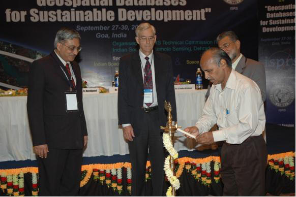
 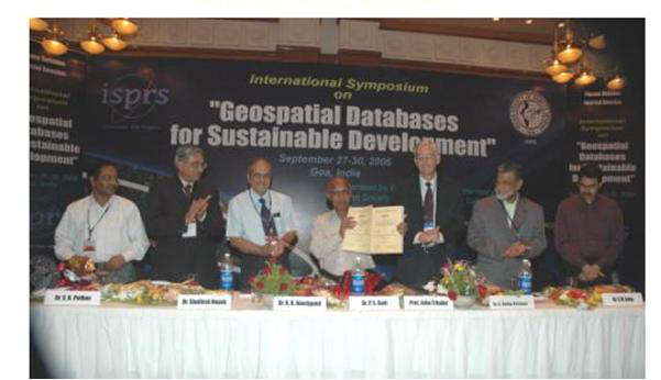 The inaugural session started with traditional invocation and lighting of the lamp by the dignitaries of the symposium. The symposium was inaugurated by Dr. P.S. Goel, Secretary, Ministry of Earth Sciences, Govt. of India, New Delhi. He said that India is looking for a database for development and not just about the creation of databases but to make them available to the right person at right time. He has also reiterated that it is equally important to develop common standards to make different systems interoperable to facilitate the exchange of data and to have some agency that can take the responsibility of maintaining the databases, like the NSDI. He advocated creation of "Synergy between Science and Application of Geospatial Databases" for sustainable development. He also gave away ISRS awards for outstanding contributions in the field of remote sensing and geospatial sciences. Prof. John Trinder, First Vice President, ISPRS opened the exhibition.
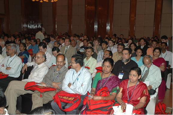
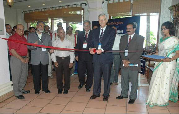 In all 325 scientists including 125 scientists from 23 countries attended the symposium and participated in deliberations. Three plenary sessions, highlighting the main theme of the symposium was organized. On the first day, ten invited talks were delivered by eminent scientists and working group chair/co-chairs of the ISPRS TC-IV. Twenty-four technical sessions, two poster sessions and one special session on 'Digital Asia' were organized. Two technical sessions on CARTOSAT - Scientific Assessment Programme (C-SAP) , a joint study between ISRO and ISPRS, were also organized. All technical sessions were initiated by a lead talk. In all, 211 papers were presented in both oral (161 papers) and poster (50 papers) presentations. Symposium proceedings (two volumes) have been brought out. In addition to this, abstract volume was also brought out. Soft copy of both abstract and proceedings volume with navigational tools were brought out and distributed to all the participants.