|
ISPRS workshop on Multiple Representation and Interoperability of Spatial Data 22 t/m 24 February 2006, Hannover by Jantien Stoter (ITC, Enschede) and Edward Verbree (Delft University of Technology)
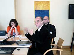
The keynote speech was given by Professor W. Förstner (University of Bonn), president of ISPRS WG III. The speech was about 'natural and artificial scale of geoinformation' with a few very nice examples of 'multiple scales at the same position'. He mentioned the city views with continuous scale-ranges from close by (Level of Detail 0) to far away (Level of Detail 4), according to the City Model division of Thomas Kolbe. The principle of Level of Details was effectively illustrated by Förstner with an animation of the work of Escher. Besides that Förster gave a nice example of generalization (abstraction) in using natural language in our daily lives, i.e. in case of emergencies. There is a clear difference in 'There is fire at Churchstreet 12th, second floor, room 2.24.0' and 'I see a plume of smoke when I look outside my window'. It was good to see that Förstner recognizes the importance of non-photorealistic 3D City Models in geo-applications as well as an essential role for cartographic aspects within computer graphics.
The second session was on 'Ontology and Semantic Integration'. A remark from the audience that ontology is just another saying for 'Knowledge Representation' made clear that ontology is still a confusing term. Reading Nietzsche's 'Beyond good and evil' might help by understanding more about ontologies. E. Tomai (Institute of Applied and Computational Mathematics, Heraklion, Crete) presented her work in which she integrated two different ontologies by focusing on instances rather than on classes of ontologies. J. Stoter (ITC Enschede, co-author of this report) talked about semantic data integration within the MRDBMS environment of the Dutch Topographic Survey (TD Kadaster). Part of her presentation focused on integration of the ontology of TD Kadaster with ontologies from other domains. It included machine ontologies, semantic web and Web Ontology Language (OWL). The session was closed by a paper of W. Shi and L. Meng (Technical University of Munich) on the integration of multidisciplinary spatial data. In the afternoon J. de Waele (Nationaal Geografisch Instituut Belgium) talked about the integration of road networks by linking the 1:10.000 database with the 1:50.000 database in order to align cartographic production of those two databases.
The conclusion of the session on Generalization Web Services was that it should be clear for what user the service is intended (generalization researcher, planner or a user who wants to simplify her data but does not know anything about generalization). The specific use(r) lays down specific requirements for the service. The major difficulties of setting up web services were identified as:
The second day E. Verbree (Delft University of Technology, co-author of this report) started in the 'Generalization' session with a presentation on the en- and decoding of planar maps through conformal triangulation. J. Haunert (University of Hannover) presented his research on 'Hierarchical structures for rule base incremental generalization'. He showed a nice implementation in ArcGIS of the aggregation of polygons. M. Kada (University of Stuttgart) had an animated talk about 3D building generalization based on half space modeling. In the session on 'Hierarchies in images and in text' J. Heuwold (University of Hannover) talked about the automatic scale-dependent adaption of object models to support the automatic extraction of objects from images. Unfortunately this was the only presentation on images. M. Müller (University of Karlsruhe) spoke about the transmission of the Brazilian Cadastre, which is a textual system, to a system that is based on a description with real-world coordinates. To make this happen different kinds of property descriptions need to be translated into real-world coordinates which is a hard job. L. Harrie (Lund University) had a nice idea to automate vegetation symbol placement on Ordnance Survey 1:50.000 maps. In the last session (on 'Matching') S. MustiÄ-re (IGN France) tried to match networks in the BD Topo database (~1:10.000) of IGN with networks in the BD Carto database (~1:50.000). He had a nice approach with good results: first find all the sets of possible similar nodes and secondly the sets of possible similar arcs after which the matching can take place. The 'fitness of the match' is expressed in a 'confidence' value. In the last and final talk S. Volz (University of Stuttgart) presented a similar story but now with two street networks at approximately the same scale (from ATKIS and Geographic Data Files). All papers can be downloaded from http://www.ikg.uni-hannover.de/isprs/workshop.htm.
|
|
|
|
|
 Although these two working groups are within one ISPRS commission (Spatio-temporal data handling and information) the focus of the workshop was not always clear. On the other hand, this also led to a wide variety of topics which was very interesting for the participants. Generalization was in any case a topic that came up during the whole workshop. The workshop itself was neatly organized (as Germans are known for); with a nice congress hotel and sufficient time for both social and information exchange. There were about 40 participants from twelve countries.
 The paper of N. Regnauld (Ordnance Survey, UK) in the first session 'Generalization Web Services' was about efficiency improvement for developing automatic generalization solutions. His message was clear. Research is only looking for proof of concepts. As a consequence generalization research does hardly lead to reusable prototypes. Only a few - and mostly simple - results are taken over by the industry. This problem can be met by 'Generalization Web Services'. Nicolas had tested this concept by providing one of his algorithms to the WebGen platform of M. Neun (University of Zürich) which Neun presented in the second presentation. Neun based his web service on standardized web technology, i.e. Simple Object Access Protocol (SOAP). T. Foerster (ITC) is currently working on making this service OGC compliant by implementing it in a OGC Web Processing Service.
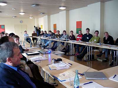 The remainder of the afternoon was dedicated to two parallel discussions: one on issues related to integrating Geo-ontologies and one on the use and usefulness of Generalization Web Services. In the ontology session it was concluded that the term ontology is maturing within the geo-community, although the term is still a source of confusion. Ontologists and geo-it professionals need to work closely together and need to be willing to look at each others terminology and needs in order to make considerable progress in applying geo-ontologies.