Click on this
link
if you cannot read this email.
 |
 |
| |
 |
|
ISPRS e-Bulletin
Issue No 5 - 2013
|
 |
| |
|
|
|
Editorial
 |
|
ISPRS Scientific Initiatives: Announcement of
2014 Funding
by Jon Mills
ISPRS Treasurer
|
In accordance with the statutory mission and activities of ISPRS, the Society shall provide funds to support scientific and other initiatives, which will further improve its international status in the field of the photogrammetry, remote sensing and spatial information sciences, and will therefore benefit all ISPRS members. To this end, a call for new Scientific Initiatives was issued in September 2013 with a 2014 budget of 40,000 Swiss Francs. By the call deadline, 11 teams of researchers across six of the eight Technical Commissions had submitted cases for support. Comment was sought from the relevant Technical Commission Presidents, and a sub-committee of three Council members was convened to independently review the proposals on the basis of scientific excellence. The sub-committee then convened at the recent SSG Conference in Antalya to draw up a ranked list of projects to be funded. The sub-committee’s recommendation to fund the following projects was then accepted by ISPRS Council at its meeting in Antalya:
ISPRS Council would like to thank all scientists who submitted proposals, and to congratulate the successful applicants. The decision to allocate more funding than originally budgeted reflects the high quality of the proposals received, and ISPRS Council’s desire to support and pump-prime scientific endeavours across all Commissions that submitted proposals to the call. Council looks forward to hearing of the future success of the funded projects and reporting the outcomes through this and other media in due course.
Jon Mills
ISPRS Treasurer 2012-16
jon.mills@ncl.ac.uk
|
|
| |
|
|
Society News
|
 |
|
Congress pre-view: Vyšehrad Legends
Every country has its history and its legends. One such Czech legend speaks about the name of our nation and language - Czech nation and Czech language.
Czech was name of our forefather who together with his brother Lech brought his nation to our land.
» Read more
|
|

|
|
Two new ISPRS sustaining members
ISPRS is proud to announce two new sustaining members:
Welcome to these two latest members of ISPRS!
|
|
 |
|
Revision of ISPRS Financing policy approved
by Financial Commission
Financial planning and management within ISPRS is done according to the ISPRS Financial Policy. This paper discusses the establishment of an annual budget, regular reports by the Treasurer to the Council and the General Assembly, and formal operating policies and procedures. It is prepared and regularly updated by the Treasurer, before approval by Council and the ISPRS Financial Commission.
The last update was presented to Council during the recent Council Meeting held in Antalya, Turkey. Council approved the changes, and so did the Financial Commission. As Marie-José Lefevre-Fonollosa, the ISPRS Financial commission Chair, writes "After reading the document and consulting the other members of the Commission is my pleasure to inform you that we approve terms and spirit of the ISPRS Financial Policy. We find that is a good guideline, clear and complete. So we agree this proposal."
The current ISPRS Financial Policy can be found at
www.isprs.org/documents/guidelines/financial-policy.aspx
Together with the Financial Policy also an updated version of the ISPRS Spending Policy has been approved by Council and the Financial Commission. It consists of a number of guidelines ensuring that resources spent by any ISPRS officer or persons charged with conducting ISPRS business, are always directed at achieving the aims of the Society. The guidelines are published in the web, see
www.isprs.org/documents/guidelines/c-spend.aspx
|
|
|
| |
|
 |
|
Member News
|
 |
|
ASPRS President Steven DeGloria on
"Advancing our Role in the Geospatial
Revolution"
» Read more
|
|

|
|
|
 |
|
Quick Links
|

|
|
|
| |
|
|
General Announcements
 |
|
CIPA Heritage Documentation
cipa.icomos.org/
is a dynamic international organisation that has twin responsibilities: (1) keeping up with technology and (2) ensuring its usefulness for cultural heritage conservation, education and dissemination.
This dual role is exhibited in our parent organizations - ICOMOS - International Council of Monuments and Sites (www.icomos.org/
) and ISPRS - International Society of Photogrammetry and Remote Sensing (www.isprs.org/
). This means a marriage of Science and Culture.
We recently issued the first issue of the newly established newsletter which is aiming at freely reporting news, projects or disseminate any information related to recording, documentation of conservation of Cultural Heritage, see
here or details.
Enjoy the reading of the CIPA newsletter!
CIPA Executive Board
|
 |
|
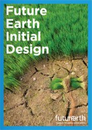
Future Earth Initial Design Report published
Future Earth is an ambitious research initiative on global sustainability initiated by ICSU - the International Council for Science, see
www.icsu.org/future-earth.
Recently, the Future Earth Initial Design Report has been published. It is available for download at
http://www.icsu.org/news-centre/news/top-news/final-report-of-the-future-earth-transition-team-published.
The team comprised seventeen members from a wide range of disciplines and countries, and also included ex-officio members representing the main partners of the Science and Technology Alliance for Global Sustainability.
Co-chaired by Johan Rockström and Diana Liverman, the team proposed a vision for integrated and solutions-oriented research that can support a transformation towards global sustainability over the coming decade. The report sets out the initial design of Future Earth, comprising a research framework and governance structure, preliminary reflections on communication and engagement, capacity-building and education strategies, and implementation guidelines.
Structuring the research agenda around three central themes – dynamic planet; global development; transformations towards sustainability – the report details the key research questions that will be addressed in each area. At its core lies a new partnership between science and society to co-design research priorities and co-produce knowledge.
To ensure that the research conducted under the umbrella of Future Earth is actionable, relevant to stakeholders and done to the highest scientific standards, the team also designed a unique governance structure for the initiative. Led by a multi-stakeholder Governing Council, the ultimate decision-making body, Future Earth's direction will be guided by a Science Committee and an Engagement Committee. The Science Committee will provide scientific guidance, ensure scientific quality and guide the development of new projects. The Engagement Committee will provide leadership and strategic guidance on involving stakeholders throughout the entire research process from co-design to dissemination, ensuring that Future Earth produces the knowledge that society needs.
The recommendations of this report are now being taken forward by the Future Earth interim secretariat, and the full initiative is expected to be up and running by the end of 2014.
|
 |
|
DGI 2014
London, UK
Jan. 21-23, 2014
The Defence Geospatial Intelligence Meeting 2014 is held in London on Jan. 21-23. As in previous years, ISPRS is happy to be one of the supporting organisations of this major event.
|
 |
|
The 2014 series of e-learning courses from
EuroSDR
will begin with a pre-course seminar, hosted by FBK in
Trento, Italy, from 3rd to 4th of March 2014.
The seminar will be followed by four two-week distance e-learning courses.
EduServ courses are followed over the Internet from any location and require about thirty hours of online study. They are completed over a period of two weeks during Spring of each year.
Course fees are: €600 for 1-2 courses, and €700 for 3-4 courses
The courses:
- High Density Image Matching
Principal group: Stuttgart University, Germany
Tutor: Norbert Haala
- Integrated use of airborne laser scanning and aerial photogrammetry
Principal group: Aalto University, Finland
Tutor: Petri Rönnholm
- Mapping using high-resolution satellite imagery
Principal group: Terra Messflug GmbH, Austria
Tutor: Daniela Poli
- Change detection in high-resolution land use/cover geodatabases (at object level)
Principal group: IGN, France
Tutor: Clément Mallet
You can find more information on our website:
www.eurosdr.net/eduserv12/
|
|
|
| |
|
|
Announcements of Scientific Meetings
(see also
ISPRS Calendar)
|
|
|
2014 is the year of Symposia in ISPRS.
In the last issue of the eBulletin, we have highlighted the first two Symposia to be held in China in May, here is a more complete list:
- Technical Commission II
(deadline for abstracts is Feb. 1st 2014, although
the Symposium will only take place October 2014),
see
http://www2.isprs.org/2014GeoTPMA/home.html
-
Technical Commission III
Zürich, Sept. 5-7, 2014
-
Technical Commission IV
Suzhou, May 14-16, 2014
-
Technical Commission V
Riva del Garda, June 23-25, 2014
-
Technical Commission VI
Wuhan, May 19-21, 2014
A complete list of all Symposia can be found at
www.isprs.org/society/midterm.aspx.
|
|
|
| |
|
|
Event Reports
 |
|
2nd International Conference on Sensors and Models in Photogrammetry and Remote Sensing
Tehran, Iran
October 4-8, 2013
» Report
|
 |
|
First International Conference on Computer Vision in Remote Sensing
Xiamen, China
December 16-18, 2012
» Report
|
|
|
| |
|
|
ISPRS Journal of Photogrammetry and Remote Sensing
 |
|
New publications in the ISPRS Journal of
Photogrammetry and Remote Sensing Volume 85 (November 2013)
A spectral gradient difference based approach for land cover change detection
Jun Chen, Miao Lu, Xuehong Chen, Jin Chen, Lijun Chen
Pages: 1-12
Improving MODIS sea ice detectability using gray level co-occurrence matrix texture analysis method: A case study in the Bohai Sea
Hua Su, Yunpeng Wang, Jie Xiao, Lili Li
Pages: 13-20
A semi-ellipsoid-model based fuzzy classifier to map grassland in Inner Mongolia, China
Hai Lan, Yichun Xie
Pages: 21-31
Object detection in remote sensing imagery using a discriminatively trained mixture model
Gong Cheng, Junwei Han, Lei Guo, Xiaoliang Qian, Peicheng Zhou, Xiwen Yao, Xintao Hu
Pages: 32-43
An automated algorithm for extracting road edges from terrestrial mobile LiDAR data
Pankaj Kumar, Conor P. McElhinney, Paul Lewis, Timothy McCarthy
Pages: 44-55
Automatic techniques for 3D reconstruction of critical workplace body postures from range imaging data
Patrick Westfeld, Hans-Gerd Maas, Oliver Bringmann, Daniel Gröllich, Martin Schmauder
Pages: 56-65
Single tree biomass modelling using airborne laser scanning
Ville Kankare, Minna Räty, Xiaowei Yu, Markus Holopainen, Mikko Vastaranta, Tuula Kantola, Juha Hyyppä, Hannu Hyyppä, Petteri Alho, Risto Viitala
Pages: 66-73
Adaptive algorithm for large scale dtm interpolation from lidar data for forestry applications in steep forested terrain
Almasi S. Maguya, Virpi Junttila, Tuomo Kauranne
Pages: 74-83
An approach for developing Landsat-5 TM-based retrieval models of suspended particulate matter concentration with the assistance of MODIS
Guofeng Wu, Lijuan Cui, Hongtao Duan, Teng Fei, Yaolin Liu
Pages: 84-92
Diurnal and seasonal impacts of urbanization on the urban thermal environment: A case study of Beijing using MODIS data
Zhi Qiao, Guangjin Tian, Lin Xiao
Pages: 93-101
Impact of feature selection on the accuracy and spatial uncertainty of per-field crop classification using Support Vector Machines
F. Löw, U. Michel, S. Dech, C. Conrad
Pages: 102-119
Urban DEM generation, analysis and enhancements using TanDEM-X
Cristian Rossi, Stefan Gernhardt
Pages: 120-131
Assessment of number and distribution of persistent scatterers prior to radar acquisition using open access land cover and topographical data
Simon Plank, John Singer, Kurosch Thuro
Pages: 132-147
Image deblurring for satellite imagery using small-support-regularized deconvolution
Yan Li, Keith C. Clarke
Pages: 148-155
New publications in the ISPRS Journal of
Photogrammetry and Remote Sensing Volume 86 (December 2013)
Development of an image based integrated method for determining and mapping aerosol optical thickness (AOT) over urban areas using the darkest pixel atmospheric correction method, RT equation and GIS: A case study of the Limassol area in Cyprus
Kyriacos Themistocleous, Diofantos G. Hadjimitsis
Pages: 1-10
Radargrammetric registration of airborne multi-aspect SAR data of urban areas
Michael Schmitt, Oliver Maksymiuk, Christophe Magnard, Uwe Stilla
Pages: 11-20
Automated detection of buildings from single VHR multispectral images using shadow information and graph cuts
Ali Ozgun Ok
Pages: 21-40
Development of a geometric model for an all-reflective camera system
K. Richter, D. Mader, K. Seidl, H.-G. Maas
Pages: 41-51
Change detection in urban areas by object-based analysis and on-the-fly comparison of multi-view ALS data
Marcus Hebel, Michael Arens, Uwe Stilla
Pages: 52-64
Bi-cubic interpolation for shift-free pan-sharpening
Bruno Aiazzi, Stefano Baronti, Massimo Selva, Luciano Alparone
Pages: 65-76
Satellite-based investigation of flood-affected rice cultivation areas in Chao Phraya River Delta, Thailand
N.T. Son, C.F. Chen, C.R. Chen, L.Y. Chang
Pages: 77-88
Camera derived vegetation greenness index as proxy for gross primary production in a low Arctic wetland area
Andreas Westergaard-Nielsen, Magnus Lund, Birger Ulf Hansen, Mikkel Peter Tamstorf
Pages: 89-99
The use of single-date MODIS imagery for estimating large-scale urban impervious surface fraction with spectral mixture analysis and machine learning techniques
Chengbin Deng, Changshan Wu
Pages: 100-110
Automatic detection of a one dimensional ranging pole for robust external camera calibration in mobile mapping
Koen Douterloigne, Werner Goeman, Sidharta Gautama, Wilfried Philips
Pages: 111-123
The potential of linear discriminative Laplacian eigenmaps dimensionality reduction in polarimetric SAR classification for agricultural areas
Lei Shi, Lefei Zhang, Lingli Zhao, Jie Yang, PingXiang Li, Liangpei Zhang
Pages: 124-135
An approach for characterizing the distribution of shrubland ecosystem components as continuous fields as part of NLCD
George Xian, Collin Homer, Debbie Meyer, Brian Granneman
Pages: 136-149
Photogrammetric modeling of the relative orientation in underwater environments
Gili Telem, Sagi Filin
Pages: 150-156
Gaussian processes uncertainty estimates in experimental Sentinel-2 LAI and leaf chlorophyll content retrieval
Jochem Verrelst, Juan Pablo Rivera, José Moreno, Gustavo Camps-Valls
Pages: 157-167
Assessing canopy PRI from airborne imagery to map water stress in maize
M. Rossini, F. Fava, S. Cogliati, M. Meroni, A. Marchesi, C. Panigada, C. Giardino, L. Busetto, M. Migliavacca, S. Amaducci, R. Colombo
Pages: 168-177
|
|
|
| |
|
|
ISPRS International Journal of Geo-Information — Open Access Journal
 |
|
New publications in the ISPRS International Journal of Geo-Information
Open Access Journal (September - December 2013)
The Semantics of Web Services: An Examination in GIScience Applications
Shi, Xuan
Pages: 888-907
A Self-Contained and Self-Checking LPS with High Accuracy
Walter, Christian, Syafrudin, Mohammad, Schweinzer, Herbert
Pages: 908-934
Integrating Open Access Geospatial Data to Map the Habitat Suitability of the Declining Corn Bunting (Miliaria calandra)
Abdi, Abdulhakim M.
Pages: 935-954
The Rise of Collaborative Mapping: Trends and Future Directions
See, Linda, Fritz, Steffen, Leeuw, Jan de
Pages: 955-958
Simplified Occupancy Grid Indoor Mapping Optimized for Low-Cost Robots
Gonzalez-Arjona, David, Sanchez, Alberto, López-Colino, Fernando, de Castro, Angel, Garrido, Javier
Pages: 959-977
Forecast-Driven Enhancement of Received Signal Strength (RSS)-Based Localization Systems
Barsocchi, Paolo, Chessa, Stefano, Micheli, Alessio, Gallicchio, Claudio
Pages: 978-995
Using the Hierarchical Pathfinding A* Algorithm in GIS to Find Paths through Rasters with Nonuniform Traversal Cost
Antikainen, Harri
Pages: 996-1014
User Experience Design in Professional Map-Based Geo-Portals
Resch, Bernd, Zimmer, Bastian
Pages: 1015-1037
Georeferenced Point Clouds: A Survey of Features and Point Cloud Management
Otepka, Johannes, Ghuffar, Sajid, Waldhauser, Christoph, Hochreiter, Ronald, Pfeifer, Norbert
Pages: 1038-1065
Measuring Completeness of Building Footprints in OpenStreetMap over Space and Time
Hecht, Robert, Kunze, Carola, Hahmann, Stefan
Pages: 1066-1091
Mapping Ontario’s Wind Turbines: Challenges and Limitations
Christidis, Tanya, Law, Jane
Pages: 1092-1105
|
|
|
| |
|
|
New Events
21-23 Jan 2014
Defence and Intelligence Conference in London
www.dgieurope.com
London, UK
28-29 May 2014
GEO Business 2014
www.GeoBusinessShow.com
London, UK
17-26 June 2014
14th SGEM2014 International Scientific GeoConferences
www.sgem.org
Albena, BULGARIA
23-28 Jun 2014
IEEE/ISPRS Workshop on Multi-Sensor Fusion for Outdoor Dynamic Scene Understanding
website not yet available
Colombus, OH, USA
1-4 Jul 2014
GI_Forum 2014 - Geospatial Innovation for Society
www.gi-forum.org
Salzburg, AUSTRIA
23-26 Sep 2014
GIScience 2014
8th International Conference on Geographic Information Science
www.giscience.org
Vienna, AUSTRIA
» See more
|
|
| |
|
|
Updated Events
22-28 May 2014
2014 GeoInformatics Summer Camp & 11th ISPRS SC WG VI/5 Summer School and 5th 3S – WG VI/4 Students Summer Seminar
Sponsored also by ISPRS WG VI/6
www.lmars.whu.edu.cn/isprscom6/summercamp.html
Wuhan, CHINA
» See more
|
|
| |
|
|
New Publications in the ISPRS Archives & Annals
Booklet, The Value of Geoinformation for Disaster and Risk Management (VALID)
Benefit Analysis and Stakeholder Assessment
Editors: Orhan Altan, Robert Backhaus, Piero Boccardo, Fabio Giulio Tonolo, John Trinder, Niels van Manen, Sisi Zlatanova
Booklet |
Archives - 2013, WG I/4, WG II/4
SMPR Conference 2013
5-8 Oct, Tehran, Iran
XL-1/W3 |
Archives - 2013, TCII, III, IV, VII
ISPRS2013-SSG
11-17 Nov, Antalya, Turkey
XL-7/W2 |
Archives - 2013, WG IV/5
ISPRS WebMGS 2013 & DMGIS 2013 Topics: Global Spatial Grid & Cloud-based Services
11-12 Nov, Xuzhou, Jiangsu, China
XL-4/W2 |
Archives - 2013, WG II/2
ISPRS 8th 3D GeoInfo Conference & WG II/2 Workshop
27–29 Nov, Istanbul, Turkey
XL-2/W2 |
Archives - 2006, Volume XXXVI Part 4, 2006
Symposium of ISPRS Commission IV
September 25-30, 2006, Goa, India
XXXVI part 4 |
Archives - 2000, Volume XXXIII Part A, 2000
XIXth ISPRS Congress, Proceedings and Results
July 16-23, 2000, Amsterdam, The Netherlands
XXXIII part A |
Archives - 1980, Vol. XXIII, part A,B1-11
Proceedings of the XIVth ISPRS Congress
13-25 July 1980, Hamburg, GERMANY
XXXIII part A |
Archives - 1972, Volume XIX Part 1, 1972
XIIth ISPRS Congress, Proceedings and Results
July 24 - August 04, 1972, Ottawa, Canada
XIX part 1 |
Annals - 2013, WG III/4, ICWG III/VII
CMRT13 – City Models, Roads and Traffic 2013
12-13 Nov, Antalya, Turkey
II-3/W3 |
Annals - 2013, WG V/3, I/2, I/3, III/2, V/2, VII/7, ICWG I/Va
ISPRS Workshop Laser Scanning 2013
11-13 Nov, Antalya, Turkey
II-5/W2 |
Annals - 2013, WG III/3
ISA13 – The ISPRS Workshop on Image Sequence Analysis 2013
11 Nov, Antalya, Turkey
II-3/W2 |
Annals - 2013, WG II/2
ISPRS 8th 3D GeoInfo Conference & WG II/2 Workshop
27–29 Nov Istanbul, Turkey
II-2/W1 |
» See more (ISPRS Archives)
» See more (ISPRS Annals)
» See more (Non ISPRS Proceedings)
|
|
| |
|
|
Job Opportunities
|
29-Nov-2013 |
Stewart Fotheringham Lectureships in GeoInformatics (2 posts)
School of Geography & Geosciences, Department of Geography & Sustainable Development, University of St Andrews, UK
Deadline: 17-Jan-2014 |
|
26-Nov-2013 |
Assistant Professor of Remote Sensing and Spatial Analysis
School of Forest Resources and Environmental Science, Michigan Technological University, USA
Deadline: 15-Jan-2014 |
|
26-Nov-2013 |
PhD position on "Interactive Natural-Hazard Database for the Central Anatolian Plateau, Turkey"
BSF Swissphoto GmbH, Berlin-Schönefeld and University of Potsdam, Earth and Environmental Sciences, Geohazards Group, Germany
Deadline: 20-Dec-2013 |
» See more
|
|
| |
|
|
|
To unsubscribe from the email list, send this with 'Unsubscribe ISPRS' in subject line to
ISPRS webmaster.
© ISPRS, 2013.
|