ISPRS e-Bulletin: July 2019


ISPRS e-Bulletin
Issue No 3 - 2019


Quick Links

•  ISPRS Homepage
•  Editorial
•  General Announcements
•  Obituaries
•  New Events
•  The ISPRS Foundation
•  TIF News
•  Scientific Meetings
•  Journal of Geo-Information
•  ISPRS Calendar
•  Society News
•  Event Reports
•  ISPRS Journal


Editorial

Nicolas Paparoditis      

Open Call for Paper Submissions, Tutorials and Special Sessions at the
ISPRS 2020 Congress,
June 14-20, 2019

by Nicolas Paparoditis
ISPRS Congress Director

bar

The ISPRS Congress is the largest scientific event of the geospatial community which takes place every four years. The 24th ISPRS Congress will be held in the city of Nice, France, from 14-20 June 2020. This Congress will gather leading specialists, researchers, engineers, practitioners and students in the field of photogrammetry, remote sensing, and spatial information sciences, from universities and research organisations, mapping and cadastre agencies, space agencies, private companies, and end-users. A rich program will enable participants to obtain an overview of the state-of-the-art in current trends in science and technology, and to meet and network with a very large number of experts.

Since the last ISPRS Congress in Prague in 2016, new major developments and trends have emerged in the fields of photogrammetry, remote sensing and spatial information sciences. Throughout the Congress, participants will present scientific and technical contributions in the scope of the technical commissions of ISPRS in five parallel scientific tracks (sensor systems, photogrammetry, remote sensing, spatial information science, education and outreach).  In addition, a special sessions track will be dedicated to new topics and application fields. We aim at favouring emerging themes and cross-fertilization between communities.

Call for papers

Prospective authors willing to present results of their scientific and technical developments in the 6 tracks described above are invited to submit their contribution in the form of an extended abstract (2-3 pages) or under the form of a full paper of 6-8 pages (following the ISPRS guidelines).

The deadline for submission is February 3,2020.

Full papers and extended abstracts are to be submitted through the submission platform on the ISPRS 2020 Congress website: http://www.isprs2020-nice.com/index.php/participate-submit/. The full papers will go through a double blind peer-review process; extended abstracts will be reviewed as well. If the contribution is accepted for presentation at the Congress, the authors will be asked to submit camera-ready full papers of 6-8 pages that will be published in the ISPRS Archives or Annals, the series of peer-reviewed proceedings published by ISPRS. Only full camera-ready papers will be published.

All authors may optionally upload videos showcasing the proposed approach and the main results when submitting their initial submission and/or when submitting their camera-ready papers. These videos will help the reviewers to take their decision and the International Science Committee of the Congress to assign papers to long oral, short oral and interactive sessions. They will also be available for the participants of the Congress to better appreciate the contribution.

Topics of interest include:

  • Foundations of photogrammetry (camera calibration, orientation, bundle block adjustment etc.) and lidargrammetry
  • Synthetic Aperture Radar
  • Calibration and use of sensor networks for geospatial data
  • Multi-modal, multi-temporal, and multi-resolution data fusion
  • Image sequence analysis
  • 3D point cloud analysis
  • Hyperspectral image analysis
  • 3D reconstruction and 3D scene analysis
  • Multi-sensor and image-based localization
  • Deep learning for geospatial data analysis
  • Geospatial data analysis for Sustainable Development Goals
  • Big data techniques and technologies for massive data processing
  • Autonomous navigation and vehicles
  • Augmented reality and aided navigation
  • Geovisualisation and big data analytics
  • Indoor/outdoor location-based services
  • BIM and GIS
  • Environmental analysis with the Sentinel satellites
  • Social media and geospatial data
  • Extraterrestrial remote sensing
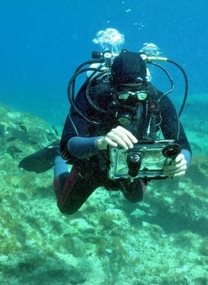
  • Underwater photogrammetry


Call for special sessions

Special sessions are selected on the basis of an open call. Applications can be submitted by any researcher or professional in the geospatial field. Proposals should gather 5 to 10 potential papers covering the topic and showing its importance and complexity. Each application must include a title, keywords, a short abstract of the topic (1/2 page) stressing its importance and its relation to the ISPRS missions, the name and CV of the applicants, as well as a preliminary list of full papers and authors that agree to submit papers to the Congress and to give a presentation during the session.

The deadline for proposing a special session is October 1, 2019. Proposals should be sent to sessions@isprs2020-nice.com in a single PDF file. An acceptance/rejection decision for special sessions will be taken by November 15, 2019. Then, all invited papers composing the selected sessions will go through the regular submission and review process for papers. The number of presentation slots allocated for a special session will eventually depend on the number and quality of the accepted papers, as well as the complementarity with regular sessions of the scientific tracks.


Call for tutorials

Short courses and tutorials will be held on Sunday June 14, 2020 before the beginning of the scientific tracks of the Congress. Tutorials should give a comprehensive overview or a basic understanding of a specific topic related to photogrammetry, remote sensing, and spatial information sciences. The topic should be sufficiently relevant and important to attract significant interest from the ISPRS community: graduate students, researchers, and practitioners from both academia and industry.

We invite proposals for both half-day and full-day courses. An equal share between oral presentations and programming exercises per tutorial is encouraged. Each submission must include a full course description, the name and CV of the lecturers, the expected target audience, a description of the resources that will be needed (e.g., digital projector, computers), and a list of recent tutorials related to the proposed topic (at any past ISPRS, GIS, robotics or computer vision event).

The deadline for proposals is October 1, 2019.  Proposals should be sent to tutorials@isprs2020-nice.com in PDF format (a single document).

More information is available on the ISPRS 2020 Congress website: www.isprs2020-nice.com. Looking forward to meeting you in Nice. Nice is nice!


The ISPRS Foundation (TIF) News

The ISPRS Foundation


TIF Travel Grant Recipients Reports

TIF awarded 26 Travel Grants to worthy applicants to take part in the GSW 2019. Read the following reports:

  1. ISPRS Travel Grant Receiver Report
    by Alessio Calantropio
     
  2. ISPRS GSW 2019
    by Efstratios Karantanellis
     
  3. TIF Travel Grant Report – ISPRS Geospatial Week 2019
    by Marcela do Valle Machado
     
  4. TIF Travel Grant Report – ISPRS Geospatial Week 2019
    by Gabriela Takahashi Miyoshi
     
  5. ISPRS Geospatial Week 2019
    by Katarina Spasenovic


The ISPRS Foundation Travel Grants to participate in the PIA19 conference - Photogrammetric Image Analysis 2019, Sep 18-20, 2019, Munich, Germany

The ISPRS Foundation provides travel grants to enable young authors, distinguished speakers, and officially designated Delegates, especially from developing countries, to participate in ISPRS sponsored events and in forums promoting international cooperation, advancements and benefits of the P&RS&SI sciences. Click here to complete your travel grant application online. 

Deadline for applications is July 15, 2019.

Info on PIA 2019 can be found here
 

↑ Up


Society News

Jack Dangermond


Jack Dangermond Best Paper Awards 2017 and 2018 presented in Enschede
bar

For the very first time, the Jack Dangermond Best Paper Award was presented at the GSW 2019, in June, for the years 2017 and 2018.

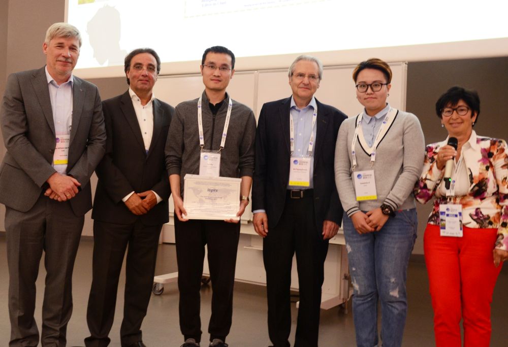
In 2017, the winners were Lei Ma, Tengyu Fu, Thomas Blaschke, Manchun Li, Dirk Tiede, Zhenjin Zhou, Xiaoxue Ma and Deliang Chen, for the paper:

Evaluation of Feature Selection Methods for Object-Based Land Cover Mapping of Unmanned AerialVehicle Imagery Using Random Forest and Support Vector Machine Classifiers
https://doi.org/10.3390/ijgi6020051

The winners for 2018 were Ilke Demir, Forest Hughes, Aman Raj, Kaunil Dhruv, Suryanarayana Murthy Muddala, Sanyam Garg, Barrett Doo and Ramesh Raskar for the paper:

Generative Street Addresses from Satellite Imagery
https://doi.org/10.3390/ijgi7030084

The Jack Dangermond Award, sponsored by MDPI and ESRI, consists of a grand prize of USD 10,000 and an ISPRS certificate presented to the author(s) of the most outstanding paper published exclusively in the ISPRS International Journal of Geo-Information during the four years preceding the Congress, and three runner- up prizes of a Journal subscription and certificate, presented to the author(s) of the best papers published in each of the other three years preceding the Congress year.

Jan Willem van Eck, Chief Research Officer ESRI Nederland, Aart van Wingerden, General Manager ESRI Europe, Lei Ma, first author of the 2017 Best Paper, Wolfgang Kainz, Editor-in-Chief ISPRS International Journal of Geo-Information,Suzanne Ji, MDPI and Lena Halounová, ISPRS (from left)


U.V. Helava


U.V.Helava Best Paper 2018 Award presented at the GSW2019
bar

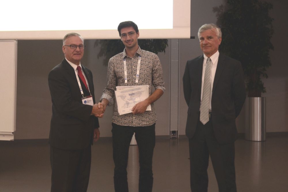
At the opening of the GSW in Enschede, the U.V. Helava Best Paper 2018 Award was handed over for From Google Maps to a fine-grained catalog of street trees by Steve Branson, Jan Dirk Wegner, David Hall, Nico Lang, Konrad Schindler, and Pietro Perona.

The fifth U.V. Helava Award will be presented at the 24th ISPRS Congress in Nice, France, 14-20 June 2020. The Award consists of a monetary grant of SFr. 10,000 and a plaque.

Representing his co-authors, Nico Lang receives the U. V. Helava Best Paper 2018 Award from Hartmut Rosengartner, Director Airborne Sensors EMEA at Hexagon Geosystems and ISPRS 2nd Vice President, Charles Toth.


ISPRS Awards


Impact Factor of ISPRS Journals

International Journal of Geo-Information bar

We are very pleased to inform you that the latest Impact Factor of the ISPRS International Journal of Geo-Information is 1.840, increased from 1.723 in 2017.

  • 5-Year Impact Factor (2018): 2.022
  • CiteScore (2018): 2.58
  • Ranking in Q1 (78/629) in the category 'Geography, Planning and Development', Scopus
  • Ranking in Q2 (22/86) in the category 'Earth and Planetary Sciences (miscellaneous)', Scopus
  • Ranking in Q3 (31/50) in the category 'Geography, Physical', Web of Science
  • Ranking in Q3 (19/30) in the category 'Remote Sensing', Web of Science

More information on the ISPRS International Journal of Geo-Information can be found at: https://www.mdpi.com/journal/ijgi


ISPRS Journal


ISPRS Journal of Photogrammetry and Remote Sensing Metrics
bar

The continuing success of the Journal of Photogrammetry and Remote Sensing is reflected in the following figures:

  • CiteScore: 8.64
  • Impact Factor: 6.942
  • 5-Year Impact Factor: 7.856
  • Source Normalized Impact per Paper (SNIP): 2.862
  • SCImago Journal Rank (SJR): 2.979

More information on this Journal can be found at https://www.journals.elsevier.com/isprs-journal-of-photogrammetry-and-remote-sensing


ISPRS


Call for Proposals - ISPRS Educational and Capacity Building Initiatives 2020
bar

In accordance with the statutory mission and activities of ISPRS, Council is making up to SFr. 70,000 available to support winning projects under the Educational and Capacity Building Initiative 2020. The maximum funding assigned to any one project shall be SFr. 10,000 per annum. Projects should commence on January 1, 2020 and typically last up to 12 months. In exceptional cases, applications for projects lasting up to 24 months will be considered. Projects of greater than one-year duration will be subject to annual review before subsequent funding will be released. 

ISPRS Working Group Officers are invited to submit applications to their respective Technical Commission President by the deadline below, using the template provided (download the template here as MS-Word / PDF). The submission must be compiled in one PDF document. Further details, including information on the topics and the application process, are available in Appendix 9 of the Orange Book at:

https://www.isprs.org/documents/orangebook/app9b.aspx

All applications will be reviewed based on the following criteria:

  • Overall Benefits to ISPRS and its Community
  • Merit of the Proposal
  • Competence of the Team
  • Contribution to Education and Capacity Building
  • Budget and Feasibility

Any queries should be addressed to the ISPRS Treasurer, Songnian Li, at isprs-tr@isprs.org.

Timeline

  • Announcement of Scientific Initiatives: June 15, 2019.
  • Deadline for submission of proposals from WG Officers to TCPs: November 1, 2019.
  • Deadline for submission of recommendation from TCPs to ISPRS Treasurer: November 22, 2019.
  • Announcement of successful awards by Council: December 15, 2019.
  • Funding available from: January 1, 2020.


ISPRS


Education and Capacity Building Initiative Reports
bar

Reports on the results of the seven 2018 Education and Capacity Building Initiative projects can be found at https://www.isprs.org/society/ecbi/default.aspx


MDPI Publication Remote Sensing and Geospatial Technologies in Public Health


MDPI Publication Remote Sensing and Geospatial Technologies in Public Health
bar

This book is a printed edition of the Special Issue Remote Sensing and Geospatial Technologies in Public Health that was published in the ISPRS International Journal of GeoInformation (IJGI ).

For more information and to order the print version, visit:

https://www.mdpi.com/books/pdfview/book/753


↑ Up


General Announcements

New Zealand goes 3D      

New Zealand goes 3D
bar

ISPRS Ordinary Member, Land Information New Zealand (LINZ) is shortly to release an international Request for Tender (RFT) to select aerial survey companies to obtain LiDAR (Light Detection and Ranging) elevation datasets.

Read more here… 


GEO logo      

2019 EuroSDR Award for the best PhD Thesis related to Geoinformation Science
bar

In order to enhance collaboration between European academia and NMCAs, as well as to engage young scientists in its research endeavours, EuroSDR, an ISPRS Regional Member, is pleased to announce its 2019 competition. Since 2016, EuroSDR has recognised contemporary PhD theses that have significantly contributed to the development of geoinformation science in the context of national mapping and cadastral agencies (NMCAs).

To find out more information please visit


Day of Geodesy      

International Scientific Societies meet in Hannover for the Day of Geodesy
bar

During the Day of the Geodesy on May 24, 2019, the leaders of four international scientific societies in the field of geodesy and geoinformatics met in Hannover, Germany, for talks on possible collaboration. What is remarkable about this meeting is that all four representatives come from Germany; an unprecedented constellation in the, for some of the societies, more than 100-year history.

To Read the report here...

↑ Up


Announcements of Scientific Meetings                (see also ISPRS Calendar)

40th Canadian Symposium on Remote Sensing and Geomatics Atlantic 2019      

GI4DM – Geoinformation for Disaster Management

3-6 September 2019
Prague, Czech Republic
bar

Information on the conference can be found at http://www.gi4dm2019.org

Contact info@gi4dm2019.org


Workshop on Evaluation and Benchmarking of Sensors, Systems and Geospatial Data in Photogrammetry and Remote Sensing and VOLTA Summer School

16-20 September 2019
Warsaw, Poland

Information about conference can be found at http://ptfit.sgp.geodezja.org.pl/workshop2019/index.html

Contact workshop.gik@pw.edu.pl

More information here...


MVPBIM2019      

Measurement, Visualisation and Processing in BIM for Design and Construction Management

24 – 25 September 2019
Prague, Czech Republic
bar

Information about conference can be found at http://mvpbim2019.org

Contact info@mvpbim2019.org


GISTAM 2020      

GISTAM 2020
6th International Conference on Geographical Information Systems Theory, Applications and Management

7-9 May 2020
Prague, Czech Republic
bar

http://www.gistam.org/


Event Reports


International Geoinformatics Conference 2019

10-13 February, 2019
Riyadh, Saudi Arabia
bar

Read the report here… 


Report of ISPRS Technical Commission III WG III/2, 10 Joint Workshop -Multidisciplinary Remote Sensing for Environmental Monitoring

12-14 March 2019
Kyoto, Japan
bar

Read the report here… 


Report of ISPRS/CIPA workshop UNDERWATER 3D RECORDING & MODELING

2-3 May 2019
Limassol, Cyprus
bar

Read the report here… 


Report on 4th Joint International Symposium on Deformation Monitoring (JISDM)

15 – 17 May 2019
Athens, Greece
bar

Read the report here… 


GSW 2019

10 – 14 June 2019
Enschede, the Netherlands
by Lena Halounová
bar

Read the report here… 


GSW Director, George Vosselman introducing the Keynote Speaker, Edward Anderson, from the World Bank, at the Opening Ceremony


Obituaries

Prof. Haruhisa Shimoda      

Prof. Haruhisa Shimoda
bar

by Kohei Cho

Read the obituary here… 
 

ISPRS International Journal of Geo-Information — Open Access Journal

ISPRS International Journal of Geo-Information — Open Access Journal      

New publications in the ISPRS International Journal of Geo-Information
Open Access Journal
Volume 8, Issue 5 (May 2019)

Capturing and Characterizing Human Activities Using Building Locations in America
Ren, Zheng, Jiang, Bin, Seipel, Stefan
No: 200

Spatial Pattern Consistency among Different Remote-Sensing Land Cover Datasets: A Case Study in Northern Laos
Kang, Junmei, Sui, Lichun, Yang, Xiaomei, Wang, Zhihua, Huang, Chong, Wang, Jun
No: 201

Solving Competitive Location Problems with Social Media Data Based on Customers’ Local Sensitivities
Jiang, Wei, Wang, Yandong, Dou, Mingxuan, Liu, Senbao, Shao, Shiwei, Liu, Hui
No: 202

Could Crime Risk Be Propagated across Crime Types?
Wang, Zengli, Zhang, Hong
No: 203

Visualization of Flooding Using Adaptive Spatial Resolution
Hadimlioglu, I. Alihan, King, Scott A.
No: 204

Obtaining Land Cover Type for Urban Storm Flood Model in UAV Images Using MRF and MKFCM Clustering Techniques
Wang, Yanmei, Zhang, Chengcai, Zhang, Yisheng, Huang, He, Feng, Lingtong
No: 205

LADM Based Utility Network Cadastre in Serbia
Radulović, Aleksandra, Sladić, Dubravka, Govedarica, Miro, Ristić, Aleksandar, Jovanović, Dušan
No: 206

Analysis of Spatial Characteristics of Digital Signage in Beijing with Multi-Source Data
Zhang, Xun, Ma, Guangchi, Jiang, Li, Zhang, Xiaohu, Liu, Ying, Wang, Yuxue, Zhao, Conghui
No: 207

Mobility Modes Awareness from Trajectories Based on Clustering and a Convolutional Neural Network
Chen, Rui, Chen, Mingjian, Li, Wanli, Wang, Jianguang, Yao, Xiang
No: 208

Adaptive Construction of the Virtual Debris Flow Disaster Environments Driven by Multilevel Visualization Task
Zhang, Yunhao, Zhu, Jun, Li, Weilian, Zhu, Qing, Hu, Ya, Fu, Lin, Zhang, Junxiao, Huang, Pengcheng, Xie, Yakun, Yin, Lingzhi
No: 209

Hazard Assessment of Earthquake Disaster Chains Based on a Bayesian Network Model and ArcGIS
Han, Lina, Zhang, Jiquan, Zhang, Yichen, Ma, Qing, Alu, Si, Lang, Qiuling
No: 210

An Occupancy Simulator for a Smart Parking System: Developmental Design and Experimental Considerations
Mendoza-Silva, Germán Martín, Gould, Michael, Montoliu, Raul, Torres-Sospedra, Joaquín, Huerta, Joaquín
No: 212

Monitoring and Mapping of Rice Cropping Pattern in Flooding Area in the Vietnamese Mekong Delta Using Sentinel-1A Data: A Case of An Giang Province
Minh, Huynh Vuong Thu, Avtar, Ram, Mohan, Geetha, Misra, Prakhar, Kurasaki, Masaaki
No: 211

Voxel-based 3D Point Cloud Semantic Segmentation: Unsupervised Geometric and Relationship Featuring vs Deep Learning Methods
Poux, Florent, Billen, Roland
No: 213

Bicycle Level of Service for Route Choice—A GIS Evaluation of Four Existing Indicators with Empirical Data
Pritchard, Ray, Frøyen, Yngve, Snizek, Bernhard
No: 214

Online Map Services: Contemporary Cartography or a New Cartographic Culture?
Skopeliti, Andriani, Stamou, Leda
No: 215

Constructing Geographic Dictionary from Streaming Geotagged Tweets
Lim, Jeongwoo, Nitta, Naoko, Nakamura, Kazuaki, Babaguchi, Noboru
No: 216

Why Shape Matters—On the Inherent Qualities of Geometric Shapes for Cartographic Representations
Klettner, Silvia
No: 217

Integrated UAV-Based Real-Time Mapping for Security Applications
Hein, Daniel, Kraft, Thomas, Brauchle, Jörg, Berger, Ralf
No: 219

NS-DBSCAN: A Density-Based Clustering Algorithm in Network Space
Wang, Tianfu, Ren, Chang, Luo, Yun, Tian, Jing
No: 218

Spatial Interaction Modeling of OD Flow Data: Comparing Geographically Weighted Negative Binomial Regression (GWNBR) and OLS (GWOLSR)
Zhang, Lianfa, Cheng, Jianquan, Jin, Cheng
No: 220

Automated Multi-Sensor 3D Reconstruction for the Web
Julin, Arttu, Jaalama, Kaisa, Virtanen, Juho-Pekka, Maksimainen, Mikko, Kurkela, Matti, Hyyppä, Juha, Hyyppä, Hannu
No: 221

Reliability Analysis of LandScan Gridded Population Data. The Case Study of Poland
Calka, Beata, Bielecka, Elzbieta
No: 222

The Spatial Equity of Nursing Homes in Changchun: A Multi-Trip Modes Analysis
Hu, Shuju, Song, Wei, Li, Chenggu, Lu, Jia
No: 223

Top-Bounded Spaces Formed by the Built Environment for Navigation Systems
Yan, Jinjin, Diakité, Abdoulaye A., Zlatanova, Sisi, Aleksandrov, Mitko
No: 224

A Convenient Tool for District Heating Route Optimization Based on Parallel Ant Colony System Algorithm and 3D WebGIS
Zhang, Yang, Zhang, Guoyong, Zhao, Huihui, Cao, Yuming, Liu, Qinhuo, Shen, Zhanfeng, Li, Aimin
No: 225

GIS Mapping of Driving Behavior Based on Naturalistic Driving Data
Balsa-Barreiro, José, Valero-Mora, Pedro M., Berné-Valero, José L., Varela-García, Fco-Alberto
No: 226

Prototype of the 3D Cadastral System Based on a NoSQL Database and a JavaScript Visualization Application
Višnjevac, Nenad, Mihajlović, Rajica, Šoškić, Mladen, Cvijetinović, Željko, Bajat, Branislav
No: 227

A Robust Early Warning System for Preventing Flash Floods in Mountainous Area in Vietnam
Hoang, Thanh Van, Chou, Tien Yin, Nguyen, Ngoc Thach, Fang, Yao Min, Yeh, Mei Ling, Nguyen, Quoc Huy, Nguyen, Xuan Linh
No: 228

Generating Different Urban Land Configurations Based on Heterogeneous Decisions of Private Land Developers: An Agent-Based Approach in a Developing Country Context
Wahyudi, Agung, Liu, Yan, Corcoran, Jonathan
No: 229

Recommendation of Heterogeneous Cultural Heritage Objects for the Promotion of Tourism
Rajaonarivo, Landy, Fonteles, André, Sallaberry, Christian, Bessagnet, Marie-Noëlle, Roose, Philippe, Etcheverry, Patrick, Marquesuzaà, Christophe, Lacayrelle, Annig Le Parc, Cayèré, Cécile, Coudert, Quentin
No: 230

Combining Water Fraction and DEM-Based Methods to Create a Coastal Flood Map: A Case Study of Hurricane Harvey
Li, Xiaoxuan, Cummings, Anthony R., Alruzuq, Ali Rashed, Matyas, Corene J., Amanambu, Amobichukwu Chukwudi
No: 231

Corporate Editors in the Evolving Landscape of OpenStreetMap
Anderson, Jennings, Sarkar, Dipto, Palen, Leysia
No: 232

Obstacle-Aware Indoor Pathfinding Using Point Clouds
Díaz-Vilariño, Lucía, Boguslawski, Pawel, Khoshelham, Kourosh, Lorenzo, Henrique
No: 233

Anisotropic Diffusion for Improved Crime Prediction in Urban China
Tang, Yicheng, Zhu, Xinyan, Guo, Wei, Wu, Ling, Fan, Yaxin
No: 234

Analyzing Newspaper Maps for Earthquake News through Cartographic Approach
Sarın, Pınar, Uluğtekin, Necla
No: 235

Multi-Mode Two-Step Floating Catchment Area (2SFCA) Method to Measure the Potential Spatial Accessibility of Healthcare Services
Ni, Jianhua, Liang, Ming, Lin, Yan, Wu, Yanlan, Wang, Chen
No: 236

A Hybrid of Differential Evolution and Genetic Algorithm for the Multiple Geographical Feature Label Placement Problem
Lu, Fuyu, Deng, Jiqiu, Li, Shiyu, Deng, Hao
No: 237

Extracting Main Center Pattern from Road Networks Using Density-Based Clustering with Fuzzy Neighborhood
Cui, Xiaojie, Wang, Jiayao, Wu, Fang, Li, Jinghan, Gong, Xianyong, Zhao, Yao, Zhu, Ruoxin
No: 238

Heuristic Bike Optimization Algorithm to Improve Usage Efficiency of the Station-Free Bike Sharing System in Shenzhen, China
Gu, Zhihui, Zhu, Yong, Zhang, Yan, Zhou, Wanyu, Chen, Yu
No: 239

A Comparison Between Major Artificial Intelligence Models for Crop Yield Prediction: Case Study of the Midwestern United States, 2006–2015
Kim, Nari, Ha, Kyung-Ja, Park, No-Wook, Cho, Jaeil, Hong, Sungwook, Lee, Yang-Won
No: 240

Spatiotemporal Pattern Analysis of China’s Cities Based on High-Resolution Imagery from 2000 to 2015
Zhang, Hanchao, Ning, Xiaogang, Shao, Zhenfeng, Wang, Hao
No: 241

Shared Data Sources in the Geographical Domain—A Classification Schema and Corresponding Visualization Techniques
Mocnik, Franz-Benjamin, Ludwig, Christina, Grinberger, A. Yair, Jacobs, Clemens, Klonner, Carolin, Raifer, Martin
No: 242

↑ Up

bar

New publications in the ISPRS International Journal of Geo-Information
Open Access Journal
Volume 8, Issue 6 (June 2019)

Predicting Station-Level Short-Term Passenger Flow in a Citywide Metro Network Using Spatiotemporal Graph Convolutional Neural Networks
Han, Yong, Wang, Shukang, Ren, Yibin, Wang, Cheng, Gao, Peng, Chen, Ge
No: 243

PPGIS and Public Use in Protected Areas: A Case Study in the Ebro Delta Natural Park, Spain
Palacio Buendía, Amalia Vaneska, Pérez Albert, María Yolanda, Serrano Giné, David
No: 244

Variables Selection for Aboveground Biomass Estimations Using Satellite Data: A Comparison between Relative Importance Approach and Stepwise Akaike’s Information Criterion
Adame-Campos, Rita Libertad, Ghilardi, Adrian, Gao, Yan, Paneque-Gálvez, Jaime, Mas, Jean-François
No: 245

Harmonising the OGC Standards for the Built Environment: A CityGML Extension for LandInfra
Kumar, Kavisha, Labetski, Anna, Ohori, Ken Arroyo, Ledoux, Hugo, Stoter, Jantien
No: 246

Identifying Building Functions from the Spatiotemporal Population Density and the Interactions of People among Buildings
Zhuo, Li, Shi, Qingli, Zhang, Chenyang, Li, Qiuping, Tao, Haiyan
No: 247

Machine Learning Algorithms for Automatic Lithological Mapping Using Remote Sensing Data: A Case Study from Souk Arbaa Sahel, Sidi Ifni Inlier, Western Anti-Atlas, Morocco
Bachri, Imane, Hakdaoui, Mustapha, Raji, Mohammed, Teodoro, Ana Cláudia, Benbouziane, Abdelmajid
No: 248

An Application of the Spatial Autocorrelation Method on the Change of Real Estate Prices in Taitung City
Wang, Wen-Ching, Chang, Yu-Ju, Wang, Hsueh-Ching
No: 249

A GIS Tool for Mapping Dam-Break Flood Hazards in Italy
Albano, Raffaele, Mancusi, Leonardo, Adamowski, Jan, Cantisani, Andrea, Sole, Aurelia
No: 250

Navigation in Indoor Environments: Does the Type of Visual Learning Stimulus Matter?
Snopková, Dajana, Švedová, Hana, Kubíček, Petr, Stachoň, Zdeněk
No: 251

Earthquake Information Extraction and Comparison from Different Sources Based on Web Text
Han, Xuehua, Wang, Juanle
No: 252

Multidimensional Web GIS Approach for Citizen Participation on Urban Evolution
Lafrance, Frederick, Daniel, Sylvie, Dragićević, Suzana
No: 253

Knowledge Embedding with Geospatial Distance Restriction for Geographic Knowledge Graph Completion
Qiu, Peiyuan, Gao, Jialiang, Yu, Li, Lu, Feng
No: 254

Eye-tracking Evaluation of Weather Web Maps
Popelka, Stanislav, Vondrakova, Alena, Hujnakova, Petra
No: 256

A Multilevel Terrain Rendering Method Based on Dynamic Stitching Strips
Zhang, Liwei, She, Jiangfeng, Tan, Junzhong, Wang, Biao, Sun, Yuchang
No: 255

Revealing Spatial-Temporal Characteristics and Patterns of Urban Travel: A Large-Scale Analysis and Visualization Study with Taxi GPS Data
Wang, Huihui, Huang, Hong, Ni, Xiaoyong, Zeng, Weihua
No: 257

Learning Cartographic Building Generalization with Deep Convolutional Neural Networks
Feng, Yu, Thiemann, Frank, Sester, Monika
No: 258

Speed Estimation of Multiple Moving Objects from a Moving UAV Platform
Biswas, Debojit, Su, Hongbo, Wang, Chengyi, Stevanovic, Aleksandar
No: 259

An Assessment of Police Officers’ Perception of Hotspots: What Can Be Done to Improve Officer’s Situational Awareness?
Ilijazi, Venezija, Milic, Nenad, Milidragovic, Dragan, Popovic, Brankica
No: 260

Impact of the ARSET Program on Use of Remote-Sensing Data
Prados, Ana I., Carleton-Hug, Annelise, Gupta, Pawan, Mehta, Amita, Blevins, Brock, Schmidt, Cynthia, Barbato, David G., McCullum, Amber Jean, Hook, Elizabeth, Podest, Erika, Follette-Cook, Melanie, Hudson-Odoi, Selwyn, Kinsey, Tom
No: 261

Spatial Variations in Fertility of South Korea: A Geographically Weighted Regression Approach
Jung, Myunggu, Ko, Woorim, Choi, Yeohee, Cho, Youngtae
No: 262

Toward the Evolution of National Spatial Data Infrastructure Development in Indonesia
Putra, Tandang Yuliadi Dwi, Sekimoto, Yoshihide, Shibasaki, Ryosuke
No: 263

Road Congestion Detection Based on Trajectory Stay-Place Clustering
Yu, Qingying, Luo, Yonglong, Chen, Chuanming, Zheng, Xiaoyao
No: 264

Evaluating Urban Bicycle Infrastructures through Intersubjectivity of Stress Sensations Derived from Physiological Measurements
Werner, Christian, Resch, Bernd, Loidl, Martin
No: 265

A Landslide Susceptibility Assessment Method Based on GIS Technology and an AHP-Weighted Information Content Method: A Case Study of Southern Anhui, China
He, Handong, Hu, Di, Sun, Qun, Zhu, Lei, Liu, Yanrong
No: 266

Diachronic UAV Photogrammetry of a Sandy Beach in Brittany (France) for a Long-Term Coastal Observatory
Jaud, Marion, Delacourt, Christophe, Le Dantec, Nicolas, Allemand, Pascal, Ammann, Jérôme, Grandjean, Philippe, Nouaille, Henri, Prunier, Christophe, Cuq, Véronique, Augereau, Emmanuel, Cocquempot, Lucie, Floc’h, France
No: 267

Research on the Construction Method of the Service-Oriented Web-SWMM System
Xiao, Dawei, Chen, Min, Lu, Yuchen, Yue, Songshan, Hou, Tao
No: 268

MGWR: A Python Implementation of Multiscale Geographically Weighted Regression for Investigating Process Spatial Heterogeneity and Scale
Oshan, Taylor M., Li, Ziqi, Kang, Wei, Wolf, Levi J., Fotheringham, A. Stewart
No: 269

Taxonomy-Oriented Domain Analysis of GIS: A Case Study for Paleontological Software Systems
Buccella, Agustina, Cechich, Alejandra, Porfiri, Juan, Diniz Dos Santos, Domenica
No: 270

Who, Where, Why and When? Using Smart Card and Social Media Data to Understand Urban Mobility
Yang, Yuanxuan, Heppenstall, Alison, Turner, Andy, Comber, Alexis
No: 271

Simplification and Detection of Outlying Trajectories from Batch and Streaming Data Recorded in Harsh Environments
Pulshashi, Iq Reviessay, Bae, Hyerim, Choi, Hyunsuk, Mun, Seunghwan, Sutrisnowati, Riska Asriana
No: 272

Spatio-Temporal Change Characteristics of Spatial-Interaction Networks: Case Study within the Sixth Ring Road of Beijing, China
Yang, Jing, Yi, Disheng, Qiao, Bowen, Zhang, Jing
No: 273

A New Agent-Based Methodology for the Seismic Vulnerability Assessment of Urban Areas
Greco, Annalisa, Pluchino, Alessandro, Barbarossa, Luca, Barreca, Giovanni, Caliò, Ivo, Martinico, Francesco, Rapisarda, Andrea
No: 274

Comparative Analysis of Firearm Discharge Recorded by Gunshot Detection Technology and Calls for Service in Louisville, Kentucky
Renda, William, Zhang, Charlie H.
No: 275

A Data Augmentation Strategy Based on Simulated Samples for Ship Detection in RGB Remote Sensing Images
Yan, Yiming, Tan, Zhichao, Su, Nan
No: 276

Methods to Detect Edge Effected Reductions in Fire Frequency in Simulated Forest Landscapes
Wei, Xinyuan, Larsen, Chris P. S.
No: 277

Evaluation of Topological Consistency in CityGML
Giovanella, Anna, Bradley, Patrick Erik, Wursthorn, Sven
No: 278

Discovering Memory-Based Preferences for POI Recommendation in Location-Based Social Networks
Gan, Mingxin, Gao, Ling
No: 279

Geographic Information Metadata—An Outlook from the International Standardization Perspective
Brodeur, Jean, Coetzee, Serena, Danko, David, Garcia, Stéphane, Hjelmager, Jan
No: 280

Weighted Dynamic Time Warping for Grid-Based Travel-Demand-Pattern Clustering: Case Study of Beijing Bicycle-Sharing System
Zhao, Xiaofei, Hu, Caiyi, Liu, Zhao, Meng, Yangyang
No: 281

Urban Parcel Grouping Method Based on Urban Form and Functional Connectivity Characterisation
Wu, Peng, Zhang, Shuqing, Li, Huapeng, Dale, Patricia, Ding, Xiaohui, Lu, Yuanbing
No: 282

Detecting Urban Polycentric Structure from POI Data
Deng, Yue, Liu, Jiping, Liu, Yang, Luo, An
No: 283

GeoSOT-Based Spatiotemporal Index of Massive Trajectory Data
Qian, Chunyao, Yi, Chao, Cheng, Chengqi, Pu, Guoliang, Wei, Xiaofeng, Zhang, Huangchuang
No: 284

An Application of Integrated 3D Technologies for Replicas in Cultural Heritage
Balletti, Caterina, Ballarin, Martina
No: 285

Measuring Urban Greenspace Distribution Equity: The Importance of Appropriate Methodological Approaches
Mears, Meghann, Brindley, Paul
No: 286

Spatial Keyword Query of Region-Of-Interest Based on the Distributed Representation of Point-Of-Interest
Zhu, Xiangdian, Wu, Ye, Chen, Luo, Jing, Ning
No: 287

Estimating Autonomous Vehicle Localization Error Using 2D Geographic Information
Wong, Kelvin, Javanmardi, Ehsan, Javanmardi, Mahdi, Kamijo, Shunsuke
No: 288

A Low-Altitude Flight Conflict Detection Algorithm Based on a Multilevel Grid Spatiotemporal Index
Miao, Shuangxi, Cheng, Chengqi, Zhai, Weixin, Ren, Fuhu, Zhang, Bo, Li, Shuang, Zhang, Junxiao, Zhang, Huangchuang
No: 289

↑ Up


ISPRS Journal of Photogrammetry and Remote Sensing

ISPRS Journal of Photogrammetry and Remote Sensing      

New publications in the ISPRS Journal of Photogrammetry and Remote Sensing Volume 151 (May 2019)

Filter tensor analysis: A tool for multi-temporal remote sensing target detection
Xiurui Geng, Luyan Ji, Yongchao Zhao
Pages: 290-301

Automatic building extraction from high-resolution aerial images and LiDAR data using gated residual refinement network
Jianfeng Huang, Xinchang Zhang, Qinchuan Xin, Ying Sun, Pengcheng Zhang
Pages: 91-105

Editorial Board

Pages: ii

Corrigendum to “Computing multiple aggregation levels and contextual features for road facilities recognition using mobile laser scanning data” [ISPRS J. Photogram. Rem. Sens. 126 (2017) 180–194]
Bisheng Yang, Zhen Dong, Yuan Liu, Fuxun Liang, Yongjun Wan
Pages: 14

A new method of equiangular sectorial voxelization of single-scan terrestrial laser scanning data and its applications in forest defoliation estimation
Langning Huo, Xiaoli Zhang
Pages: 302-312

Robust registration for remote sensing images by combining and localizing feature- and area-based methods
Ruitao Feng, Qingyun Du, Xinghua Li, Huanfeng Shen
Pages: 15-26

Multi-temporal image change mining based on evidential conflict reasoning
Fatma Haouas, Basel Solaiman, Zouhour Ben Dhiaf, Atef Hamouda, Khaled Bsaies
Pages: 59-75

Fusion of thermal imagery with point clouds for building façade thermal attribute mapping
Dong Lin, Malgorzata Jarzabek-Rychard, Xiaochong Tong, Hans-Gerd Maas
Pages: 162-175

Estimation of the forest stand mean height and aboveground biomass in Northeast China using SAR Sentinel-1B, multispectral Sentinel-2A, and DEM imagery
Yanan Liu, Weishu Gong, Yanqiu Xing, Xiangyun Hu, Jianya Gong
Pages: 277-289

Pairwise coarse registration of point clouds in urban scenes using voxel-based 4-planes congruent sets
Yusheng Xu, Richard Boerner, Wei Yao, Ludwig Hoegner, Uwe Stilla
Pages: 106-123

Deep built-structure counting in satellite imagery using attention based re-weighting
Anza Shakeel, Waqas Sultani, Mohsen Ali
Pages: 313-321

A new fully convolutional neural network for semantic segmentation of polarimetric SAR imagery in complex land cover ecosystem
Fariba Mohammadimanesh, Bahram Salehi, Masoud Mahdianpari, Eric Gill, Matthieu Molinier
Pages: 223-236

Planar surface detection for sparse and heterogeneous mobile laser scanning point clouds
Hoang Long Nguyen, David Belton, Petra Helmholz
Pages: 141-161

A spatially structured adaptive two-stage model for retrieving ground-level PM2.5 concentrations from VIIRS AOD in China
Fei Yao, Jiansheng Wu, Weifeng Li, Jian Peng
Pages: 263-276

Detecting and characterizing downed dead wood using terrestrial laser scanning
Tuomas Yrttimaa, Ninni Saarinen, Ville Luoma, Topi Tanhuanpää, Ville Kankare, Xinlian Liang, Juha Hyyppä, Markus Holopainen, Mikko Vastaranta
Pages: 76-90

A dual band algorithm for shallow water depth retrieval from high spatial resolution imagery with no ground truth
Benqing Chen, Yanming Yang, Dewei Xu, Erhui Huang
Pages: 1-13

Remote sensing-based crop lodging assessment: Current status and perspectives
Sugandh Chauhan, Roshanak Darvishzadeh, Mirco Boschetti, Monica Pepe, Andrew Nelson
Pages: 124-140

Automatic mapping of planting year for tree crops with Landsat satellite time series stacks
Bin Chen, Yufang Jin, Patrick Brown
Pages: 176-188

Exploring semantic elements for urban scene recognition: Deep integration of high-resolution imagery and OpenStreetMap (OSM)
Wenzhi Zhao, Yanchen Bo, Jiage Chen, Dirk Tiede, Thomas Blaschke, William J. Emery
Pages: 237-250

Vegetation Index Weighted Canopy Volume Model (CVMVI) for soybean biomass estimation from Unmanned Aerial System-based RGB imagery
Maitiniyazi Maimaitijiang, Vasit Sagan, Paheding Sidike, Matthew Maimaitiyiming, Sean Hartling, Kyle T. Peterson, Michael J.W. Maw, Nadia Shakoor, Todd Mockler, Felix B. Fritschi
Pages: 27-41

Automatic reconstruction of fully volumetric 3D building models from oriented point clouds
Sebastian Ochmann, Richard Vock, Reinhard Klein
Pages: 251-262

Virtual Support Vector Machines with self-learning strategy for classification of multispectral remote sensing imagery
Christian Geiß, Patrick Aravena Pelizari, Lukas Blickensdörfer, Hannes Taubenböck
Pages: 42-58

Pipeline leakage detection for district heating systems using multisource data in mid- and high-latitude regions
Yanfei Zhong, Yao Xu, Xinyu Wang, Tianyi Jia, Guisong Xia, Ailong Ma, Liangpei Zhang
Pages: 207-222

Balancing prediction accuracy and generalization ability: A hybrid framework for modelling the annual dynamics of satellite-derived land surface temperatures
Zihan Liu, Wenfeng Zhan, Jiameng Lai, Falu Hong, Jinling Quan, Benjamin Bechtel, Fan Huang, Zhaoxu Zou
Pages: 189-206

bar

New publications in the ISPRS Journal of Photogrammetry and Remote Sensing Volume 152 (June 2019)

Estimating forest stand density and structure using Bayesian individual tree detection, stochastic geometry, and distribution matching
Kasper Kansanen, Jari Vauhkonen, Timo Lähivaara, Aku Seppänen, Matti Maltamo, Lauri Mehtätalo
Pages: 66-78

Normalization of the temporal effect on the MODIS land surface temperature product using random forest regression
Wei Zhao, Hua Wu, Gaofei Yin, Si-Bo Duan
Pages: 109-118

Data extraction from digital repeat photography using xROI: An interactive framework to facilitate the process
Bijan Seyednasrollah, Thomas Milliman, Andrew D. Richardson
Pages: 132-144

Investigating the effects of 3D urban morphology on the surface urban heat island effect in urban functional zones by using high-resolution remote sensing data: A case study of Wuhan, Central China
Xin Huang, Ying Wang
Pages: 119-131

Meta-analysis of deep neural networks in remote sensing: A comparative study of mono-temporal classification to support vector machines
Shahriar S. Heydari, Giorgos Mountrakis
Pages: 192-210

A new stochastic simulation algorithm for image-based classification: Feature-space indicator simulation
Qing Wang, Hua Sun, Ruopu Li, Guangxing Wang
Pages: 145-165

Editorial Board

Pages: ii

Spatial, temporal, and spectral variations in albedo due to vegetation changes in China’s grasslands
Lei Zheng, Guosong Zhao, Jinwei Dong, Quansheng Ge, Jian Tao, Xuezhen Zhang, Youcun Qi, Russell B. Doughty, Xiangming Xiao
Pages: 1-12

Scale invariant line-based co-registration of multimodal aerial data using L1 minimization of spatial and angular deviations
Przemyslaw Polewski, Wei Yao
Pages: 79-93

An improved algorithm for estimating the Secchi disk depth from remote sensing data based on the new underwater visibility theory
Dalin Jiang, Bunkei Matsushita, Fajar Setiawan, Augusto Vundo
Pages: 13-23

The U. V. Helava Award – Best Paper Volumes 135-146 (2018)

Pages: 65

A novel framework to detect conventional tillage and no-tillage cropping system effect on cotton growth and development using multi-temporal UAS data
Akash Ashapure, Jinha Jung, Junho Yeom, Anjin Chang, Murilo Maeda, Andrea Maeda, Juan Landivar
Pages: 49-64

Automatic land-water classification using multispectral airborne LiDAR data for near-shore and river environments
Ahmed Shaker, Wai Yeung Yan, Paul E. LaRocque
Pages: 94-108

Remote sensing image fusion via compressive sensing
Morteza Ghahremani, Yonghuai Liu, Peter Yuen, Ardhendu Behera
Pages: 34-48

Characterization and modeling of power line corridor elements from LiDAR point clouds
Sebastián Ortega, Agustín Trujillo, José Miguel Santana, José Pablo Suárez, Jaisiel Santana
Pages: 24-33

Urban flood mapping with an active self-learning convolutional neural network based on TerraSAR-X intensity and interferometric coherence
Yu Li, Sandro Martinis, Marc Wieland
Pages: 178-191

Deep learning in remote sensing applications: A meta-analysis and review
Lei Ma, Yu Liu, Xueliang Zhang, Yuanxin Ye, Gaofei Yin, Brian Alan Johnson
Pages: 166-177

bar

New publications in the ISPRS Journal of Photogrammetry and Remote Sensing Volume 153 (July 2019)

Editorial Board

Pages: ii

Innovative pheno-network model in estimating crop phenological stages with satellite time series
Chunyuan Diao
Pages: 96-109

Structural segmentation and classification of mobile laser scanning point clouds with large variations in point density
Yuan Li, Bo Wu, Xuming Ge
Pages: 151-165

Social sensing from street-level imagery: A case study in learning spatio-temporal urban mobility patterns
Fan Zhang, Lun Wu, Di Zhu, Yu Liu
Pages: 48-58

Illumination-Robust remote sensing image matching based on oriented self-similarity
Amin Sedaghat, Nazila Mohammadi
Pages: 21-35

Developing a new cross-sensor calibration model for DMSP-OLS and Suomi-NPP VIIRS night-light imageries
Qiming Zheng, Qihao Weng, Ke Wang
Pages: 36-47

Determining switching threshold for NIR-SWIR combined atmospheric correction algorithm of ocean color remote sensing
Huizeng Liu, Qiming Zhou, Qingquan Li, Shuibo Hu, Tiezhu Shi, Guofeng Wu
Pages: 59-73

An a-contrario method of mismatch detection for two-view pushbroom satellite images
Yi Wan, Yongjun Zhang, Xinyi Liu
Pages: 123-136

Effects of broad bandwidth on the remote sensing of inland waters: Implications for high spatial resolution satellite data applications
Zhigang Cao, Ronghua Ma, Hongtao Duan, Kun Xue
Pages: 110-122

Thin cloud removal with residual symmetrical concatenation network
Wenbo Li, Ying Li, Di Chen, Jonathan Cheung-Wai Chan
Pages: 137-150

Relative space-based GIS data model to analyze the group dynamics of moving objects
Mingxiang Feng, Shih-Lung Shaw, Zhixiang Fang, Hao Cheng
Pages: 74-95

Reliable image matching via photometric and geometric constraints structured by Delaunay triangulation
San Jiang, Wanshou Jiang
Pages: 1-20

bar

New publications in the ISPRS Journal of Photogrammetry and Remote Sensing Volume 154 (August 2019)

Editorial Board

Pages: ii

Estimating leaf area index and aboveground biomass of grazing pastures using Sentinel-1, Sentinel-2 and Landsat images
Jie Wang, Xiangming Xiao, Rajen Bajgain, Patrick Starks, Jean Steiner, Russell B. Doughty, Qing Chang
Pages: 189-201

Local climate zone-based urban land cover classification from multi-seasonal Sentinel-2 images with a recurrent residual network
Chunping Qiu, Lichao Mou, Michael Schmitt, Xiao Xiang Zhu
Pages: 151-162

Evaluation of topographic effects on multiscale leaf area index estimation using remotely sensed observations from multiple sensors
Huaan Jin, Ainong Li, Weixing Xu, Zhiqiang Xiao, Jingyi Jiang, Huazhu Xue
Pages: 176-188

Generation of long-term InSAR ground displacement time-series through a novel multi-sensor data merging technique: The case study of the Shanghai coastal area
Qing Zhao, Guanyu Ma, Qiang Wang, Tianliang Yang, Min Liu, Wei Gao, Francesco Falabella, Pietro Mastro, Antonio Pepe
Pages: 10-27

LAM: Locality affine-invariant feature matching
Jiayuan Li, Qingwu Hu, Mingyao Ai
Pages: 28-40

Explanation for the seam line discontinuity in terrestrial laser scanner point clouds
D.D. Lichti, C.L. Glennie, K. Al-Durgham, A. Jahraus, J. Stewar
Pages: 59-69

Improving public data for building segmentation from Convolutional Neural Networks (CNNs) for fused airborne lidar and image data using active contours
David Griffiths, Jan Boehm
Pages: 70-83

Measurement of three dimensional volcanic plume properties using multiple ground based infrared cameras
Kieran Wood, Helen Thomas, Matt Watson, Andrew Calway, Tom Richardson, Kerstin Stebel, Ailsa Naismith, Lucy Berthoud, Josh Lucas
Pages: 163-175

Modelling of buildings from aerial LiDAR point clouds using TINs and label maps
Minglei Li, Franz Rottensteiner, Christian Heipke
Pages: 127-138

Pyramid scene parsing network in 3D: Improving semantic segmentation of point clouds with multi-scale contextual information
Hao Fang, Florent Lafarge
Pages: 246-258

Direct linear and refraction-invariant pose estimation and calibration model for underwater imaging
Bashar Elnashef, Sagi Filin
Pages: 259-271

A critical analysis of satellite stereo pairs for digital surface model generation and a matching quality prediction model
Rongjun Qin
Pages: 139-150

Development of soil moisture indices from differences in water absorption between shortwave-infrared bands
Jibo Yue, Jia Tian, Qingjiu Tian, Kaijian Xu, Nianxu Xu
Pages: 216-230

Pixel size of aerial imagery constrains the applications of unmanned aerial vehicle in crop breeding
Pengcheng Hu, Wei Guo, Scott C. Chapman, Yan Guo, Bangyou Zheng
Pages: 1-9

Learning from data: A post classification method for annual land cover analysis in urban areas
Shishi Liu, Hang Su, Guofeng Cao, Shanqin Wang, Qingfeng Guan
Pages: 202-215

Calculating potential evapotranspiration and single crop coefficient based on energy balance equation using Landsat 8 and Sentinel-2
Ali Mokhtari, Hamideh Noory, Farrokh Pourshakouri, Parisa Haghighatmehr, Yasamin Afrasiabian, Maryam Razavi, Fatemeh Fereydooni, Ali Sadeghi Naeni
Pages: 231-245

Real-time georeferencing of thermal images using small fixed-wing UAVs in maritime environments
Håkon Hagen Helgesen, Frederik Stendahl Leira, Torleiv H. Bryne, Sigurd M. Albrektsen, Tor Arne Johansen
Pages: 84-97

Automatic extraction of accurate 3D tie points for trajectory adjustment of mobile laser scanners using aerial imagery
Zille Hussnain, Sander Oude Elberink, George Vosselman
Pages: 41-58

Semi-automatic extraction of liana stems from terrestrial LiDAR point clouds of tropical rainforests
Sruthi M. Krishna Moorthy, Yunfei Bao, Kim Calders, Stefan A. Schnitzer, Hans Verbeeck
Pages: 114-126

Semantic segmentation of road furniture in mobile laser scanning data
Fashuai Li, Matti Lehtomäki, Sander Oude Elberink, George Vosselman, Antero Kukko, Eetu Puttonen, Yuwei Chen, Juha Hyyppä
Pages: 98-113

bar

↑ Up


New Events

07-09 Jul 2019
Esri Imagery Summit
https://www.esri.com/en-us/about/events/imagery-summit/overview
San Diego, CA , USA
 

13-14 Jul 2019
CEW&CM Workshop
DISASTER RISK REDUCTION (DRR) CHALLENGES FOR CARTOGRAPHY IN BIG DATA ERA
website not yet available
Tokyo and Tsukuba, Japan
 

26-30 Aug 2019
ISPRS WG IV/1, WG V/5, Student Consortium Summer School
Geospatial technologies for natural environment management and monitoring
http://isprs.pwr.edu.pl/
Wroclaw , Poland
 

26-30 Aug 2019
FOSS4G 2019 Academic Track
https://2019.foss4g.org/call-for-papers/academic-sessions/
Bucharest, Romania
 

03 Sep 2019
Gi4DM Radar Training Tutorial
An Inter-Union URSI-ISPRS Cooperation
‘Advanced Radar Methods and their Application in Disaster Management'
website not yet available
Prague, Czech Republic
 

11-14 Sep 2019
AGSE 2019
Applied Geoinformatics for Society and Environment
http://applied-geoinformatics.org/
Stuttgart, Germany
 

22-25 Oct 2019
SGEM Florence 2019
http://www.sgemflorence.org/
Florence, Italy
 

14-15 Nov 2019
PhilGEOS X GeoAdvances 2019
Joint Philippine Geomatics Symposium and 6th International Conference on Geoinformation Advances
http://geoadvances2019.org/
Manila, Philippines
 

19-20 Nov 2019
ISPRS and GEO workshop on Geospatial-enabled SDGs Monitoring for the 2030 Agenda
http://www.geoinfobar.com/gi4sdgs
Changsha, China
 

09-11 Dec 2019
AI3D 2019
Second International Workshop on
https://sites.google.com/view/ai3d2019/home
San Diego, California, USA
 

23-27 Mar 2020
LAGIRS 2020 – the Latin America GRSS & ISPRS Remote Sensing Conference
https://2020.lagirs.org/
Santiago de Chile, Chile
 

07-09 May 2020
GISTAM 2020
6th International Conference on Geographical Information Systems Theory, Applications and Management
http://www.gistam.org/
Prague, Czech Republic
 

» See more


Job Opportunities

4-Jun-2019 Researcher position
Geomatics Division – Geodesy and Navigation Department, Centre Tecnològic de Telecomunicacions de Catalunya (CTTC), Castelldefels – Barcelona, Spain
6-Jun-2019 Co-visualization and Visual Analytics of climate/weather-prediction simulation & spatial data. (Postdoc – 16 months)
IGN-France, LaSTIG, GeoVIS Team, Saint-Mandé (close to Paris), France
23-Jun-2019 Assistant Professorship in Remote Sensing of Global Environmental Change
Department of Geography, Simon Fraser University, Burnaby, BC,USA
Deadline: 30-Aug-2019
23-Jun-2019 Post-Doctoral Researcher Position in Ocean Color Remote Sensing
Masdar Institute Campus, Khalifa University of Science and Technology, Abu Dhabi (UAE)
23-Jun-2019 Post-Doctoral Researcher Position in Ocean Color Remote Sensing (2nd open position)
Masdar Institute Campus, Khalifa University of Science and Technology, Abu Dhabi (UAE)
23-Jun-2019 Postdoctoral Fellow (Oceanographer)
Masdar Institute Campus, Khalifa University of Science and Technology, Abu Dhabi (UAE)
28-Jun-2019 Head of Department of Land Surveying and Geo-Informatics
Department of Land Surveying and Geo-Informatics, The Hong Kong Polytechnic University (PolyU)
29-Jun-2019 Intelligent integration of acoustic and optical sensors for underwater automatic navigation and surveying with small ROV
LIS, Laboratoire d’Informatique et des Systèmes, Aix-Marseille Université, Marseille, France
6-Jul-2019 Postdoc contract at the Geomatics Division of CTTC
Geomatics Division of the CTTC (Centre Tecnològic de Telecomunicacions de Catalunya), Castelldefels – Barcelona, Spain
Deadline: 26-Jul-2019
11-Jul-2019 Tenure track position "Geohealth"
University of Twente, Faculty ITC – Enschede, the Netherlands
Deadline: 30-Aug-2019
11-Jul-2019 Assistant Professor Photogrammetry
University of Twente, Faculty ITC – Enschede, the Netherlands
Deadline: 28-Aug-2019

» See more


You got this email as you subscribed to the ISPRS mailing list.
Officers, members and contact persons of members get it by default.
 
To unsubscribe from the ISPRS mailing list, click here.
© ISPRS, 2019.
Imprint