ISPRS updates Strategic Vision and Mission Plan for its Publications
Vision:
Publications of the International Society for Photogrammetry and Remote Sensing (ISPRS) are the scientific voice of the Society for the acquisition, processing and analysis of geospatial information addressing technical, commercial, environmental and societal benefits. Our journals are peer-reviewed, indexed and recognized among the top five journals of our field. We promote open access of our publications with a full paper and abstract reviewing, a state-of-art web site and active use of social media for broadest dissemination of information on emerging technologies, innovative methods, landmark research, best practices, and activities of ISPRS Commissions and Working Groups. We envision our publications as the highest quality representations of our society and best means of global communication, recognizing ISPRS as the foremost international scientific society in the fields of photogrammetry, remote sensing and spatial information sciences.
Mission:
Publications of the International Society for Photogrammetry and Remote Sensing (ISPRS) support its mission to advance geospatial science through international cooperation in research, development and education for the benefit of society and for environmental sustainability. Three aspects of this mission addressing publications are:
to support our peer-reviewed international journals (IJPRS, IOJPRS, IJGI) with excellent editorial resources, expert reviewers and best publishers to ensure highest quality, integrity and cutting-edge content of reported science.
to ensure wide international circulation of the results of research and the records of discussion by publication of the abstract-reviewed ISPRS Archives and the full paper double-blind peer-reviewed ISPRS Annals, which form the record of Congresses, Symposia and other scientific meetings of the Society;
to publish and circulate an e-Bulletin, maintain a web site, and actively pursue other communications such as social media to remain relevant to the interest of the Society and the community at large; and
to publish books of a variety of types including edited collections of high quality scientific papers, authored research monographs, textbooks and tutorials (ISPRS Book Series)
TIF travel grants will be offered to enable deserving young authors, and officially designated Delegates, especially from developing countries, to participate in the XXIV ISPRS Congress ISPRS, to be held in Nice, France, from 6-11 June 2022. Three sources of funds are available: TIF Funds derived from donations, funds available from the French IRD Research Institute for Development (Institut de Recherche pour le Développement), and those provided by the AGSI North Africa 2022 Award. Grants will be awarded according to the conditions of each of the awards, but it is unlikely that adequate funds will be available to fully fund requests from applicants. Therefore, it is recommended that applicants also seek top-up funds from elsewhere.
Important dates are as follows:
Deadline for submission of applications for travel grants: March 7, 2022
Date for notification of results of assessment of applications: April 4, 2022
Deadline to confirm to the Operations Officer that the travel grants will be acceptable.: April 11, 2022
TIF welcomes Prof. Dr. Qihao Weng to the Board of Trustees of The ISPRS Foundation
TIF is pleased to announce that Prof. Dr. Qihao Weng of Hong Kong Polytechnic University, has joined the Board of Trustees of The ISPRS Foundation. The eleven members of the Board manage the fundraising activities and disbursement of funds to deserving individuals to further the scientific and technological work of ISPRS. Prof. Weng will have a three-year term as a Trustee, renewable for up to two further terms.
Dr. Qihao Weng has been a Chair Professor at Hong Kong Polytechnic University since July 2021. He worked as the Director of the Center for Urban and Environmental Change (July 2004-2021) and a Full Professor at Indiana State University, 2001-21, and was a Senior Fellow at the NASA Marshall Space Flight Center from December, 2008-09. He received his Ph.D. in geography from the University of Georgia in 1999. He is currently the Lead of the Group on Earth Observation’s (GEO) Global Urban Observation and Information Initiative, and serves as an Editor-in-Chief of the ISPRS Journal of Photogrammetry and Remote Sensing. Additionally, he works as the Series Editor of the Taylor & Francis Series in Remote Sensing Applications and Taylor & Francis Series in Imaging Science.
As Prof. Weng starts his term, Prof. Li Deren steps down. Prof. Deren has been a trustee since 2012 and ISPRS acknowledges his contribution as one of many invaluable services he has rendered to the Society.
About The ISPRS Foundation: The ISPRS Foundation, Inc. (TIF), is an independently registered entity established to provide financial assistance and in-kind support for benevolent purposes pursued by ISPRS. TIF is a public charity formed to administer an extensive and broadly-based international program that through the raising of funds shall provide grants, scholarships, awards, training supplies and other forms of scientific assistance to qualified individuals and organizations who are pursuing and/or applying knowledge for advancing the sciences and technologies associated with the disciplines embodied by the ISPRS, especially to support those in developing countries and regions.
ISPRS Student Consortium News
Past and Upcoming Activities of the ISPRS Student Consortium
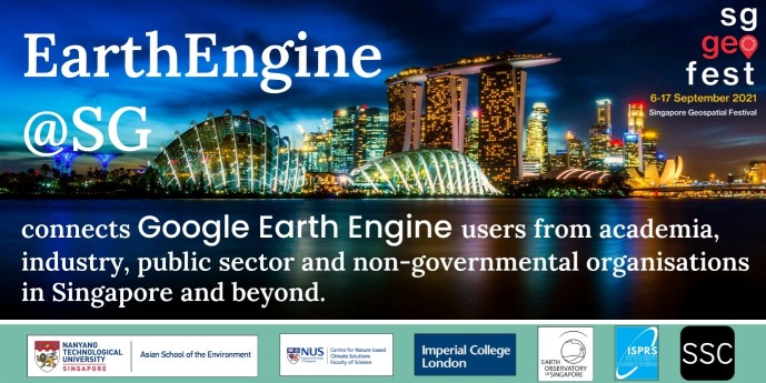
The Google Earth Engine Singapore (EarthEngine@SG) is a virtual meetup that took place on 13th September 2021, as part of the Singapore Geospatial Festival 2021. Lead by the Nangyang Technological University Singapore – Asian School of the Environment, the ISPRS Student Consortium (ISPRS SC) is one of the organizers of the event, together with National University of Singapore – Centre for Nature-Based Climate Solutions, Imperial College London, Earth Observatory of Singapore and Sabrina Szeto Consulting.
Google Earth Engine (GEE) is a powerful cloud-based platform used to process remotely sensed satellite imagery and conduct large-scale land cover mapping on-the-fly. The applications of GEE are numerous and cover a range of topics such as urban expansion, deforestation, and mapping of hazards, just to name a few. This workshop gathered GEE users from academia, industry, as well as the public sector and non-government organisations for a one-day event comprised of a with a keynote presentation, parallel sessions on the various applications of GEE, a virtual networking session, and workshops offered for beginners to advanced users.
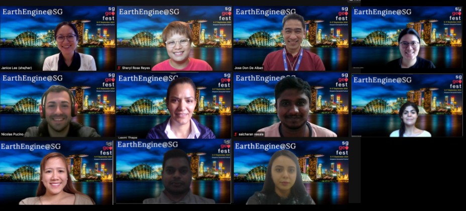
The keynote presentation was delivered by Dr. Nicholas Clinton, Developer Advocate at Google, who gave an overview of the current and future capabilities of the GEE. After a short break, the audience participated in their selected parallel session and specific topic of interest. Keiko Nomura, Director of Product Development at Climate Engine, gave a lecture entitled, “Fate of forests at your fingertips”. Nicholas Murray, Senior Research Fellow at James Cook University talked about “Losses and gains of Earth’s intertidal ecosystems”. Jakrapong Tawala, Satellite Analyst at the United Nations Satellite Centre, talked about “GEE for the United Nations humanitarian assistance missions”, while Mong Suan Yee, Director of Engineering at Kumi Analytics, provided a lecture on “Machine Learning with Google Earth Engine”.
A virtual networking session followed, which engaged the participants in discussions on the various applications of GEE as well as their visions for its future as one of the many users of this platform. The afternoon was reserved for three different workshops where the audience was guided by the experts in GEE to work on practical. Minerva Singh, Research Fellow at Imperial College London, provided an introduction to GEE for beginners, Keiko Nomura presented tips and tricks for the intermediate audience, while Yvonne Fong,Data Scientist at EO Data Science,provided an intermediate to advanced level overview of the Google Earth Engine Apps.
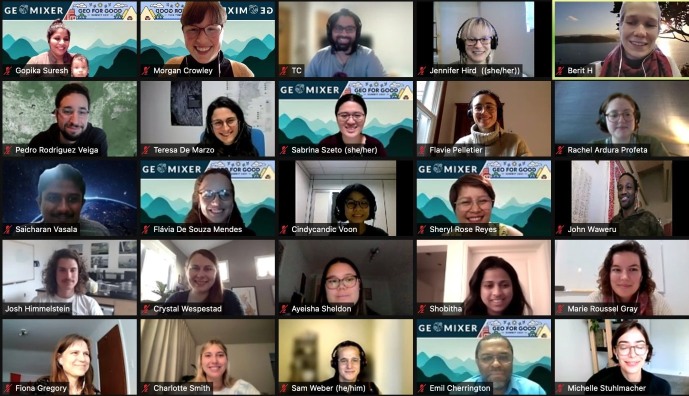
Overall, the event was a huge success! Thanks to the incredible collaboration among all the organizers, under the leadership of Janice Lee (Nanyang Technological University) – Jose Don De Alban (National University of Singapore), Sabrina Szeto (Sabrina Szeto Consulting), Sheryl Rose Reyes (ISPRS SC) and Minerva Singh (Imperial College London) as well as the amazing technical support provided by the ISPRS SC board members, Charmaine Cruz and Sona Guliyeva, and the Leadership and Service Mentorship Programme mentees, Nicolas Pucino, Laxmi Thapa, Saicharan Vasala and Sunni Kanta Prasad Kushwaha.
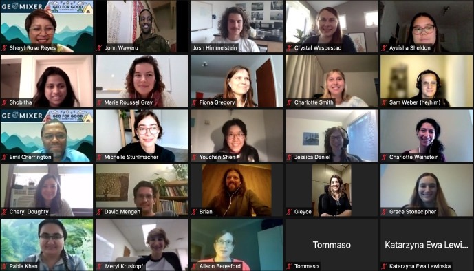
The GeoMixer format for connecting and direct networking allows for creating totally new and random connections that you may not have otherwise crossed paths with at a virtual or in-person event. It can be an opportunity for friendly banter, a source of inspiration for future collaborations, a way to connect with a former colleague and share experiences, or a place to share Google Maps or Earth Engine tips or tricks! Who you connect with in your break-out room is up to randomization, which makes this event excitingly unpredictable and unique!
This meet-up was organized with members from Ladies of Landsat, Sisters of SAR, ISPRS SC, Women in Geospatial+, AARS, and SERVIR as one of the virtual meetups in this year’s Geo for Good Summit hosted by Google.
This was a wonderful opportunity to meet members of the remote sensing and geospatial communities who have been using Google Earth Engine in their daily work and research. This meetup was exclusive to all the Geo for Good participants and discussions focused on the applications of Google Earth Engine, with some participants seeking or providing advice to other users. It was also a great time to meet up with folks from North America.
This coming June 6 –11, 2020, the XXIVth ISPRS Congress will be held in Nice, France. After two virtual editions of the ISPRS Congress, the event will be organized again in person and is expected to host thousands of participants including leading specialists and technologists, engineers, researchers and students in the field of photogrammetry, remote sensing, and spatial information sciences coming from universities, research foundations, space agencies, mapping and cadaster agencies, public organizations and private companies, and end-users. The ISPRS Congress will be hosting Youth Forum, which includes technical sessions dedicated for the youth. The Youth Forum will host a series of events led by the ISPRS Student Consortium (ISPRS SC), including a summer school, technical sessions, social events and special sessions.
The technical sessions dedicated for the youth will be organized and papers submitted to the Youth Forum will undergo the regular ISPRS reviewing process. We would like to invite all students, young professionals and researchers to submit your abstracts and full papers to the Youth Forum. Deadline is on January 10, 2022!
Society News
Reminder: Call for Paper - XXIV ISPRS Congress 2022
You are invited to submit your research to the XXIV ISPRS Congress 2022 by January 10, 2022.
Accepted publications will be presented during the Congress through orals, spotlight talks, and posters, and will be published in ISPRS Annals or Archives (listed in CPCI of Web of Sciences, Scopus, E/I Compendex and DOAJ).
In anticipation of potential travel restrictions for some parts of the world in June, we introduce a new registration category for participants with a paper accepted for publication and wishing to give their presentation remotely, which includes a 50% reduction of registration fees. Please be aware that remote participants will not benefit from all on-site features. It will be possible at any time to upgrade such registration to in-person attendance if traveling restrictions are waived or if a participant finally decides to join the XXIV Congress in person. We hope that the situation will improve and that we all will be able to meet in person in Nice for a successful and friendly Congress. All updated news can be found on our Congress website (www.isprs2022-nice.com).
Toronto to Bid to Host the XXV ISPRS Congress in 2026
The Canadian Remote Sensing Society – Société Canadienne de Télédétection (CRSS-SCT) will submit a bid to host the XXV ISPRS Congress in Toronto, Canada in July 2026. Please visit https://crss-sct.ca/isprs-congress-bid/ to learn more and to read our first newsletter.
More information will follow in the coming months!
A first Geospatial Week in Africa?
Following the postponement of the Geospatial Week (GSW) due to the pandemic in 2021, the Mohamad Bin Rashid Space Center, Dubai, UAE, has informed ISPRS that organising the GSW in 2023 instead of 2021 would unfortunately not be possible (see ISPRS news from June 3, 2021). Nevertheless, ISPRS believes that it is a good idea to have this meeting in the Arab States which is one of the fastest growing areas with a great interest in photogrammetry, remote sensing and spatial information sciences. After several discussions with various parties, the idea emerged to organise the Geospatial Week in Egypt in autumn 2023. Initial feedback has been encouraging, as such arrangement is not only feasible but having a Geospatial Week in Africa for the first time is extremely attractive and welcome.
While under normal circumstances the GSW host is elected at the previous meeting by the working group officers (see Orange Book for details), currently this is impossible as the GSW 2021 had to be cancelled. As a result, Council, while supporting the idea of having GSW 2023 in Egypt, wants to consult with the community to see if additional interests exist. If so, please contact the Secretary General Lena Halounová at isprs-sg@isprs.org before January 31, 2022.
ISPRS announces 2022 Educational and Capacity Building Initiatives Projects
In accordance with the statutory mission and activities of ISPRS, the Society shall provide funds to support educational and capacity building initiatives, which will further improve its international status in education and training in the field of the photogrammetry, remote sensing and spatial information sciences, and will therefore benefit all ISPRS members. For 2022, four Educational and Capacity Building Initiatives projects were selected and approved by the Council for funding.
Project Title
PIs
TC
A Challenge-based Learning Framework Design and Practice for UAV Photogrammetry (CBL4UAV)
Farzaneh Dadrass Javan, Francesco Nex (Netherlands)
I & II
Capacity Building for GIS-based SDG Indicator Analysis with Global High-resolution Land Cover Datasets
Daniele Oxoli (Italy), Sheryl Rose Reyes (Philippines), Shu Peng (China)
IV, I & III
Collaborative Analysis of Flooding Events with processing of Earth observation datasets
Nusret Demir (Turkey)
V
InterACT - Multimedia supporting materials for smart educational approaches in Geosciences: 360° interactive and enriched videos
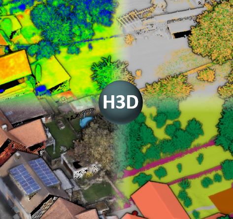
Multiple-Epochs for ISPRS Benchmark on Semantic Segmentation of High-Resolution 3D Points and Meshes now available.
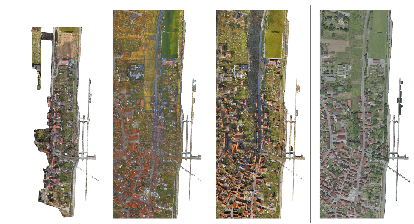
The ISPRS scientific initiative Hessigheim 3D (H3D) on semantic segmentation provides benchmark data in terms of labeled laser scanning point clouds and 3D textured meshes. Our first release earlier this year already provided a UAV data set captured at the village of Hessigheim (Germany). Now additional epochs of that configuration are available. Thus, multi-temporal analyses are feasible.
The point cloud features a mean point density of about 800 pts/m² and the oblique imagery used for colorization and 3D mesh texturing realizes a ground sampling distance of about 2-3 cm. This enables the identification of fine-grained structures and represents the state of the art in UAV-based mapping. The respective point clouds are manually labeled into 11 classes and are additionally used to derive labeled textured 3D meshes as an alternative representation.
While our first release provided a data set captured in March 2018, now additional epochs captured with the same high-resolution sensor configuration in November 2018 and March 2019 are available at our benchmark homepage https://ifpwww.ifp.uni-stuttgart.de/benchmark/hessigheim/default.aspx . As fourth epoch, a LiDAR data set captured from a manned aircraft at lower resolution in March 2016 is added, which incorporates typical characteristics of NMA data sets.
Interested researchers can use these state-of-the-art data sets to test their methods and algorithms on semantic segmentation of 3D point clouds and 3D meshes for geospatial applications. Detailed information on the data, the participation and the submission of results for the H3D benchmark is also available in the accompanying paper https://www.sciencedirect.com/science/article/pii/S2667393221000016?via%3Dihub .
Changes in Technical Commission IV - Spatial Information Science
Regretfully, Prof. Dr. Suzana Dragicevic is unable to continue in her role as a Vice President of TC IV until the ISPRS Congress in Nice, 2022.
It is our pleasure to announce that Dr. George Sithole, of Cape Town, South Africa, will continue as Vice President of the commission and Dr. Jack Barton, Sydney, Australia, will be the new Commission Secretary. We welcome the new Commission Officers and look forward to working with them.
On behalf of the ISPRS community, we thank Prof. Dragicevic, who has served as Vice-President since 2012, for her long service to ISPRS. We look forward to seeing her at the ISPRS Congress next year and hope to continue collaborations in the future.
Sisi Zlatanova
TC IV President
MDPI Awards and Travel Grants announced for 2021 and 2022
MDPI, publisher of the ISPRS International Journal for Geo-Information, has announced a number of awards and travel grants for 2021 and 2022.
The two awards offered provide financial support for the winners to attend an international conference in the field of IJGI to be held in 2022, in order to hold a presentation, present a poster, or both.
Application deadline: 31 December 2021
MDPI AG and ESRI have agreed to jointly present “The Jack Dangermond Award” to encourage and stimulate the submission of high-quality scientific papers by individual authors or groups to the Journal, to promote and advertise the Journal, and to honour the outstanding contributions of Jack Dangermond to research and development in Geospatial Sciences.
To reward those authors who have published important research results in IJGI, MDPI has announced the IJGI 2021–2022 Best Cover Awards, to be selected from the 24 cover stories received in 2021 and 2022.
On behalf of the editor-in-chief, Prof. Dr. Wolfgang Kainz, MDPI wishes to acknowledge the reviewers who so generously give their time to review the papers submitted to IJGI by presenting awards to the those who have demonstrated their dedication, professionalism, and timeliness in reviewing manuscripts for IJGI. All of the reviewers for IJGI in 2021 will be automatically included.
Speakers: Emmanuel Stefanakis; Perry Peterson; Erin Li, Marta Padilla Ruiz; David Bowater
Department of Geomatics Engineering, University of Calgary, Canada
Moderator: Prof Emmanuel Stefanakis (University of Calgary)
Short description:
Discrete Global Grid Systems (DGGS) are increasingly being adopted for modelling, analysis, and visualization of geospatial data. DGGS have been identified as the backbone of modern Digital Earth frameworks as they “improve the way information is referenced to the earth.” This webinar will provide an overview of the DGGS concepts, DGGS initiatives in Canada, and the research directions and outcomes of our group at the University of Calgary.
General Announcements
ISC is pleased to announce that after many months of campaigning, the Science Commission at UNESCO has unanimously passed the Recommendation on Open Science at its 41st session. It will now go to the full plenary of Member States for endorsement. We thank all our Members for their involvement in this journey.
Announcements of Scientific Meetings
(see also
ISPRS Calendar)
Geo Week
6-8 February 2022
Denver, Colorado
Carving out time and money for professional education and meaningful networking can be challenging, but if that investment results in increased efficiency, better collaboration, safer operations, and valuable connections, you would probably say,
“Tell me more!”
At Geo Week, February 6-8, 2022, in Denver, CO, you can expect:
Practical, actionable education presented by industry experts, including vertically-focused content for professionals working in AEC, 3D technology, and geospatial/lidar.
A glimpse into the future of geospatial and built world technology and applications with keynotes by leaders from Draper, Microsoft, USGS, Planet, EndeavorXR, and NASA.
Insights and best practices from 125+ speakers across 50 sessions, with content that explores best practices in 3D capture, working in the built environment, gaining ROI from BIM, defining what’s possible now with lidar, and more.
Extensive educational programming hosted by ASPRS, The Imaging and Geospatial Information Society, and USIBD, the U.S. Institute of Building Documentation, that can be stand-alone registration options or added to your Geo Week pass.
A vendor-neutral show floor, featuring 100+ exhibitors, where you’ll find the latest and greatest geospatial and built world solutions under one roof. Whether you are seeking commercial applications of 3D technologies, exploring innovations in the built environment, viewing advanced airborne and terrestrial remote sensing solutions, or looking ahead to the future of the industry, you'll find it here.
Connecting with peers and industry thought-leaders from top organizations and government agencies. See who you could meet.
Use code SAVE100 for $100 off a conference pass or a FREE Exhibit Hall Pass.
Geosensing Systems Engineering Seeks Faculty for Assistant Professor
Department of Civil and Environmental Engineering (CEE), University of Houston, USA
5-Nov-2021
Assistant or Associate Professor Position in Environmental Artificial Intelligence
Department of Geography, University of Georgia, Athens, GA, USA
Deadline: 31-Dec-2021
17-Nov-2021
Researcher (PostDoc) in Ethical Artificial Intelligence for Unmanned Aerial Vehicles
Faculty of Geo-Information Science and Earth Observation, University of Twente, Enschede, the Netherlands
Deadline: 9-Jan-2022
17-Nov-2021
Researcher (PostDoc) Regulatory Design of Data Protection in Humanitarian Practice
Faculty of Geo-Information Science and Earth Observation, University of Twente, Enschede, the Netherlands
Deadline: 19-Dec-2021
24-Nov-2021
10x 4-year fully-funded MRes + PhD studentships
UKRI Centre for Doctoral Training in Geospatial Systems, Newcastle University and the University of Nottingham, UK
Deadline: 30-Jan-2022
8-Dec-2021
Assistant Professor in »Remote Sensing Applications« at Technical University of Munich
TUM School of Engineering and Design, Department of Aerospace and Geodesy
Deadline: 31-Jan-2022
8-Dec-2021
Professor in »Photogrammetry and Remote Sensing« at Technical University of Munich
TUM School of Engineering and Design, Department of Aerospace and Geodesy
Deadline: 31-Jan-2022
13-Dec-2021
A Tenure Track position for a Researcher in the field of 3D Optical Metrology at Digital Industry Center
Digital Industry Center, Fondazione Bruno Kessler, Povo, Trento, Italy
Deadline: 21-Dec-2021