ISPRS e-Bulletin
Issue No 3 - 2022

Editorial


Nicolas Paparoditis Nicolas Paparoditis

Congress

Dear Colleagues and friends,

The XXIV Congress is now over after a 6-year long preparation !

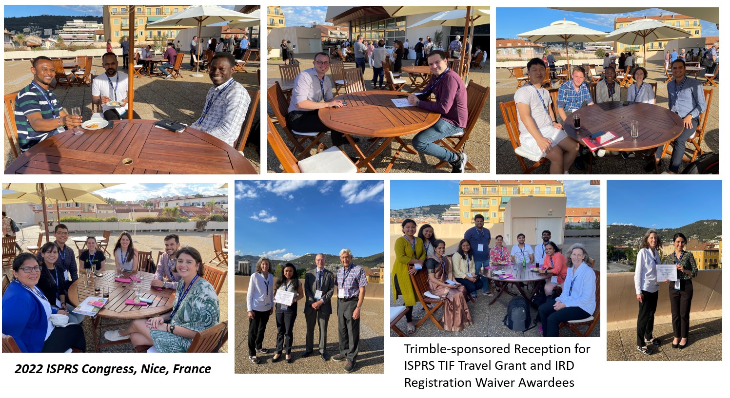
As you may know or have experienced, the 2022 ISPRS physical meeting in Nice was the third edition of the XXIV ISPRS Congress after the 2020 and 2021 digital events which were organised in place of the postponed physical meeting. Indeed, we have done everything possible to ensure scientific continuity during the pandemic, enabling our researchers and especially our PhD and master students to disseminate new knowledge, and get some feedback from discussions with experienced colleagues. To encourage this continuity, we have kept each registration alive for the 3 editions, thus one single registration giving access to up to 3 editions. We also wanted this event to be inclusive. Indeed, we have offered very early bird rates and quite a number of fee waivers to allow many colleagues and especially young colleagues across the world to attend the Congress.

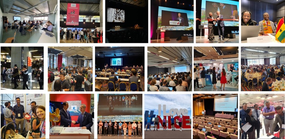
For many of us, this Nice meeting was the first large geospatial physical event since the beginning of the pandemic. We thoroughly enjoyed networking again and meeting our colleagues from all over the world, although many colleagues could not join because of their national travelling policies.

The Nice meeting had a rich programme with, of course, science at the centre, but not just limited to science. Indeed, one of ISPRS’ main missions, beyond extending the frontier of knowledge, is to address both science and technology together, and to keep a strong link between academia, agencies and industry. Besides the scientific tracks and sessions of the five ISPRS commissions and the plenary sessions, featuring the keynote and the award ceremonies, we also enjoyed the exhibition, allowing us to meet our colleagues from Industry, a new technology track, allowing our sponsors to present their latest technologies, and also a very exciting forum track with ten half-day sessions over the 6 days of the Congress, where hot topics were discussed to better enable our community to respond to the challenges that our world is currently facing.

Now some quick numbers on this Congress : 3 editions, one General Assembly in the 2022 edition with 29 Ordinary members represented in person and around 25 participants remotely, 2700+ participants, 3400+ submitted contributions from over 80 countries, 16 keynote speakers from all the continents, 7000+ reviews performed, 1800+ oral or poster presentations and 2263 papers published in the Annals and Archives which are reference by Web of Science, Scopus and EI. I would like to warmly acknowledge the program chairs (Clément Mallet, Florent Lafarge, Ewelina Rupnik, Loïc Landrieu and Sander Oude Elberink), the ISPRS Commissions Presidents and officers, and all the reviewers who have done a tremendous job.

Throughout these 3 editions, we have experienced a new media complementary to the papers: the 10-minute pre-recorded videos, which were made open access on the ISPRS media library after the Congress. For the 3 editions, we have collected over 1500 videos. I believe they are going to be very useful and valuable for researchers to have a quick overview of the paper content but also for educational purposes. A survey carried out in 2021, with nearly 500 responses, already showed that they were much appreciated by our community.

With the experience we have now acquired, one question remains on the future shape and flavour of our large ISPRS events. Hybrid or not hybrid, that is the question. These large events are already very complex to organize. The additional complexity and costs of a hybrid format lead to real organizational challenges and a necessary change of economic model. Again, ISPRS is all about networking and sharing, and we believe that this can best be done in a physical meeting. In any case, finding the good settings for our future events will be a challenge that the future ISPRS Council will have to tackle with future event organisers and with the consent of the community.

At last, I would like to warmly acknowledge our institutional sponsors IGN, CNES, IRD, CNRS, INRIA and OGE, and the Order of French chartered surveyors, who have all been very supportive, but also and above all, our industry sponsors AIRBUS, Thales Alenia Space, esri, HEXAGON, MOMRA, Aerometrex, Agisoft, Piesat, PIX4D, RACURS, RIEGL, Trimble, VEXCEL and YellowScan, for their fidelity to ISPRS and to this XXIV Congress throughout these three editions.

All our wishes and encouragement now go to Derek Lichti, the new Congress Director, to the Canadian Remote Sensing Society, and to our Canadian colleagues and friends who will organise, we are sure, a very successful XXV Congress in Toronto in 2026.

Long live photogrammetry, remote sensing, and spatial information sciences!


Nicolas Paparoditis
Vice-President, ISPRS
Congress Director XXIV ISPRS Congress

Nice

Lena Halounova Lena Halounova

Greetings from the President

by Lena Halounová

Dear colleagues, friends and those of you I have not yet met,

It is just a few weeks ago that my function as President in the ISPRS Council was approved by the General Assembly in Nice.

To be a good manager, be it of a family, a department, or any type of organisation, means to listen to their members, try to understand the problem at hand, and follow up with a discussion within the decisive body. In the case of ISPRS, it is the General Assembly, which is usually represented by Council between Congresses, and is guided by the Statutes and Bylaws.

Council’s actions between Congresses are sometimes less transparent than some may like, and four years is a long time in which many decisions are made, not all of them must be good.

I would like to improve what can be improved and therefore, as nobody is perfect, ask you, ISPRS members and friends, for comments, recommendations and advice to help Council to continue its successful work of the past.

These past six years were not easy; on the other side, they were also good training on how to react in unexpected situations. Let us hope we will not have to face them again.

Introducing ISPRS for the Term 2022-2026


ISPRS logo ISPRS logo

ISPRS Technical Commissions 2022-26

Technical Commission I
isprs-pr-c1@isprs.org
President TANG Xinming China
Vice President Antonio Maria Garcia Tommaselli Brasil
Secretary ZHANG Tao China
 
Technical Commission II
isprs-pr-c2@isprs.org
President Alper Yilmaz USA
Vice President Jan Dirk Wegner Switzerland
Secretary Rongjun Qin USA
 
Technical Commission III
isprs-pr-c3@isprs.org
President Laurent Polidori France
Vice President Alessandra Gomes Brazil
Secretary Jean-Francois Faure France
 
Technical Commission IV
isprs-pr-c4@isprs.org
President Sisi Zlatanova Australia
Vice President Maria Antonia Brovelli Italy
Secretary Hao Wu China
 
Technical Commission V
isprs-pr-c5@isprs.org
President Gay Jane Perez Philippines
Vice President Josefino Comiso USA
Secretary Ayin Tamondong Philippines
 

ISPRS XXV Congress logo ISPRS XXV Congress logo

ISPRS XXV Congress 2026 Toronto Canada

Toronto, Canada, will host the XXV ISPRS Congress in 2026! At the XXIV Congress in Nice, France, the ISPRS General Assembly elected Canada to host the Congress and Derek Lichti was elected as Congress Director.

The 2026 Congress will take place at the Metro Toronto Convention Centre (MTCC) 4-11 July 2026.  Toronto is a vibrant, multicultural city that is very well connected to international destinations and is easy to get around thanks to its extensive transit system. This and many other reasons make it an excellent location to host the quadrennial ISPRS event.

The Congress will make a long-awaited return to the Americas. The last Congress held in Canada was in Ottawa in 1972, when our society was known as the International Society for Photogrammetry (ISP). The last time it took place in the Americas was in 1992.

We look forward to welcoming you to Toronto in 2026!


ISPRS Awards 2020-2022


Awards Awards

by Christian Heipke

During the XXIV ISPRS Congress recently held in Nice, the society presented a number of prestigious awards to its most deserving members. Some of these awards had already been announced in early 2020, and some awardees had received a recognition during the 2021 virtual edition of the Congress, but it was only during the in-person meeting this June that most recipients could be honoured appropriately. Sadly, our friends from China, as well as some other individuals, could not travel to Nice this summer and will receive the awards in person at the next possible occasion.

As generally acknowledged, the Brock Gold Medal and the Honorary Membership are the most important awards offered by ISPRS. They were presented in the opening session on June 6. The other awardees were recognized either in the plenary sessions, the gala dinner, the closing ceremony or at other occasions such as the special session of the Best Young Authors on Tuesday, June 7.

In the following, the awardees of the XXIV Congress are introduced. A more detailed description, incl. the list of best reviewers per commission, can be found in the 2022 Awards Booklet, see www.isprs.org/society/awards.aspx. This web site also contains background information on the ISPRS awards.

Read more here…

Society News


ISPRS Journal ISPRS Journal

New Impact Factor of the ISPRS Journal of Photogrammetry and Remote Sensing.

The huge efforts of the ISPRS Editors-in-Chief, the associate editors, many reviewers, and the authors of papers published in the ISPRS Journal of Photogrammetry and Remote Sensing were so successful that the journal has now reached an Impact Factor of 11.774.


ISPRS International Journal of Geo-Information — Open Access Journal ISPRS International Journal of Geo-Information — Open Access Journal

Impact Factor for ISPRS International Journal of Geo-Information exceeds 3 for the first time

We are pleased to inform you that the latest Impact Factor for ISPRS International Journal of Geo-Information is 3.099, which exceeds 3 for the first time. The CiteScore has also been increased from 4.6 to 5.0.

• Journal Impact Factor (2021): 3.099;
• 5-Year Impact Factor (2021): 3.165;
• CiteScore (2021): 5.0;
• Ranking in Q1 (97/747) in the category 'Geography, Planning and Development', Scopus;
• Ranking in Q1 (26/128) in the category 'Earth and Planetary Sciences (miscellaneous)', Scopus;
• Ranking in Q1 (17/61) in the category 'Computers in Earth Sciences’, Scopus;
• Ranking in Q2 (23/48) in the category 'Geography, Physical', Web of Science;
• Ranking in Q3 (22/34) in the category 'Remote Sensing', Web of Science.
• Ranking in Q3 (88/164) in the category 'Computer Science, Information System', Web of Science;


Christian Heipke and Alessandro Annoni Christian Heipke and Alessandro Annoni

ISDE and ISPRS signed MoU

During the Nice Congress, ISPRS then President, Christian Heipke, and Alessandro Annoni, ISDE President signed a Memorandum of Understanding (MoU) between ISPRS and the International Society for Digital Earth, to further develop cooperation in the areas of Digital Earth, photogrammetry, remote sensing, spatial information, data science and other activities that they deem mutually beneficial.

See MoU here…

All MoUs can be viewed at https://www.isprs.org/society/interorganization.aspx


The ISPRS Foundation (TIF) News


The ISPRS Foundation The ISPRS Foundation

The ISPRS Foundation, National Research Institute for Sustainable Development (IRD, France) and White Elephant Travel Grants for the Nice Congress

by Marguerite Madden

The ISPRS Foundation (TIF) awarded a total of 65 Grants to partially support travel expenses of stu-dents, young professionals and geospatial practitioners from 27 countries to attend the 24th ISPRS Congress in Nice, France on 6-11 June 2022. Included in these grants were registration waivers for 38 awardees by the National Research Institute for Sustainable Development (IRD, France).

Travel grants totaled 37,100 USD and registration waivers totaled 17,850 EUR. Three White Elephant Travel Grants of $1,250 each, honoring Professor Kennert Torlegard, were awarded to Ahmad Elalailyi, for his paper entitled, “Portable Multi-camera System: From fast tunnel mapping to semiautomatic space decomposition and cross-section extraction”, Nina Homainejad, for her paper entitled, “A voxel-based method for the three-dimensional modelling of heathland from Lidar point clouds: First results” and Hariniaina Ramiaramanana for her paper entitled, “A cognitive approach for landsystem identification using a graph database – Towards the identification of landforms in context.”

A reception for the travel grant and registration waiver recipients was generously sponsored by Trimble during the Congress. TIF greatly appreciates the efforts of Ron Bisio, TIF Trustee and Senior Vice President of Trimble Geospatial, for providing this Trimble sponsorship. Many of the recipients, TIF donors, TIF officers, ISPRS Council, Congress organizers and Trimble representative, Dr. Mohsen Miri, Senior Product Manager of Trimble Geospatial, gathered for refreshments in the open-air Congress Terrasse of the Acropolis Convention Center. Dr. Miri attended his first ISPRS Congress in 2004 in Istanbul after he finished his BSc and before he began work on his MSc. He wanted to meet the professionals from the scientific articles he was reading, but had no grant to travel to Istanbul since he was early in his studies and had no paper to submit. He and 20 other students decided to make this trip, overcame bureaucratic complications to obtain visas and traveled about 40 hours by bus to attend the Istanbul Congress. He noted, “Believe it or not, the students from that trip are now managers worldwide in different companies, professionals in institutes like NASA, and professors at universities.” He added, “Yesterday on the terrace, as the students came to me and thanked Trimble for the sponsorship, I could understand with every singe cell how difficult it was for them to pass bureaucracy, get a visa, (etc.), and how important it was to get these sponsorships, but at the same time, I was proud of seeing the future professionals in front of me.”

TIF Receiption

Nice Logo Nice Logo

TIF Grant Recipient Reports

Read the following reports from recipients of grants, enabling them to attend the XXIV Congress in Nice.

  1. ISPRS Congress 2022
    by Letícia Ferrari Castanheiro
  2. TIF Travel Grant Report
    by Irene Cortesi
  3. TIF Travel Grant Report
    by Hongjie He
  4. ISPRS Nice Congress Report 2022
    by Madan Mohan
  5. ISPRS Travel Grant Receiver Report
    by Eugenio Pellis
  6. XXIV ISPRS Congress 2022 – Nice, France
    by Letícia Rosim Porto
  7. Travel Grants Report
    by Ana Toro
  8. ISPRS Congress Report
    by João Paulo Sampaio Werner

Student Consortium News


Student Consortium logo Student Consortium logo

ISPRS Student Consortium Report on the ISPRS Congress 2022

ISPRS SC had the honor to participate and be involved in various activities during the ISPRS Congress 2022. ISPRS SC organized a forum on “Women in Remote Sensing, Photogrammetry and Spatial Information Science'' together with ISPRS and the Ladies of Landsat, on Monday, June 7. The event was conducted in two parts: the first part consisted of virtual lightning talks, having speakers from 9 different professional organizations- She Maps Australia, IEEE GRSS IDEA, Women+ in Geospatial, African Women in GIS, Women in GIS Kenya, Sisters of SAR, Geoladies PH, Women in Copernicus and Ladies of Landsat, and the second part was a panel discussion about the experiences that the women gained during their education and professional life. The event was well perceived, and more detailed coverage will be available during the next volume of ISPRS SC Newsletter “SPECTRUM”.  ISPRS SC also hosted the Youth Forum track on Friday, June 11, where four interesting papers on topics such as point cloud processing, segmentation driven stereo matching and BIM were presented. ISPRS SC also provided technical support during the ISPRS General Assembly.

Read more here…

Announcements of Scientific Meetings                (see also ISPRS Calendar)


BUCEA 2022 BUCEA 2022

Summer School on Resilient City - BUCEA (2022)

Virtual Event, Free Registration
25-29 July 2022

For more information see the website


SUNRISE Summer School SUNRISE Summer School

SUNRISE Summer School- Seashore and Underwater Documentation of Archaeological Heritage Palimpsests and Environment

3-9 September 2022
Ragusa, Sicily – Italy

For more information see https://www.sunrisesummerschool.com/


Gi4DM 2022 Gi4DM 2022

The Gi4DM 2022 & Urban Geoinformatics 2022

1-4 November 2022
Beijing, China

The event is organized by ISPRS Technical Commission III and IV. It is consisted by 2 sub-events. One is the ISPRS Workshop on Geo-Information for Disaster Management (Gi4DM 2022). The other is the ISPRS High-level Forum on Urban Geoinformatics (Urban Geo-informatics 2022). The aims of the events are to provide an inter-disciplinary platform for scientists, researchers and practitioners in the field, to present the latest developments and applications, discuss cutting-edge technologies, exchange research ideas, and promote international collaboration.

For details visit https://www.gi4dm.net/2022/


GSW 2023 GSW 2023

GeoSpatial Week 2023

The next Geospatial Week will be held in Cairo, Egypt. For the first time, the event will take place in Africa and the Middle East from 2-7 September 2023.

Read more here…

Event Reports


CATCON 2022 CATCON 2022

CATCON 2022 Contest at Congress

Read the report by CATCON President, Anjana Vyas here…

ISPRS International Journal of Geo-Information — Open Access Journal


ISPRS International Journal of Geo-Information — Open Access Journal ISPRS International Journal of Geo-Information — Open Access Journal

New publications
Volume 11, Issue 05 (May 2022)

Landslide Susceptibility Assessment Considering Spatial Agglomeration and Dispersion Characteristics: A Case Study of Bijie City in Guizhou Province, China
Yao, Kezhen, Yang, Saini, Wu, Shengnan, Tong, Bin
No: 269

A Trade-Off Algorithm for Solving p-Center Problems with a Graph Convolutional Network
Liang, Haojian, Wang, Shaohua, Li, Huilai, Ye, Huichun, Zhong, Yang
No: 270

WaterSmart-GIS: A Web Application of a Data Assimilation Model to Support Irrigation Research and Decision Making
Zhao, Haoteng, Di, Liping, Sun, Ziheng
No: 271

Investigating Relationships between Runoff–Erosion Processes and Land Use and Land Cover Using Remote Sensing Multiple Gridded Datasets
Fonseca, Cláudia Adriana Bueno da, Al-Ansari, Nadhir, Silva, Richarde Marques da, Santos, Celso Augusto Guimarães, Zerouali, Bilel, Oliveira, Daniel Bezerra de, Elbeltagi, Ahmed
No: 272

An Empirical Study on the Effects of Temporal Trends in Spatial Patterns on Animated Choropleth Maps
Cybulski, Paweł
No: 273

Managing Inhomogeneity in the Control Point Network during Staking Out Cadastral Boundaries in Austria
Weber, Valentin, Navratil, Gerhard, Blauensteiner, Franz
No: 274

Developing Relative Spatial Poverty Index Using Integrated Remote Sensing and Geospatial Big Data Approach: A Case Study of East Java, Indonesia
Putri, Salwa Rizqina, Wijayanto, Arie Wahyu, Sakti, Anjar Dimara
No: 275

Spatial Variability and Clustering of Quality of Life at Local Level: A Geographical Analysis in Athens, Greece
Faka, Antigoni, Kalogeropoulos, Kleomenis, Maloutas, Thomas, Chalkias, Christos
No: 276

Deep Learning-Assisted Smart Process Planning, Robotic Wireless Sensor Networks, and Geospatial Big Data Management Algorithms in the Internet of Manufacturing Things
Lăzăroiu, George, Andronie, Mihai, Iatagan, Mariana, Geamănu, Marinela, Ștefănescu, Roxana, Dijmărescu, Irina
No: 277

Spatiotemporal Evolution of the Urban Thermal Environment Effect and Its Influencing Factors: A Case Study of Beijing, China
Ren, Ziqi, Li, Zhe, Wu, Feng, Ma, Huiqiang, Xu, Zhanjun, Jiang, Wei, Wang, Shaohua, Yang, Jun
No: 278

Geographic Approach: Identifying Relatively Stable Tibetan Dialect and Subdialect Area Boundaries
Duan, Mingyuan, Zhou, Shangyi
No: 280

Spatial Pattern of the Walkability Index, Walk Score and Walk Score Modification for Elderly
Horak, Jiri, Kukuliac, Pavel, Maresova, Petra, Orlikova, Lucie, Kolodziej, Ondrej
No: 279

Towards a Core Set of Landscape Metrics of Urban Land Use in Wuhan, China
Shao, Shiwei, Yu, Mengting, Huang, Yimin, Wang, Yiheng, Tian, Jing, Ren, Chang
No: 281

Assessing Street Space Quality Using Street View Imagery and Function-Driven Method: The Case of Xiamen, China
Wang, Moyang, He, Yijun, Meng, Huan, Zhang, Ye, Zhu, Bao, Mango, Joseph, Li, Xiang
No: 282

Identifying Multiple Scales of Spatial Heterogeneity in Housing Prices Based on Eigenvector Spatial Filtering Approaches
Peng, Zhan, Inoue, Ryo
No: 283

Development of Spatial Model for Food Security Prediction Using Remote Sensing Data in West Java, Indonesia
Virtriana, Riantini, Riqqi, Akhmad, Anggraini, Tania Septi, Fauzan, Kamal Nur, Ihsan, Kalingga Titon Nur, Mustika, Fatwa Cahya, Suwardhi, Deni, Harto, Agung Budi, Sakti, Anjar Dimara, Deliar, Albertus, Soeksmantono, Budhy, Wikantika, Ketut
No: 284

Evaluation of Urban Flood Resilience Enhancement Strategies—A Case Study in Jingdezhen City under 20-Year Return Period Precipitation Scenario
Zhang, Jingxuan, Wang, Huimin, Huang, Jing, Sun, Dianchen, Liu, Gaofeng
No: 285

GIScience and Historical Visual Sources: A Promising Look at Past Scenarios and Sceneries
Zohar, Motti
No: 286

A New Graph-Based Fractality Index to Characterize Complexity of Urban Form
Ma, Lei, Seipel, Stefan, Brandt, Sven Anders, Ma, Ding
No: 287

A Field Investigation on Gully Erosion and Implications for Changes in Sediment Delivery Processes in Some Tributaries of the Upper Yellow River in China
Yang, Hui, Shi, Changxing, Cao, Jiansheng
No: 288

Wildland Fires in the Czech Republic—Review of Data Spanning 20 Years
Špulák, Pavel
No: 289

GeoSDVA: A Semi-Supervised Dirichlet Variational Autoencoder Model for Transportation Mode Identification
Zhang, Xiaoxi, Gao, Yuan, Wang, Xin, Feng, Jun, Shi, Yan
No: 290

Mapping for Awareness of Indigenous Stories
Pyne, Stephanie, Castron, Melissa, Parish, Annita, Farrell, Peter, Johnston, Shawn
No: 292

Preservation of Villages in Central Italy: Geomatic Techniques’ Integration and GIS Strategies for the Post-Earthquake Assessment
Piccinini, Fabio, Gorreja, Alban, Di Stefano, Francesco, Pierdicca, Roberto, Sanchez Aparicio, Luis Javier, Malinverni, Eva Savina
No: 291

Predicting Poverty Using Geospatial Data in Thailand
Puttanapong, Nattapong, Martinez, Arturo, Bulan, Joseph Albert Nino, Addawe, Mildred, Durante, Ron Lester, Martillan, Marymell
No: 293

An Integrated Graph Model for Spatial–Temporal Urban Crime Prediction Based on Attention Mechanism
Hou, Miaomiao, Hu, Xiaofeng, Cai, Jitao, Han, Xinge, Yuan, Shuaiqi
No: 294

Modeling Health Seeking Behavior Based on Location-Based Service Data: A Case Study of Shenzhen, China
Hu, Wei, Li, Lin, Su, Mo
No: 295

Exploring the Evolution of the Accessibility of Educational Facilities and Its Influencing Factors in Mountainous Areas: A Case Study of the Rocky Desertification Area in Yunnan, Guangxi, and Guizhou
Yao, Lingling, Lv, Minjuan, Li, Tao, Wang, Donghua, Cao, Xiaoshu
No: 296

A New Urban Space Analysis Method Based on Space Syntax and Geographic Information System Using Multisource Data
Xing, Zhaolian, Guo, Weimin
No: 297

Revising Cadastral Data on Land Boundaries Using Deep Learning in Image-Based Mapping
Fetai, Bujar, Grigillo, Dejan, Lisec, Anka
No: 298

How Has the Recent Climate Change Affected the Spatiotemporal Variation of Reference Evapotranspiration in a Climate Transitional Zone of Eastern China?
Li, Meng, Chu, Ronghao, Sha, Xiuzhu, Islam, Abu Reza Md. Towfiqul, Jiang, Yuelin, Shen, Shuanghe
No: 300

Digital Soil Mapping of Soil Organic Matter with Deep Learning Algorithms
Zeng, Pengyuan, Song, Xuan, Yang, Huan, Wei, Ning, Du, Liping
No: 299

Spatio-Temporal Monitoring of Atmospheric Pollutants Using Earth Observation Sentinel 5P TROPOMI Data: Impact of Stubble Burning a Case Study
Maurya, Neeraj K., Pandey, Prem Chandra, Sarkar, Subhadip, Kumar, Rajesh, Srivastava, Prashant K.
No: 301

Geographical Determinants of Regional Retail Sales: Evidence from 12,500 Retail Shops in Qiannan County, China
Wang, Wei, Wang, Luyao, Wang, Xu, Wang, Yankun
No: 302

Quantifying Urban Expansion from the Perspective of Geographic Data: A Case Study of Guangzhou, China
Huang, Qingyao, Liu, Yihua, Chen, Chengjing
No: 303

Geo-Enabled Sustainable Municipal Energy Planning for Comprehensive Accessibility: A Case in the New Federal Context of Nepal
Dhonju, Hari Krishna, Uprety, Bikash, Xiao, Wen
No: 304

Continuous Monitoring of the Surface Water Area in the Yellow River Basin during 1986–2019 Using Available Landsat Imagery and the Google Earth Engine
Hu, Qingfeng, Li, Chongwei, Wang, Zhihui, Liu, Yang, Liu, Wenkai
No: 305

Deducing Flood Development Process Using Social Media: An Event-Based and Multi-Level Modeling Approach
Liu, Yang, Li, Rui, Wang, Shunli, Wu, Huayi, Gui, Zhipeng
No: 306

Space—Time Surveillance of COVID-19 Seasonal Clusters: A Case of Sweden
Aturinde, Augustus, Mansourian, Ali
No: 307

Geographic Complexity: Concepts, Theories, and Practices
Cheng, Changxiu, Cushman, Samuel A., Ho, Hung-Chak, Gao, Peichao
No: 308

Scientometric Analysis for Spatial Autocorrelation-Related Research from 1991 to 2021
Luo, Qing, Hu, Kai, Liu, Wenxuan, Wu, Huayi
No: 309

Analysis of Spatiotemporal Data Imputation Methods for Traffic Flow Data in Urban Networks
Joelianto, Endra, Fathurrahman, Muhammad Farhan, Sutarto, Herman Yoseph, Semanjski, Ivana, Putri, Adiyana, Gautama, Sidharta
No: 310

Few-Shot Building Footprint Shape Classification with Relation Network
Hu, Yaohui, Liu, Chun, Li, Zheng, Xu, Junkui, Han, Zhigang, Guo, Jianzhong
No: 311

Spatial Concept Query Based on Lattice-Tree
Xu, Aopeng, Zhang, Zhiyuan, Ma, Xiaqing, Zhang, Zixiang, Xu, Tao
No: 312

Sustainable Urban Land-Use Optimization Using GIS-Based Multicriteria Decision-Making (GIS-MCDM) Approach
Rahman, Md. Mostafizur, Szabó, György
No: 313

Applying Check-in Data and User Profiles to Identify Optimal Store Locations in a Road Network
Lin, Yen-Hsun, Chen, Yi-Chung, Chiu, Sheng-Min, Lee, Chiang, Wang, Fu-Cheng
No: 314

The Impact of Built Environment Factors on Elderly People’s Mobility Characteristics by Metro System Considering Spatial Heterogeneity
Yang, Hong, Ruan, Zehan, Li, Wenshu, Zhu, Huanjie, Zhao, Jie, Peng, Jiandong
No: 315

Development of a Conceptual Data Model for 3D Geospatial Road Management Based on LandInfra Standard: A Case Study of Korea
Buuveibaatar, Munkhbaatar, Lee, Kangjae, Lee, Wonhee
No: 316

An Improved Ant Colony Algorithm for Urban Bus Network Optimization Based on Existing Bus Routes
Wei, Yuanyuan, Jiang, Nan, Li, Ziwei, Zheng, Dongdong, Chen, Minjie, Zhang, Miaomiao
No: 317

Organizational Geosocial Network: A Graph Machine Learning Approach Integrating Geographic and Public Policy Information for Studying the Development of Social Organizations in China
Zhao, Xinjie, Wang, Shiyun, Wang, Hao
No: 318

Research on Three-Dimensional Electronic Navigation Chart Hybrid Spatial Index Structure Based on Quadtree and R-Tree
Zhang, Yunong, Zhang, Anmin, Gao, Miao, Liang, Yi
No: 319

County-Level Assessment of Vulnerability to COVID-19 in Alabama
Fall, Souleymane, Abdalla, Ehsan, Quansah, Joseph, Franklin, Meghan J., Whaley-Omidire, Timmera
No: 320


Volume 11, Issue 06 (June 2022)

Analysis of the Characteristics and Spatial Pattern of the Catering Industry in the Four Central Cities of the Yangtze River Delta
Wang, Weiwu, Wang, Shan, Chen, Huan, Liu, Lingjun, Fu, Tianle, Yang, Yuxin
No: 321

Efficient Calculation of Distance Transform on Discrete Global Grid Systems
Kazemi, Meysam, Wecker, Lakin, Samavati, Faramarz
No: 322

Long- and Short-Term Preference Modeling Based on Multi-Level Attention for Next POI Recommendation
Wang, Xueying, Liu, Yanheng, Zhou, Xu, Leng, Zhaoqi, Wang, Xican
No: 323

Landslide Susceptibility Mapping Using Machine Learning: A Danish Case Study
Ageenko, Angelina, Hansen, Lærke Christina, Lyng, Kevin Lundholm, Bodum, Lars, Arsanjani, Jamal Jokar
No: 324

Exploring the Impact of Built Environment Attributes on Social Followings Using Social Media Data and Deep Learning
Tang, Yiwen, Zhang, Jiaxin, Liu, Runjiao, Li, Yunqin
No: 325

Extracting the Urban Landscape Features of the Historic District from Street View Images Based on Deep Learning: A Case Study in the Beijing Core Area
Yin, Siming, Guo, Xian, Jiang, Jie
No: 326

Improving LST Downscaling Quality on Regional and Field-Scale by Parameterizing the DisTrad Method
Ibrahim, Taha I. M., Al-Maliki, Sadiq, Salameh, Omar, Waltner, István, Vekerdy, Zoltán
No: 327

Landscape Ecological Risk and Ecological Security Pattern Construction in World Natural Heritage Sites: A Case Study of Bayinbuluke, Xinjiang, China
Chen, Xiaodong, Yang, Zhaoping, Wang, Tian, Han, Fang
No: 328

Pathwalker: A New Individual-Based Movement Model for Conservation Science and Connectivity Modelling
Unnithan Kumar, Siddharth, Kaszta, Żaneta, Cushman, Samuel A.
No: 329

Urban Air Quality Assessment by Fusing Spatial and Temporal Data from Multiple Study Sources Using Refined Estimation Methods
Chen, Lirong, Wang, Junyi, Wang, Hui, Jin, Tiancheng
No: 330

A Multi-Scale Residential Areas Matching Method Considering Spatial Neighborhood Features
Ma, Jingzhen, Sun, Qun, Zhou, Zhao, Wen, Bowei, Li, Shaomei
No: 331

Recognizing Building Group Patterns in Topographic Maps by Integrating Building Functional and Geometric Information
He, Xianjin, Deng, Min, Luo, Guowei
No: 332

Limiting the Collection of Ground Truth Data for Land Use and Land Cover Maps with Machine Learning Algorithms
Ali, Usman, Esau, Travis J., Farooque, Aitazaz A., Zaman, Qamar U., Abbas, Farhat, Bilodeau, Mathieu F.
No: 333

Quality Assurance for Spatial Research Data
Wagner, Michael, Henzen, Christin
No: 334

Exploring Spatial Nonstationarity in Determinants of Intercity Commuting Flows: A Case Study of Suzhou–Shanghai, China
Li, Zhipeng, Niu, Xinyi
No: 335

GIS and Machine Learning for Analysing Influencing Factors of Bushfires Using 40-Year Spatio-Temporal Bushfire Data
He, Wanqin, Shirowzhan, Sara, Pettit, Christopher James
No: 336

Quantitative Analysis of the Factors Influencing the Spatial Distribution of Benggang Landforms Based on a Geographical Detector
Liao, Kaitao, Song, Yuejun, Xie, Songhua, Luo, Yichen, Liu, Quan, Lin, Hui
No: 337

3D Modeling Method for Dome Structure Using Digital Geological Map and DEM
Liu, Xian-Yu, Li, An-Bo, Chen, Hao, Men, Yan-Qing, Huang, Yong-Liang
No: 339

Evaluating Impacts of Bus Route Map Design and Dynamic Real-Time Information Presentation on Bus Route Map Search Efficiency and Cognitive Load
Wu, Chih-Fu, Gao, Chenhui, Lin, Kai-Chieh, Chang, Yi-Hsin
No: 338

A Three-Dimensional Visualization and Optimization Method of Landslide Disaster Scenes Guided by Knowledge
Fu, Lin, Zhu, Jun, Lai, Jianbo, Li, Weilian, Dang, Pei, Yin, Lingzhi, Li, Jialuo, Guo, Yukun, You, Jigang
No: 340

A Comprehensive Spatio-Temporal Model for Subway Passenger Flow Prediction
Zhang, Zhihao, Han, Yong, Peng, Tongxin, Li, Zhenxin, Chen, Ge
No: 341

Vulnerability Analysis of Geographical Railway Network under Geological Hazard in China
Yin, Lingzhi, Zhu, Jun, Li, Wenshu, Wang, Jinhong
No: 342

Potential of the Geometric Layer in Urban Digital Twins
Scalas, Andreas, Cabiddu, Daniela, Mortara, Michela, Spagnuolo, Michela
No: 343

EmergEventMine: End-to-End Chinese Emergency Event Extraction Using a Deep Adversarial Network
Yan, Jianzhuo, Chen, Lihong, Yu, Yongchuan, Xu, Hongxia, Gao, Qingcai, Cao, Kunpeng, Chen, Jianhui
No: 345

Susceptibility Mapping of Typical Geological Hazards in Helong City Affected by Volcanic Activity of Changbai Mountain, Northeastern China
Sun, Xiaohui, Yu, Chenglong, Li, Yanrong, Rene, Ngambua N.
No: 344

Investigating Factors Related to Criminal Trips of Residential Burglars Using Spatial Interaction Modeling
Hirama, Kazuki, Yokota, Kaeko, Otsuka, Yusuke, Watanabe, Kazumi, Yabe, Naoto, Hawai, Yoshinori
No: 346

Editorial on Special Issue “Geo-Information Technology and Its Applications”
Wu, Weicheng, Liu, Yalan, Hu, Mingxing
No: 347

An Integrated Environment for Monitoring and Documenting Quality in Map Composition Utilizing Cadastral Data
Kavadas, Ioannis, Tsoulos, Lysandros
No: 348

Estimation of Urban Housing Vacancy Based on Daytime Housing Exterior Images—A Case Study of Guangzhou in China
Yue, Xiaoli, Wang, Yang, Zhao, Yabo, Zhang, Hongou
No: 349

Combining Temporal and Multi-Modal Approaches to Better Measure Accessibility to Banking Services
Langford, Mitchel, Price, Andrew, Higgs, Gary
No: 350

Context-Aware Matrix Factorization for the Identification of Urban Functional Regions with POI and Taxi OD Data
Jing, Changfeng, Hu, Yanru, Zhang, Hongyang, Du, Mingyi, Xu, Shishuo, Guo, Xian, Jiang, Jie
No: 351

Applying Decision Trees to Examine the Nonlinear Effects of Multiscale Transport Accessibility on Rural Poverty in China
Cui, Leibo, Li, Tao, Qiu, Menglong, Cao, Xiaoshu
No: 352

Integration of Geostatistical and Sentinal-2AMultispectral Satellite Image Analysis for Predicting Soil Fertility Condition in Drylands
Shokr, Mohamed S., Mazrou, Yasser S. A., Abdellatif, Mostafa A., El Baroudy, Ahmed A., Mahmoud, Esawy K., Saleh, Ahmed M., Belal, Abdelaziz A., Ding, Zheli
No: 353


ISPRS Journal of Photogrammetry and Remote Sensing


ISPRS Journal ISPRS Journal

New publications
Volume 189 (July 2022)

Editorial Board
Pages: ii

The U. V. Helava Award – Best Paper Volumes 171-182 (2021)
Pages: 218-219

SyntEO: Synthetic dataset generation for earth observation and deep learning – Demonstrated for offshore wind farm detection
Thorsten Hoeser, Claudia Kuenzer
Pages: 163-184

Lidar point–to–point correspondences for rigorous registration of kinematic scanning in dynamic networks
Aurélien Brun, Davide A. Cucci, Jan Skaloud
Pages: 185-200

Improving estimation of urban land cover fractions with rigorous spatial endmember modeling
Sen Cao, Jilu Feng, Zhongwen Hu, Qingquan Li, Guofeng Wu
Pages: 36-49

An optical water classification and quality control model (OC_QC model) for spectral diffuse attenuation coefficient
Song Qing, Tingwei Cui, Junwu Tang, Qingjun Song, Rongjie Liu, Yuhai Bao
Pages: 255-271

A LiDAR-based single-shot global localization solution using a cross-section shape context descriptor
Dong Xu, Jingbin Liu, Yifan Liang, Xuanfan Lv, Juha Hyyppä
Pages: 272-288

Density Map-based vehicle counting in remote sensing images with limited resolution
Yinong Guo, Chen Wu, Bo Du, Liangpei Zhang
Pages: 201-217

Enhanced mangrove vegetation index based on hyperspectral images for mapping mangrove
Gang Yang, Ke Huang, Weiwei Sun, Xiangchao Meng, Dehua Mao, Yong Ge
Pages: 236-254

Deep learning-based individual tree crown delineation in mangrove forests using very-high-resolution satellite imagery
Guillaume Lassalle, Matheus Pinheiro Ferreira, Laura Elena Cué {La Rosa}, Carlos Roberto {de Souza Filho}
Pages: 220-235

Improvements in GPR-SAR imaging focusing and detection capabilities of UAV-mounted GPR systems
María García-Fernández, Guillermo Álvarez-Narciandi, Yuri {Álvarez López}, Fernando {Las-Heras Andrés}
Pages: 128-142

Multisensor approach to land use and land cover mapping in Brazilian Amazon
Victor Hugo Rohden Prudente, Sergii Skakun, Lucas Volochen Oldoni, Haron {A. M. Xaud}, Maristela R. Xaud, Marcos Adami, Ieda Del'Arco Sanches
Pages: 95-109

Semantic feature-constrained multitask siamese network for building change detection in high-spatial-resolution remote sensing imagery
Qian Shen, Jiru Huang, Min Wang, Shikang Tao, Rui Yang, Xin Zhang
Pages: 78-94

Robust point clouds registration with point-to-point lp distance constraints in large-scale metrology
Ziwei Wang, Sijie Yan, Long Wu, Xiaojian Zhang, BinJiang Chen
Pages: 23-35

Terrain feature-aware deep learning network for digital elevation model superresolution
Yifan Zhang, Wenhao Yu, Di Zhu
Pages: 143-162

Street-view imagery guided street furniture inventory from mobile laser scanning point clouds
Yuzhou Zhou, Xu Han, Mingjun Peng, Haiting Li, Bo Yang, Zhen Dong, Bisheng Yang
Pages: 63-77

Geocoding of ground-based SAR data for infrastructure objects using the Maximum A Posteriori estimation and ray-tracing
Matthieu Rebmeister, Stefan Auer, Andreas Schenk, Stefan Hinz
Pages: 110-127

Nation-wide mapping and classification of ground deformation phenomena through the spatial clustering of P-SBAS InSAR measurements: Italy case study
Davide Festa, Manuela Bonano, Nicola Casagli, Pierluigi Confuorto, Claudio {De Luca}, Matteo {Del Soldato}, Riccardo Lanari, Ping Lu, Michele Manunta, Mariarosaria Manzo, Giovanni Onorato, Federico Raspini, Ivana Zinno, Francesco Casu
Pages: 1-22

FeatLoc: Absolute pose regressor for indoor 2D sparse features with simplistic view synthesizing
Thuan Bui Bach, Tuan Tran Dinh, Joo-Ho Lee
Pages: 50-62

A second-order attention network for glacial lake segmentation from remotely sensed imagery
Shidong Wang, Maria V. Peppa, Wen Xiao, Sudan B. Maharjan, Sharad P. Joshi, Jon P. Mills
Pages: 289-301


New Events


25-29 Jul 2022
Summer School on Resilient City - BUCEA (2022)
website
Virtual Event, Free Registration
 

12-14 Oct 2022
ISAG2022
International Symposium on Applied Geoinformatics
http://isagsymposium.org/
Chania, Crete, Greece
 

24-28 Apr 2023
ISRSE-39
39th International Remote Environmental Sensing Symposium
website not yet available
Antalya, Turkiye
 

02-07 Sep 2023
ISPRS Geospatial Week 2023
http://www.gsw2023.com/
Cairo, Egypt
 

» See more

Updated Events


03-09 Sep 2022
SUNRISE (Seashore and UNderwater documentation of aRchaeological herItage palimpSests and Environment) SUMMER SCHOOL
https://www.sunrisesummerschool.com
Ragusa, Italy
 

» See more

Job Opportunities


30-May-2022 Assistant Professor - Department of Built Environment
College of Science and Technology at North Carolina A&T State University
2-Jun-2022 PhD position in Time sequence analysis for aerial and satellite image exploitation
Institute of Photogrammetry and GeoInformation (IPI), Leibniz University Hannover, Germany
2-Jun-2022 Position in Leibniz AI Academy – development of image analysis course material
Institute of Photogrammetry and GeoInformation (IPI), Leibniz University Hannover, Germany
10-Jun-2022 Assistant Professorship tenure track in Remote Sensing Fundamentals and Methods
Faculty of Science, University of Zurich, Switzerland
Deadline: 24-Jul-2022
20-Jun-2022 Funding available for multiple (up to 10) Ph.D. students
Geosensing Systems Engineering & Sciences, University of Houston, USA
Deadline: 1-Feb-2023
7-Jul-2022 Post-Doc position in hyperspectral remote sensing for forest trait retrievals and biodiversity estimation
University of Milano-Bicocca, Milano, Italy

» See more

 
© ISPRS, 2022.
Imprint