 |
| |
| |
 |
|
ISPRS e-Bulletin
Issue No 1 - 2019
|
 |
| |
|
|
Quick Links
|
|
| |
|
Editorial

|
|
2020 ISPRS Awards - Call for Nominations
by Jun Chen
ISPRS 1st Vice President

The International Society for Photogrammetry and Remote Sensing (ISPRS) recognizes individual accomplishments through the sponsorship of awards and honours, and most of them are granted at each quadrennial ISPRS Congress. The next 24th ISPRS Congress will be held from June 14 to 20, 2020 in Nice, France. Nominations for deserving candidates for awards are welcome and may be made by individuals or organizations at any time, but before the following deadlines:
| Award |
Deadline |
| Fellows |
1st October 2019 |
| Brock Gold Medal Award |
1st October 2019 |
| Eduard Doležal Award |
1st January 2020 |
| ISPRS Best Young Author Award |
1st February 2020 |
| Otto von Gruber Award |
1st February 2020 |
| Samuel Gamble Award |
1st February 2020 |
| Willem Schermerhorn Award |
1st February 2020 |
| Schwidefsky Medal |
1st February 2020 |
| Wang Zhizhuo Award |
1st February 2020 |
| Karl Kraus Medal |
1st February 2020 |
| Frederick J. Doyle Award |
1st February 2020 |
| Giuseppe Inghilleri Award |
1st February 2020 |
| President's Honorary Citation |
1st March 2020 |
Also see: http://www.isprs.org/society/awards/Awards_Brochure_2020.pdf
Please note that (1) the terms of references of a few awards have been revised by ISPRS Council, together with the award sponsors, including the Wang Zhizhuo Award, the Best Young Author Award and the ISPRS Best Poster Award; (2) Self-nomination is only possible for the Otto von Gruber Award, the Schwidefsky Medal, the Karl Kraus Medal, the Best Young Author Award, the CATCON Prize and the Doležal Award. (3) An online nomination system will be provided to facilitate your nomination.
For more information, please refer to the following webpage:
http://www.isprs.org/society/awards.aspx
You are welcome to nominate deserving candidates for 2020 ISPRS awards.
|
|
|
| |
|
The ISPRS Foundation (TIF) News
|
 |
|
TIF News
by John Trinder
It is with great pleasure that I introduce the reports from the winners of The ISPRS Foundation (TIF) travel grants to attend the five 2018 ISPRS Symposia. The ISPRS Foundation was formally established at the 2004 ISPRS Congress in Istanbul and has continued to support worthy applicants, primarily from developing countries, to attend ISPRS sponsored events. In 2018, there were a total of 39 successful applicants who received travel grants out of a total of 92 applicants, which is a success rate of 42%. Approximately USD25,000 was allocated to the successful applicants. The decisions on the grants are made by the Grants Evaluation Committee, a permanent committee of The ISPRS Foundation. I especially express appreciations to Professor Songnian Li, the Chair of the Grants Evaluation Committee, who did most of the grant application evaluations.
All of the successful applicants have been asked to provide reports of their impressions of their experiences at the Symposia and most have already complied as shown in the previous newsletter and the current one. The reports are intended to demonstrate to the whole ISPRS community the benefits gained by the recipients of travel grants from the funds of The ISPRS Foundation. The enthusiasm with which the grant recipients have described their experiences is testament to benefit of The ISPRS Foundation’s philanthropic activities in supporting deserving individuals from developing countries.
However, there are many people who have missed out on receiving grants because of the limited funds available to The Foundation. Therefore, The ISPRS Foundation welcomes donations from individuals and companies to further support its philanthropic aims. Indeed, with the ISPRS Congress programmed in less than 18 months’ time, The ISPRS Foundation will be hoping to support a large contingent of students from developing countries to attend the Congress.
Please consider giving generously to the activities of the ISPRS Foundation.
http://www.isprs.org/foundation/donations/default.aspx
Stewart Walker – TIF Chair
John Trinder - TIF Operations Officer
Marguerite Madden – TIF Finance Officer

- Report on ISPRS 2018
by Maki Kishimoto
- Report of my experiences at the ISPRS Commission IV Symposium – Delft (2018)
by Elaine Gomes Vieira de Jesus
- Report on Attending the ISPRS Commission IV Symposium
by Gorica Bratic
- Experience report of the attendance at the ISPRS Commission IV Symposium 2018
by Michael Georg Niestroj
- Impressions from ISPRS Commission IV Symposium
by Ido Massad
- A report on my experiences of attending the Midterm Symposium TC 5 held at IIRS, Dehradun
by Mutum Bidyarani Devi
- Attending ISPRS Technical Commission V Mid-Term Symposium
by Er Laxmi Thapa
- Thankfulness to The ISPRS Foundation
by Thi Tran An Nguyen
- ISPRS TIF Travel Grant Report
by Mehmet Büyükdemircioğlu
↑ Up
|
|
|
| |
|
Society News
|

|
|
ISPRS Annals now Listed in the E/I Compendex
Last month, ISPRS received the news that the ISPRS Annals are now also listed in the E/I Compendex, https://www.elsevier.com/solutions/engineering-village/content/compendex.
Thus, both ISPRS proceedings series, the Annals and the Archives, are now listed in the ISI Conference Proceedings Citation Index (CPCI) of the Web of Science, SCOPUS, the E/I Compendex, and the Directory of Open Access Journals (DOAJ).
It goes without saying that our contributions can also be found under Google Scholar and Research Gate.
This completes the current efforts to have the ISPRS proceedings series indexed in the major publication databases. We will obviously continue to be on the lookout to further enhance the service for our community and will try to have the proceedings listed in any additional indices as desired by future authors.
Christian Heipke
President ISPRS
|
|
|
|
ISPRS Annals Publication - The Reviewing Process for ISPRS Events
Following the first initiatives taken for the 2016 ISPRS Congress, the reviewing process of ISPRS events was revised in 2017-2018. It was carried out by the 2020 Congress Director, ISAC members, Technical Commission Presidents (TCP), Council members, and 2016 and 2020 Congress Programme Chairs. This publication firstly targets to better fit to the current requirements and expectations of the ISPRS community. Secondly, it aims to provide unified guidelines for the different steps of the process. This document applies for all types of ISPRS events (from Congress and Geospatial Week to smaller workshops), and all categories of people involved in the evaluation process of scientific contributions (authors, reviewers, etc.). It also specifies the novel evaluation criteria, similar for full papers and abstracts, for methodological and thematic contributions. The following guidelines are currently adopted for the 2019 ISPRS Geospatial Week and will be fully implemented for the 2020 Congress.
More details can be found in the following publication: C. Mallet, I. Dowman, G. Vosselman, U. Stilla, L. Halounova, N. Paparoditis. The reviewing process for ISPRS events. ISPRS Ann. Photogramm. Remote Sens. Spatial Inf. Sci., IV-5, 53-58, 2018
https://doi.org/10.5194/isprs-annals-IV-5-53-2018
|
|

|
|
New Book "Planetary Remote Sensing and Mapping" in ISPRS Book Series
Edited by Bo WU (The Hong Kong Polytechnic University), Kaichang DI (Chinese Academy of Sciences), Jürgen OBERST (German Aerospace Center), and Irina KARACHEVTSEVA (Moscow State University of Geodesy and Cartography), this book, published by Taylor & Francis, offers new insights and timely updates on the research and developments in planetary remote sensing and mapping.
More information can be found here…
|
|

|
|
Invitation to submit Contributions for the new IJGI Special Issue
"State-of-the-Art in Spatial Information Science"
Deadline for submissions: 1 May 2019
This Special Issue, as part of the preparation for 2020 ISPRS Congress, will review and document recent developments in spatial information science with a focus on multi-dimensional (3D, 4D, 5D ...) representations, geospatial big spatial data processing and applications, in addition to research spanning the theoretical foundations of spatial information science, through computation with spatial information, to technologies for spatial information use. High-quality contributions are invited in the form of comprehensive scientific review papers and position papers that address the state-of-the-art in a particular branch of spatial information science. Papers targeting more recently developed fields or research directions are especially welcome.
http://www.mdpi.com/journal/ijgi/special_issues/ISPRS_2020_Nice
↑ Up
|
|
|
| |
|
General Announcements
 |
|
EuroSDR 2019 series of e-learning
The 2019 series of e-learning courses from EuroSDR is now open for registration: http://www.eurosdr.net/education/course/eduserv17-2019.
Topics of four e-learning courses will be introduced during the seminar hosted by the Cartographic and Geologic Institute of Catalunya, Barcelona, Spain, from 4th to 5th March 2019. Two-week e-learning courses are scheduled from March to June 2019.
Read more here… |
|

|
|
New Gi4DM Publication: Intelligent Systems for Crisis Management
In the past several years, there have been significant technological advances in the field of crisis response. However, many aspects concerning the efficient collection and integration of geo-information, applied semantics and situation awareness for disaster management remain open. Improving crisis response systems and making them intelligent requires extensive collaboration between emergency responders, disaster managers, system designers and researchers alike. To facilitate this process, the Gi4DM (GeoInformation for Disaster Management) conferences have been held regularly since 2005. The events are coordinated by the UN-GGIM Geospatial Societies (previously JB GIS) and the "GeoUnions of the International Science Council".
This book presents the outcomes of the Gi4DM 2018 conference, which was organised by the ISPRS-URSI Joint Working Group ICWG III/IVa: Disaster Assessment, Monitoring and Management and supported by many GeoUnions, held in Istanbul, Turkey on 18-21 March 2018. It includes 12 scientific papers focusing on the intelligent use of geo-information, semantics and situation awareness.
The book is available online https://link.springer.com/book/10.1007/978-3-030-05330-7 and hardcopy will be published soon…
Editors: Orhan Altan, Madhu Chandra, Filiz Sunar, Tullio Tanzi
↑ Up
|
|
|
| |
|
Announcements of Scientific Meetings
(see also
ISPRS Calendar)
 |
|
57th Photogrammetric Week 2019
Advancement in Photogrammetry, Remote Sensing and Geoinformatics
Stuttgart, Germany
September 9-13, 2019
Lectures will focus on trends and achievements of the following topics:
- Sensors and Data Acquisition
- Photogrammetry, Computer Vision and Remote Sensing
- Geoinformatics
In addition, one tutorial with three topics will be held by the Institute for Photogrammetry (ifp) on Sunday afternoon, September 8, 2019:
topics include state-of-the-art in UAV-based mapping, modern LIDAR sensor technologies and Deep Learning
More information in the flyer and on phowo.ifp.uni-stuttgart.de
|
 |
|
Summer School “COPERNICUS Sentinels: Remote Sensing Techniques in Forestry”
16 -20 September, 2019
agro-farm premises Centro Formazione Tadini
Loc. Cariga Podenzano (PC), Italy
The deadline for candidacy submission is April 30th, 2019
Download the “Call for Application”
Download Timetable
Download the Application Form
For more information please visit: https://aitonline.org/
|
 |
|
Call for Papers - MRSS19 - Munich Remote Sensing Symposium 2019
September 18-20, 2019
Munich, Germany
- Full papers deadline: March 31, 2019
- Abstract deadline: April 15, 2019
Read more here…
http://www.mrss.tum.de |
 |
|
Call for Papers - PIA19 - Photogrammetric Image Analysis 2019
September 18-20, 2019
Munich, Germany
- Full papers deadline: March 31, 2019
- Abstract deadline: April 15, 2019
Read more here…
http://www.pia.tum.de
↑ Up
|
|
|
| |
|
Event Reports
 |
|
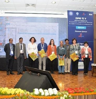
ISPRS Technical Commission V on Education and Outreach Mid-Term Symposium
“Geospatial Technology - Pixel to People”
Indian Institute of Remote Sensing (IIRS)
Dehradun, India
November 20-23, 2018
Read the report
here…
|
 |
|
Second GIS DAY FOR EDUCATION “Space School” Educational Initiative
First English Language School
Sofia, Bulgaria
13 December 2018
Read the report
here… |
|
|
| |
|
Obituaries
 |
|
Klaas Jan Beek, 1935-2019
ISPRS Fellow, Congress Director of the 2000 Amsterdam Congress, and former President of Commission VII, Klaas Jan Beek passed away on 13 January, 2019.
Read the obituary
here…
|
|
|
| |
|
ISPRS International Journal of Geo-Information — Open Access Journal
 |
|
New publications in the ISPRS International Journal of Geo-Information
Open Access Journal
Volume 7, Issue 12 (December 2018)
Automatic Classification of Major Urban Land Covers Based on Novel Spectral Indices
Faridatul, Mst Ilme, Wu, Bo
No: 453
Public Participation Using 3D Web-Based City Models: Opportunities for E-Participation in Kisumu, Kenya
Onyimbi, Jacob R., Koeva, Mila, Flacke, Johannes
No: 454
From a Vegetation Index to a Sustainable Development Goal Indicator: Forest Trend Monitoring Using Three Decades of Earth Observations across Switzerland
Honeck, Erica, Castello, Roberto, Chatenoux, Bruno, Richard, Jean-Philippe, Lehmann, Anthony, Giuliani, Gregory
No: 455
Characterizing Data Ecosystems to Support Official Statistics with Open Mapping Data for Reporting on Sustainable Development Goals
Van den Homberg, Marc, Susha, Iryna
No: 456
AutoCloud+, a “Universal” Physical and Statistical Model-Based 2D Spatial Topology-Preserving Software for Cloud/Cloud–Shadow Detection in Multi-Sensor Single-Date Earth Observation Multi-Spectral Imagery—Part 1: Systematic ESA EO Level 2 Product Generation at the Ground Segment as Broad Context
Baraldi, Andrea, Tiede, Dirk
No: 457
Towards HD Maps from Aerial Imagery: Robust Lane Marking Segmentation Using Country-Scale Imagery
Fischer, Peter, Azimi, Seyed Majid, Roschlaub, Robert, Krauß, Thomas
No: 458
Identifying Urban Functional Zones Using Public Bicycle Rental Records and Point-of-Interest Data
Zhang, Xiaoyi, Li, Wenwen, Zhang, Feng, Liu, Renyi, Du, Zhenhong
No: 459
Real-Time Visualization of Geo-Sensor Data Based on the Protocol-Coupling Symbol Construction Method
Jiao, Donglai, Sun, Jintao
No: 460
Combining the Stock Unearthing Method and Structure-from-Motion Photogrammetry for a Gapless Estimation of Soil Mobilisation in Vineyards
Remke, Alexander, Rodrigo-Comino, Jesús, Gyasi-Agyei, Yeboah, Cerdà, Artemi, Ries, Johannes B.
No: 461
Integrating GEOBIA, Machine Learning, and Volunteered Geographic Information to Map Vegetation over Rooftops
Griffith, David C., Hay, Geoffrey J.
No: 462
An Architecture for Mobile Outdoors Augmented Reality for Cultural Heritage
Panou, Chris, Ragia, Lemonia, Dimelli, Despoina, Mania, Katerina
No: 463
How to Contextualize SDG 11? Looking at Indicators for Sustainable Urban Development in Germany
Koch, Florian, Krellenberg, Kerstin
No: 464
Measuring Inequality of Opportunity in Access to Quality Basic Education: A Case Study in Florida, US
Prieto, Lydia M., Flacke, Johannes, Aguero-Valverde, Jonathan, Van Maarseveen, Martin
No: 465
A Remote Sensing Algorithm of Column-Integrated Algal Biomass Covering Algal Bloom Conditions in a Shallow Eutrophic Lake
Li, Jing, Ma, Ronghua, Xue, Kun, Zhang, Yuchao, Loiselle, Steven
No: 466
HiBuffer: Buffer Analysis of 10-Million-Scale Spatial Data in Real Time
Ma, Mengyu, Wu, Ye, Luo, Wenze, Chen, Luo, Li, Jun, Jing, Ning
No: 467
Optimising Citizen-Driven Air Quality Monitoring Networks for Cities
Gupta, Shivam, Pebesma, Edzer, Degbelo, Auriol, Costa, Ana Cristina
No: 468
Reduction of Map Information Regulates Visual Attention without Affecting Route Recognition Performance
Keil, Julian, Mocnik, Franz-Benjamin, Edler, Dennis, Dickmann, Frank, Kuchinke, Lars
No: 469
Geospatial Methods and Tools for Natural Risk Management and Communications
Albano, Raffaele, Sole, Aurelia
No: 470
Identification of Experimental and Control Areas for CCTV Effectiveness Assessment—The Issue of Spatially Aggregated Data
Dąbrowski, Adam, Matczak, Piotr, Wójtowicz, Andrzej, Leitner, Michael
No: 471
A Parallel-Computing Approach for Vector Road-Network Matching Using GPU Architecture
Wan, Bo, Yang, Lin, Zhou, Shunping, Wang, Run, Wang, Dezhi, Zhen, Wenjie
No: 472
Assessment of Displacements of Linestrings Based on Homologous Vertexes
Mozas-Calvache, Antonio Tomás, Ariza-López, Francisco Javier
No: 473
Geoinformatics in Citizen Science
Bordogna, Gloria
No: 474
A Framework for Visual Analytics of Spatio-Temporal Sensor Observations from Data Streams
Sibolla, Bolelang H., Coetzee, Serena, Van Zyl, Terence L.
No: 475
On the Statistical Distribution of the Nonzero Spatial Autocorrelation Parameter in a Simultaneous Autoregressive Model
Luo, Qing, Griffith, Daniel A., Wu, Huayi
No: 476
Cartographic Line Generalization Based on Radius of Curvature Analysis
Kolanowski, Bogdan, Augustyniak, Jacek, Latos, Dorota
No: 477
New Trends in Using Augmented Reality Apps for Smart City Contexts
Ramos, Francisco, Trilles, Sergio, Torres-Sospedra, Joaquín, Perales, Francisco J.
No: 478
CATCHA: Real-Time Camera Tracking Method for Augmented Reality Applications in Cultural Heritage Interiors
Siekański, Piotr, Michoński, Jakub, Bunsch, Eryk, Sitnik, Robert
No: 479
Combining the Two-Layers PageRank Approach with the APA Centrality in Networks with Data
Agryzkov, Taras, Pedroche, Francisco, Tortosa, Leandro, Vicent, José F.
No: 480
Towards Detecting Social Events by Mining Geographical Patterns with VGI Data
Liu, Zhewei, Zhou, Xiaolin, Shi, Wenzhong, Zhang, Anshu
No: 481
Challenges of Mapping Sustainable Development Goals Indicators Data
Kraak, Menno Jan, Ricker, Britta, Engelhardt, Yuri
No: 482
Multi-Scale and Multi-Sensor 3D Documentation of Heritage Complexes in Urban Areas
Murtiyoso, Arnadi, Grussenmeyer, Pierre, Suwardhi, Deni, Awalludin, Rabby
No: 483
Creating a Story Map Using Geographic Information Systems to Explore Geomorphology and History of Methana Peninsula
Antoniou, Varvara, Ragia, Lemonia, Nomikou, Paraskevi, Bardouli, Pavlina, Lampridou, Danai, Ioannou, Theodora, Kalisperakis, Ilias, Stentoumis, Christos
No: 484
Developing a Dynamic Web-GIS Based Landslide Early Warning System for the Chittagong Metropolitan Area, Bangladesh
Ahmed, Bayes, Rahman, Md. Shahinoor, Islam, Rahenul, Sammonds, Peter, Zhou, Chao, Uddin, Kabir, Al-Hussaini, Tahmeed M.
No: 485
Geospatial Monitoring of Land Surface Temperature Effects on Vegetation Dynamics in the Southeastern Region of Bangladesh from 2001 to 2016
Islam, Shahidul, Ma, Mingguo
No: 486
Checking the Consistency of Volunteered Phenological Observations While Analysing Their Synchrony
Mehdipoor, Hamed, Zurita-Milla, Raul, Augustijn, Ellen-Wien, Van Vliet, Arnold J. H.
No: 487
Comparison of Independent Component Analysis, Principal Component Analysis, and Minimum Noise Fraction Transformation for Tree Species Classification Using APEX Hyperspectral Imagery
Dabiri, Zahra, Lang, Stefan
No: 488
Air Pollution Dispersion Modelling Using Spatial Analyses
Bitta, Jan, Pavlíková, Irena, Svozilík, Vladislav, Jančík, Petr
No: 489
↑ Up
New publications in the ISPRS International Journal of Geo-Information
Open Access Journal
Volume 8, Issue 12 (January 2019)
Improved Decision-Making Geo-Information System for Continuous Monitoring of Deformations on Airport Infrastructure
Doler, Damjan, Kovačič, Boštjan
No: 1
Mapping Long-Term Dynamics of Population and Dwellings Based on a Multi-Temporal Analysis of Urban Morphologies
Hecht, Robert, Herold, Hendrik, Behnisch, Martin, Jehling, Mathias
No: 2
Collaborative Immersive Virtual Environments for Education in Geography
Šašinka, Čeněk, Stachoň, Zdeněk, Sedlák, Michal, Chmelík, Jiří, Herman, Lukáš, Kubíček, Petr, Šašinková, Alžběta, Doležal, Milan, Tejkl, Hynek, Urbánek, Tomáš, Svatoňová, Hana, Ugwitz, Pavel, Juřík, Vojtěch
No: 3
Landslide Susceptibility Mapping Based on Weighted Gradient Boosting Decision Tree in Wanzhou Section of the Three Gorges Reservoir Area (China)
Song, Yingxu, Niu, Ruiqing, Xu, Shiluo, Ye, Runqing, Peng, Ling, Guo, Tao, Li, Shiyao, Chen, Tao
No: 4
Investigation of Post-Fire Debris Flows in Montecito
Cui, Yifei, Cheng, Deqiang, Chan, Dave
No: 5
The Impact of Urban Inequalities on Monitoring Progress towards the Sustainable Development Goals: Methodological Considerations
Ulbrich, Philipp, Porto de Albuquerque, João, Coaffee, Jon
No: 6
Spatiotemporal Analysis of Carbon Emissions and Carbon Storage Using National Geography Census Data in Wuhan, China
Liu, Yanan, Hu, Xiangyun, Wu, Hao, Zhang, Anqi, Feng, Jieting, Gong, Jianya
No: 7
A Reconstruction Method for Broken Contour Lines Based on Similar Contours
Li, Chengming, Liu, Xiaoli, Wu, Wei, Hao, Zhiwei
No: 8
Semantic Geometric Modelling of Unstructured Indoor Point Cloud
Shi, Wenzhong, Ahmed, Wael, Li, Na, Fan, Wenzheng, Xiang, Haodong, Wang, Muyang
No: 9
Ratio of Land Consumption Rate to Population Growth Rate—Analysis of Different Formulations Applied to Mainland Portugal
Nicolau, Rita, David, João, Caetano, Mário, Pereira, José M. C.
No: 10
Gender and Age Differences in Using Indoor Maps for Wayfinding in Real Environments
Wang, Chengshun, Chen, Yufen, Zheng, Shulei, Liao, Hua
No: 11
Distributed Geoscience Algorithm Integration Based on OWS Specifications: A Case Study of the Extraction of a River Network
Tan, Xicheng, Di, Liping, Zhong, Yanfei, Chen, Nengcheng, Huang, Fang, Wang, Jinchuan, Sun, Ziheng, Khan, Yahya Ali
No: 12
A Cluster-Based Machine Learning Ensemble Approach for Geospatial Data: Estimation of Health Insurance Status in Missouri
Mueller, Erik, Sandoval, J. S. Onésimo, Mudigonda, Srikanth, Elliott, Michael
No: 13
A Spatial Analysis Framework to Monitor and Accelerate Progress towards SDG 3 to End TB in Bangladesh
Rood, Ente, Khan, Ahmadul Hasan, Modak, Pronab Kumar, Mergenthaler, Christina, Van Gurp, Margo, Blok, Lucie, Bakker, Mirjam
No: 14
Geo-Tagged Social Media Data-Based Analytical Approach for Perceiving Impacts of Social Events
Zhu, Ruoxin, Lin, Diao, Jendryke, Michael, Zuo, Chenyu, Ding, Linfang, Meng, Liqiu
No: 15
Prediction of Hourly Effect of Land Use on Crime
Matijosaitiene, Irina, Zhao, Peng, Jaume, Sylvain, Gilkey Jr, Joseph W.
No: 16
Acknowledgement to Reviewers of IJGI in 2018
IJGI Editorial Office
No: 17
An Integrated Graphic Modeling System for Three-Dimensional Hydrodynamic and Water Quality Simulation in Lakes
Huang, Mutao, Tian, Yong
No: 18
Mobile Phone Indicators and Their Relation to the Socioeconomic Organisation of Cities
Cottineau, Clémentine, Vanhoof, Maarten
No: 19
Remote Sensing in Environmental Justice Research—A Review
Weigand, Matthias, Wurm, Michael, Dech, Stefan, Taubenböck, Hannes
No: 20
Interactive and Online Buffer-Overlay Analytics of Large-Scale Spatial Data
Ma, Mengyu, Wu, Ye, Chen, Luo, Li, Jun, Jing, Ning
No: 21
Investigating the Utility Potential of Low-Cost Unmanned Aerial Vehicles in the Temporal Monitoring of a Landfill
Incekara, Abdullah Harun, Delen, Ahmet, Seker, Dursun Zafer, Goksel, Cigdem
No: 22
Spatiotemporal Influence of Urban Environment on Taxi Ridership Using Geographically and Temporally Weighted Regression
Zhang, Xinxin, Huang, Bo, Zhu, Shunzhi
No: 23
A Comparison of Standard Modeling Techniques Using Digital Aerial Imagery with National Elevation Datasets and Airborne LiDAR to Predict Size and Density Forest Metrics in the Sapphire Mountains MT, USA
Ahl, Robert, Hogland, John, Brown, Steve
No: 24
Application of UAV Photogrammetry in Displacement Measurement of the Soil Nail Walls Using Local Features and CPDA Method
Esmaeili, Farid, Ebadi, Hamid, Saadatseresht, Mohammad, Kalantary, Farzin
No: 25
Adaptive Non-Negative Geographically Weighted Regression for Population Density Estimation Based on Nighttime Light
Chu, Hone-Jay, Yang, Chen-Han, Chou, Chelsea C.
No: 26
Exploiting the Potential of Integrated Public Building Data: Energy Performance Assessment of the Building Stock in a Case Study in Northern Italy
Pasquinelli, Alice, Agugiaro, Giorgio, Tagliabue, Lavinia Chiara, Scaioni, Marco, Guzzetti, Franco
No: 27
Multisource Hyperspectral and LiDAR Data Fusion for Urban Land-Use Mapping based on a Modified Two-Branch Convolutional Neural Network
Feng, Quanlong, Zhu, Dehai, Yang, Jianyu, Li, Baoguo
No: 28
Social Media Big Data Mining and Spatio-Temporal Analysis on Public Emotions for Disaster Mitigation
Yang, Tengfei, Xie, Jibo, Li, Guoqing, Mou, Naixia, Li, Zhenyu, Tian, Chuanzhao, Zhao, Jing
No: 29
Spatial–Temporal Evolution and Regional Differentiation Features of Urbanization in China from 2003 to 2013
Zhang, Peiyu, Pan, Jianjun, Xie, Longtao, Zhou, Tao, Bai, Haoran, Zhu, Yanxiang
No: 31
Effect of DEM Interpolation Neighbourhood on Terrain Factors
Zhu, Ying, Liu, Xuejun, Zhao, Jing, Cao, Jianjun, Wang, Xiaolei, Li, Dongliang
No: 30
Probabilistic Model of Random Encounter in Obstacle Space
Yin, Zhang-Cai, Liu, Hui, Zhang, Zhi-Jun, Jin, Zhang-Hao-Nan, Li, San-Juan, Xiao, Jia-Qiang
No: 32
A Geospatial Application Framework for Directional Relations
Clementini, Eliseo, Bellizzi, Giampaolo
No: 33
Taming Disruption? Pervasive Data Analytics, Uncertainty and Policy Intervention in Disruptive Technology and its Geographic Spread
Brackin, Roger C., Jackson, Michael J., Leyshon, Andrew, Morley, Jeremy G.
No: 34
An Analysis of the Evolution, Completeness and Spatial Patterns of OpenStreetMap Building Data in China
Tian, YuanJian, Zhou, Qi, Fu, Xiaolin
No: 35
Dynamic Monitoring of Forest Land in Fuling District Based on Multi-Source Time Series Remote Sensing Images
Bai, Bingxin, Tan, Yumin, Guo, Dong, Xu, Bo
No: 36
Threat of Pollution Hotspots Reworking in River Systems: Case Study of the Ploučnice River (Czech Republic)
Elznicová, Jitka, Matys Grygar, Tomáš, Popelka, Jan, Sikora, Martin, Novák, Petr, Hošek, Michal
No: 37
Automated Matching of Multi-Scale Building Data Based on Relaxation Labelling and Pattern Combinations
Zhang, Yunfei, Huang, Jincai, Deng, Min, Chen, Chi, Zhou, Fangbin, Xie, Shuchun, Fang, Xiaoliang
No: 38
Identifying Asphalt Pavement Distress Using UAV LiDAR Point Cloud Data and Random Forest Classification
Li, Zhiqiang, Cheng, Chengqi, Kwan, Mei-Po, Tong, Xiaochong, Tian, Shaohong
No: 39
Semi-Automatic Versus Manual Mapping of Cold-Water Coral Carbonate Mounds Located Offshore Norway
Jarna, Alexandra, Baeten, Nicole J., Elvenes, Sigrid, Bellec, Valérie K., Thorsnes, Terje, Diesing, Markus
No: 40
Role-Tailored Map Dashboards—A New Approach for Enhancing the Forest-based Supply Chain
Atzl, Caroline, Scholz, Johannes, Vockner, Bernhard, Mittlböck, Manfred, Knoth, Laura
No: 41
Relationship between Winter Snow Cover Dynamics, Climate and Spring Grassland Vegetation Phenology in Inner Mongolia, China
Qiao, Dejing, Wang, Nianqin
No: 42
Recent NDVI Trends in Mainland Spain: Land-Cover and Phytoclimatic-Type Implications
Novillo, Carlos J., Arrogante-Funes, Patricia, Romero-Calcerrada, Raúl
No: 43
TLS Measurement during Static Load Testing of a Railway Bridge
Gawronek, Pelagia, Makuch, Maria
No: 44
Deep Neural Networks and Kernel Density Estimation for Detecting Human Activity Patterns from Geo-Tagged Images: A Case Study of Birdwatching on Flickr
Koylu, Caglar, Zhao, Chang, Shao, Wei
No: 45
GEOBIA at the Terapixel Scale: Toward Efficient Mapping of Small Woody Features from Heterogeneous VHR Scenes
Merciol, François, Faucqueur, Loïc, Damodaran, Bharath Bhushan, Rémy, Pierre-Yves, Desclée, Baudouin, Dazin, Fabrice, Lefèvre, Sébastien, Masse, Antoine, Sannier, Christophe
No: 46
Deep Learning Segmentation and 3D Reconstruction of Road Markings Using Multiview Aerial Imagery
Kurz, Franz, Azimi, Seyed Majid, Sheu, Chun-Yu, d’Angelo, Pablo
No: 47
Consideration of Level of Confidence within Multi-Approach Satellite-Derived Bathymetry
Chénier, René, Ahola, Ryan, Sagram, Mesha, Faucher, Marc-André, Shelat, Yask
No: 48
Small Manhole Cover Detection in Remote Sensing Imagery with Deep Convolutional Neural Networks
Liu, Wei, Cheng, Dayu, Yin, Pengcheng, Yang, Mengyuan, Li, Erzhu, Xie, Meng, Zhang, Lianpeng
No: 49
A Web Service-Oriented Geoprocessing System for Supporting Intelligent Land Cover Change Detection
Xing, Huaqiao, Chen, Jun, Wu, Hao, Hou, Dongyang
No: 50
The Spatial and Social Patterning of Property and Violent Crime in Toronto Neighbourhoods: A Spatial-Quantitative Approach
Wang, Lu, Lee, Gabby, Williams, Ian
No: 51
↑ Up
|
|
|
| |
|
ISPRS Journal of Photogrammetry and Remote Sensing
 |
|
New publications in the ISPRS Journal of
Photogrammetry and Remote Sensing Volume 148 (February 2019)
Editorial Board
Pages: ii
Mapping the Yellow River Delta land subsidence with multitemporal SAR interferometry by exploiting both persistent and distributed scatterers
Bowen Zhang, Robert Wang, Yunkai Deng, Peifeng Ma, Hui Lin, Jili Wang
Pages: 157-173
Improvement of photogrammetric accuracy by modeling and correcting the thermal effect on camera calibration
M. Daakir, Y. Zhou, M. Pierrot Deseilligny, C. Thom, O. Martin, E. Rupnik
Pages: 142-155
TanDEM-X digital surface models in boreal forest above-ground biomass change detection
Kirsi Karila, Xiaowei Yu, Mikko Vastaranta, Mika Karjalainen, Eetu Puttonen, Juha Hyyppä
Pages: 174-183
Assessment of Caatinga response to drought using Meteosat-SEVIRI Normalized Difference Vegetation Index (2008–2016)
Humberto Alves Barbosa, T.V. Lakshmi Kumar, Franklin Paredes, Simon Elliott, J.G. Ayuga
Pages: 235-252
Thanks to outgoing Associate Editors
Derek Lichti, Qihao Wen
Pages: 156
Analysis of urban surface morphologic effects on diurnal thermal directional anisotropy
Leiqiu Hu, Jochen Wendel
Pages: 1-12
Improving LiDAR classification accuracy by contextual label smoothing in post-processing
Nan Li, Chun Liu, Norbert Pfeifer
Pages: 13-31
Cloud removal in remote sensing images using nonnegative matrix factorization and error correction
Xinghua Li, Liyuan Wang, Qing Cheng, Penghai Wu, Wenxia Gan, Lina Fang
Pages: 103-113
A derivative-free optimization-based approach for detecting architectural symmetries from 3D point clouds
Fan Xue, Weisheng Lu, Christopher J. Webster, Ke Chen
Pages: 32-40
Estimating canopy structure and biomass in bamboo forests using airborne LiDAR data
Lin Cao, Nicholas C. Coops, Yuan Sun, Honghua Ruan, Guibin Wang, Jinsong Dai, Guanghui She
Pages: 114-129
Another look on region merging procedure from seed region shift for high-resolution remote sensing image segmentation
Xueliang Zhang, Pengfeng Xiao, Xuezhi Feng, Guangjun He
Pages: 197-207
Retrieving leaf area index in discontinuous forest using ICESat/GLAS full-waveform data based on gap fraction model
Xuebo Yang, Cheng Wang, Feifei Pan, Sheng Nie, Xiaohuan Xi, Shezhou Luo
Pages: 54-62
Participatory mapping of forest plantations with Open Foris and Google Earth Engine
J. Koskinen, U. Leinonen, A. Vollrath, A. Ortmann, E. Lindquist, R. d'Annunzio, A. Pekkarinen, N. Käyhkö
Pages: 63-74
A random forest classifier based on pixel comparison features for urban LiDAR data
Chisheng Wang, Qiqi Shu, Xinyu Wang, Bo Guo, Peng Liu, Qingquan Li
Pages: 75-86
Mapping salt marsh soil properties using imaging spectroscopy
Caiyun Zhang, Deepak R. Mishra, Steven C. Pennings
Pages: 221-234
How do people understand convenience-of-living in cities? A multiscale geographic investigation in Beijing
Xiuyuan Zhang, Shihong Du, Jixian Zhang
Pages: 87-102
Seamline network generation based on foreground segmentation for orthoimage mosaicking
Li Li, Jingmin Tu, Ye Gong, Jian Yao, Jie Li
Pages: 41-53
Point clouds for direct pedestrian pathfinding in urban environments
Jesús Balado, Lucía Díaz-Vilariño, Pedro Arias, Henrique Lorenzo
Pages: 184-196
Potential of nonlocally filtered pursuit monostatic TanDEM-X data for coastline detection
Michael Schmitt, Gerald Baier, Xiao Xiang Zhu
Pages: 130-141
Variation of leaf angle distribution quantified by terrestrial LiDAR in natural European beech forest
Jing Liu, Andrew K. Skidmore, Tiejun Wang, Xi Zhu, Joe Premier, Marco Heurich, Burkhard Beudert, Simon Jones
Pages: 208-220
↑ Up
|
|
|
| |
|
New Events
06-07 Apr 2019
UASG-2019
1st International Conference on Unmanned Aerial System in Geomatics – 2019
https://www.iitr.ac.in/uasg2019/
Greater Noida, India
30 Apr 2019
Journée du bicentenaire Aimé Laussedat (1819-1907)
http://www.sfpt.fr
Paris, France
28-31 May 2019
Photogrammetric 3D Reconstruction for Geo-Applications (PhotoGA 2019)
Computer and Robot Vision (CRV) Workshop
http://www2.isprs.org/commissions/comm2/wg1/PhotoGA19.html
Kingston, Canada
16-17 Jun 2019
EARTHVISION 2019
IEEE/ISPRS Workshop. Large Scale Computer Vision for Remote Sensing Imagery
https://www.grss-ieee.org/earthvision2019/
Long Beach, CA, USA
16-17 Jun 2019
PCV 19
Workshop ‘Photogrammetric Computer Vision 2019’
https://sites.google.com/view/pcv19/home
Long Beach, CA, USA
24-26 Jun 2019
EOEC-GiT4NDM 2019
The Joint International Conference on Earth Observation for Environmental Changes and Geoinformation Technologies for Natural Disaster Management
http://eoec2019.csp.escience.cn/dct/page/1
Chengdu, China
22-31 Jul 2019
Laboratory of Place 2019
Ghesc and surroundings: history, survey, evolution. Summer School on 3D Surveying in Cultural Heritage
http://www.sitech-3dsurvey.polimi.it/?lang=en
Sacro Monte Calvario di Domodossola, Italy
01-06 Sep 2019
27th CIPA International Symposium
Documenting the past for a better future
http://www.cipa2019.org
Avila, Spain
01-03 Oct 2019
Geospatial Kuala Lumpur 2019
http://www.geoinfo.utm.my/geospatial2019
Kuala Lumpur, Malaysia
28-31 Oct 2019
19th International Scientific and Technical Conference “From Imagery to Digital Reality: ERS & Photogrammetry”
http://conf.racurs.ru/conf2019/eng/
Seoul, Republic of Korea
11-13 Nov 2019
LBS 2019
15th International Conference on Location Based Services
https://lbsconference.org/
Vienna, Austria
15-17 Nov 2019
International Conference on Geomatics in the Big Data Era
http://2019geoinformatics.csp.escience.cn/
Guilin, Guangxi, China
02-03 Dec 2019
LowCost 3D 2019
6th International Workshop LowCost 3D – Sensors, Algorithms, Applications
http://www.lc3d.net
Strasbourg, France
10-14 May 2020
FIG2020 Working Week
Smart surveyors for land and water management
http://www.fig.net/fig2020/
Amsterdam, The Netherlands
» See more
|
|
| |
|
Updated Events
09-13 Sep 2019
57th Photogrammetric Week
PhoWo 2019
https://phowo.ifp.uni-stuttgart.de
Stuttgart, Germany
» See more
|
|
| |
|
Job Opportunities
|
23-Jan-2019 |
Job opportunity for PhD candidate (in the field of advanced image matching)
Jade University of Applied Sciences, Institute for Applied Photogrammetry and Geoinformatics, Oldenburg, Germany
|
|
27-Jan-2019 |
Two Immediate Opening Positions for Post-Doctoral Researchers
Guangxi Key Laboratory for Geoinformatics at Guilin University of Technology, Guilin, China
|
|
29-Jan-2019 |
Post-Doctoral Fellowship and PhD Studentship in Computer Vision, Machine Learning and Photogrammetry
Dept. Earth and Space Science and Engineering Lassonde School of Engineering York University, Toronto, Canada
|
|
6-Feb-2019 |
Research Assistant or Postdoc 3D/4D modeling of South Pacific Islands (Moorea IDEA Avatar)
ETH Zurich, Institute of Theoretical Physics, Platform for Advanced Scientific Computing, Switzerland
|
» See more
|
|
|
| |
|
|
 |
You got this email as you subscribed to the ISPRS mailing list.
Officers, members and contact persons of members get it by default.
To unsubscribe from the ISPRS mailing list,
click here.
© ISPRS, 2019.
Imprint
|