ISPRS e-Bulletin: May 2020


ISPRS e-Bulletin
Issue No 2 - 2020


Quick Links

•  ISPRS Homepage
•  Editorial
•  General Announcements
•  Obituaries
•  New Events
•  The ISPRS Foundation
•  TIF News
•  Scientific Meetings
•  Journal of Geo-Information
•  ISPRS Calendar
•  Society News
•  Reports
•  ISPRS Journal


Editorial

Christian Heipke      

Dear all,

This is the first eBulletin since the outbreak of the worldwide corona pandemic, which has caused so many unexpected changes in both our everyday lives and also in our professional activities. In ISPRS, we are trying our best to keep you connected to the ISPRS community, we sympathize with those who suffer, and we offer our condolence to those who lost their loved ones.

As you may know, at the end of March, Council postponed the ISPRS Congress to July 2021. We struggled hard when taking this decision, but it was inevitable. At the moment, nearly all national borders are closed, and travel is virtually impossible – who knows, when this nightmare will be over.

The Congress is of course not the only ISPRS meeting affected. For example, the ISPRS Geospatial Week, to be held in Dubai and originally planned for March 2021, has been postponed by 12 months as a consequence of moving the Congress to 2021. Also, the Latin America GRSS and ISPRS Remote Sensing Symposium (LAGIRS 2020), scheduled to be held in Chile in late March 2020, was cancelled altogether. We are hoping for a new edition in 2022 in Brazil.

Other meetings have been turned into online events. In this regard, I would like to draw your attention of the Virtual Rooms of the ISPRS Student Consortium, http://sc.isprs.org/virtual-rooms.html. The SC (see editorial by Sheryl Rose Reyes in the last eBulletin) has started the great initiative, and is organising different online lectures on various topics related to ISPRS. I would like to express my gratitude to Sheryl and her team, and to Armin Grün, who was instrumental in bringing the ISPRS While Elephants to this activity. Besides connecting people – a very worthwhile activity in these times of social distancing - the Virtual Rooms are also bringing together different generations. This is a truly outstanding example of how to make the best out of the current situation – thanks again to all involved!

The Congress will now take place in Nice in July 2021. Preparations by Nicolas Paparoditis and his team are already well on the way, and we will gather in Nice in very much the same way as we had hoped to do this summer. July 2021 is also the time when we will recognise our champions and present them with the ISPRS 2020 awards. The awardees have been selected during the last few months and an announcement can be found in this eBulletin.
Coming to the scientific publications, we will have two editions of Congress proceedings, one for 2020, and another one for 2021 with new papers to be submitted by 5 February 2021. All registrations for 2020 will be carried forward to 2021. Further questions with respect to the Congress postponement are answered on the web site, http://www.isprs2020-nice.com/index.php/postponed-congress-info/#faqcovid.  Besides this, we strive to have an online two-day event for those who wish to present their papers accepted for the 2020 edition.

The General Assembly and all elections have also been postponed until next year. The regular sequence of events, however, will be maintained. In 2021, the General Assembly will decide where to hold the 2024 Congress, which members are to host the 2021 – 2024 Commissions, and about positions in Council. The deadlines for proposals is March 1st, 2021. We ask all ISPRS officers to please continue their service for the society in their current position until July 2021.

ISPRS is a worldwide community. We feel strongly connected around the world and we hope the pandemic will be over soon. In the meantime, please do not hesitate to contact us if there is anything we can do for you, or if you have a good idea how we can help to ease the current situation for you and for all of us!

All the best and hoping to see you in Nice in July 2021, 
Christian Heipke, ISPRS President
May 2nd, 2020


The ISPRS Foundation (TIF) News

The ISPRS Foundation


Wanted: Trustees for The ISPRS Foundation (TIF)

TIF seeks replacements for four Trustees due to the expiration of their terms. If you are interested, or know someone else who may be interested, please contact the current Chair of the Board of Trustees, Stewart Walker, foundationchair@isprs.org.

According to its Bylaws, The ISPRS Foundation (TIF) must have eleven Trustees. TIF’s Board of Trustees is responsible for its correct and successful operation, for example: investment, management and disbursement of funds; the annual budget; assurance that TIF’s operations and accounts are in accordance with ISPRS Statutes and Bylaws and relevant laws and regulations. The full list of duties is given in TIF’s Bylaws, Article III (https://www.isprs.org/foundation/foundation/bylaw.aspx). Of the eleven Trustees,  two are appointed by ISPRS Council with terms of office running from one ISPRS Congress to the next. The other nine all well known in the profession, come from all over the world and bring extensive experience and wisdom to the Board. The current Trustees are given at https://www.isprs.org/foundation/trustees.aspx and past Trustees at https://www.isprs.org/foundation/past-trustees.aspx. The nine non-Council Trustees have three-year terms and typically retire after two such terms. One of the Trustees ended his second term in February 2020 and is continuing until we appoint a replacement. The term of one other Trustee expires in 2020 and those of two more in 2021. Therefore we need to find four new Trustees!
The duties are not onerous. There is a face-to-face meeting of Trustees during each Congress and typically there are no other formal meetings. From a practical point of view, the work of TIF is done by four committees, each of which includes one or more Trustees. Trustees are kept informed of the work of the committees and their comments are always welcome and taken into account. Often their special knowledge – technical, professional, geographical – can be of great benefit and is requested from time to time.
If you are interested, or know someone else who may be interested, please contact the current Chair of the Board of Trustees, Stewart Walker, foundationchair@isprs.org. Your participation in TIF will be much appreciated.


Did you know that TIF has a Fund-Raising Committee?

In order to expand its efforts to support more students and help them attend events and present their papers, TIF needs to increase the level of funding available. Please consider joining the Committee to pursue the worthwhile goal of expanding TIF’s activities. If you are interested – or know someone who may be interested – please contact Michael Gruber at TIF-fundraising@isprs.org.

The eBulletin often contains articles and reports about students who have won awards from The ISPRS Foundation (TIF) to help them attend conferences, symposia, Geospatial Weeks or other events and present their papers. This valuable, rewarding work clearly benefits the recipients and helps ISPRS move its research agenda forward.

TIF would like to expand its efforts, i.e. make more awards each year and help an increasing number of students. The funds for TIF’s work come partly from donors and partly from ISPRS. To do more we need to increase the level of funding. Last year we established a Fund-Raising Committee with Dr. Michael Gruber of Vexcel Imaging in Graz, Austria, as chair. The terms of reference of the committee are available on request. Currently we see its role as identifying potential donor organizations (private companies, government departments, agencies that make grants, philanthropists etc.) and finding points of contact within these organizations to whom to reach out. The Committee itself may then make contact or enlist the TIF Trustees to help. The Committee will also play a role in recognizing new donors in appropriate ways. The Committee is seeking members who will enable it eventually to cover as much of the world as possible. The current membership is:

Michael Gruber (chair) Austria TIF Trustee
Ron Bisio USA TIF Trustee
Lawrie Jordan USA TIF Trustee
Paul Marshall UK  
Fabio Menna Italy  
Marko Pasko Slovak Republic  
Miguel Pelaz Spain  

Thus the Committee is well posed with respect to Europe and North America, but rather thin elsewhere. Most of the Committee’s work will be done by e-mail and telephone calls; if a meeting is needed, it will take place remotely. Please consider joining the Committee to pursue the worthwhile goal of expanding TIF’s activities. If you are interested – or know someone who may be interested – please contact Michael Gruber at TIF-fundraising@isprs.org. Thank you.


Cancellation of Travel Grants for 2020 due to Postponement of ISPRS XXIV Congress to July 2021

Find out about cancellations, unrecoverable travel costs and how to have your accepted paper published in 2020

Due to the postponement of the 2020 ISPRS Congress to 4-10 July 2021, all travel grants awarded to those listed below, including the associated registration fee waivers, will be cancelled, because there will be no travel to Nice in 2020.

A new round of travel grant applications will be offered for 2021. As a result, all potential attendees at the Congress in 2021 will be invited to apply for a travel grant based on their paper prepared for presentation at Nice during the 2021 Congress. Applicants for 2020 travel grants, whether successful or not, are welcome to apply in 2021 based on fresh papers.

Grantees who would like to have their accepted papers included in the 2020 edition of proceedings will not be charged the publication fee of 100 euros. Winners of 2020 grants who are troubled by unrecoverable travel costs should write to TIF Operations Officer, John Trinder, setting out your case for reimbursement.

Table with Recipients of Travel Grants for 2020


Society News

ISPRS


GSW postponed to March 2022
bar

ISPRS officially announces that due to the coronavirus crisis, and following the postponement of the XXIV ISPRS Congress to July 2021, also the ISPRS Geospatial Week, which was planned to take place in March 2021, has been postponed by 12 months. The exact dates will be fixed shortly.

Workshop organisers, authors, potential participants, sponsors and exhibitors are encouraged to maintain their involvement in the ISPRS Geospatial Week in Dubai even though it has been postponed. The involvement of the whole geospatial community in the activities of ISPRS is indeed essential. 

Together with Mohamad Bin Rashid Space Centre, our local host, and under the leadership of Geospatial Week Director, Saeed Al Mansoori, ISPRS Council is diligently working to ensure that GSW 2022 in Dubai will be a prime scientific meeting and a memorable experience. Further announcements regarding the schedule and other relevant issues will be made in subsequent communications in the near future.

All the best and hoping to see you in Dubai in March 2022,
 
Christian Heipke, ISPRS President
Saeed Al Mansoori, ISPRS Geospatial Week Director 2022


Bid and Nomination Deadlines extended
bar

Bid and nomination deadlines to host the XXV Congress in 2024, the Technical Commissions and for Council positions for the 2021-24 term have been extended by one year due to the postponement of the XXIV ISPRS Congress.

ISPRS 2021 – 2024

The following bids and nominations for positions have been received for the 2020-2024 term. Elections will take place in the General Assembly during the ISPRS Congress in Nice. Detailed documents will be made available to the Ordinary Member in due time.

Nominations for Council Positions 2021-2024

President Lena Halounová, Czech Technical University Prague, Czech Republic
Vice President Nicolas Paparoditis, IGN-ENSG, Paris, France
Secretary General Jie Jiang, Beijing University of Civil Engineering and Architecture, China
Treasurer Stewart Walker, photogrammetry4u llc, San Diego, USA
Past President The position will be filled by appointment.
Christian Heipke, the current president has indicated his willingness to serve in this office from 2020-2024.


Bids for the XXVth ISPRS Congress 2024 (listed in alphabetical order)

Canada, Toronto Congress Director: Ahmed Shaker, Ryerson University, Toronto
China, Wuhan Congress Director: Wu Huayi, Wuhan University
India, New Delhi Congress Director: Prakash Chauhan, Indian Institute of Remote Sensing, Dehradun
USA, Denver    Congress Director: Charles Toth, The Ohio State University, Columbus


Bids for Technical Commissions 2021-2024


Commission I - Sensor Systems
China / Brazil
President: Tang Xinming, Land Satellite Remote Sensing Application Center,   Ministry of Natural Resources, Beijing
Vice-president: Antonio Tommaselli, São Paulo State University
Secretary: Zhang Tao, Land Satellite Remote Sensing Application Center, Ministry of Natural Resources, Beijing

Commission II – Photogrammetry
1. China / Finland
President: Yang Bisheng, Wuhan University
Vice-president: Juha Hyyppä, Finnish Geospatial Research Institute, Espoo
Secretary: Chen Chi, Wuhan University
2. USA / Switzerland
President: Alper Yilmaz, The Ohio State University, Columbus
Vice-president: Jan Dirk Wegner, ETH Zurich
Secretary: Rongjun Qin, The Ohio State University, Columbus

Commission III - Remote Sensing
1. Germany / Japan
President: Uwe Stilla, Technical University of Munich
Vice-president: Junichi Susaki, Kyoto University
Secretary: Ludwig Högner, Technical University of Munich
2. India / Turkey
President: Prakash Chauhan, Indian Institute of Remote Sensing, Dehradun
Vice-president: Sultan Kocaman, Hacettepe University, Ankara
Secretary: Sameer Saran, Indian Institute of Remote Sensing, Dehradun

Commission IV - Spatial Information Systems
Australia / Italy
President: Sisi Zlatanova, University of New South Wales, Sydney
Vice-president: Maria Antonia Brovelli, Politecnico di Milano
Secretary: Serena Coetzee, University of Pretoria

Commission V - Education and Outreach
South Africa / Nigeria
President: Julian Smit, University of Cape Town
Vice-president: Matthew O. Adepoju, National Space Research and Development Agency, Abuja
Secretary: Patricia Duncan, Cape Peninsula University of Technology


Chen Jun


New ISPRS Honorary Member nominated
bar

Chen Jun, current Past President, Director of the 2008 ISPRS Congress in Beijing and long-standing ISPRS representative, has been nominated as Honorary Member for his dedication to the aims and the activities of the Society to be elected by the General Assembly.

Chen Jun is a most deserving choice! Congratulations!


ISPRS


New ISPRS Fellows nominated

bar

The ISPRS Fellows Nomination Committee selected 5 individuals from the 11 worthy nominations for Fellowships to be elected by the General Assembly. They are:

  • Kohei Cho
  • Songnian Li
  • Marguerite Madden
  • Charles Toth
  • George Vosselman

Council is also very pleased to congratulate these five individuals!


ISPRS


The 2020 Brock Gold Medal

bar

Prof. Li Deren, of Wuhan University, China, will be presented with the 2020 Brock Gold Medal for his outstanding scientific achievements in the photogrammetry, remote sensing and geospatial information sciences.

ISPRS awards Prof. Li Deren with the Brock Gold Medal in Recognition of Outstanding Contributions to Photogrammetry

The International Society for Photogrammetry and Remote Sensing (ISPRS) announced today that Prof. Li Deren, of Wuhan University, China, will be presented with the 2020 Brock Gold Medal for his outstanding scientific achievements in the photogrammetry, remote sensing and geospatial information sciences.

Prof. Li Deren is a professor at the Laboratory of Information Engineering in Surveying, Mapping and Remote Sensing (LIESMARS) and the Director of the Collaborative Innovation Center of Geospatial Technology, both at Wuhan University of China. He enjoys dual membership of both the Chinese Academy of Sciences and the Chinese Academy of Engineering. In 1985, he received his doctoral degree from the University of Stuttgart, Germany, and in 2008, an Honorary Doctorate from ETH Zürich, Switzerland. 

Highlights of his many achievements are the design of ZY-3, the first Chinese mapping satellite used to produce 1:50.000 orthophotos and digital surface models for large area (1000-2500km2) without ground control points. Collaborating with Prof. Jianya Gong, he further developed the three generations of GIS software GeoStar, GeoGlobe and GeoSmart, which have been widely used for the construction of digital cities and smart cities in China and beyond. He was also instrumental in introducing the integration of theories and algorithms of global navigation satellite systems, remote sensing and geographic information systems, which support such diverse applications as mobile mapping, UAV systems and many others.

The Brock Gold Medal, sponsored by the American Society for Photogrammetry and Remote Sensing (ASPRS), is awarded to an individual in respect of an outstanding landmark in the evolution of the photogrammetry, remote sensing and spatial information sciences every four years.

Prof. Li will receive the award at the XXIV ISPRS Congress to be held in Nice, France. The quadrennial Congress brings together the global community of scientists and technologists in the photogrammetry, remote sensing and spatial information sciences and is expected to be visited by some 3000 to 4000 participants over its week long duration.

ISPRS is the foremost global non-governmental organization that promotes international cooperation between the worldwide organizations with interests in the photogrammetry, remote sensing and spatial information sciences. Established in 1910, ISPRS is the oldest international umbrella organization in its field, which may be summarized as addressing information from imagery.

ISPRS Headquarters, Hannover, Germany


U.V. Helava


The U.V. Helava Award
2019 Best Paper for the U.V. Helava Award announced bar

The U. V. Helava Award – Best Paper Volumes 147-158 (2019) is:

Design and evaluation of a full-wave surface and bottom-detection algorithm for LiDAR bathymetry of very shallow waters

by Roland Schwarz, Gottfried Mandlburger, Martin Pfennigbauer and Norbert Pfeifer.


The U. V. Helava Award 2016 – 2019 bar

The U. V. Helava Award - Best Paper for the period 2016 – 2019 was awarded to

Davide Antonio Cucci, Martin Rehak and Jan Skaloud for their paper

Bundle adjustment with raw inertial observations in UAV applications.

Read more details »


Jack Dangermond


The Jack Dangermond Award Best Paper 2019 and the Jack Dangermond Award 2017-2019
bar

The best paper 2019 for the Jack Dangermond Award, selected by the award committee, has also been selected as the Jack Dangermond Award 2017-2019:

Voxel-based 3D Point Cloud Semantic Segmentation: Unsupervised Geometric and Relationship Featuring vs Deep Learning Methods
https://doi.org/10.3390/ijgi8050213

by Florent Poux and Roland Billen

The Jack Dangermond Award, sponsored by MDPI and ESRI, consists of a grand prize of USD 10,000 and an ISPRS certificate presented to the author(s) of the most outstanding paper published exclusively in the ISPRS International Journal of Geo-Information during the four years preceding the Congress, and three runner- up prizes of a Journal subscription and certificate, presented to the author(s) of the best papers published in each of the other three years preceding the Congress year.


Awards


ISPRS announces Awards to be presented at the XXIV ISPRS Congress in Nice
bar

Award Awardee(s)
Brock Gold Medal Award Deren Li (CHINA)
Otto von Gruber Award not awarded
Samuel Gamble Award Jan Skaloud (CH)
Jonathan Li (CAN)
Willem Schermerhorn Award Michael Yang (NL)
Schwidefsky Medal Derek Lichti (CAN)
Wang Zhizhuo Award Wolfgang Kainz (AUT)
Karl Kraus Medal Wolfgang Förstner and Bernhard P. Wrobel (GER)
Frederick J Doyle Award Konrad Schindler (CH)
Giuseppe Inghilleri Award Cheng Wang (CHINA)
Marc-Pierrot Deseilligny (F)
Eduard Dolezal Award Damdinsuren Amarsaikhan (MNG)
U.V. Helava Award Davide Cucci, Martin Rehak and Jan Skaloud (CH)
Jack Dangermond Award Florent Poux and Roland Billen (BEL)
Young Author's Award
TC I Emmanuel Cledat (CH)
Stefan Blaser (CH)
TC II Dennis Wittich (GER)
Eleonora Maset (IT)
TC III Rory Clifford Pittman (CAN)
Jiangyuan Zeng (CHINA)
TC IV Patrick Hübner (GER)
Xiaoli Li (CHINA)
TC V Priyanka Singh (IND)
Recep Can (TR)
President's Honorary Citations
TC I Francesco Nex (NL)
TC II Diego Gonzalez-Aguilera (ESP)
TC III Eija Honkavaara (FIN)
TC IV Maria Antonia Brovelli (ITA)
TC V Vladimir A. Seredovich (RUS)
Student Consortium Service Award Sheryl Rose Reyes (PHL)

The ISPRS Council wholeheartedly congratulates all awardees to their splendid success! We also want to thank all nominators, jury members and everybody else who had a part in selecting the awardees. More information on ISPRS awards can be found at https://www.isprs.org/society/awards.aspx.

Unfortunately, due to the current situation, the awards can only be presented at the ISPRS Congress in Nice in July 2021.


INPE


New Brazilian Ordinary Member – INPE
bar

Instituto Nacional de Pesquisas Espaciais (INPE) has been approved as the new Brazilian Ordinary Member following the withdrawal of the Brazilian Society of Cartography.
On behalf of the Society, ISPRS Council welcomes INPE in their new role, previously having been a Sustaining Member.
More information on INPE can be found at www.inpe.br.


General Announcements

WHU-TLS Benchmark      

WHU-TLS Benchmark available
bar

The WHU-TLS Benchmark, consisting of 115 sets of point clouds and in total over 1740 million 3D points collected from 11 different scenarios, has been made publicly available for the ISPRS community.

Read more here…


GEO


GEO initiates Repository to share Information and Data related to COVID-19
bar

The Group on Earth Observations (GEO) has invited GEO Work Programme activities, GEO Members, Participating Organizations and Associates to share information about projects using Earth observations to support monitoring, response or recovery actions related to the COVID‑19 pandemic.

GEO has published a list of Earth observations projects responding to COVID‑19. Explore the list of projects here.

This list is not meant to be exhaustive, and it does not imply endorsement from GEO. However, it is intended as a repository to share information and data from the wider GEO community and will be continuously updated.

To request to add your project to this list, please email the GEO Secretariat secretariat@geosec.org.


EO


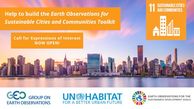
EO Toolkit for Sustainable Cities and Communities – Call for Contributions
bar

The Group on Earth Observations (GEO) and UN-Habitat are building an “Earth Observation Toolkit for Sustainable Cities and Communities” Programme designed to support UN Member States, including cities, in achieving the United Nations Sustainable Development Goal (SDG) 11 to “make cities and human settlements inclusive, safe, resilient and sustainable,” and to implement the New Urban Agenda (NUA) through sustained utilization of Earth observation (EO) data and applications.

The deadline for applications is 15 May 2020.

Dear Colleagues,

The Group on Earth Observations (GEO) and UN-Habitat are building an “Earth Observation Toolkit for Sustainable Cities and Communities” Programme designed to support UN Member States, including cities, in achieving the United Nations Sustainable Development Goal (SDG) 11 to “make cities and human settlements inclusive, safe, resilient and sustainable,” and to implement the New Urban Agenda (NUA) through sustained utilization of Earth observation (EO) data and applications.

The Programme aims to develop a customizable and continually updated toolkit on the integration of Earth observation and geospatial information into the urban monitoring and reporting processes on SDG targets and indicators based on inputs from UN Member States and cities.

The “EO Toolkit for Sustainable Cities and Communities” Programme will facilitate knowledge sharing, connect national, sub-national, and city experiences, and foster understanding between technical analysts and decision makers regarding the role and potential contributions of EO in support of SDG 11 and the NUA. Key areas will include but will not be limited to: monitoring urban expansion and densification, tracking accessibility to public transport, taking stock of open public spaces and their distributions across urban extents, mapping slums, informal settlements and inadequate housing conditions, assessing enviro-climatic conditions and spatial typology as well as urban vulnerabilities, and reducing the adverse per capita environmental impacts of cities, including air quality.

The programme will illustrate guidance and use cases on how EO technologies and advances in cloud computing platforms are applied to enable fast and cost effective access to, and use of, EO by countries, cities, and local communities. Special emphasis will be applied to analysis ready data, open data cubes, training data sets and Artificial Intelligence (AI) and Machine Learning (ML) techniques to harness EO for decision makers.

GEO Members, and interested cities from Member countries, are invited to contribute to the design and implementation of this toolkit, in accordance with their needs and priorities. A selected list of regionally representative countries, and interested cities from those countries, will participate in a Steering Committee that will serve for a period of one year, with the possibility for renewal. The Steering Committee, consisting of the selected countries and cities from those countries, UN-Habitat, EO providers, and representatives of GEO urban-related activities, will meet (in person or virtually) as needed, and consult electronically between meetings. The participating countries and cities will act as case studies and demonstration pilots to showcase how the toolkit is used to support their monitoring, reporting, and planning activities in relation to SDG 11, the NUA and other, identified urban-related priorities.
To learn more about the Programme, including assessment criteria and full details on how to join, please visit the website here.

The deadline for applications is 15 May, 2020.

Kind regards,

The GEO Secretariat


Announcements of Scientific Meetings                (see also ISPRS Calendar)

CRSS      

E- CSRS 2020

13-16 July 2020 bar

A Landmark Virtual Conference on Remote Sensing. The pandemic is not going to stop the world’s longest running national conference on remote sensing – the Canadian Remote Sensing Symposium. In 2020 we are offering a virtual conference using the latest technology to bring the whole world together. We invite our colleagues from around the world to join us in July for what we expect to be a unique and interesting conference showcasing the latest research and information our planet needs to make tomorrow better. 

The E- CSRS 2020 is now open for registration.
https://crss-sct.ca/conferences/csrs-2020/ 


EARSEL


40th EARSeL Symposium 2020

7-10 June 2021
University of Warsaw Library, Warsaw, Poland bar

Contact: Bogdan Zagajewski bogdan@uw.edu.pl
http://symposium.earsel.org/40th-symposium-Warszaw/home/


SPIE


SPIE Security + Defence

Edinburgh, United Kingdom
21 - 24 September 2020

Edinburgh International Conference Centre
https://spie.org/conferences-and-exhibitions/security-and-defence


GEO BUSINESS 2020


GEO Business 2020

24-25 September 2020

The geospatial event
ExCeL London, UK
www.GEOBusinessShow.com
info@geobusinessshow.com


Reports


First Report of the 2020 ISPRS Educational and Capacity Building Initiatives Project

UAV Photogrammetry for Developing Resilience and Educational Activities in Malawi

Read the report here…


Obituaries

Hans J. Wehrli      

Hans J. Wehrli
bar

† 20 February 2020

Hans passed away at the age of 93 years. He was an early pioneer in adapting computing power to the field of photogrammetry, through his work with Kern Instruments, Inc.

Read the obituary here… 


Gordon Petrie


Gordon Petrie
bar

† 4 April 2020

Emeritus Professor of Topographic Science and Honorary Research Fellow at the University of Glasgow passed away on 4 April 2020 at the age of 89.

Read the obituary here… 


ISPRS International Journal of Geo-Information — Open Access Journal

ISPRS International Journal of Geo-Information — Open Access Journal      

Two new Special Issues of ISPRS International Journal of Geo-Information initiated

Uncertainty Modeling in Spatial Data Analysis
Deadline for manuscript submissions: 30 June 2020
more information »

Data Quality in Geographic Information Science
Deadline for manuscript submissions: 31 January 2021
more information »


New publications in the ISPRS International Journal of Geo-Information
Open Access Journal
Volume 9, Issue 2 (February 2020)

Similarity Retention Loss (SRL) Based on Deep Metric Learning for Remote Sensing Image Retrieval
Zhao, Hongwei, Yuan, Lin, Zhao, Haoyu
No: 61

Conciliating Perspectives from Mapping Agencies and Web of Data on Successful European SDIs: Toward a European Geographic Knowledge Graph
Bucher, Bénédicte, Tiainen, Esa, Ellett von Brasch, Thomas, Janssen, Paul, Kotzinos, Dimitris, Čeh, Marjan, Rijsdijk, Martijn, Folmer, Erwin, Van Damme, Marie-Dominique, Zhral, Mehdi
No: 62

Towards Integrating Heterogeneous Data: A Spatial DBMS Solution from a CRC-LCL Project in Australia
Li, Wei, Zlatanova, Sisi, Diakite, Abdoulaye A., Aleksandrov, Mitko, Yan, Jinjin
No: 63

Spatiotemporal Evolution of Urban Expansion Using Landsat Time Series Data and Assessment of Its Influences on Forests
Zhang, Meng, Du, Huaqiang, Mao, Fangjie, Zhou, Guomo, Li, Xuejian, Dong, Luofan, Zheng, Junlong, Zhu, Di’en, Liu, Hua, Huang, Zihao, He, Shaobai
No: 64

Indoor Reconstruction from Floorplan Images with a Deep Learning Approach
Jang, Hanme, Yu, Kiyun, Yang, JongHyeon
No: 65

Multitemporal Land Use and Land Cover Classification from Time-Series Landsat Datasets Using Harmonic Analysis with a Minimum Spectral Distance Algorithm
Sun, Jing, Ongsomwang, Suwit
No: 67

Data Model for IndoorGML Extension to Support Indoor Navigation of People with Mobility Disabilities
Park, Seula, Yu, Kiyun, Kim, Jiyoung
No: 66

Analysis of Spatial Interaction between Different Food Cultures in South and North China: Practices from People’s Daily Life
Zhang, Haiping, Zhou, Xingxing, Huang, Yi
No: 68

SLiX: A GIS Toolbox to Support Along-Stream Knickzones Detection through the Computation and Mapping of the Stream Length-Gradient (SL) Index
Piacentini, Daniela, Troiani, Francesco, Servizi, Tommaso, Nesci, Olivia, Veneri, Francesco
No: 69

Spatiotemporal Analysis of Tourists and Residents in Shanghai Based on Location-Based Social Network’s Data from Weibo
Khan, Naimat Ullah, Wan, Wanggen, Yu, Shui
No: 70

Determination of a Hazard Compensations Based on Land Administration Data
Vučić, Nikola, Mađer, Mario, Pivac, Doris, Roić, Miodrag, Križanović, Josip
No: 71

A Simple Semantic-Based Data Storage Layout for Querying Point Clouds
El-Mahgary, Sami, Virtanen, Juho-Pekka, Hyyppä, Hannu
No: 72

Spatial Analysis of Seasonal Precipitation over Iran: Co-Variation with Climate Indices
Dehghani, Majid, Salehi, Somayeh, Mosavi, Amir, Nabipour, Narjes, Shamshirband, Shahaboddin, Ghamisi, Pedram
No: 73

Integration of Convolutional Neural Network and Error Correction for Indoor Positioning
Lu, Eric Hsueh-Chan, Ciou, Jing-Mei
No: 74

PalmitoAR: The Last Battle of the U.S. Civil War Reenacted Using Augmented Reality
Jung, Kwanghee, Nguyen, Vinh T., Yoo, Seung-Chul, Kim, Seungman, Park, Sohyun, Currie, Melissa
No: 75

Location-Based Social Network’s Data Analysis and Spatio-Temporal Modeling for the Mega City of Shanghai, China
Khan, Naimat Ullah, Wan, Wanggen, Yu, Shui
No: 76

Landscape Sustainability Evaluation of Ecologically Fragile Areas Based on Boltzmann Entropy
Xu, Jingyi, Liang, Xiaoying, Chen, Hai
No: 77

Algebraic Operations on Spatiotemporal Data Based on RDF
Zhu, Lin, Li, Nan, Bai, Luyi
No: 80

A Comparison of Satellite-Based Estimates of Urban Agglomeration Size for the Accra Area
Møller-Jensen, Lasse, Allotey, Albert N., Kofie, Richard Y., Yankson, Paul W. K.
No: 79

Requirements, Development, and Evaluation of A National Building Standard—A Swedish Case Study
Eriksson, Helen, Johansson, Tim, Olsson, Per-Ola, Andersson, Maria, Engvall, Jakob, Hast, Isak, Harrie, Lars
No: 78

Extracting Representative Images of Tourist Attractions from Flickr by Combining an Improved Cluster Method and Multiple Deep Learning Models
Han, Shanshan, Ren, Fu, Du, Qingyun, Gui, Dawei
No: 81

Assessing the Influence of Landmarks and Paths on the Navigational Efficiency and the Cognitive Load of Indoor Maps
Fang, Hao, Xin, Shiwei, Zhang, Yanlin, Wang, Zhong, Zhu, Jing
No: 82

Lattice Quad-Tree Indexing Algorithm for a Hexagonal Discrete Global Grid System
Zhou, Jianbin, Ben, Jin, Wang, Rui, Zheng, Mingyang, Du, Lingyu
No: 83

A Decentralized Model for Spatial Data Digital Rights Management
Zhang, Yun, Tang, Zhi, Huang, Jing, Ding, Yue, He, Hao, Xia, Xiaosheng, Li, Chunhua
No: 84

Application of AHP to Road Selection
Han, Yuan, Wang, Zhonghui, Lu, Xiaomin, Hu, Bowei
No: 86

Dynamics of Land Use and Land Cover Changes in An Arid Piedmont Plain in the Middle Reaches of the Kaxgar River Basin, Xinjiang, China
Wei, Tianfeng, Shangguan, Donghui, Shen, Xia, Ding, Yongjian, Yi, Shuhua
No: 87

A Survey on Big Data for Trajectory Analytics
Ribeiro de Almeida, Damião, de Souza Baptista, Cláudio, Gomes de Andrade, Fabio, Soares, Amilcar
No: 88

Space-Time Hierarchical Clustering for Identifying Clusters in Spatiotemporal Point Data
Lamb, David S., Downs, Joni, Reader, Steven
No: 85

Reliable 2D Crowdsourced Cadastral Surveys: Case Studies from Greece and Romania
Potsiou, Chryssy, Paunescu, Cornel, Ioannidis, Charalabos, Apostolopoulos, Konstantinos, Nache, Florin
No: 89

Open Geospatial Software and Data: A Review of the Current State and A Perspective into the Future
Coetzee, Serena, Ivánová, Ivana, Mitasova, Helena, Brovelli, Maria Antonia
No: 90

GIS-Based Assessment of Habitat Networks for Conservation Planning in Kas-Kekova Protected Area (Turkey)
Tezel, Dilek, Inam, Saban, Kocaman, Sultan
No: 91

Mapping Urban Spatial Structure Based on POI (Point of Interest) Data: A Case Study of the Central City of Lanzhou, China
Lu, Chenyu, Pang, Min, Zhang, Yang, Li, Hengji, Lu, Chengpeng, Tang, Xianglong, Cheng, Wei
No: 92

A Multi-Mode PDR Perception and Positioning System Assisted by Map Matching and Particle Filtering
Wang, Xuan, Chen, Guoliang, Yang, Mengyi, Jin, Saizhou
No: 93

Numerical Simulation of Donghu Lake Hydrodynamics and Water Quality Based on Remote Sensing and MIKE 21
Li, Xiaojuan, Huang, Mutao, Wang, Ronghui
No: 94

Research on Generating an Indoor Landmark Salience Model for Self-Location and Spatial Orientation from Eye-Tracking Data
Wang, Chengshun, Chen, Yufen, Zheng, Shulei, Yuan, Yecheng, Wang, Shuang
No: 97

A Spatial Analysis of the Potentials for Offshore Wind Farm Locations in the North Sea Region: Challenges and Opportunities
Gusatu, Laura Florentina, Yamu, Claudia, Zuidema, Christian, Faaij, André
No: 96

Geospatial Data Management Research: Progress and Future Directions
Breunig, Martin, Bradley, Patrick Erik, Jahn, Markus, Kuper, Paul, Mazroob, Nima, Rösch, Norbert, Al-Doori, Mulhim, Stefanakis, Emmanuel, Jadidi, Mojgan
No: 95

Towards Detecting Building Facades with Graffiti Artwork Based on Street View Images
Novack, Tessio, Vorbeck, Leonard, Lorei, Heinrich, Zipf, Alexander
No: 98

Intelligent High-Resolution Geological Mapping Based on SLIC-CNN
Sang, Xuejia, Xue, Linfu, Ran, Xiangjin, Li, Xiaoshun, Liu, Jiwen, Liu, Zeyu
No: 99

Using Open Source Data to Identify Transit Deserts in Four Major Chinese Cities
Jiao, Junfeng, Cai, Mingming
No: 100

Performance Testing on Vector vs. Raster Map Tiles—Comparative Study on Load Metrics
Netek, Rostislav, Masopust, Jan, Pavlicek, Frantisek, Pechanec, Vilem
No: 101

Digital Soil Mapping over Large Areas with Invalid Environmental Covariate Data
Fan, Nai-Qing, Zhu, A-Xing, Qin, Cheng-Zhi, Liang, Peng
No: 102

A Head/Tail Breaks-Based Method for Efficiently Estimating the Absolute Boltzmann Entropy of Numerical Raster Data
Zhang, Hong, Wu, Zhiwei
No: 103

Prototyping a Social Media Flooding Photo Screening System Based on Deep Learning
Ning, Huan, Li, Zhenlong, Hodgson, Michael E., Wang, Cuizhen (Susan)
No: 104

Remote Sensing Data Assimilation in Dynamic Crop Models Using Particle Swarm Optimization
Wagner, Matthias P., Slawig, Thomas, Taravat, Alireza, Oppelt, Natascha
No: 105

Measuring Impacts of Urban Environmental Elements on Housing Prices Based on Multisource Data—A Case Study of Shanghai, China
Chen, Liujia, Yao, Xiaojing, Liu, Yalan, Zhu, Yujiao, Chen, Wei, Zhao, Xizhi, Chi, Tianhe
No: 106

3D Land Administration: A Review and a Future Vision in the Context of the Spatial Development Lifecycle
Kalogianni, Eftychia, van Oosterom, Peter, Dimopoulou, Efi, Lemmen, Christiaan
No: 107

Modeling the Optimal Baseline for a Spaceborne Bistatic SAR System to Generate DEMs
Li, Shijin, Zhang, Shubi, Li, Tao, Gao, Yandong, Chen, Qianfu, Zhang, Xiang
No: 108

Research on an Urban Building Area Extraction Method with High-Resolution PolSAR Imaging Based on Adaptive Neighborhood Selection Neighborhoods for Preserving Embedding
Cheng, Bo, Cui, Shiai, Ma, Xiaoxiao, Liang, Chenbin
No: 109

The Use of AHP to Prioritize Five Waste Processing Plants Locations in Krakow
Siejka, Monika
No: 110

Vegetation Phenological Changes in Multiple Landforms and Responses to Climate Change
Han, Hongzhu, Bai, Jianjun, Ma, Gao, Yan, Jianwu
No: 111

Smart Tour Route Planning Algorithm Based on Naïve Bayes Interest Data Mining Machine Learning
Zhou, Xiao, Su, Mingzhan, Liu, Zhong, Hu, Yu, Sun, Bin, Feng, Guanghui
No: 112

A Spatiotemporal Dilated Convolutional Generative Network for Point-Of-Interest Recommendation
Liu, Chunyang, Liu, Jiping, Xu, Shenghua, Wang, Jian, Liu, Chao, Chen, Tianyang, Jiang, Tao
No: 113

Use of Mamdani Fuzzy Algorithm for Multi-Hazard Susceptibility Assessment in a Developing Urban Settlement (Mamak, Ankara, Turkey)
Yanar, Tugce, Kocaman, Sultan, Gokceoglu, Candan
No: 114

Assessing Similarities and Differences between Males and Females in Visual Behaviors in Spatial Orientation Tasks
Dong, Weihua, Zhan, Zhicheng, Liao, Hua, Meng, Liqiu, Liu, Jiping
No: 115

Predicting Future Locations of Moving Objects by Recurrent Mixture Density Network
Chen, Rui, Chen, Mingjian, Li, Wanli, Guo, Naikun
No: 116

Complexity Level of People Gathering Presentation on an Animated Map—Objective Effectiveness Versus Expert Opinion
Medyńska-Gulij, Beata, Wielebski, Łukasz, Halik, Łukasz, Smaczyński, Maciej
No: 117

Developing a Serious Game That Supports the Resolution of Social and Ecological Problems in the Toolset Environment of Cities: Skylines
Olszewski, Robert, Cegiełka, Mateusz, Szczepankowska, Urszula, Wesołowski, Jacek
No: 118

Geoweaver: Advanced Cyberinfrastructure for Managing Hybrid Geoscientific AI Workflows
Sun, Ziheng, Di, Liping, Burgess, Annie, Tullis, Jason A., Magill, Andrew B.
No: 119

Fusion of Sentinel-1 with Official Topographic and Cadastral Geodata for Crop-Type Enriched LULC Mapping Using FOSS and Open Data
Hütt, Christoph, Waldhoff, Guido, Bareth, Georg
No: 120

The Indoor Localization of a Mobile Platform Based on Monocular Vision and Coding Images
Liu, Fei, Zhang, Jixian, Wang, Jian, Li, Binghao
No: 122

Automatic Threat Detection for Historic Buildings in Dark Places Based on the Modified OptD Method
Błaszczak-Bąk, Wioleta, Suchocki, Czesław, Janicka, Joanna, Dumalski, Andrzej, Duchnowski, Robert, Sobieraj-Żłobińska, Anna
No: 123

A Harmonized Data Model for Noise Simulation in the EU
Kumar, Kavisha, Ledoux, Hugo, Schmidt, Richard, Verheij, Theo, Stoter, Jantien
No: 121

Analyzing Social-Geographic Human Mobility Patterns Using Large-Scale Social Media Data
Ebrahimpour, Zeinab, Wan, Wanggen, Velázquez García, José Luis, Cervantes, Ofelia, Hou, Li
No: 125

A New Approach to Refining Land Use Types: Predicting Point-of-Interest Categories Using Weibo Check-in Data
Zhang, Xucai, Sun, Yeran, Zheng, Anyao, Wang, Yu
No: 124

Using Areal Interpolation to Deal with Differing Regional Structures in International Research
Netrdová, Pavlína, Nosek, Vojtěch, Hurbánek, Pavol
No: 126

A Graph-Based Spatiotemporal Data Framework for 4D Natural Phenomena Representation and Quantification–An Example of Dust Events
Yu, Manzhu
No: 127

An OD Flow Clustering Method Based on Vector Constraints: A Case Study for Beijing Taxi Origin-Destination Data
Guo, Xiaogang, Xu, Zhijie, Zhang, Jianqin, Lu, Jian, Zhang, Hao
No: 128

Behavioural Effects of Spatially Structured Scoring Systems in Location-Based Serious Games—A Case Study in the Context of OpenStreetMap
Westerholt, Rene, Lorei, Heinrich, Höfle, Bernhard
No: 129

Promoting Environmental Justice through Integrated Mapping Approaches: The Map of Water Conflicts in Andalusia (Spain)
Pedregal, Belen, Laconi, Cesare, del Moral, Leandro
No: 130

Slope Hazard Monitoring Using High-Resolution Satellite Remote Sensing: Lessons Learned from a Case Study
Qin, Yuxiao, Hoppe, Edward, Perissin, Daniele
No: 131

Spatiotemporal Characteristics and Driving Force Analysis of Flash Floods in Fujian Province
Xiong, Junnan, Pang, Quan, Fan, Chunkun, Cheng, Weiming, Ye, Chongchong, Zhao, Yunliang, He, Yuanrong, Cao, Yifan
No: 133

On the Right Track: Comfort and Confusion in Indoor Environments
Vanhaeren, Nina, De Cock, Laure, Lapon, Lieselot, Van de Weghe, Nico, Ooms, Kristien, De Maeyer, Philippe
No: 132

Land Use and Land Cover Change Modeling and Future Potential Landscape Risk Assessment Using Markov-CA Model and Analytical Hierarchy Process
Nath, Biswajit, Wang, Zhihua, Ge, Yong, Islam, Kamrul, P. Singh, Ramesh, Niu, Zheng
No: 134

Understanding the Shared E-scooter Travels in Austin, TX
Jiao, Junfeng, Bai, Shunhua
No: 135

Traffic Impact Area Detection and Spatiotemporal Influence Assessment for Disaster Reduction Based on Social Media: A Case Study of the 2018 Beijing Rainstorm
Yang, Tengfei, Xie, Jibo, Li, Guoqing, Mou, Naixia, Chen, Cuiju, Zhao, Jing, Liu, Zhan, Lin, Zhenyu
No: 136

Visualization, Spatiotemporal Patterns, and Directional Analysis of Urban Activities Using Geolocation Data Extracted from LBSN
Rizwan, Muhammad, Wan, Wanggen, Gwiazdzinski, Luc
No: 137

↑ Up

bar

New publications in the ISPRS International Journal of Geo-Information
Open Access Journal
Volume 9, Issue 3 (March 2020)

Leveraging Container Technologies in a GIScience Project: A Perspective from Open Reproducible Research
Zaragozí, Benito M., Trilles, Sergio, Navarro-Carrión, José T.
No: 138

An English-Chinese Machine Translation and Evaluation Method for Geographical Names
Ren, Hongkai, Mao, Xi, Ma, Weijun, Wang, Jizhou, Wang, Linyun
No: 139

Uncovering the Relationship between Human Connectivity Dynamics and Land Use
Novović, Olivera, Brdar, Sanja, Mesaroš, Minučer, Crnojević, Vladimir, N. Papadopoulos, Apostolos
No: 140

Evaluating Spatial Scenarios for Sustainable Development in Quito, Ecuador
Salazar, Esthela, Henríquez, Cristián, Sliuzas, Richard, Qüense, Jorge
No: 141

Cartographic Symbology for Crisis Mapping: A Comparative Study
Kuveždić Divjak, Ana, Đapo, Almin, Pribičević, Boško
No: 142

Eutrophication Monitoring for Lake Pamvotis, Greece, Using Sentinel-2 Data
Peppa, Maria, Vasilakos, Christos, Kavroudakis, Dimitris
No: 143

Spatial Prediction of Landslide Susceptibility Based on GIS and Discriminant Functions
Wang, Guirong, Chen, Xi, Chen, Wei
No: 144

A Modeling Method for Automatic Extraction of Offshore Aquaculture Zones Based on Semantic Segmentation
Sui, Baikai, Jiang, Tao, Zhang, Zhen, Pan, Xinliang, Liu, Chenxi
No: 145

A Review of Geospatial Semantic Information Modeling and Elicitation Approaches
Kokla, Margarita, Guilbert, Eric
No: 146

Spatial Context-Based Local Toponym Extraction and Chinese Textual Address Segmentation from Urban POI Data
Kuai, Xi, Guo, Renzhong, Zhang, Zhijun, He, Biao, Zhao, Zhigang, Guo, Han
No: 147

GIScience Theory Based Assessment of Spatial Disparity of Geodetic Control Points Location
Bielecka, Elzbieta, Pokonieczny, Krzysztof, Borkowska, Sylwia
No: 148

Applicability of a Recreational-Grade Interferometric Sonar for the Bathymetric Survey and Monitoring of the Drava River
Halmai, Ákos, Gradwohl–Valkay, Alexandra, Czigány, Szabolcs, Ficsor, Johanna, Liptay, Zoltán Árpád, Kiss, Kinga, Lóczy, Dénes, Pirkhoffer, Ervin
No: 149

The Impact of “Strike Hard” on Repeat and Near-Repeat Residential Burglary in Beijing
Chen, Peng, Kurland, Justin
No: 150

Integration of Remote Sensing and GIS to Extract Plantation Rows from A Drone-Based Image Point Cloud Digital Surface Model
Fareed, Nadeem, Rehman, Khushbakht
No: 151

Public Traffic Congestion Estimation Using an Artificial Neural Network
Gu, Yanyan, Wang, Yandong, Dong, Shihai
No: 152

Making Smart Cities Resilient to Climate Change by Mitigating Natural Hazard Impacts
Ragia, Lemonia, Antoniou, Varvara
No: 153

Linking Ecosystem Services to Land Use Decisions: Policy Analyses, Multi-Scenarios, and Integrated Modelling
Peng, Li, Chen, Tiantian, Wang, Qiang, Deng, Wei
No: 154

Flow Modeling and Rendering to Support 3D River Shipping Based on Cross-Sectional Observation Data
Zhang, Xuequan, Liu, Jin, Hu, Zihe, Zhong, Ming
No: 156

Concept Lattice Method for Spatial Association Discovery in the Urban Service Industry
Liao, Weihua, Zhang, Zhiheng, Jiang, Weiguo
No: 155

Analysing the Police Patrol Routing Problem: A Review
Dewinter, Maite, Vandeviver, Christophe, Vander Beken, Tom, Witlox, Frank
No: 157

Identification of Urban Functional Regions in Chengdu Based on Taxi Trajectory Time Series Data
Liu, Xudong, Tian, Yongzhong, Zhang, Xueqian, Wan, Zuyi
No: 158

Think Spatially With Game Engine
Carbonell-Carrera, Carlos, Gunalp, Peri, Saorin, Jose Luis, Hess-Medler, Stephany
No: 159

A Novel Method of Spatiotemporal Dynamic Geo-Visualization of Criminal Data, Applied to Command and Control Centers for Public Safety
Salcedo-Gonzalez, Mayra, Suarez-Paez, Julio, Esteve, Manuel, Gómez, Jon Ander, Palau, Carlos Enrique
No: 160

Analyzing Road Coverage of Public Vehicles According to Number and Time Period for Installation of Road Inspection Systems
Kashiyama, Takehiro, Sekimoto, Yoshihide, Seto, Toshikazu, Lwin, Ko Ko
No: 161

Urban Scene Vectorized Modeling Based on Contour Deformation
Zhu, Lingjie, Shen, Shuhan, Gao, Xiang, Hu, Zhanyi
No: 162

FloodSim: Flood Simulation and Visualization Framework Using Position-Based Fluids
Hadimlioglu, I. Alihan, King, Scott A., Starek, Michael J.
No: 163

Accuracy Assessment of a UAV Block by Different Software Packages, Processing Schemes and Validation Strategies
Casella, Vittorio, Chiabrando, Filiberto, Franzini, Marica, Manzino, Ambrogio Maria
No: 164

Identifying Users’ Requirements for Emergency Mapping Team Operations in the Dominican Republic
Rosario Michel, Gregorio, Muñoz Tapia, Santiago, Manzano Aybar, Fernando, Guzmán Javier, Vladimir, Crompvoets, Joep
No: 165

Dynamic Online 3D Visualization Framework for Real-Time Energy Simulation Based on 3D Tiles
Mao, Bo, Ban, Yifang, Laumert, Björn
No: 166

Development and Application of an Intelligent Modeling Method for Ancient Wooden Architecture
Jiang, Yonghui, Li, Aiqun, Xie, Linlin, Hou, Miaole, Qi, Ying, Liu, Haoyu
No: 167

A Topology Preserving Gridding Method for Vector Features in Discrete Global Grid Systems
Zhou, Liangchen, Lian, Wenjie, Zhang, Yudi, Lin, Bingxian
No: 168

A Proposal for Modeling Indoor–Outdoor Spaces through IndoorGML, Open Location Code and OpenStreetMap
Cantarero Navarro, Rubén, Rubio Ruiz, Ana, Dorado Chaparro, Javier, Villanueva Molina, Felix J., Santofimia Romero, Maria J., Villa Alises, David, Lopez Lopez, Juan C.
No: 169

Minecraft as a Tool for Engaging Children in Urban Planning: A Case Study in Tirol Town, Brazil
de Andrade, Bruno, Poplin, Alenka, Sousa de Sena, Ítalo
No: 170

Indexing Mixed Aperture Icosahedral Hexagonal Discrete Global Grid Systems
Wang, Rui, Ben, Jin, Zhou, Jianbin, Zheng, Mingyang
No: 171

Study on the Level and Type Identification of Rural Development in Wuhan City’s New Urban Districts
Jiang, Liang, Luo, Jing, Zhang, Chunyan, Tian, Lingling, Liu, Qingqing, Chen, Guolei, Tian, Ye
No: 172

Estimation of Crop Water Deficit in Lower Bari Doab, Pakistan Using Reflection-Based Crop Coefficient
Javed, Muhammad Asif, Rashid Ahmad, Sajid, Awan, Wakas Karim, Munir, Bilal Ahmed
No: 173

Measuring Delays for Bicycles at Signalized Intersections Using Smartphone GPS Tracking Data
Gillis, Dominique, Gautama, Sidharta, Van Gheluwe, Casper, Semanjski, Ivana, Lopez, Angel J., Lauwers, Dirk
No: 174

Online Education Program in Operational Meteorology and a Case Study about a Product for Decision Making
Garbanzo-Salas, Marcial, Jimenez-Robles, Diana
No: 175

From Spatial Data Infrastructures to Data Spaces—A Technological Perspective on the Evolution of European SDIs
Kotsev, Alexander, Minghini, Marco, Tomas, Robert, Cetl, Vlado, Lutz, Michael
No: 176

Information Fusion for Cultural Heritage Three-Dimensional Modeling of Malay Cities
Mohd Noor, Norzailawati, Ibrahim, Illyani, Abdullah, Alias, Abdullah, Ahmad Afiq Aiman
No: 177

Methodological Approach to Incorporate the Involve of Stakeholders in the Geodesign Workflow of Transmission Line Projects
Moreno-Marimbaldo, Francisco-Javier, Manso-Callejo, Miguel-Ángel
No: 178

Spatial Relationship between Natural Wetlands Changes and Associated Influencing Factors in Mainland China
Zhou, Ting, Niu, Anyi, Huang, Zhanpeng, Ma, Jiaojiao, Xu, Songjun
No: 179

A GIS-Based Multi-Criteria Decision Analysis Model for Determining Glacier Vulnerability
Yalcin, Mustafa
No: 180

Extended Classification Course Improves Road Intersection Detection from Low-Frequency GPS Trajectory Data
Chen, Banqiao, Ding, Chibiao, Ren, Wenjuan, Xu, Guangluan
No: 181

Classification and Segmentation of Mining Area Objects in Large-Scale Spares Lidar Point Cloud Using a Novel Rotated Density Network
Yan, Yueguan, Yan, Haixu, Guo, Junting, Dai, Huayang
No: 182

Spatio-Temporal Analysis of Intense Convective Storms Tracks in a Densely Urbanized Italian Basin
Sangiorgio, Matteo, Barindelli, Stefano
No: 183

Uber Movement Data: A Proxy for Average One-way Commuting Times by Car
Sun, Yeran, Ren, Yinming, Sun, Xuan
No: 184

Recent Sea Level Change in the Black Sea from Satellite Altimetry and Tide Gauge Observations
Avşar, Nevin Betül, Kutoğlu, Şenol Hakan
No: 185

↑ Up

bar

New publications in the ISPRS International Journal of Geo-Information
Open Access Journal
Volume 9, Issue 4 (March April)

The Relationship between Near-Repeat Street Robbery and the Environment: Evidence from Malmö, Sweden
Rasmusson, Markus, Helbich, Marco
No: 188

A Hybrid Method to Incrementally Extract Road Networks Using Spatio-Temporal Trajectory Data
Zhang, Yunfei, Zhang, Zexu, Huang, Jincai, She, Tingting, Deng, Min, Fan, Hongchao, Xu, Peng, Deng, Xingshen
No: 186

A Multi-Scale Water Extraction Convolutional Neural Network (MWEN) Method for GaoFen-1 Remote Sensing Images
Guo, Hongxiang, He, Guojin, Jiang, Wei, Yin, Ranyu, Yan, Lei, Leng, Wanchun
No: 189

Quantification Method for the Uncertainty of Matching Point Distribution on 3D Reconstruction
Bian, Yuxia, Liu, Xuejun, Wang, Meizhen, Liu, Hongji, Fang, Shuhong, Yu, Liang
No: 187

IT Services and Crowdsourcing in Support of the Hellenic Cadastre: Advanced Citizen Participation and Crowdsourcing in the Official Property Registration Process
Mourafetis, George, Potsiou, Chryssy
No: 190

Understanding Chinese Urban Form: The Universal Fractal Pattern of Street Networks over 298 Cities
Ma, Ding, Guo, Renzhong, Zheng, Ye, Zhao, Zhigang, He, Fangning, Zhu, Wei
No: 192

Abandoned Farmland Location in Areas Affected by Rapid Urbanization Using Textural Characterization of High Resolution Aerial Imagery
Ruiz-Lendínez, Juan José
No: 191

Optimal Location Analysis of Delivery Parcel-Pickup Points Using AHP and Network Huff Model: A Case Study of Shiweitang Sub-District in Guangzhou City, China
Zheng, Zilai, Morimoto, Takehiro, Murayama, Yuji
No: 193

Landslide Image Captioning Method Based on Semantic Gate and Bi-Temporal LSTM
Cui, Wenqi, He, Xin, Yao, Meng, Wang, Ziwei, Li, Jie, Hao, Yuanjie, Wu, Weijie, Zhao, Huiling, Chen, Xianfeng, Cui, Wei
No: 194

Assessment of Enhanced Dempster-Shafer Theory for Uncertainty Modeling in a GIS-Based Seismic Vulnerability Assessment Model, Case Study—Tabriz City
Delavar, Mahmoud Reza, Sadrykia, Mansoureh
No: 195

The Influence of Map Projections on People’s Global-Scale Cognitive Map: A Worldwide Study
Lapon, Lieselot, Ooms, Kristien, De Maeyer, Philippe
No: 196

Cartographic Vandalism in the Era of Location-Based Games—The Case of OpenStreetMap and Pokémon GO
Juhász, Levente, Novack, Tessio, Hochmair, Hartwig H., Qiao, Sen
No: 197

Distribution Pattern of Coseismic Landslides Triggered by the 2017 Jiuzhaigou Ms 7.0 Earthquake of China: Control of Seismic Landslide Susceptibility
Chen, Xiao-li, Shan, Xin-jian, Wang, Ming-ming, Liu, Chun-guo, Han, Na-na
No: 198

An Approach Based on Landsat Images for Shoreline Monitoring to Support Integrated Coastal Management—A Case Study, Ezbet Elborg, Nile Delta, Egypt
Elnabwy, Mohamed T., Elbeltagi, Emad, El Banna, Mahmoud M., Elshikh, Mohamed M.Y., Motawa, Ibrahim, Kaloop, Mosbeh R.
No: 199

The Cultural Heritage and the Shaping of Tourist Itineraries in Rural Areas: The Case of Historical Ensembles of Extremadura, Spain
Sánchez-Martín, José-Manuel, Gurría-Gascón, José-Luis, García-Berzosa, María-José
No: 200

Skewness-Based Partitioning in SpatialHadoop
Belussi, Alberto, Migliorini, Sara, Eldawy, Ahmed
No: 201

Disaster Mitigation in Urban Pakistan Using Agent Based Modeling with GIS
Maqbool, Ayesha, Usmani, Zain ul Abideen, Afzal, Farkhanda, Razia, Alia
No: 203

DM-SLAM: A Feature-Based SLAM System for Rigid Dynamic Scenes
Cheng, Junhao, Wang, Zhi, Zhou, Hongyan, Li, Li, Yao, Jian
No: 202

Spatial Paradigms in Road Networks and Their Delimitation of Urban Boundaries Based on KDE
Lin, Yuying, Hu, Xisheng, Lin, Mingshui, Qiu, Rongzu, Lin, Jinguo, Li, Baoyin
No: 204

Micro-scale Flood Hazard Assessment Based on Catastrophe Theory and an Integrated 2-D Hydraulic Model: A Case Study of Gongshuangcha Detention Basin in Dongting Lake Area, China
Shen, Dingtao, Qian, Tianlu, Xia, Yu, Zhang, Yu, Wang, Jiechen
No: 206

Flood Evacuation Mapping Using a Time–Distance cartogram
Park, Seula, Lee, Gunhak, Kim, Jung Ok
No: 207

The Spatial Heterogeneity of Factors of Drug Dealing: A Case Study from ZG, China
Chen, Jianguo, Liu, Lin, Liu, Huiting, Long, Dongping, Xu, Chong, Zhou, Hanlin
No: 205

An Analysis of Online Reputation Indicators by Means of Geostatistical Techniques—The Case of Rural Accommodation in Extremadura, Spain
Martín-Delgado, Luz-María, Sánchez-Martín, José-Manuel, Rengifo-Gallego, Juan-Ignacio
No: 208

CostNet: A Concise Overpass Spatiotemporal Network for Predictive Learning
Sun, Fengzhen, Li, Shaojie, Wang, Shaohua, Liu, Qingjun, Zhou, Lixin
No: 209

Tri-Clustering Based Exploration of Temporal Resolution Impacts on Spatio-Temporal Clusters in Geo-Referenced Time Series
Wu, Xiaojing, Zheng, Donghai
No: 210

Mountainous City Featured Landscape Planning Based on GIS-AHP Analytical Method
Liu, Yanlong, Li, Li
No: 211

Contribution of Connectivity Assessments to Green Infrastructure (GI)
Bolliger, Janine, Silbernagel, Janet
No: 212

Spatial Analysis of the Rural-Urban Structure of the Spanish Municipalities
Nieto Masot, Ana, Cárdenas Alonso, Gema, Engelmo Moriche, Ángela
No: 213

Automatic Generation of High-Accuracy Stair Paths for Straight, Spiral, and Winder Stairs Using IFC-Based Models
Lin, Will Y.
No: 215

Different Sourcing Point of Interest Matching Method Considering Multiple Constraints
Li, Chengming, Liu, Li, Dai, Zhaoxin, Liu, Xiaoli
No: 214

Spatial Orientation Skill Performance with a Workshop Based on Green Infrastructure in Cities
Carbonell-Carrera, Carlos, Saorin, Jose Luis, Melián-Díaz, Dámari, Hess-Medler, Stephany
No: 216

Site Selection of Digital Signage in Beijing: A Combination of Machine Learning and an Empirical Approach
Wang, Yuxue, Li, Su, Zhang, Xun, Jiang, Dong, Hao, Mengmeng, Zhou, Rui
No: 217

Urban Fire Dynamics and Its Association with Urban Growth: Evidence from Nanjing, China
Zhang, Xiaoxiang, Yao, Jing, Sila-Nowicka, Katarzyna, Jin, Yuhao
No: 218

The Effects of Length and Orientation on Numerical Representation in Flow Maps
Lin, Yun, Xue, Chengqi, Niu, Yafeng, Zhou, Xiaozhou, Zhu, Yanfei
No: 219

GNSS Positioning Using Mobile Devices with the Android Operating System
Dabove, Paolo, Di Pietra, Vincenzo, Piras, Marco
No: 220

Assessing Safety and Suitability of Old Trails for Hiking Using Ground and Drone Surveys
Lee, Shiou Yih, Du, Chengju, Chen, Zhihui, Wu, Hao, Guan, Kailang, Liu, Yirong, Cui, Yongjie, Li, Wenyan, Fan, Qiang, Liao, Wenbo
No: 221

Citizens’ Spatial Footprint on Twitter—Anomaly, Trend and Bias Investigation in Istanbul
Gulnerman, Ayse Giz, Karaman, Himmet, Pekaslan, Direnc, Bilgi, Serdar
No: 222

Accuracy of Ground Surface Interpolation from Airborne Laser Scanning (ALS) Data in Dense Forest Cover
Cățeanu, Mihnea, Ciubotaru, Arcadie
No: 224

Effectiveness of Sentinel-2 in Multi-Temporal Post-Fire Monitoring When Compared with UAV Imagery
Pádua, Luís, Guimarães, Nathalie, Adão, Telmo, Sousa, António, Peres, Emanuel, Sousa, Joaquim J.
No: 225

A Citizen-Centric Approach for the Improvement of Territorial Services Management
Sebillo, Monica, Vitiello, Giuliana, Grimaldi, Michele, De Piano, Antonio
No: 223

Estimation of Indoor Location Through Magnetic Field Data: An Approach Based On Convolutional Neural Networks
Galván-Tejada, Carlos E., Zanella-Calzada, Laura A., García-Domínguez, Antonio, Magallanes-Quintanar, Rafael, Luna-García, Huizilopoztli, Celaya-Padilla, Jose M., Galván-Tejada, Jorge I., Vélez-Rodríguez, Alberto, Gamboa-Rosales, Hamurabi
No: 226

Missing Data Imputation for Geolocation-based Price Prediction Using KNN–MCF Method
Sanjar, Karshiev, Bekhzod, Olimov, Kim, Jaesoo, Paul, Anand, Kim, Jeonghong
No: 227

Digital Twin: Research Framework to Support Preventive Conservation Policies
Jouan, Pierre, Hallot, Pierre
No: 228

GIS-Based Statistical Analysis of Detecting Fear of Crime with Digital Sketch Maps: A Hungarian Multicity Study
Jakobi, Ákos, Pődör, Andrea
No: 229

When Traditional Selection Fails: How to Improve Settlement Selection for Small-Scale Maps Using Machine Learning
Karsznia, Izabela, Sielicka, Karolina
No: 230

Recognizing Linear Building Patterns in Topographic Data by Using Two New Indices based on Delaunay Triangulation
He, Xianjin, Deng, Min, Luo, Guowei
No: 231

Correlation Studies between Land Cover Change and Baidu Index: A Case Study of Hubei Province
Zhao, Yongqing, Li, Rendong, Wu, Mingquan
No: 232

General Method for Extending Discrete Global Grid Systems to Three Dimensions
Ulmer, Benjamin, Hall, John, Samavati, Faramarz
No: 233

Development of the Theory of Six Value Aggregation Paths in Network Modeling for Spatial Analyses
Kowalczyk, Anna Maria, Bajerowski, Tomasz
No: 234

An Improved Parallelized Multi-Objective Optimization Method for Complex Geographical Spatial Sampling: AMOSA-II
Li, Xiaolan, Gao, Bingbo, Bai, Zhongke, Pan, Yuchun, Gao, Yunbing
No: 236

Potential Water Harvesting Sites Identification Using Spatial Multi-Criteria Evaluation in Maysan Province, Iraq
Alwan, Imzahim A., Aziz, Nadia A., Hamoodi, Mustafa N.
No: 235

Evaluation of Geological and Ecological Bearing Capacity and Spatial Pattern along Du-Wen Road Based on the Analytic Hierarchy Process (AHP) and the Technique for Order of Preference by Similarity to an Ideal Solution (TOPSIS) Method
Wang, Zhoufeng, He, Xiangqi, Zhang, Chen, Xu, Jianwei, Wang, Yujun
No: 237

A Postearthquake Multiple Scene Recognition Model Based on Classical SSD Method and Transfer Learning
Xu, Zhiqiang, Chen, Yumin, Yang, Fan, Chu, Tianyou, Zhou, Hongyan
No: 238

A Multi-Scale Representation of Point-of-Interest (POI) Features in Indoor Map Visualization
Xiao, Yi, Ai, Tinghua, Yang, Min, Zhang, Xiang
No: 239

Digital Twin and CyberGIS for Improving Connectivity and Measuring the Impact of Infrastructure Construction Planning in Smart Cities
Shirowzhan, Sara, Tan, Willie, Sepasgozar, Samad M. E.
No: 240

Identifying Urban Residents’ Activity Space at Multiple Geographic Scales Using Mobile Phone Data
Gong, Lunsheng, Jin, Meihan, Liu, Qiang, Gong, Yongxi, Liu, Yu
No: 241

A New Architecture of Densely Connected Convolutional Networks for Pan-Sharpening
Huang, Wei, Feng, Jingjing, Wang, Hua, Sun, Le
No: 242

A Multi-Objective Permanent Basic Farmland Delineation Model Based on Hybrid Particle Swarm Optimization
Wang, Hua, Li, Wenwen, Huang, Wei, Nie, Ke
No: 243

GIS-Based Modeling for Selection of Dam Sites in the Kurdistan Region, Iraq
Othman, Arsalan Ahmed, Al-Maamar, Ahmed F., Al-Manmi, Diary Ali Mohammed Amin, Liesenberg, Veraldo, Hasan, Syed E., Obaid, Ahmed K., Al-Quraishi, Ayad M. Fadhil
No: 244

Watershed Segmentation Algorithm Based on Luv Color Space Region Merging for Extracting Slope Hazard Boundaries
Zhang, Mingmei, Xue, Yongan, Ge, Yonghui, Zhao, Jinling
No: 246

Spatial Reliability Assessment of Social Media Mining Techniques with Regard to Disaster Domain-Based Filtering
Gulnerman, Ayse Giz, Karaman, Himmet
No: 245

Exploring Resilient Observability in Traffic-Monitoring Sensor Networks: A Study of Spatial–Temporal Vehicle Patterns
Tang, Junqing, Wan, Li, Nochta, Timea, Schooling, Jennifer, Yang, Tianren
No: 247

Evaluation of Replication Mechanisms on Selected Database Systems
Pohanka, Tomáš, Pechanec, Vilém
No: 249

A Method for Generating Variable-Scale Maps for Small Displays
Zhao, Rong, Ai, Tinghua, Wen, Chen
No: 250

A Vector Line Simplification Algorithm Based on the Douglas–Peucker Algorithm, Monotonic Chains and Dichotomy
Liu, Bo, Liu, Xuechao, Li, Dajun, Shi, Yu, Fernandez, Gabriela, Wang, Yandong
No: 251

Machine Learning for Gully Feature Extraction Based on a Pan-Sharpened Multispectral Image: Multiclass vs. Binary Approach
Phinzi, Kwanele, Abriha, Dávid, Bertalan, László, Holb, Imre, Szabó, Szilárd
No: 252

Detection of Levee Damage Based on UAS Data—Optical Imagery and LiDAR Point Clouds
Bakuła, Krzysztof, Pilarska, Magdalena, Salach, Adam, Kurczyński, Zdzisław
No: 248

Comparison of Relief Shading Techniques Applied to Landforms
Farmakis-Serebryakova, Marianna, Hurni, Lorenz
No: 253

High-Resolution Remote Sensing Image Integrity Authentication Method Considering Both Global and Local Features
Zhang, Xingang, Yan, Haowen, Zhang, Liming, Wang, Hao
No: 254

Efficient Coarse Registration of Pairwise TLS Point Clouds Using Ortho Projected Feature Images
Liu, Hua, Zhang, Xiaoming, Xu, Yuancheng, Chen, Xiaoyong
No: 255

Water Areas Segmentation from Remote Sensing Images Using a Separable Residual SegNet Network
Weng, Liguo, Xu, Yiming, Xia, Min, Zhang, Yonghong, Liu, Jia, Xu, Yiqing
No: 256

Determination of the Normalized Difference Vegetation Index (NDVI) with Top-of-Canopy (TOC) Reflectance from a KOMPSAT-3A Image Using Orfeo ToolBox (OTB) Extension
Lee, Kiwon, Kim, Kwangseob, Lee, Sun-Gu, Kim, Yongseung
No: 257

Dynamics of Sediments in Reservoir Inflows: A Case Study of the Skalka and Nechranice Reservoirs, Czech Republic
Pacina, Jan, Lenďáková, Zuzana, Štojdl, Jiří, Matys Grygar, Tomáš, Dolejš, Martin
No: 258

Selecting Prices Determinants and Including Spatial Effects in Peer-to-Peer Accommodation
Suárez-Vega, Rafael, Hernández, Juan M.
No: 259

Multitemporal Analysis of Gully Erosion in Olive Groves by Means of Digital Elevation Models Obtained with Aerial Photogrammetric and LiDAR Data
Fernández, Tomás, Pérez-García, José Luis, Gómez-López, José Miguel, Cardenal, Javier, Calero, Julio, Sánchez-Gómez, Mario, Delgado, Jorge, Tovar-Pescador, Joaquín
No: 260

An Efficient Indoor Wi-Fi Positioning Method Using Virtual Location of AP
Xu, Fan, Hu, Xuke, Luo, Shuaiwei, Shang, Jianga
No: 261

Assessing Earthquake-Induced Urban Rubble by Means of Multiplatform Remotely Sensed Data
Pollino, Maurizio, Cappucci, Sergio, Giordano, Ludovica, Iantosca, Domenico, De Cecco, Luigi, Bersan, Danilo, Rosato, Vittorio, Borfecchia, Flavio
No: 262

Household Level Vulnerability Analysis—Index and Fuzzy Based Methods
Baučić, Martina
No: 263

Quantifying the Characteristics of the Local Urban Environment through Geotagged Flickr Photographs and Image Recognition
Chen, Meixu, Arribas-Bel, Dani, Singleton, Alex
No: 264

Oil Flow Analysis in the Maritime Silk Road Region Using AIS Data
Xiao, Yijia, Chen, Yanming, Liu, Xiaoqiang, Yan, Zhaojin, Cheng, Liang, Li, Manchun
No: 265

A CitSci Approach for Rapid Earthquake Intensity Mapping: A Case Study from Istanbul (Turkey)
Yalcin, Ilyas, Kocaman, Sultan, Gokceoglu, Candan
No: 266

Application of Hybrid Prediction Methods in Spatial Assessment of Inland Excess Water Hazard
Laborczi, Annamária, Bozán, Csaba, Körösparti, János, Szatmári, Gábor, Kajári, Balázs, Túri, Norbert, Kerezsi, György, Pásztor, László
No: 268

Deep Learning for Fingerprint Localization in Indoor and Outdoor Environments
Li, Da, Lei, Yingke, Li, Xin, Zhang, Haichuan
No: 267

Enhancing Image-Based Multiscale Heritage Recording with Near-Infrared Data
Adamopoulos, Efstathios, Rinaudo, Fulvio
No: 269

Representing Complex Evolving Spatial Networks: Geographic Network Automata
Anderson, Taylor, Dragićević, Suzana
No: 270

A Systematic Review into Factors Influencing Sketch Map Quality
Hátlová, Kateřina, Hanus, Martin
No: 271

A Holistic Overview of Anticipatory Learning for the Internet of Moving Things: Research Challenges and Opportunities
Cao, Hung, Wachowicz, Monica
No: 272

Identification and Extraction of Geomorphological Features of Landslides Using Slope Units for Landslide Analysis
Wang, Kai, Xu, Hui, Zhang, Shaojie, Wei, Fangqiang, Xie, Wanli
No: 274

Testing a Comprehensive Volcanic Risk Assessment of Tenerife by Volcanic Hazard Simulations and Social Vulnerability Analysis
Liu, Weiqiang, Li, Long, Chen, Longqian, Wen, Mingxin, Wang, Jia, Yuan, Lina, Liu, Yunqiang, Li, Han
No: 273

Comparing Machine Learning Models and Hybrid Geostatistical Methods Using Environmental and Soil Covariates for Soil pH Prediction
Tziachris, Panagiotis, Aschonitis, Vassilis, Chatzistathis, Theocharis, Papadopoulou, Maria, Doukas, Ioannis (John) D.
No: 276

Impact of Various Atmospheric Corrections on Sentinel-2 Land Cover Classification Accuracy Using Machine Learning Classifiers
Rumora, Luka, Miler, Mario, Medak, Damir
No: 277

An Integrative Approach to Assessing Property Owner Perceptions and Modeled Risk to Coastal Hazards
Hao, Huili, Eulie, Devon, Weide, Allison
No: 275

IFC Schemas in ISO/TC 211 Compliant UML for Improved Interoperability between BIM and GIS
Jetlund, Knut, Onstein, Erling, Huang, Lizhen
No: 278

Hierarchical Behavior Model for Multi-Agent System with Evasion Capabilities and Dynamic Memory
Cetin, Aydin, Bulbul, Erhan
No: 279

Spatial–Temporal Evolution and Analysis of the Driving Force of Oil Palm Patterns in Malaysia from 2000 to 2018
Li, Wenhui, Fu, Dongjie, Su, Fenzhen, Xiao, Yang
No: 280

Spatiotemporal Analysis of Taxi-Driver Shifts Using Big Trace Data
Cheng, Luling, Yang, Xue, Tang, Luliang, Duan, Qian, Kan, Zihan, Zhang, Xia, Ye, Xinyue
No: 281

Geological Map Generalization Driven by Size Constraints
Sayidov, Azimjon, Aliakbarian, Meysam, Weibel, Robert
No: 284

Exploiting Two-Dimensional Geographical and Synthetic Social Influences for Location Recommendation
Liu, Jiping, Zhang, Zhiran, Liu, Chunyang, Qiu, Agen, Zhang, Fuhao
No: 285

Spatiotemporal Variation of NDVI in the Vegetation Growing Season in the Source Region of the Yellow River, China
Wang, Mingyue, Fu, Jun’e, Wu, Zhitao, Pang, Zhiguo
No: 282

Damage Signature Generation of Revetment Surface along Urban Rivers Using UAV-Based Mapping
Chen, Ting, He, Haiqing, Li, Dajun, An, Puyang, Hui, Zhenyang
No: 283

↑ Up


ISPRS Journal of Photogrammetry and Remote Sensing

ISPRS Journal of Photogrammetry and Remote Sensing      

New publications in the ISPRS Journal of Photogrammetry and Remote Sensing Volume 162 (April 2020)

Editorial Board

Pages: ii

Directionally constrained fully convolutional neural network for airborne LiDAR point cloud classification
Congcong Wen, Lina Yang, Xiang Li, Ling Peng, Tianhe Chi
Pages: 50-62

LiDAR-guided dense matching for detecting changes and updating of buildings in Airborne LiDAR data
K. Zhou, R. Lindenbergh, B. Gorte, S. Zlatanova
Pages: 200-213

Detection of Xylella fastidiosa infection symptoms with airborne multispectral and thermal imagery: Assessing bandset reduction performance from hyperspectral analysis
T. Poblete, C. Camino, P.S.A. Beck, A. Hornero, T. Kattenborn, M. Saponari, D. Boscia, J.A. Navas-Cortes, P.J. Zarco-Tejada
Pages: 27-40

Integrated geometric self-calibration of stereo cameras onboard the ZiYuan-3 satellite
Bo Yang, Yingdong Pi, Xin Li, Yuhui Yang
Pages: 173-183

Voronoi classified and clustered data constellation: A new 3D data structure for geomarketing strategies
Suhaibah Azri, Uznir Ujang, Alias [Abdul Rahman]
Pages: 1-16

Geocoding of trees from street addresses and street-level images
Daniel Laumer, Nico Lang, Natalie [van Doorn], Oisin [Mac Aodha], Pietro Perona, Jan Dirk Wegner
Pages: 125-136

Recent ENSO influence on East African drought during rainy seasons through the synergistic use of satellite and reanalysis data
Seonyoung Park, Daehyun Kang, Cheolhee Yoo, Jungho Im, Myong-In Lee
Pages: 17-26

A global canopy water content product from AVHRR/Metop
Francisco Javier García-Haro, Manuel Campos-Taberner, Álvaro Moreno, Håkan Torbern Tagesson, Fernando Camacho, Beatriz Martínez, Sergio Sánchez, María Piles, Gustau Camps-Valls, Marta Yebra, María Amparo Gilabert
Pages: 77-93

Conterminous United States land cover change patterns 2001–2016 from the 2016 National Land Cover Database
Collin Homer, Jon Dewitz, Suming Jin, George Xian, Catherine Costello, Patrick Danielson, Leila Gass, Michelle Funk, James Wickham, Stephen Stehman, Roger Auch, Kurt Riitters
Pages: 184-199

Destruction from sky: Weakly supervised approach for destruction detection in satellite imagery
Muhammad Usman Ali, Waqas Sultani, Mohsen Ali
Pages: 115-124

Thick cloud and cloud shadow removal in multitemporal imagery using progressively spatio-temporal patch group deep learning
Qiang Zhang, Qiangqiang Yuan, Jie Li, Zhiwei Li, Huanfeng Shen, Liangpei Zhang
Pages: 148-160

ResUNet-a: A deep learning framework for semantic segmentation of remotely sensed data
Foivos I. Diakogiannis, François Waldner, Peter Caccetta, Chen Wu
Pages: 94-114

An integrated environmental analytics system (IDEAS) based on a DGGS
Colin Robertson, Chiranjib Chaudhuri, Majid Hojati, Steven A. Roberts
Pages: 214-228

Global high-resolution mountain green cover index mapping based on Landsat images and Google Earth Engine
Jinhu Bian, Ainong Li, Guangbin Lei, Zhengjian Zhang, Xi Nan
Pages: 63-76

Segmentation of large-scale remotely sensed images on a Spark platform: A strategy for handling massive image tiles with the MapReduce model
Ning Wang, Fang Chen, Bo Yu, Yuchu Qin
Pages: 137-147

Above-ground biomass estimation and yield prediction in potato by using UAV-based RGB and hyperspectral imaging
Bo Li, Xiangming Xu, Li Zhang, Jiwan Han, Chunsong Bian, Guangcun Li, Jiangang Liu, Liping Jin
Pages: 161-172

A trunk-based SLAM backend for smartphones with online SLAM in large-scale forest inventories
Yongxiang Fan, Zhongke Feng, Chaoyong Shen, Tauheed Ullah Khan, Abdul Mannan, Xiang Gao, Panpan Chen, Sajjad Saeed
Pages: 41-49

bar

New publications in the ISPRS Journal of Photogrammetry and Remote Sensing Volume 163 (May 2020)

Editorial Board

Pages: ii

A label-noise robust active learning sample collection method for multi-temporal urban land-cover classification and change analysis
Jiayi Li, Xin Huang, Xiaoyu Chang
Pages: 1-17

SLAM-aided forest plot mapping combining terrestrial and mobile laser scanning
Jie Shao, Wuming Zhang, Nicolas Mellado, Nan Wang, Shuangna Jin, Shangshu Cai, Lei Luo, Thibault Lejemble, Guangjian Yan
Pages: 214-230

A framework for large-scale mapping of human settlement extent from Sentinel-2 images via fully convolutional neural networks
Chunping Qiu, Michael Schmitt, Christian Geiß, Tzu-Hsin Karen Chen, Xiao Xiang Zhu
Pages: 152-170

Filtering of airborne LiDAR bathymetry based on bidirectional cloth simulation
Anxiu Yang, Ziyin Wu, Fanlin Yang, Dianpeng Su, Yue Ma, Dineng Zhao, Chao Qi
Pages: 49-61

Automated and efficient powerline extraction from laser scanning data using a voxel-based subsampling with hierarchical approach
Jaehoon Jung, Erzhuo Che, Michael J. Olsen, Katherine C. Shafer
Pages: 343-361

Region level SAR image classification using deep features and spatial constraints
Anjun Zhang, Xuezhi Yang, Shuai Fang, Jiaqiu Ai
Pages: 36-48

Global multi-scale grid integer coding and spatial indexing: A novel approach for big earth observation data
Yi Lei, Xiaochong Tong, Yongsheng Zhang, Chunping Qiu, Xiangyu Wu, Guangling Lai, He Li, Congzhou Guo, Yong Zhang
Pages: 202-213

Fractional evergreen forest cover mapping by MODIS time-series FEVC-CV methods at sub-pixel scales
Yingying Yang, Taixia Wu, Shudong Wang, Hao Li
Pages: 272-283

Deep point embedding for urban classification using ALS point clouds: A new perspective from local to global
Rong Huang, Yusheng Xu, Danfeng Hong, Wei Yao, Pedram Ghamisi, Uwe Stilla
Pages: 62-81

Mapping coastal wetlands of China using time series Landsat images in 2018 and Google Earth Engine
Xinxin Wang, Xiangming Xiao, Zhenhua Zou, Luyao Hou, Yuanwei Qin, Jinwei Dong, Russell B. Doughty, Bangqian Chen, Xi Zhang, Ying Chen, Jun Ma, Bin Zhao, Bo Li
Pages: 312-326

Interactive dense point clouds in a game engine
Juho-Pekka Virtanen, Sylvie Daniel, Tuomas Turppa, Lingli Zhu, Arttu Julin, Hannu Hyyppä, Juha Hyyppä
Pages: 375-389

Remote sensing of chlorophyll a concentration in turbid coastal waters based on a global optical water classification system
T.W. Cui, J. Zhang, K. Wang, J.W. Wei, B. Mu, Y. Ma, J.H. Zhu, R.J. Liu, X.Y. Chen
Pages: 187-201

Inlier extraction for point cloud registration via supervoxel guidance and game theory optimization
Wei Li, Cheng Wang, Congren Lin, Guobao Xiao, Chenglu Wen, Jonathan Li
Pages: 284-299

Evaluation of Sentinel-1 & 2 time series for predicting wheat and rapeseed phenological stages
Audrey Mercier, Julie Betbeder, Jacques Baudry, Vincent [Le Roux], Fabien Spicher, Jérôme Lacoux, David Roger, Laurence Hubert-Moy
Pages: 231-256

Robust normal vector estimation in 3D point clouds through iterative principal component analysis
Julia Sanchez, Florence Denis, David Coeurjolly, Florent Dupont, Laurent Trassoudaine, Paul Checchin
Pages: 18-35

Intertidal topography mapping using the waterline method from Sentinel-1 & -2 images: The examples of Arcachon and Veys Bays in France
Edward Salameh, Frédéric Frappart, Imen Turki, Benoit Laignel
Pages: 98-120

Potential of hyperspectral data and machine learning algorithms to estimate the forage carbon-nitrogen ratio in an alpine grassland ecosystem of the Tibetan Plateau
Jinlong Gao, Tiangang Liang, Jie Liu, Jianpeng Yin, Jing Ge, Mengjing Hou, Qisheng Feng, Caixia Wu, Hongjie Xie
Pages: 362-374

Analyzing spatial variability in night-time lights using a high spatial resolution color Jilin-1 image – Jerusalem as a case study
Edna Guk, Noam Levin
Pages: 121-136

A method to improve the accuracy of SAR image change detection by using an image enhancement method
Zhi Li, Zhenhong Jia, luyang liu, Jie Yang, Nikola Kasabov
Pages: 137-151

A differential information residual convolutional neural network for pansharpening
Menghui Jiang, Huanfeng Shen, Jie Li, Qiangqiang Yuan, Liangpei Zhang
Pages: 257-271

Deep learning-based remote and social sensing data fusion for urban region function recognition
Rui Cao, Wei Tu, Cuixin Yang, Qing Li, Jun Liu, Jiasong Zhu, Qian Zhang, Qingquan Li, Guoping Qiu
Pages: 82-97

SVLA: A compact supervoxel segmentation method based on local allocation
Huan Ni, Xiaonan Niu
Pages: 300-311

Registration of large-scale terrestrial laser scanner point clouds: A review and benchmark
Zhen Dong, Fuxun Liang, Bisheng Yang, Yusheng Xu, Yufu Zang, Jianping Li, Yuan Wang, Wenxia Dai, Hongchao Fan, Juha Hyyppä, Uwe Stilla
Pages: 327-342

Modeling strawberry biomass and leaf area using object-based analysis of high-resolution images
Zhen Guan, Amr Abd-Elrahman, Zhen Fan, Vance M. Whitaker, Benjamin Wilkinson
Pages: 171-186

bar

↑ Up


New Events

13-16 Jul 2020
E- CSRS 2020
E-Canadian Symposium on Remote Sensing 2020
https://crss-sct.ca/conferences/csrs-2020/
online meeting
 

07-10 Sep 2020
20th Anniversary International Scientific and Technical Conference
“FROM IMAGERY TO DIGITAL REALITY: Earth Remote Sensing and Photogrammetry”
http://conf.racurs.ru/conf2020/eng/
Irkutsk, Russia
 

09-12 Sep 2020
HERITAGE 2020 (3D Past | Risk-Terra)
International Conference on Vernacular Architecture in World Heritage Sites. Risks and New Technologies
Online Conference
https://heritage2020.blogs.upv.es
Valencia, Spain
 

14-17 Sep 2020
AI3D2020
3rd International Workshop on Artificial Intelligence for 3D Big Spatial Data Processing
http://www.dexa.org/ai3d2020
Bratislava, Slovakia
 

22-25 Sep 2020
40th EARSeL Symposium 2020
Postponement is possible
http://symposium.earsel.org/40th-symposium-Warszaw/home/
Warsaw, Poland
 

07-09 Oct 2020
The 5th International Conference on Smart City Applications
http://www.medi-ast.org/SCA20/
Safranbolu, Turkey
 

31 Oct - 02 Nov 2020
UASG-2020
Second International Conference on Unmanned Aerial Systems-2020
https://www.iitr.ac.in/uasg2020/
Greater Noida, India
 

03-04 Nov 2020
International Workshop of ISPRS WG V/7, ISPRS WG III/5 and ISPRS WG II/10 on
International scientific and technical conference “GEOSPACE 2020”
and “Digital technologies in architecture and construction education – BIM modelling, virtual and augmented reality”
http://www.geospacer.net.ua
Kyiv, Ukraine
 

26-27 Nov 2020
Geospatial Asia-Europe 2020
http://www.geoinfo.utm.my/gae2020/
Marrakech, Morocco
 

07-09 Dec 2020
Urban Geoinformatics 2020
International High-level Forum on Urban Geoinformatics
website not yet available
Beijing, China
 

08-11 Dec 2020
SGEM Vienna Green 2020
20th International Scientific GeoConference SGEM Vienna Green 2020
http://www.sgemviennagreen.org/
Vienna, Austria
 

10-15 Jan 2021
11th IAPR Workshop on Pattern Recognition in Remote Sensing
http://iapr-tc7.ipb.uni-bonn.de/prrs2020/
Milan, Italy
 

28 Jan - 04 Feb 2021
COSPAR 2020
43rd Scientific Assembly of the Committee on Space Research (COSPAR) and Associated Events
http://www.cospar2020.org/
Sydney, Australia
 

24-26 Mar 2021
12th EARSeL Imaging Spectroscopy Workshop 2021
http://is.earsel.org/workshop/12-IS-Potsdam2021/
Potsdam, Germany
 

07-10 Jun 2021
40th EARSeL Symposium 2020
http://symposium.earsel.org/40th-symposium-Warszaw/home/
Warsaw, Poland
 

19-21 May 2021
JURSE 2021
Joint Urban Remote Sensing Event
http://www.eafit.edu.co/jurse2021
Medellin, Colombia
 

04-10 Jul 2021
XXIVth ISPRS Congress
Imaging today, Foreseeing tomorrow
http://www.isprs2020-nice.com/
Nice, France
 

» See more


Updated Events

10-14 May
Cancelled!
FIG2020 Working Week
website
Amsterdam, The Netherlands
 

26-28 May
Postponed!
Joint EARSeL Workshop "Earth Observation for sustainable cities and communities"
website
Liège, Belgium
 

01-06 Jun
Cancelled!
7th SPLIT Remote Sensing® Professional Summer School 2020
website
Zadar, Croatia
 

03-05 Jun 2020
27th International Conference on Systems, Signals and Image Processing IWSSIP 2020
held as an online conference 
http://iwssip2020.ic.uff.br/
Niteroi – Rio de Janeiro, Brasil
 

06-10 Jul 2020
GI_Forum Symposium | Exhibit
connecting spatially
GI_Forum 2020 will take place as virtual conference
http://www.gi-forum.org/
Salzburg, Austria
 

24-29 Aug
Cancelled!
FOSS4G 2020
website
Calgary, Canada
 

08-11 Sep 2020
3D GeoInfo 2020
** Note this is now a virtual/online event **
http://ucl.ac.uk/3dgeoinfo
London, UK
 

» See more


Job Opportunities

1-Mar-2020 2-3 Ph.D. students to work under the general topic of “Semantic 3D Reconstruction from heterogeneous sources”
Geospatial data analytics Lab, Department of Civil, Environmental and Geodetic Engineering, Department of Electrical and Computer Engineering, The Ohio State University, USA
3-Apr-2020 Open PhD-research positions in the context of the international graduate school TransTIP (funded by German Science Foundation), e.g. related to remote sensing
Institute of Geodesy and Photogrammetry, Technische Universität Braunschweig, Germany
Project S7, remote sensing
Deadline: 31-May-2020
14-Apr-2020 Professorship in Photogrammetry
Faculty Spatial Information, University of Applied Sciences Dresden, Germany
Deadline: 26-May-2020

» See more


You got this email as you subscribed to the ISPRS mailing list.
Officers, members and contact persons of members get it by default.
 
To unsubscribe from the ISPRS mailing list, click here.
© ISPRS, 2020.
Imprint