ISPRS e-Bulletin
Issue No 5 - 2022

Editorial


GSW 2023 GSW 2023

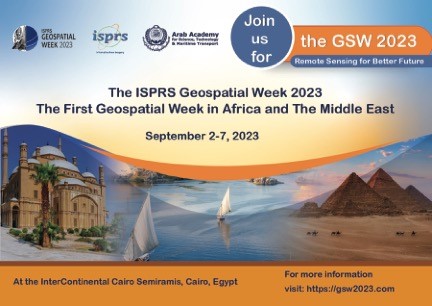
Join us for the ISPRS GSW2023 – Remote Sensing for Better Future

We are delighted to invite you to participate and present your research at the ISPRS Geospatial Week to be held on 2-7 September 2023 at the InterContinental Cairo Semiramis, Cairo, Egypt.


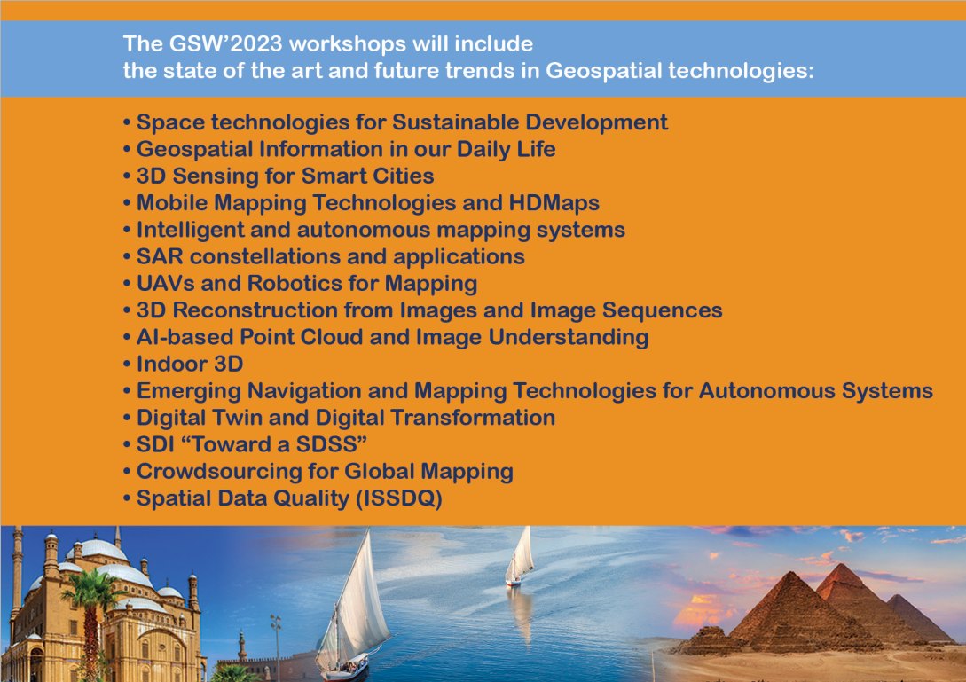
The details of these workshops (chairs, ISPRS WGs, themes and the scientific committees) are listed at the GSW2023 website (www.gsw2023.com).

Exhibition

An exhibition will be held during the conference. This provides companies in the geospatial industries with the opportunity to be involved and showcase their products, services, and expertise to an international audience. Companies also get the chance to attend the presentations and follow the latest scientific developments in the field.

A number of sponsorship and exhibition packages are available. Tailor-made options are also available. Interested companies should contact the GSW Director, Prof. Naser El-Sheimy, at elsheimy@ucalgary.ca or Prof. Amr Hanafi at amrhali@feng.bu.edu.eg or Prof. Alaa Abd El Bary aaelbary@aast.edu for more details of the sponsorship opportunities for the GSW 2023.

We hope you will consider the opportunity to participate at the ISPRS Geospatial Week 2023 and look forward to meeting you in Cairo!

Important Dates

Paper submissions

  • Full paper submission (Annals): March 2023 (hard deadline, no extension)
  • Abstract submission (Archives): April 2023 (hard deadline, no extension)
  • Full paper Author notification: May 2023
  • Camera ready paper submission: July 2023

Registration deadlines

  • Early-bird registration deadline: 1 May 2023
  • Late registration deadline: 1 July 2023

Looking forward to seeing you in Cairo in September 2023.


Prof. Naser El-Sheimy
Geospatial Week Director
The University of Calgary

Prof. Alaa Abd El Bary
Chair, GSW2023 LOC
Arab Academy for Science, Technology and Maritime Transport


Lena Halounova Lena Halounova

President’s Message

Dear colleagues and friends,

It is already six months since the end of the XXIV ISPRS Congress. As you probably know, ISPRS has five Technical Commissions. I informed you in the previous eBulletin that Technical Commission Presidents have prepared structures of their Commissions, and Working Group Officers have posted details about their Missions and Terms of Reference. You can find information on all Technical Commissions and Working Groups on the ISPRS website.

Council continues funding projects submitted in the framework of the Scientific Initiatives. The selection results and awarded projects will be announced in December 2022 with funding available from the 1 January 2023.

I would like to recommend that you follow the ISPRS calendar, where you will find many events planned in 2023. These are ISPRS-sponsored events (light blue), ISPRS co-sponsored event (yellow), and other events (white).

Two of the most important events next year are ISRSE – International Symposium on Remote Sensing of Environment, which will be held in Antalya, Turkey (24-28 April 2023), and ISPRS Geospatial Week, which will take place in Cairo, Egypt (2-7 September 2023). Both events will provide results of developments since the XXIV Congress in Nice.

ISPRS continues to publish three successful journals: ISPRS Journal of Photogrammetry and Remote Sensing (IF 11.774, Q1), ISPRS International Journal of Geo-Information (IF 3,099) and a very “young”  ISPRS Open Journal of Photogrammetry and Remote Sensing.

Let me wish a very Merry Christmas to those who celebrate it, and a Happy New Year to those for whom the new year begins in January.

All the best, good health and happiness to you all.

Lena Halounová

The ISPRS Foundation (TIF) News


The ISPRS Foundation The ISPRS Foundation

The ISPRS Foundation (TIF) Travel Grants for the 39th International Symposium on Remote Sensing of Environment (ISRSE-39)

TIF travel grants will be offered to enable deserving young authors,  and officially designated Delegates, especially from developing countries, to participate in the 39th International Remote Environmental Sensing Symposium, 24-28 April 2023, Antalya, Türkiye.

Important dates are as follows:

  • Applications for travel grants live on TIF web site:  11 December 2022
  • Deadline for submission of travel grant applications: 31 January 2023
  • Decision and notification of successful applicants: 15 February 2023
  • Notification of acceptance of travel grant to Operations Officer:  15 March 2023

White White

New Officers for The ISPRS Foundation (TIF)

The officers of The ISPRS Foundation (TIF) will change from 1 January 2023 since the incumbents will complete their terms specified by the TIF Bylaws. The following list includes the current officers, who will serve until 31 December 2022, and the new officers who will commence their terms from 1 January 2023, and also become TIF Trustees.

Chair: Stewart Walker, USA, will be replaced by Mario Hernandez, Switzerland, from 1 January 2023

Operations Officer: John Trinder, Australia, will be replaced by Senthil Kumar, India, from 1 January 2023

Finance Officer:  Marguerite Madden, USA, will be replaced by Jeff Yates, USA, from 1 January 2023


ISPRS Council Representatives on the TIF Board of Trustees

According to the TIF Bylaws, ISPRS Council must appoint two members of Council as Council representatives on the Board of Trustees for the period 2022-2026.  They are:

  • President of ISPRS, Lena Halounová
  • Treasurer of ISPRS, Stewart Walker


Other members of the current Board of Trustees are:

  • Ron Bisio, USA
  • Sandra Maria Fonseca da Costa, Brazil
  • Michael Gruber, Austria
  • Lawrie Jordan, USA
  • Shailesh Nayak, India
  • Qihao Weng, Hong Kong


John Trinder
Operations Officer until 31 December 2022


Resumés of new TIF Trustees and Officers

Chair

Mario Hernandez

Mario Hernandez

Mario Hernandez is from Mexico and has a PhD in mathematics. His professional career has been dedicated to satellite image processing (remote sensing), doing applied research on the use of space technologies for the monitoring of the environment and at a later stage for the monitoring, management and presentation of heritage sites.

Mario started working with IBM at the IBM Scientific Center for Latin America located in Mexico City. He then moved to IBM Europe (Paris) to coordinate a research group developing new hardware and software for digital image processing. At that time, research on digital image processing was an extremely innovative field. 

Mario then joined the United Nations Environment Programme (UNEP) with headquarters in Nairobi, Kenya. Later on he was offered a post at the United Nations Educational Scientific and Cultural Organization (UNESCO) in Paris in order to manage, coordinate and to launch the European Space Agency (ESA) – UNESCO Open Initiative of the use of Space Technologies to support World Heritage sites. An impressive number of partners joined the ESA-UNESCO initiative, including space agencies, space research institutions and universities.  Among these extraordinary partners, was University of Ghent (Belgium) and the Belgium Science Policy Office (BELSPO). 

After retirement from the UN, Dr. Hernandez continues to work in partnerships with the space agencies and space research institutions supporting cultural heritage sites. He  has a series of honorific titles and has published several papers.


Senthil Kumar

Operations officer

Senthil Kumar

Dr Kumar received his MSc (Eng.) and PhD in image processing in 1985 and 1990 respectively from the Indian Institute of Science, Bangalore, India. He joined the Indian Space Research Organisation (ISRO) in 1991, and since then has served in various capacities before superannuating as Director of Indian Institute of Remote Sensing (IIRS). He has also served as Director of UN-affiliated Centre for Space Science of Technology Education in Asia and the Pacific (CSSTEAP) for five years. During this tenure, he represented ISRO as a member and Chair of the CEOS Working Group on Capacity Development and as a member of the CEOS Working Group on Calibration-Validation. He served as President of ISPRS Technical Commission V on Education and Outreach from 2016 to 2022. He presently serves as chair of the ISPRS Financial Commission for the period 2022-2026. He has served as Associate Editor and as Executive Editor for the Journal of Indian Society of Remote Sensing for five years. He has published more than 115 peer-reviewed technical papers, co-edited two books and co-authored one book. In recognition of his contributions, he has been conferred with life-time achievement awards by the Asian Association of Remote Sensing (2019) and by the Indian Society of Remote Sensing (2018), as well as team awards for Chandrayaan-1 and Cartosat-1 missions by the ISRO. He was elected as a Fellow of the Indian Society of Remote Sensing in the year 2021.


Jeffrey Yates

Finance Officer

Jeffrey Yates

Jeffrey Yates has a Bachelor of Science degree in land resources from Montana State University. Upon graduation Jeff worked as surveyor with the U.S. Forest Service in Montana and then with the U.S. Geological Survey in Denver on a nation-wide map digitizing project. In 1982 he ventured north to Alaska, where he became a stereoplotter operator and aerial camera operator for AeroMap U.S. In 1985 Jeff received his ASPRS Certified Photogrammetrist credential. In 1989 he was the co-coordinator for the project that enabled the first-ever GPS measurements on the summit of Denali (aka Mt. McKinley), Alaska. Also in 1989, he placed the first GPS receivers on Mt. Fuji, Japan, and in 1995 he participated in an expedition sponsored by National Geographic- to place the first GPS receivers on the summit of Mt. Everest, Nepal. Since 1995 Jeff has been General Manager of DAT/EM Systems International, a developer of digital mapping software, which is used by customers around the world. He is currently a member of the University of Alaska Anchorage (UAA) Geomatics Advisory Board (GAB) as well as being the Secretary/Treasurer for the Alaska Region of ASPRS.


White White

Events supported by The ISPRS Foundation in 2023

The ISPRS events that The ISPRS Foundation (TIF) proposes to provide financial support to deserving authors and students are listed below.  Included are also the approximate dates when the online application form will be available on TIF web site www.isprs.org/foundation.

ISRSE-39

24-28 April 2023
Antalya, Türkiye

39th International Symposium for Remote Sensing of the Environment
Application live on TIF web site: 11 December 2022
 

CIPA 2023

25-30 June 2023
Florence, Italy

Documenting, Understanding, Preserving Cultural Heritage. Humanities and digital technologies for shaping the future
Application live on TIF web site: 15 February 2023
 

GSW2023

2-7 Sept. 2023
Cairo, Egypt

ISPRS Geospatial Week 2023 – Workshops organized by ISPRS Commissions and Working Groups
Application live on TIF web site: 1 May 2023
 

Student Consortium News


Student Consortium logo Student Consortium logo

Update on the latest Activities of ISPRS Student Consortium

by Laxmi Thapa, President ISPRS SC

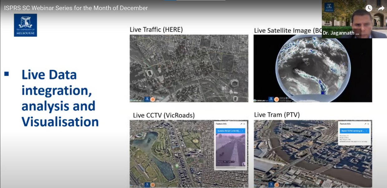
ISPRS Student Consortium (ISPRS SC) organized its latest ISPRS SC Webinar series on 7th December 2022. Dr Jagannath Aryal (PhD in Optimisation and Systems Modelling), working as a Senior Lecturer in the Department of Infrastructure Engineering at University of Melbourne, joined us as the speaker of this last webinar series for the year 2022. The title of the talk was “Earth Observation and Digital Transformation: An Outlook from Infrastructure Engineering” and he highlighted on the recent development of earth observation data and platforms, the practices, and their wider applications with a focus on digital infrastructure engineering. In addition, he also presented case studies illustrating how techniques for accurate and precise data capture, object recognition and interpretation are used in digital city design to integrate new information in cities digital models. The webinar was followed by Q/A session where Dr. Aryal addressed the questions raised by the attendees. The presentation was insightful in providing information about ongoing researches on using earth observation and digital transformation techniques in cities digital models.


White White

Opportunities to work within the ISPRS Student Consortium

If you are interested in becoming involved in the SC and making things happen, we are looking for volunteers to work in our design team, and for proof-readers.

See our web site http://sc.isprs.org/opportunities/index.html or contact sc.isprs@gmail.com for more details.

We'd love to have you on board!

Society News


WeChat WeChat
WeChat - ISPRS WeChat - ISPRS

Official ISPRS WeChat Account

ISPRS Council is pleased to announce that with the support of our Ordinary Member, CSGPC (Chinese Society for Geodesy, Photogrammetry & Cartography), we now have an official ISPRS WeChat account which was released last month. An introduction to ISPRS has been published (translated into Chinese), along with the Gi4DM workshop announcement, and further events planned for 2023, and will be followed by the introduction of the new TCs and WGs.

WeChat has 1.2 billion users, the 3rd largest number in the world (the 1st is Facebook), and almost every Chinese uses it for communication.  

We are sure the account will transfer more ISPRS information to Chinese scientists, researchers and industry, and thus, attract more participants and activities.

Our thanks go to our Chinese colleagues for their assistance.


ISPRS ISPRS

New ISPRS Members

In the past six months, ISPRS has had changes to two Ordinary Members. SELPER Capítulo Brasil (Sociedad Latinoamericana en Percepción Remota y Sistemas de Información Espacial) took over the Brazilian membership from Instituto Nacional de Pesquisas Espaciais (INPE) following the cancellation by the latter, and the Federal Geographic Information Center (FGIC) took over the national representation for the United Arab Emirates from Remote Sensing Center of the UAE University.

Council is also very pleased to introduce our new Sustaining Member, China International Geo-Information Co. Ltd. (CIGIC) to the community. More information can be found at http://www.cigic.cn/gsjj?_l=en

The new members are heartily welcomed. ISPRS looks forward to future collaboration!


IJGI IJGI

The International Journal of Geo-Information presents Annual Recommended Articles (2020–2021)

More information you will find here

General Announcements


ASPRS ASPRS

2023 ASPRS Election Results

Results of the 2023 National Election can be found at https://www.asprs.org/archives/asprs-2023-election-results.html

Join ASPRS at the Installation of Officers on Wednesday, 15 February at 8:00 AM MST at Geo Week 2023!

ISPRS congratulates the newly elected Council Members and Board of Directors.


Krzysztof Bakuła Krzysztof Bakuła

Polish Society for Photogrammetry and Remote Sensing elects new President

After 21 years of chairmanship of the Polish Society for Photogrammetry and Remote Sensing, Aleksandra Bujakiewicz handed over the presidency to Dr eng. Krzysztof Bakuła, who was elected the new President of the Association.

On behalf of ISPRS, Council thanks Aleksandra Bujakiewicz for the past collaboration and wishes her all the best for the future. We congratulate Dr. Bakuła to his new position and look forward to ongoing cooperation between the societies.


Geocarto Geocarto

Geocarto Announces new Finding about the Use of NDVI

Geocarto International Centre Limited has been a Sustaining Member of ISPRS since 1996. Geocarto began research on monitoring individual tree health using high-resolution WorldView-2/3 satellite data in 2015 and now have a new finding about the use of NDVI to assess the internal health of an individual tree.

From their global case studies of removed and collapsed stressed trees, they have found the following results:
(1) NDVI works when the spectral reflectance in both NIR and red bands deteriorate together/concurrently.
(2) NDVI does not work when the spectral reflectance in NIR and red bands vary. This will happen, as shown by their case studies of Tree 1 and Tree 2 of the removed stressed trees, and Tree 4 and Tree 5 of the collapsed stressed trees.

K.N.Au, from Geocarto announces: “NDVI has been widely used to monitor crops. But it is not appropriate for monitoring an individual tree, because the results may be incorrect as revealed by our case studies. Many remote sensing scientists are not aware of this finding, so NDVI may still be used to assess an individual tree. I should be grateful if this new finding could be published in the eBulletin or other ISPRS publications, so that remote sensing scientists will be aware of this new finding. Many thanks and best regards.”

Contact geocarto@geocarto.com for more information or visit:

www.geocarto.hk
www.geocarto.com.hk
www.geocarto.com

Announcements of Scientific Meetings                (see also ISPRS Calendar)


PCP 2023 PCP 2023

3rd International Workshop Point Cloud Processing

26-27 January 2023
Stuttgart, Germany

https://pcp2023.ifp.uni-stuttgart.de/

The quality of area-covering 3D point clouds as captured by aerial and mobile mapping platforms still experiences a considerable boost due to the ongoing advancements in lidar technology and multi-view-stereo-matching (MVS). In addition to further enhancement of the respective accuracy, density and reliability, the semantic segmentation of these point clouds comes more and more into focus. Also triggered by the astonishing improvements in the fields of pattern recognition and machine learning, automatic interpretation of area-covering point clouds including tasks like object detection and classification or object-dependent filtering and smoothing is moving rapidly to a mature state. In view of these developments, the meeting brings together experts from industry, academia and national mapping agencies to present and discuss the processing and evaluation of point clouds, focusing on mapping purposes.

Themes of the event include

  •     Hardware developments
  •     Acquisition of point cloud data and its visualization
  •     Intelligent generation of training data
  •     Multi-Modal data processing of LiDAR data and imagery
  •     Semantic segmentation and classification
  •     Applications and use-cases from practice

 
The program is available on the event website, see https://pcp2023.ifp.uni-stuttgart.de/#schedule


Geo Week 2023 Geo Week 2023

Geo Week 2023

13-15 February 2023
Denver, Colorado, USA

Visit http://www.geo-week.com/

Geo Week 2023 in Denver, is the learning and networking nexus of the geospatial and built worlds.

Professionals from a wide variety of industries and disciplines convene to advance digital technologies in these sectors. It combines 3 previous event brands (in AEC, 3D and Lidar) and important collocated user meetings (ASPRS, USIBD, MAPPS, WGIC and more to be announced). The 2022 event had 2,121 registrants, and hosted 1,889 verified delegates from 48 nations. Geo Week 2023 will convene 2,500+ attendees from 6 continents. Use code SAVE100 for a $100 discount and/or FREE Expo.


COSPAR 2023 COSPAR 2023

5th Symposium of the Committee on Space Research (COSPAR): Space Science with Small Satellites “COSPAR 2023”

16-21 April 2023
Singapore

Contact: COSPAR Secretariat cospar@cosparhq.cnes.fr
https://www.cospar-assembly.org (scientific program, abstract submission)
https://www.cospar2023.org/ (registration, accommodation, etc.)

Abstract Deadline: 31 December 2022

  • Space science with small satellites
  • Space debris monitoring and mitigation using small satellites
  • Earth observation and environment monitoring from small satellites
  • Deep-space science and exploration with miniaturized systems
  • Capacity building with small satellites – a COSPAR-inspired long-term plan
  • Enabling technologies from small satellites
  • Microsatellites for space weather and radio astronomy
  • Establishing a constellation of small satellites

 
Selected papers are published in Advances in Space Research and Life Sciences in Space Research, fully refereed journals with no deadlines open to all submissions in relevant fields.


UAV-g UAV-g

Unmanned Aerial Vehicles in Geomatics is BACK

19-21 April 2023
Jeju Island, Korea

Unmanned Aerial Vehicles in Geomatics (UAV-g) is an international workshop to discuss the scientific and technological development of UAVs and their applications in geomatics. It has been held bi-annually since 2011, organized by the then ISPRS Working Groups on UAV related themes. Due to the pandemic, the UAV-g could not be organized for more than three years. The 6th UAV-g will be held during 19-21 April 2023.

The UAV-g 2023 will be jointly organized by ISPRS Inter-Commission Working Group on Autonomous Sensing Systems and their Applications (ICWGII/Ia) and the Korean Society on Remote Sensing (KSRS) and will be held jointly with the 28th International Symposium on Remote Sensing, an annual regional event among three East Asian Societies (KSRS, the Remote Sensing Society of Japan and the Chinese Society of Photogrammetry and Remote Sensing). The venue will take place on Jeju Island, the most famous tourist destination of Korea and a world natural heritage.

Important Dates

Abstract Submission Deadline: 10 February 2023
Full Paper Submission Deadline: 10 March 2023
Early Bird Registration Deadline: 10 March 2023

Contact: ksrs@ksrs.or.kr
Website: http://isrs.or.kr (To be renewed soon)


Geoinformation Week Geoinformation Week

12th International Symposium on Mobile Mapping Technology (MMT)

24-26 May 2023
Padua, Italy

This is a premier event traditionally jointly organized by ISPRS, FIG, and IAG.

The Symposium will cover the entire spectrum of the latest developments in mobile mapping technology, including research, algorithm implementation and system developments, ranging from land-based to airborne platforms, from direct georeferencing to sensor integration, from mobile data collection to dynamic GIS management, from positioning to mapping, from autonomous vehicles to drones, from data analytics to artificial intelligence tools to support geospatial data understanding and interpretation, moving from post-processing to real-time operations.

For more details please send an enquiry to cirgeo@unipd.it or visit the Symposium website: https://www.cirgeo.unipd.it/mmt/


PHEDCS PHEDCS

“PHEDCS 2023, ALMATY” - Geoeducation for Mining, Architecture, and Civil Engineering

15-16 June 2023
Almaty, Kazakhstan

International conference Geoeducation for Mining, Architecture, and Civil Engineering and WG V/6 Workshop BIM and Geospatial Technologies.
The international conference is organized by ISPRS Technical Commission V WG V/6 and will take place will take place on 15-16 June 2023 at Satbayev University, Almaty, Kazakhstan.

Conference Objective

The conference intends to bring together scientists and entrepreneurs from various branches related to geospatial knowledge. The primary goal is focused on the most efficient ways to integrate professionally and crowdsourced geospatial data into civil, architectural, and environmental engineering. To meet this challenge, we are planning to hold several scientific sessions and the ISPRS WG V/6 Workshop. Special attention will be given to the close-range photogrammetry, UAS, LiDAR, and open-sourced geospatial technologies suitable for the conference's key directions.


Key Directions

  • Civil Engineering (Territory Management, BIM, Surveying, Facility Management)
  • Architecture (Urban Planning, Architectural Surveys, HBIM)
  • Mining (Surveying, Environmental Impact)
  • Environmental Engineering (Environmental Impact of Construction, Geohazards)
  • Fundamental Sciences (Geology, Geography, Geophysics, Archaeology)


Conference topics

  1. Innovative geospatial technologies in multidisciplinary training and knowledge exchange of AEC majors.
  2. Teaching innovative geospatial technologies to get learning skills in assessing the environmental impact of construction.
  3. BIM and geospatial education for building life cycle support.
  4. Geospatial education for civil engineering.
  5. Digital Twins and their geospatial educational constituent.
  6. Real estate management and its geospatial educational constituent.
  7. Smart Cities and their geospatial educational constituent.
  8. Geospatial technologies for facilities management.


WG V/6 Workshop BIM and Geospatial Technologies

  1. Training and retraining of specialists in the field of BIM technologies. New specialties and scientific directions.
  2. Modern measurement and data processing tools for the implementation of BIM.
  3. Implementation of the tasks of design, construction and operation of facilities at all stages of the life cycle using BIM.
  4. Remote sensing and laser scanning in the implementation of BIM technologies and modeling.
  5. New opportunities for mining industry management using BIM.
  6. The use of BIM for solving applied problems in the field of architecture, urbanism, ecology, transport, real estate transactions, etc.


Dates

Full paper deadline (Annals)15.2.2023
Abstract deadline (Archives)1.3.2023
Notification to authors1.4.2023
Final paper submission1.5.2023
Early bird reg. deadline6.4.2023
Regular reg. deadline14.6.2023
On-site registration15.6.2023

The link of the event: https://www.phedcs.com/phedcs-2023-almaty/


FOSS4G FOSS4G

ICWG IV/III/II Academic Track within the FOSS4G

26 June-2 July 2023
Prizren, Kososvo

ICWG IV/III/II will organise an Academic Track within the FOSS4G (Free and Open Source Software for Geospatial) 2023, which will take place 26 June-2 July 2023, Prizren, Kososvo. The Academic Track at the global FOSS4G conferences has become an established opportunity for academics, researchers and scientists adopting open source software in their research work in the geospatial and remote sensing domains to showcase applications and exchange knowledge. Since 2018, the FOSS4G Academic Track is jointly organised by OSGeo and ISPRS, and all the papers presented at the conference are published in the ISPRS Archives.


PHEDCS PHEDCS

International Summer School: Modern Surveying Techniques for Cultural Heritage Documentation

17-23 September 2023
Telč, Czech Republic

Working Group V/6 invites participation in an international summer school on surveying techniques for cultural heritage documentation.

The summer school is open to students and professionals in the field of architecture, civil engineering, and geomatics who are focused on documentation, preservation, and restoration of cultural heritage.

During the summer school, the students will learn innovative surveying and modelling techniques applicable in cultural heritage documentation. The emphasis will be on practical sessions in modern photogrammetry and laser scanning. Besides that, there will be lectures on modelling, current trends in cultural heritage and architecture, facility management, etc.

The summer school will take place from 17th to 23rd September 2023 in a beautiful town Telč, Czech Republic. The town is listed in the UNESCO list of World Heritage. The place itself is worth visiting from a cultural point of view but, at the same time, it offers great working facilities. Apart form the official programme, joint visits of historical monuments, walks though the historical centre or just relaxing in one of the cafés and enjoying the cosy atmosphere of the town promises widening of professional and social networks.

The price for the summer school is 990 EUR which includes lectures and practical sessions, accommodation, meals, transfer from Prague to Telč, and transfer back to Prague.

Participants shall bring their own laptop and a camera, other equipment will be provided. If you are interested, register yourself by sending an email with a CV and a motivational letter to info@phedcs.com. The registration is open until 31 March 2023. The number of places is limited!

For details visit the summer school website: https://www.phedcs.com/iss2023/


Qatar Qatar

EOEC-GiT4NDM

The 8th International Conference on Earth Observation for Environmental Changes (EOEC) and the 10th International Conference on Geoinformation Technologies for Natural Disaster Management (GiT4NDM) will be held on 25-29 Nov 2023, at Qatar University, Doha, Qatar.

For more information visit: https://www2.isprs.org/commissions/comm3/icwg-3-4a/events/. This event is co-sponsored by ISPRS.

Event Reports


2022 Belt and Road International Student Competition on Digital Architectural Design 2022 Belt and Road International Student Competition on Digital Architectural Design

2022 Belt and Road International Student Competition on Digital Architectural Design

by Jiang Jie, BUCEA

Read the report here…


12th IAPR International Workshop on Pattern Recognition in Remote Sensing 2022 (PRRS) 12th IAPR International Workshop on Pattern Recognition in Remote Sensing 2022 (PRRS)

12th IAPR International Workshop on Pattern Recognition in Remote Sensing 2022 (PRRS)

21-25 August 2022
Montreal, Canada

Read the report here…


SUNRISE ISPRS SC Summer School in Marina di Ragusa SUNRISE ISPRS SC Summer School in Marina di Ragusa

SUNRISE ISPRS SC Summer School in Marina di Ragusa

3-9 September 2022
Marina di Ragusa in Sicily, Italy

Read the report here…


The 7th Smart Data Smart Cities and the 17th 3D GeoInfo Conferences The 7th Smart Data Smart Cities and the 17th 3D GeoInfo Conferences

The 7th Smart Data Smart Cities and the 17th 3D GeoInfo Conferences

19-21 October 2022
UNSW, Sydney

Read the report here…


SELPER Logo SELPER Logo

XX Simposio International SELPER

26-28 October 2022
Monterrey, Mexico

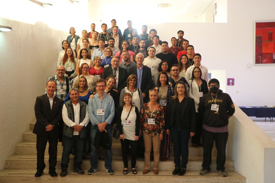
The XX Simposio International SELPER “la geoinformación al servicio de un futuro sostenible para la sociedad” was conducted on 26-28 October in Monterrey (Mexico), by Professor Fabiola Yépez, SELPER President and co-chair of ISPRS ICWG III/IVa (Disaster Management).

SELPER International is the longest-running Latin American society for remote sensing and space systems. Founded 42 years ago, SELPER remains active through the members and directives of its partner countries, Argentina, Bolivia, Brazil, Chile, Colombia, Cuba, France, Haiti, Mexico and Venezuela; and Special Chapters Spain and Italy, corresponding to countries that have a more significant advanced development in remote sensing technology. SELPER International is open to receive more partners to share knowledge of the Latin-American Region and interested in human or technology capacity building. For more information, visit: https://selper.info/ or send an e-mail to selper.mx@gmail.com.

SELPER is a Regional Member of ISRPS.


Gi4DM 2022 & Urban Geoinformatics 2022 Gi4DM 2022 & Urban Geoinformatics 2022

Gi4DM 2022 & Urban Geoinformatics 2022

1-3 November 2022
Beijing, China

Read the report here…


Gi4DM 2022 & Urban Geoinformatics 2022 Gi4DM 2022 & Urban Geoinformatics 2022

'The International Conference on Geospatial Information Science Education, Innovation and Application

10-11 November 2022
Wuhan, China

Read the report here…

ISPRS International Journal of Geo-Information — Open Access Journal


ISPRS International Journal of Geo-Information — Open Access Journal ISPRS International Journal of Geo-Information — Open Access Journal

New publications
Volume 11, Issue 10 (October 2022)

The Design and Implementation of Geospatial Information Verification Middle Platform for Natural Resources Government Affairs
Meng, Fanrong, Zhou, Junjie, Kong, Dengkui, Yao, Min, Wu, Kongyi, Liu, Xuchun, Wang, Xuefei, Guo, Yike
No: 496

Using Flickr Data to Understand Image of Urban Public Spaces with a Deep Learning Model: A Case Study of the Haihe River in Tianjin
Yang, Chenghao, Liu, Tongtong, Zhang, Shengtian
No: 497

A GloVe Model for Urban Functional Area Identification Considering Nonlinear Spatial Relationships between Points of Interest
Chen, Yue, Qian, Haizhong, Wang, Xiao, Wang, Di, Han, Lijian
No: 498

Spatial Modeling of COVID-19 Prevalence Using Adaptive Neuro-Fuzzy Inference System
Tabasi, Mohammad, Alesheikh, Ali Asghar, Kalantari, Mohsen, Babaie, Elnaz, Mollalo, Abolfazl
No: 499

Placial-Discursive Topologies of Violence: Volunteered Geographic Information and the Reproduction of Violent Places in Recife, Brazil
Moura de Souza, Cléssio, Kremer, Dominik, Walker, Blake Byron
No: 500

Research into the Optimal Regulation of the Groundwater Table and Quality in the Southern Plain of Beijing Using Geographic Information Systems Data and Machine Learning Algorithms
Li, Chen, Men, Baohui, Yin, Shiyang, Zhang, Teng, Wei, Ling
No: 501

Incremental Road Network Update Method with Trajectory Data and UAV Remote Sensing Imagery
Qin, Jianxin, Yang, Wenjie, Wu, Tao, He, Bin, Xiang, Longgang
No: 502

ICD: VHR-Oriented Interactive Change-Detection Algorithm
Jiang, Zhuoran, Zhou, Xinxin, Cao, Wei, Sun, Zaihong, Wu, Changbin
No: 503

How Are Macro-Scale and Micro-Scale Built Environments Associated with Running Activity? The Application of Strava Data and Deep Learning in Inner London
Jiang, Hongchao, Dong, Lin, Qiu, Bing
No: 504

Variable-Scale Visualization of High-Density Polygonal Buildings on a Tile Map
Chen, Zhixiong, Shen, Yilang, Lv, Xinlin, Qin, Qiaolin, Chen, Xin
No: 505

HiPDERL: An Improved Implementation of the PDERL Viewshed Algorithm and Accuracy Analysis
Cheng, Haozhe, Dou, Wanfeng
No: 506

Exploring the Association of Spatial Capital and Economic Diversity in the Tourist City of Surat Thani, Thailand
Srivanit, Manat, Kongphunphin, Chompoonut, Rinchumphu, Damrongsak
No: 507

A GIS Pipeline to Produce GeoAI Datasets from Drone Overhead Imagery
Ballesteros, John R., Sanchez-Torres, German, Branch-Bedoya, John W.
No: 508

Passenger Flow Prediction of Scenic Spots in Jilin Province Based on Convolutional Neural Network and Improved Quantile Regression Long Short-Term Memory Network
Qin, Xiwen, Yin, Dongmei, Dong, Xiaogang, Chen, Dongxue, Zhang, Shuang
No: 509

Identification of Paddy Varieties from Landsat 8 Satellite Image Data Using Spectral Unmixing Method in Indramayu Regency, Indonesia
Cipta, Iqbal Maulana, Jaelani, Lalu Muhamad, Sanjaya, Hartanto
No: 510

Quantify the Potential Spatial Reshaping Utility of Urban Growth Boundary (UGB): Evidence from the Constrained Scenario Simulation Model
Ma, Shifa, Jiang, Haiyan, Zhang, Xiwen, Xie, Dixiang, Cai, Yunnan, Zhao, Yabo, Wang, Guanwei
No: 511

Analysis of the Evolution of the Relationship between the Urban Pattern and Economic Development in Guangdong Province Based on Coupled Multisource Data
Li, Pengfei, Hao, Shuang, Cui, Yuhuan, Xu, Yazhou, Liao, Congcong, Sheng, Liangliang
No: 512

Towards Integrated Land Management: The Role of Green Infrastructure
Bačić, Samanta, Tomić, Hrvoje, Andlar, Goran, Roić, Miodrag
No: 513

Ndist2vec: Node with Landmark and New Distance to Vector Method for Predicting Shortest Path Distance along Road Networks
Chen, Xu, Wang, Shaohua, Li, Huilai, Lyu, Fangzheng, Liang, Haojian, Zhang, Xueyan, Zhong, Yang
No: 514

Assessing the Accessibility of Swimming Pools in Nanjing by Walking and Cycling Using Baidu Maps
Dong, Yifan, Zhang, Bing, Zhou, Zhenqi, Xu, Zhen
No: 515

Measuring Spatial Accessibility of Healthcare Facilities in Marinduque, Philippines
Salvacion, Arnold R.
No: 516

Using Machine Learning to Extract Building Inventory Information Based on LiDAR Data
Kaplan, Gordana, Comert, Resul, Kaplan, Onur, Matci, Dilek Kucuk, Avdan, Ugur
No: 517

Research on Spatial Distribution Characteristics and Influencing Factors of Pension Resources in Shanghai Community-Life Circle
Huang, Xiaoran, Gong, Pixin, White, Marcus, Zhang, Bo
No: 518

Multifractal Correlation between Terrain and River Network Structure in the Yellow River Basin, China
Qin, Zilong, Wang, Jinxin
No: 519

Spatiotemporal Change in Livestock Population and Its Correlation with Meteorological Disasters during 2000–2020 across Inner Mongolia
Bai, Hui, Wang, Baizhu, Zhu, Yuanjun, Kwon, Semyung, Yang, Xiaohui, Zhang, Kebin
No: 520

Extraction of Urban Built-Up Areas Based on Data Fusion: A Case Study of Zhengzhou, China
Chen, Yaping, Zhang, Jun
No: 521

Application of Social Network Analysis in the Economic Connection of Urban Agglomerations Based on Nighttime Lights Remote Sensing: A Case Study in the New Western Land-Sea Corridor, China
Zhang, Bin, Yin, Jian, Jiang, Hongtao, Qiu, Yuanhong
No: 522

A Stacking Ensemble Learning Method to Classify the Patterns of Complex Road Junctions
Yang, Min, Cheng, Lingya, Cao, Minjun, Yan, Xiongfeng
No: 523

Socio-Ecological Vulnerability in Aba Prefecture, Western Sichuan Plateau: Evaluation, Driving Forces and Scenario Simulation
Yang, Xingping, Dai, Xiaoai, Li, Wenyu, Lu, Heng, Liu, Chao, Li, Naiwen, Yang, Zhengli, He, Yuxin, Li, Weile, Fu, Xiao, Ma, Lei, Shan, Yunfeng, Wang, Youlin
No: 524

From Meadow to Map: Integrating Field Surveys and Interactive Visualizations for Invasive Species Management in a National Park
Randall, Joshua, Inglis, Nicole C., Smart, Lindsey, Vukomanovic, Jelena
No: 525

Aesthetics and Cartography: Post-Critical Reflections on Deviance in and of Representations
Edler, Dennis, Kühne, Olaf
No: 526

A Comparative Study of Various Deep Learning Approaches to Shape Encoding of Planar Geospatial Objects
Yan, Xiongfeng, Yang, Min
No: 527

Time-Space Compression Effect of High-Speed Rail on Tourist Destinations in China
Li, Taohong, Shi, Hong, Chen, Ning Chris, Yang, Luo
No: 528

ST3DNetCrime: Improved ST-3DNet Model for Crime Prediction at Fine Spatial Temporal Scales
Dong, Qifen, Li, Yu, Zheng, Ziwan, Wang, Xun, Li, Guojun
No: 529

The Polygonal 3D Layout Reconstruction of an Indoor Environment via Voxel-Based Room Segmentation and Space Partition
Yang, Fan, Li, You, Che, Mingliang, Wang, Shihua, Wang, Yingli, Zhang, Jiyi, Cao, Xinliang, Zhang, Chi
No: 530

GIS Based Procedural Modeling in 3D Urban Design
Zhang, Ming, Wu, Jielin, Liu, Yang, Zhang, Ji, Li, Guanyao
No: 531

Topological Access Methods for Spatial and Spatiotemporal Data
Jahn, Markus Wilhelm, Bradley, Patrick Erik
No: 533

Spatio-Temporal Variability of the Impact of Population Mobility on Local Business Sales in Response to COVID-19 in Seoul, Korea
Koo, Hyeongmo, Lee, Soyoung, Lee, Jiyeong, Cho, Daeheon
No: 532


Volume 11, Issue 11 (November 2022)

Dynamics of the Burlan and Pomacochas Lakes Using SAR Data in GEE, Machine Learning Classifiers, and Regression Methods
Gómez Fernández, Darwin, Salas López, Rolando, Rojas Briceño, Nilton B., Silva López, Jhonsy O., Oliva, Manuel
No: 534

Google Earth Engine as Multi-Sensor Open-Source Tool for Monitoring Stream Flow in the Transboundary River Basin: Doosti River Dam
Pakdel-Khasmakhi, Hadis, Vazifedoust, Majid, Paudyal, Dev Raj, Chadalavada, Sreeni, Alam, Md Jahangir
No: 535

Understanding the Dynamic Mechanism of Urban Land Use and Population Distribution Evolution from a Microscopic Perspective
Jin, Min, Wang, Lizhe, Ge, Fudong, Xie, Bing
No: 536

Data-Driven Approach to Assess Street Safety: Large-Scale Analysis of the Microscopic Design
Wu, Wanshu, Guo, Jinhan, Ma, Ziying, Zhao, Kai
No: 537

Map-Matching Error Identification in the Absence of Ground Truth
Dey, Subhrasankha, Tomko, Martin, Winter, Stephan
No: 538

Technical Analysis of Contact Tracing Platform Developed by Google–Apple for Constraining the Spread of COVID-19
Majeed, Abdul
No: 539

Machine Recognition of Map Point Symbols Based on YOLOv3 and Automatic Configuration Associated with POI
Zhang, Huili, Zhou, Xiaowen, Li, Huan, Zhu, Ge, Li, Hongwei
No: 540

Use of a MODIS Satellite-Based Aridity Index to Monitor Drought Conditions in the Pearl River Basin from 2001 to 2021
Niu, Kunlong, Qiu, Junliang, Cai, Shirong, Zhang, Wenxin, Mu, Xiaolin, Park, Edward, Yang, Xiankun
No: 541

Spatio-Temporal Unequal Interval Correlation-Aware Self-Attention Network for Next POI Recommendation
Li, Zheng, Huang, Xueyuan, Liu, Chun, Yang, Wei
No: 543

Thematic Content and Visualization Strategy for Map Design of City-Specific Culture Based on Local Chronicles: A Case Study of Dengfeng City, China
He, Xiaohui, Liu, Chuan, Wu, Lili, Wang, Yongji, Tian, Zhihui
No: 542

Using Isovists in Measuring Surveillance and Expected Guardianship in Residential Neighborhood Property Crimes
Nubani, Linda, Wineman, Jean
No: 544

Assessing the Spatial Accessibility of Urban Medical Facilities in Multi-Level and Multi-Period Scales Based on Web Mapping API and an Improved Potential Model
Wang, Jingyong, Su, Yuwei, Chen, Zihao, Tang, Lixuan, Wang, Guoen, Wang, Jiangping
No: 545

Spatiotemporal Evolution and Influential Factors of Rural Poverty in Poverty-Stricken Areas of Guizhou Province: Implications for Consolidating the Achievements of Poverty Alleviation
Li, Guie, Jiao, Yangyang, Li, Jie, Yan, Qingwu
No: 546

Multi-Source Spatio-Temporal Data-Based Tourism Structure Analysis of Demonstration City for Global Tourism: Case Study of Liyang, China
Wu, Haoqi, Chen, Zhenan, Yan, Jun, Tang, Xiaolan
No: 547

Delineating Urban Community Life Circles for Large Chinese Cities Based on Mobile Phone Data and POI Data—The Case of Wuhan
Jiao, Hongzan, Xiao, Miaomiao
No: 548

Differentiation of Vegetation Community Characteristics by Altitude within Urban Parks and Their Service Functions in a Semi-Arid Mountain Valley: A Case Study of Lanzhou City
Tang, Xianglong, Wei, Tianfeng, He, Yueming, He, Kun
No: 549

Ecological Associations between Obesity Prevalence and Neighborhood Determinants Using Spatial Machine Learning in Chicago, Illinois, USA
Lotfata, Aynaz, Georganos, Stefanos, Kalogirou, Stamatis, Helbich, Marco
No: 550

Modelling Bottlenecks of Bike-Sharing Travel Using the Distinction between Endogenous and Exogenous Demand: A Case Study in Beijing
Chao, Sun, Jian, Lu
No: 551

Panic Detection Using Machine Learning and Real-Time Biometric and Spatiotemporal Data
Lazarou, Ilias, Kesidis, Anastasios L., Hloupis, George, Tsatsaris, Andreas
No: 552

Reconsidering Tourism Destination Images by Exploring Similarities between Travelogue Texts and Photographs
Zhang, Xin, Lu, Xiaoqian, Zhou, Xiaolan, Shen, Chaohai
No: 553

Geomedia Attributes for Perspective Visualization of Relief for Historical Non-Cartometric Water-Colored Topographic Maps
Medyńska-Gulij, Beata
No: 554

Agglomeration Externalities, Network Externalities and Urban High-Quality Development: A Case Study of Urban Agglomeration in the Middle Reaches of the Yangtze River
Liu, He, Li, Xueming, Li, Songbo, Tian, Shenzhen, Gong, Yilu, Guan, Yingying, Sun, He
No: 555

Evaluating Stable Matching Methods and Ridesharing Techniques in Optimizing Passenger Transportation Cost and Companionship
Magsino, Elmer, Ching, Gerard Ryan, Espiritu, Francis Miguel, Go, Kerwin
No: 556

Proposal of Redefinition of the Terms Geomatics and Geoinformatics on the Basis of Terminological Postulates
Krawczyk, Artur
No: 557

A Shape-Preserving Simplification Method for Urban Building Models
Xiang, Hanyu, Huang, Xianfeng, Lan, Feng, Yang, Chong, Gao, Yunlong, Wu, Wenyu, Zhang, Fan
No: 562

Evaluation of Automatic Prediction of Small Horizontal Curve Attributes of Mountain Roads in GIS Environments
Gülci, Sercan, Acar, Hafiz Hulusi, Akay, Abdullah E., Gülci, Neşe
No: 560

Mining the Spatial Distribution Pattern of the Typical Fast-Food Industry Based on Point-of-Interest Data: The Case Study of Hangzhou, China
Zhou, Yan, Shen, Xuan, Wang, Chen, Liao, Yixue, Li, Junli
No: 559

Construction of a COVID-19 Pandemic Situation Knowledge Graph Considering Spatial Relationships: A Case Study of Guangzhou, China
Yang, Xiaorui, Li, Weihong, Chen, Yebin, Guo, Yunjian
No: 561

Acceptance of Online Mapping Technology among Older Adults: Technology Acceptance Model with Facilitating Condition, Compatibility, and Self-Satisfaction
Man, Siu Shing, Guo, Yingqian, Chan, Alan Hoi Shou, Zhuang, Huiping
No: 558

An Evaluation of Urban Renewal Based on Inclusive Development Theory: The Case of Wuhan, China
Liu, Wei, Yang, Jie, Gong, Yue, Cheng, Qi
No: 563

Vulnerability Identification and Cascading Failure Spatiotemporal Patterns on Road Network under the Rainstorm Disaster
Wu, Qirui, Han, Zhigang, Cui, Caihui, Liu, Feng, Zhao, Yifan, Xie, Zhaoxin
No: 564

The Influence of Point Cloud Accuracy from Image Matching on Automatic Preparation of Training Datasets for Object Detection in UAV Images
Zachar, Paulina, Ostrowski, Wojciech, Płatek-Żak, Anna, Kurczyński, Zdzisław
No: 565

Optimization of Complex Function Expansions for Gauss-Krüger Projections
Li, Xiaoyong, Li, Houpu, Liu, Guohui, Bian, Shaofeng
No: 566

The Verification of Land Cover Datasets with the Geo-Tagged Natural Scene Images
Cui, Liu, Yang, Hui, Chu, Liang, He, Qingping, Xu, Fei, Qiao, Yina, Yan, Zhaojin, Wang, Ran, Ci, Hui
No: 567

Evaluation of Coastal Erosion in the Watersheds of Municipality of Buenaventura, Colombia: Using Geospatial Techniques and the Composite Vulnerability Index
Fuentes, Jose Eduardo, Olaya, Robin Alexis, Garcia, Cesar Edwin
No: 568

Geographic Information System Applied to Sustainability Assessments: Conceptual Structure and Research Trends
Oliveira, Victor Tomaz de, Teixeira, Denilson, Rocchi, Lucia, Boggia, Antonio
No: 569

A Machine Learning Approach for Detecting Rescue Requests from Social Media
Wang, Zheye, Lam, Nina S. N., Sun, Mingxuan, Huang, Xiao, Shang, Jin, Zou, Lei, Wu, Yue, Mihunov, Volodymyr V.
No: 570

Building Block Extraction from Historical Maps Using Deep Object Attention Networks
Zhao, Yao, Wang, Guangxia, Yang, Jian, Zhang, Lantian, Qi, Xiaofei
No: 572

Site Selection of Natural Gas Emergency Response Team Centers in Istanbul Metropolitan Area Based on GIS and FAHP
Sarıkaya, Mehmet Şerif, Yanalak, Mustafa, Karaman, Himmet
No: 571

Evaluating BFASTMonitor Algorithm in Monitoring Deforestation Dynamics in Coniferous and Deciduous Forests with LANDSAT Time Series: A Case Study on Marmara Region, Turkey
Mashhadi, Nooshin, Alganci, Ugur
No: 573

Field Cognitive Styles on Visual Cognition in the Event Structure Design of Bivariate Interactive Dorling Cartogram—The Similarities and Differences of Field-Independent and Field-Dependent Users
Zhu, Yanfei, Gu, Jie, Lin, Yun, Chen, Mo, Guo, Qi, Du, Xiaoxi, Xue, Chengqi
No: 574

Urban Human-Land Spatial Mismatch Analysis from a Source-Sink Perspective with ICT Support
Li, Tong, Xiu, Chunliang, Yu, Huisheng
No: 575

Spatial Pattern and Influencing Factors of Basic Education Resources in Rural Areas around Metropolises—A Case Study of Wuhan City’s New Urban Districts
Jiang, Liang, Chen, Jie, Tian, Ye, Luo, Jing
No: 576

Map Design and Usability of a Simplified Topographic 2D Map on the Smartphone in Landscape and Portrait Orientations
Medyńska-Gulij, Beata, Gulij, Jacek, Cybulski, Paweł, Zagata, Krzysztof, Zawadzki, Jakub, Horbiński, Tymoteusz
No: 577

Does Culture Shape Our Spatial Ability? An Investigation Based on Eye Tracking
Tian, Yuyang, Yang, Tianyu, Dong, Weihua
No: 578

Multi-Mode Huff-Based 2SFCA: Examining Geographical Accessibility to Food Outlets in Austin, Texas
Jin, He, Lu, Yongmei
No: 579

 

ISPRS Journal of Photogrammetry and Remote Sensing


ISPRS Journal ISPRS Journal

New publications
Volume 193 (November 2022)

Editorial Board
Pages: ii

Nonlocal feature learning based on a variational graph auto-encoder network for small area change detection using SAR imagery
Hang Su, Xinzheng Zhang, Yuqing Luo, Ce Zhang, Xichuan Zhou, Peter M. Atkinson
Pages: 137-149

Large-scale road extraction from high-resolution remote sensing images based on a weakly-supervised structural and orientational consistency constraint network
Mingting Zhou, Haigang Sui, Shanxiong Chen, Junyi Liu, Weiyue Shi, Xu Chen
Pages: 234-251

Optimal selection of wavelet transform parameters for spatio-temporal analysis based on non-stationary NDVI MODIS time series in Mediterranean region
Manel Rhif, Ali {Ben Abbes}, Beatriz Martínez, Imed Riadh Farah, M. Amparo Gilabert
Pages: 216-233

An omni-scale global–local aware network for shadow extraction in remote sensing imagery
Yakun Xie, Dejun Feng, Hongyu Chen, Ziyang Liao, Jun Zhu, Chuangnong Li, Sung {Wook Baik}
Pages: 29-44

Determination of foliar traits in an ecologically distinct conifer species in Maine using Sentinel-2 imagery and site variables: Assessing the effect of leaf trait expression and upscaling approach on prediction accuracy
Tawanda W. Gara, Parinaz Rahimzadeh-Bajgiran, Aaron Weiskittel
Pages: 150-163

Optimal positioning of terrestrial LiDAR scanner stations in complex 3D environments with a multiobjective optimization method based on GPU simulations
Gilles Rougeron, Jérémie Le Garrec, Claude Andriot
Pages: 60-76

Towards spatially continuous mapping of soil organic carbon in croplands using multitemporal Sentinel-2 remote sensing
Pu Shi, Johan Six, Andrew Sila, Bernard Vanlauwe, Kristof {Van Oost}
Pages: 187-199

Cross-phenological-region crop mapping framework using Sentinel-2 time series Imagery: A new perspective for winter crops in China
Ziqiao Wang, Hongyan Zhang, Wei He, Liangpei Zhang
Pages: 200-215

A joint deep learning network of point clouds and multiple views for roadside object classification from lidar point clouds
Lina Fang, Zhilong You, Guixi Shen, Yiping Chen, Jianrong Li
Pages: 115-136

An advanced bidirectional reflectance factor (BRF) spectral approach for estimating flavonoid content in leaves of Ginkgo plantations
Kai Zhou, Lin Cao, Shiyun Yin, Guibin Wang, Fuliang Cao
Pages: 1-16

Mapping African wetlands for 2020 using multiple spectral, geo-ecological features and Google Earth Engine
Anzhen Li, Kaishan Song, Shengbo Chen, Yongling Mu, Zhengyuan Xu, Qinghong Zeng
Pages: 252-268

Outlier removal and feature point pairs optimization for piecewise linear transformation in the co-registration of very high-resolution optical remote sensing imagery
Houcai Guo, Hanzeyu Xu, Yuchun Wei, Yuzhen Shen, Xudong Rui
Pages: 299-313

An investigation into lidar scan angle impacts on stand attribute predictions in different forest environments
Karun R. Dayal, Sylvie Durrieu, Kamel Lahssini, Samuel Alleaume, Marc Bouvier, Jean-Matthieu Monnet, Jean-Pierre Renaud, Frédéric Revers
Pages: 314-338

Developing a sub-meter phenological spectral feature for mapping poplars and willows in urban environment
Xiangcai Li, Jinyan Tian, Xiaojuan Li, Le Wang, Huili Gong, Chen Shi, Sheng Nie, Lin Zhu, Beibei Chen, Yun Pan, Jijun He, Rongguang Ni, Chunyuan Diao
Pages: 77-89

Large-scale deep learning based binary and semantic change detection in ultra high resolution remote sensing imagery: From benchmark datasets to urban application
Shiqi Tian, Yanfei Zhong, Zhuo Zheng, Ailong Ma, Xicheng Tan, Liangpei Zhang
Pages: 164-186

Retrieval of carbon content and biomass from hyperspectral imagery over cultivated areas
Matthias Wocher, Katja Berger, Jochem Verrelst, Tobias Hank
Pages: 104-114

Spatially gap free analysis of aerosol type grids in China: First retrieval via satellite remote sensing and big data analytics
Ke Li, Kaixu Bai, Mingliang Ma, Jianping Guo, Zhengqiang Li, Gehui Wang, Ni-Bin Chang
Pages: 45-59

Point2Roof: End-to-end 3D building roof modeling from airborne LiDAR point clouds
Li Li, Nan Song, Fei Sun, Xinyi Liu, Ruisheng Wang, Jian Yao, Shaosheng Cao
Pages: 17-28

Assessment of crop traits retrieved from airborne hyperspectral and thermal remote sensing imagery to predict wheat grain protein content
A.R. Longmire, T. Poblete, J.R. Hunt, D. Chen, P.J. Zarco-Tejada
Pages: 284-298

Decision surface optimization in mapping exotic mangrove species (Sonneratia apetala) across latitudinal coastal areas of China
Chuanpeng Zhao, Cheng-Zhi Qin, Zongming Wang, Dehua Mao, Yeqiao Wang, Mingming Jia
Pages: 269-283

Transformer-induced graph reasoning for multimodal semantic segmentation in remote sensing
Qibin He, Xian Sun, Wenhui Diao, Zhiyuan Yan, Dongshuo Yin, Kun Fu
Pages: 90-103


New publications
Volume 194 (December 2022)

Editorial Board
Pages: ii

A revision of NASA SeaDAS atmospheric correction algorithm over turbid waters with artificial Neural Networks estimated remote-sensing reflectance in the near-infrared
Junwei Wang, Yongchao Wang, Zhongping Lee, Daosheng Wang, Shuguo Chen, Wendian Lai
Pages: 235-249

Estimating 10-m land surface albedo from Sentinel-2 satellite observations using a direct estimation approach with Google Earth Engine
Xingwen Lin, Shengbiao Wu, Bin Chen, Ziyu Lin, Zhengbing Yan, Xiuzhi Chen, Gaofei Yin, Dongqin You, Jianguang Wen, Qiang Liu, Qing Xiao, Qinhuo Liu, Raffaele Lafortezza
Pages: 1-20

VIBUS: Data-efficient 3D scene parsing with VIewpoint Bottleneck and Uncertainty-Spectrum modeling
Beiwen Tian, Liyi Luo, Hao Zhao, Guyue Zhou
Pages: 302-318

Global spatiotemporal completion of daily high-resolution TCCO from TROPOMI over land using a swath-based local ensemble learning method
Yuan Wang, Qiangqiang Yuan, Siqin Zhou, Liangpei Zhang
Pages: 167-180

What’s wrong with the rainbow? An interdisciplinary review of empirical evidence for and against the rainbow color scheme in visualizations
Izabela Gołębiowska, Arzu Çöltekin
Pages: 195-208

Organizing and visualizing point clouds with continuous levels of detail
Peter {van Oosterom}, Simon {van Oosterom}, Haicheng Liu, Rod Thompson, Martijn Meijers, Edward Verbree
Pages: 119-131

Geometry, calibration, and robust centering procedures for refractive dome-port based imaging systems
Bashar Elnashef, Sagi Filin
Pages: 132-151

Temporally corrected long-term satellite solar-induced fluorescence leads to improved estimation of global trends in vegetation photosynthesis during 1995–2018
Songhan Wang, Yongguang Zhang, Weimin Ju, Mousong Wu, Lei Liu, Wei He, Josep Peñuelas
Pages: 222-234

An optimal method for validating satellite-derived land surface phenology using in-situ observations from national phenology networks
Yongchang Ye, Xiaoyang Zhang, Yu Shen, Jianmin Wang, Theresa Crimmins, Helfried Scheifinger
Pages: 74-90

Developing seagrass index for long term monitoring of Zostera japonica seagrass bed: A case study in Yellow River Delta, China
Qingqing Zhou, Yinghai Ke, Xinyan Wang, Junhong Bai, Demin Zhou, Xiaojuan Li
Pages: 286-301

In-season crop type identification using optimal feature knowledge graph
Longcai Zhao, Qiangzi Li, Qingrui Chang, Jiali Shang, Xin Du, Jiangui Liu, Taifeng Dong
Pages: 250-266

Reconstructing compact building models from point clouds using deep implicit fields
Zhaiyu Chen, Hugo Ledoux, Seyran Khademi, Liangliang Nan
Pages: 58-73

Empirical SNR-based model of the displacement accuracy for ground-based radar measurements
Przemysław Kuras, Łukasz Ortyl, Tomasz Owerko
Pages: 181-194

Structural projection points estimation and context priors for oil tank storage estimation in SAR image
Chao Ma, Yueting Zhang, Jiayi Guo, Yuxin Hu, Xiurui Geng, Fangfang Li, Bin Lei, Chibiao Ding
Pages: 267-285

Mapping water clarity in North American lakes and reservoirs using Landsat images on the GEE platform with the RGRB model
Qiang Wang, Kaishan Song, Xiangming Xiao, Pierre-Andre Jacinthe, Zhidan Wen, Fangrui Zhao, Hui Tao, Sijia Li, Yingxin Shang, Yu Wang, Ge Liu
Pages: 39-57

I2D-Loc: Camera localization via image to LiDAR depth flow
Kuangyi Chen, Huai Yu, Wen Yang, Lei Yu, Sebastian Scherer, Gui-Song Xia
Pages: 209-221

An efficient saliency prediction model for Unmanned Aerial Vehicle video
Kao Zhang, Zhenzhong Chen, Songnan Li, Shan Liu
Pages: 152-166

Mosaic gradient histogram for object tracking in DoFP infrared polarization imaging
Xinbo Qiao, Yongqiang Zhao, Lulu Chen, Seong G. Kong, Jonathan {Cheung-Wai Chan}
Pages: 108-118

A full resolution deep learning network for paddy rice mapping using Landsat data
Lang Xia, Fen Zhao, Jin Chen, Le Yu, Miao Lu, Qiangyi Yu, Shefang Liang, Lingling Fan, Xiao Sun, Shangrong Wu, Wenbin Wu, Peng Yang
Pages: 91-107

Optimal selection from extremely redundant satellite images for efficient large-scale mapping
Pengjie Tao, Ke Xi, Zhuangqun Niu, Qi Chen, Yifan Liao, Yuxuan Liu, Kunbo Liu, Zuxun Zhang
Pages: 21-38


ISPRS Open Journal of Photogrammetry and Remote Sensing


ISPRS Open Journal of Photogrammetry and Remote Sensing ISPRS Open Journal of Photogrammetry and Remote Sensing

New publications
Volume 5 (August 2022)

Spatially autocorrelated training and validation samples inflate performance assessment of convolutional neural networks
Teja Kattenborn, Felix Schiefer, Julian Frey, Hannes Feilhauer, Miguel D. Mahecha, Carsten F. Dormann
Pages: 100018

Change detection in street environments based on mobile laser scanning: A fuzzy spatial reasoning approach
Joachim Gehrung, Marcus Hebel, Michael Arens, Uwe Stilla
Pages: 100019

Generating impact maps from bomb craters automatically detected in aerial wartime images using marked point processes
Christian Kruse, Dennis Wittich, Franz Rottensteiner, Christian Heipke
Pages: 100017

Transfer learning from citizen science photographs enables plant species identification in UAV imagery
Salim Soltani, Hannes Feilhauer, Robbert Duker, Teja Kattenborn
Pages: 100016


New publications
Volume 6 (December 2022)


New Events


26-27 Jan 2023
3rd EuroSDR Workshop on Point Cloud Processing
https://pcp2023.ifp.uni-stuttgart.de/
Stuttgart, Germany
 

19-22 Feb 2023
6th SMPR and 4th GIResearch
ISPRS Geospatial Conference
https://geospatialconf2022.ut.ac.ir
Tehran, Iran
 

16-21 Apr 2023
COSPAR 2023
5th Symposium of the Committee on Space Research (COSPAR): Space Science with Small Satellites
https://www.cospar-assembly.org
Singapore, Singapore
 

19-23 Apr 2023
UAV-g 2023
Unmanned Aerial Vehicles in Geomatics 2023
http://www.ksrs.or.kr
Jeju Island, Republic of Korea
 

24-26 Apr 2023
International Workshop on “Photogrammetric and computer vision techniques for surveillance, biometrics and biomedicine”
http://technicalvision.ru/ISPRS/PSBB23
Moscow, Russia
 

24-25 May 2023
GeoAdvances 2023
8th International Conference on Geoinformation Advances
http://www.geoadvances.web.tr
Istanbul, Türkiye
 

15-16 Jun 2023
“PHEDCS 2023, ALMATY”
Geoeducation for Mining, Architecture, and Civil Engineering
https://www.phedcs.com/phedcs-2023-almaty/
Almaty, Kazakhstan
 

26 Jun - 02 Jul 2023
Academic Track of FOSS4G (Free and Open Source Software for Geospatial) 2023
https://2023.foss4g.org
Prizren, Kosovo
 

11-20 Jul 2023
IUGG General Assembly 2023
http://www.iugg2023berlin.org/
Berlin, Germany
 

16-20 Jul 2023
Surveying and Geomatics Educators' Society (SaGES) 2023 conference
website not yet available
Calgary, Canada
 

25-29 Nov 2023
EOEC & GiT4NDM
The 8th International Conference on Earth Observation for Environmental Changes (EOEC) &
The 10th International Conference on Geoinformation Technologies for Natural Disaster Management (GiT4NDM)
website not yet available
Doha, Qatar
 

13-21 Jul 2024
COSPAR 2024
45th Scientific Assembly of the Committee on Space Research (COSPAR) and Associated Events
https://www.cospar-assembly.org
Busan, South Korea
 

» See more

Updated Events


02-07 Sep 2023
ISPRS Geospatial Week 2023
http://www.gsw2023.com/
Cairo, Egypt
 

25-29 Nov 2023
EOEC & GiT4NDM
The 8th International Conference on Earth Observation for Environmental Changes (EOEC) &
The 10th International Conference on Geoinformation Technologies for Natural Disaster Management (GiT4NDM)
website not yet available
Doha, Qatar
 

» See more

Job Opportunities


Byrd Polar and Climate Research Center, The Ohio State University, Columbus, USA
21-Nov-2022 Chair (W2) of Optical 3D Measurement
Geodetic Institute, Faculty of Environmental Sciences, Technische Universität Dresden (TUD), Germany
Deadline: 12-Jan-2023
28-Nov-2022 PhD position in highspeed camera image sequence analysis
Institute of Photogrammetry and Remote Sensing, TU Dresden, Germany
Deadline: 15-Dec-2022
1-Dec-2022 PostDoc/Senior scientist Position "Remote Sensing for Ecohydrology”
Helmholtz Centre for Environmental Research -UFZ, Leipzig, Germany
Deadline: 31-Dec-2022
6-Dec-2022 PhD position "Real-time 3D semantic mapping with UAV images"
Collaboration framework between the UAV Centre of the University of Twente (The Netherlands) and the Department Security Research and Applications of DLR (Germany), deployment at DLR in Berlin.
Deadline: 31-Dec-2022
7-Dec-2022 Faculty Position in Cartography and GIS
Department for Geodetic Sciences and Geomatics at the University of Concepción, Los Angeles, Chile
Deadline: 31-Mar-2023
14-Dec-2022 Research Assistant, PostDoc
Institute for Photogrammetry (ifp), University of Stuttgart, Germany
Deadline: 31-Jan-2023
14-Dec-2022 PhD position “Environmental Remote Sensing”
Department of Geography at the University of Innsbruck, Austria
Deadline: 15-Jan-2023

» See more

 
© ISPRS, 2022.
Imprint