ISPRS e-Bulletin
Issue No 4 - 2023

Editorial


Naser El-Sheimy Naser El-Sheimy

ISPRS GSW’2023 Report

by Prof. Naser El-Sheimy, PEng, CRC, FCAE, FION
ISPRS GSW’2023 Conference Director
 

GSW 2023

 
On behalf of the Arab Academy for Science, Technology, and Maritime Transport (AASTMT), it was a great honour to host the International Society for Photogrammetry and Remote Sensing Geospatial week 2023 (GSW’2023) at the Semiramis Cairo Hotel, on the magnificent river Nile – under the theme “Remote Sensing For Better Future”. As the first ISPRS Geospatial Week (GSW) to be held in Africa and the Middle East, the conference was chaired by Prof. Naser EL-Sheimy, and Prof. Ismail Abdelgafhar as the Honorary Chair and host of the conference, under the Auspices of H.E. Professor Mostafa Madbouly, Prime Minister of the Arab Republic of Egypt.

ISPRS President with the Students from AAST who served on the LOC

ISPRS President with the Students from AAST who served on the LOC

 
It took 18 months of hard work from many committees including an international scientific committee of over 80 scientists from all over the world, and close to 40 local organizing committee members from AAST, chaired by Prof. Alaa Abdel Barry.

The conference program included:

GSW 2023


  • 4 tutorials on UAV, sensor fusion, geospatial in public health, and deep learning in remote sensing given by the best specialists in the field. About 200 attendees (+50 students offered free registration) joined these 4 tutorials
  • 15 exciting keynote and plenary presentations from leaders in the geospatial technologies
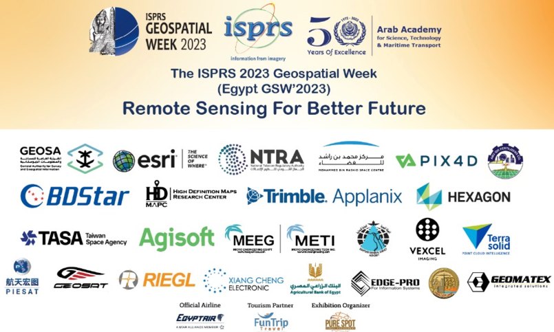
  • 25 major industries in the fields of remote sensing, mapping, navigation, geospatial technologies, and GNSS
  • 3 space agencies from Taiwan, UAE, and Egypt
  • 2 major mapping agencies from Egypt and Saudi Arabia
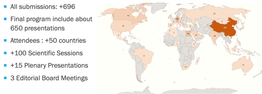
  • 29 workshops divided into 100 sessions which included over 650 presentations and posters. The 29 workshops included state of the art and future trends in geospatial technologies and their applications in many industries and economic sectors
ISPRS GSW’2023 List of Industry and Supporting Organizations

ISPRS GSW’2023 List of Industry and Supporting Organizations


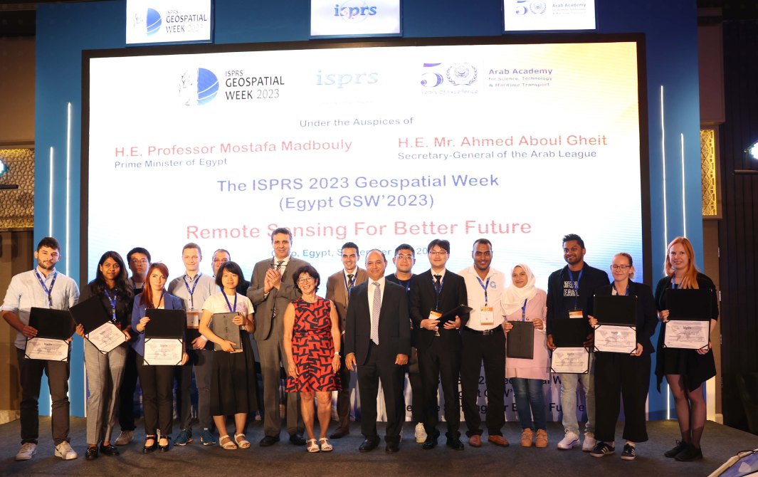
The conference also witnessed the announcement of many awards, including the ISPRS TIF awards, best papers awards, best presentation awards, and the presentation of ISPRS Honorary Membership to Prof. Chen Jun, the ISPRS Fellowship to Prof. Kohei Cho, and the ISPRS Brock Gold Medal Award to Prof. Deren Li.

ISPRS President, Prof. Lena Halounova, GSW’2023 Director, Prof. Naser El-Sheimy, and Prof. Alaa Abdelbarry, Chair of the LOC, with the recipients of the Best Papers Awards

ISPRS President, Prof. Lena Halounova, GSW’2023 Director, Prof. Naser El-Sheimy, and Prof. Alaa Abdelbarry, Chair of the LOC, with the recipients of the Best Papers Awards


This rich program enabled the participants to remain at the state-of-the-art on the current trends in Geospatial science, technology & business, and also give them opportunity to meet and network with a very large number of experts, and to cross-fertilize with colleagues coming from neighboring fields! The conference also provided a platform for international scholars, graduate students, future scientists, and industrial sectors to learn and exchange knowledge and experience in the application of up-to-date geospatial technologies for sustainable development.

The GSW’2023 Conference was not only about science, but also about Egypt - a vibrant, fascinating and welcoming country. Cairo is home to the best Pharaonic, Coptic and Islamic sights in Egypt. Most of the attendees visited Cairo’s architectural and cultural treasures which is the dream of every traveler. The mystifying Pyramids, the vast sand dunes of the deserts, the oasis, the Nile, it's dazzling capital Cairo, countless temples and tombs along the river bank makes it amazingly beautiful and a land to be loved by all. The conference attendees enjoyed two social dinners: a dinner and show on the Nile Crystal Cruising Restaurant, and dinner and show at the Citadel of Cairo.

It was great to have the ISPRS Geospatial Week organized in Egypt where, most probably, the first Geospatial mapping systems were developed 1000s of years ago! We are happy that the attendees enjoyed this conference and could bask in Egypt’s warmth and thousands of years of civilization.


Lena Halounova Lena Halounova

President’s Message

Dear colleagues and friends,

It is my pleasure to share with you my experience from the second largest ISPRS event - the Geospatial Week (GSW).

Geospatial Week 2023 in Cairo was the first large ISPRS event on the African continent: no symposia, no GSWs, and no congresses have been organised on this continent before. The programme included 650 presentations from more than 50 countries. Prof. Naser El-Sheimy from Canada, the GSW 2023 Director, together with the Arab Academy for Science, Technology and Maritime Transport, I am sure, have found that their efforts were rewarding and very fruitful; all participants very much appreciated the event. Two gala dinners will stay in our memories for a long time. Both were combined with a social programme, the second with the active participation of everybody. Egypt, with its amazing history, was also an interesting place for private travel before, during and after the conference. My thanks go to all who were involved in the preparation.

During the conference, we heard about the 2024 and 2025 ISPRS events.

2024 will bring five Mid-Term Symposia on four continents:

You can find information about all these events, and also other, smaller events, in the ISPRS Calendar.

Technical Commission Presidents, Tang Xinming, Alper Yilmaz, Laurent Polidori, Sisi Zlatanova, and Gay Jane Perez sincerely invite all of you and your colleagues to come and share your knowledge, learn something new, find new friends and enjoy yourselves at their symposia in 2024.

2025 is the year of the next GSW. The GSW 2025 will be organised in Dubai, U.A.E., by Muhammed Bin Rashid Space Center (MBRSC) under the title of Photogrammetry & Remote Sensing for a Better Tomorrow… on 16-21 February 2025. I hope it will be another very successful ISPRS event. Saeed Al Mansoori, GSW 2025 director, and his team are already busy with the preparation.

Come and support these exciting ISPRS events in good health and humour!

Lena

The ISPRS Foundation (TIF) News


The ISPRS Foundation The ISPRS Foundation

The ISPRS Foundation

The ISPRS Foundation (TIF) is a non-profit entity established in 2003 and managed by a Board of Trustees. It responds to ISPRS grant needs that are identified by the ISPRS Council. Grant recipients are active participants in ISPRS and ISPRS-sponsored events, presenting posters and oral presentations, publishing in the ISPRS Archives and Annals, and joining both technical discussions and cultural exchanges. While their experiences may sometimes lead to academic and professional opportunities, they always lead to new friendships and exposure to the latest research and advancements in geospatial sciences. More details can be found in our new brochure published recently in the TIF webpage.

The ISPRS Foundation depends on individual donations and contributions from ISPRS. Donations may be mailed directly to the TIF Finance Officer, Jeff Yates (General Manager, DAT/EM Systems International, a division of NV5 Geospatial, 2014 Merrill Field Drive, Anchorage, Alaska 99501, USA) e-mail: jyates@datem.com


White White

Student Consortium News


Student Consortium logo Student Consortium logo

New Issue of the ISPRS SC Official Newsletter – SPECTRUM is out now!

ISPRS SC has released SPECTRUM, issue 2, volume 16, themed on “Use of Social media data in Geospatial Analysis”. The newsletter contains articles on how social media data are being analyzed using geospatial technologies. It further features Dr. Liyanage Kithsiri Perera from the University of Southern Queensland, Australia, in its IFOV section, and Dr. Zainab Akhtar from Hamad Bin Khalifa University, Qatar, in the spotlight section, sharing their research activities.

Society News


ISPRS ISPRS

ISPRS seeks Social Media Manager

The International Society for Photogrammetry and Remote Sensing (ISPRS: www.isprs.org) is a non-governmental organization devoted to the development of international cooperation for the advancement of the photogrammetry, remote sensing and spatial information sciences and their applications. Its activities include managing events of various sizes such as conferences, symposia, and workshops, publishing journals, and encouraging research in the geospatial sciences. As a result, its success hinges on communicating effectively with a community of students as well as post-docs, early-career researchers, and established professionals in academia, government and the private sector, who are heavy users of information technology and use social media continually.
» Read more details


ISPRS ISPRS

Call for Proposals
ISPRS Educational and Capacity Building Initiatives 2024

In accordance with the statutory mission and activities of ISPRS, the Society shall provide funds to support educational and capacity building initiatives, which will further improve its international status in education and training in the field of the photogrammetry, remote sensing and spatial information sciences, and will therefore benefit all ISPRS members. For 2024, the ISPRS Council is making up to CHF70,000 (70,000 Swiss francs) available to support winning projects under the educational and capacity building initiatives. The maximum funding assigned to any one project shall be CHF10,000 per annum. Projects should commence on January 1, 2024 and typically last up to 12 months. In exceptional cases, applications for projects lasting up to 24 months will be considered. Projects of greater duration than one year will be subject to annual review before subsequent funding will be released.

» Read more details


Toronto 2026 Toronto 2026

First announcement of the XXV ISPRS Congress

Dear Colleagues and Friends,

Please find here the first announcement of the XXV ISPRS Congress, From Imagery to Understanding, to be held in Toronto, Canada, 4-11 July 2026.

Best regards,

Derek Lichti
Congress Director
isprs-cd@isprs.org


ISPRS ISPRS

New ISPRS Ordinary Members

ISPRS Ordinary Members unanimously voted for the transfer of membership for the Spanish Ordinary Member representation from the Spanish Society of Cartography, Photogrammetry & Remote Sensing (SECFT) to Instituto Geográfico Nacional (IGN).

The transfer of membership for the Vietnamese representation from the Institute of Geography, Vietnam Academy of Science and Technology (VAST) to the Faculty of Geography, VNU University of Science (VNU – HUS) was also unanimously approved by Ordinary Members.

ISPRS welcomes both IGN and VNU, and looks forward to continuing collaboration.

Read a short profile on IGN here…

Visit the VNU website.


ISPRS International Journal of Geo-Information — Open Access Journal ISPRS International Journal of Geo-Information — Open Access Journal

IJGI Featured Papers from 2022 Q1 and 2023 Q3

Find the Featured Papers from the first quarter of 2022 which, among others, have substantially impacted the rising IF (3.4) of the ISPRS International Journal of Geo-Information, and the 2023 Featured Papers, from the 3rd quarter, an array of high-quality papers published by MDPI.

General Announcements


HKIS Awards 2024 HKIS Awards 2024

HKIS Awards 2024

The Hong Kong Institute of Surveyors

The HKIS Awards endeavour to acknowledge and recognise the outstanding achievements of Hong Kong Surveyors. The Awards serve as a platform to showcase the exceptional work of surveyors in the industry and promote their professional image. Read more here…

  • Application Opens 20 September 2023
  • Early-bird Application Deadline 12:00 noon, 31 October 2023
  • Regular Application and Materials Submission Deadline 12:00 noon, 15 December 2023
  • Award Presentation Ceremony-cum-Dinner 12 July 2024

Announcements of Scientific Meetings                (see also ISPRS Calendar)


ISPRS ISPRS

3-Hour Online Tutorial

Low-cost photogrammetry for the metric documentation of cultural heritage

presented by ISPRS WGII/6 in collaboration with CIPA Heritage Documentation Emerging Professionals

Date, duration and technical means

  • Date: 20 October 2023
  • Start time: 13:00 CEST (UTC+02:00) / 7:00 EDT (UTC−04:00)
  • Duration: 3 hours
  • Platform: Zoom, recording uploaded onto YouTube

» Read more details


Lviv Lviv

International Scientific and Technical Conference - Environmental Monitoring, Photogramme-try, Geoinformatics – Modern Technologies and Development Perspectives

Dedicated to the 60th anniversary of the Department of Photogrammetry and Geoinformatics, Lviv Polytechnic National University

8-10 November 2023
Lviv, Ukraine

More information


ISPRS ISPRS

ISPRS WG I/6, WG I/7, ICWG I/IV - GEOBENCH

2nd Workshop on Evaluation and Benchmark of Sensors and Systems in Photogrammetry and Remote Sensing

23-24 Oct 2023
Cracow, Poland

https://geobench.fbk.eu/


Geo Week 2024 Geo Week 2024

Geo Week 2024

Geo Week is the intersection of geospatial + the built world. The event brings together previous event brands AEC Next, SPAR 3D and the International Lidar Mapping Forum with 4 co-located user conferences into a single powerhouse event. Industries covered include Architecture, Engineering & Construction; Asset & Facility Management; Disaster & Emergency Response; Earth Observation & Satellite Applications; Energy & Utilities, Infrastructure & Transportation; Land & Natural Resource Management, Mining & Aggregates, Surveying & Mapping, and Urban Planning/Smart Cities.

11-13 Feb 2024
Colorado Convention Center, Denver, CO, USA

http://www.geo-week.com


GISTAM 2024 GISTAM 2024

GISTAM 2024
The International Conference on Geographical Information Systems Theory, Applications and Management

2-4 May 2024
Angers, France

The conference aims at creating a meeting point of researchers and practitioners that address new challenges in geo-spatial data sensing, observation, representation, processing, visualization, sharing and managing, in all aspects concerning both information communication and technologies (ICT) as well as management information systems and knowledge-based systems. The conference welcomes original papers of either practical or theoretical nature, presenting research or applications, of specialized or interdisciplinary nature, addressing any aspect of geographic information systems and technologies.

https://gistam.scitevents.org/

  • Regular Paper Submission: December 13, 2023
  • Position Paper Submission: January 25, 2024
  • Doctoral Consortium Paper Submission: March 6, 2024


Event Reports


GSW 2023 GSW 2023

Participation of ISPRS Student Consortium at ISPRS GSW 2023, Cairo

By Laxmi Thapa
President SC

Read the report here…

ISPRS International Journal of Geo-Information — Open Access Journal


ISPRS International Journal of Geo-Information — Open Access Journal ISPRS International Journal of Geo-Information — Open Access Journal

New publications
Volume 12, Issue 8 (August 2023)

Is Ride-Hailing an Effective Tool for Improving Transportation Services in Suburban New Towns in China? Evidence from Wuhan Unicom Users’ Mobile Phone Usage Big Data
Zou, Wenjun, Wu, Lei, Chang, Yunrui, Niu, Qiang
No: 299

Target Localization Method Based on Image Degradation Suppression and Multi-Similarity Fusion in Low-Illumination Environments
Tang, Huapeng, Qin, Danyang, Yang, Jiaqiang, Bie, Haoze, Yan, Mengying, Zhang, Gengxin, Ma, Lin
No: 300

Tourism Support System to Utilize Virtual Reality Space Reflecting Dynamic Information in Real Time
Koga, Yuro, Yamamoto, Kayoko
No: 301

Evolution Characteristics and Causes—An Analysis of Urban Catering Cluster Spatial Structure
Ma, Dongling, Liu, Baoze, Huang, Qingji, Zhang, Qian
No: 302

The Influence of Street Morphology on Thermal Environment Based on ENVI-met Simulation: A Case Study of Hangzhou Core Area, China
Bao, Jin, Xu, Lihua, Shi, Yijun, Ma, Qiwei, Lu, Zhangwei
No: 303

Urban Resident Travel Survey Method Based on Cellular Signaling Data
Li, Junzhuo, Li, Wenyong, Lian, Guan
No: 304

Modelling Global Deforestation Using Spherical Geographic Automata Approach
Addae, Bright, Dragićević, Suzana
No: 306

Explanation and Analysis of Spatio-Temporal Correlations—Towards a Conceptual Approach of a Semantic Comparison Visualization in a Use Case of Carparks in Mainz, Germany
Rolwes, Alexander, Böhm, Klaus
No: 305

Geological Hazard Assessment of Secondary Collapses Due to Volcanic Earthquakes on Changbai Mountain in China
Pan, Zengkai, Lang, Qiuling, Zhang, Yichen, Zhang, Jiquan, Yu, Chenglong, Wu, Chenyang
No: 307

Sensing Mobility and Routine Locations through Mobile Phone and Crowdsourced Data: Analyzing Travel and Behavior during COVID-19
Rodrigues, Cláudia, Veloso, Marco, Alves, Ana, Bento, Carlos
No: 308

Open Geospatial Data Integration in Game Engine for Urban Digital Twin Applications
Rantanen, Toni, Julin, Arttu, Virtanen, Juho-Pekka, Hyyppä, Hannu, Vaaja, Matti T.
No: 310

Revealing Schematic Map Designs with Preservation of Relativity in Node Position and Segment Length in Existing Official Maps
Ti, Peng, Wu, Hao, Li, Zhilin, Li, Mingyao, Dai, Ruyu, Xiong, Tao
No: 309

Usefulness of an Urban Growth Model in Creating Scenarios for City Resilience Planning: An End-User Perspective
Debnath, Ripan, Pettit, Christopher, Soundararaj, Balamurugan, Shirowzhan, Sara, Jayasekare, Ajith Shamila
No: 311

Proposing Optimal Locations for Runoff Harvesting and Water Management Structures in the Hami Qeshan Watershed, Iraq
Al-Kakey, Omeed, Othman, Arsalan Ahmed, Al-Mukhtar, Mustafa, Dunger, Volkmar
No: 312

Convolutional Neural Network-Based Approximation of Coverage Path Planning Results for Parking Lots
Kriščiūnas, Andrius, Čalnerytė, Dalia, Fyleris, Tautvydas, Jurgutis, Tadas, Makackas, Dalius, Barauskas, Rimantas
No: 313

Application of Hydro-Based Morphological Models for Environmental Assessment of Watersheds
Neto, Silvio Luís Rafaeli, dos Santos, Vanessa Jutel, Schutz, Emili Louise Diconcili, de Moliner, Leticia Margarete, Kloth, Cristiane Gracieli, Schier, Daiane Teixeira, Othman, Arsalan Ahmed, Liesenberg, Veraldo, Bispo, Polyanna da Conceição
No: 314

Investigating Metropolitan Hierarchies through a Spatially Explicit (Local) Approach
Salvia, Rosanna, Quaranta, Giovanni, Rontos, Kostas, Cudlin, Pavel, Salvati, Luca
No: 315

Hessian Distributed Ant Optimized Perron–Frobenius Eigen Centrality for Social Networks
Kumaraguru, P.V., Kamalakkannan, Vidyavathi, H L, Gururaj, Flammini, Francesco, Sulaiman Alfurhood, Badria, Natarajan, Rajesh
No: 316

Spatial Morphological Characteristics and Evolution of Traditional Villages in the Mountainous Area of Southwest Zhejiang
Zhu, Quan, Liu, Shuang
No: 317

Exploring Equity in a Hierarchical Medical Treatment System: A Focus on Determinants of Spatial Accessibility
Du, Xishihui, Liu, Maohua, Luo, Siqi
No: 318

Spatial–Temporal Analysis of Vehicle Routing Problem from Online Car-Hailing Trajectories
Feng, Xuyu, Yu, Jianhua, Kan, Zihan, Zhou, Lin, Tang, Luliang, Yang, Xue
No: 319

Assessment of the Bike-Sharing Socioeconomic Equity in the Use of Routes
Suárez-Vega, Rafael, Santana-Jiménez, Yolanda, Hernández, Juan M., Santana-Figueroa, José Juan
No: 320

The Spatial Mechanism and Predication of Rural Tourism Development in China: A Random Forest Regression Analysis
Du, Xishihui, Wang, Zhaoguo, Wang, Yan
No: 321

Identifying Conditioning Factors and Predictors of Conflict Likelihood for Machine Learning Models: A Literature Review
Obukhov, Timur, Brovelli, Maria A.
No: 322

A Lighting Consistency Technique for Outdoor Augmented Reality Systems Based on Multi-Source Geo-Information
Zhu, Kunpeng, Liu, Shuo, Sun, Weichao, Yuan, Yixin, Wu, Yuang
No: 324

Analysis of Correlation between Anthropization Phenomena and Landscape Values of the Territory: A GIS Framework Based on Spatial Statistics
García-Ayllón, Salvador, Martínez, Gloria
No: 323

A Multi-Level Grid Database for Protecting and Sharing Historical Geographic Urban Data: A Case Study of Shanghai
Li, Shuang
No: 325

Cartography and Geomedia in Pragmatic Dimensions
Medyńska-Gulij, Beata, Forrest, David, Kersten, Thomas P.
No: 326

Research on Road Network Partitioning Considering the Coupling of Network Connectivity and Traffic Attributes
Ma, Yingying, Xu, Minglang, Qin, Xiaoran, Zeng, Ying, Zeng, Lingyu
No: 327

Site Selection Prediction for Coffee Shops Based on Multi-Source Space Data Using Machine Learning Techniques
Zhao, Jiaqi, Zong, Baiyi, Wu, Ling
No: 329

Comparison of Soft Indicator and Poisson Kriging for the Noise-Filtering and Downscaling of Areal Data: Application to Daily COVID-19 Incidence Rates
Goovaerts, Pierre, Hermans, Thomas, Goossens, Peter F., Van De Vijver, Ellen
No: 328

HMM-Based Map Matching and Spatiotemporal Analysis for Matching Errors with Taxi Trajectories
Qu, Lin, Zhou, Yue, Li, Jiangxin, Yu, Qiong, Jiang, Xinguo
No: 330

Metric and Color Modifications for the Automated Construction of Map Symbols
Gong, Xinyu, Lan, Tian, Ti, Peng
No: 331

Detection of Forest Fires through Deep Unsupervised Learning Modeling of Sentinel-1 Time Series
Di Martino, Thomas, Le Saux, Bertrand, Guinvarc’h, Régis, Thirion-Lefevre, Laetitia, Colin, Elise
No: 332

Geographical Information System Based Spatial and Statistical Analysis of the Green Areas in the Cities of Abha and Bisha for Environmental Sustainability
Abuhasel, Khaled
No: 333

An Improved Adaptive Sparrow Search Algorithm for TDOA-Based Localization
Dong, Jiaqi, Lian, Zengzeng, Xu, Jingcheng, Yue, Zhe
No: 334

An Evaluation of Smartphone Tracking for Travel Behavior Studies
Gillis, Dominique, Lopez, Angel J., Gautama, Sidharta
No: 335

Global Digital Elevation Model Comparison Criteria: An Evident Need to Consider Their Application
López-Vázquez, Carlos, Ariza-López, Francisco Javier
No: 337

A Method for Intelligent Road Network Selection Based on Graph Neural Network
Guo, Xuan, Liu, Junnan, Wu, Fang, Qian, Haizhong
No: 336

Profiling Public Transit Passenger Mobility Using Adversarial Learning
Li, Yicong, Zhang, Tong, Lv, Xiaofei, Lu, Yingxi, Wang, Wangshu
No: 338

Using a Cost-Distance Time-Geographic Approach to Identify Red Deer Habitat Use in Banff National Park, Alberta, Canada
Ho, Katherine, Loraamm, Rebecca
No: 339

Analysis of PM2.5 Synergistic Governance Path from a Socio-Economic Perspective: A Case Study of Guangdong Province
Fan, Kunkun, Li, Daichao, Li, Cong, Jin, Xinlei, Ding, Fei, Zeng, Zhan
No: 340

Multi-Criterion Analysis of Cyclone Risk along the Coast of Tamil Nadu, India—A Geospatial Approach
Saravanan, Subbarayan, Abijith, Devanantham, Kulithalai Shiyam Sundar, Parthasarathy, Reddy, Nagireddy Masthan, Almohamad, Hussein, Al Dughairi, Ahmed Abdullah, Al-Mutiry, Motrih, Abdo, Hazem Ghassan
No: 341

Land Use and Land Cover Classification in the Northern Region of Mozambique Based on Landsat Time Series and Machine Learning
Macarringue, Lucrêncio Silvestre, Bolfe, Édson Luis, Duverger, Soltan Galano, Sano, Edson Eyji, Caldas, Marcellus Marques, Ferreira, Marcos César, Zullo Junior, Jurandir, Matias, Lindon Fonseca
No: 342

Identification of Urban Functional Zones Based on POI Density and Marginalized Graph Autoencoder
Xu, Runpeng, Chen, Zhenjie, Li, Feixue, Zhou, Chen
No: 343

Spatial Distribution Characteristics and Influencing Factors on the Retail Industry in the Central Urban Area of Lanzhou City at the Scale of Daily Living Circles
Lu, Chenyu, Yu, Changbin, Xin, Yu, Zhang, Wendi
No: 344

Old Mine Map Georeferencing: Case of Marsigli’s 1696 Map of the Smolník Mines
Hvizdák, Ladislav, Tometzová, Dana, Iannaccone, Barbora, Šoltésová, Marieta, Domaracká, Lucia, Kyšeľa, Kamil
No: 345

SASTGCN: A Self-Adaptive Spatio-Temporal Graph Convolutional Network for Traffic Prediction
Li, Wei, Zhan, Xi, Liu, Xin, Zhang, Lei, Pan, Yu, Pan, Zhisong
No: 346

Enhancing Indoor Air Quality Estimation: A Spatially Aware Interpolation Scheme
Jung, Seungwoog, Han, Seungwan, Choi, Hoon
No: 347


Volume 12, Issue 9 (September 2023)

Positional Accuracy Assessment of Digital Elevation Models and 3D Vector Datasets Using Check-Surfaces
Mozas-Calvache, Antonio Tomás
No: 348

Evaluation of Sustainable Development Potential of High-Speed Railway Station Areas Based on “Node-Place-Industry” Model
Zou, Zhuojun, Tang, Yiwen
No: 349

Geostatistics on Real-Time Geodata Streams—High-Frequent Dynamic Autocorrelation with an Extended Spatiotemporal Moran’s I Index
Lemmerz, Thomas, Herlé, Stefan, Blankenbach, Jörg
No: 350

IFC-CityGML Data Integration for 3D Property Valuation
El Yamani, Siham, Hajji, Rafika, Billen, Roland
No: 351

Modeling Long and Short Term User Preferences by Leveraging Multi-Dimensional Auxiliary Information for Next POI Recommendation
Li, Zheng, Huang, Xueyuan, Gong, Liupeng, Yuan, Ke, Liu, Chun
No: 352

Research on the Cyberspace Map and Its Conceptual Model
Zhang, Lan, Wang, Guangxia, You, Xiong, Liu, Zhiyong, Ma, Lin, Tian, Jiangpeng, Su, Mingzhan
No: 353

Carbon Biomass Estimation Using Vegetation Indices in Agriculture–Pasture Mosaics in the Brazilian Caatinga Dry Tropical Forest
Sousa Júnior, Vicente de Paula, Sparacino, Javier, Espindola, Giovana Mira de, Assis, Raimundo Jucier Sousa de
No: 354

Geospatial XAI: A Review
Roussel, Cédric, Böhm, Klaus
No: 355

Multi-Type Features Embedded Deep Learning Framework for Residential Building Prediction
Zhao, Yijiang, Tang, Xiao, Liao, Zhuhua, Liu, Yizhi, Liu, Min, Lin, Jian
No: 356

Measuring the Spatial Accessibility of Parks in Wuhan, China, Using a Comprehensive Multimodal 2SFCA Method
Mao, Kainan, Li, Jingzhong, Yan, Haowen
No: 357

Chinese Modern Architectural Heritage Resources: Perspectives of Spatial Distribution and Influencing Factors
Liao, Yidan, Cenci, Jeremy, Zhang, Jiazhen
No: 358

Spatio-Temporal Relevance Classification from Geographic Texts Using Deep Learning
Tian, Miao, Hu, Xinxin, Huang, Jiakai, Ma, Kai, Li, Haiyan, Zheng, Shuai, Tao, Liufeng, Qiu, Qinjun
No: 359

LBS Tag Cloud: A Centralized Tag Cloud for Visualization of Points of Interest in Location-Based Services
Cheng, Xiaoqiang, Liu, Zhongyu, Wu, Huayi, Xiao, Haibo
No: 360

Evaluation of Machine Learning Algorithms in the Classification of Multispectral Images from the Sentinel-2A/2B Orbital Sensor for Mapping the Environmental Dynamics of Ria Formosa (Algarve, Portugal)
Souza, Flavo Elano Soares de, Rodrigues, José Inácio de Jesus
No: 361

Exploring Divergent Patterns and Dynamics of Urban and Active Rural Developments—A Case Study of Dezhou City
Zhong, Huimin, Liu, Zhengjia, Huang, Yihang
No: 362

A Method for Regularizing Buildings through Combining Skeleton Lines and Minkowski Addition
Chen, Guoqing, Qian, Haizhong
No: 363

A Critical Review of Smart City Frameworks: New Criteria to Consider When Building Smart City Framework
Shi, Fan, Shi, Wenzhong
No: 364

Assessing Potable Water Access and Its Implications for Households’ Livelihoods: The Case of Sibi in the Nkwanta North District, Ghana
Kanjin, Kingsley, Adade, Richard, Quaicoe, Julia, Lan, Minxuan
No: 365

Evolution of the Urban Network in the Upper Yellow River Region of China: Enterprise Flow, Network Connections, and Influence Mechanisms—A Case Study of the Ningxia Urban Agglomeration along the Yellow River
Zhai, Jiagang, Li, Mingji, Ming, Mengjiao, Yimit, Marbiya, Bi, Jinlu
No: 367

Gated Recurrent Unit Embedded with Dual Spatial Convolution for Long-Term Traffic Flow Prediction
Zhang, Qingyong, Zhou, Lingfeng, Su, Yixin, Xia, Huiwen, Xu, Bingrong
No: 366

A Spatial Information Extraction Method Based on Multi-Modal Social Media Data: A Case Study on Urban Inundation
Wu, Yilong, Chen, Yingjie, Zhang, Rongyu, Cui, Zhenfei, Liu, Xinyi, Zhang, Jiayi, Wang, Meizhen, Wu, Yong
No: 368

Large-Scale Mobile-Based Analysis for National Travel Demand Modeling
Nahmias-Biran, Bat-hen, Cohen, Shuki, Simon, Vladimir, Feldman, Israel
No: 369

A Multi-Framework of Google Earth Engine and GEV for Spatial Analysis of Extremes in Non-Stationary Condition in Southeast Queensland, Australia
Pakdel, Hadis, Paudyal, Dev Raj, Chadalavada, Sreeni, Alam, Md Jahangir, Vazifedoust, Majid
No: 370

Nonlinear Hierarchical Effects of Housing Prices and Built Environment Based on Multiscale Life Circle—A Case Study of Chengdu
Song, Yandi, Zhang, Shaoyao, Deng, Wei
No: 371

Detecting Turning Relationships and Time Restrictions of OSM Road Intersections from Crowdsourced Trajectories
Chen, Xin, Xiang, Longgang, Jiao, Fengwei, Wu, Huayi
No: 372

Novel CNN-Based Approach for Reading Urban Form Data in 2D Images: An Application for Predicting Restaurant Location in Seoul, Korea
Yang, Jeyun, Kwon, Youngsang
No: 373

Geospatial Analysis in Web Browsers—Comparison Study on WebGIS Process-Based Applications
Netek, Rostislav, Pohankova, Tereza, Bittner, Oldrich, Urban, Daniel
No: 374

An Ontology-Based Framework for Geospatial Integration and Querying of Raster Data Cube Using Virtual Knowledge Graphs
Hamdani, Younes, Xiao, Guohui, Ding, Linfang, Calvanese, Diego
No: 375

Redesigning Graphical User Interface of Open-Source Geospatial Software in a Community-Driven Way: A Case Study of GRASS GIS
Karlovska, Linda, Petrasova, Anna, Petras, Vaclav, Landa, Martin
No: 376

Spatio-Temporal Information Extraction and Geoparsing for Public Chinese Resumes
Li, Xiaolong, Zhang, Wu, Wang, Yanjie, Tan, Yongbin, Xia, Jing
No: 377

A Latent-Factor-Model-Based Approach for Traffic Data Imputation with Road Network Information
Su, Xing, Sun, Wenjie, Song, Chenting, Cai, Zhi, Guo, Limin
No: 378

Assessing the Hazard Degree of Wadi Malham Basin in Saudi Arabia and Its Impact on North Train Railway Infrastructure
Alqreai, Fatmah Nassir, Altuwaijri, Hamad Ahmed
No: 380

A Wandering Detection Method Based on Processing GPS Trajectories Using the Wavelet Packet Decomposition Transform for People with Cognitive Impairment
Jafarpournaser, Naghmeh, Delavar, Mahmoud Reza, Noroozian, Maryam
No: 379

Cross-Attention-Guided Feature Alignment Network for Road Crack Detection
Xu, Chuan, Zhang, Qi, Mei, Liye, Chang, Xiufeng, Ye, Zhaoyi, Wang, Junjian, Ye, Lang, Yang, Wei
No: 382

A Comprehensive Evaluation of Machine Learning and Classical Approaches for Spaceborne Active-Passive Fusion Bathymetry of Coral Reefs
Cheng, Jian, Cheng, Liang, Chu, Sensen, Li, Jizhe, Hu, Qixin, Ye, Li, Wang, Zhiyong, Chen, Hui
No: 381

An Ontology-Based Knowledge Representation Method for Typhoon Events from Chinese News Reports
Chen, Danjie, Zheng, Yan, Ma, Liqun, Qin, Fen
No: 383

Influence of the Built Environment on Pedestrians’ Route Choice in Leisure Walking
Ge, Yifu, He, Zhongyu, Shang, Kai
No: 384

Carbon Emission Patterns and Carbon Balance Zoning in Urban Territorial Spaces Based on Multisource Data: A Case Study of Suzhou City, China
Zhang, Zhenlong, Yu, Xiaoping, Hou, Yanzhen, Chen, Tianhao, Lu, Yun, Sun, Honghu
No: 385

Spatiotemporal Analytics of Environmental Sounds and Influencing Factors Based on Urban Sensor Network Data
Zhao, Yanjie, Cheng, Jin, Wang, Shaohua, Qin, Lei, Zhang, Xueyan
No: 386


ISPRS Journal of Photogrammetry and Remote Sensing


ISPRS Journal ISPRS Journal

New publications
Volume 203 (September 2023)

Editorial Board
Pages: ii

E2EVAP: End-to-end vectorization of smallholder agricultural parcel boundaries from high-resolution remote sensing imagery
Yang Pan, Xinyu Wang, Liangpei Zhang, Yanfei Zhong
Pages: 246-264

Predicting soil organic carbon in cultivated land across geographical and spatial scales: Integrating Sentinel-2A and laboratory Vis-NIR spectra
Yilin Bao, Fengmei Yao, Xiangtian Meng, Jiahua Zhang, Huanjun Liu, Abdul {Mounem Mouazen}
Pages: 1-18

Robust line segment mismatch removal using point-pair representation and Gaussian-uniform mixture formulation
Liang Shen, Jiahua Zhu, Qin Xin, Xiaotao Huang, Tian Jin
Pages: 314-327

Cost-efficient bathymetric mapping method based on massive active–passive remote sensing data
Tong Han, Huaguo Zhang, Wenting Cao, Chengfeng Le, Chen Wang, Xinke Yang, Yunhan Ma, Dongling Li, Juan Wang, Xiulin Lou
Pages: 285-300

Screening the stones of Venice: Mapping social perceptions of cultural significance through graph-based semi-supervised classification
Nan Bai, Pirouz Nourian, Renqian Luo, Tao Cheng, Ana {Pereira Roders}
Pages: 135-164

Automatic silo axis detection from RGB-D sensor data for content monitoring
Oriol Vila, Imma Boada, Narcis Coll, Marta Fort, Esteve Farres
Pages: 345-357

A robust approach for large-scale cropping intensity mapping in smallholder farms from vegetation, brownness indices and SAR time series
Bingwen Qiu, Xiang Hu, Peng Yang, Zhenghong Tang, Wenbin Wu, Zhengrong Li
Pages: 328-344

A Review of panoptic segmentation for mobile mapping point clouds
Binbin Xiang, Yuanwen Yue, Torben Peters, Konrad Schindler
Pages: 373-391

Vegetation descriptors from Sentinel-1 SAR data for crop growth monitoring
Xin Bao, Rui Zhang, Jichao Lv, Renzhe Wu, Hongsheng Zhang, Jie Chen, Bo Zhang, Xiaoying Ouyang, Guoxiang Liu
Pages: 86-114

Removing temperature drift and temporal variation in thermal infrared images of a UAV uncooled thermal infrared imager
Ziwei Wang, Ji Zhou, Jin Ma, Yong Wang, Shaomin Liu, Lirong Ding, Wenbin Tang, Nuradili Pakezhamu, Lingxuan Meng
Pages: 392-411

Retraction notice to “Transformer-induced graph reasoning for multimodal semantic segmentation in remote sensing” [ISPRS J. Photogramm. Remote Sens. 193 (2022) 90-103]
Qibin He, Xian Sun, Wenhui Diao, Zhiyuan Yan, Dongshuo Yin, Kun F
Pages: 165

Built-up area mapping using Sentinel-1 SAR data
Abhinav Verma, Avik Bhattacharya, Subhadip Dey, Carlos López-Martínez, Paolo Gamba
Pages: 55-70

Empirical insights on the use of sun-induced chlorophyll fluorescence to estimate short-term changes in crop transpiration under controlled water limitation
Kazi Rifat Ahmed, Eugenie Paul-Limoges, Uwe Rascher, Jan Hanus, Franco Miglietta, Roberto Colombo, Alessandro Peressotti, Andrea Genangeli, Alexander Damm
Pages: 71-85

Improving autonomous detection in dynamic environments with robust monocular thermal SLAM system
Yuzhen Wu, Lingxue Wang, Lian Zhang, Yu Bai, Yi Cai, Shuigen Wang, Yanqiu Li
Pages: 265-284

Integration of microwave satellite soil moisture products in the contextual surface temperature-vegetation index models for spatially continuous evapotranspiration estimation
Wenbin Zhu, Li Fan, Shaofeng Jia
Pages: 211-229

Solar-induced chlorophyll fluorescence captures photosynthetic phenology better than traditional vegetation indices
Jingru Zhang, Alemu Gonsamo, Xiaojuan Tong, Jingfeng Xiao, Cheryl A. Rogers, Shuhong Qin, Peirong Liu, Peiyang Yu, Pu Ma
Pages: 183-198

Slice-to-slice context transfer and uncertain region calibration network for shadow detection in remote sensing imagery
Hongyu Chen, Dejun Feng, Shaohan Cao, Wanqi Xu, Yakun Xie, Jun Zhu, Heng Zhang
Pages: 166-182

Characterizing annual dynamics of urban form at the horizontal and vertical dimensions using long-term Landsat time series data
Yixuan Wang, Xuecao Li, Peiyi Yin, Guojiang Yu, Wenting Cao, Jinxiu Liu, Lin Pei, Tengyun Hu, Yuyu Zhou, Xiaoping Liu, Jianxi Huang, Peng Gong
Pages: 199-210

ReCuSum: A polyvalent method to monitor tropical forest disturbances
Ygorra Bertrand, Frappart Frederic, Wigneron Jean-Pierre, Moisy Christophe, Catry Thibault, Pillot Benjamin, Courtalon Jonas, Kharlanova Anna, Riazanoff Serge
Pages: 358-372

From local context-aware to non-local: A road extraction network via guidance of multi-spectral image
Yang Du, Qinghong Sheng, Weili Zhang, Chongrui Zhu, Jun Li, Bo Wang
Pages: 230-245

Supervised and self-supervised learning-based cascade spatiotemporal fusion framework and its application
Weixuan Sun, Jie Li, Menghui Jiang, Qiangqiang Yuan
Pages: 19-36

Total-variation regularized U-Net for wildfire burned area mapping based on Sentinel-1 C-Band SAR backscattering data
Puzhao Zhang, Yifang Ban, Andrea Nascetti
Pages: 301-313

Three-dimensional singular spectrum analysis for precise land cover classification from UAV-borne hyperspectral benchmark datasets
Hang Fu, Genyun Sun, Li Zhang, Aizhu Zhang, Jinchang Ren, Xiuping Jia, Feng Li
Pages: 115-134

Cross-scene wetland mapping on hyperspectral remote sensing images using adversarial domain adaptation network
Yi Huang, Jiangtao Peng, Na Chen, Weiwei Sun, Qian Du, Kai Ren, Ke Huang
Pages: 37-54


New publications
Volume 204 (October 2023)

Fine-scale characterization of irrigated and rainfed croplands at national scale using multi-source data, random forest, and deep learning algorithms
Kudzai S. Mpakairi, Timothy Dube, Mbulisi Sibanda, Onisimo Mutanga
Pages: 117-130

Global distinct variations of surface urban heat islands in inter- and intra-cities revealed by local climate zones and seamless daily land surface temperature data
Bo Yuan, Xuecao Li, Liang Zhou, Tiecheng Bai, Tengyun Hu, Jianxi Huang, Dongjie Liu, Yangchun Li, Jincheng Guo
Pages: 1-14

A symmetry-aware alignment method for photogrammetric 3D models
Wenyuan Niu, Xianfeng Huang, Hanyu Xiang, Xuan Wang, Sentao Ji, Fan Zhang
Pages: 184-208

A spectral-temporal constrained deep learning method for tree species mapping of plantation forests using time series Sentinel-2 imagery
Zehua Huang, Liheng Zhong, Feng Zhao, Jin Wu, Hao Tang, Zhengang Lv, Binyuan Xu, Longfei Zhou, Rui Sun, Ran Meng
Pages: 397-420

Crucial feature capture and discrimination for limited training data SAR ATR
Chenwei Wang, Siyi Luo, Jifang Pei, Yulin Huang, Yin Zhang, Jianyu Yang
Pages: 291-305

UPDExplainer: An interpretable transformer-based framework for urban physical disorder detection using street view imagery
Chuanbo Hu, Shan Jia, Fan Zhang, Changjiang Xiao, Mindi Ruan, Jacob Thrasher, Xin Li
Pages: 209-222

Atmosphere-aware photoclinometry for pixel-wise 3D topographic mapping of Mars
Wai Chung Liu, Bo Wu
Pages: 237-256

Deep learning based multi-view stereo matching and 3D scene reconstruction from oblique aerial images
Jin Liu, Jian Gao, Shunping Ji, Chang Zeng, Shaoyi Zhang, JianYa Gong
Pages: 42-60

One Class One Click: Quasi scene-level weakly supervised point cloud semantic segmentation with active learning
Puzuo Wang, Wei Yao, Jie Shao
Pages: 89-104

Volumetric nonlinear ortho full-waveform stacking in airborne LiDAR bathymetry for reliable water bottom point detection in shallow waters
D. Mader, K. Richter, P. Westfeld, H.-G. Maas
Pages: 145-162

CIT: Content-invariant translation with hybrid attention mechanism for unsupervised change detection
Bo Fang, Gang Chen, Rong Kou, Mercedes E. Paoletti, Juan M. Haut, Antonio Plaza
Pages: 321-339

Estimating the concentration of total suspended solids in inland and coastal waters from Sentinel-2 MSI: A semi-analytical approach
Dalin Jiang, Bunkei Matsushita, Nima Pahlevan, Daniela Gurlin, Cédric G. Fichot, Joshua Harringmeyer, Giulia Sent, Ana C. Brito, Vanda Brotas, Mortimer Werther, Veloisa Mascarenhas, Matthew Blake, Peter Hunter, Andrew Tyler, Evangelos Spyrakos
Pages: 362-377

Application of a two source energy balance model coupled with satellite based soil moisture and thermal infrared data
Lisheng Song, Yanhao Xu, Michael Liddell, Yaokui Cui, Shaomin Liu, Peipei Xu
Pages: 15-26

Temporal-agnostic change region proposal for semantic change detection
Shiqi Tian, Xicheng Tan, Ailong Ma, Zhuo Zheng, Liangpei Zhang, Yanfei Zhong
Pages: 306-320

Generating evidential BEV maps in continuous driving space
Yunshuang Yuan, Hao Cheng, Michael Ying Yang, Monika Sester
Pages: 27-41

MuCoGraph: A multi-scale constraint enhanced pose-graph framework for MLS point cloud inconsistency correction
Yuhao Li, Xianghong Zou, Tian Li, Sihan Sun, Yuan Wang, Fuxun Liang, Jiangping Li, Bisheng Yang, Zhen Dong
Pages: 421-441

Single-image piecewise planar reconstruction of urban buildings based on geometric priors
Wei Wang, Qiulei Dong, Zhanyi Hu
Pages: 105-116

Soybean seed composition prediction from standing crops using PlanetScope satellite imagery and machine learning
Supria Sarkar, Vasit Sagan, Sourav Bhadra, Kristen Rhodes, Meghnath Pokharel, Felix B. Fritschi
Pages: 257-274

Editorial Board

Pages: ii

Multimodal image matching: A scale-invariant algorithm and an open dataset
Jiayuan Li, Qingwu Hu, Yongjun Zhang
Pages: 77-88

Deep multitask learning with label interdependency distillation for multicriteria street-level image classification
Patrick {Aravena Pelizari}, Christian Geiß, Sandro Groth, Hannes Taubenböck
Pages: 275-290

Completing point clouds using structural constraints for large-scale points absence in 3D building reconstruction
Bufan Zhao, Xijiang Chen, Xianghong Hua, Wei Xuan, Derek D. Lichti
Pages: 163-183

SFA-guided mosaic transformer for tracking small objects in snapshot spectral imaging
Lulu Chen, Yongqiang Zhao, Seong G. Kong
Pages: 223-236

A self-supervised remote sensing image fusion framework with dual-stage self-learning and spectral super-resolution injection
Jiang He, Qiangqiang Yuan, Jie Li, Yi Xiao, Liangpei Zhang
Pages: 131-144

Spatio-temporal hierarchical feature transformer for UAV object tracking
Fuzhen Zhu, Jingyi Cui, Kaiqi Dou
Pages: 442-452

Monitoring inland water via Sentinel satellite constellation: A review and perspective
Fanxuan Zeng, Chunqiao Song, Zhigang Cao, Kun Xue, Shanlong Lu, Tan Chen, Kai Liu
Pages: 340-361

Machine learning for cyanobacteria mapping on tropical urban reservoirs using PRISMA hyperspectral data
Felipe N. Begliomini, Claudio C.F. Barbosa, Vitor S. Martins, Evlyn M.L.M. Novo, Rejane S. Paulino, Daniel A. Maciel, Thainara M.A. Lima, Ryan E. O'Shea, Nima Pahlevan, Marta C. Lamparelli
Pages: 378-396

Drone-based RGBT tiny person detection
Yan Zhang, Chang Xu, Wen Yang, Guangjun He, Huai Yu, Lei Yu, Gui-Song Xia
Pages: 61-76


New Events


10 Nov 2023
SAR Workshop 2023
https://www.ieee-jp.org/section/tokyo/chapter/GRS-29/events/sarworkshop2023/SARworkshop2023.html
Tokyo, Japan
 

24 Nov 2023
Workshop on Machine Vision for Earth Observation and Environment Monitoring
https://mveo.github.io/
Aberdeen, UK
 

11-13 Feb 2024
Geo Week 2024
http://www.geo-week.com/
Denver, CO, USA
 

07-11 Apr 2024
SPIE Photonics Europe 2024
https://spie.org/epe_isprs
Strasbourg, France
 

02-04 May 2024
GISTAM 2024
10th International Conference on Geographical Information Systems Theory, Applications and Management
https://gistam.scitevents.org/
Angers, France
 

09-10 May 2024
ISAG2024
International Symposium on Applied Geoinformatics 2024
https://isagsymposium.org
Wroclaw, Poland
 

17-20 Jun 2024
43rd EARSeL Symposium
https://manchester2024.earsel.org/
Manchester, UK
 

29-31 Jan 2025
Topographic Mapping from Space dedicated to Dr. Karsten Jacobsen’s 80th birthday
website not yet available
Istanbul, Türkiye
 

16-21 Feb 2025
ISPRS Geospatial Week 2025
Photogrammetry & Remote Sensing for a Better Tomorrow...
https://gsw2025.ae/
Dubai, UAE
 

04-11 Jul 2026
XXVth ISPRS Congress
From Imagery to Understanding
https://www.isprs2026toronto.com
Toronto, Canada
 

» See more

Updated Events

17-18 Oct 2023
2023 International Workshop on National 3D mapping and 8th International Workshop on Dynamic and Multi-dimensional GIS
https://dmgis2023.scievent.com
Chengdu, China
 

14-18 Jan 2024
EOEC & GiT4NDM
The 8th International Conference on Earth Observation for Environmental Changes (EOEC) &
The 10th International Conference on Geoinformation Technologies for Natural Disaster Management (GiT4NDM)
http://www.qu.edu.qa/conference/eoec
Doha, Qatar
 

11-14 Jun 2024
ISPRS TC II Mid-term Symposium
The Role of Photogrammetry for a Sustainable World
https://www.isprs.org/tc2-symposium2024/index.html
Las Vegas, Nevada, USA
 

29-31 Jan 2025
Topographic Mapping from Space dedicated to Dr. Karsten Jacobsen’s 80th birthday
website not yet available
Istanbul, Türkiye
 

» See more

Job Opportunities

 
1-Oct-2023
Multiple Ph.D. student positions (with funds)
Geosensing Systems Engineering & Sciences graduate research program, University of Houston, USA
 
7-Sep-2023
PhD Candidate on Machine-learned Building Information Vectorization from Satellite Imagery
Remote Sensing Technology Institute (IMF), German Aerospace Center (DLR), Oberpfaffenhofen, Germany
 

» See more

 
© ISPRS, 2023.
Imprint