ISPRS e-Bulletin
Issue No 5 - 2023

Editorial


Geospatial Week 2025 Geospatial Week 2025

ISPRS Geospatial Week 2025

by Saeed Al Mansoori
Geospatial Week 2025 Director
Mohammed Bin Rashid Space Centre (MBRSC)


Exciting news is on the horizon as the Mohammed Bin Rashid Space Centre (MBRSC) prepares to host the ISPRS Geospatial Week 2025 (GSW2025) in Dubai on 16-21 March 2025. Under the overarching theme, "Photogrammetry and Remote Sensing for a Better Tomorrow," this event promises to be a transformative gathering of minds, pushing the boundaries of scientific exploration and innovation.
The chosen theme goes beyond the realm of scientific disciplines: it is a testament to our collective mission. These domains are not merely tools but agents of transformation, providing us with the capability to perceive our world from novel perspectives, make informed decisions, and set a course toward a sustainable and inclusive future.
On our journey to shape the technical program of GSW2025, we have received 27 workshop proposals so far. We are currently in the process of evaluating these to select workshops that align with the conference theme, considering aspects such as novelty, impact of the topic, and innovation. Call for Papers & Abstracts, along with the Call for Registration, opens on 4 March 2024.
We hope you will consider the opportunity to participate in the ISPRS Geospatial Week 2025 and look forward to meeting you in Dubai!

Important Dates:
Annals (fully reviewed papers):
Full paper submission (Annals): 1 September 2024
Full paper author notification: 30 October 2024
Camera ready paper submission: 30 November 2024

Archives (abstract reviewed papers):
Abstracts submission (Archives): 1 September 2024
Abstracts author notification: 30 October 2024
Camera ready paper submission: 30 November 2024

Registration deadlines:
Early bird registration deadline: 30 November 2024
Late registration deadline: 17 January 2025
Mark your calendars, and let us together embrace the power of geospatial technologies to create a world that stands testament to the harmonious integration of science, technology, and the pursuit of a better tomorrow.


Lena Halounova Lena Halounova

President’s Message

Dear colleagues and friends,

I thank those of you very much who have worked for ISPRS in 2023.

ISPRS members were very active in presenting and publicising the results of their research. The publications website boasts eleven volumes of Archives, including the GSW 2023 volume. Two of them are from ISPRS Committees – from the CIPA conference held in Florence, and from the International Symposium of Remote Sensing of Environment (ISRSE), organised by ICORSE and held in Antalya.

In 2020, ISPRS began offering Ordinary Members the opportunity to publish proceedings from their national conferences in the Archives, on condition that the reviewing process follows the rules defined by the Orange Book. ASPRS has taken advantage of this offer for its annual conferences since 2020.

Four volumes of the ISPRS Annals have also been published in 2023, including the GSW 2023 volume.

ISPRS is grateful to the organisers of all events and for the preparation of the proceedings. The events and their papers bring scientific news to ISPRS branches and share the capacity building of our society’s members.

ISPRS is very rich in publications, not only through the proceedings. The three scientific journals rank the Society among the top in the world.

The ISPRS Journal of Photogrammetry and Remote Sensing (IJPRS), the “oldest” ISPRS journal, has continuously increased its impact factor (IF), which has reached 12.7 with a CiteScore of 19.2. It is our hybrid journal.

ISPRS Open Journal of Photogrammetry and Remote Sensing (IOJPRS) is the “youngest” ISPRS journal. The first volume was issued in 2021. Elsevier is the publisher of both these journals.

The  ISPRS International Journal of Geo-Information (IJGI) is published by MDPI. Volume 1 was issued in June 2012, and the journal has reached an impact factor of 3.4 with a CiteScore of 6.2.

The latter two journals are open access, whereas IJPRS operates on a mixed open access/subscription model.

ISPRS Council selects the Editors-in-Chief for all three journals These then propose Associate Editors for Council approval. These top scientists continuously strive to maintain the very high quality of papers published in ISPRS journals.

ISPRS acknowledges the best papers from all three journals by selecting a best paper, published within a calendar year, from each journal. At the end of the four-year evaluation period, a jury from each journal selects the most outstanding paper of the four best papers, who are awarded the U. V. Helava Award for IJPRS, The Jack Dangermond Award for IJGI and The ISPRS Fritz Ackermann Award for IOJPRS.

It is my pleasure and duty to thank the Editors-in-Chiefs: Clément Mallet and Qihao Weng from IJPRS, George Vosselman from IOJPRS, and Wolfgang Kainz from IJGI, together with all Associate Editors, for their hard, responsible and professional work that greatly contributes to the high scientific reputation of ISPRS.

Lena

The ISPRS Foundation (TIF) News


The ISPRS Foundation The ISPRS Foundation

TIF Travel Grants for ISPRS Symposia 2024

The ISPRS Foundation (TIF) offers travel grants to enable deserving young authors, especially from developing countries, to participate the Midterm Symposia to be conducted next year by the ISPRS Technical Commissions. Tips for applying travel grants are available in https://www.isprs.org/foundation/forms/Travel_Grants.aspx

The application form going live on the website and the deadlines for submission of applications are listed in the following table.

TC Term Place TIF Call for Applications TIF Applications Deadline
I May 13-17 Changsha, China December 20, 2023 January 17, 2024
II June 11-14 Las Vegas, USA January 5, 2024 February 2, 2024
V August 6-8 Manila, Philippines March 6, 2024 April 3, 2024
IV October 22-25 Perth, Australia April 6, 2024 May 4, 2024
III November 4-8 Belém, Brazil April 21, 2024 May 19, 2024

Society News


GSW 2023 GSW 2023

GSW 2023 Publications

Geospatial Week 2023 publications are now available online for both the Archives and the Annals.


Riegl Logo Riegle Logo

New Sustaining Member – RIEGL Laser Measurement Systems GmbH

ISPRS welcomes our new Sustaining member from Austria and looks forward to a fruitful collaboration.
For more information on RIEGL, read a short profile below, and visit http://www.riegl.com.

RIEGL is an international leading provider of cutting-edge technology in airborne, mobile, terrestrial, UAV-based, bathymetric and industrial laser scanning solutions for applications in surveying.
RIEGL has been producing LiDAR systems commercially for the general surveying market, as well as providing turn-key solutions for specific industrial demand or niche applications.
RIEGL focuses on pulsed time-of-flight laser radar technology in multiple wavelengths. Their core “Smart-Waveform” technologies provide purely digital signal processing, unique methodologies for resolving range ambiguities, multiple targets per laser shots, optimum distribution of measurements, calibrated amplitudes and reflectance estimates, as well as the seamless integration and calibration of systems.
RIEGL’s Ultimate LiDARTM technology combines state-of-the-art laser scanning capabilities with performant software solutions for efficient data processing.


ISPRS ISPRS

ISPRS Scientific Initiatives 2023 Results

The following projects, to be completed in 2023, won ISPRS funding under the Scientific Initiatives program:

Geospatial Data Base for Exposomics
This arXiv preprint and the portal at https://geoexposomics.org/ are the results of a one-year project funded by ISPRS under the ISPRS Scientific Initiatives 2023.

The project is about proof-concepting a metadata catalogue of Earth observation data sources/products and types that are relevant to human health research in exposomics, as a free service to interested researchers worldwide.

NAUTILUS uNder And throUgh waTer datasets for geospatIaL studies
In line with the scopes of ISPRS WG II/7, the NAUTILUS project aims at promoting underwater datasets for geospatial applications, bringing together people with a specific interest in the underwater domain, in general, and benchmark datasets in particular, fostering existing and drawing guidelines for creating new datasets. 

The ISPRS WG II/7 and  NAUTILUS teams are glad to announce the online user meeting on 15 January 2024.

Two sessions will be organized to optimize coverage of different time zones around the globe:

  • Session A: 0700-0900 (GMT+0)
  • Session B: 1600-1800 (GMT+0)

Please click here in order to register for the Online User Meeting


ISPRS ISPRS

ISPRS Declaration: Dissemination after COP28

The ISPRS International Policy Advisory Committee (IPAC) has prepared a declaration on the development of Earth Observation for climate research.
The declaration was submitted to the Space Climate Observatory (SCO) which presented the declaration at COP 28 in Dubai.
ISPRS Council is very grateful to IPAC for this activity.

Find the declaration here


ISPRS ISPRS

Datasets for Cultural Heritage

ISPRS Working Group II/6, Cultural Heritage Data Acquisition and Processing, is working on generating a list of datasets for cultural heritage and asks the society at large to contribute.

WG II/6 has developed a form intending to compile a comprehensive list of available cultural heritage benchmark data, which can serve as a valuable reference for the scientific community. Our aim is to circulate this questionnaire and publish the compiled list, complete with reference information, within WG II/6 and possibly other channels as ISPRS deems valuable.

Your participation would be greatly appreciated!


ISPRS ISPRS

ISPRS Awards offered in 2026

ISPRS recognizes individual accomplishments through the sponsorship of awards and honours which are granted at each quadrennial ISPRS Congress.

Information on awards offered at the XXV Congress in Toronto in 2026 can be found here…


Shunji_Murai Shunji_Murai

New Publication – Autobiography by Shunji Murai

ISPRS Past President Shunji Murai (presidency 1992-1996), has published his autobiography: Original Creativity – An Autobiography, Bangkok : Chulalongkorn University Press, 2023. 232 p. ISBN 978-616-604-844-5

The publication can be found at: https://www.isprs.org/documents/archive/autobiographies/default.aspx


ISPRS International Journal of Geo-Information — Open Access Journal ISPRS International Journal of Geo-Information — Open Access Journal

IJGI Featured Papers Q1 and Q2 2023

View the Featured Papers published by MDPI in the ISPRS International Journal of Geo-Information for the first and second quarter of 2023.

2023 Q1 Feature Papers:

  1. Uggla, M.; Olsson, P.; Abdi, B.; Axelsson, B.; Calvert, M.; Christensen, U.; Gardevärn, D.; Hirsch, G.; Jeansson, E.; Kadric, Z.; et al. Future Swedish 3D City Models—Specifications, Test Data, and Evaluation. ISPRS Int. J. Geo-Inf. 2023, 12, 47. https://doi.org/10.3390/ijgi12020047
  2. Wang, J.; Hu, Y.; Duolihong, W. Diagnosis and Planning Strategies for Quality of Urban Street Space Based on Street View Images. ISPRS Int. J. Geo-Inf. 2023, 12, 15. https://doi.org/10.3390/ijgi12010015
  3. Li, W.; Wang, S.; Chen, X.; Tian, Y.; Gu, Z.; Lopez-Carr, A.; Schroeder, A.; Currier, K.; Schildhauer, M.; Zhu, R. GeoGraphVis: A Knowledge Graph and Geovisualization Empowered Cyberinfrastructure to Support Disaster Response and Humanitarian Aid. ISPRS Int. J. Geo-Inf. 2023, 12, 112. https://doi.org/10.3390/ijgi12030112
  4. Monteiro, J.; Para, M.; Sousa, N.; Natividade-Jesus, E.; Ostorero, C.; Coutinho-Rodrigues, J. Filling in the Spaces: Compactifying Cities towards Accessibility and Active Transport. ISPRS Int. J. Geo-Inf. 2023, 12, 120. https://doi.org/10.3390/ijgi12030120
  5. Claridades, A.R.C.; Kim, M.; Lee, J. Developing a Model to Express Spatial Relationships on Omnidirectional Images for Indoor Space Representation to Provide Location-Based Services. ISPRS Int. J. Geo-Inf. 2023, 12, 101. https://doi.org/10.3390/ijgi12030101
  6. Vanicek, T.; Popelka, S. The Think-Aloud Method for Evaluating the Usability of a Regional Atlas. ISPRS Int. J. Geo-Inf. 2023, 12, 95. https://doi.org/10.3390/ijgi12030095
  7. Touya, G.; Gruget, M.; Muehlenhaus, I. Where Am I Now? Modelling Disorientation in Pan-Scalar Maps. ISPRS Int. J. Geo-Inf. 2023, 12, 62. https://doi.org/10.3390/ijgi12020062
  8. Corcoran, P.; Spasić, I. Self-Supervised Representation Learning for Geographical Data—A Systematic Literature Review. ISPRS Int. J. Geo-Inf. 2023, 12, 64. https://doi.org/10.3390/ijgi12020064
  9. Zagata, K.; Medyńska-Gulij, B. Mini-Map Design Features as a Navigation Aid in the Virtual Geographical Space Based on Video Games. ISPRS Int. J. Geo-Inf. 2023, 12, 58. https://doi.org/10.3390/ijgi12020058
  10. Alonso, A.; Monzón, A.; Aguiar, I.; Ramírez-Saiz, A. Explanatory Factors of Daily Mobility Patterns in Suburban Areas: Applications and Taxonomy of Two Metropolitan Corridors in Madrid Region. ISPRS Int. J. Geo-Inf. 2023, 12, 16. https://doi.org/10.3390/ijgi12010016


2023 Q2 Feature Papers:

  1. Li, Z.; Han, Y.; Xu, Z.; Zhang, Z.; Sun, Z.; Chen, G. PMGCN: Progressive Multi-Graph Convolutional Network for Traffic Forecasting. ISPRS Int. J. Geo-Inf. 2023, 12, 241. https://doi.org/10.3390/ijgi12060241
  2. Zhai, Y.; Gong, R.; Huo, J.; Fan, B. Building Façade Color Distribution, Color Harmony and Diversity in Relation to Street Functions: Using Street View Images and Deep Learning. ISPRS Int. J. Geo-Inf. 2023, 12, 224. https://doi.org/10.3390/ijgi12060224
  3. Cresswell, K.; Mitsova, D.; Liu, W.; Fadiman, M.; Hindle, T. Gauging Heat Vulnerability in Southeast Florida: A Multimodal Approach Integrating Physical Exposure, Sensitivity, and Adaptive Capacity. ISPRS Int. J. Geo-Inf. 2023, 12, 242. https://doi.org/10.3390/ijgi12060242
  4. Alvarado Vazquez, S.; Madureira, A.M.; Ostermann, F.O.; Pfeffer, K. The Use of ICTs to Support Social Participation in the Planning, Design and Maintenance of Public Spaces in Latin America. ISPRS Int. J. Geo-Inf. 2023, 12, 237. https://doi.org/10.3390/ijgi12060237
  5. Bergmann, L.; Chaves, L.F.; O’Sullivan, D.; Wallace, R.G. Dominant Modes of Agricultural Production Helped Structure Initial COVID-19 Spread in the U.S. Midwest. ISPRS Int. J. Geo-Inf. 2023, 12, 195. https://doi.org/10.3390/ijgi12050195
  6. Miletić, A.; Kuveždić Divjak, A.; Welle Donker, F. Assessment of the Croatian Open Data Portal Using User-Oriented Metrics. ISPRS Int. J. Geo-Inf. 2023, 12, 185. https://doi.org/10.3390/ijgi12050185
  7. Dabove, P.; Colombero, C.; Salerno Quaroni, A. Towards the Monitoring of Underground Caves Using Geomatics and Geophysical Techniques: 3D Analyses and Seismic Response. ISPRS Int. J. Geo-Inf. 2023, 12, 191. https://doi.org/10.3390/ijgi12050191
  8. Bordogna, G.; Carrara, P.; Frigerio, L.; Lella, S. Flexible Trip-Planning Queries. ISPRS Int. J. Geo-Inf. 2023, 12, 204. https://doi.org/10.3390/ijgi12050204
  9. Thiery, F.; Veller, J.; Raddatz, L.; Rokohl, L.; Boochs, F.; Mees, A.W. A Semi-Automatic Semantic-Model-Based Comparison Workflow for Archaeological Features on Roman Ceramics. ISPRS Int. J. Geo-Inf. 2023, 12, 167. https://doi.org/10.3390/ijgi12040167
  10. Wu, H.; Wang, Y.; Sun, Y.; Yin, D.; Li, Z.; Luo, X. Identification and Spatiotemporal Analysis of Bikesharing-Metro Integration Cycling. ISPRS Int. J. Geo-Inf. 2023, 12, 166. https://doi.org/10.3390/ijgi12040166
  11. Grzelka, K.; Bieda, A.; Bydłosz, J.; Kondak, A. Visual Perception of Property Rights in 3D. ISPRS Int. J. Geo-Inf. 2023, 12, 164. https://doi.org/10.3390/ijgi12040164
  12. Schaffert, M.; Geist, K.; Albrecht, J.; Enners, D.; Müller, H. Walk Score from 2D to 3D—Walkability for the Elderly in Two Medium-Sized Cities in Germany. ISPRS Int. J. Geo-Inf. 2023, 12, 157. https://doi.org/10.3390/ijgi12040157

ISPRS ISPRS
Seasons Greetings

 
Dear colleagues and friends.

We would like to express our sincere gratitude for your support to ISPRS in 2023 and look forward to ongoing cooperation with you in 2024.

We wish you good luck, health and success in 2024.

ISPRS Council Members

General Announcements


ASPRS ASPRS

Congratulation to the newly elected ASPRS Leadership

newly elected ASPRS Leadership
  • VP: Al Karlin
  • GIS Asst. Director: Michael Baranowski
  • UAS Asst. Director: Rebecca Capps
  • PAD Asst. Director: Jae Sung Kim
  • Lidar Asst. Director: Nora May

Installation of officers on Tuesday, February 13th at 8:00 AM (MT) at Geo Week 2024.


UN DRR UN DRR

The ISC GeoUnions Standing Committee on Disaster Risk Reduction signed a Memorandum of Understanding (MoU) with UN DRR to collaborate and combine efforts

For details, read here…

Announcements of Scientific Meetings                (see also ISPRS Calendar)


ISPRS ISPRS
Geo Week 2024

Geo Week 2024

11-13 February 2024
Denver, Colorado, USA

Geo Week is the intersection of geospatial + the built world. The event brings together three previous event brands in AEC, 3D and lidar mapping with four collocated user group meetings forming a single powerhouse event where cutting-edge technology offers new possibilities, improved efficiencies, and better outcomes.
www.geo-week.com
info@geo-week.com

Event Reports


Chengdu, China Chengdu, China

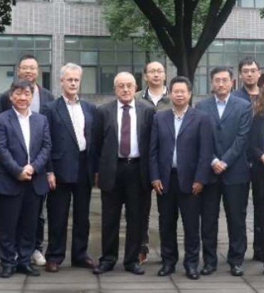
Summary Report of 2023 International Workshop on National 3D Mapping and 8th International workshop on Dynamic and Multi-dimensional GIS

18 October 2023
Southwest Jiaotong University (SWJTU) in Chengdu, China

Read the report here…


ISPRS SC ISPRS SC

ISPRS Student Consortium presentation at National Institute of Technology

2nd Boot Camp on Applications of Drones in Mapping
27-31 October 2023
Kurukshetra, India

Read the report here…


post ACRS 2023 post ACRS 2023

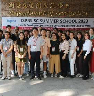
ISPRS Student Consortium Summer School - post ACRS 2023

Remote Sensing for Sustainable Environment: From Land to Water
3-8 November 2023
National Cheng Kung University, Taiwan

Read the report here…


ISPRS SC ISPRS SC

ISPRS Student Consortium Webinar Series 2023

Large-Scale Individual Tree Mapping
29 November 2023

Read the report here…

ISPRS International Journal of Geo-Information — Open Access Journal


ISPRS International Journal of Geo-Information — Open Access Journal ISPRS International Journal of Geo-Information — Open Access Journal

New publications
Volume 12, Issue 10 (October 2023)

Growth Simulations of Urban Underground Space with Ecological Constraints Using a Patch-Based Cellular Automaton
Wei, Lingxiang, Guo, Dongjun, Chen, Zhilong, Hu, Yingying, Wu, Yanhua, Ji, Junyuan
No: 387

An Analysis of the Evolution of Public Sentiment and Spatio-Temporal Dynamics Regarding Building Collapse Accidents Based on Sina Weibo Data
Ma, Dongling, Zhang, Chunhong, Zhao, Liang, Huang, Qingji, Liu, Baoze
No: 388

Geovisualization of Temporal Change in Urban Racial Geography: A Step towards Explaining Persistent Segregation
Stepinski, Tomasz, Dmowska, Anna
No: 389

Investigating the Spatiotemporal Relationship between the Built Environment and COVID-19 Transmission
Huang, Hao, Shi, Haochen, Zordan, Mirna, Lo, Siu Ming, Tsou, Jin Yeu
No: 390

Assessment of Urban Resilience and Detection of Impact Factors Based on Spatial Autocorrelation Analysis and GeoDetector Model: A Case of Hunan Province
Chen, Jianhong, Ma, Hongcai, Yang, Shan, Zhou, Zhiyong, Huang, Jianhui, Chen, Licheng
No: 391

A Heuristic Approach for Resolving Spatial Conflicts of Buildings in Urban Villages
Li, Wende, Yan, Haowen, Lu, Xiaomin, Shen, Yilang
No: 392

Group-Privacy Threats for Geodata in the Humanitarian Context
Masinde, Brian K., Gevaert, Caroline M., Nagenborg, Michael H., Zevenbergen, Jaap A.
No: 393

ChineseCTRE: A Model for Geographical Named Entity Recognition and Correction Based on Deep Neural Networks and the BERT Model
Zhang, Wei, Meng, Jingtao, Wan, Jianhua, Zhang, Chengkun, Zhang, Jiajun, Wang, Yuanyuan, Xu, Liuchang, Li, Fei
No: 394

Application of AHP-ICM and AHP-EWM in Collapse Disaster Risk Mapping in Huinan County
Lu, Zengkang, Yu, Chenglong, Liu, Huanan, Zhang, Jiquan, Zhang, Yichen, Wang, Jie, Chen, Yanan
No: 395

Flow-Data-Based Global Spatial Autocorrelation Measurements for Evaluating Spatial Interactions
Sun, Shuai, Zhang, Haiping
No: 396

An Intelligent UAV Path-Planning Method Based on the Theory of the Three-Dimensional Subdivision of Earth Space
Sun, Guoyi, Xu, Qian, Zhang, Guangyuan, Qu, Tengteng, Cheng, Chengqi, Deng, Haojiang
No: 397

A Vector Field Visualization Method for Trajectory Big Data
Li, Aidi, Xu, Zhijie, Zhang, Jianqin, Li, Taizeng, Cheng, Xinyue, Hu, Chaonan
No: 398

Batch Simplification Algorithm for Trajectories over Road Networks
Reyes, Gary, Estrada, Vivian, Tolozano-Benites, Roberto, Maquilón, Victor
No: 399

Target Search for Joint Local and High-Level Semantic Information Based on Image Preprocessing Enhancement in Indoor Low-Light Environments
Tang, Huapeng, Qin, Danyang, Yang, Jiaqiang, Bie, Haoze, Li, Yue, Zhu, Yong, Ma, Lin
No: 400

Assessing the Influence of Land Cover and Climate Change Impacts on Runoff Patterns Using CA-ANN Model and CMIP6 Data
Rahman, Mahfuzur, Islam, Md. Monirul, Kim, Hyeong-Joo, Sadiq, Shamsher, Alam, Mehtab, Siddiqua, Taslima, Mamun, Md. Al, Gazi, Md. Ashiq Hossen, Raju, Matiur Rahman, Chen, Ningsheng, Hossain, Md. Alamgir, Dewan, Ashraf
No: 401

Portraying the Influence Factor of Urban Vibrancy at Street Level Using Multisource Urban Data
Lu, Rujuan, Wu, Liang, Chu, Deping
No: 402

Knowledge Graph Construction to Facilitate Indoor Fire Emergency Evacuation
Da, Mingkang, Zhong, Teng, Huang, Jiaqi
No: 403

A High-Resolution Spatial Distribution-Based Integration Machine Learning Algorithm for Urban Fire Risk Assessment: A Case Study in Chengdu, China
Hao, Yulu, Li, Mengdi, Wang, Jianyu, Li, Xiangyu, Chen, Junmin
No: 404

The Spatio-Temporal Dynamics, Driving Mechanism, and Management Strategies for International Students in China under the Background of the Belt and Road Initiatives
Li, Weiwei, Wang, Meimei, Zhao, Sidong
No: 405

Assessing the Effect of Urban Growth on Surface Ecological Status Using Multi-Temporal Satellite Imagery: A Multi-City Analysis
Karimi Firozjaei, Mohammad, Mijani, Naeim, Nadizadeh Shorabeh, Saman, Kazemi, Yasin, Ebrahimian Ghajari, Yasser, Jokar Arsanjani, Jamal, Kiavarz, Majid, Alavipanah, Seyed Kazem
No: 406

Development of an Algorithm to Evaluate the Quality of Geolocated Addresses in Urban Areas
Sierra Requena, Rafael, Martínez-Llario, José Carlos, Lorenzo-Sáez, Edgar, Coll-Aliaga, Eloína
No: 407

Using Dual Spatial Clustering Models for Urban Fringe Areas Extraction Based on Night-time Light Data: Comparison of NPP/VIIRS, Luojia 1-01, and NASA’s Black Marble
Zhu, Jie, Lang, Ziqi, Wang, Shu, Zhu, Mengyao, Na, Jiaming, Zheng, Jiazhu
No: 408

Large-Scale Automatic Identification of Industrial Vacant Land
Sun, Yihao, Hu, Han, Han, Yawen, Wang, Ziyan, Zheng, Xiaodi
No: 409

Do Locations of Employment and Residence Influence whether People Use Virtual Social Networks? A Case Study of Residents in Wuhan, China
Deng, Huixia, Niu, Qiang, Wu, Lei
No: 410

The Spatial Structure and Driving Mechanisms of Multi-Source Networks in the Chengdu–Chongqing Economic Circle of China
Zhang, Ludan, Zuo, Xueman, Wu, Ziyi, Chen, Cheng, Pan, Zibao, Hu, Xisheng
No: 411

Evaluating the Usability of a Gaze-Adaptive Approach for Identifying and Comparing Raster Values between Multilayers
Zhang, Changbo, Liao, Hua, Huang, Yongbo, Dong, Weihua
No: 412

Implementation of Web Map Services for Old Cadastral Maps
Verdu-Candela, Alvaro, Femenia-Ribera, Carmen, Mora-Navarro, Gaspar, Sierra-Requena, Rafael
No: 413

The Spatiotemporal Pattern Evolution and Driving Force of Tourism Information Flow in the Chengdu–Chongqing City Cluster
Zhao, Yang, Wang, Zegen, Yong, Zhiwei, Xu, Peng, Wang, Qian, Du, Xuemei
No: 414

Question Classification for Intelligent Question Answering: A Comprehensive Survey
Sun, Hao, Wang, Shu, Zhu, Yunqiang, Yuan, Wen, Zou, Zhiqiang
No: 415

CatBoost-Based Automatic Classification Study of River Network
Wang, Di, Qian, Haizhong
No: 416

Deformation of High Rise Cooling Tower through Projection of Coordinates Resulted from Terrestrial Laser Scanner Observations onto a Vertical Plane
Beshr, Ashraf A. A., Basha, Ali M., El-Madany, Samir A., El-Azeem, Fathi Abd
No: 417

Estimation of a Fundamental Diagram with Heterogeneous Data Sources: Experimentation in the City of Santander
Alonso, Borja, Musolino, Giuseppe, Rindone, Corrado, Vitetta, Antonino
No: 418

Identifying Urban Park Events through Computer Vision-Assisted Categorization of Publicly-Available Imagery
Tan, Yizhou, Li, Wenjing, Chen, Da, Qiu, Waishan
No: 419

A Self-Attention Model for Next Location Prediction Based on Semantic Mining
Lu, Eric Hsueh-Chan, Lin, You-Ru
No: 420

Enhancing the Understanding of the EU Gender Equality Index through Spatiotemporal Visualizations
Targa, Laya, Rueda, Silvia, Riera, Jose Vicente, Casas, Sergio, Portalés, Cristina
No: 421

Deep-Learning-Based Annotation Extraction Method for Chinese Scanned Maps
Rao, Xun, Wang, Jiasheng, Ran, Wenjing, Sun, Mengzhu, Zhao, Zhe
No: 422

The Seasonal Migrants Spatially Affect the Park Green Space Accessibility and Equity under Different Travel Modes: Evidence from Sanya, China
Yang, Wentong, Cheng, Yeqing, Xu, Chunru, Zhang, Jinping
No: 423

A Knowledge-Guided Fusion Visualisation Method of Digital Twin Scenes for Mountain Highways
Tang, Ranran, Zhu, Jun, Ren, Ying, Ding, Yongzhe, Wu, Jianlin, Guo, Yukun, Xie, Yakun
No: 424

The Analyses of Land Use and Prevention in High-Density Main Urban Areas under the Constraint of Karst Ground Subsidence: Study of Wuhan City, China
Gao, Lin, Shi, Yan, Qiu, Yang, Ma, Chuanming, Zhou, Aiguo
No: 425

Extraction of Urban Road Boundary Points from Mobile Laser Scanning Data Based on Cuboid Voxel
Wang, Jingxue, Dong, Xiao, Liu, Guangwei
No: 426

Automated Generation of Room Usage Semantics from Point Cloud Data
Cai, Guoray, Pan, Yimu
No: 427

The Study of Regional Innovation Network Structure: Evidence from the Yangtze River Delta Urban Agglomeration
Chen, Jie, Jiang, Liang, Tian, Ye, Luo, Jing
No: 428

A Hybrid Discrete Artificial Bee Colony Algorithm Based on Label Similarity for Solving Point-Feature Label Placement Problem
Cao, Wen, Xu, Jiaqi, Zhang, Yong, Zhao, Siqi, Xu, Chu, Wu, Xiaofeng
No: 429

Describing the Urban Jungle: A Multicriteria Urbanization Index for the Amazon
Cabrera-Barona, Pablo, Albán, Denise, Durán, Gustavo
No: 430

An Efficient and Accurate Convolution-Based Similarity Measure for Uncertain Trajectories
Li, Guanyao, Deng, Xingdong, Xu, Jianmin, Liu, Yang, Zhang, Ji, Xiong, Simin, Gao, Feng
No: 432

A Hybrid POI Recommendation System Combining Link Analysis and Collaborative Filtering Based on Various Visiting Behaviors
Darapisut, Sumet, Amphawan, Komate, Leelathakul, Nutthanon, Rimcharoen, Sunisa
No: 431

Revealing the Spatio-Temporal Heterogeneity of the Association between the Built Environment and Urban Vitality in Shenzhen
Li, Zhitao, Zhao, Guanwei
No: 433

ExhibitXplorer: Enabling Personalized Content Delivery in Museums Using Contextual Geofencing and Artificial Intelligence
Ivanov, Rosen
No: 434

Spatiotemporal Pattern of Carbon Compensation Potential and Network Association in Urban Agglomerations in the Yellow River Basin
Song, Haihong, Li, Yifan, Gu, Liyuan, Tang, Jingnan, Zhang, Xin
No: 435

Climate Change, Forest Fires, and Territorial Dynamics in the Amazon Rainforest: An Integrated Analysis for Mitigation Strategies
Celis, Nathalia, Casallas, Alejandro, Lopez-Barrera, Ellie Anne, Felician, Martina, De Marchi, Massimo, Pappalardo, Salvatore E.
No: 436

Measuring the Influence of Multiscale Geographic Space on the Heterogeneity of Crime Distribution
He, Zhanjun, Wang, Zhipeng, Gu, Yu, An, Xiaoya
No: 437

Research on Time-Aware Group Query Method with Exclusion Keywords
Zhang, Liping, Li, Jing, Li, Song
No: 438

GIS-Based Multi-Criteria Evaluation (MCE) Methods for Aquaculture Site Selection: A Systematic Review and Meta-Analysis
Chentouf, Sanae, Sebbah, Boutaina, Bahousse, El Houssine, Wahbi, Miriam, Maâtouk, Mustapha
No: 439

 

Volume 12, Issue 11 (November 2023)

An Automated Method for Generating Prefabs of AR Map Point Symbols Based on Object Detection Model
Zou, Nixiao, Xu, Qing, Wu, Yuqing, Zhu, Xinming, Su, Youneng
No: 440

Development of a Voice Virtual Assistant for the Geospatial Data Visualization Application on the Web
Mahmoudi, Homeyra, Camboim, Silvana, Brovelli, Maria Antonia
No: 441

What Determinants Will Enhance or Constrain the Spatiality of Agricultural Products with Geographical Indications in Northeast China? An Interpretable Learning Approach
Luo, Siqi, Ma, Yanji, Wang, Tianli
No: 442

Evaluation of the Resilience of the Catering Industry in Hong Kong before and after the COVID-19 Outbreak Based on Point-of-Interest Data
Liu, Yijia, Shi, Wenzhong, Yu, Yue, Peng, Linya, Zhang, Anshu
No: 443

Observed Equity and Driving Factors of Automated External Defibrillators: A Case Study Using WeChat Applet Data
Liao, Shunyi, Gao, Feng, Feng, Lei, Wu, Jiemin, Wang, Zexia, Chen, Wangyang
No: 444

Morphometric Analysis of Trail Network and Tourist Vulnerability in a Highly Frequented Protected Area
Paliaga, Guido, Ferrando, Andrea, Brandolini, Pierluigi, Coratza, Paola, Faccini, Francesco
No: 445

Comparative Hotspot Analysis of Urban Living Environments and Transit-Oriented Development (TOD) Strategies: A Case Study of Beijing and Xi’an
Dai, Yuchen, Du, Shouhang, Min, Hanqing
No: 446

Identifying Spatiotemporal Patterns of Multiscale Connectivity in the Flow Space of Urban Agglomeration in the Yellow River Basin
Chen, Yaohui, Cui, Caihui, Han, Zhigang, Liu, Feng, Wu, Qirui, Yu, Wangqin
No: 447

Spatial and Temporal Evolution of the Characteristics of Spatially Aggregated Elements in an Urban Area: A Case Study of Wuhan, China
Sun, Zhihao, Kang, Dezhi, Jiao, Hongzan, Yang, Ya, Xue, Wei, Wu, Hao, Liu, Lingbo, Su, Yuwei, Peng, Zhenghong
No: 448

Policing Social Disorder and Broken Windows Theory: Spatial Evidence from the “Franeleros” Experience
García-Tejeda, Enrique, Fondevila, Gustavo
No: 449

Enhancing Crop Classification Accuracy through Synthetic SAR-Optical Data Generation Using Deep Learning
Mirzaei, Ali, Bagheri, Hossein, Khosravi, Iman
No: 450

Optimization and Simulation of Mountain City Land Use Based on MOP-PLUS Model: A Case Study of Caijia Cluster, Chongqing
Zhong, Yuqing, Zhang, Xiaoxiang, Yang, Yanfei, Xue, Minghui
No: 451

Decoding Spontaneous Informal Spaces in Old Residential Communities: A Drone and Space Syntax Perspective
Zhang, Ran, Cao, Lei, Liu, Yiqing, Guo, Ru, Luo, Junjie, Shu, Ping
No: 452

Bibliometric Insights into the Implications of Urban Built Environment on Travel Behavior
Gao, Chao, Lai, Xinyi, Li, Shasha, Cui, Zhiwei, Long, Zhiyou
No: 453

VEPL-Net: A Deep Learning Ensemble for Automatic Segmentation of Vegetation Encroachment in Power Line Corridors Using UAV Imagery
Cano-Solis, Mateo, Ballesteros, John R., Sanchez-Torres, German
No: 454

Geo-Visualization of Spatial Occupancy on Smart Campus Using Wi-Fi Connection Log Data
Zhao, Zihao, Wang, Tao, Zhang, Yiru, Wang, Zixiang, Geng, Ruixuan
No: 455

Automatic Detection and Mapping of Dolines Using U-Net Model from Orthophoto Images
Polat, Ali, Keskin, İnan, Polat, Özlem
No: 456

Multi-Scale Road Matching Based on the Summation Product of Orientation and Distance and Shape Descriptors
Sun, Ying, Lu, Yuefeng, Ding, Ziqi, Wen, Qiao, Li, Jing, Liu, Yanru, Yao, Kaizhong
No: 457

Function2vec: A Geographic Knowledge Graph Model of Urban Function Evolution and Its Application
Li, Tianle, Zheng, Minrui, Wang, Xiaoli, Zheng, Xinqi
No: 458

A Fine-Grained Simulation Study on the Incidence Rate of Dysentery in Chongqing, China
Hao, Jian, Shen, Jingwei
No: 459

Random Forest Variable Importance Measures for Spatial Dynamics: Case Studies from Urban Demography
Georgati, Marina, Hansen, Henning Sten, Keßler, Carsten
No: 460

Evaluation and Spatiotemporal Differentiation of Cultural Tourism Development Potential: The Case of the Middle and Lower Reaches of the Yellow River
Chen, Yuying, Li, Yajie, Gu, Xiangfeng, Yuan, Qing, Chen, Nan, Jin, Qi
No: 461

Landscape Sensitivity Assessment of Historic Districts Using a GIS-Based Method: A Case Study of Beishan Street in Hangzhou, China
Yang, Xueyan, Shen, Jie
No: 462

A Weighted k-Nearest-Neighbors-Based Spatial Framework of Flood Inundation Risk for Coastal Tourism—A Case Study in Zhejiang, China
Liu, Shuang, Tan, Nengzhi, Liu, Rui
No: 463

Early Flood Monitoring and Forecasting System Using a Hybrid Machine Learning-Based Approach
Koutsovili, Eleni-Ioanna, Tzoraki, Ourania, Theodossiou, Nicolaos, Tsekouras, George E.
No: 464

Flash Flood Hazard Assessment along the Red Sea Coast Using Remote Sensing and GIS Techniques
Rashwan, Mohamed, Mohamed, Adel K., Alshehri, Fahad, Almadani, Sattam, Khattab, Mohammed, Mohamed, Lamees
No: 465

Editorial on Special Issue “Geo-Information Applications in Active Mobility and Health in Cities”
Gudes, Ori, Zarpelon Leao, Simone
No: 466

Urban Road Lane Number Mining from Low-Frequency Floating Car Data Based on Deep Learning
Li, Xiaolong, Zhang, Yun, Xiang, Longgang, Wu, Tao
No: 467


ISPRS Journal of Photogrammetry and Remote Sensing


ISPRS Journal ISPRS Journal

New publications
Volume 205 (November 2023)

Editorial Board
Pages: ii

MA-SARNet: A one-shot nowcasting framework for SAR image prediction with physical driving forces
Zhouyayan Li, Zhongrun Xiang, Bekir Z. Demiray, Muhammed Sit, Ibrahim Demir
Pages: 176-190

A large-scale climate-aware satellite image dataset for domain adaptive land-cover semantic segmentation
Songlin Liu, Linwei Chen, Li Zhang, Jun Hu, Ying Fu
Pages: 98-114

A Phenology-guided Bayesian-CNN (PB-CNN) framework for soybean yield estimation and uncertainty analysis
Chishan Zhang, Chunyuan Diao
Pages: 50-73

GATraj: A graph- and attention-based multi-agent trajectory prediction model
Hao Cheng, Mengmeng Liu, Lin Chen, Hellward Broszio, Monika Sester, Michael Ying Yang
Pages: 163-175

Urban-rural gradient in vegetation phenology changes of over 1500 cities across China jointly regulated by urbanization and climate change
Yingying Ji, Wenfeng Zhan, Huilin Du, Shasha Wang, Long Li, Jingfeng Xiao, Zihan Liu, Fan Huang, Jiaxin Jin
Pages: 367-384

Globally quantitative analysis of the impact of atmosphere and spectral response function on 2-band enhanced vegetation index (EVI2) over Sentinel-2 and Landsat-8
Zhijun Zhen, Shengbo Chen, Tiangang Yin, Jean-Philippe Gastellu-Etchegorry
Pages: 206-226

Mapping snow depth distribution from 1980 to 2020 on the tibetan plateau using multi-source remote sensing data and downscaling techniques
Ying Ma, Xiao-Dong Huang, Xia-Li Yang, Yu-Xin Li, Yun-Long Wang, Tian-Gang Liang
Pages: 246-262

Atmospheric correction algorithm based on deep learning with spatial-spectral feature constraints for broadband optical satellites: Examples from the HY-1C Coastal Zone Imager
Xin Zhao, Yi Ma, Yanfang Xiao, Jianqiang Liu, Jing Ding, Xiaomin Ye, Rongjie Liu
Pages: 147-162

A novel method for identification of disturbance from surface coal mining using all available Landsat data in the GEE platform
Tingting He, Jiwang Guo, Wu Xiao, Suchen Xu, Hang Chen
Pages: 17-33

Multi-year hyperspectral remote sensing of a comprehensive set of crop foliar nutrients in cranberries
Nanfeng Liu, Erin {Wagner Hokanson}, Nicole Hansen, Philip A. Townsend
Pages: 135-146

Generating 60–100 m, hourly, all-weather land surface temperatures based on the Landsat, ECOSTRESS, and reanalysis temperature combination (LERC)
Jinling Quan, Yongjuan Guan, Wenfeng Zhan, Ting Ma, Dandan Wang, Zheng Guo
Pages: 115-134

BoundED: Neural boundary and edge detection in 3D point clouds via local neighborhood statistics
Lukas Bode, Michael Weinmann, Reinhard Klein
Pages: 334-351

Examining the potential for early detection of spruce bark beetle attacks using multi-temporal Sentinel-2 and harvester data
Sadegh Jamali, Per-Ola Olsson, Arsalan Ghorbanian, Mitro Müller
Pages: 352-366

Improving agricultural field parcel delineation with a dual branch spatiotemporal fusion network by integrating multimodal satellite data
Zhiwen Cai, Qiong Hu, Xinyu Zhang, Jingya Yang, Haodong Wei, Jiayue Wang, Yelu Zeng, Gaofei Yin, Wenjuan Li, Liangzhi You, Baodong Xu, Zhihua Shi
Pages: 34-49

Simple yet efficient downscaling of land surface temperatures by suitably integrating kernel- and fusion-based methods
Pan Dong, Wenfeng Zhan, Chenguang Wang, Sida Jiang, Huilin Du, Zihan Liu, Yangyi Chen, Long Li, Shasha Wang, Yingying Ji
Pages: 317-333

Mapping intertidal topographic changes in a highly turbid estuary using dense Sentinel-2 time series with deep learning
Chunpeng Chen, Ce Zhang, Bo Tian, Wenting Wu, Yunxuan Zhou
Pages: 1-16

Mapping crop phenophases in reproductive growth period by satellite solar-induced chlorophyll fluorescence: A case study in mid-temperate zone in China
Cong Wang, Yunping Chen, Wanting Tong, Wei Zhou, Jing Li, Baodong Xu, Qiong Hu
Pages: 191-205

A 2D/3D multimodal data simulation approach with applications on urban semantic segmentation, building extraction and change detection
Mario {Fuentes Reyes}, Yuxing Xie, Xiangtian Yuan, Pablo d’Angelo, Franz Kurz, Daniele Cerra, Jiaojiao Tian
Pages: 74-97

Mapping annual center-pivot irrigated cropland in Brazil during the 1985–2021 period with cloud platforms and deep learning
Xiangyu Liu, Wei He, Wenbin Liu, Guoying Yin, Hongyan Zhang
Pages: 227-245

Spatio-temporal registration of plants non-rigid 3-D structure
Tian Zhang, Bashar Elnashef, Sagi Filin
Pages: 263-283

Identifying active retrogressive thaw slumps from ArcticDEM
Lingcao Huang, Michael J. Willis, Guiye Li, Trevor C. Lantz, Kevin Schaefer, Elizabeth Wig, Guofeng Cao, Kristy F. Tiampo
Pages: 301-316

Scene-aware refinement network for unsupervised monocular depth estimation in ultra-low altitude oblique photography of UAV
Kailong Yu, Hao Li, Linjie Xing, Tao Wen, Die Fu, Yang Yang, Chengjiang Zhou, Rong Chang, Shan Zhao, Lin Xing, Haicheng Bai
Pages: 284-300


New publications
Volume 206 (December 2023)

Editorial Board
Pages: ii

Multiscale probability map guided index pooling with attention-based learning for road and building segmentation
Shirsha Bose, Ritesh Sur Chowdhury, Debabrata Pal, Shivashish Bose, Biplab Banerjee, Subhasis Chaudhuri
Pages: 132-148

Satellite remote sensing model for estimating canopy transpiration in cypress plantation using in situ sap flow observations and forest inventory
Asahi Hashimoto, Chen-Wei Chiu, Yuichi Onda, Makiko Tateishi, Kenji Tsuruta, Takashi Gomi
Pages: 258-272

Spatio-temporal multi-level attention crop mapping method using time-series SAR imagery
Zhu Han, Ce Zhang, Lianru Gao, Zhiqiang Zeng, Bing Zhang, Peter M. Atkinson
Pages: 293-310

Cross-domain point cloud completion for multi-class indoor incomplete objects via class-conditional GAN inversion
Zhenxin Zhang, Siyi Leng, Liqiang Zhang
Pages: 118-131

SAR-ATR with knowledge hierarchy division and information dissemination networks
Zhiqiang Zeng, Jinping Sun, Xianxun Yao, Dandan Gu, Wen Hong
Pages: 242-257

Exchange means change: An unsupervised single-temporal change detection framework based on intra- and inter-image patch exchange
Hongruixuan Chen, Jian Song, Chen Wu, Bo Du, Naoto Yokoya
Pages: 87-105

Solving photogrammetric cold cases using AI-based image matching: New potential for monitoring the past with historical aerial images
Ferdinand Maiwald, Denis Feurer, Anette Eltner
Pages: 184-200

Leveraging topology for domain adaptive road segmentation in satellite and aerial imagery
Javed Iqbal, Aliza Masood, Waqas Sultani, Mohsen Ali
Pages: 106-117

WaterFormer: A coupled transformer and CNN network for waterbody detection in optical remotely-sensed imagery
Jian Kang, Haiyan Guan, Lingfei Ma, Lanying Wang, Zhengsen Xu, Jonathan Li
Pages: 222-241

An Effective Attention-based CNN Model for Fire Detection in Adverse Weather Conditions
Hikmat Yar, Waseem Ullah, Zulfiqar {Ahmad Khan}, Sung {Wook Baik}
Pages: 335-346

DC3DCD: Unsupervised learning for multiclass 3D point cloud change detection
Iris {de Gélis}, Sébastien Lefèvre, Thomas Corpetti
Pages: 168-183

A deep learning-based local feature extraction method for improved image matching and surface reconstruction from Yutu-2 PCAM images on the Moon
Jiageng Zhong, Jianguo Yan, Ming Li, Jean-Pierre Barriot
Pages: 16-29

PatchAugNet: Patch feature augmentation-based heterogeneous point cloud place recognition in large-scale street scenes
Xianghong Zou, Jianping Li, Yuan Wang, Fuxun Liang, Weitong Wu, Haiping Wang, Bisheng Yang, Zhen Dong
Pages: 273-292

Merging multiple sensing platforms and deep learning empowers individual tree mapping and species detection at the city scale
Ryoungseob Kwon, Youngryel Ryu, Tackang Yang, Zilong Zhong, Jungho Im
Pages: 201-221

PanoVLM: Low-Cost and accurate panoramic vision and LiDAR fused mapping
Diantao Tu, Hainan Cui, Shuhan Shen
Pages: 149-167

A deep transfer learning framework for mapping high spatiotemporal resolution LAI
Junxiong Zhou, Qi Yang, Licheng Liu, Yanghui Kang, Xiaowei Jia, Min Chen, Rahul Ghosh, Shaomin Xu, Chongya Jiang, Kaiyu Guan, Vipin Kumar, Zhenong Jin
Pages: 30-48

STEPSBI: Quick spatiotemporal fusion with coarse- and fine-resolution scale transformation errors and pixel-based synthesis base image pair
Yuyang Ma, Yonglin Shen, Guoling Shen, Jie Wang, Wen Xiao, Huiyang He, Chuli Hu, Kai Qin
Pages: 1-15

Estimation of grain protein content in commercial bread and durum wheat fields via traits inverted by radiative transfer modelling from Sentinel-2 timeseries
A Longmire, T Poblete, A Hornero, D Chen, P.J Zarco-Tejada
Pages: 49-62

Blind single-image-based thin cloud removal using a cloud perception integrated fast Fourier convolutional network
Yujun Guo, Wei He, Yu Xia, Hongyan Zhang
Pages: 63-86

A review of regional and Global scale Land Use/Land Cover (LULC) mapping products generated from satellite remote sensing
Yanzhao Wang, Yonghua Sun, Xuyue Cao, Yihan Wang, Wangkuan Zhang, Xinglu Cheng
Pages: 311-334


ISPRS Open Journal of Photogrammetry and Remote Sensing


ISPRS Open Journal of Photogrammetry and Remote Sensing ISPRS Open Journal of Photogrammetry and Remote Sensing

New publications
Volume 9 (August 2023)

Instance segmentation of individual tree crowns with YOLOv5: A comparison of approaches using the ForInstance benchmark LiDAR dataset
Adrian Straker, Stefano Puliti, Johannes Breidenbach, Christoph Kleinn, Grant Pearse, Rasmus Astrup, Paul Magdon
Pages: 100045

Automated pipeline reconstruction using deep learning & instance segmentation
Lukas Hart, Stefan Knoblach, Michael Möser
Pages: 100043

Deep unsupervised learning for 3D ALS point clouds change detection
Iris {de Gélis}, Sudipan Saha, Muhammad Shahzad, Thomas Corpetti, Sébastien Lefèvre, Xiao Xiang Zhu
Pages: 100044

Branch information extraction from Norway spruce using handheld laser scanning point clouds in Nordic forests
Olli Winberg, Jiri Pyörälä, Xiaowei Yu, Harri Kaartinen, Antero Kukko, Markus Holopainen, Johan Holmgren, Matti Lehtomäki, Juha Hyypp
Pages: 100040

Individual tree segmentation and species classification using high-density close-range multispectral laser scanning data
Aada Hakula, Lassi Ruoppa, Matti Lehtomäki, Xiaowei Yu, Antero Kukko, Harri Kaartinen, Josef Taher, Leena Matikainen, Eric Hyyppä, Ville Luoma, Markus Holopainen, Ville Kankare, Juha Hyyppä
Pages: 100039

Automatic labelling for semantic segmentation of VHR satellite images: Application of airborne laser scanner data and object-based image analysis
Kirsi Karila, Leena Matikainen, Mika Karjalainen, Eetu Puttonen, Yuwei Chen, Juha Hyyppä
Pages: 100046

Multi-modal image matching to colorize a SLAM based point cloud with arbitrary data from a thermal camera
Melanie Elias, Alexandra Weitkamp, Anette Eltner
Pages: 100041

A step towards inter-operable Unmanned Aerial Vehicles (UAV) based phenotyping; A case study demonstrating a rapid, quantitative approach to standardize image acquisition and check quality of acquired images
Gattu Priyanka, Sunita Choudhary, Krithika Anbazhagan, Dharavath Naresh, Rekha Baddam, Jan Jarolimek, Yogesh Parnandi, P. Rajalakshmi, Jana Kholova
Pages: 100042


New publications
Volume 10 (December 2023)

Spectral Profile Partial Least-Squares (SP-PLS): Local multivariate pansharpening on spectral profiles
Tuomas Sihvonen, Zina-Sabrina Duma, Heikki Haario, Satu-Pia Reinikainen
Pages: 100049

How suitable are vegetation indices for estimating the (R)USLE C-factor for croplands? A case study from Southeast Brazil
Filipe Castro Felix, Bernardo M. Cândido, Jener F.L. {de Moraes}
Pages: 100050

Pol-InSAR-Island - A benchmark dataset for multi-frequency Pol-InSAR data land cover classification
Sylvia Hochstuhl, Niklas Pfeffer, Antje Thiele, Stefan Hinz, Joel Amao-Oliva, Rolf Scheiber, Andreas Reigber, Holger Dirks
Pages: 100047


New Events


01 Jan - 30 Nov 2024
2023 International Remote Sensing Image Intelligent Processing Algorithm Contest
http://rsipac.whu.edu.cn/index?lang=en_US
Wuhan, China
 

11-13 Feb 2024
Geo Week 2024
http://www.geo-week.com/
Denver, CO, USA
 

04-07 Jun 2024
8th International Conference on Smart Data and Smart Cities
http://www.udms.net
Athens, Greece
 

10-13 Jun 2024
45th Canadian Symposium on Remote Sensing (CSRS)
https://crss-sct.ca/events/csrs2024-halifax/
Halifax, Canada
 

16-21 Jun 2024
9 International Conference on Cartography and GIS
https://iccgis2024.cartography-gis.com/
Nessebar, Bulgaria
 

01-05 Jul 2024
3D GeoInfo and EG-ICE joint conference 2024
http://3dgeoinfoeg-ice.webs.uvigo.es/
Vigo, Spain
 

01-07 Jul 2024
Academic Track of FOSS4G (Free and Open Source Software for Geospatial) Europe 2024
https://2024.europe.foss4g.org
Tartu, Estonia
 

18-22 Aug 2024
SPIE Optics + Photonics 2024
https://spie.org/op_isprs
San Diego, California, USA
 

» See more

Job Opportunities

 
11-Oct-2023
Multiple Ph.D. student positions (with funds)
Geosensing Systems Engineering & Sciences graduate research program, University of Houston, USA
 
26-Oct-2023
Doctor/Engineer for Technological development in a research and design company for 3D scanners in engineering and architecture.
2 Freedom Imaging Software and Hardware S .L, Mérida (Badajoz), Spain
 
3-Nov-2023
Postdoctoral Associate in Multi-scale analysis of landfill methane emissions
Department of Geography and Environment, The University of Western Ontario, Canada
 
21-Nov-2023
PhD student on multi-modal UAV navigation in Research Training Group AirMetro
Institute of Photogrammetry and Remote Sensing, TU Dresden, Germany
Deadline: 14-Feb-2024
 
23-Nov-2023
Research Assistant/Associate Professor of Digital Forestry ‐ Non‐Tenure Track
Purdue University, West Lafayette, Indiana, USA
 
2-Dec-2023
PhD vacancy in Developing Ecosystem Digital Twins with Remote Sensing to Combat Biodiversity Loss
Dept. of Geoscience & Remote Sensing, TU Delft
Deadline: 12-Jan-2024
 

» See more

 
© ISPRS, 2023.
Imprint