ISPRS e-Bulletin
Issue No 4 - 2024

Editorial


Toronto 2026 Toronto 2026

2026 ISPRS Congress Update

by Derek Lichti
Bob Ryerson
Shabnam Jabari


Partnerships

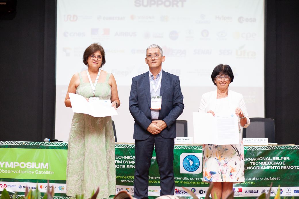
The importance of our partners to the Congress cannot be overstated. We see the accomplishments of our partners—sponsors and exhibitors—as one of the key drivers in how we will set up the entire program. We will have not only the Forum activities described below that will attract decision makers, but also special sessions that will allow our partners and sponsors to share their most recent achievements - the applied abstract submissions described below. All of this will be in addition to the latest papers on the science for which the ISPRS Congresses are so well known. We are pleased to announce MDPI is an early Bronze Sponsor of the XXV Congress. We invite the community to join with us as sponsors and exhibitors to make this the most successful Congress ever—successful for everyone! Future sponsors and exhibitors can explore our Partnership Prospectus at https://www.isprs2026toronto.com/become-a-sponsor.

Attendee assistance

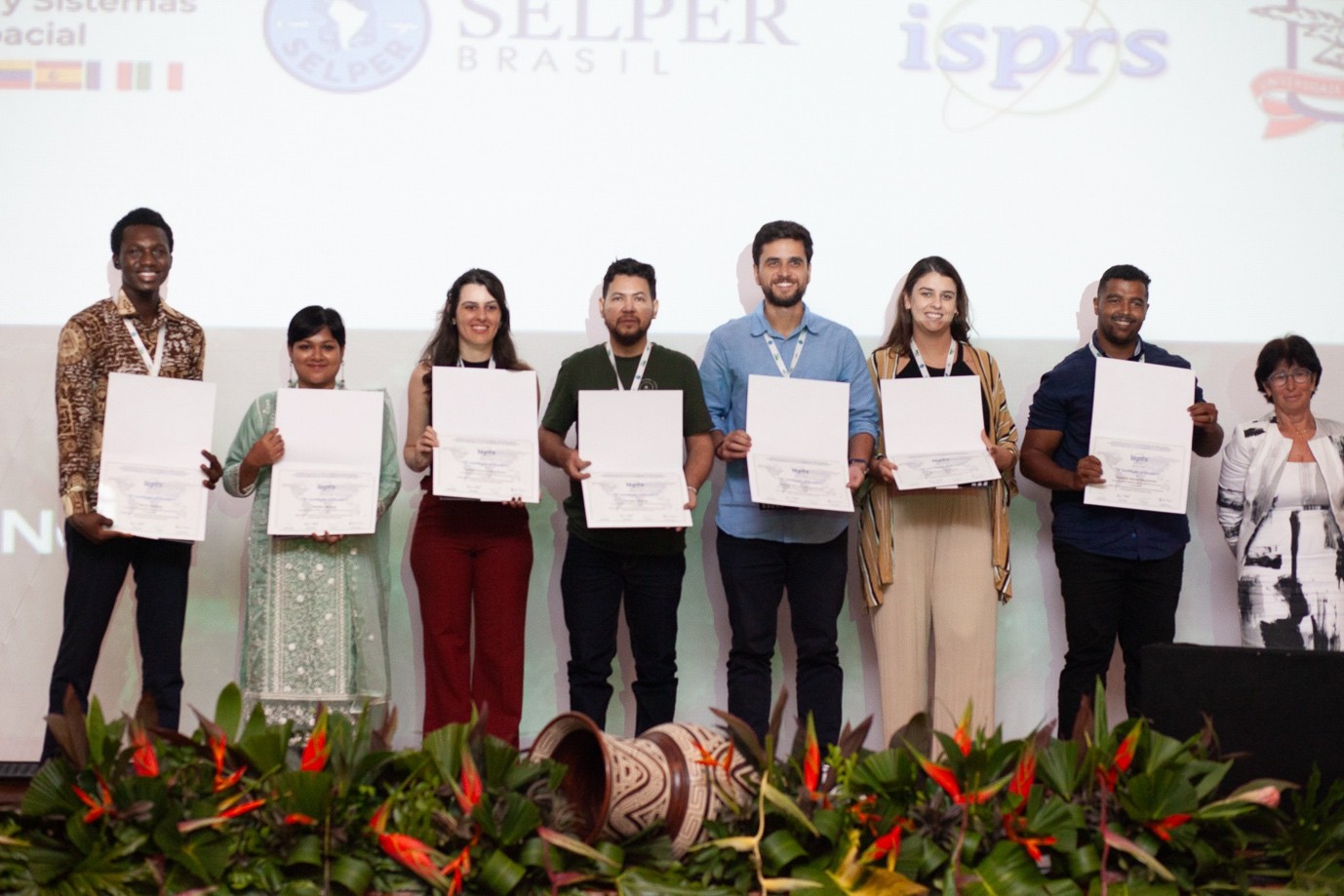
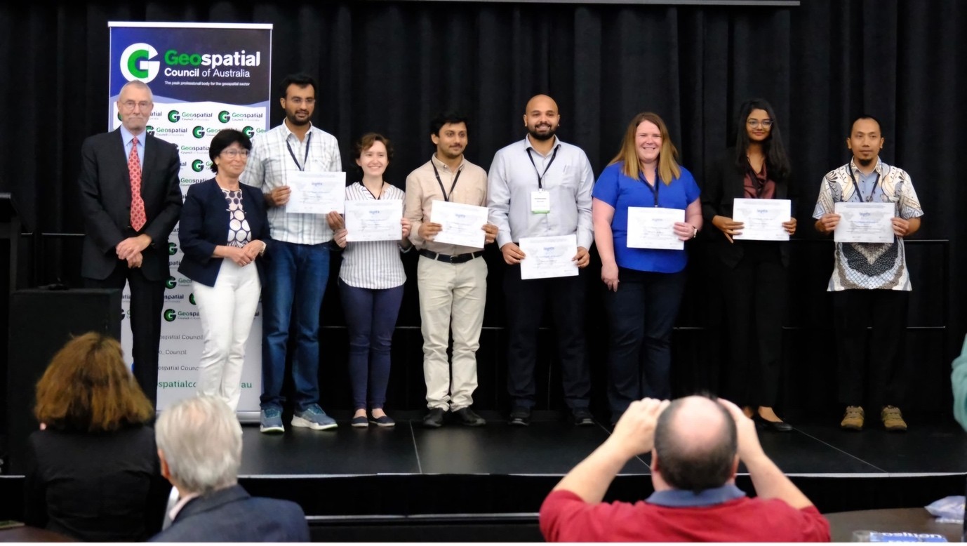
We have secured additional sources of funding to provide financial support for international attendees from the Global South, who are often underrepresented at the Congress. This includes a Leaders Circle1 Research Grant and a donation from the Schulich School of Engineering, University of Calgary. Details about how to apply for support will be available in 2025. This support is in addition to The ISPRS Foundation (TIF) travel grants.

Forum session planning

Forum sessions will take place in parallel with the scientific sessions, with the objective of addressing the interactions between science, public organizations, industry and decision-makers on hot topics of the geospatial community. The Forum is not a place to make research presentations but to address the impact of innovations and the role that our community can play in “building a better future together by providing collective visions and/or roadmaps.”
The concepts already identified for Forum attention at the 2026 Congress include:

  • Congress legacy project: how to secure funding to support geospatial activities
  • Bringing diversity equity and inclusion to the geospatial world (tentative title)
  • Challenges faced by national mapping and remote sensing agencies
  • Earth observation satellites

People who wish to contact the leaders of these Forum topics are invited to contact Dr. Bob Ryerson at bryerson@kimgeomatics.com. (Please use ISPRS Forum as the subject.)
The Congress Organizing Committee has identified several other topics that may be of interest should a champion emerge:

  • The role of geospatial information in climate change
  • Interactions between computer vision and photogrammetry in surveying industry
  • Geospatial information in international development and poverty alleviation
  • The role of ai in the future geospatial world
  • Foundational models in spatial information systems
  • What does quantum computing + AI mean for the geospatial industry?

Abstract only and applied sessions

We plan to offer two abstract-only submission types for the 2026 Congress: scientific and applied. For authors who submit extended abstracts to the scientific program, submission of a full-length paper will be optional if the abstract is accepted.
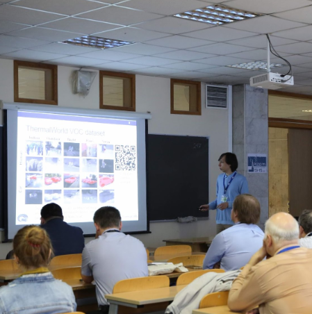
Recognizing the invaluable perspectives and contributions that non-academic professionals bring to our field, we will invite applied abstract submissions from industry, government agencies and NGOs. In our national symposia we have found that industry and the user community value the opportunity to describe how they have been using geospatial technology in an operational (as compared to scientific or research) manner. We see this approach, as well as the usual ways for industry to present itself at a conference, as a highly valuable way to share results, build client interest, and develop both leads and new business ideas. We have found that, in addition to decision makers with budgets, these sessions tend to attract younger professionals and graduate students, many of whom are seeking employment. Of course, we also plan to have student awards and competitions.


1 The Toronto Leaders Circle is a distinguished network of Canadian experts committed to enhancing the city’s global reputation by bringing international meetings to Toronto.


Lena Halounova Lena Halounova

President’s Message

Each ISPRS Congress serves as a cornerstone in ISPRS history. Not only do they provide a platform for the presentation of scientific achievements but also for various meetings and the General Assembly, the highest-level meeting of the Society. The General Assembly plays a decisive role in the development of the Society for the new ISPRS term until the next congress. The General Assembly selects the Presidents and Vice-Presidents of the Technical Commissions, the next Congress host and the Congress Director, and the new Council Members, and along with other duties. The details can be found in the ISPRS Statutes and Bylaws.

The present Council is obliged to inform the ISPRS community about its rights and possibilities for the period after the coming Congress. Therefore, Council has officially launched calls for the above-mentioned positions via email to its Ordinary members, and by promoting the positions also through the eBulletin and ISPRS website.

Council kindly asks you to reflect on possibilities, make suggestions, and support those who are willing to devote their free time to successfully continue the development of ISPRS. ISPRS history is based on personal activities directed by a relatively small group of individuals but performed by a very large community from all over the world. Please select the best colleagues you know for individual positions mentioned in the Calls below and help ISPRS to continue in its successful development under the fast-changing conditions.

At the Congress, ISPRS Awards are presented in appreciation and gratitude to exceptional colleagues. We ask you to “look around” and nominate those whose work and achievements are on a level that should be highlighted by an ISPRS Award.

Thank you very much and all the best in 2025.

Lena Halounová

The ISPRS Foundation (TIF) News


The ISPRS Foundation The ISPRS Foundation

TIF Activities 2024 – Travel Grants to Midterm Symposia

2024 has been the year of Mid-term Symposia for the ISPRS Technical Commissions. ISPRS and The ISPRS Foundation (TIF) granted 30 Travel Grants to students and young professionals from developing countries to attend the ISPRS Midterm Symposia for all five Technical Commissions. The early career scientists and practitioners travelled from over 12 countries to attend Symposia in Changsha, China (TC-I) – reports can be found in the June eBulletin, Las Vegas, Nevada, USA (TC-II), Belém, Brazil (TC-III), Fremantle, Australia (TC-IV) and Manila, Philippines (TC-V). Totalling approximately 39,500 USD, the ISPRS-TIF Travel Grants brought individuals from different continents, excluding Antarctica, to the foremost event of the 4-year term of each Technical Commission. Grant recipients were active participants in the Symposia, presenting posters and oral presentations, publishing in the ISPRS Archives and Annals, and joining both technical discussions and cultural exchanges. Although their experiences may sometimes lead to academic and professional opportunities, they always lead to new friendships and exposure to the latest research and advancements in geospatial sciences.

TIF is a non-profit entity established in 2003 and managed by a Board of Trustees responding to ISPRS grant needs that are identified by the ISPRS Council. The ISPRS Foundation depends on individual donations and contributions from ISPRS and ISPRS-sponsored events. Donations
to the non-profit TIF may be mailed directly to the TIF Finance Officer, Jeff Yates 13641 Capstan Drive, Anchorage, Alaska 99516, USA. E-mail: jyates@datem.com or via the TIF PayPal donation link on the TIF website:
http://www.isprs.org/foundation/donations/make.aspx.

TIF@ Technical Commission I Symposium - Changsha, China

  1. Enriching and Exceptional Experience, by Ferdaous Chaabane
  2. My Experience and Benefits from the ISPRS TC I Symposium, by Santa Pandit
  3. Experience Report, by Ravindra Nath Tripathi
  4. Insights and Experiences, by Yongmao Hou
  5. Reflections on the Mid Term Symposium, by Zhaoning Zhang


TIF@ Technical Commission II Symposium - Las Vegas, Nevada, USA

  1. Gratitude to The ISPRS Foundation, by Francesca Condorelli
  2. TIF Grant Feedback, by Abdelgwad Elashry
  3. Report on the TC II Symposium of ISPRS: The Role of Photogrammetry for a Sustainable World, by Pamela Carolina Pesántez-Cabrera
  4. TC II Symposium Report, by Priyanka Singh


TIF@ Technical Commission III Symposium - Belém, Brazil

  1. Report on Local knowledge sharing, my experience at Geo-Information for Disaster Management (Gi4DM 2024) and ISPRS-SELPER Technical Commission III Symposium in Belém, Brazil from November 2nd-8th 2024, by Mercy Akintola
  2. My Experience at the ISPRS-SELPER Technical Commission III Symposium in Belém, Brazil by Mallika Bhuyan
  3. ISPRS TC III Mid-term Symposium “Beyond the canopy: technologies and applications of remote sensing” 2024 – Belém, Brazil, by Letícia Ferrari Castanheiro
  4. TC III Symposium feedback, by Nathan Goncalves
  5. My Experience at the ISPRS-SELPER Technical Commission III Symposium in Belém, by Douglas Moraes
  6. ISPRS Technical Commission III Mid-term Symposium on Remote Sensing, by Eduardo Soares Nasicmento
  7. ISPRS TC III Mid-term Symposium “Beyond the canopy: technologies and applications of remote sensing” 2024, by Vinicius Silva Werneck Orlando
  8. ISPRS Technical Commission III Mid-term Symposium on Remote Sensing – Belém, Brazil, by Letícia Rosim Porto

TC III
Group photo of TIF Travel Grant recipients with ISPRS President Lena Halounová at the TC III Symposium in Belém, Brazil.


TIF@ Technical Commission IV Symposium - Fremantle, Australia

  1. Heartfelt Gratitude to **ISPRS TIF Grants**, by Ishtiaq Ahmed
  2. Report on ISPRS TC IV Symposium 2024 Attendance in Perth, Australia, by Agus Ambarwari
  3. Sincere Thanks to TIF, by Surbhi Barnwal
  4. Attending the ISPRS Symposium in Fremantle, Perth, by Michelle de Klerk
  5. Special thanks to ISPRS and TIF, by Aditya Kumar
  6. Invaluable Experience, by Renate Thiede

TC IV
Group photo of ISPRS President Lena Halounová with recipients of ISPRS/TIF travel grants at the 2024 Technical Commission IV Symposium in Fremantle, Australia.


TIF@ Technical Commission V Symposium - Manila, Philippines

  1. Outcome Report, by Jonali Goswami
  2. My experience at the Technical Commission V Midterm Symposium 2024, by Darshana Rawal
  3. Attending the ISPRS TC V Mid Term Symposium, by Elif Özlem Yılmaz


Student Consortium News


ISPRS SC ISPRS SC

ISPRS Student Consortium Activities 2024

Find details here

Society News


ISPRS ISPRS

Call for Bids for the ISPRS 2026 – 2030 Term

Dear ISPRS Ordinary Members,
We are pleased to announce an open call for bidding for important positions and events within our organization for the period 2026-2030.

Ordinary Members who consider themselves in a position to support candidates for the respective offices, or who wish to bid for an event, are welcome to send the necessary documents to the Secretary General by the given deadline. For further information please contact ISPRS Secretary General JIANG Jie at isprs-sg@isprs.org.

POSITIONS:

1. ISPRS Council Officer Positions for the 2026-2030 Term

Ordinary Members may bid for ISPRS President, Vice President, Secretary General or Treasurer positions. The responsibilities and obligations of the elected officers are set forth in ISPRS BYLAW VIII – Officers and BYLAW XI - Council (see https://www.isprs.org/documents/bylaws.aspx), and Responsibilities and Duties of ISPRS Council Members (see https://www.isprs.org/documents/pdf/240120-Green_Book.pdf). Guidelines can also be found at https://www.isprs.org/documents/guidelines/c-gide.aspx.

ISPRS Ordinary Members wishing to host a position of a Council Member shall submit an application to the ISPRS Secretary General before 1st March 2026. The application shall contain the following information:

  • name of Ordinary Member making the application;
  • name of the proposed Council Officer and the intended position;
  • brief CV of the candidate, especially experience in ISPRS activities;
  • a provisional plan for the position in the following 4 years.

All Ordinary Members are entitled to vote. The results will be announced directly after voting.
 

2. Bids to Host the XXVI ISPRS Congress 2030

Ordinary Members may bid to host the XXVI ISPRS Congress 2030 by nominating a Congress Director and proposing the site of the Congress. The Congress Director is a member of the ISPRS Council. The responsibilities and obligations of the Congress Director are set forth in BYLAW IX – Congress and BYLAW XI - Council (see https://www.isprs.org/documents/bylaws.aspx), and Responsibilities and Duties of ISPRS Council Members (see https://www.isprs.org/documents/pdf/240120-Green_Book.pdf). Guidelines can also be found at https://www.isprs.org/documents/guidelines/conggide.aspx. A Sample Congress Contract, which the Ordinary Member hosting the Congress is to sign with ISPRS Council, can be found at https://www.isprs.org/documents/Default.aspx.

ISPRS Ordinary Members wishing to host the XXVI ISPRS Congress 2030 shall submit an application to the ISPRS Secretary General before 1st March 2026. The application shall contain the following information in the form of a bidding book comprising:

  • dates and location of the Congress;
  • name and brief CV of the proposed Congress Director;
  • preliminary financial budget;
  • supporting letters, etc.

During the General Assembly of the XXV ISPRS Congress 2026, the Congress Director candidate shall present the proposal. All Ordinary Members may vote, and the result will be announced directly after voting.
 

3. Bids to Host ISPRS Technical Commissions in the 2026-2030 Term

Ordinary Members may bid to host Technical Commissions in the 2026-2030 term. Each Technical Commission will have one President, one Vice President and one Scientific Secretary. The bid shall be presented by the proposed Commission President who also introduces the Vice President from the co-hosting Ordinary Member. The responsibilities and obligations of the elected officers are set forth in BYLAW XIII - Technical Commissions (see https://www.isprs.org/documents/bylaws.aspx), and ISPRS Orange Book – Manual of Operation of ISPRS Technical Commissions and Working Groups (see https://www.isprs.org/documents/orangebook.aspx). A Sample Symposium Contract, which the Ordinary Member hosting the Technical Commission is to sign with ISPRS Council for the Technical Commission Symposium, can be found at https://www.isprs.org/documents/Default.aspx.

ISPRS Ordinary Members wishing to host a Technical Commission shall submit an application to the ISPRS Secretary General before 1st March 2026. The application shall contain the following information:

  • name(s) of Ordinary Member(s) making the application;
  • names of the proposed Technical Commission President (TCP) and Vice -President (preferably from another Ordinary Member) and the Scientific Secretary (max. one each);
  • a provisional plan for financial and management arrangements;
  • a provisional plan for technical meetings (Symposium, contribution to Geospatial Week, workshops etc.).

During the General Assembly of the XXV ISPRS Congress 2026, the Commission President candidate shall present the proposal. All Ordinary Members may vote, and the result will be announced directly after voting.
 

4. Bids to Host ISPRS Geospatial Week 2027

Candidates may bid to host the ISPRS Geospatial Week, to be held in 2027 (ISPRS GSW 2027). Guidelines for the ISPRS Geospatial Week are available at https://www.isprs.org/documents/orangebook/app10.aspx. A Sample Geospatial Week Contract, which the Ordinary Member hosting ISPRS GSW 2027 is to sign with ISPRS Council, can be found at https://www.isprs.org/documents/Default.aspx.

A written bid application should be sent to ISPRS Council before 1st March 2025. The bid is to be presented in a special session during Geospatial Week 2025, to be held 6-11 April in Dubai, UAE. The application should comprise of

  • the names of the prospective GSW Director, the local organiser(s) and the members of the local organising committee;
  • a tentative location and date for the Geospatial Week;
  • an estimate of the budget and a schedule of proposed registration fees;
  • a list of tentative workshops to be organised within the Geospatial Week including names of potential workshop organisers (note: a call for workshops can be launched at a later stage).

During GSW 2025, the Geospatial Week Selection Committee will select the site for the GSW 2027 from proposals submitted by interested parties. The committee is composed of the Director of the current and of the previous Geospatial Weeks, the chairs of the workshops being held at GSW 2025, the Council members, the Technical Commission Presidents, the ISAC Chair, the IPAC Chair, the IIAC Chair, the TIF Chair, the President of the Student Consortium, and one representative of each sponsor of GSW 2025 (three highest sponsorship levels only). Each member can be accompanied by an advisor. Those members of the Geospatial Week Selection Committee who are in attendance are entitled to vote.

Voting will take place immediately after the presentation of the bids.


ISPRS Awards ISPRS Awards

ISPRS Awards offered in 2026

ISPRS honours excellent researchers and experts by both, awards provided by organisations closely connected with ISPRS and by awards highlighting excellent papers in ISPRS journals.
The procedures for the selection of awardees are described in the Terms of Reference of the individual Awards.

Should you consider a colleague from your team, department, or community deserving of one of the ISPRS awards, please do not hesitate to nominate them.
The ISPRS Awards brochure provides details for awards and deadlines for the submission of nominations. An online nomination portal will be open from mid-2025 and the deadline for most Award nominations is 1 January 2026.
We look forward to receiving your submissions by the deadline.


Jack Dangermond Jack Dangermond

Belém Declaration signed

During the closing ceremony of the ISPRS-SELPER Symposium, held in Brazil in November 2024, the presidents of the two scientific societies, Lena Halounová and Hilcéa Ferreira, signed the Belém Declaration on behalf of the international remote sensing community, represented by both organizations. This declaration expresses our concern about the degradation of our planet. It highlights our commitment to implement remote sensing technologies to support decisions to reduce this degradation and its impacts, remembering that this requires long time series, adhering to Open Science standards, and investments in research and development. This declaration constitutes a statement and a roadmap for the represented scientific and professional community in sight of the next Conference of the Parties (COP) to be hosted in 2025 in Belém.

Belem Declaration

From left to right: Hilcéa Ferreira (president SELPER), Laurent Polidori (President TC III), Lena Halounová (President ISPRS)


Christian Heipke Honorary Doctorate Christian Heipke Honorary Doctorate

ISPRS Past President Christian Heipke receives Honorary Doctorate in Stuttgart

Read more...


ISPRS Book Series ISPRS Book Series

New Book "Global Land Cover Validation: Methodology, Tools, and Practices" in ISPRS Book Series

Accurate characterization of land cover at global, regional, and local scales is essential for sustainable development monitoring, environmental change studies, natural resource management, disaster assessment and mitigation, and many other applications. The thematic accuracy of these land cover data products can be documented through sample-based validation or comparison with existing reference data. The accuracy assessment results will not only help the users to understand the uncertainty and the scope of data applications but also enable the producers to examine and analyze the types, sources, and spatial distribution of errors.

This book aims to summarize and report the major research achievements and validation results under the global land cover (GLC) initiative led by the Group of Earth Observation (GEO). The first part of the book introduces the major tasks and challenges facing the validation of finer-resolution GLC maps and presents the concepts and overall framework of the GEO-led initiative. Chapters 2–5 provide systematic introductions to the major methodology of finer-resolution GLC map validation, including sampling design, reference data collection, sample labeling, and accuracy assessment. Chapter 6 introduces the online validation tools that have been developed, including their design, considerations, and functionalities. Chapter 7 presents the international validation practices and the results of validating GlobeLand30 at country, regional, and global scales. Future directions are also discussed at the end.

Edited by Jun Chen (National Geomatics Center of China), Xiaohua Tong (Tongji University), Huan Xie (Tongji University), Lijun Chen (National Geomatics Center of China) and Songnian Li (Toronto Metropolitan University), this book offers the following features:

  • Presents complete coverage of land cover validation, from concepts, methodology, and collaborative tools to applications.
  • Details algorithms, techniques, and methods for land cover validation, including sampling, judgment, and accuracy assessment.
  • Reviews some of the software tools that can be used for GLC validation and discusses the issues related to the design, usability, efficiency, and limitations of these tools.
  • Highlights case studies of validation at global, regional, and national scales, which can serve as great references for researchers.
  • Provides an extensive bibliography covering the whole scope of land cover validation.

Global Land Cover Validation: Methodology, Tools, and Practices serves as a reference for those engaged in land cover validation, especially at a global scale, including students, professionals, researchers, and general practitioners. It is also an excellent resource for professionals involved in
sustainable development monitoring, environmental change studies, natural resource management, disaster assessment and mitigation, and many other applications.


ISPRS International Journal of Geo-Information — Open Access Journal ISPRS International Journal of Geo-Information — Open Access Journal

News from ISPRS International Journal of Geo-Information

Multi-Criteria Decision Analysis to Evaluate the Geographic Potential of Alternative Photovoltaic Types
https://doi.org/10.3390/ijgi13080269

Spatiotemporal Analysis of Nighttime Crimes in Vienna, Austria
https://doi.org/10.3390/ijgi13070247

A Comprehensive Survey on High-Definition Map Generation and Maintenance
https://doi.org/10.3390/ijgi13070232

Methodology of Mosaicking and Georeferencing for Multi-Sheet Early Maps with Irregular Cuts Using the Example of the Topographic Chart of the Kingdom of Poland
https://doi.org/10.3390/ijgi13070249

Privacy Preserving Human Mobility Generation Using Grid-Based Data and Graph Autoencoders
https://doi.org/10.3390/ijgi13070245

Bridging Human Expertise with Machine Learning and GIS for Mine Type Prediction and Classification
https://doi.org/10.3390/ijgi13070259

Genetic Programming to Optimize 3D Trajectories
https://doi.org/10.3390/ijgi13080295

Spatial Semantics for the Evaluation of Administrative Geospatial Ontologies
https://doi.org/10.3390/ijgi13080291

Multi-Criteria Decision Analysis to Evaluate the Geographic Potential of Alternative Photovoltaic Types
https://doi.org/10.3390/ijgi13080269

Cultural Heritage in Times of Crisis: Damage Assessment in Urban Areas of Ukraine Using Sentinel-1 SAR Data
https://doi.org/10.3390/ijgi13090319

Mapping Localization Preferences for Residential Buildings
https://doi.org/10.3390/ijgi13090329

The Impact of Airbnb on Long-Term Rental Markets in San Francisco: A Geospatial Analysis Using Multiscale Geographically Weighted Regression
https://doi.org/10.3390/ijgi13090298

Characterizing the Role of Geospatial Science in Digital Twins
https://doi.org/10.3390/ijgi13090320

Mapping Geospatial AI Flood Risk in National Road Networks
https://doi.org/10.3390/ijgi13090323

Scale- and Resolution-Adapted Shaded Relief Generation Using U-Net
https://doi.org/10.3390/ijgi13090326

Potentials in Using VR for Facilitating Geography Teaching in Classrooms: A Systematic Review
https://doi.org/10.3390/ijgi13090332


Greetings

General Announcements


LASAC LASAC

Chinese Land Satellite Remote Sensing Application Centre (LASAC) shares Sample Data from China's Natural Resources Satellites to ISPRS

The Chinese Land Satellite Remote Sensing Application Centre (LASAC) under the Ministry of Nature Resources has very generously shared with the International Society for Photogrammetry and Remote Sensing (ISPRS) sample data from China's Natural Resources Satellites for scientific research and education. The shared data can be freely used for non-commercial purposes by the whole society free of charge. This is the first time that ISPRS has been offered such a wide range of open-access satellite imagery for the scientific and academic community.

The sample data consists of sensor-corrected (SC) products from China’s Natural Resources Satellites, including ZY3, GF-1, 2m/8m Optical, GF-2, and 5m Optical, which provide stereo mapping, 2m-resolution optics, 1m-resolution optics, and hyperspectral imaging. The data comprises 175 scenes, with typical geomorphic features.

The sample data is available at https://www.isprs.org/resources/datasets/images/lasac.aspx. It shall only be used for non-commercial purposes such as scientific research and education. Data application reports or questions are welcome. Please contact to Lyu Shanshan from LASAC at lvss@lasac.cn or 905872648@qq.com.

More information about China's Natural Resources Satellites is available at https://sasclouds.com/english/satellite/chinese/.


Hessigheim Benchmark Hessigheim Benchmark

Hessigheim 3D benchmark – ground truth data released

The H3D - Hessigheim 3D - Benchmark on Semantic Segmentation of High-Resolution 3D Point Clouds and Meshes from Airborne LiDAR and Multi-View-Stereo-Image-Matching started as a scientific initiative of ISPRS in 2021. It provides an ultra-high resolution, fully annotated 3D dataset acquired from a LiDAR system and cameras integrated on the same Unmanned Aerial Vehicle (UAV) platform. Further information on aims, scope results and available data can be found at https://ifpwww.ifp.uni-stuttgart.de/benchmark/hessigheim/default.aspx
As of November 2024, ground truth data has now been made available for the test set of all epochs and modalities.  The submissions will therefore no longer be evaluated by the H3D team. We thank all participants for their contributions!
The benchmark team at Institute for Photogrammetry and Geoinfomatics, University of Stuttgart: Norbert Haala, Michael Kölle, Dominik Laupheimer


Geospatial Practices for Sustainable Development in East and North-East Asia 2024 Geospatial Practices for Sustainable Development in East and North-East Asia 2024

Geospatial Practices for Sustainable Development in East and North-East Asia 2024: A Compendium

The “Geospatial Practices for Sustainable Development in East and North-East Asia 2024: A Compendium” showcases the transformative role of space applications, featuring 100 examples that demonstrate how geospatial data, space technology, and digital innovations are advancing the Sustainable Development Goals (SDGs).
It explores opportunities to make geospatial data more available, accessible, affordable, and actionable in an era of rapid digital transformation. The Compendium also highlights governance frameworks for space applications, aiming to strengthen the impact of geospatial practices on sustainable development, policies, and knowledge. Additionally, it recommends regional accelerators to ensure that all countries can benefit from the rapidly expanding role of geospatial information in development.


GEOSA GEOSA

GEOSA awards the best Geospatial Applications in Saudi Arabia

The General Authority for Survey and Geospatial Information has announced the “Best Geospatial Application” competition, aimed at contributing to the development of the national geospatial infrastructure by encouraging government and private sectors, as well as individuals, to create modern and effective applications based on geospatial data.

Twelve winners of the GEOSA Award were announced across three categories during the National Geospatial Platform Forum 2024, held in Riyadh on 30th  October. These applications were recognized based on their adherence to the award’s criteria, which required the application idea to be innovative, have economic and social impact, support one of the Sustainable Development Goals, align with Saudi Vision 2030, and be developed using geospatial data from the National Geospatial Platform.

The evaluation of these applications was based on eight criteria: scalability and sustainability, ease of use, integration with other systems, community engagement, innovation, compatibility across different operating systems, accessibility for people with disabilities, and profitability and marketing potential.

GEOSA announced the “Best Geospatial Application 2024” competition as part of its efforts to promote geospatial innovation and contribute to the development of the national geospatial infrastructure by encouraging various sectors and individuals to develop modern and efficient applications utilizing geospatial data.
https://www.leaders-mena.com/geosa-launches-competition-for-best-geospatial-app/

Announcements of Scientific Meetings                (see also ISPRS Calendar)


Carsten Jacobsen Carsten Jacobsen

Topographic Mapping from Space dedicated to Dr. Karsten Jacobsen’s 80th birthday

29-31 January 2025
Istanbul, Türkiye

Find more information on the event website


EuroSDR EuroSDR

4th EuroSDR Workshop Point Cloud Processing

6-7 February 2025
Stuttgart, Germany

https://pcp2025.ifp.uni-stuttgart.de/

Point clouds captured from aerial and mobile mapping platforms are an important source of information in the geospatial domain. Ongoing research efforts on Multi-View-Stereo-Matching and LiDAR sensor technology provide data of remarkable accuracy, density and reliability. In addition to the provision of core geometric information, point clouds are the foundation of tasks like land use classification and 3D modelling. Also triggered by the recent developments in the field of geometric Deep Learning, the automatic interpretation of unordered point sets to generate high-level 3D representations of the environment i.e. by 3D building models is becoming mainstream.
In view of these developments, the 4th International Workshop on Point Cloud Processing brings together experts from industry, academia and national mapping agencies to present and discuss the processing, evaluation and interpretant of point clouds with a main focus on mapping purposes.
Like in the previous workshops held in Delft and Stuttgart in the years 2018, 2019 and 2023, the program will provide a mix of invited speakers from industry, academia and governmental organizations as well as presentations selected on an abstract based review process.
Themes of the event include

  • Hardware developments
  • Visualization and acquisition
  • Multi-Modal data processing LiDAR and imagery
  • Semantic segmentation and classification
  • Automatic generation of building models
  • Applications and use-cases from practice


GISTAM 2025 GISTAM 2025

GISTAM 2025

11th International Conference on Geographical Information Systems Theory, Applications and Management
1-3 April 2025
Porto, Portugal

Call for papers


PhoWo 2025 PhoWo 2025

59th Photogrammetric Week '25
Advancement in Photogrammetry, Remote Sensing and Geoinformatics

1-4 April 2025
Stuttgart, Germany

Detailed information can be found in the programme or on the website.
The registration via ConfTool is now open.
The event is offered as a face-to-face event only.

As you may know, Leica Geosystems will present the prestigious Carl Pulfrich Award 2025 on April 2, 2025. The deadline for application is January 31, 2025. We kindly ask you to forward this message to eligible candidates.
For more information please refer to https://leica-geosystems.com/about-us/events/events-overview/2024/carl-pulfrich-award


ISPRS ISPRS

ISPRS WG II/8 PSBB25

Photogrammetric techniques for surveillance, biometrics and biomedicine
9-11 June 2025
Moscow, Russia

More information on the website


EuroCow EuroCow

ISPRS WG I/6 EUROCOW

European Workshop on Calibration and Orientation Remote Sensing
16-18 June 2025
Warsaw, Poland


MMT 2025 MMT 2025

The 13th International Conference on Mobile Mapping Technology

20-22 June 2025
Xiamen, China

Read more information here

Event Reports


ISPRS ISPRS

ISPRS TC V Symposium

6-8 August 2024
Manila, Philippines

Read the report here…


ASPRS at TC IV Symposium ASPRS at TC IV Symposium

ASPRS at TC IV Symposium

(Report from PHOTOGRAMMETRIC ENGINEERING & REMOTE SENSING, Dec. 2024)
22-25 October 2024
Fremantle, Australia

Read the report here…


PDA24 Workshop PDA24 Workshop

PDA24 Workshop

7-9 October 2024
Moscow, Russia

Read the report here…

ISPRS International Journal of Geo-Information — Open Access Journal


ISPRS International Journal of Geo-Information — Open Access Journal ISPRS International Journal of Geo-Information — Open Access Journal

New publications
Volume 13, Issue 9 (September 2024)

The Symbolization of Regional Elements Based on Local-Chronicle Text Mining and Image-Feature Extraction
Wu, Lili, Cao, Di, Yang, Jinjin, Zhang, Ruoyi, Yan, Xinran
No: 299

Road Network Intelligent Selection Method Based on Heterogeneous Graph Attention Neural Network
Zheng, Haohua, Zhang, Jianchen, Li, Heying, Wang, Guangxia, Guo, Jianzhong, Wang, Jiayao
No: 300

A Study on the Spatiotemporal Distribution and Usage Pattern of Dockless Shared Bicycles—The Case of Nanjing
Shi, Yi, Zhang, Zhonghu, Zhou, Chunyu, Bai, Ruxia, Li, Chen
No: 301

A Dempster–Shafer Enhanced Framework for Urban Road Planning Using a Model-Based Digital Twin and MCDM Techniques
Maserrat, Zahra, Alesheikh, Ali Asghar, Jafari, Ali, Charandabi, Neda Kaffash, Shahidinejad, Javad
No: 302

Landslide Risk Assessments through Multicriteria Analysis
Chaabane, Fatma Zohra, Lamine, Salim, Guettouche, Mohamed Said, Bachari, Nour El Islam, Hallal, Nassim
No: 303

Spatial and Temporal Dynamics in Vegetation Greenness and Its Response to Climate Change in the Tarim River Basin, China
Jin, Kai, Jin, Yansong, Li, Cuijin, Li, Lin
No: 304

Investigating Resident–Tourist Sharing of Urban Public Recreation Space and Its Influencing Factors
Tang, Yanan, Li, Lin, Gan, Yilin, Xie, Shuangyu
No: 305

Landslide Recognition Based on Machine Learning Considering Terrain Feature Fusion
Wang, Jincan, Wang, Zhiheng, Peng, Liyao, Qian, Chenzhihao
No: 306

Retrospective Analysis of Municipal Geoportal Usability in the Context of the Evolution of Online Data Presentation Techniques
Król, Karol
No: 307

Association between Autism Spectrum Disorder and Environmental Quality in the United States
Wu, Jianyong, McLain, Alexander C., Rosile, Paul, Hood, Darryl B.
No: 308

An Efficient Algorithm for Extracting Railway Tracks Based on Spatial-Channel Graph Convolutional Network and Deep Neural Residual Network
Weng, Yanbin, Xu, Meng, Chen, Xiahu, Peng, Cheng, Xiang, Hui, Xie, Peixin, Yin, Hua
No: 309

On the Theoretical Link between Optimized Geospatial Conflation Models for Linear Features
Lei, Zhen, Yuan, Zhangshun, Lei, Ting L.
No: 310

CSMNER: A Toponym Entity Recognition Model for Chinese Social Media
Qi, Yuyang, Zhai, Renjian, Wu, Fang, Yin, Jichong, Gong, Xianyong, Zhu, Li, Yu, Haikun
No: 311

Integrating Sequential Backward Selection (SBS) and CatBoost for Snow Avalanche Susceptibility Mapping at Catchment Scale
Cetinkaya, Sinem, Kocaman, Sultan
No: 312

Navigating Immovable Assets: A Graph-Based Spatio-Temporal Data Model for Effective Information Management
Syafiq, Muhammad, Azri, Suhaibah, Ujang, Uznir
No: 313

Fine-Grained Metro-Trip Detection from Cellular Trajectory Data Using Local and Global Spatial–Temporal Characteristics
Li, Guanyao, Xu, Ruyu, Shi, Tingyan, Deng, Xingdong, Liu, Yang, Di, Deshi, Zhao, Chuanbao, Liu, Guochao
No: 314

Universal Snow Avalanche Modeling Index Based on SAFI–Flow-R Approach in Poorly-Gauged Regions
Durlević, Uroš, Valjarević, Aleksandar, Novković, Ivan, Vujović, Filip, Josifov, Nemanja, Krušić, Jelka, Komac, Blaž, Djekić, Tatjana, Singh, Sudhir Kumar, Jović, Goran, Radojković, Milan, Ivanović, Marko
No: 315

Association between Built Environment and Bus Usage among Older Adults: Urban–Rural Differences in the Nonlinearities
Peng, Bozhezi, Wang, Lanjing, Wu, Jiani, Li, Chaoyang, Wang, Tao, Yuan, Shengqiang, Zhang, Yi
No: 316

GIS-Based Analytical Hierarchy Process for Identifying Groundwater Potential Zones in Punjab, Pakistan
Naeem, Maira, Farid, Hafiz Umar, Madni, Muhammad Arbaz, Albano, Raffaele, Inam, Muhammad Azhar, Shoaib, Muhammad, Shoaib, Muhammad, Rashid, Tehmena, Dilshad, Aqsa, Ahmad, Akhlaq
No: 317

Post-Occupancy Evaluation of the Improved Old Residential Neighborhood Satisfaction Using Principal Component Analysis: The Case of Wuxi, China
Zhao, Jing, Abdul Aziz, Faziawati, Cheng, Ziyi, Ujang, Norsidah, Zhang, Hui, Xu, Jiajun, Xiao, Yi, Shi, Lin
No: 318

Cultural Heritage in Times of Crisis: Damage Assessment in Urban Areas of Ukraine Using Sentinel-1 SAR Data
Bachmann-Gigl, Ute, Dabiri, Zahra
No: 319

Characterizing the Role of Geospatial Science in Digital Twins
Metcalfe, Jack, Ellul, Claire, Morley, Jeremy, Stoter, Jantien
No: 320

An Efficient and Expressive Fully Policy-Hidden Ciphertext-Policy Attribute-Based Encryption Scheme for Satellite Service Systems
Shi, Jiaoli, Hu, Chao, Zhang, Shunli, Zhou, Qing, Mei, Zhuolin, Yao, Shimao, Deng, Anyuan
No: 321

Identification and Analysis of Ecological Corridors in the Central Urban Area of Xuchang Based on Multi-Source Geospatial Data
Wei, Wenyu, Wang, Shaohua, Li, Xiao, Zhou, Junyuan, Zhong, Yang, Li, Pengze, Zhang, Zhidong
No: 322

Mapping Geospatial AI Flood Risk in National Road Networks
Rezvani, Seyed M. H. S., Silva, Maria João Falcão, Almeida, Nuno Marques de
No: 323

Determinants of Intra-City Residential Migration Patterns of Older Adults: A GIS and Decision Tree Analysis of Yancheng City, China
Hou, Zhulin, Li, Xiangfeng, Li, Xiaoming
No: 324

Evaluation of the Monitoring Capabilities of Remote Sensing Satellites for Maritime Moving Targets
Li, Weiming, Du, Zhiqiang, Wang, Li, Zhou, Tiancheng
No: 325

Scale- and Resolution-Adapted Shaded Relief Generation Using U-Net
Farmakis-Serebryakova, Marianna, Heitzler, Magnus, Hurni, Lorenz
No: 326

Construction and Inference Method of Semantic-Driven, Spatio-Temporal Derivation Relationship Network for Place Names
Dong, Wenjie, Mao, Xi, Lu, Wenjuan, Wang, Jizhou, Cheng, Yao
No: 327

A Review of Pakistan’s National Spatial Data Infrastructure Using Multiple Assessment Frameworks
Ahmad, Munir, Ali, Asmat, Nawaz, Muhammad, Sattar, Farha, Hussain, Hammad
No: 328

Mapping Localization Preferences for Residential Buildings
Jabłoński, Jacek, Wielebski, Łukasz, Medyńska-Gulij, Beata
No: 329

Investigating Spatial Effects through Machine Learning and Leveraging Explainable AI for Child Malnutrition in Pakistan
Zhang, Xiaoyi, Usman, Muhammad, Irshad, Ateeq ur Rehman, Rashid, Mudassar, Khattak, Amira
No: 330

Urban Internal Network Structure and Resilience Characteristics from the Perspective of Population Mobility: A Case Study of Nanjing, China
Li, Zherui, Chen, Wen, Liu, Wei, Cui, Zhe
No: 331

Potentials in Using VR for Facilitating Geography Teaching in Classrooms: A Systematic Review
Czimre, Klára, Teperics, Károly, Molnár, Ernő, Kapusi, János, Saidi, Ikram, Gusman, Deddy, Bujdosó, Gyöngyi
No: 332

Geometric Characterization of the Mateur Plain in Northern Tunisia Using Vertical Electrical Sounding and Remote Sensing Techniques
Issaoui, Wissal, Nasr, Imen Hamdi, D. Alexakis, Dimitrios, Bejaoui, Wafa, Ibraheem, Ismael M., Ezzine, Ahmed, Ben Othman, Dhouha, Inoubli, Mohamed Hédi
No: 333

Geographical Entity Management Model Based on Multi-Classification
Shi, Lin, Lan, Xiaoji, Xiao, Ming, Liu, Ning
No: 334

Improved Population Mapping for China Using the 3D Building, Nighttime Light, Points-of-Interest, and Land Use/Cover Data within a Multiscale Geographically Weighted Regression Model
Lei, Zhen, Zhou, Shulei, Cheng, Penggen, Xie, Yijie
No: 335

A New Subject-Sensitive Hashing Algorithm Based on Multi-PatchDrop and Swin-Unet for the Integrity Authentication of HRRS Image
Ding, Kaimeng, Wang, Yingying, Wang, Chishe, Ma, Ji
No: 336

Nonlinear Influence of the Built Environment on the Attraction of the Third Activity: A Comparative Analysis of Inflow from Home and Work
Luo, Lin, Yang, Xiping, Chen, Xueye, Liu, Jiayu, An, Rui, Li, Jiyuan
No: 337

Commutative Encryption and Reversible Watermarking Algorithm for Vector Maps Based on Virtual Coordinates
Dai, Qianyi, Wu, Baiyan, Liu, Fanshuo, Bu, Zixuan, Zhang, Haodong
No: 338

Urban–Rural Exposure to Flood Hazard and Social Vulnerability in the Conterminous United States
Dhungana, Bishal, Liu, Weibo
No: 339


Volume 13, Issue 10 (October 2024)

Urban Spatiotemporal Event Prediction Using Convolutional Neural Network and Road Feature Fusion Network
Jiang, Yirui, Zhao, Shan, Li, Hongwei, Wu, Huijing, Zhu, Wenjie
No: 341

Analysis of Guidance Signage Systems from a Complex Network Theory Perspective: A Case Study in Subway Stations
Peng, Fei, Zhang, Zhe, Ding, Qingyan
No: 342

Pre-Dam Vltava River Valley—A Case Study of 3D Visualization of Large-Scale GIS Datasets in Unreal Engine
Janovský, Michal
No: 344

The Status of the Implementation of the Building Information Modeling Mandate in Poland: A Literature Review
Borkowski, Andrzej Szymon, Drozd, Wojciech, Zima, Krzysztof
No: 343

Sky-Scanning for Energy: Unveiling Rural Electricity Consumption Patterns through Satellite Imagery’s Convolutional Features
Huang, Yaofu, Xu, Weipan, Chen, Dongsheng, Li, Qiumeng, Deng, Weihuan, Li, Xun
No: 345

SGIR-Tree: Integrating R-Tree Spatial Indexing as Subgraphs in Graph Database Management Systems
Kim, Juyoung, Hong, Seoyoung, Jeong, Seungchan, Park, Seula, Yu, Kiyun
No: 346

Improved Road Extraction Models through Semi-Supervised Learning with ACCT
Yu, Hao, Du, Shihong, Tan, Zhenshan, Zhang, Xiuyuan, Li, Zhijiang
No: 347

ChatGeoAI: Enabling Geospatial Analysis for Public through Natural Language, with Large Language Models
Mansourian, Ali, Oucheikh, Rachid
No: 348

A Method for Constructing an Urban Waterlogging Emergency Knowledge Graph Based on Spatiotemporal Processes
Mao, Wei, Shen, Jie, Su, Qian, Liu, Sihu, Pirasteh, Saied, Ishii, Kunihiro
No: 349

Contextual Enrichment of Crowds from Mobile Phone Data through Multimodal Geo-Social Media Analysis
Honzák, Klára, Schmidt, Sebastian, Resch, Bernd, Ruthensteiner, Philipp
No: 350

A Study of the Evolution of Haze Microblog Concerns Based on a Co-Word Network Analysis
Lu, Haiyue, Rui, Xiaoping, Li, Runkui, Zhang, Guangyuan, Zhang, Ziqian, Wu, Mingguang
No: 352

Spatially Varying Effect Mechanism of Intermodal Connection on Metro Ridership: Evidence from a Polycentric Megacity with Multilevel Ring Roads
Peng, Bozhezi, Wang, Tao, Zhang, Yi, Li, Chaoyang, Lu, Chunxia
No: 353

Detecting Urban Traffic Anomalies Using Traffic-Monitoring Data
Mao, Yunkun, Shi, Yilin, Lu, Binbin
No: 351

WC-CP: A Bluetooth Low Energy Indoor Positioning Method Based on the Weighted Centroid of the Convex Polygon
Yan, Jinjin, Zhang, Manyu, Yang, Jinquan, Mihaylova, Lyudmila, Yuan, Weijie, Li, You
No: 354

Where and Why Travelers Visit? Classifying Coastal Tourism Activities Using Geotagged Image Content from Social Media Data
Kim, Gang Sun, Kim, Choong-Ki, Lee, Woo-Kyun
No: 355

An Algorithm for Simplifying 3D Building Models with Consideration for Detailed Features and Topological Structure
Li, Zhenglin, Zhao, Zhanjie, Gao, Wujun, Jiao, Li
No: 356

Comprehensive Assessment of Large-Scale Regional Fluvial Flood Exposure Using Public Datasets: A Case Study from China
Chen, Xuanchi, Liang, Bingjie, Li, Junhua, Cai, Yingchun, Liang, Qiuhua
No: 357

Deep Learning Application for Biodiversity Conservation and Educational Tourism in Natural Reserves
Flórez, Marco, Becerra, Oscar, Carrillo, Eduardo, Villa, Manny, Álvarez, Yuli, Suárez, Javier, Mendes, Francisco
No: 358

Comment on Ioannidou, S.; Pantazis, G. Helmert Transformation Problem. From Euler Angles Method to Quaternion Algebra. ISPRS Int. J. Geo-Inf. 2020, 9, 494
Bektaş, Sebahattin
No: 359

A Study on a Spatiotemporal Entity-Based Event Data Model
Wang, Mingming, Zhang, Jiangshui, Cao, Yibing, Li, Shenghui, Chen, Minjie
No: 360

A New Framework for Integrating DNN-Based Geographic Simulation Models within GISystems
Zhang, Peng, Wu, Wenzhou, Xue, Cunjin, Shi, Shaochen, Su, Fenzhen
No: 361

Research on Global Off-Road Path Planning Based on Improved A* Algorithm
Lv, Zhihong, Ni, Li, Peng, Hongchun, Zhou, Kefa, Zhao, Dequan, Qu, Guangjun, Yuan, Weiting, Gao, Yue, Zhang, Qing
No: 362

Applications for Semantic 3D Streetspace Models and Their Requirements—A Review and Look at the Road Ahead
Beil, Christof, Kolbe, Thomas H.
No: 363

A Semantically Enhanced Label Prediction Method for Imbalanced POI Data Category Distribution
Zhang, Hongwei, Du, Qingyun, Zhang, Shuai, Yang, Renfei
No: 364

Nonlinear and Threshold Effects on Station-Level Ridership: Insights from Disproportionate Weekday-to-Weekend Impacts
Gu, Yanyan, Dou, Mingxuan
No: 365

Reply to Bektaş, S. Comment on “Ioannidou, S.; Pantazis, G. Helmert Transformation Problem. From Euler Angles Method to Quaternion Algebra. ISPRS Int. J. Geo-Inf. 2020, 9, 494”
Pantazis, George, Ioannidou, Stefania
No: 366

Assessment of Fine-Scale Urban Heat Health Risk and Its Potential Driving Factors Based on Local Climate Zones in Shenzhen, China
Su, Riguga, Yang, Chaobin, Xu, Zhibo, Luo, Tingwen, Yang, Lilong
No: 367

Discovering Electric Vehicle Charging Locations Based on Clustering Techniques Applied to Vehicular Mobility Datasets
Magsino, Elmer, Espiritu, Francis Miguel M., Go, Kerwin D.
No: 368

Feasibility of Emergency Flood Traffic Road Damage Assessment by Integrating Remote Sensing Images and Social Media Information
Zhu, Hong, Meng, Jian, Yao, Jiaqi, Xu, Nan
No: 369

Spatiotemporal Information, Near-Field Perception, and Service for Tourists by Distributed Camera and BeiDou Positioning System in Mountainous Scenic Areas
Shi, Kuntao, Zhu, Changming, Li, Junli, Zhang, Xin, Yang, Fan, Zhang, Kun, Shen, Qian
No: 370

Prediction of Commercial Street Location Based on Point of Interest (POI) Big Data and Machine Learning
Yao, Linghan, Gao, Chao, Xu, Yanqing, Zhang, Xinyue, Wang, Xiaoyi, Hu, Yequan
No: 371


Volume 13, Issue 11 (November 2024)

Constructing Efficient Mesh-Based Global Grid Systems with Reduced Distortions
Wecker, Lakin, Hall, John, Samavati, Faramarz F.
No: 373

Mining Spatiotemporal Mobility Patterns Using Improved Deep Time Series Clustering
Zhang, Ziyi, Li, Diya, Zhang, Zhe, Duffield, Nick
No: 374

Multi-Objective Optimization of Urban Gas Station Site Selection Under Territorial Spatial Planning Constraints
Zhu, Jie, Zhu, Mengyao, Chen, Li, Luo, Li, Wang, Weihua, Zhu, Xueming, Sun, Yizhong
No: 375

Improved Early-Stage Maize Row Detection Using Unmanned Aerial Vehicle Imagery
Xue, Lulu, Xing, Minfeng, Lyu, Haitao
No: 376

A GIS-Based Framework to Analyze the Behavior of Urban Greenery During Heatwaves Using Satellite Data
Cardone, Barbara, Di Martino, Ferdinando, Mauriello, Cristiano, Miraglia, Vittorio
No: 377

Urban Land Use Classification Model Fusing Multimodal Deep Features
Ren, Yougui, Xie, Zhiwei, Zhai, Shuaizhi
No: 378

Modeling Population Mobility Flows: A Hybrid Approach Integrating a Gravity Model and Machine Learning
Liu, Jingjing, Xu, Lei, Ma, Le, Chen, Nengcheng
No: 379

Context-Aware Search for Environmental Data Using Dense Retrieval
Wetzel, Simeon, Mäs, Stephan
No: 380

A Novel Approach for Ex Situ Water Quality Monitoring Using the Google Earth Engine and Spectral Indices in Chilika Lake, Odisha, India
Das, Subhasmita, Nandi, Debabrata, Thakur, Rakesh Ranjan, Bera, Dillip Kumar, Behera, Duryadhan, Đurin, Bojan, Cetl, Vlado
No: 381

Potential and Observed Supply–Demand Characteristics of Medical Services: A Case Study of Nighttime Visits in Shenzhen
Wu, Xiaojie, Huang, Zhengdong, Yu, Xi
No: 382

Identification of Key Determinants Influencing Spatiotemporal Heterogeneity of Urban Resilience
Hou, Jingwei, Hou, Bo, He, Gongpeng
No: 384

Efficient Vehicle Detection and Optimization in Multi-Graph Mode Considering Multi-Section Tracking Based on Geographic Similarity
Chen, Yue, Lu, Jian
No: 383

Scoping the Field: Recent Advances in Optical Remote Sensing for Precision Viticulture
Loggenberg, Kyle, Strever, Albert, Münch, Zahn
No: 385

Research on Land Use and Land Cover Information Extraction Methods for Remote Sensing Images Based on Improved Convolutional Neural Networks
Ding, Xue, Wang, Zhaoqian, Peng, Shuangyun, Shao, Xin, Deng, Ruifang
No: 386

Future Site Suitability for Urban Waste Management in English Bazar and Old Malda Municipalities, West Bengal: A Geospatial and Machine Learning Approach
Mondal, Suresh, Parveen, Mst Tania, Alam, Asraful, Rukhsana, Islam, Nazrul, Calka, Beata, Bashir, Bashar, Zhran, Mohamed
No: 388

Spatio-Temporal Variation in Pluvial Flash Flood Risk in the Lhasa River Basin, 1991–2020
Fu, Xiaoran, Wang, Zhonggen, Sun, Hongquan, Wang, Dong, Tian, Jiayu, Sun, Pingping, Su, Xin, Liang, Liaofeng
No: 387

Exploring Georeferenced Augmented Reality for Architectural Visualization with Unmanned Aerial Vehicles
Assumpção, João Paulo Franco, Cuperschmid, Ana Regina Mizrahy
No: 389

Spatiotemporal Relationship Between Land Subsidence and Ecological Environmental Quality in Shenfu Mining Area, Loess Plateau, China
Kang, Shuaizhi, Jia, Xia, Zhao, Yonghua, Ao, Yong, Ma, Chaoqun
No: 390

Mining and Visualization of Tourism Cultural Image Based on the Information Transmission Model of Tourism Cultural Map—Taking Nanjing Xuanwu Lake Tourist Attraction as an Example
Yang, Haoyu, Shen, Jie, Hong, Shuai, Zhu, Fengzhen
No: 391

Power Corridor Safety Hazard Detection Based on Airborne 3D Laser Scanning Technology
Wang, Shuo, Zhao, Zhigen, Liu, Hang
No: 392

A Localized Evaluation of Surface Water Quality Using GIS-Based Water Quality Index along Satpara Watershed Skardu Baltistan, Pakistan
Muhammad, Ali, Shangguan, Donghui, Rasool, Ghulam, Khan, Amjad Ali, Butt, Asim Qayyum, Hussain, Ayesha, Mukhtar, Muhammad Ahsan
No: 393

Multi-Scale Effects of Supply–Demand Changes in Water-Related Ecosystem Services Across Different Landscapes in River Basin
Ouyang, Bin, Yan, Zhigang, Jiang, Yuncheng, Deng, Chuanjun, Chen, Yanhong, Wu, Longhua
No: 394

Population Distribution Forecasting Based on the Fusion of Spatiotemporal Basic and External Features: A Case Study of Lujiazui Financial District
Cheng, Xianzhou, Wang, Xiaoming, Jiang, Renhe
No: 395

Spatial and Temporal Variation of GPP and Its Response to Urban Environmental Changes in Beijing
Chen, Le, Yu, Simin, Shen, Shi, Wan, You, Song, Changqing
No: 396

Space–Time Analysis of the COVID-19 Pandemic and Its Relationship with Socioeconomic and Demographic Variables in the Metropolitan Region of São Paulo, Brazil
Santana, Keila Valente de Souza de, Marino, Aluízio, Martins, Gabriela Rosa, Lima, Pedro Henrique Barbosa Muniz, Mendonça, Pedro Henrique Rezende, Rolnik, Raquel
No: 397

An Improved Generative Adversarial Network for Generating Multi-Scale Electronic Map Tiles Considering Cartographic Requirements
Zhu, Wei, Guo, Qingsheng, Yang, Nai, Tong, Ying, Zheng, Chuanbang
No: 398

Using Space Syntax and GIS to Determine Future Growth Routes of Cities: The Case of the Kyrenia White Zone
Doğu, Cem, Atakara, Cemil
No: 399

TPTrans: Vessel Trajectory Prediction Model Based on Transformer Using AIS Data
Wang, Wentao, Xiong, Wei, Ouyang, Xue, Chen, Luo
No: 400

Open Data for Transparency of Government Tenders: A State Analysis in Croatian Agriculture Land Lease
Hrustek, Larisa, Kević, Karlo, Varga, Filip
No: 401

Unveiling Urban River Visual Features Through Immersive Virtual Reality: Analyzing Youth Perceptions with UAV Panoramic Imagery
Shou, Yunlei, Lei, Zexin, Li, Jiaying, Luo, Junjie
No: 402

Examining Spatial Accessibility and Equity of Public Hospitals for Older Adults in Songjiang District, Shanghai
Mahmut, Mirkamiljan, Yin, Pei, Peng, Bozhezi, Wu, Jiani, Wang, Tao, Yuan, Shengqiang, Zhang, Yi
No: 403

Analysis of Decoupling Effects and Influence Factors in Transportation: Evidence from Guangdong Province, China
Bi, Hualing, Zhang, Shiying, Lu, Fuqiang
No: 404

Large Language Model-Driven Structured Output: A Comprehensive Benchmark and Spatial Data Generation Framework
Li, Diya, Zhao, Yue, Wang, Zhifang, Jung, Calvin, Zhang, Zhe
No: 405

Identification and Causes of Neighborhood Commercial Areas: Focusing on the Development of Daily Life Circles in Urban Built Environments
Feng, Tianyi, Zhou, Ying
No: 406

Quantitative Estimation and Analysis of Spatiotemporal Delay Effects in Expressway Traffic Accidents
Zhang, Yunfei, Pan, Zhengrui, Zhu, Fangqi, Shi, Chaoyang, Yang, Xue
No: 407

Spatiotemporal Dynamics of Water Quality: Long-Term Assessment Using Water Quality Indices and GIS
Balla, Dániel, Kiss, Emőke, Zichar, Marianna, Mester, Tamás
No: 408

A Raster-Based Multi-Objective Spatial Optimization Framework for Offshore Wind Farm Site-Prospecting
Katikas, Loukas, Kontos, Themistoklis, Dimitriadis, Panayiotis, Kavouras, Marinos
No: 409

Delineations for Police Patrolling on Street Network Segments with p-Median Location Models
Lee, Changho, Kim, Hyun, Chun, Yongwan, Griffith, Daniel A.
No: 410

Classifying the Shapes of Buildings by Combining Distance Field Enhancement and a Convolution Neural Network
Zou, Xinyan, Yang, Min, Li, Siyu, Hu, Hai
No: 411

Spatial-Temporal Changes in Ecosystem Service Value and Its Overlap with Coal Mining Intensity in the Yellow River Basin, China, During 2000–2030
Yang, Yongjun, Gong, Renjie, Wu, Qinyu, Chen, Fu
No: 412

Geographically-Informed Modeling and Analysis of Platform Attitude Jitter in GF-7 Sub-Meter Stereo Mapping Satellite
Xia, Haoran, Tang, Xinming, Mo, Fan, Xie, Junfeng, Li, Xiang
No: 413

TravelRAG: A Tourist Attraction Retrieval Framework Based on Multi-Layer Knowledge Graph
Song, Sihan, Yang, Chuncheng, Xu, Li, Shang, Haibin, Li, Zhuo, Chang, Yinghui
No: 414

Integrated Assessment of Security Risk Considering Police Resources
Chen, Jieying, Li, Weihong, Li, Yaxing, Chen, Yebin
No: 415

A Geographic Information System-Based Model and Analytic Hierarchy Process for Wind Farm Site Selection in the Red Sea
Albraheem, Lamya, Almutlaq, Fahad
No: 416

Spatial Equity Disparities of Work Commuting Based on Job Accessibility in Chengdu, China
Wang, Zhuoyu, Wang, Tao, Zang, Linlin, Wang, Li, Zhang, Yi
No: 417


ISPRS Journal of Photogrammetry and Remote Sensing


ISPRS Journal ISPRS Journal

New publications
Volume 218 Part A (December 2024)

Editorial Board
Pages: ii

HyperDehazing: A hyperspectral image dehazing benchmark dataset and a deep learning model for haze removal
Hang Fu, Ziyan Ling, Genyun Sun, Jinchang Ren, Aizhu Zhang, Li Zhang, Xiuping Jia
Pages: 663-677

PRISMethaNet: A novel deep learning model for landfill methane detection using PRISMA satellite data
Mohammad Marjani, Fariba Mohammadimanesh, Daniel J. Varon, Ali Radman, Masoud Mahdianpari
Pages: 802-818

SAMPolyBuild: Adapting the Segment Anything Model for polygonal building extraction
Chenhao Wang, Jingbo Chen, Yu Meng, Yupeng Deng, Kai Li, Yunlong Kong
Pages: 707-720

Effective variance attention-enhanced diffusion model for crop field aerial image super resolution
Xiangyu Lu, Jianlin Zhang, Rui Yang, Qina Yang, Mengyuan Chen, Hongxing Xu, Pinjun Wan, Jiawen Guo, Fei Liu
Pages: 50-68

Mangrove mapping in China using Gaussian mixture model with a novel mangrove index (SSMI) derived from optical and SAR imagery
Zhaojun Chen, Huaiqing Zhang, Meng Zhang, Yehong Wu, Yang Liu
Pages: 466-486

Sequential polarimetric phase optimization algorithm for dynamic deformation monitoring of landslides
Yian Wang, Jiayin Luo, Jie Dong, Jordi J. Mallorqui, Mingsheng Liao, Lu Zhang, Jianya Gong
Pages: 84-100

Reconstructing NDVI time series in cloud-prone regions: A fusion-and-fit approach with deep learning residual constraint
Peng Qin, Huabing Huang, Peimin Chen, Hailong Tang, Jie Wang, Shuang Chen
Pages: 170-186

Re-evaluating winter carbon sink in Southern Ocean by recovering MODIS-Aqua chlorophyll-a product at high solar zenith angles
Ke Zhang, Zhaoru Zhang, Jianfeng He, Walker O. Smith, Na Liu, Chengfeng Le
Pages: 588-599

Nonlinear least-squares solutions to the TLS multi-station registration adjustment problem
Yu Hu, Xing Fang, Wenxian Zeng
Pages: 220-231

A new methodology for establishing an SOC content prediction model that is spatiotemporally transferable at multidecadal and intercontinental scales
Xiangtian Meng, Yilin Bao, Chong Luo, Xinle Zhang, Huanjun Liu
Pages: 531-550

Time series sUAV data reveal moderate accuracy and large uncertainties in spring phenology metric of deciduous broadleaf forest as estimated by vegetation index-based phenological models
Li Pan, Xiangming Xiao, Haoming Xia, Xiaoyan Ma, Yanhua Xie, Baihong Pan, Yuanwei Qin
Pages: 339-351

A unified feature-motion consistency framework for robust image matching
Yan Zhou, Jinding Gao, Xiaoping Liu
Pages: 368-388

Using difference features effectively: A multi-task network for exploring change areas and change moments in time series remote sensing images
Jialu Li, Chen Wu
Pages: 487-505

Predicting gradient is better: Exploring self-supervised learning for SAR ATR with a joint-embedding predictive architecture
Weijie Li, Wei Yang, Tianpeng Liu, Yuenan Hou, Yuxuan Li, Zhen Liu, Yongxiang Liu, Li Liu
Pages: 326-338

A cost-effective and robust mapping method for diverse crop types using weakly supervised semantic segmentation with sparse point samples
Zhiwen Cai, Baodong Xu, Qiangyi Yu, Xinyu Zhang, Jingya Yang, Haodong Wei, Shiqi Li, Qian Song, Hang Xiong, Hao Wu, Wenbin Wu, Zhihua Shi, Qiong Hu
Pages: 260-276

Joint block adjustment and variational optimization for global and local radiometric normalization toward multiple remote sensing image mosaicking
Dekun Lin, Huanfeng Shen, Xinghua Li, Chao Zeng, Tao Jiang, Yongming Ma, Mingjie Xu
Pages: 187-203

Global perspectives on sand dune patterns: Scale-adaptable classification using Landsat imagery and deep learning strategies
Zhijia Zheng, Xiuyuan Zhang, Jiajun Li, Eslam Ali, Jinsongdi Yu, Shihong Du
Pages: 781-801

ASANet: Asymmetric Semantic Aligning Network for RGB and SAR image land cover classification
Pan Zhang, Baochai Peng, Chaoran Lu, Quanjin Huang, Dongsheng Liu
Pages: 574-587

High-resolution mapping of grassland canopy cover in China through the integration of extensive drone imagery and satellite data
Tianyu Hu, Mengqi Cao, Xiaoxia Zhao, Xiaoqiang Liu, Zhonghua Liu, Liangyun Liu, Zhenying Huang, Shengli Tao, Zhiyao Tang, Yanpei Guo, Chengjun Ji, Chengyang Zheng, Guoyan Wang, Xiaokang Hu, Luhong Zhou, Yunxiang Cheng, Wenhong Ma, Yonghui Wang, Pujin Zhang, Yuejun Fan, Feihai Yu, Zhong Wang, Xiujuan Qiao, Xiaoli Cheng, Chunying Yin, Hongyuan Ma, Liping Li, Yan Yang, Wanyin Luo, Yanming Gong, Lei Wang, Leiyi Chen, Guofang Liu, Chuangye Song, Xuejun Yang, Xuehua Ye, Shuren Zhang, Xiangyun Zhu, Qinggang Wang, Shijin Li, Yongchuan Yang, Lingli Liu, Maggi Kelly, Jingyun Fang, Yanjun Su
Pages: 69-83

Homogeneous tokenizer matters: Homogeneous visual tokenizer for remote sensing image understanding
Run Shao, Zhaoyang Zhang, Chao Tao, Yunsheng Zhang, Chengli Peng, Haifeng Li
Pages: 294-310

VDFT: Robust feature matching of aerial and ground images using viewpoint-invariant deformable feature transformation
Bai Zhu, Yuanxin Ye, Jinkun Dai, Tao Peng, Jiwei Deng, Qing Zhu
Pages: 311-325

Vision-guided robot calibration using photogrammetric methods
Markus Ulrich, Carsten Steger, Florian Butsch, Maurice Liebe
Pages: 645-662

A general albedo recovery approach for aerial photogrammetric images through inverse rendering
Shuang Song, Rongjun Qin
Pages: 101-119

A highly efficient index for robust mapping of tidal flats from sentinel-2 images directly
Pengfei Tang, Shanchuan Guo, Peng Zhang, Lu Qie, Xiaoquan Pan, Jocelyn Chanussot, Peijun Du
Pages: 742-760

Weather-aware autopilot: Domain generalization for point cloud semantic segmentation in diverse weather scenarios
Jing Du, John Zelek, Jonathan Li
Pages: 204-219

Variational Autoencoder with Gaussian Random Field prior: Application to unsupervised animal detection in aerial images
Hugo Gangloff, Minh-Tan Pham, Luc Courtrai, Sébastien Lefèvre
Pages: 600-609

SoftFormer: SAR-optical fusion transformer for urban land use and land cover classification
Rui Liu, Jing Ling, Hongsheng Zhang
Pages: 277-293

OR-LIM: Observability-aware robust LiDAR-inertial-mapping under high dynamic sensor motion
Yangzi Cong, Chi Chen, Bisheng Yang, Ruofei Zhong, Shangzhe Sun, Yuhang Xu, Zhengfei Yan, Xianghong Zou, Zhigang Tu
Pages: 610-627

Estimating AVHRR snow cover fraction by coupling physical constraints into a deep learning framework
Qin Zhao, Xiaohua Hao, Tao Che, Donghang Shao, Wenzheng Ji, Siqiong Luo, Guanghui Huang, Tianwen Feng, Leilei Dong, Xingliang Sun, Hongyi Li, Jian Wang
Pages: 120-135

Clustering, triangulation, and evaluation of 3D lines in multiple images
Dong Wei, Haoyu Guo, Yi Wan, Yongjun Zhang, Chang Li, Guangshuai Wang
Pages: 678-692

Mineral detection based on hyperspectral remote sensing imagery on Mars: From detection methods to fine mapping
Tian Ke, Yanfei Zhong, Mi Song, Xinyu Wang, Liangpei Zhang
Pages: 761-780

A thin cloud blind correction method coupling a physical model with unsupervised deep learning for remote sensing imagery
Liying Xu, Huifang Li, Huanfeng Shen, Chi Zhang, Liangpei Zhang
Pages: 246-259

Recursive classification of satellite imaging time-series: An application to land cover mapping
Helena Calatrava, Bhavya Duvvuri, Haoqing Li, Ricardo Borsoi, Edward Beighley, Deniz Erdoğmuş, Pau Closas, Tales Imbiriba
Pages: 447-465

SDCINet: A novel cross-task integration network for segmentation and detection of damaged/changed building targets with optical remote sensing imagery
Haiming Zhang, Guorui Ma, Hongyang Fan, Hongyu Gong, Di Wang, Yongxian Zhang
Pages: 422-446

An automatic procedure for mapping burned areas globally using Sentinel-2 and VIIRS/MODIS active fires in Google Earth Engine
Aitor Bastarrika, Armando Rodriguez-Montellano, Ekhi Roteta, Stijn Hantson, Magí Franquesa, Leyre Torre, Jon Gonzalez-Ibarzabal, Karmele Artano, Pilar Martinez-Blanco, Amaia Mesanza, Jesús A. Anaya, Emilio Chuvieco
Pages: 232-245

Small object change detection in UAV imagery via a Siamese network enhanced with temporal mutual attention and contextual features: A case study concerning solar water heaters
Shikang Tao, Mengyuan Yang, Min Wang, Rui Yang, Qian Shen
Pages: 352-367

A boundary-aware point clustering approach in Euclidean and embedding spaces for roof plane segmentation
Li Li, Qingqing Li, Guozheng Xu, Pengwei Zhou, Jingmin Tu, Jie Li, Mingming Li, Jian Yao
Pages: 518-530

A phenological-knowledge-independent method for automatic paddy rice mapping with time series of polarimetric SAR images
Suya Lin, Zhixin Qi, Xia Li, Hui Zhang, Qianwen Lv, Di Huang
Pages: 628-644

MuSRFM: Multiple scale resolution fusion based precise and robust satellite derived bathymetry model for island nearshore shallow water regions using sentinel-2 multi-spectral imagery
Xiaoming Qin, Ziyin Wu, Xiaowen Luo, Jihong Shang, Dineng Zhao, Jieqiong Zhou, Jiaxin Cui, Hongyang Wan, Guochang Xu
Pages: 150-169

VNI-Net: Vector neurons-based rotation-invariant descriptor for LiDAR place recognition
Gengxuan Tian, Junqiao Zhao, Yingfeng Cai, Fenglin Zhang, Xufei Wang, Chen Ye, Sisi Zlatanova, Tiantian Feng
Pages: 506-517

Mapping the Brazilian savanna’s natural vegetation: A SAR-optical uncertainty-aware deep learning approach
Paulo {Silva Filho}, Claudio Persello, Raian V. Maretto, Renato Machado
Pages: 405-421

Snow depth retrieval method for PolSAR data using multi-parameters snow backscattering model
Haiwei Qiao, Ping Zhang, Zhen Li, Lei Huang, Zhipeng Wu, Shuo Gao, Chang Liu, Shuang Liang, Jianmin Zhou, Wei Sun
Pages: 136-149

PolyGNN: Polyhedron-based graph neural network for 3D building reconstruction from point clouds
Zhaiyu Chen, Yilei Shi, Liangliang Nan, Zhitong Xiong, Xiao Xiang Zhu
Pages: 693-706

Automated localization of dike leakage outlets using UAV-borne thermography and YOLO-based object detectors
Renlian Zhou, Monjee K. Almustafa, Moncef L. Nehdi, Huaizhi Su
Pages: 551-573

Review of synthetic aperture radar with deep learning in agricultural applications
Mahya G.Z. Hashemi, Ehsan Jalilvand, Hamed Alemohammad, Pang-Ning Tan, Narendra N. Das
Pages: 20-49

Improving drone-based uncalibrated estimates of wheat canopy temperature in plot experiments by accounting for confounding factors in a multi-view analysis
Simon Treier, Juan M. Herrera, Andreas Hund, Norbert Kirchgessner, Helge Aasen, Achim Walter, Lukas Roth
Pages: 721-741

Harmony in diversity: Content cleansing change detection framework for very-high-resolution remote-sensing images
Mofan Cheng, Wei He, Zhuohong Li, Guangyi Yang, Hongyan Zhang
Pages: 1-19

Reconstructing high-resolution subsurface temperature of the global ocean using deep forest with combined remote sensing and in situ observations
Hua Su, Feiyan Zhang, Jianchen Teng, An Wang, Zhanchao Huang
Pages: 389-404


New publications
Volume 218 Part B(December 2024)

Editorial Board
Pages: ii

A multi-view graph neural network for building age prediction
Yi Wang, Yizhi Zhang, Quanhua Dong, Hao Guo, Yingchun Tao, Fan Zhang
Pages: 294-311

Cascaded recurrent networks with masked representation learning for stereo matching of high-resolution satellite images
Zhibo Rao, Xing Li, Bangshu Xiong, Yuchao Dai, Zhelun Shen, Hangbiao Li, Yue Lou
Pages: 151-165

HDRSA-Net: Hybrid dynamic residual self-attention network for SAR-assisted optical image cloud and shadow removal
Jun Pan, Jiangong Xu, Xiaoyu Yu, Guo Ye, Mi Wang, Yumin Chen, Jianshen Ma
Pages: 258-275

ACMatch: Improving context capture for two-view correspondence learning via adaptive convolution
Xiang Fang, Yifan Lu, Shihua Zhang, Yining Xie, Jiayi Ma
Pages: 466-480

A_OPTRAM-ET: An automatic optical trapezoid model for evapotranspiration estimation and its global-scale assessments
Zhaoyuan Yao, Wangyipu Li, Yaokui Cui
Pages: 181-197

Contrastive learning for real SAR image despeckling
Yangtian Fang, Rui Liu, Yini Peng, Jianjun Guan, Duidui Li, Xin Tian
Pages: 376-391

A unique dielectric constant estimation for lunar surface through PolSAR model-based decomposition
Inderkumar Kochar, Anup Das, Rajib Kumar Panigrahi
Pages: 546-554

Unwrap-Net: A deep neural network-based InSAR phase unwrapping method assisted by airborne LiDAR data
Wang Yang, Yi He, Qing Zhu, Lifeng Zhang, Long Jin
Pages: 510-529

MIWC: A multi-temporal image weighted composition method for satellite-derived bathymetry in shallow waters
Zhixin Duan, Liang Cheng, Qingzhou Mao, Yueting Song, Xiao Zhou, Manchun Li, Jianya Gong
Pages: 430-445

3D point cloud regularization method for uniform mesh generation of mining excavations
Przemysław Dąbek, Jacek Wodecki, Paulina Kujawa, Adam Wróblewski, Arkadiusz Macek, Radosław Zimroz
Pages: 324-343

Generalization in deep learning-based aircraft classification for SAR imagery
Andrea Pulella, Francescopaolo Sica, Carlos {Villamil Lopez}, Harald Anglberger, Ronny Hänsch
Pages: 312-323

Optimizing hybrid models for canopy nitrogen mapping from Sentinel-2 in Google Earth Engine
Emma {De Clerck}, Dávid D.Kovács, Katja Berger, Martin Schlerf, Jochem Verrelst
Pages: 530-545

On-orbit geometric calibration of MERSI whiskbroom scanner
Hongbo Pan, Xue Zhang, Zixuan Liu, Tao Huang
Pages: 481-497

A UAV-based sparse viewpoint planning framework for detailed 3D modelling of cultural heritage monuments
Zebiao Wu, Patrick Marais, Heinz Rüther
Pages: 555-571

A robust method for mapping soybean by phenological aligning of Sentinel-2 time series
Xin Huang, Anton Vrieling, Yue Dou, Mariana Belgiu, Andrew Nelson
Pages: 1-18

Multi-level urban street representation with street-view imagery and hybrid semantic graph
Yan Zhang, Yong Li, Fan Zhang
Pages: 19-32

B3-CDG: A pseudo-sample diffusion generator for bi-temporal building binary change detection
Peng Chen, Peixian Li, Bing Wang, Sihai Zhao, Yongliang Zhang, Tao Zhang, Xingcheng Ding
Pages: 408-429

PolyR-CNN: R-CNN for end-to-end polygonal building outline extraction
Weiqin Jiao, Claudio Persello, George Vosselman
Pages: 33-43

Detection of buildings with potential damage using differential deformation maps
Saeedeh Shahbazi, Anna Barra, Qi Gao, Michele Crosetto
Pages: 57-69

Bridging real and simulated data for cross-spatial- resolution vegetation segmentation with application to rice crops
Yangmingrui Gao, Linyuan Li, Marie Weiss, Wei Guo, Ming Shi, Hao Lu, Ruibo Jiang, Yanfeng Ding, Tejasri Nampally, P. Rajalakshmi, Frédéric Baret, Shouyang Liu
Pages: 133-150

Generalized spatio-temporal-spectral integrated fusion for soil moisture downscaling
Menghui Jiang, Huanfeng Shen, Jie Li, Liangpei Zhang
Pages: 70-86

Improving crop type mapping by integrating LSTM with temporal random masking and pixel-set spatial information
Xinyu Zhang, Zhiwen Cai, Qiong Hu, Jingya Yang, Haodong Wei, Liangzhi You, Baodong Xu
Pages: 87-101

Atmospheric correction of geostationary ocean color imager data over turbid coastal waters under high solar zenith angles
Hao Li, Xianqiang He, Palanisamy Shanmugam, Yan Bai, Xuchen Jin, Zhihong Wang, Yifan Zhang, Difeng wang, Fang Gong, Min Zhao
Pages: 166-180

Word2Scene: Efficient remote sensing image scene generation with only one word via hybrid intelligence and low-rank representation
Jiaxin Ren, Wanzeng Liu, Jun Chen, Shunxi Yin, Yuan Tao
Pages: 231-257

METNet: A mesh exploring approach for segmenting 3D textured urban scenes
Qendrim Schreiber, Nicola Wolpert, Elmar Schömer
Pages: 498-509

Mesh refinement method for multi-view stereo with unary operations
Jianchen Liu, Shuang Han, Jin Li
Pages: 361-375

Cross-modal change detection using historical land use maps and current remote sensing images
Kai Deng, Xiangyun Hu, Zhili Zhang, Bo Su, Cunjun Feng, Yuanzeng Zhan, Xingkun Wang, Yansong Duan
Pages: 114-132

Common-feature-track-matching approach for multi-epoch UAV photogrammetry co-registration
Xinlong Li, Mingtao Ding, Zhenhong Li, Peng Cui
Pages: 392-407

Selective weighted least square and piecewise bilinear transformation for accurate satellite DSM generation
Nazila Mohammadi, Amin Sedaghat
Pages: 214-230

Fast and accurate SAR geocoding with a plane approximation
Shaokun Guo, Jie Dong, Yian Wang, Mingsheng Liao
Pages: 344-360

A universal adapter in segmentation models for transferable landslide mapping
Ruilong Wei, Yamei Li, Yao Li, Bo Zhang, Jiao Wang, Chunhao Wu, Shunyu Yao, Chengming Ye
Pages: 446-465

Integrating synthetic datasets with CLIP semantic insights for single image localization advancements
Dansheng Yao, Mengqi Zhu, Hehua Zhu, Wuqiang Cai, Long Zhou
Pages: 198-213

Nighttime fog and low stratus detection under multi-scene and all lunar phase conditions using S-NPP/VIIRS visible and infrared channels
Jun Jiang, Zhigang Yao, Yang Liu
Pages: 102-113

Advancing mangrove species mapping: An innovative approach using Google Earth images and a U-shaped network for individual-level Sonneratia apetala detection
Chuanpeng Zhao, Yubin Li, Mingming Jia, Chengbin Wu, Rong Zhang, Chunying Ren, Zongming Wang
Pages: 276-293

Deep shared proxy construction hashing for cross-modal remote sensing image fast target retrieval
Lirong Han, Mercedes E. Paoletti, Sergio Moreno-Álvarez, Juan M. Haut, Antonio Plaza
Pages: 44-56


New publications
Volume 219 (January 2025)

Editorial Board
Pages: ii

Field-scale evaluation of a satellite-based terrestrial biosphere model for estimating crop response to management practices and productivity
Jingwen Wang, Jose Luis Pancorbo, Miguel Quemada, Jiahua Zhang, Yun Bai, Sha Zhang, Shanxin Guo, Jinsong Chen
Pages: 1-21

Location and orientation united graph comparison for topographic point cloud change estimation
Shoujun Jia, Lotte {de Vugt}, Andreas Mayr, Chun Liu, Martin Rutzinger
Pages: 52-70

Pansharpening via predictive filtering with element-wise feature mixing
Yongchuan Cui, Peng Liu, Yan Ma, Lajiao Chen, Mengzhen Xu, Xingyan Guo
Pages: 22-37

MGCNet: Multi-granularity consensus network for remote sensing image correspondence pruning
Fengyuan Zhuang, Yizhang Liu, Xiaojie Li, Ji Zhou, Riqing Chen, Lifang Wei, Changcai Yang, Jiayi Ma
Pages: 38-51

A real time LiDAR-Visual-Inertial object level semantic SLAM for forest environments
Hongwei Liu, Guoqi Xu, Bo Liu, Yuanxin Li, Shuhang Yang, Jie Tang, Kai Pan, Yanqiu Xing
Pages: 71-90


ISPRS Open Journal of Photogrammetry and Remote Sensing


ISPRS Open Journal of Photogrammetry and Remote Sensing ISPRS Open Journal of Photogrammetry and Remote Sensing

New publications
Volume 13 (August 2024)

Depth estimation and 3D reconstruction from UAV-borne imagery: Evaluation on the UseGeo dataset
M. Hermann, M. Weinmann, F. Nex, E.K. Stathopoulou, F. Remondino, B. Jutzi, B. Ruf
Article: 100065

Individual tree detection and crown delineation in the Harz National Park from 2009 to 2022 using mask R–CNN and aerial imagery
Moritz Lucas, Maren Pukrop, Philip Beckschäfer, Björn Waske
Article: 100071

Erratum to “Comparison of neural networks and k-nearest neighbors methods in forest stand variable estimation using airborne laser data” [ISPRS Open J. Photogram. Rem. Sens. 4 (2022) 100012]
Andras Balazs, Eero Liski, Sakari Tuominen, Annika Kanga
Article: 100066

UseGeo - A UAV-based multi-sensor dataset for geospatial research
F. Nex, E.K. Stathopoulou, F. Remondino, M.Y. Yang, L. Madhuanand, Y. Yogender, B. Alsadik, M. Weinmann, B. Jutzi, R. Qin
Article: 100070

Automated extrinsic calibration of solid-state frame LiDAR sensors with non-overlapping field of view for monitoring indoor stockpile storage facilities
Mina Joseph, Haydn Malackowski, Hazem Hanafy, Jidong Liu, Zach DeLoach, Darcy Bullock, Ayman Habib
Article: 100073

Robust marker detection and identification using deep learning in underwater images for close range photogrammetry
Jost Wittmann, Sangam Chatterjee, Thomas Sure
Article: 100072

Target-based georeferencing of terrestrial radar images using TLS point clouds and multi-modal corner reflectors in geomonitoring applications
Lorenz Schmid, Tomislav Medic, Othmar Frey, Andreas Wieser
Article: 100074

Erratum to “Individual tree segmentation and species classification using high-density close-range multispectral laser scanning data” [ISPRS Open J. Photogram. Rem. Sens. 9 (2023) 100039]
Aada Hakula, Lassi Ruoppa, Matti Lehtomäki, Xiaowei Yu, Antero Kukko, Harri Kaartinen, Josef Taher, Leena Matikainen, Eric Hyyppä, Ville Luoma, Markus Holopainen, Ville Kankare, Juha Hyypp
Article: 100067

Erratum to “Principled bundle block adjustment with multi-head cameras” [ISPRS Open J. Photogram. Rem. Sens. 11 (2023) 100051]
Eleonora Maset, Luca Magri, Andrea Fusiell
Article: 100068

Low-cost real-time aerial object detection and GPS location tracking pipeline
Allan Lago, Sahaj Patel, Aditya Singh
Article: 100069


New Events


17-21 Nov 2024
Geoinformation Society of Nigeria (GEOSON)
2024 Annual General Assembly and Conference.
Theme: Leveraging Geospatial Technologies for Integrated National Development
website not yet available
Federal Capital Territory, Abuja, Nigeria
 

13-17 Jan 2025
NCKU LiDAR Winter School 2025
http://lidarws2025.geomatics.ncku.edu.tw/
Tainan, Taiwan
 

06-07 Feb 2025
4th EuroSDR Workshop on Point Cloud Processing
https://pcp2025.ifp.uni-stuttgart.de/
Stuttgart, Germany
 

01-03 Apr 2025
GISTAM 2025
https://gistam.scitevents.org
Porto, Portugal
 

09-11 Jun 2025
PSBB25
Photogrammetric techniques for surveillance, biometrics and biomedicine
https://sites.google.com/view/psbb25/
Moscow, Russia
 

16-18 Jun 2025
EUROCOW – European Workshop on Calibration and Orientation Remote Sensing
https://www.eurocow.org/
Warsaw, Poland
 

20-22 Jun 2025
The 13th International Conference on Mobile Mapping Technology
https://mmt2025.xmu.edu.cn/2025/
Xiamen, China
 

08-11 Jul 2025
3D underwater mapping from above and below
https://www.tuwien.at/en/mg/geo/photo/events/3d-underwater
Vienna, Austria
 

24-25 Jul 2025
Unleashing the power of Geospatial and Frontier Technologies for a Sustainable Future
website not yet available
Pune, Maharashtra State, India
 

18-22 Aug 2025
ICC2025
https://icc2025.com
Vancouver, Canada
 

02-05 Sep 2025
3D GeoInfo & SDSC 2025
website not yet available
Tokyo, Japan
 

13-15 Oct 2025
The 8th ISPRS Geospatial Conference 2025
website not yet available
Tehran, Iran
 

27-31 Oct 2025
ACRS 2025
The 46th Asian Conference on Remote Sensing
website not yet available
Makassar, Indonesia
 

02-04 Dec 2025
ISPRS/ISDE Conference on Geo-digitalization for Sustainable Development Goals
Innovation and Future Trends in Geo-digitalization for Sustainable Development
website not yet available
Nairobi, Kenya
 

» See more

Updated Events

29-31 Jan 2025
Topographic Mapping from Space dedicated to Dr. Karsten Jacobsen’s 80th birthday
https://isprsistanbul2025.org/
Istanbul, Türkiye
 

06-11 Apr 2025
ISPRS Geospatial Week 2025
Photogrammetry & Remote Sensing for a Better Tomorrow...
https://gsw2025.ae/
Dubai, UAE
 

26-29 May 2025
44th EARSeL Symposium
https://symposium.earsel.org/44th-symposium-Prague/
Prague, Czech Republic
 

20-22 Jun 2025
The 13th International Conference on Mobile Mapping Technology
https://mmt2025.xmu.edu.cn/2025/
Xiamen, China
 

10-12 Sep 2025
UAV-g Uncrewed Aerial Vehicles in Geomatics 2025
https://uav-g2025.com/
Helsinki/Espoo, Finland
 

» See more

Job Opportunities

 
29-Oct-2024
Canada Research Chair (CRC) Tier 1 in Earth Observation for a Sustainable Future
Department of Geography and Environment, University of Western Ontario, London, ON, Canada
Deadline: 15-Jan-2025
 
18-Nov-2024
Research Associate as Remote Sensing Developer
Environmental Center Of Remote Sensing (TECRS), Riyadh, Saudi Arabia
 

» See more

 
© ISPRS, 2024.
Imprint