
ISPRS e-Bulletin
Issue No 2 - 2025

Dear colleagues and friends,
I would like to draw your attention to financial support offered to ISPRS members.
The first of these is The ISPRS Foundation (TIF) grant scheme. TIF is an independently registered organisation that cooperates with ISPRS to provide financial support, mainly in the form of travel grants, to attend the most important ISPRS events.
TIF was officially inaugurated at its first Board of Trustees meeting on 31 March 2004. Although ISPRS is the major donor of these funds, anybody can donate. TIF receives donations from both individuals and organizations. The last generous donation was from Deren LI, ISPRS Honorary Member.
The procedure to receive a TIF Travel Grant involves several steps. Individual calls for travel grants are prepared by the TIF officers before selected events, and posted on the TIF and ISPRS web sites. Applicants must fill in an online application form. The TIF Grants Evaluation Committee selects recipients according to criteria such as paper quality, balance of geographic regions, gender, amount requested etc. The event organisers provide the Grants Evaluation Committee with the results of the papers submitted by the grant applicants to TIF (accepted/rejected, poster/oral, Archives/Annals etc.). Travel grants cover only a portion of the required travel expenses. Financial support can also be extended by the respective event organiser, who decides about waiving grant recipients’ registration fees. Travel grants are handed over during the Opening Ceremony of each event.
The evaluation process is a time-consuming effort performed by the Grants Evaluation Committee, which consists of several ISPRS and TIF members. This activity is highly appreciated by Council and all recipients.
Travel grants were awarded to 75 applicants for six Geospatial Weeks (2013, 2015, 2017, 2019, 2023 and 2025); 142 were awarded for Symposia (2006, 2010, 2014, 2018, 2024); and 139 for Congresses (2008, 2012, 2016, 2022). These numbers represented about one third of applicants.
The second type of financial support is provided by ISPRS for its Ordinary, Associate and Regional Members and is called the ISPRS Keynote Speaker Programme. Its goal is to enhance the scientific quality of members’ important events by providing the opportunity to invite excellent keynote speakers. While ISPRS covers travel expenses, the local organiser covers accommodation for a maximum of three nights, as requested by the Keynote Speaker, including full board, and waives the Keynote Speaker’s registration fee. ISPRS has reserved funds for this service for up to ten speakers annually.
We look forward to receiving more applications for both services in the future.
Lena Halounová

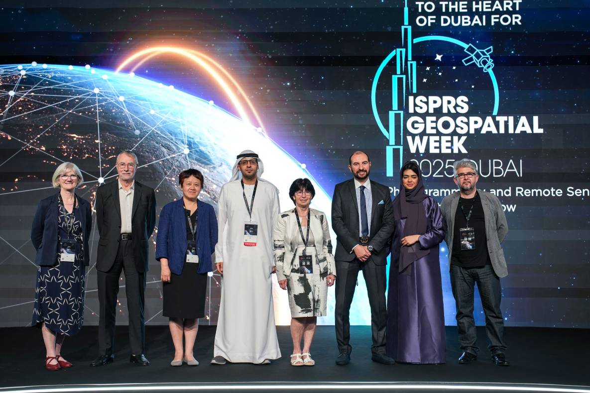
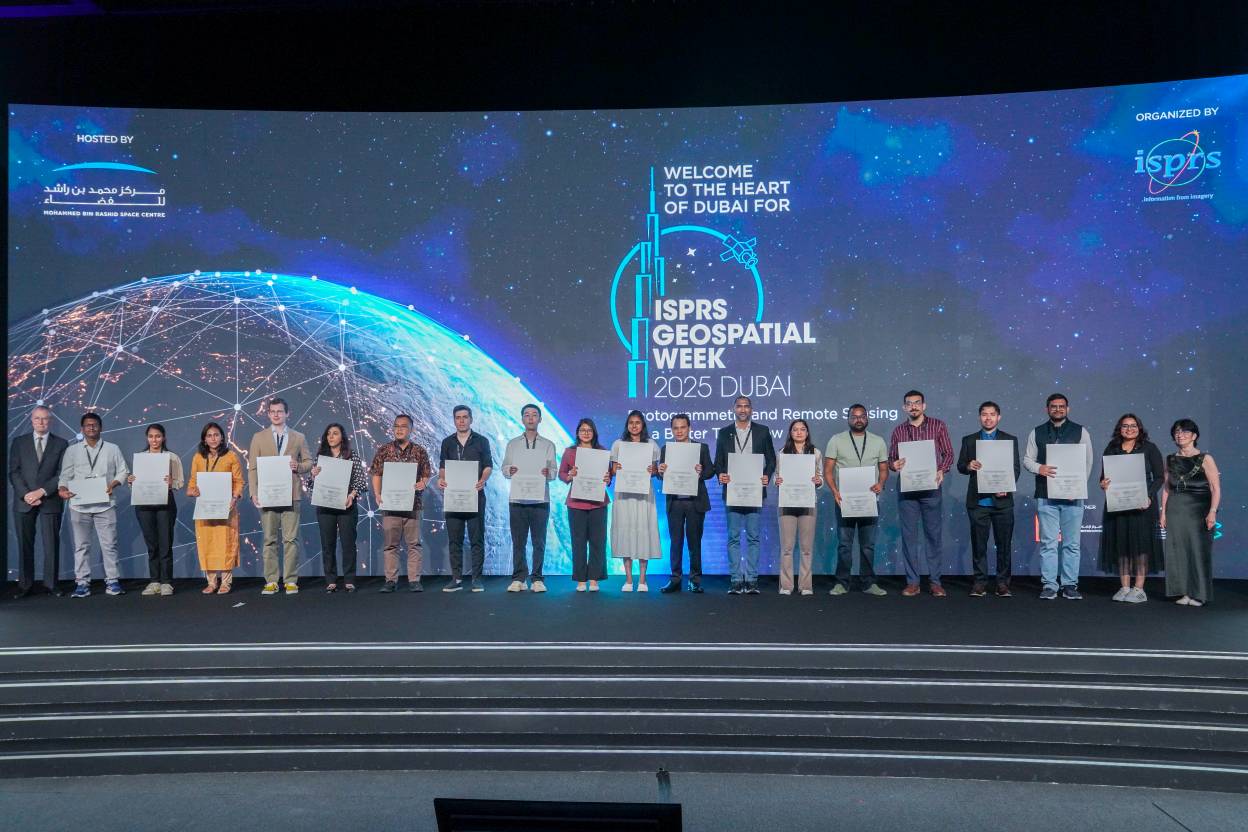
The ISPRS Foundation (TIF) granted 23 travel grants to deserving students and young professionals out of 57 applicants to attend the Geospatial Week held in Dubai, UAE on April 6-11, 2025. The awardees were asked to register for a minimum of three days to justify their attendance, thereby increasing the benefits of interaction with experts, which is one of the prime objectives of offering the grant.
Read more here…
Laxmi Thapa, President, and Nicolas Pucino, Vice President of the ISPRS SC, attended the ISPRS Geospatial Week, held in Dubai, UAE, from 7th to 11th April 2025. The ISPRS SC hosted a booth in the exhibition hall, where Laxmi and Nicolas were supported by three other volunteers – Bikesh Bade from ESRI, Dristy Bajimaya from CIMMYT, Nepal and Bhavna Yadav, PhD student from Central University of Rajasthan, India. We received several visitors, including students and professors, who inquired about the activities we have been undertaking for students and young professionals. We also discussed potential collaborative opportunities, such as summer schools, student chapters, and other ways to get involved with us, whether as general members or volunteers. We were pleased to share ISPRS SC-related souvenirs with our visitors. Additionally, we had a fruitful discussion with Abdalla Alobeid, ISPRS Vice Regional Coordinator for the Arab States, regarding the possibilities of organising capacity-building initiatives for university students – an initiative we are enthusiastic about and look forward to collaborating on in the near future.
Since the initial announcement, ISPRS SC has continued to receive applications from student networks at universities worldwide. Two additional student chapters have been approved, further expanding the ISPRS SC community:
With these recent additions, the total number of established student chapters has reached nine, with one more application currently under review.
Virtual Breakout Session for the ISPRS SC Student Chapter: Fostering Global Networking and Collaboration
To strengthen connections between student chapters, ISPRS SC has been organizing bi-monthly virtual breakout sessions since January 2025. These sessions provide a platform for the founding members of all the student chapters to network, exchange information about the activities of each other’s chapters, and interact with scholars belonging to the ISPRS Community.
Third Virtual Breakout Session (May 13, 2025)
The third breakout session, held on 13th May 2025, focused on the theme "Publishing in Journals". It was organised with the intention of providing our student chapter members with guidance on the dos and don’ts of writing a journal article. This event featured Dr Clément Mallet, Editor-in-Chief of the ISPRS Journal of Photogrammetry and Remote Sensing.
During this interactive session, Dr Mallet shared insights on various aspects of writing an academic article, including key considerations authors should bear in mind when submitting to journals, the acceptance-rejection rate of the ISPRS Journal, the concept of novelty sought by editors, the possible use of AI tools in writing, and concerns around plagiarism. Following the talk, two student chapters – ISPRS SC Nepal – Kathmandu University Geomatics Engineering Society and ISPRS SC – India ITM Gwalior Student Chapter gave presentations to introduce their respective chapters and the activities they plan to organise this year. We then held a 10-minute breakout session, in which 3–4 founding members from different chapters were assigned to each room to facilitate direct interaction and networking among members.
We are grateful to Dr Clément Mallet for his valuable presence and for sharing his knowledge with our attendees. Likewise, we appreciated the participation of founding members and advisors from various chapters. The session was moderated by Laxmi, and Efthymios Georgiou, Editor-in-Chief of ISPRS SC, gave the closing remarks.
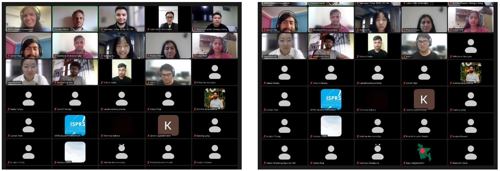
Attendees of the 3rd ISPRS SC Student Chapters Virtual Session.
The ISPRS Student Consortium (ISPRS SC) has been actively supporting various ISPRS working groups by hosting their webinar series through its Zoom platform.
ISPRS WG III/3 (Active Microwave Remote Sensing) Webinar Series
The ISPRS WG III/3 (Active Microwave Remote Sensing) webinar series is an ongoing initiative, technically supported by ISPRS SC. These webinars typically last for one hour, with a 40–45-minute lecture followed by 15–20 minutes of discussion. They are held on the second Wednesday of every month and have received strong participation and engagement from attendees.
April Webinar
Date: April 9, 2025
Title: Deep learning for SAR image processing
Speaker: Florence Tupin, Télécom Paris
Moderator: Michael Schmitt
This session started with the introductory remarks and moderation from Michael followed by the presentation and Q/A by Florence. Q/A session was very interactive with lots of questions from the participants and there were 94 participants who attended this webinar.
ISPRS WG ICWG II/Ib (Digital Construction: Reality Capture, Automated Inspection, and Integration to BIM) Webinar Series
The ISPRS SC also provided technical support to the ISPRS WG ICWG II/Ib to organise a webinar series in the month of March and April. Each webinar has two speakers; the first webinar organised in March 27, was entitled ‘Computer Vision and Multi-Modal Data Analytics for Human-AI Collaboration in Civil Systems’ and was delivered by Pingbo Tan, Carnegie Mellon University, USA. Whereas Jiansong Zhang from Purdue University, USA delivered the presentation on the title ‘Empowering Seamless and Universal BIM Interoperability with Invariant Signatures of AEC Objects’.
Likewise, the second webinar of the series was organised in April 29. Borja Garcia de Soto from NYU Abu Dhabi, UAE delivered the first presentation on the title ‘Progress monitoring of construction sites using lidar and computer vision’ and Maarten Bassier from KU Leuven, Belgium delivered the presentation on ‘The Role of Robotics and Automation in Data Acquisition for the Built Environment’. Both the webinars were interactive and were moderated by Jónatas Valença, secretary of the working group.
All these webinars are recorded and shared on the YouTube channel of the ISPRS SC: https://www.youtube.com/@ISPRSSC.
Summer School on Smart Cities
Date: July 3–12, 2025
Location: Beijing, China
Organizers: ISPRS SC, ISPRS TC V, Beijing University of Civil Engineering and Architecture (BUCEA), Belt and Road Architectural University International Consortium (BRAUIC)
For more details, visit: BUCEA Summer School
If the website is inaccessible, the application form is available here.
For inquiries, contact: guoxian@bucea.edu.cn

ISPRS is proud to launch two new awards, the Gottfried Konecny Award and the Li Deren Award. The awards will be presented during ISPRS Congresses to outstanding ISPRS scientists for their exceptional achievements. The procedures for the selection of awardees are described in the regulations of the individual awards.

Nominations for ISPRS awards for 2026 can soon be submitted via the online portal, which will open on 10 June 2025. For more information, see the regulations for the individual awards and the updated Awards Offered in 2026 brochure.
Please note that the deadline for most nominations is 1 January 2026.

Congratulations go to the following authors for their selection for Best Papers in 2024 in the ISPRS International Journal of Photogrammetry and Remote Sensing and the Open Journal of Photogrammetry and Remote Sensing, respectively:
The U. V. Helava Award – Best Paper Volumes 207-218 (2024)
“Word2Scene: Efficient remote sensing image scene generation with only one word via hybrid intelligence and low-rank representation”, by Jiaxin Ren, Wanzeng Liu, Jun Chen, Shunxi Yin and Yuan Tao.
Read more...
The Fritz Ackermann Award – Best Paper 2024
"Airborne sensor fusion: Expected accuracy and behavior of a concurrent adjustment”, by Kyriaki Mouzakidou, Aurélien Brun, Davide Antonio Cucci and Jan Skaloud
Read more...

Submission deadline: 01 August 2025
This special issue covers research themes of the ISPRS Istanbul Workshop - Topographic Mapping from Space dedicated to Dr. Karsten Jacobsen for his 80th Birthday. Dr. Jacobsen is one of the leading scientists in the field of mapping and a very well-known for his warm personal characteristics. He has contributed to the development of researchers from many countries of the world. With this planned issue, current contributions from experts with their respective areas of expertise are to be brought together and recent research results presented. Therefore, the editorial board of the journal - ISPRS Open Journal of Photogrammetry and Remote Sensing (OJPRS) - intends to publish a special issue Topographic Mapping from Space.
Detailed information can be found here:
https://www.sciencedirect.com/special-issue/318797/topographic-mapping-from-space

In the Footsteps of Grandtourists: Envisioning Itineraries in Inner Areas for Literary and Responsible Tourism https://doi.org/10.3390/ijgi14020067
Beyond the Road: A Regional Perspective on Traffic Congestion in Metro Atlanta https://doi.org/10.3390/ijgi14020061
Enhancing Spatial Awareness and Collaboration: A Guide to VR-Ready Survey Data Transformation https://doi.org/10.3390/ijgi14020059
The Machine Learning-Based Mapping of Urban Pluvial Flood Susceptibility in Seoul Integrating Flood Conditioning Factors and Drainage-Related Data † https://doi.org/10.3390/ijgi14020057
Use of Semantic Web Technologies to Enhance the Integration and Interoperability of Environmental Geospatial Data: A Framework Based on Ontology-Based Data Access https://doi.org/10.3390/ijgi14020052
Enhancing Precision Beekeeping by the Macro-Level Environmental Analysis of Crowdsourced Spatial Data https://doi.org/10.3390/ijgi14020047
Hexahedral Projections: A Comprehensive Review and Ranking https://doi.org/10.3390/ijgi14030122 Understanding the Carbon Footprint of Tile Transfer for Web Maps https://doi.org/10.3390/ijgi14030107
Climate Change Maps for the Atlas of Switzerland https://doi.org/10.3390/ijgi14030099
The Impact of Built-Up Area Dispersion on the Cultural Heritage of the Region of the South Aegean, Greece https://doi.org/10.3390/ijgi14030097
Mobile Cadastral Application with Open-Source Software in Colombia https://doi.org/10.3390/ijgi14030096
Use and Effectiveness of Chatbots as Support Tools in GIS Programming Course Assignments https://doi.org/10.3390/ijgi14040156
A Model of Building Changes to Support Comparative Studies and Open Discussions on Densification https://doi.org/10.3390/ijgi14040155
Critical Success Factors of Participatory Community Planning with Geospatial Digital Participatory Platforms https://doi.org/10.3390/ijgi14040153
Automated Detection of Pedestrian and Bicycle Lanes from High-Resolution Aerial Images by Integrating Image Processing and Artificial Intelligence (AI) Techniques https://doi.org/10.3390/ijgi14040135
ISPRS warmly welcomes a new Sustaining Member from Iran, Faculty of Geodesy and Geomatics Engineering, K. N. Toosi University of Technology in Teheran.
An introduction and history of the faculty can be found here …

In EOSC EDEN, we are interested in how digital preservation professionals across the globe currently work. We are keen to understand the existing frameworks, guidelines and practices for identification, selection and appraisal of data for “long-term” preservation – and what “long term” means in different organisational and professional settings. This is an important area where sharing knowledge can make a meaningful impact as digital preservation continues to grow as a diverse field and community.
To that end, we're running an inquiry to gather, compare and evaluate current knowledge and practice. We need your help to gain a more comprehensive picture of these frameworks, guidelines and practices in the field. Written from the perspective of digital preservationists working within the sector, we have created a short and focused survey which should take no more than about five to seven minutes to complete:
The survey is open until 30 June 2025. Please take part now at:
https://ec.europa.eu/eusurvey/runner/EOSC-EDEN-T1survey2025

Dear colleagues,
we are happy to invite you all to the "3rd International Workshop on 3D underwater mapping". Co-organized by ISPRS, CIPA, and DGPF, it will be hosted at TU Wien, Austria from 8 to 11 July 2025.
The workshop will provide a unique opportunity to meet researchers, users and interested persons in the field of underwater 3D imaging from above or below the water surface (photogrammetry, bathymetry, etc.). The event will feature half-day tutorials, 2 days of single-track technical sessions, invited talks, oral presentations, posters and demos at the water lab facility of TU Wien, and a post-event excursion to the pre-Alpine Pielach river.
Further details can be found via the event website (https://www.tuwien.at/en/mg/geo/photo/events/3d-underwater) or email (3d-underwater@geo.tuwien.ac.at).
We look forward to seeing you in Wien,
The Organizing Committee.
Thank you very much,
Erica, Fabio and Gottfried


ISPRS, in partnership with IEEE-GRSS and SELPER Brasil, proudly announces the 2025 IEEE Latin American GRSS & ISPRS Remote Sensing Conference (LAGIRS 2025) to be held at Itaipu Parquetec, Foz do Iguaçu, Brazil, from November 10-13, 2025.
LAGIRS 2025 will be a unnique forum for researchers, professionals, and students to exchange cutting-edge ideas, identify emerging trends, and build networks within the Latin American and international remote sensing community.
The technical program will feature sessions on Data Analysis Methods, Atmosphere, Cryosphere, Oceans, Land, Missions, and Sensors, among other remote sensing related topics.
LAGIRS 2025 stands out for its exceptional venue near one of the Seven Natural Wonders of the World—the magnificent Iguazu Falls—providing an inspiring atmosphere for scientific exchange and new collaborative opportunities.
Full papers can be submitted until May 30, 2025.
For registration and detailed information, please visit: https://selperbrasil.org.br/events/lagirs-2025/home/


Extended deadline for long abstract submission: June 15, 2025
https://sot.kcau.ac.ke/ISPRS-2025-conference/
Best Practices for Applying and Interpreting the Total Operating Characteristic
Honnef, Tanner, Pontius, Robert Gilmore
No: 134
Automated Detection of Pedestrian and Bicycle Lanes from High-Resolution Aerial Images by Integrating Image Processing and Artificial Intelligence (AI) Techniques
Antwi, Richard Boadu, Lawson, Prince Lartey, Kimollo, Michael, Ozguven, Eren Erman, Moses, Ren, Dulebenets, Maxim A., Sando, Thobias
No: 135
A New Derivation of the Formula for the Length of a Loxodrome Arc on a Sphere Using Cylindrical Projections
Lapaine, Miljenko
No: 137
A Multidimensional Study of the 2023 Beijing Extreme Rainfall: Theme, Location, and Sentiment Based on Social Media Data
Zhang, Xun, Zhang, Xin, Zhang, Yingchun, Liu, Ying, Zhou, Rui, Raxidin, Abdureyim, Li, Min
No: 136
Multi-Scenario Simulation of Urban Land Expansion Modes Considering Differences in Spatial Functional Zoning
Yang, Jing, Wang, Zheng, Sun, Yizhong
No: 138
Documentation for Architectural Heritage: A Historical Building Information Modeling Data Modeling Approach for the Valentino Castle North Wing
Li, Xiang, Teppati Losè, Lorenzo, Rinaudo, Fulvio
No: 139
Exploring the Use of Data in a Digital Twin for the Marine and Coastal Environment
Haupt, Shelley, Sibolla, Bolelang, Molapo, Raymond, Mdakane, Lizwe, Fourie, Nicolene
No: 140
Geographic Distribution of Lung and Bronchus Cancer Mortality and Elevation in the United States: Exploratory Spatial Data Analysis and Spatial Statistics
Ha, Hoehun
No: 141
A New Typification Method for Combined Linear Building Patterns with the Resolution of Spatial Conflicts
Tong, Ying, Guo, Qingsheng, Zhu, Wei, Zheng, Chuanbang
No: 142
A Selection Method of Massive Point Cluster Using the Delaunay Triangulation to Support Real-Time Visualization
Gong, Chongya, Ai, Tinghua, Xiao, Tianyuan, Yu, Huafei, Liu, Pengcheng
No: 143
Evaluating Shallow Landslide Prediction Mapping by Using Two Different GIS-Based Models: 4SLIDE and SHALSTAB
Moresi, Federico Valerio, Maesano, Mauro, di Cristofaro, Marco, Scarascia Mugnozza, Giuseppe, Brunori, Elena
No: 144
Analysis of Regional Spatial Characteristics and Optimization of Tourism Routes Based on Point Cloud Data from Unmanned Aerial Vehicles
Chen, Yu, Zhong, Hui, Yu, Jianglong
No: 145
Changes in Tourists’ Perceptions of Community-Based Ecotourism (CBET) After COVID-19 Pandemic: A Study on the Country of Origin and Economic Development Level
Oltean, Flavia Dana, Curta, Petru Alexandru, Nagy, Benedek, Huseyn, Arzu, Gabor, Manuela Rozalia
No: 146
Voxel-Based Path Planning for Autonomous Vehicles in Parking Lots
Lin, Zhaoyu, Wang, Zhiyong, Gong, Tailin, Ma, Yingying, Xie, Weidong
No: 147
Nonlinear Impact of Built Environment on Older Adults’ Bus Use Behavior: A Hybrid Model Considering Spatial Heterogeneity
Peng, Jiandong, Li, Jingjing, Yang, Hong, Sun, Lele
No: 148
NPP-VIIRS Nighttime Lights Illustrate the Post-Earthquake Damage and Subsequent Economic Recovery in Hatay Province, Turkey
Li, Feng, Liao, Shunbao, Fu, Xingjian, Liu, Tianxuan
No: 149
Conceptual Neighborhood Graphs of Topological Relations in Z2
Hall, Brendan Patrick, Dube, Matthew Paul
No: 150
The Impact of Residents’ Daily Internet Activities on the Spatial Distribution of Online Fraud: An Analysis Based on Mobile Phone Application Usage
Song, Guangwen, Liang, Jiajun, Wu, Linlin, Liu, Lin, Zhang, Chunxia
No: 151
A New Earth System Spatial Grid Extending the Great Circle Arc QTM: The Spherical Geodesic Degenerate Octree Grid
Ren, Yilin, Zhou, Mengyun, Zhong, Aijun
No: 152
Critical Success Factors of Participatory Community Planning with Geospatial Digital Participatory Platforms
Atzmanstorfer, Karl, Bartling, Mona, Haltofová, Barbora, Zurita-Arthos, Leo, Grubinger-Preiner, Judith, Eitzinger, Anton
No: 153
A Building Group Recognition Method Integrating Spatial and Semantic Similarity
Liu, Huimin, Wang, Wenpei, Tang, Jianbo, Deng, Min, Ding, Chen
No: 154
A Model of Building Changes to Support Comparative Studies and Open Discussions on Densification
Bucher, Bénédicte, Raimbault, Juste, Ndim, Mouhamadou, Raimond, Ana-Maria, Perret, Julien, Dembski, Sebastian, Jehling, Mathias
No: 155
Use and Effectiveness of Chatbots as Support Tools in GIS Programming Course Assignments
Hochmair, Hartwig H.
No: 156
Assess Spatial Equity Considering the Similarity Between GIS-Based Supply and Demand Maps: A New Framework with Case Study in Beijing
Hao, Xiatong, Hu, Xiaojian, Zhang, Ke, Chen, Qian
No: 157
Spatial Agglomeration Characteristics and Impact Factors of the Cultural and Creative Industries in Harbin
Liu, Zuhang, Xu, Daming, Wang, Xinyang
No: 158
Quantitative and Spatially Explicit Clustering of Urban Grocery Shoppers in Montreal: Integrating Loyalty Data with Synthetic Population
Zhang, Duo, Dubé, Laurette, Gieschen, Antonia, Paquet, Catherine, Sengupta, Raja
No: 159
Multi-Scenario Forecasting of Land Use and Ecosystem Service Values in Coastal Regions: A Case Study of the Chaoshan Area, China
Xiong, Zili, Yao, Song, Liu, Hongmei, Yu, Liang
No: 160
Integrating Machine Learning and Geospatial Data for Mapping Socioeconomic Vulnerability to Urban Natural Hazard
Dufitimana, Esaie, Gahungu, Paterne, Uwayezu, Ernest, Mugisha, Emmy, Bizimana, Jean Pierre
No: 161
Computerized Proof of Fundamental Properties of the p-Median Problem Using Integer Linear Programming and a Theorem Prover
Lei, Ting L., Lei, Zhen
No: 162
Explainable Spatio-Temporal Inference Network for Car-Sharing Demand Prediction
Brahimi, Nihad, Zhang, Huaping, Razzaq, Zahid
No: 163
Mapping Spatial Inequity in Urban Fire Service Provision: A Moran’s I Analysis of Station Pressure Distribution
Li, Jianyu, Hu, Mingxing
No: 164
Scientific Production on GPS Trajectory Clustering: A Bibliometric Analysis
Reyes, Gary, Tolozano-Benites, Roberto, Lanzarini, Laura, Estrebou, César, Bariviera, Aurelio F.
No: 165
Design and Development of a Local-First Collaborative 3D WebGIS Application for Mapping
Wang, Bohua, Zhao, Qiansheng, Zeng, Di, Yao, Yibin, Hu, Chunchun, Luo, Nianxue
No: 166
Spatiotemporal Analysis of Urban Vitality and Its Drivers from a Human Mobility Perspective
Wu, Youwan, Xie, Chenxi, Zhang, Aiping, Zhao, Tianhong, Cao, Jinzhou
No: 167
Unveiling the Spatial Inequality of Accessibility to High-Quality Healthcare Resources in the Beijing–Tianjin–Hebei Urban Agglomeration of China: A Focus on the Impacts of Intercity Patient Mobility
Wang, Yandi, Chen, Lin, Liu, Binglin, Tao, Zhuolin
No: 168
MVCF-TMI: A Travel Mode Identification Framework via Contrastive Fusion of Multi-View Trajectory Representations
Lei, Yutian, Guan, Xuefeng, Wu, Huayi
No: 169
Text Geolocation Prediction via Self-Supervised Learning
Wu, Yuxing, Zeng, Zhuang, Liu, Kaiyue, Xu, Zhouzheng, Ye, Yaqin, Zhou, Shunping, Yao, Huangbao, Li, Shengwen
No: 170
Innovation and Research to Support Policies on Sustainable Development Goals: An Integrated ICT Platform for the Definition and Monitoring of Programs in Puglia Region, Italy
Lerario, Antonella, Chieco, Michele, Binetti, Maria Silvia, Uricchio, Vito Felice, Clemente, Massimo, Massarelli, Carmine
No: 171
Generating Large-Scale Origin–Destination Matrix via Progressive Growing Generative Adversarial Networks Model
Yuan, Zehao, Chen, Xuanyan, Chen, Biyu, Luo, Yubo, Zhang, Yu, Teng, Wenxin, Zhang, Chao
No: 172
Spatio-Temporal Analysis of the Redundancies of Construction Land in the Beijing-Tianjin-Hebei Region (2000–2020)
Zhang, Ting, Shen, Rui, Xie, Yongqing, Gao, Haowen, Lv, Weitong
No: 173
Geospatial Analysis of Regional Disparities in Non-Grain Cultivation: Spatiotemporal Patterns and Driving Mechanisms in Jiangsu, China
Chen, Yingxi, Xu, Yan, Ye, Nannan
No: 174
Three-Dimensional Outdoor Pedestrian Road Network Map Construction Based on Crowdsourced Trajectory Data
Tang, Jianbo, Zhang, Tianyu, Ding, Junjie, Tao, Ke, Yang, Chen, Xiang, Jianbing, Ning, Xia
No: 175
Static–Dynamic Analytical Framework for Urban Health Resilience Evaluation and Influencing Factor Exploration from the Perspective of Public Health Emergencies—Case Study of 61 Cities in Mainland China
Chen, Meijie, Peng, Mingjun, Li, Bowen, Cai, Zhongliang, Li, Rui
No: 176
A Study of the Non-Linear Relationship Between Urban Morphology and Vitality in Heritage Areas Based on Multi-Source Data and Machine Learning: A Case Study of Dalian
Li, He, Miao, Li
No: 177
Spatial Analysis of Urban Expansion and Energy Consumption Using Nighttime Light Data: A Comparative Study of Google Earth Engine and Traditional Methods for Improved Living Spaces
Anucharn, Thidapath, Hongpradit, Phongsakorn, Iamchuen, Niti, Puttinaovarat, Supattra
No: 178
Simulating Co-Evolution and Knowledge Transfer in Logistic Clusters Using a Multi-Agent-Based Approach
Salas-Peña, Aitor, García-Palomares, Juan Carlos
No: 179
Georeferencing Building Information Models for BIM/GIS Integration: A Review of Methods and Tools
Azari, Peyman, Li, Songnian, Shaker, Ahmed, Sattar, Shahram
No: 180
The Integration of Geospatial Data for the BIM-Based Inventory of a Skatepark—A Case Study
Klapa, Przemysław, Małek, Maciej
No: 181
Hybrid Learning Model of Global–Local Graph Attention Network and XGBoost for Inferring Origin–Destination Flows
Shan, Zhenyu, Yang, Fei, Shi, Xingzi, Cui, Yaping
No: 182
The Urban–Rural Education Divide: A GIS-Based Assessment of the Spatial Accessibility of High Schools in Romania
Petre, Angelo Andi, Dumitrache, Liliana, Mareci, Alina, Cioclu, Alexandra
No: 183
Park Development, Potential Measurement, and Site Selection Study Based on Interpretable Machine Learning—A Case Study of Shenzhen City, China
Li, Haihong, He, Li
No: 184
Geospatial Framework for Assessing the Suitability and Demand for Agricultural Digital Solutions in Europe: A Tool for Informed Decision-Making
Chalazas, Theodoros, Koukourikos, Antonis, Bauwens, Jan, Berkvens, Nick, Van Beek, Jonathan, Kalatzis, Nikos, Papadopoulos, George, Ilias, Panagiotis, Marianos, Nikolaos, Brewster, Christopher
No: 185
Analysis of Spatial and Driving Factors of National Sanitary Resources in China Using GIS
Deng, Yujia, Feng, Lixia, Cenci, Jeremy, Zhang, Jiazhen, Cai, Jun
No: 186
RouteLAND: An Integrated Method and a Geoprocessing Tool for Characterizing the Dynamic Visual Landscape Along Highways
Misthos, Loukas-Moysis, Krassanakis, Vassilios
No: 187
Spatiotemporal Typhoon Damage Assessment: A Multi-Task Learning Method for Location Extraction and Damage Identification from Social Media Texts
Zou, Liwei, He, Zhi, Wang, Xianwei, Liang, Yutian
No: 189
Heterogeneity Analysis of Resident Demands and Public Service Facilities in Megacities of China from the Perspective of Urban Health Examination
Zhang, Ning, Wang, Shaohua, Liang, Haojian, Huang, Zhuonan, Li, Xiao, Wang, Zhenbo
No: 188
Spatiotemporal Distribution and Evolution of Global World Cultural Heritage, 1972–2024
Lu, Yangyang, Han, Qingwen, Zhang, Zheng, Sun, Zhong, Dai, Jian
No: 190
Pattern Recognition in Urban Maps Based on Graph Structures
Lu, Xiaomin, Zhang, Zhiyi, Song, Haoran, Yan, Haowen
No: 191
Trajectory- and Friendship-Aware Graph Neural Network with Transformer for Next POI Recommendation
Yu, Chenglin, Shi, Lihong, Zhao, Yangyang
No: 192
PixelQuery: Efficient Distance Range Join Query Technique for Visualization Analysis
Pang, Bo, Liu, Zebang, Xiong, Wei, Ma, Mengyu
No: 193
Leveraging Principal Component Analysis for Data-Driven and Objective Weight Assignment in Spatial Decision-Making Framework for Qanat-Induced Subsidence Susceptibility Assessment in Railway Networks
Naeimiasl, Farzaneh, Vahidi, Hossein, Soheili, Niloufar
No: 195
Geospatial Approach to Assess Flash Flood Vulnerability in a Coastal District of Bangladesh: Integrating the Multifaceted Dimension of Vulnerabilities
Sarker, Sajib, Jahan, Israt, Wang, Xin, Azad, Abul
No: 194
Contrastive Learning with Image Deformation and Refined NT-Xent Loss for Urban Morphology Discovery
Hua, Chunliang, Chen, Daijun, Niu, Mengyuan, Gao, Lizhong, Yang, Junyan, Wang, Qiao
No: 196
Evacuation Behavioural Instructions with 3D Motions: Insights from Three Use Cases
Xie, Ruihang, Zlatanova, Sisi, Lee, Jinwoo (Brian), Borrmann, André
No: 197
Geometry and Topology Correction of 3D Building Models with Fragmented and Disconnected Components
Lee, Ahyun
No: 198
Street Legibility and Sustainable Urban Development: Insights from Saudi Arabia’s Addressing System
Alshammari, Maher S.
No: 199
Urban Street Network Configuration and Property Crime: An Empirical Multivariate Case Study
Kefayat, Erfan, Thill, Jean-Claude
No: 200
Automatic Elevation Contour Vectorization: A Case Study in a Deep Learning Approach
Vynikal, Jakub, Pacina, Jan
No: 201
Spatio-Temporal Paths and Influencing Factors of Residential Mobility in Guangzhou: A Micro-Level Perspective of Newly Employed College Graduates
Dai, Xiangjun, Zhou, Chunshan, He, Xiong
No: 202
A Natural Language-Based Automatic Identification System Trajectory Query Approach Using Large Language Models
Guo, Xuan, Yu, Shutong, Zhang, Jinxue, Bi, Huanyu, Chen, Xiaohui, Liu, Junnan
No: 204
Mapping Urban Divides: Analyzing Residential Segregation and Housing Types in a Medium-Sized Romanian City
Vîlcea, Cristiana, Popescu, Liliana
No: 203
Walking to Public Transport: Rethinking Catchment Areas Considering Topography and Surrogate Buffers
Pais, Filipe, Sousa, Nuno, Monteiro, João, Coutinho-Rodrigues, João, Natividade-Jesus, Eduardo
No: 205
Topography–Land Surface Temperature Coupling: A Promising Approach for the Early Identification of Coal Seam Fire Zones
Wang, Yao, Zhang, Mao-Sheng, Yang, Chuanbo, Luo, Da, Dong, Ying, Liu, Hao, Zhang, Xu, Yan, Yuteng, Feng, Li
No: 206
Grid Partition-Based Dynamic Spatial–Temporal Graph Convolutional Network for Large-Scale Traffic Flow Forecasting
Gao, Lifeng, Chen, Liujia, Qiu, Agen, Wang, Qinglian, Wang, Jianlong, Chen, Cai, Zhang, Fuhao, Ou’er, Geli
No: 207

Editorial Board
Pages: ii
Superpixel-aware credible dual-expert learning for land cover mapping using historical land cover product
Yujia Chen, Guo Zhang, Hao Cui, Xue Li, Shasha Hou, Chunyang Zhu, Zhigang Xie, Deren Li
Pages: 296-316
DiffSARShipInst: Diffusion model for ship instance segmentation from synthetic aperture radar imagery
Xiaowo Xu, Xiaoling Zhang, Shunjun Wei, Jun Shi, Wensi Zhang, Tianwen Zhang, Xu Zhan, Yanqin Xu, Tianjiao Zeng
Pages: 440-455
Semantically-Aware Contrastive Learning for multispectral remote sensing images
Leandro Stival, Ricardo {da Silva Torres}, Helio Pedrini
Pages: 173-187
SFA-Net: A SAM-guided focused attention network for multimodal remote sensing image matching
Tian Gao, Chaozhen Lan, Wenjun Huang, Sheng Wang
Pages: 188-206
Omni-Scene Infrared Vehicle Detection: An Efficient Selective Aggregation approach and a unified benchmark
Nan Zhang, Borui Chai, Jiamin Song, Tian Tian, Pengfei Zhu, Jiayi Ma, Jinwen Tian
Pages: 244-260
Global patterns and determinants of year-to-year variations in surface urban heat islands
Xuanqing Guo, Huilin Du, Wenfeng Zhan, Yingying Ji, Chenguang Wang, Chunli Wang, Shuang Ge, Shasha Wang, Jiufeng Li, Sida Jiang, Dazhong Wang, Zihan Liu, Yusen Chen, Jiarui Li
Pages: 399-412
Map-Assisted remote-sensing image compression at extremely low bitrates
Yixuan Ye, Ce Wang, Wanjie Sun, Zhenzhong Chen
Pages: 159-172
Precise and efficient high-frequency trajectory estimation for LiDAR georeferencing
Florian Pöppl, Andreas Ullrich, Gottfried Mandlburger, Norbert Pfeifer
Pages: 344-361
Improving XCO2 retrieval under high aerosol loads with fused satellite aerosol Data: Advancing understanding of anthropogenic emissions
Hao Zhu, Tianhai Cheng, Xingyu Li, Xiaotong Ye, Donghao Fan, Tao Tang, Haoran Tong, Lili Zhang
Pages: 146-158
TRSP: Texture reconstruction algorithm driven by prior knowledge of ground object types
Zhendong Liu, Liang Zhai, Jie Yin, Xiaoli Liu, Shilong Zhang, Dongyang Wang, Abbas Rajabifard, Yiqun Chen
Pages: 221-243
Mobile robotic multi-view photometric stereo
Suryansh Kumar
Pages: 15-27
Paved or unpaved? A deep learning derived road surface global dataset from mapillary street-view imagery
Sukanya Randhawa, Eren Aygün, Guntaj Randhawa, Benjamin Herfort, Sven Lautenbach, Alexander Zipf
Pages: 362-374
Multi-frequency tomographic SAR: A novel 3-D imaging configuration for limited acquisitions
Jian Zhao, Zegang Ding, Zhen Wang, Tao Sun, Kaiwen Zhu, Yuhan Wang, Zehua Dong, Linghao Li, Han Li
Pages: 91-108
InSAR estimates of excess ground ice concentrations near the permafrost table
S. Zwieback, G. Iwahana, Q. Chang, F. Meyer
Pages: 261-273
Editorial for special issue on “Innovations in SAR image analysis − From global mapping to high-resolution monitoring”☆
Michael Schmitt, Zhong Lu, Franz J. Meyer, Gilda Schirinzi, Florence Tupi
Pages: 398
Toward Automated and Comprehensive Walkability Audits with Street View Images: Leveraging Virtual Reality for Enhanced Semantic Segmentation
Keundeok Park, Donghwan Ki, Sugie Lee
Pages: 78-90
Hybrid depth-event pose estimation for online dense reconstruction in challenging conditions
Guohua Gou, Xuanhao Wang, Yang Ye, Han Li, Hao Zhang, Weicheng Jiang, Mingting Zhou, Haigang Sui
Pages: 328-343
Potential of Sentinel-1 time-series data for monitoring the phenology of European temperate forests
Michael Schlund
Pages: 131-145
Automated registration of forest point clouds from terrestrial and drone platforms using structural features
Yiliu Tan, Xin Xu, Hangkai You, Yupan Zhang, Di Wang, Yuichi Onda, Takashi Gomi, Xinwei Wang, Min Chen
Pages: 28-45
GOOD: Towards domain generalized oriented object detection
Qi Bi, Beichen Zhou, Jingjun Yi, Wei Ji, Haolan Zhan, Gui-Song Xia
Pages: 207-220
3D semantic segmentation: Cluster-based sampling and proximity hashing for novel class discovery
Jing Du, Linlin Xu, Lingfei Ma, Kyle Gao, John Zelek, Jonathan Li
Pages: 274-295
A novel cyanobacteria occurrence index derived from optical water types in a tropical lake
Davide Lomeo, Stefan G.H. Simis, Xiaohan Liu, Nick Selmes, Mark A. Warren, Anne D. Jungblut, Emma J. Tebbs
Pages: 58-77
HeteCD: Feature Consistency Alignment and difference mining for heterogeneous remote sensing image change detection
Wei Jing, Haichen Bai, Binbin Song, Weiping Ni, Junzheng Wu, Qi Wang
Pages: 317-327
Satellite-Based energy balance for estimating actual sugarcane evapotranspiration in the Ethiopian Rift Valley
Gezahegn W. Woldemariam, Berhan Gessesse Awoke, Raian Vargas Maretto
Pages: 109-130
ICESat-2 bathymetry algorithms: A review of the current state-of-the-art and future outlook
Jaehoon Jung, Christopher E. Parrish, Lori A. Magruder, Joan Herrmann, Suhong Yoo, Jeffrey S. Perry
Pages: 413-439
SDCluster: A clustering based self-supervised pre-training method for semantic segmentation of remote sensing images
Hanwen Xu, Chenxiao Zhang, Peng Yue, Kaixuan Wang
Pages: 1-14
SAR altimeter 3-D localization with combined Delay Doppler Image and spatio-temporal echo similarity
Yu Wei, Weibo Qin, Fengming Hu
Pages: 46-57
Towards building floor-level nighttime light exposure assessment using SDGSAT-1 GLI data
Hailan Huang, Bin Wu, Yu Wang, Bailang Yu, Huabing Huang, Wuming Zhang
Pages: 375-397
Editorial Board
Pages: ii
Super-resolution supporting individual tree detection and canopy stratification using half-meter aerial data
Zhu Mao, Omid Abdi, Jori Uusitalo, Ville Laamanen, Veli-Pekka Kivinen
Pages: 251-271
On the consistency and stability of vegetation biophysical variables retrievals from Landsat-8/9 and Sentinel-2
Najib Djamai, Richard Fernandes, Lixin Sun, Gang Hong, Luke A. Brown, Harry Morris, Jadu Dash
Pages: 329-347
GAT-LSTM: A feature point management network with graph attention for feature-based visual SLAM in dynamic environments
Xuan Wang, Yuan Zhuang, Xiaoxiang Cao, Jianzhu Huai, Zhenghua Zhang, Zhenqi Zheng, Naser El-Sheimy
Pages: 75-93
Efficient metric-resolution land cover mapping using open-access low resolution annotations with prototype learning and modified Segment Anything model
W.Y. Shi, H.G. Sui, C.L. Zhang, N. Zhou, M.T. Zhou, J.X. Wang, Z.T. Du
Pages: 19-41
MMFF: Multiview and multi-level feature fusion method within limited sample conditions for SAR image target recognition
Benyuan Lv, Ying Luo, Jiacheng Ni, Siyuan Zhao, Jia Liang, Yingxi Liu, Qun Zhang
Pages: 302-316
RSGPT: A remote sensing vision language model and benchmark
Yuan Hu, Jianlong Yuan, Congcong Wen, Xiaonan Lu, Yu Liu, Xiang Li
Pages: 272-286
Simultaneous planning of standpoints and routing for laser scanning of buildings with network redundancy
Julius Knechtel, Youness Dehbi, Lasse Klingbeil, Jan-Henrik Haunert
Pages: 59-74
GACraterNet: A collaborative geometry-attribute domain network for enhanced detection of Martian impact craters
Fan Hu, Dong Chen, Jiaming Na, Zhen Cao, Zhenxin Zhang, Liqiang Zhang, Zhizhong Kang
Pages: 133-154
DeepCropClustering: A deep unsupervised clustering approach by adopting nearest and farthest neighbors for crop mapping
Hengbin Wang, Yuanyuan Zhao, Shaoming Li, Zhe Liu, Xiaodong Zhang
Pages: 187-201
Saliency supervised masked autoencoder pretrained salient location mining network for remote sensing image salient object detection
Yuxiang Fu, Wei Fang, Victor S. Sheng
Pages: 222-234
From rice planting area mapping to rice agricultural system mapping: A holistic remote sensing framework for understanding China's complex rice systems
Zizhang Zhao, Jinwei Dong, Jilin Yang, Luo Liu, Nanshan You, Xiangming Xiao, Geli Zhang
Pages: 382-397
Improving visual grounding in remote sensing images with adaptive modality guidance
Shabnam Choudhury, Pratham Kurkure, Biplab Banerjee
Pages: 42-58
TKSF-KAN: Transformer-enhanced oat yield modeling and transferability across major oat-producing regions in China using UAV multisource data
Pengpeng Zhang, Bing Lu, Jiali Shang, Changwei Tan, Qihan Xu, Lei Shi, Shujian Jin, Xingyu Wang, Yunfei Jiang, Yadong Yang, Huadong Zang, Junyong Ge, Zhaohai Zeng
Pages: 166-186
Advancements in satellite-based methane point source monitoring: A systematic review
Fariba Mohammadimanesh, Masoud Mahdianpari, Ali Radman, Daniel Varon, Mohammadali Hemati, Mohammad Marjani
Pages: 94-112
A robust framework for mapping complex cropping patterns: The first national-scale 10 m map with 10 crops in China using Sentinel 1/2 images
Bingwen Qiu, Fangzheng Wu, Xiang Hu, Peng Yang, Wenbin Wu, Jin Chen, Xuehong Chen, Liyin He, Berry Joe, Francesco N. Tubiello, Jianping Qian, Laigang Wang
Pages: 361-381
Reliable-loc: Robust sequential LiDAR global localization in large-scale street scenes based on verifiable cues
Xianghong Zou, Jianping Li, Weitong Wu, Fuxun Liang, Bisheng Yang, Zhen Dong
Pages: 287-301
RoIPoly: Vectorized building outline extraction using vertex and logit embeddings
Weiqin Jiao, Hao Cheng, George Vosselman, Claudio Persello
Pages: 317-328
An nD-histogram technique for querying non-uniformly distributed point cloud data
Haicheng Liu, Zhiwei Li, Peter {van Oosterom}, Martijn Meijers, Chuqi Zhang
Pages: 1-18
SfM on-the-fly: A robust near real-time SfM for spatiotemporally disordered high-resolution imagery from multiple agents
Zongqian Zhan, Yifei Yu, Rui Xia, Wentian Gan, Hong Xie, Giulio Perda, Luca Morelli, Fabio Remondino, Xin Wang
Pages: 202-221
AWDA: Adversarial and Weighted Domain Adaptation for cross-dataset change detection
Xueting Zhang, Xin Huang, Jiayi Li
Pages: 398-409
Evaluating saliency scores in point clouds of natural environments by learning surface anomalies
Reuma Arav, Dennis Wittich, Franz Rottensteiner
Pages: 235-250
Infrared thermal dense point clouds: A new frontier for remote landslide investigation
D. Caliò, M. Intelisano, G. Pappalardo, S. Mineo
Pages: 155-165
New maps of mafic mineral abundances in global mare units on the Moon
Yuzhen Wang, Haijun Cao, Jian Chen, Changqing Liu, Xuejin Lu, Chengxiang Yin, Xiaohui Fu, Le Qiao, Guang Zhang, Chengbao Liu, Peng Zhang, Zongcheng Ling
Pages: 348-360
Self-attention and frequency-augmentation for unsupervised domain adaptation in satellite image-based time series classification
David Gackstetter, Kang Yu, Marco Körner
Pages: 113-132
Editorial Board
Pages: ii
SCAGAT: A scene-aware ensemble graph attention network for global PM2.5 pollution mapping via land–atmosphere interactions
Kaixu Bai, Ke Li, Songyun Qiu, Zhe Zheng, Penglong Jiao, Yibing Sun, Liuqing Shao, Chaoshun Liu, Xinran Li, Zhengqiang Li, Jianping Guo, Ni-Bin Chang
Pages: 19-35
Estimation of surface all-wave net radiation from MODIS data using deep residual neural network based on limited samples
Shaopeng Li, Bo Jiang, Shunlin Liang, Xiongxin Xiao, Jianghai Peng, Hui Liang, Jiakun Han, Xiuwan Yin
Pages: 131-143
MT_GAN: A SAR-to-optical image translation method for cloud removal
Peng Wang, Yongkang Chen, Bo Huang, Daiyin Zhu, Tongwei Lu, Mauro Dalla Mura, Jocelyn Chanussot
Pages: 180-195
Deep learning coupled with split window and temperature-emissivity separation (DL-SW-TES) method improves clear-sky high-resolution land surface temperature estimation
Huanyu Zhang, Tian Hu, Bo-Hui Tang, Kanishka Mallick, Xiaopo Zheng, Mengmeng Wang, Albert Olioso, Vincent Rivalland, Darren Ghent, Agnieszka Soszynska, Zoltan Szantoi, Lluís Pérez-Planells, Frank M. Göttsche, Dražen Skoković, José A. Sobrino
Pages: 1-18
Multimodal large language model for wheat breeding: A new exploration of smart breeding
Guofeng Yang, Yu Li, Yong He, Zhenjiang Zhou, Lingzhen Ye, Hui Fang, Yiqi Luo, Xuping Feng
Pages: 492-513
FarmSeg_VLM: A farmland remote sensing image segmentation method considering vision-language alignment
Haiyang Wu, Weiliang Mu, Dandan Zhong, Zhuofei Du, Haifeng Li, Chao Tao
Pages: 423-439
Tidal flat topography mapping with Sentinel time series using cross-modal sample transfer and deep learning
Pengfei Tang, Shanchuan Guo, Lu Qie, Xingang Zhang, Hong Fang, Liang Wan, Jocelyn Chanussot, Peijun Du
Pages: 69-87
PSeqNet: A crop phenology monitoring model accounting for phenological associations
Qiyu Tian, Hao Jiang, Renhai Zhong, Xingguo Xiong, Xuhui Wang, Jingfeng Huang, Zhenhong Du, Tao Lin
Pages: 257-274
LoGAN: A novel local attentive generative adversarial resizable network for detailed 3D reconstruction of the Martian surface using monocular HiRISE images and DTMs
Jiarui Cao, Rong Huang, Yusheng Xu, Zhen Ye, Jia Qian, Ludwig Hoegner, Xiaohua Tong
Pages: 302-327
Efficient large-scale vegetation mapping at the formation level using multi-source data: A case study in Beijing, China
Jiachen Xu, Yongmei Huang, Kai Cheng, Yi Wang, Tianyu Hu, Hongcan Guan, Yuling Chen, Yu Ren, Mengxi Chen, Zekun Yang, Jiarui Wang, Qinghua Guo
Pages: 36-51
Open-vocabulary generative vision-language models for creating a large-scale remote sensing change detection dataset
Yujie Zan, Shunping Ji, Songtao Chao, Muying Luo
Pages: 275-290
Comparison of gap-filling methods for generating landsat-like land surface temperatures under all-weather conditions
Jiali Guo, Jinling Quan, Wenfeng Zhan, Zhongguan Wen
Pages: 113-130
Deep learning in remote sensing image matching: A survey
Liangzhi Li, Ling Han, Yuanxin Ye, Yuming Xiang, Tingyu Zhang
Pages: 88-112
VecMapLocNet: Vision-based UAV localization using vector maps in GNSS-denied environments
Zhen Wang, Dianxi Shi, Chunping Qiu, Songchang Jin, Tongyue Li, Ziteng Qiao, Yang Chen
Pages: 362-381
A vision-language foundation model-based multi-modal retrieval-augmented generation framework for remote sensing lithological recognition
Xiaodao Chen, Yupeng Liu, Wei Han, Xiongwei Zheng, Sheng Wang, Jun Wang, Lizhe Wang
Pages: 328-340
Can satellite observations detect global ocean heat content change with high resolution by deep learning?
Hua Su, Jianchen Teng, Feiyan Zhang, An Wang, Zhanchao Huang
Pages: 52-68
A new approach to color correction and equalization for generating mars global color image mosaics from Tianwen-1 MoRIC images
Xin Ren, Xiaoxia Zhang, Wangli Chen, Wei Yan, Xingguo Zeng, Xu Tan, Xingye Gao, Qiang Fu, Lin Guo, Qing Zhang, Zhaopeng Chen, Guobin Yu, Rujin Zhao, Zhiping He, Jianjun Liu, Chunlai Li
Pages: 291-301
SSRMF: A sparse spectral reconstruction enhanced matched filter for improving point-source methane emission detection in complex terrain
Ke Li, Kaixu Bai, Peng Fu, Penglong Jiao, He Chen, Xinqing Huang, Chaoshun Liu, Ni-Bin Chang
Pages: 238-256
An integrated algorithm to estimate chlorophyll-a concentration in various optical waters using HY-3A CZI
Lan Zhang, Chaofei Ma, Xi Chen, Chen Zhang, Qi Li, Xiaomin Ye, Liqiao Tian
Pages: 402-422
Continuous flood monitoring using on-demand SAR data acquired with different geometries: Methodology and test on COSMO-SkyMed images
Luca Pulvirenti, Giuseppe Squicciarino, Luca Cenci, Luca Ferraris, Maria Virelli, Laura Candela, Silvia Puca
Pages: 382-401
Robust variance–covariance estimation of tropospheric turbulence improves InSAR capability for monitoring of small tectonic displacements
Yunmeng Cao, Ian Hamling, Zhiwei Li, Chris Rollins
Pages: 144-162
BGSNet: A boundary-guided Siamese multitask network for semantic change detection from high-resolution remote sensing images
Jiang Long, Sicong Liu, Mengmeng Li, Hang Zhao, Yanmin Jin
Pages: 221-237
Annual winter wheat mapping for unveiling spatiotemporal patterns in China with a knowledge-guided approach and multi-source datasets
Gaoxiang Yang, Xingrong Li, Yuan Xiong, Meng He, Lei Zhang, Chongya Jiang, Xia Yao, Yan Zhu, Weixing Cao, Tao Cheng
Pages: 163-179
PRISMA imaging for land covers and surface materials composition in urban and rural areas adopting multiple endmember spectral mixture analysis (MESMA)
Giandomenico {De Luca}, Jose Luis Pancorbo, Federico Carotenuto, Beniamino Gioli, Giuseppe Modica, Lorenzo Genesio
Pages: 196-220
Pose-graph optimization for efficient tie-point matching and 3D scene reconstruction from oblique UAV images
Zhihua Xu, Yongze Niu, Jincheng Jiang, Rongjun Qin, Ximin Cui
Pages: 461-491
Deep learning-based bathymetry retrieval without in-situ depths using remote sensing imagery and SfM-MVS DSMs with data gaps
Panagiotis Agrafiotis, Begüm Demir
Pages: 341-361
Mapping seamless surface water dynamics over East Africa semimonthly at a 10-meter resolution in 2017–2023 by integrating Sentinel-1/2 data
Zirui Wang, Zhen Hao, Qichi Yang, Paul Mapfumo, Elijah Nyakudya, Yun Du, Xue Yan, Feng Ling
Pages: 440-460
Minimal rotations in arbitrary dimensions with applications to hypothesis testing and parameter estimation
Jochen Meidow, Horst Hammer
Article: 100085
Comparing Deep Learning models for mapping rice cultivation area in Bhutan using high-resolution satellite imagery
Biplov Bhandari, Timothy Mayer
Article: 100084
Intensity-based stochastic model of terrestrial laser scanners: Methodological workflow, empirical derivation and practical benefit
Florian Schill, Christoph Holst, Daniel Wujanz, Jens Hartmann, Jens-André Paffenholz
Article: 100079
Transfer learning and single-polarized SAR image preprocessing for oil spill detection
Nataliia Kussul, Yevhenii Salii, Volodymyr Kuzin, Bohdan Yailymov, Andrii Shelestov
Article: 100081
Detecting and measuring fine-scale urban tree canopy loss with deep learning and remote sensing
David Pedley, Justin Morgenroth
Article: 100082
Plant trait retrieval from hyperspectral data: Collective efforts in scientific data curation outperform simulated data derived from the PROSAIL model
Daniel Mederer, Hannes Feilhauer, Eya Cherif, Katja Berger, Tobias B. Hank, Kyle R. Kovach, Phuong D. Dao, Bing Lu, Philip A. Townsend, Teja Kattenborn
Article: 100080
A new unified framework for supervised 3D crown segmentation (TreeisoNet) using deep neural networks across airborne, UAV-borne, and terrestrial laser scans
Zhouxin Xi, Dani Degenhardt
Article: 100083
Performance analysis of ultra-wideband positioning for measuring tree positions in boreal forest plots
Zuoya Liu, Harri Kaartinen, Teemu Hakala, Heikki Hyyti, Juha Hyyppä, Antero Kukko, Ruizhi Chen
Article: 100087
Hyperspectral unmixing with spatial context and endmember ensemble learning with attention mechanism
R.M.K.L. Ratnayake, D.M.U.P. Sumanasekara, H.M.K.D. Wickramathilaka, G.M.R.I. Godaliyadda, H.M.V.R. Herath, M.P.B. Ekanayake
Article: 100086
12-13 May 2025
Budapest GeoSummit 2025
https://geosummit2025.bme.hu/
Budapest, Hungary
29-30 May 2025
10th International conference on Geoinformation Advances
https://geoadvances2025.org/
Marrakech, Morocco
07-08 Jun 2025
DSRSG 2025
2025 Deep Space Exploration Remote Sensing and Mapping Symposium
https://csgpc.kejie.org.cn/meeting/sktcyg/
Shenzhen, China
16-20 Jun 2025
International Capacity Building Training Program
Geospatial Technology for Urban Development and Management (GT4UDM)
website not yet available
Ahmedabad, India
05-08 Aug 2025
GSCS&ICUI 2025
Global Smart Cities Summit 2025 cum the 4th International Conference on Urban Informatics
https://www.isocui.org/icui2025/
Hong Kong, Hong Kong
06-08 Sep 2025
FBAS 2025
The 5th International Forum on Big Data for Sustainable Development Goals
https://www.fbas.org.cn/fbas2025/en/index/index.html
Beijing, China
03-05 Nov 2025
13th International FIG Workshop on the Land Administration Domain Model & 3D Land Administration
Integrated Land Administration for Climate Resilience and Sustainable Development
joint event also including the Annual Meeting FIG Commission 7 - Cadastre and Land Management
Annual Meeting FIG Commission 8 - Spatial planning and development and UN Habitat Social Tenure Doman Model, STDM
https://gdmc.nl/3DCadastres/workshop2025
Florianópolis, Santa Catarina, Brazil
10-13 Nov 2025
LAGIRS 2025
Latin America GRSS and ISPRS Remote Sensing Conference
https://selperbrasil.org.br/events/lagirs-2025
Foz do Iguaçu, Brazil
15-16 Nov 2025
GeoHB2025
2nd International Workshop on Geo-spatial Computing for Understanding Human Behaviours
https://geohb2025.tongji.edu.cn/
Shanghai, China
24-25 Nov 2025
PhilGEOS 2025
Philippine Geomatics Symposium 2025
Enhancing Human Quality of Life through Geospatial Technologies
https://philgeos.dge.upd.edu.ph/
On-Site, Quezon City, Philippines
24-27 Nov 2025
Pacific Islands GIS and Remote Sensing User Conference
https://pgrsc.org
Suva, Fiji
23-29 Sep 2026
Sensing Mountains 2026
Innsbruck Summer School of Alpine Research
https://www.uibk.ac.at/en/geography/sensing-mountains/2026/
Obergurgl, Austria
13-15 Oct 2025
The 8th ISPRS Geospatial Conference 2025
https://geospatialconf2025.ut.ac.ir/
Tehran, Iran
27-31 Oct 2025
ACRS 2025
The 46th Asian Conference on Remote Sensing
https://acrs2025.mapin.or.id/
Makassar, Indonesia