ISPRS e-Bulletin
Issue No 1 - 2024

Editorial


	JIANG Jie 	JIANG Jie

Welcome to ISPRS Technical Commission Mid-term Symposia

by JIANG Jie


One of the paths for ISPRS to achieve its missions is to convene international congresses, symposia and other meetings with lectures, communications, discussions, and as appropriate, tutorials, exhibitions, technical visits, and social events. Another is to ensure wide international circulation of the results of research through the publication of The International Archives and ISPRS Annals of the Photogrammetry, Remote Sensing and Spatial Information Sciences, which also serve as a record of the results of Congresses and Symposia, and other scientific meetings of the Society.

The Symposium is the most important event organized by each ISPRS Technical Commission in the even numbered years between two Congresses, also called Mid-term Symposium. The diverse cutting-edge topics are related to the field of each Commission. The Symposium provides a unique opportunity for the participants to meet highly distinguished scientists, practitioners, engineers, pioneers and leaders in the field to discuss recent research breakthroughs, technical advances, existing opportunities and emerging technologies.

For the term 2022-2026, the Mid-term Symposia will take place in 2024. All five Technical Commissions have preparations running in full swing for their Symposium, and will provide everyone with a wonderful academic feast. Together with the Commission Presidents and the organisers, ISPRS Council hopes to meet you at one of these coming events.

Here are the topic, date, place and website of each symposium. Details are also available at the ISPRS Calendar (https://www.isprs.org/calendar/default.aspx ).

ISPRS TC I (Sensor Systems)
Title: Intelligent Sensing and Remote Sensing Application
Date: May 13-17, 2024
Place: Changsha, China
Website link: http://www.isprs2024tc1.net/

ISPRS TC II (Photogrammetry)
Title: The Role of Photogrammetry for a Sustainable World
Date: June 11-14, 2024
Place: Las Vegas, USA
Deadline for extended abstract submission: March 31, 2024
Website link:   https://www.isprs.org/tc2-symposium2024/index.html

ISPRS TC V (Education and Outreach)
Title: Insight to Foresight via Geospatial Technologies
Date: August 6-8, 2024
Place: Manila, Philippines
Deadline for paper submission: April 5, 2024
Website link:https://www.isprs.org/tc5-symposium2024/index.html

ISPRS TC IV (Spatial Information Science)
Title: Spatial Information to Empower the Metaverse
Date: October 22-25, 2024
Place: Perth, Australia
Deadline for paper submission: March 31, 2024
Website link: https://www.isprs.org/tc4-symposium2024/index.html

ISPRS TC III (Remote Sensing)
Title: Beyond the canopy: technologies and applications of remote sensing
Date: November 4-8, 2024
Place: Belem, Brazil
Deadline for paper submission: April 15, 2024
Website link: https://selperbrasil.org.br/events/belem-2024-tc3-symposium/


Lena Halounova Lena Halounova

President’s Message

We are approaching the end of the first quarter of the third millennium, and the beginning of the ISPRS Symposia.
Many of us are authors of scientific publications, the number of which has been significantly increasing.
In 2019, the International Science Council (ISC), the global voice for science for more than 100 years, asked its members to express their opinions on the key issues in a “policy for science“. The result confirmed that scientific publishing is the most important issue.
In 2021, ISC presented eight principles to improve scientific publications. ISPRS can be proud, not only of supporting the principles during the discussion, but also of the fact that ISPRS had previously followed them.
The content of seven of these principles - rapid and global circulation of the scientific process with no barriers, open licencing of publications, peer review, availability of publications for future generations, support for cooperation with other branches, and application of adaptable publication systems - are respected by our Society.
However, principle 4, The data and observations on which a published truth claim is based should be concurrently accessible to scrutiny and supported by the necessary metadata, is sometimes less noted.
Therefore, my message to authors: please take this principle into account for your future publications.

Lena

The ISPRS Foundation (TIF) News


The ISPRS Foundation The ISPRS Foundation

TIF Travel Grants for ISPRS Symposia 2024

Travel Grants by The ISPRS Foundation for
ISPRS TC V Midterm Symposium on “Insight to Foresight via Geospatial Technologies”, 6-8 August 2024, Manila, Philippines

The ISPRS Foundation (TIF) is delighted to inform that it will be sponsoring travel grants to deserving applicants, especially from developing countries, to participate in the Midterm Symposium of ISPRS Technical Commission V in Philippines during August 6-8, 2024.

Important dates for applicants for travel grants:

Applications for travel grants go live on TIF web site: March 27, 2024

Deadline for submission of travel grant applications: April 24, 2024

Applications can be submitted through this link, https://www.isprs.org/foundation/forms/Travel_Grants.aspx


Travel Grants by The ISPRS Foundation for
ISPRS TC IV Midterm Symposium on “Spatial Information to Empower the Metaverse”, 22-25 October, 2024, Fremantle, Australia

The ISPRS Foundation (TIF) is delighted to inform that it will be sponsoring travel grants to deserving applicants, especially from developing countries, to participate in the Midterm Symposium of ISPRS Technical Commission IV in Australia during October 22-25, 2024.

Important dates for applicants for travel grants:

Applications for travel grants go live on TIF web site: April 06, 2024

Deadline for submission of travel grant applications: May 4, 2024

Applications can be submitted through this link, https://www.isprs.org/foundation/forms/Travel_Grants.aspx


Travel Grants by The ISPRS Foundation for
ISPRS TC III Midterm Symposium on “Technologies and Applications of Remote Sensing”, 4-8 November 2024, Belém, Brazil

The ISPRS Foundation (TIF) is delighted to inform that it will be sponsoring travel grants to deserving applicants, especially from developing countries, to participate in the Midterm Symposium of ISPRS Technical Commission III in Brazil during November 4-8, 2024.

Important dates for applicants for travel grants:

Applications for travel grants go live on TIF web site: April 21, 2024

Deadline for submission of travel grant applications: May 19, 2024

Applications can be submitted through this link, https://www.isprs.org/foundation/forms/Travel_Grants.aspx

Student Consortium News


SPECTRUM SPECTRUM

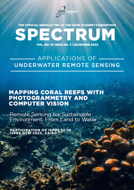
ISPRS SC Publishes Latest Volume of its Newsletter – SPECTRUM

ISPRS SC recently published its Volume 16, Issue No. 3 of the official Newsletter-SPECTRUM on the theme 'Applications of Underwater Remote Sensing'. In its backsight, the newsletter consists of reports on the ISPRS SC Summer School 2023 Taiwan hosted by National Cheng Kung University, Taiwan as post ACRS 2023 event, and participation of ISPRS SC during ISPRS Geospatial Week 2023, Cairo. Likewise, the spotlight section consists of an article titled 'Application of Underwater Remote Sensing' written by Dr. Devis Tuia, Professor at Ecole Polytechnique Fédérale de Lausanne. Moreover, the IFOV section features three prominent personalities in the field of maritime archaeology, photogrammetry, and remote sensing: Professor Dimitrios Skarlatos from Cyprus University of Technology, Professor Emad Khalil from
Alexandria University, Egypt (he is also the UNESCO Chair in Underwater Cultural Heritage), and Associate Professor Gottfried Mandlburger from TU Wien. In addition, the newsletter contains news about upcoming events, scholarships, and opportunities. The full newsletter for this issue and previous issues are at Newsletters (sc.isprs.org).

The theme of the next issue is 'Twinning in the Digital Realm: Exploring the Potential of Digital Twins'. Feel free to contact us at sc.isprs@gmail.com by March 31 if you have articles related to this theme or want to feature related research groups.


Student Consortium logo Student Consortium logo

ISPRS SC Summer School – CLIGEOS in Pokhara, Nepal

ISPRS WG V/IV is organizing ISPRS SC Summer School, CLImbing for CLImate GEOspatial School (CLIGEOS), from April 7-11, 2024, at the Institute of Engineering, Paschimanchal Campus, Pokhara, Nepal. This summer school aims to emphasize on the application of Spatial Data Analysis in the context of hilly and mountainous environment for sustainable tourism.

For more information, contact (Prof. Krishna Parsad Bhandari, ISPRS WG V/IV, E-mail: bhandarikrishna@wrc.edu.np and Prof Anjana Vyas, Chair, ISPRS WG V/IV, Email: anjanavyas@yahoo.com.


Student Consortium logo Student Consortium logo

GeoLeague Contest

The Student Association of the Faculty of Geodesy & Geomatic Engineering at K. N. Toosi University of Technology, Iran is hosting the 9th GeoLeague contest from 9-10 May 2024 and ISPRS SC has joined hands as the co-sponsor of this national competition. This is the only country-wide student contest designed to host B.Sc students of all geomatics engineering faculties of Iran and the students interested in participating in this event can find more details at ژئولیگ خواجه نصیر (geokntu.ir)

Society News


ISPRS ISPRS

Call for Papers: ISPRS TC IV Symposium 2024  - Unlocking the Potential of Spatial Information in the Metaverse

Fremantle, Australia
22-25 October 2024
Website: https://www.isprs.org/tc4-symposium2024/index.html


Dear Researchers and  Innovators

Embark on a journey into the future of spatial information at the ISPRS TC IV Symposium 2024, where we delve into the theme "Spatial Information to Empower the Metaverse". Set against the captivating backdrop of Fremantle, Australia, this symposium promises to be a convergence of cutting-edge research, industry insights, and visionary discussions.

In today's digital age, digital twins stand as a cornerstone of innovation, offering a platform for the analysis and simulation of complex systems. However, this transformative technology faces numerous challenges, from data fusion and visualization to the management of vast multidimensional datasets. Join us as we explore these challenges and chart a course toward solutions.

This year, we're breaking new ground by accepting also abstracts only.  Mark your calendars and submit your abstracts by the 31st of March 2024 to be part of this transformative event. Let's come together to share research, exchange experiences, and pave the way for a future empowered by spatial information.

The ISPRS Foundation (TIF) has announced travel grants to encourage young authors especially from developing countries to attend these Symposiums. For further information, please visit the website https://www.isprs.org/foundation/


ISPRS ISPRS

ISPRS TC III "Remote Sensing" Mid-term Symposium "Beyond the canopy: technologies and applications of remote sensing"

Belém, Brazil
4-8 November 2024
Website: https://www.isprs.org/tc4-symposium2024/index.html

Submit your papers until April 15

ISPRS Technical Commission III is dedicated to the technologies and applications of remote sensing. It is jointly hosted by Brazil and France from 2022 to 2026 and its mid-term symposium will be held in Belém, Brazil, on 4-8 November 2024, together with the Latin-American remote sensing symposium SELPER and several thematic workshops and tutorials in the field of remote sensing. Belém is located in the Amazon, a region that attracts the attention of the global community and will host COP30 in 2025.

The symposium will cover a very wide range of topics related to remote sensing: from satellite image acquisition and processing techniques (space missions, sensors, algorithms) to a wide variety of applications in Earth and planetary sciences, climate, environment, and society, with a particular focus on the Amazon and tropical environments.

For further information about the symposium visit our website : https://selperbrasil.org.br/events/belem-2024-tc3-symposium/  


Submit your contribution until April 15 and get ready to come to Belem, where you can promote your work, meet the scientific and industrial community, and discover an amazing city and magnificent tropical landscapes.

The ISPRS Foundation (TIF) has announced travel grants to encourage young authors especially from developing countries to attend these Symposiums. For further information, please visit the website https://www.isprs.org/foundation/


ISPRS ISPRS

New Author Guidelines for Archives and Annals

The Author Guidelines for Archives and Annals have been revised according to suggestions from Copernicus and others, which should make format-checking less cumbersome and also lead to a better and easier indexing procedure in Google Scholar, SCOPUS etc. The new guidelines are available on the web at https://www.isprs.org/documents/orangebook/app5.aspx.
These guidelines are to be implemented for the coming Symposia and all other ISPRS publications.


Sunni Kushwaha Sunni Kushwaha

ISPRS appoints Social Media Manager

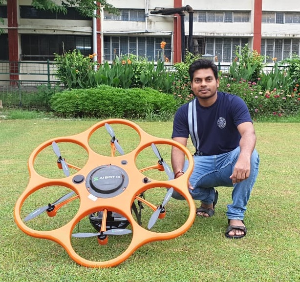
ISPRS is pleased to announce that it has appointed Sunni Kushwaha to the position of Social Media Manager. Sunni was born in Visakhapatnam in India. Currently, he is finishing his PhD in urban and forestry applications of close-range lidar and photogrammetry from the Geomatics Group, Indian Institute of Technology Roorkee, India. Sunni’s focus as media manager is growing the awareness of and interest in ISPRS through posting on the Facebook, LinkedIn, WeChat and X platforms. Sunni can be reached on s.k.p.kushwaha92@gmail.com.


Chen Jun Chen Jun

Prof. Chen Jun new ISC Fellow

The International Science Council (ISC) recently announced the new ISC Fellows. Nominated by ISPRS, the ISPRS Honorary Member and past ISPRS President (2012-2016), Prof. Chen Jun was appointed as ISC Fellow in recognition of his outstanding contributions in promoting science as a global public good.
See the list of new ISC Fellows.
https://council.science/wp-content/uploads/2023/12/2023-ISC-Fellows.pdf


ISPRS ISPRS

Seven Projects win ISPRS Education and Capacity Building Initiatives 2024 (ECBI2024) Awards

The ISPRS Education and Capacity Building Initiatives are defined in the ISPRS Orange Book, Appendix 9b https://www.isprs.org/documents/orangebook/app9b.aspx. Every two years applications are invited for proposals and a total of up to CHF70,000 is awarded.

A number of strong applications was received for the SI2024s. These usually come up through the Working Groups, then the Technical Commission Presidents, who provide input to the adjudication process. Finally, a small panel chosen from ISPRS Council makes the final decisions.

Seven ECBI2024 proposals were given awards, which total around CHF64,000. The titles and principal investigators of these projects are as follows (see https://www.isprs.org/society/ecbi/default.aspx for more detail):

  • SUNRISE (Seashore and UNderwater documentation of aRchaeological herItage palimpSests and Environment) SUMMER SCHOOL – second edition (Lorenzo Teppati Los)
  • EDU-UAV photogrammetry: current online educational landscape (Yolla Al Asmar, Bashar Alsadik)
  • POSER: an oPen sOurce Simulation platform for tEaching and tRaining underwater photogrammetry (Fabio Menna)
  • From forests to 3D digital models: training new generations on 3D geodata surveying and analysis (3DForTrain) (Francesco Pirotti, Erico Kutchartt)
  • Empowering education and capacity building focusing on natural disasters based on GeoAI and computer vision (Saied Pirasteh, Laurent Polidori, Kaveh Madani, Jonathan Li)
  • Development of VR/AR applications to support geospatial education (Dimitrios Bolkas)
  • Innovative training unit for civil engineers on remote sensing for construction impact assessment (Roman Shults)

ISPRS congratulates these winners and wishes them every success with their projects. Funding is for one calendar year for six of the projects and is spread over two years for the seventh. Once the projects are complete, the resulting reports will be posted on the ISPRS website.


Eliseo Clementini Eliseo Clementini

Prof. Dr. Eliseo Clementini Appointed Associate Editor of ISPRS International Journal of Geo-Information (IJGI)

IJGI Editorial Office is proud to have one new Associate Editor, Prof. Dr. Eliseo Clementini, joining the ISPRS International Journal of Geo-Information (IJGI, ISSN: 2220-9964) Editorial Board in March. His brief introduction is listed below.

For more information read the announcement here: https://www.mdpi.com/about/announcements/8008


ISPRS International Journal of Geo-Information — Open Access Journal ISPRS International Journal of Geo-Information — Open Access Journal

IJGI Featured Papers 2023 Q4

The Feature Papers published in the International Journal of GeoInformation can be found

2023 Q4 Feature Papers:

  1. 1. Knowledge-Based Recommendation for On-Demand Mapping: Application to Nautical Charts
        https://doi.org/10.3390/ijgi10110786
     2. Between Consultation and Collaboration: Self-Reported Objectives for 25 Web-Based Geoparticipation Projects in Urban Planning
        https://doi.org/10.3390/ijgi10110783
     3. A Web GIS-Based Integration of 3D Digital Models with Linked Open Data for Cultural Heritage Exploration
        https://doi.org/10.3390/ijgi10100684
     4. The Evolution of Interactivity, Immersion and Interoperability in HBIM: Digital Model Uses, VR and AR for Built Cultural Heritage
        https://doi.org/10.3390/ijgi10100685
     5. Mapping Inuinnaqtun: The Role of Digital Technology in the Revival of Traditional Inuit Knowledge Ecosystems
        https://doi.org/10.3390/ijgi10110749
     6. Usability of WebXR Visualizations in Urban Planning
        https://doi.org/10.3390/ijgi10110721
     7. Development of a 3D WebGIS Application for the Visualization of Seismic Risk on Infrastructural Work
        https://doi.org/10.3390/ijgi11010022
     8. The Problem of Reference Rot in Spatial Metadata Catalogues
        https://doi.org/10.3390/ijgi11010027
     9. Historical Vltava River Valley–Various Historical Sources within Web Mapping Environment
        https://doi.org/10.3390/ijgi11010035
    10. An End-to-End Point of Interest (POI) Conflation Framework
        https://doi.org/10.3390/ijgi10110779
    11. Enhancing the Visibility of SuDS in Strategic Planning Using Preliminary Regional Opportunity Screening
        https://doi.org/10.3390/ijgi10110726

ISPRS Journal ISPRS Journal

ISPRS Journal of Photogrammetry and Remote Sensing thanks retiring Associate Editors

Editorial Changes in the Team of Associate Editors

As of the end of December 2023, Professors Devis Tuia, Gang Chen, and Gui-Song Xia have retired as Associate Editors of the ISPRS Journal of Photogrammetry and Remote Sensing. Our Journal has benefited greatly from their strong commitment to their editorial duties. Both Devis and Gang have dutifully served the Journal for five years since 2018; while Gui-Song for two years. Thanks to their high standards for paper quality and rigorous peer review, these editors have made invaluable contributors to the Journal’s current high standing. All are recognized experts in their respective subject areas. Devis and Gui-Song handled submissions in geospatial computer vision, whereas Gang oversaw papers in optical remote sensing. On behalf of the Journal and the International Society for Photogrammetry and Remote Sensing (ISPRS), we thank them for dedicated services to the Journal.

Starting January 1, 2024, the following individuals have been appointed Associate Editors of the Journal. These individuals have been contributing to the ISPSR Journal for years as authors, reviewers, and/or guest editors. We are looking forward to working with them to bring the journal to a higher ground.

Prof. Bisheng Yang, Wuhan University, China
Prof. Naoto Yokoya, University of Tokyo, Japan
Prof. Caiyun Zhang, Florida Atlantic University, USA

Caiyun will primarily handle remote sensing papers dealing with geospatial modeling, coastal and ecosystem analysis; Naoto will oversee papers in computer vision and data fusion; and Bisheng will focus on machine learning in addition to his expertise in LiDAR.

Qihao Weng
Clément Mallet
Editors-in-Chief


ISPRS ISPRS

Inter-Commission Working Group Workshop at GSW 2025 focusing on Artificial Intelligence for Disaster Management

ICWG III/IVa is focusing its efforts on artificial intelligence-based methods for applying geotechnologies to disaster management under the guidance of Saeid Pirasteh. To empower disaster management education, the working group submitted and granted a groundbreaking proposal for the 2024 ISPRS Educational and Capacity Initiatives, titled "Empowering Education and Capacity Building on GeoAI and Computer Vision for Natural Disasters”.

After the success of the Workshop on "Geospatial Data Analytics for Physical Geography Impact Assessment, organized together with WG III-6 and WG III-9 during the GSW 2023 (Cairo), providing valuable insights into leveraging geospatial data for assessing the impact of physical geography, ICWG III/IVa will coordinate a workshop on "Geospatial AI for Disaster Risk Reduction and Visualization: GeoIME," highlighting the importance of advanced technologies in disaster risk reduction efforts, in the upcoming Geospatial Week 2025 (Dubai).

More information: https://gsw2025.ae/earth_observation/

Announcements of Scientific Meetings                (see also ISPRS Calendar)


Geo Week 2024 Geo Week 2024

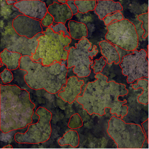
International Contest of Individual Tree Crown (ITC) Segmentation, hosted by the Commission III WGIII/1 - Remote Sensing Data Processing and Understanding

The contest aims to benchmark existing and newly developed ITC delineation methods, clarify their status and bottlenecks, and promote the development in this area.

Read more here…


ISPRS ISPRS

Webinar series on Geospatial Environment and Health Analytics

ISPRS WG III-9, chaired by Muralikrishna Iyyanki (India), has launched a series of webinars on the applications of geotechnologies and remote sensing in the field of health. Organised on the 12th of each month with the technical support of the Student Consortium, these webinars each feature two lectures by researchers from different continents, followed by a discussion on the potential of space technologies to benefit human health. Each month, the announcement can be found on the ISPRS website a few days before the webinar.


EuroSDR EuroSDR

EuroSDR Educational Service 2024

The 22nd series of EuroSDR e-learning courses will begin on March 4-5, 2024 with a pre-course seminar, hosted by the KU Leuven, Public Governance Institute, Leuven, Belgium. During the seminar, background material of four e-learning courses will be presented by the tutors, participants will meet the tutors and fellow participants, and the learning platform – Moodle, will be demonstrated. The four two-week e-learning courses are scheduled from March to June 2024. Each course requires about thirty hours of online study.

For more information see here…
and visit http://www.eurosdr.net/education/current


ISPRS ISPRS

Webinar by ISPRS WG IV/5

When: Tuesday 7th of May 9:30-11:00 CET
Where: Online (Register here)

Topics:

  • Trustworthy Maps? Case Studies from Managing Emergencies (Dr. Amy Griffin)
  • Gamified XR for hazard preparedness in mining (Yan Wong)
  • 3D selection for point clouds in XR (Luca Fluri)

» Read more details


ISPRS ISPRS

COM1: Robot Perception: Laser Scanning and Point Cloud Processing SLAM intensive course

12-16 August 2024
University of Jyväskylä, Finland

ICWG I/IV will organize COM1: Robot Perception: Laser Scanning and Point Cloud Processing SLAM intensive course on 12-16 August 2024. The course will be part of the 33rd Jyväskylä Summer School at the University of Jyväskylä, Finland. The main teacher is Dr. Ville Lehtola, Assistant Professor, University of Twente. The hosting faculty of information sciences is 38th on the Shanghai list of Library and Information Sciences, and Jyväskylä is the sauna capital of Finland. More information can be found (under "computational science"):

https://www.jyu.fi/en/study-with-us/summer-and-winter-schools/jyvaskyla-summer-school/jyvaskyla-summer-school-course-programme


TeanGeo TeanGeo

TeanGeo 2024 - 4th International Conference & Exhibition - Advanced Geospatial Science & Technology

22-24 October 2024
Tunis, Tunisia

Read more …


JISDM JISDM

Joint International Symposium on Deformation Monitoring (JISDM)

7-9 April, 2025
Karlsruhe, Germany
Deadline for abstract submission is 15 July 2024

Read more … or visit the conference website: https://jisdm2025.gik.kit.edu/


Event Reports


ICARS ICARS

The 2nd International Conference on Advanced Remote Sensing and the 2023 Wuhan Remote Sensing Week

13-15 October 2023
Wuhan, China

Read the report here…

ISPRS International Journal of Geo-Information — Open Access Journal


ISPRS International Journal of Geo-Information — Open Access Journal ISPRS International Journal of Geo-Information — Open Access Journal

New publications
Volume 12, Issue 12 (December 2024)

A Deep-Learning-Based Multimodal Data Fusion Framework for Urban Region Function Recognition
Yu, Mingyang, Xu, Haiqing, Zhou, Fangliang, Xu, Shuai, Yin, Hongling
No: 468

Simplification and Regularization Algorithm for Right-Angled Polygon Building Outlines with Jagged Edges
Kong, Linghui, Qian, Haizhong, Wu, Yuqing, Niu, Xinyu, Wang, Di, Huang, Zhekun
No: 469

A GIS-Based Damage Evaluation Method for Explosives Road Transportation Accidents
Zhao, Jing, Liu, Ning, Li, Junhui, Guo, Xi, Deng, Hongtao, Sun, Jinshan
No: 470

Quick Estimation Model for Mapping Earthquake Impacts in Bogotá, Colombia
Miura, Hiroyuki, Matsuoka, Masashi, Reyes, Juan C., Pulido, Nelson, Hashimoto, Mitsufumi, Riaño, Andrea C., Hurtado, Alvaro, Rincon, Raul, García, Helber, Lozano, Carlos
No: 471

Assessing Regional Development Balance Based on Zipf’s Law: The Case of Chinese Urban Agglomerations
Kong, Liang, Wu, Qinglin, Deng, Jie, Bai, Leichao, Chen, Zhongsheng, Du, Zhong, Luo, Mingliang
No: 472

Efficient Construction of Voxel Models for Ore Bodies Using an Improved Winding Number Algorithm and CUDA Parallel Computing
Liu, Lei, Sun, Yong, Ji, Min, Wang, Huimeng, Liu, Jiantao
No: 473

A Novel Method of Modeling Grassland Wildfire Dynamics Based on Cellular Automata: A Case Study in Inner Mongolia, China
Li, Yan, Wu, Guozhou, Zhang, Shuai, Li, Manchun, Nie, Beidou, Chen, Zhenjie
No: 474

FINNCH: Cooperative Pursuit Navigation for a Pursuer Team to Capture a Single Evader in Urban Environments
Lou, Xiayin, Sun, Min, Yang, Hanjun, Yang, Shihao
No: 475

Effects of Spatial Reference Frames, Map Dimensionality, and Navigation Modes on Spatial Orientation Efficiency
Guo, Hongyun, Yang, Nai, Wang, Zhong, Fang, Hao
No: 476

Analysis of Spatial and Temporal Distribution Patterns of Traditional Opera Culture along the Beijing–Hangzhou Grand Canal
Yang, Jiayi, Hu, Di, Chen, Zihan, Xu, Yicheng, Zou, Zewei, Zhu, Ying
No: 477

Spatial Accessibility of Public Electric Vehicle Charging Services in China
Chen, Yu, Chen, Yuehong, Lu, Yuqi
No: 478

Understanding Map Misinterpretation: Factors Influencing Correct Map Reading and Common Errors
Szigeti-Pap, Csaba, Kis, Dávid, Albert, Gáspár
No: 479

Research on Approximate Spatial Keyword Group Queries Based on Differential Privacy and Exclusion Preferences in Road Networks
Zhang, Liping, Li, Jing, Li, Song
No: 480

Mapping Gross Domestic Product Distribution at 1 km Resolution across Thailand Using the Random Forest Area-to-Area Regression Kriging Model
Jin, Yan, Ge, Yong, Fan, Haoyu, Li, Zeshuo, Liu, Yaojie, Jia, Yan
No: 481

Impacts of Urban Morphology on Seasonal Land Surface Temperatures: Comparing Grid- and Block-Based Approaches
Jeon, Gyuwon, Park, Yujin, Guldmann, Jean-Michel
No: 482

Mixed-Methods Approach to Land Use Renewal Strategies in and around Abandoned Airports: The Case of Beijing Nanyuan Airport
Cai, Haoxian, Duan, Wei
No: 483

Internet in the Middle of Nowhere: Performance of Geoportals in Rural Areas According to Core Web Vitals
Król, Karol, Sroka, Wojciech
No: 484

A Head/Tail Breaks-Based Approach to Characterizing Space-Time Risks of COVID-19 Epidemic in China’s Cities
Wu, Tingting, Hu, Bisong, Luo, Jin, Qi, Shuhua
No: 485

Measuring the Multiple Functions and Tradeoffs among Streets: A New Framework Using the Deep Learning Method
Fu, Shihang, Fang, Ying, Wang, Nannan, Tong, Zhaomin, Liu, Yaolin
No: 486

Vertical vs. Horizontal Fractal Dimensions of Roads in Relation to Relief Characteristics
Prah, Klemen, Shortridge, Ashton M.
No: 487

Applying Dynamic Human Activity to Disentangle Property Crime Patterns in London during the Pandemic: An Empirical Analysis Using Geo-Tagged Big Data
Chen, Tongxin, Bowers, Kate, Cheng, Tao
No: 488

High-Temporal-Resolution Prediction of Malaria Transmission Risk in South Kivu, Democratic Republic of the Congo, Based on Multi-Criteria Evaluation Using Geospatial Data
Komura, Ryunosuke, Matsuoka, Masayuki
No: 489

On the Definition of Standard Parallels in Map Projections
Lapaine, Miljenko
No: 490

Multiscale Analysis of Spatial Accessibility to Acute Hospitals in Carinthia, Austria
Wang, Changzhen, Leitner, Michael, Paulus, Gernot
No: 491

Exploring the Spatial Relationship between Street Crime Events and the Distribution of Urban Greenspace: The Case of Porto, Portugal
Saraiva, Miguel, Teixeira, Bárbara
No: 492

Risk Assessment of Landslide Collapse Disasters along National Highways Based on Information Quantity and Random Forest Coupling Methods: A Case Study of the G331 National Highway
Nie, Zuoquan, Lang, Qiuling, Zhang, Yichen, Zhang, Jiquan, Chen, Yanan, Pan, Zengkai
No: 493

A Motion-Based Conceptual Space Model to Support 3D Evacuation Simulation in Indoor Environments
Xie, Ruihang, Zlatanova, Sisi, Lee, Jinwoo (Brian), Aleksandrov, Mitko
No: 494

An Aggregated Shape Similarity Index: A Case Study of Comparing the Footprints of OpenStreetMap and INSPIRE Buildings
Ďuračiová, Renata
No: 495

Research on Traffic Accident Risk Prediction Method Based on Spatial and Visual Semantics
Li, Wenjing, Luo, Zihao
No: 496

Location Planning of Emergency Medical Facilities Using the p-Dispersed-Median Modeling Approach
Oh, Changwha, Chun, Yongwan, Kim, Hyun
No: 497

What Drives the Spatial Heterogeneity of Urban Leisure Activity Participation? A Multisource Big Data-Based Metrics in Nanjing, China
Liu, Shaojun, Chen, Xiawei, Zhang, Fengji, Liu, Yiyan, Ge, Junlian
No: 499

Visibility-Based R-Tree Spatial Index for Consistent Visualization in Indoor and Outdoor Scenes
Li, Chengpeng, Kuai, Xi, He, Biao, Zhao, Zhigang, Lin, Haojia, Zhu, Wei, Liu, Yu, Guo, Renzhong
No: 498

Geo-Referencing and Analysis of Entities Extracted from Old Drawings and Photos Using Computer Vision and Deep Learning Algorithms
David, Liat, Zohar, Motti, Shimshoni, Ilan
No: 500

The Spatial Effects of Regional Poverty: Spatial Dependence, Spatial Heterogeneity and Scale Effects
Liu, Mengxiao, Ge, Yong, Hu, Shan, Hao, Haiguang
No: 501

Construction of a Real-Time Ship Trajectory Prediction Model Based on Ship Automatic Identification System Data
Xi, Daping, Feng, Yuhao, Jiang, Wenping, Yang, Nai, Hu, Xini, Wang, Chuyuan
No: 502

Machine-Learning-Based Forest Classification and Regression (FCR) for Spatial Prediction of Liver Fluke Opisthorchis viverrini (OV) Infection in Small Sub-Watersheds
Pumhirunroj, Benjamabhorn, Littidej, Patiwat, Boonmars, Thidarut, Bootyothee, Kanokwan, Artchayasawat, Atchara, Khamphilung, Phusit, Slack, Donald
No: 503

A Web-Based Geodesign Tool for Evaluating the Integration of Transport Infrastructure, Public Spaces, and Human Activities
Yang, Liu
No: 504

Hyperspectral Image Classification Network Based on 3D Octave Convolution and Multiscale Depthwise Separable Convolution
Hong, Qingqing, Zhong, Xinyi, Chen, Weitong, Zhang, Zhenghua, Li, Bin
No: 505


Volume 13, Issue 1 (January 2024)

Areas of Crime in Cities: Case Study of Lithuania
Beconytė, Giedrė, Gružas, Kostas, Spiriajevas, Eduardas
No: 1

Assessing the Defensibility of Medieval Fortresses on the Mediterranean Coast: A Study of Algerian and Spanish Territories
Oulmas, Mohand, Abdessemed-Foufa, Amina, Avilés, Angel Benigno Gonzalez, Conesa, José Ignacio Pagán
No: 2

An Improved BLG Tree for Trajectory Compression with Constraints of Road Networks
Liu, Minshi, Zhang, Ling, Long, Yi, Sun, Yong, Zhao, Mingwei
No: 3

Spatiotemporal Patterns and Socioeconomic Influences on Host Participation in Short-Term Rental Markets: Airbnb in San Francisco
Sarkar, Avijit, Pick, James B., Jabeen, Shaista
No: 4

Multiscale Feature Extraction by Using Convolutional Neural Network: Extraction of Objects from Multiresolution Images of Urban Areas
Fan, Ching-Lung
No: 5

Multi-Session High-Definition Map-Monitoring System for Map Update
Wijaya, Benny, Yang, Mengmeng, Wen, Tuopu, Jiang, Kun, Wang, Yunlong, Fu, Zheng, Tang, Xuewei, Sigomo, Dennis Octovan, Miao, Jinyu, Yang, Diange
No: 6

Detecting the Spatial Association between Commercial Sites and Residences in Beijing on the Basis of the Colocation Quotient
Zhou, Lei, Wang, Chen
No: 7

Explaining Theft Using Offenders’ Activity Space Inferred from Residents’ Mobile Phone Data
Liu, Lin, Li, Chenchen, Xiao, Luzi, Song, Guangwen
No: 8

Research on the Evolution and Driving Factors of the Economic Spatial Pattern of the Guangdong–Hong Kong–Macao Greater Bay Area in the Context of the COVID-19 Epidemic
Huang, Xiaojin, Guo, Renzhong, Li, Xiaoming, Li, Minmin, Fan, Yong, Li, Yaxing
No: 9

Geographic Knowledge Base Question Answering over OpenStreetMap
Yang, Jonghyeon, Jang, Hanme, Yu, Kiyun
No: 10

A Lightweight Approach for Building User Mobility Profiles
Vallejos, Sebastián, Berdun, Luis, Armentano, Marcelo, Schiaffino, Silvia, Godoy, Daniela
No: 11

Identifying Relationship between Regional Centrality and POI Facilities: A Case Study of Seoul Metropolitan Area
Lee, Yose, Seo, Ducksu
No: 12

Parallel Channel Identification and Elimination Method Based on the Spatial Position Relationship of Different Channels
Zhao, Mingwei, Ju, Xiaoxiao, Wang, Ni, Wang, Chun, Zeng, Weibo, Xu, Yan
No: 13

Developing a Base Domain Ontology from Geoscience Report Collection to Aid in Information Retrieval towards Spatiotemporal and Topic Association
Tao, Liufeng, Ma, Kai, Tian, Miao, Hui, Zhenyang, Zheng, Shuai, Liu, Junjie, Xie, Zhong, Qiu, Qinjun
No: 14

Towards Topological Geospatial Conflation: An Optimized Node-Arc Conflation Model for Road Networks
Lei, Zhen, Lei, Ting L.
No: 15

Assessing the Transformative Potential: An Examination of the Urban Mobility Impact Based on an Open-Source Microscopic Traffic Simulator for Autonomous Vehicles
Andrei, Liliana, Luca, Oana
No: 16

The Patterns and Mechanisms of Residential Mobility in Nanjing, China: Insights from the Mantel Test
Ye, Ling, Song, Weixuan, He, Miao, Liu, Chunhui
No: 17

Bayesian Structural Time Series and Geographically Weighted Logistic Regression Modelling Impacts of COVID-19 Lockdowns on the Spatiotemporal Patterns of London’s Crimes
Wang, Rui, Li, Yijing
No: 18

Semantic Segmentation and Roof Reconstruction of Urban Buildings Based on LiDAR Point Clouds
Sun, Xiaokai, Guo, Baoyun, Li, Cailin, Sun, Na, Wang, Yue, Yao, Yukai
No: 19

A New Urban Built-Up Index and Its Application in National Central Cities of China
Wang, Linfeng, Chen, Shengbo, Chen, Lei, Wang, Zibo, Liu, Bin, Xu, Yucheng
No: 21

Improving Three-Dimensional Building Segmentation on Three-Dimensional City Models through Simulated Data and Contextual Analysis for Building Extraction
Leroux, Frédéric, Germain, Mickaël, Clabaut, Étienne, Bouroubi, Yacine, St-Pierre, Tony
No: 20

Probabilistic Time Geographic Modeling Method Considering POI Semantics
Wang, Ai-Sheng, Yin, Zhang-Cai, Ying, Shen
No: 22

Locating Senior-Friendly Restaurants in a Community: A Bi-Objective Optimization Approach for Enhanced Equality and Convenience
Yang, Shuyan, Li, Changfeng, Mu, Wangshu
No: 23

Differences in Urban Development in China from the Perspective of Point of Interest Spatial Co-Occurrence Patterns
Dong, Guangsheng, Li, Rui, Li, Fa, Liu, Zhaohui, Wu, Huayi, Xiang, Longgang, Yu, Wensen, Jiang, Jie, Zhang, Hongping, Li, Fangning
No: 24

Extension of RCC*-9 to Complex and Three-Dimensional Features and Its Reasoning System
Clementini, Eliseo, Cohn, Anthony G.
No: 25

Is ChatGPT a Good Geospatial Data Analyst? Exploring the Integration of Natural Language into Structured Query Language within a Spatial Database
Jiang, Yongyao, Yang, Chaowei
No: 26

Semantic-Enhanced Graph Convolutional Neural Networks for Multi-Scale Urban Functional-Feature Identification Based on Human Mobility
Chen, Yuting, Zhao, Pengjun, Lin, Yi, Sun, Yushi, Chen, Rui, Yu, Ling, Liu, Yu
No: 27

A Containerized Service-Based Integration Framework for Heterogeneous-Geospatial-Analysis Models
Zhu, Lilu, Wang, Yang, Kong, Yunbo, Hu, Yanfeng, Huang, Kai
No: 28

Relief Supply-Demand Estimation Based on Social Media in Typhoon Disasters Using Deep Learning and a Spatial Information Diffusion Model
Li, Shaopan, Lin, Yiping, Huang, Hong
No: 29

3D Cadastral Database Systems—A Systematic Literature Review
Shahidinejad, Javad, Kalantari, Mohsen, Rajabifard, Abbas
No: 30

Quantitative Study on American COVID-19 Epidemic Predictions and Scenario Simulations
Sun, Jingtao, Qi, Jin, Yan, Zhen, Li, Yadong, Liang, Jie, Wu, Sensen
No: 31

Spatial Relationship Analysis of Geographic Elements in Sketch Maps at the Meso and Micro Spatial Scales
Zhang, Chen, Tang, Ming, Sheng, Yehua
No: 32


Volume 13, Issue 2 (February 2024)

Evaluating Geospatial Data Adequacy for Integrated Risk Assessments: A Malaria Risk Use Case
Petutschnig, Linda, Clemen, Thomas, Klaußner, E. Sophia, Clemen, Ulfia, Lang, Stefan
No: 33

Dynamic Graph Convolutional Network-Based Prediction of the Urban Grid-Level Taxi Demand–Supply Imbalance Using GPS Trajectories
Yang, Haiqiang, Li, Zihan
No: 34

Learning Daily Human Mobility with a Transformer-Based Model
Wang, Weiying, Osaragi, Toshihiro
No: 35

Temporal Paths in Real-World Sensor Networks
Bollen, Erik, Kuijpers, Bart, Soliani, Valeria, Vaisman, Alejandro
No: 36

Analysis of Spatiotemporal Characteristics and Influencing Factors of Electric Vehicle Charging Based on Multisource Data
Liu, Chenxi, Peng, Zhenghong, Liu, Lingbo, Wu, Hao
No: 37

Assessing the Suitability of Fractal Dimension for Measuring Graphic Complexity Change in Schematic Metro Networks
Lan, Tian, Wu, Zhiwei, Sun, Chenzhen, Cheng, Donglin, Shi, Xing, Zeng, Guangjun, Zhang, Hong, Peng, Qian
No: 38

Conceptualizing and Validating the Trustworthiness of Maps through an Empirical Study on the Influence of Cultural Background on Map Design Perception
Gartner, Georg, Ignateva, Olesia, Zhunis, Bibigul, Pühringer, Johanna
No: 39

Enhancing the K-Means Algorithm through a Genetic Algorithm Based on Survey and Social Media Tourism Objectives for Tourism Path Recommendations
Damos, Mohamed A., Zhu, Jun, Li, Weilian, Khalifa, Elhadi, Hassan, Abubakr, Elhabob, Rashad, Hm, Alaa, Ei, Esra
No: 40

A Semantic Partition Algorithm Based on Improved K-Means Clustering for Large-Scale Indoor Areas
Shi, Kegong, Yan, Jinjin, Yang, Jinquan
No: 41

Measuring Efficiency and Accuracy in Locating Symbols on Mobile Maps Using Eye Tracking
Rymarkiewicz, Wojciech, Cybulski, Paweł, Horbiński, Tymoteusz
No: 42

Measuring the Potential and Realized (or Revealed) Spatial Access from Places of Residence and Work to Food Outlets in Rural Communities of Québec, Canada
Robitaille, Eric, Durette, Gabrielle, Dubé, Marianne, Arbour, Olivier, Paquette, Marie-Claude
No: 43

How Information and Communications Technology Affects the Micro-Location Choices of Stores on On-Demand Food Delivery Platforms: Evidence from Xinjiekou’s Central Business District in Nanjing
Hu, Xinyu, Zhang, Gutao, Shi, Yi, Yu, Peng
No: 44

A Novel Visual Narrative Framework for Tourist Map Design Based on Local Chronicles: A Case Study of the Songshan Scenic Area
Zhen, Wenjie, Huang, Shifang, Tian, Zhihui, Yang, Xiaoyue
No: 45

EventGeoScout: Fostering Citizen Empowerment and Augmenting Data Quality through Collaborative Geographic Information Governance and Optimization
Montenegro, Jose A., Muñoz, Antonio
No: 46

Cultural Itineraries Generated by Smart Data on the Web
Capodiferro, Cosmo, De Maria, Massimo, Mazzei, Mauro, Spreafico, Matteo, V. Bik, Oleg, Palma, Armando L., V. Solovyeva, Anna
No: 47

Multidimensional Spatial Vitality Automated Monitoring Method for Public Open Spaces Based on Computer Vision Technology: Case Study of Nanjing’s Daxing Palace Square
Hu, Xinyu, Shen, Ximing, Shi, Yi, Li, Chen, Zhu, Wei
No: 48

A Time-Identified R-Tree: A Workload-Controllable Dynamic Spatio-Temporal Index Scheme for Streaming Processing
Peng, Weichen, Chen, Luo, Ouyang, Xue, Xiong, Wei
No: 49

Study on Spatio-Temporal Patterns of Commuting under Adverse Weather Events: Case Study of Typhoon In-Fa
Ji, Tao, Huang, Xian, Shao, Jinliang, Zhu, Yunqiang, Deng, Shejun, Yu, Shijun, Liao, Huajun
No: 50

A Spatial Optimization Model for Delineating Metropolitan Areas
Wang, Gusiyuan, Mu, Wangshu
No: 51

Generating Spatial Knowledge Graphs with 2D Indoor Floorplan Data: A Case Study on the Jeonju Express Bus Terminal
Jang, Hanme, Yu, Kiyun, Kim, Jiyoung
No: 52

Online Decision Support Infrastructures for Integrating Spatial Planning and Flood Risk Management Policies
Ran, Jing, Nedovic-Budic, Zorica
No: 53

Historical Heritage Maintenance via Scan-to-BIM Approaches: A Case Study of the Lisbon Agricultural Exhibition Pavilion
Rocha, Gustavo, Mateus, Luís, Ferreira, Victor
No: 54

Evaluation of the Accessibility of Children’s Spaces at the Community Scale: The Case Study of Hangzhou
Cui, Yuanzheng, Wang, Qiuting, Zha, Guixiang, Dang, Yunxiao, Duan, Xuejun, Wang, Lei, Luo, Ming
No: 55

Secant Cylinders Are Evil—A Case Study on the Standard Lines of the Universal Transverse Mercator and Universal Polar Stereographic Projections
Kerkovits, Krisztián
No: 56

Methodological Innovations for Establishing Cemetery Spatial Databases—A UAV-Based Workflow Helping Small Communities
Pál, Márton, Hajdú, Edina
No: 57

Study on LOS to Vertical Deformation Conversion Model on Embankment Slopes Using Multi-Satellite SAR Interferometry
Liu, Jie, Li, Tao, Ma, Sijie, Shan, Qiang, Jiang, Weiping
No: 58

A Spatiotemporal Hierarchical Analysis Method for Urban Traffic Congestion Optimization Based on Calculation of Road Carrying Capacity in Spatial Grids
Jiang, Dong, Zhao, Wenji, Wang, Yanhui, Wan, Biyu
No: 59

Measuring Villagers’ Perceptions of Changes in the Landscape Values of Traditional Villages
Li, Mingxuan, Yan, Yu, Ying, Ziyi, Zhou, Long
No: 60

Comparing Characteristics of the Urban Thermal Environment Based on the Local Climate Zone in Three Chinese Metropolises
Su, Riguga, Yang, Chaobin, Xu, Zhibo, Luo, Tingwen, Yang, Lilong, Liu, Lifeng, Wang, Chao
No: 61


ISPRS Journal of Photogrammetry and Remote Sensing


ISPRS Journal ISPRS Journal

New publications
Volume 207 (January 2024)

Editorial Board
Pages: ii

Physics inspired hybrid attention for SAR target recognition
Zhongling Huang, Chong Wu, Xiwen Yao, Zhicheng Zhao, Xiankai Huang, Junwei Han
Pages: 164-174

Unsupervised domain adaptation for SAR target classification based on domain- and class-level alignment: From simulated to real data
Yu Shi, Lan Du, Chen Li, Yuchen Guo, Yuang Du
Pages: 1-13

Ship-Go: SAR Ship Images Inpainting via instance-to-image Generative Diffusion Models
Xin Zhang, Yang Li, Feng Li, Hangzhi Jiang, Yanhua Wang, Liang Zhang, Le Zheng, Zegang Ding
Pages: 203-217

Knowledge evolution learning: A cost-free weakly supervised semantic segmentation framework for high-resolution land cover classification
Hao Cui, Guo Zhang, Yujia Chen, Xue Li, Shasha Hou, Haifeng Li, Xiaolong Ma, Na Guan, Xuemin Tang
Pages: 74-91

Validating GEDI tree canopy cover product across forest types using co-registered aerial LiDAR data
Xiao Li, Linyuan Li, Wenjian Ni, Xihan Mu, Xiaodan Wu, Gaia {Vaglio Laurin}, Elia Vangi, Krzysztof Stereńczak, Gherardo Chirici, Shiyou Yu, Huaguo Huang
Pages: 326-337

Blurry dense object extraction based on buffer parsing network for high-resolution satellite remote sensing imagery
Dingyuan Chen, Yanfei Zhong, Ailong Ma, Liangpei Zhang
Pages: 122-140

3DMASC: Accessible, explainable 3D point clouds classification. Application to bi-spectral topo-bathymetric lidar data
Mathilde Letard, Dimitri Lague, Arthur {Le Guennec}, Sébastien Lefèvre, Baptiste Feldmann, Paul Leroy, Daniel Girardeau-Montaut, Thomas Corpetti
Pages: 175-197

Better localized predictions with Out-of-Scope information and Explainable AI: One-Shot SAR backscatter nowcast framework with data from neighboring region
Zhouyayan Li, Ibrahim Demir
Pages: 92-103

Automatic differentiation of Eucalyptus species through Sentinel-2 images, Worldview-3 images and LiDAR data
L. Alonso, A. Rodríguez-Dorna, J. Picos, F. Costas, J. Armesto
Pages: 264-281

Edge aware depth inference for large-scale aerial building multi-view stereo
Song Zhang, ZhiWei Wei, WenJia Xu, LiLi Zhang, Yang Wang, JinMing Zhang, JunYi Liu
Pages: 27-42

TransCNNLoc: End-to-end pixel-level learning for 2D-to-3D pose estimation in dynamic indoor scenes
Shengjun Tang, Yusong Li, Jiawei Wan, You Li, Baoding Zhou, Renzhong Guo, Weixi Wang, Yuhong Feng
Pages: 218-230

Estimating tree species composition from airborne laser scanning data using point-based deep learning models
Brent A. Murray, Nicholas C. Coops, Lukas Winiwarter, Joanne C. White, Adam Dick, Ignacio Barbeito, Ahmed Ragab
Pages: 282-297

Suaeda salsa spectral index for Suaeda salsa mapping and fractional cover estimation in intertidal wetlands
Yinghai Ke, Yue Han, Liyue Cui, Peiyu Sun, Yukui Min, Zhanpeng Wang, Zhaojun Zhuo, Qingqing Zhou, Xiaolan Yin, Demin Zhou
Pages: 104-121

An efficient point cloud place recognition approach based on transformer in dynamic environment
Qipeng Li, Yuan Zhuang, Jianzhu Huai, Yiwen Chen, Alper Yilmaz
Pages: 14-26

Self-supervised pre-training for large-scale crop mapping using Sentinel-2 time series
Yijia Xu, Yuchi Ma, Zhou Zhang
Pages: 312-325

Scales of oblique photographs updated
Eleonora Maset, Andrea Fusiello
Pages: 198-202

geeSEBAL-MODIS: Continental-scale evapotranspiration based on the surface energy balance for South America
Bruno {Comini de Andrade}, Leonardo Laipelt, Ayan Fleischmann, Justin Huntington, Charles Morton, Forrest Melton, Tyler Erickson, Debora R. Roberti, Vanessa {de Arruda Souza}, Marcelo Biudes, Nadja {Gomes Machado}, Carlos {Antonio Costa dos Santos}, Eric G. Cosio, Anderson Ruhoff
Pages: 141-163

Multi-stage progressive change detection on high resolution remote sensing imagery
Xiaogang Ning, Hanchao Zhang, Ruiqian Zhang, Xiao Huang
Pages: 231-244

The influence of BRDF effects and representativeness of training data on tree species classification using multi-flightline airborne hyperspectral imagery
Wen Jia, Yong Pang, Riccardo Tortini
Pages: 245-263

Multi-echo hyperspectral reflectance extraction method based on full waveform hyperspectral LiDAR
Yanhong Ran, Shalei Song, Xiaxia Hou, Yuxuan Chen, Zhenwei Chen, Wei Gong
Pages: 43-56

Rapid survey method for large-scale outdoor surveillance cameras using binary space partitioning
Xin Lan, Liangchen Zhou, Bingxian Lin, Jiahao Li, Guonian Lv
Pages: 57-73

An efficient urban flood mapping framework towards disaster response driven by weakly supervised semantic segmentation with decoupled training samples
Yongjun He, Jinfei Wang, Ying Zhang, Chunhua Liao
Pages: 338-358

Advancing sun glint correction in high-resolution marine UAV RGB imagery for coral reef monitoring
Jiangying Qin, Ming Li, Jie Zhao, Deren Li, Hanqi Zhang, Jiageng Zhong
Pages: 298-311


New publications
Volume 208 (February 2024)

Editorial Board
Pages: ii

Missing information reconstruction integrating isophote constraint and color-structure control for remote sensing data
Xiaoyu Yu, Jun Pan, Jiangong Xu, Mi Wang
Pages: 261-278

Assisted learning for land use classification: The important role of semantic correlation between heterogeneous images
Wangbin Li, Kaimin Sun, Wenzhuo Li, Xiao Huang, Jinjiang Wei, Yepei Chen, Wei Cui, Xueyu Chen, Xianwei Lv
Pages: 158-175

PhenoNet: A two-stage lightweight deep learning framework for real-time wheat phenophase classification
Ruinan Zhang, Shichao Jin, Yuanhao Zhang, Jingrong Zang, Yu Wang, Qing Li, Zhuangzhuang Sun, Xiao Wang, Qin Zhou, Jian Cai, Shan Xu, Yanjun Su, Jin Wu, Dong Jiang
Pages: 136-157

Hierarchical alignment network for domain adaptive object detection in aerial images
You Ma, Lin Chai, Lizuo Jin, Jun Yan
Pages: 39-52

ChangeCLIP: Remote sensing change detection with multimodal vision-language representation learning
Sijun Dong, Libo Wang, Bo Du, Xiaoliang Meng
Pages: 53-69

A multi-task learning method for extraction of newly constructed areas based on bi-temporal hyperspectral images
Lilin Tu, Xin Huang, Jiayi Li, Jie Yang, Jianya Gong
Pages: 308-323

Revealing the spatial variation in biomass uptake rates of Brazil’s secondary forests
Na Chen, Nandin-Erdene Tsendbazar, Daniela {Requena Suarez}, Celso H.L. Silva-Junior, Jan Verbesselt, Martin Herold
Pages: 233-244

Landsat assessment of variable spectral recovery linked to post-fire forest structure in dry sub-boreal forests
Sarah M. Smith-Tripp, Nicholas C. Coops, Christopher Mulverhill, Joanne C. White, Jodi Axelson
Pages: 121-135

CaR3DMIC: A novel method for evaluating UAV-derived 3D forest models by tree features
Arvin Fakhri, Hooman Latifi, Kyumars Mohammadi Samani, Fabian Ewald Fassnach
Pages: 279-295

Remote sensing image classification using an ensemble framework without multiple classifiers
Peng Dou, Chunlin Huang, Weixiao Han, Jinliang Hou, Ying Zhang, Juan Gu
Pages: 190-209

Gaussian meta-feature balanced aggregation for few-shot synthetic aperture radar target detection
Zheng Zhou, Zongyong Cui, Kailing Tang, Yu Tian, Yiming Pi, Zongjie Cao
Pages: 89-106

LiDeNeRF: Neural radiance field reconstruction with depth prior provided by LiDAR point cloud
Pengcheng Wei, Li Yan, Hong Xie, Dashi Qiu, Changcheng Qiu, Hao Wu, Yinghao Zhao, Xiao Hu, Ming Huang
Pages: 296-307

Deep learning in statistical downscaling for deriving high spatial resolution gridded meteorological data: A systematic review
Yongjian Sun, Kefeng Deng, Kaijun Ren, Jia Liu, Chongjiu Deng, Yongjun Jin
Pages: 14-38

Autoencoding tree for city generation and applications
Wenyu Han, Congcong Wen, Lazarus Chok, Yan Liang Tan, Sheung Lung Chan, Hang Zhao, Chen Feng
Pages: 176-189

Multi-sensor integrated mapping of global XCO2 from 2015 to 2021 with a local random forest model
Jiabin Chen, Ruohua Hu, Leyan Chen, Zihao Liao, Linlin Che, Tongwen Li
Pages: 107-120

Spectral mixture analysis of intimate mixtures for lithological mapping
Adnan Ahmad, Archana M. Nair
Pages: 210-232

Similarity and dissimilarity relationships based graphs for multimodal change detection
Yuli Sun, Lin Lei, Zhang Li, Gangyao Kuang
Pages: 70-88

A continuous digital elevation representation model for DEM super-resolution
Shun Yao, Yongmei Cheng, Fei Yang, Mikhail G. Mozerov
Pages: 1-13

Open-set domain adaptation for scene classification using multi-adversarial learning
Juepeng Zheng, Yibin Wen, Mengxuan Chen, Shuai Yuan, Weijia Li, Yi Zhao, Wenzhao Wu, Lixian Zhang, Runmin Dong, Haohuan Fu
Pages: 245-260


New publications
Volume 209 (March 2024)

Editorial Board
Pages: ii

A novel method for robust marine habitat mapping using a kernelised aquatic vegetation index
Stanley Mastrantonis, Ben Radford, Tim Langlois, Claude Spencer, Simon {de Lestang}, Sharyn Hickey
Pages: 472-480

A novel Building Section Skeleton for compact 3D reconstruction from point clouds: A study of high-density urban scenes
Yijie Wu, Fan Xue, Maosu Li, Sou-Han Chen
Pages: 85-100

Remote sensing image cloud detection using a shallow convolutional neural network
Dengfeng Chai, Jingfeng Huang, Minghui Wu, Xiaoping Yang, Ruisheng Wang
Pages: 66-84

The anisotropy of MODIS LST in urban areas: A perspective from different time scales using model simulations
Xiaoyu He, Dandan Wang, Si Gao, Xue Li, Gaijing Chang, Xiaodong Jia, Qiang Chen
Pages: 448-460

High completeness multi-view stereo for dense reconstruction of large-scale urban scenes
Yongjian Liao, Xuexi Zhang, Nan Huang, Chuanyu Fu, Zijie Huang, Qiku Cao, Zexi Xu, Xiaoming Xiong, Shuting Cai
Pages: 173-196

Global mapping of forest clumping index based on GEDI canopy height and complementary data
Xingmin Zhao, Jing M. Chen, Yongguang Zhang, Ziti Jiao, Liangyun Liu, Feng Qiu, Jinlong Zang, Ruochen Cao
Pages: 1-16

Multidecadal mapping of status and trends in annual burn probability over Canada’s forested ecosystems
Christopher Mulverhill, Nicholas C. Coops, Michael A. Wulder, Joanne C. White, Txomin Hermosilla, Christopher W. Bater
Pages: 279-295

Three-dimensional lookup table for more precise SAR scatterers positioning in urban scenarios
Chisheng Wang, Mingxuan Wei, Xiaoqiong Qin, Tao Li, Shuo Chen, Chuanhua Zhu, Peng Liu, Ling Chang
Pages: 133-149

Unveiling China’s natural and planted forest spatial–temporal dynamics from 1990 to 2020
Kai Cheng, Haitao Yang, Hongcan Guan, Yu Ren, Yuling Chen, Mengxi Chen, Zekun Yang, Danyang Lin, Weiyan Liu, Jiachen Xu, Guangcai Xu, Keping Ma, Qinghua Guo
Pages: 37-50

Supervised terrestrial to airborne laser scanner model calibration for 3D individual-tree attribute mapping using deep neural networks
Zhouxin Xi, Chris Hopkinson, Laura Chasmer
Pages: 324-343

A cluster-based disambiguation method using pose consistency verification for structure from motion
Ye Gong, Pengwei Zhou, Changfeng Liu, Yan Yu, Jian Yao, Wei Yuan, Li Li
Pages: 398-414

HD-Net: High-resolution decoupled network for building footprint extraction via deeply supervised body and boundary decomposition
Yuxuan Li, Danfeng Hong, Chenyu Li, Jing Yao, Jocelyn Chanussot
Pages: 51-65

Interannual changes of urban wetlands in China’s major cities from 1985 to 2022
Ming Wang, Dehua Mao, Yeqiao Wang, Huiying Li, Jianing Zhen, Hengxing Xiang, Yongxing Ren, Mingming Jia, Kaishan Song, Zongming Wang
Pages: 383-397

Advanced underwater image restoration in complex illumination conditions
Yifan Song, Mengkun She, Kevin Köser
Pages: 197-212

Daily DeepCropNet: A hierarchical deep learning approach with daily time series of vegetation indices and climatic variables for corn yield estimation
Xingguo Xiong, Renhai Zhong, Qiyu Tian, Jingfeng Huang, Linchao Zhu, Yi Yang, Tao Lin
Pages: 249-264

Estimating fractional vegetation cover from multispectral unmixing modeled with local endmember variability and spatial contextual information
Tianqi Zhang, Desheng Liu
Pages: 481-499

3D reconstruction and characterization of cotton bolls in situ based on UAV technology
Shunfu Xiao, Shuaipeng Fei, Yulu Ye, Demin Xu, Ziwen Xie, Kaiyi Bi, Yan Guo, Baoguo Li, Rui Zhang, Yuntao Ma
Pages: 101-116

Hazard or Non-Hazard Flood: Post Analysis for Paddy Rice, Wetland, and Other Potential Non-Hazard Flood Extraction from the VIIRS Flood Products
Donglian Sun, Tianshu Yang, Sanmei Li, Mitchell Goldberg, Satya Kalluri, Sean Helfrich, Bill Sjonberg, Lihang Zhou, Qingyuan Zhang, William Straka, Ruixin Yang, Fernando Miralles-Wilhelm
Pages: 415-431

Corrigendum to “Validating GEDI tree canopy cover product across forest types using co-registered aerial LiDAR data” [ISPRS J. Photogramm. Remote Sens. 207 (2024) 326–337]
Xiao Li, Linyuan Li, Wenjian Ni, Xihan Mu, Xiaodan Wu, Gaia Vaglio Laurin, Elia Vangi, Krzysztof Stereńczak, Gherardo Chirici, Shiyou Yu, Huaguo Huan
Pages: 35-36

Deep learning with multi-scale temporal hybrid structure for robust crop mapping
Pengfei Tang, Jocelyn Chanussot, Shanchuan Guo, Wei Zhang, Lu Qie, Peng Zhang, Hong Fang, Peijun Du
Pages: 117-132

Trustworthy remote sensing interpretation: Concepts, technologies, and applications
Sheng Wang, Wei Han, Xiaohui Huang, Xiaohan Zhang, Lizhe Wang, Jun Li
Pages: 150-172

WHU-Urban3D: An urban scene LiDAR point cloud dataset for semantic instance segmentation
Xu Han, Chong Liu, Yuzhou Zhou, Kai Tan, Zhen Dong, Bisheng Yang
Pages: 500-513

Scale-aware deep reinforcement learning for high resolution remote sensing imagery classification
Yinhe Liu, Yanfei Zhong, Sunan Shi, Liangpei Zhang
Pages: 296-311

From lines to Polygons: Polygonal building contour extraction from High-Resolution remote sensing imagery
Shiqing Wei, Tao Zhang, Dawen Yu, Shunping Ji, Yongjun Zhang, Jianya Gong
Pages: 213-232

LoveNAS: Towards multi-scene land-cover mapping via hierarchical searching adaptive network
Junjue Wang, Yanfei Zhong, Ailong Ma, Zhuo Zheng, Yuting Wan, Liangpei Zhang
Pages: 265-278

Bamboo classification based on GEDI, time-series Sentinel-2 images and whale-optimized, dual-channel DenseNet: A case study in Zhejiang province, China
Bo Wang, Hong Zhao, Xiaoyi Wang, Guanting Lyu, Kuangmin Chen, Jinfeng Xu, Guishan Cui, Liheng Zhong, Le Yu, Huabing Huang, Qinghong Sheng
Pages: 312-323

Few-shot remote sensing image scene classification: Recent advances, new baselines, and future trends
Chunping Qiu, Xiaoyu Zhang, Xiaochong Tong, Naiyang Guan, Xiaodong Yi, Ke Yang, Junjie Zhu, Anzhu Yu
Pages: 368-382

A new Bayesian semi-supervised active learning framework for large-scale crop mapping using Sentinel-2 imagery
Yijia Xu, Jing Zhou, Zhou Zhang
Pages: 17-34

Superpixelwise likelihood ratio test statistic for PolSAR data and its application to built-up area extraction
Fan Zhang, Xuejiao Sun, Fei Ma, Qiang Yin
Pages: 233-248

Active fire-based dating accuracy for Landsat burned area maps is high in boreal and Mediterranean biomes and low in grasslands and savannas
Alana K. Neves, José M.C. Pereira, João M.N. Silva, Sílvia Catarino, Patricia Oliva, Emilio Chuvieco, Manuel L. Campagnolo
Pages: 461-471

Unrestricted region and scale: Deep self-supervised building mapping framework across different cities from five continents
Qiqi Zhu, Zhen Li, Tianjian Song, Ling Yao, Qingfeng Guan, Liangpei Zhang
Pages: 344-367

Entropy-Based re-sampling method on SAR class imbalance target detection
Chong-Qi Zhang, Yao Deng, Ming-Zhe Chong, Zi-Wen Zhang, Yun-Hua Tan
Pages: 432-447


ISPRS Open Journal of Photogrammetry and Remote Sensing


ISPRS Open Journal of Photogrammetry and Remote Sensing ISPRS Open Journal of Photogrammetry and Remote Sensing

New publications
Volume 11 (January 2024)

Principled bundle block adjustment with multi-head cameras
Eleonora Maset, Luca Magri, Andrea Fusiello
100051

An integrated data-driven approach to monitor and estimate plant-scale growth using UAV
Philippe Vigneault, Joël Lafond-Lapalme, Arianne Deshaies, Kosal Khun, Samuel {de la Sablonnière}, Martin Filion, Louis Longchamps, Benjamin Mimee
100052

ICESat-2 noise filtering using a point cloud neural network
Mariya Velikova, Juan Fernandez-Diaz, Craig Glennie
100053

Statistically assessing vertical change on a sandy beach from permanent laser scanning time series
Mieke Kuschnerus, Roderik Lindenbergh, Sander Vos, Ramon Hanssen
100055

Revisiting the Past: A comparative study for semantic segmentation of historical images of Adelaide Island using U-nets
Felix Dahle, Roderik Lindenbergh, Bert Wouter
100056


New Events


07-09 Apr 2024
JISDM
Joint International Symposium on Deformation Monitoring
https://jisdm2025.gik.kit.edu/
Karlsruhe, Germany
 

07-11 Apr 2024
ISPRS SC Summer School
CLIGEOS
CLImbing for CLImate GEOspatial School
http://www.ioepas.edu.np
Pokhara, Nepal
 

11 May 2024
2nd Workshop on Machine Learning for Remote Sensing (ML4RS)
https://ml-for-rs.github.io/iclr2024/
Vienna, Austria
 

07-09 Jul 2024
Workshop on 3D digital modelling for SDGs
https://www.ntnu.edu/web/nordig-ai-lab/isprs-workshop-2024
Trondheim, Norway
 

14-16 Aug 2024
31st International Conference on Geoinformatics
http://www.geoinformatics2024.ca
Toronto, Canada
 

19-20 Sep 2024
13th EARSeL Workshop on Forest Fires
https://forest-fires.earsel.org/workshop/13-FF-2024/
Milan, Italy
 

29 Sep 2024
PCV24
Photogrammetric Computer Vision 2024 Workshop
website not yet available
Milano, Italy
 

07-09 Oct 2024
PDA-2024
International Workshop on “Photogrammetric Data Analysis”
http://technicalvision.ru/ISPRS/PDA24
Moscow, Russia
 

22-24 Oct 2024
TeanGeo 2024
4TH International Conference & Exhibition
Advanced Geospatial Science &amo; Technology
http://www.teangeo.org
Tunis, Tunisia
 

25-29 Aug 2025
CIPA 2025 Symposium
30th CIPA Symposium: Heritage Preservation from Bits
From Digital Documentation to Data-driven Preservation for Cultural Heritage
http://cipa2025seoul.org/
Seoul, South Korea
 

08-10 Oct 2025
GeoVisions2025
Dardanelles Symposium on GeoSpatial Technologies: Visions and Horizons 2025
http://geovisions2025.org
Çanakkale, Türkiye
 

» See more

Updated Events

13-17 May 2024
ISPRS TC I Mid-term Symposium
Intelligent Sensing and Remote Sensing Application
http://www.isprs2024tc1.net/
Changsha, China
 

06-08 Aug 2024
ISPRS TC V Mid-term Symposium
https://www.isprs.org/tc5-symposium2024/index.html
Manila, Philippines
 

22-28 Sep 2024
Sensing Mountains 2024
Innsbruck Summer School of Alpine Research - Close Range Sensing Techniques in Alpine Terrain
https://www.uibk.ac.at/en/geography/sensing-mountains/2024/
Obergurgl, Austria
 

29-31 Jan 2025
Topographic Mapping from Space dedicated to Dr. Karsten Jacobsen’s 80th birthday
https://isprsistanbul2025.org/
Istanbul, Türkiye
 

07-09 Apr 2025
6th JISDM
6th Joint International Symposium on Deformation Monitoring
https://jisdm2025.gik.kit.edu/
Karlsruhe, Germany
 

» See more

Job Opportunities

 
1-Mar-2024
Assistant Professor | Accessible and responsible Artificial Intelligence for Geographic Information Science and Earth Observation
Earth Observation Science department, Faculty ITC, University of Twente, The Netherlands
Deadline: 30-Mar-2024
 

» See more

 
© ISPRS, 2024.
Imprint