Karen Joyce
Keynote Presentation
AI and Collaboration in theFuture of Geospatial
The field of geospatial faces a major challenge: while vast amounts of Earth observation data are collected, the lack of intuitive and collaborative tools prevents most of it from being analysed. This keynote addresses the pressing need for accessible, user-friendly platforms that enable real-time collaboration, similar to advances seen in other industries. We will explore how embracing the next generation of artificial intelligence (AI) and open data sharing platforms are game changers for analysing geospatial data more effectively and collaboratively, leading to faster and more impactful results for environmental and societal challenges.
Bio:
A biographer for Mother Earth, using satellites and drones as my scientific illustrators. I share my experiences drawn from 25 years as a geospatial scientist in academia, military, industry, and small business to help people discover science beyond lab coats and test tubes. But I have an ulterior motive. I am passionate about how we can use drones and geospatial technology to watch over our environment and its changes. So the more people I can inspire to join me, the faster we can put plans in place to help keep our environment healthy into the future.

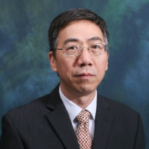
Qihao Weng
How Will AI Transform Urban Observing, Sensing, Imaging and Mapping?
Observing, sensing, imaging, and mapping urban environments are essential for effectively understanding and administering cities. Advances in computing and information technologies have led to a new paradigm based on artificial intelligence (AI) and Earth observation (EO) data from various platforms, such as satellite, aerial, and ground-based sensors, enabling more detailed and extensive sensing of urban environments. Street-level and nighttime light imagery as well as geotagged data capture urban forms and environments more directly from a human perspective and provide rich information from physical entities, socio-economic characteristics, and human perception. By leveraging multi-modal data, urban sensing, imaging, and mapping capabilities can be expanded, and previously obscure information (including landscape fabric, socio-economic activities, and human behaviours) can be rendered visible. This newfound efficacy enables human beings to undertake tasks previously deemed inconceivable. This paper provides an assessment and commentary on how AI reshapes the research paradigm of EO and how the EO and AI technologies integrate to offer advancements in many aspects of urban studies and applications. We conclude that AI will provide a deeper and more comprehensible interpretation of the fundamental principles underlying urban issues, a powerful tool for autonomous identification and solving of urban issues, and the creation of customized urban designs, which can align more closely with the goals of sustainable urban development established by governments and the United Nations. Nevertheless, open issues in GeoAI, especially integrating diverse geospatial big data, data security, and developing a general data processing and analysis framework, warrant further exploration.
Bio:
Qihao Weng, a Foreign Member of The Academy of Europe (Academia Europaea), and a Fellow of IEEE, AAAS, AAG, ASPRS and AAIA, is currently a Chair Professor at the Hong Kong Polytechnic University, and worked as the Director of the Center for Urban and Environmental Change and a Professor of Geography at Indiana State University, 2001-2021, and a Senior Fellow at the National Aeronautics and Space Administration from 2008 to 2009. He received his Ph.D. degree in geography from the University of Georgia in 1999. Weng is the Lead of GEO Global Urban Observation and Information Initiative, 2012-2022, and an Editor-in-Chief of ISPRS Journal of Photogrammetry and Remote Sensing. Additionally, he serves as the Series Editor of Taylor & Francis Series in Remote Sensing Applications, and Taylor & Francis Series in Imaging Science. Weng has been the Organizer and Program Committee Chair of the biennial IEEE/ISPRS/GEO sponsored International Workshop on Earth Observation and Remote Sensing Applications conference series since 2008, a National Director of American Society for Photogrammetry and Remote Sensing from 2007 to 2010, and a panellist of U.S. DOE’s Cool Roofs Roadmap and Strategy in 2010.
Renee Bartolo
Curious Creatures, Ghost Nets, Weeds, and Environmental Monitoring – Drones and AI and in remote Australia.
The remoteness of much of Australia presents many challenges for environmental management and protection, with 9.5% of Australia’s population distributed in the region classified as very remote. This presentation will provide an overview of the use of drones and AI to generate data to inform the conservation of threatened species, management of threats and in the support of environmental monitoring. Use cases with a focus on partnering and capability building with First Nations rangers, Edge AI and the value of real-time streaming of data will be featured.
Bio:
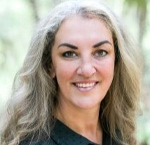
Dr Renee Bartolo currently leads drone operations and associated data analytics across the Australian Government’s Department of Climate Change, Energy, the Environment and Water with her team in the Office of the Chief Remote Pilot. The drone operations span from Antarctica to Christmas Island National Park and everywhere in between across a diverse range of applications. Renee and the team collaborate with many diverse groups in the Department to deliver operational science solutions and in developing capability to undertake cross-cutting science and innovation. She started the environment department’s drone operations in 2014 and has a background in remote sensing and landscape ecology and has worked in northern Australia for over 20 years. With the team’s current work in Parks Australia, they have been partnering with First Nations rangers to build capability in the use of drones on Country and culturally appropriate design of analytics tools, including AI.
Renee was a Fulbright Scholar in 2019, Graduate of the Australian Rural Leadership Program (2023) and is a Board Director for the Australian Association for Uncrewed Systems (AAUS). She is the Chair of the AAUS Diversity & Inclusion Working Group and is an advocate for inclusivity in the drone industry and in how people access data and analytics tools.
Hidenori Fujimura
Keynote Presentation
UN Smart Maps: An Open Initiative for Data Fusion
What if we can limitlessly import geospatial data on the web without having a web server, and in addition make them portable to anywhere? Or what if there are natural language interface to the web map resources so that we can combine different geospatial data in a nicely styled way? The United Nations Smart Maps Group is a participatory initiative to test new technologies like Interplanetary File System (IPFS) or Large Language Models (LLMs) for future geospatial data operations with a vision to keep web maps open for a better world. We present the status of our community of practice.
Bio:
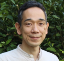
Hidenori is the Lead of the United Nations Smart Maps Group, the 7th Domain Working Group of the United Nations Open GIS Initiative, a partnership initiative for technology in peacekeeping of the United Nations Department of Operational Support. After receiving a Master’s degree in Mathematical Engineering and Information Physics from the University of Tokyo, Hidenori joined Geospatial Information Authority of Japan (GSI) in 2002. He participated several geospatial information development and application projects including Global Mapping, topographic map data quality control, address data development, and GSI Maps, the web map service of the authority. He introduced the Open Source methodology in his projects, and his Information Access Division has been awarded the Japan OSS Encouragement Award in 2015. He studied semi-automatic vector data verification in the Institute of Photogrammetry and Geoinformation at Leibniz University Hannover for one year in 2007. Hidenori served in the United Nations Geospatial Information Section for two years since 2017. He is passionate about promoting partnership through geospatial information. He started the United Nations Smart Maps Group with his colleagues and friends, with the vision to keep web maps open for a better world, a community to share practices and software for geospatial data sharing and interoperability. His current technical focus is on optimized and efficient geospatial data sharing especially in resource-limited environments making use of Interplanetary File System (IPFS) and cloud-native data formats like PMTiles. He is currently serving as a Senior Advisor for Geospatial Information, Urban and Regional Development Group, Infrastructure Management Department, Japan International Cooperation Agency (JICA).
