Remote Sensing Applications and Policies
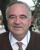
President | |
 | Ammatzia Peled
|
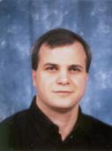
Secretary | |
 | Basheer Haj-Yehia
|
Terms of Reference
- General consideration for all aspects
- Sustainable development
- Ecological and environmental considerations
- Human Impact
- Supporting
- Decision-making by providing useful information to the user in near real time on operational basis.
- Forecasting
- Monitoring
- Solving problems and conflicts
- Topics
- Human settlements
- Hazards and disasters
- Land degradation and desertification
- Natural resources
- Geology, Geomorphology
- Water
- Arid lands
- Coastal zones and wetlands
- Ocean color and state
- Forests and Landscape biodiversity
- Agriculture and food production
- Atmosphere, climate and weather
- Regional correlated issues
- Policies and Treaties
- Collaboration with other Societies, organizations, International (regional) and national agencies and institutions
WORKING GROUPS of ISPRS COMMISSION VIII
WG VIII/1 - Human Settlements and Impact Analysis
Co-Chair
Carsten Juergens
WG VIII/1 Terms of Reference
- Application of improved interpretation and mapping methods for urban, sub-urban and peri-urban land-use in transition to help for better urban planning using aerial and high spatial resolution spaceborne data.
- Remote observations for monitoring urban environment and implementation of change detection algorithms for the study of urbanization structure and development processes.
- Use of RS & GIS for infrastructure development for rural and urban settlements.
- Study impact of urbanization, industrial growth and mega engineering structures on ecological and social environment, urban sustainability; tracking of disease vectors.
- Documentation, conservation and management of natural heritage and cultural landscapes in co-operation with UNESCO/ICOMOS/CIPA.
- Interface with IHDP
WG VIII/2 - Hazards, Disasters and Public Health
Co-Chair
Veerubhotla Bhanumurthy
WG VIII/2 Terms of Reference
- Generation of vulnerability and hazard zone maps for different type of disasters such as forest fire, cyclone, floods, drought, volcanoes, earthquake, land slides etc and Identification & assessment of potential risk zones.
- Integrate remotely sensed observation and communication strategies with enhanced predictive modelling capabilities for disaster detection, early warning, monitoring, damage assessment and Public Health in co-operation with CEOS, IGOS and other national, regional and international organizations and efforts.
- Development of disaster management plans for pre-, during and post disaster situations and enhance support for early warning systems and emergency events mitigation and management decision-making and.
- Foster the creation of more effective information systems to support disaster management activities; quick damage assessment; relief and rescue operations; and all environmentally-induced events that affect public health.
- Organize workshops and seminars for applying remote sensing data products to public health and other environmentally-induced events that may affect humankind
WG VIII/3 - Atmospheric, Climate and Weather Research
Co-Chair
Larry Di Girolamo
WG VIII/3 Terms of Reference
- Summarize an overview of existing and planned observational systems, with focus on cloud and aerosol properties.
- Identify gaps in existing observational capacity for retrieving cloud and aerosol properties.
- Contribute to the definition of a system of space, air and in-situ observations and to refinements of models in collaboration with the World Meteorological Organization (WMO).
- Identify multi-sensor techniques for retrieving cloud and aerosol properties.
- Identify the needs of numerical weather and climate models for remotely sensed cloud and aerosol properties.
- Implement, enhance and define methods and techniques for better extraction and processing the information content of satellite data for weather and climate research
WG VIII/4 - Management of Tropical Environments Research
Co-Chair
Pedro Walfir Souza Filho
Regional Coordinator Asia
Thongchai Charuppat
Secretary
Moïse Tsayem Demaze
WG VIII/4 Terms of Reference
- Identify tropical regions inherent problems related to remote sensing data acquisition and processing (cloudiness, lack of infrastructure...) and propose solutions.
- Review the potential and limitations of remote sensing and develop remote sensing applications for studying and monitoring tropical environments (mangrove, tropical wetlands, suburban areas...) and for specific issues found in tropical areas (epidemiology of vector-borne diseases, deforestation monitoring, topography through rain forest canopy...)
- Implement ground measurements to improve the understanding of sensor responses on tropical ecosystems
WG VIII/5 - Policies, Treaties and Data Access
Co-Chair
Irmgard Niemeyer
WG VIII/5 Terms of Reference
- Use of remotely sensed imagery by commercial satellites for the verification of treaties.
- Study the potential and limits of commercial satellite imagery with regard to transparency, data reliability and continuity of data availability.
- Analyzing present and future trends of national and international remote sensing programmes; remote sensing satellites and security; and policies.
- Coordinate ISPRS contributions to studies of applying remote sensing for international policies and treaties.
- Cooperate with other ISPRS working groups to support international cooperation and policy making for the implementation of optimum constellation of complementary satellites to meet Earth Observation requirements on a long term basis.
- Cooperate with IPAC and coordinate efforts to produce ISPRS white papers on space
WG VIII/6 - Coastal Management Ocean Colour and Ocean State Forecasting
Regional Coordinator
Mervyn J. Lynch
Regional Coordinator
Costas Armenakis
WG VIII/6 Terms of Reference
- Develop quantitative understanding of coastal processes, i.e., physical dynamics, delivery of land materials, particle dynamics, ecosystem structure, and carbon cycles.
- Study the impact of human activity on the coastal zones, with specific attention on wetlands, estuaries, and coral reefs.
- Monitor harmful algal blooms, including detection, understanding of factors which encourage formation. Development of control and mitigation measures.
- Further the conservation of marine ecosystems and bio-diversity, and study wild fisheries and other processes affecting stock recruitment and nursery habitats with development of indicators and monitoring of trends.
- development of analytical algorithms for retrieval of bio-geo-chemical parameters, data merging, and for the improvement of coastal products;
- Foster the development of procedures and protocols for Integrated Coastal Zone Management using remote sensing and GIS techniques. Further the work on resolving the vertical datum, linking land and chart datum, for predicting tidal cycles;
- Modelling inter-comparison activities, especially for coupled 3D hydrodynamic and biological models that are needed to study the ocean carbon cycle.
- Support an initiative to demonstrate the value of remotely sensed imagery for accurately predicting site-specific tidal cycles, and other issues, in collaboration with the International Hydrographic Organization (IHO), International Ocean Color Coordinating Group (IOCCG) and the Global Ocean Observation Experiment group
WG VIII/7 - Water Resources Security and Management
WG VIII/7 Terms of Reference
- Implementation of remotely sensed spectral data to monitor and investigate point and non-point discharge of pollutants into natural and man-made water transportation and storage system; for investigating sedimentation in reservoirs; and for any other contamination of water resources.
- Adoption of remotely sensed spectral data into GIS data bases for monitoring quality and quantity of water resources.
- Further the role of remote sensing and GIS data sources and spatial processing methods in sustainable development of water resources, water quality studies and planning continued availability.
- Integration of remote sensing and GIS for rainfall runoff modeling.
- Cooperate with ISPRS WG VIII/8, WG VIII/3 and other organizations on applications of remote sensing for snow and glaciers studies and the effect of climate change on water resources.
WG VIII/8 - Polar and Alpine Research
Regional Coordinator
Petri Pellikka
Regional Coordinator
Xiao Cheng
WG VIII/8 Terms of Reference
- Identifying and conducting remote sensing initiatives supporting the International Polar Year (2007-2008)
- Improving the retrieval of geophysical parameters relevant to the different elements of the cryosphere
- Developing strategies and algorithms for assimilating remotely sensed data in models of polar processes
- Developing long-term records and studying on-going changes in polar and other ice-covered regions. e.g. changes in terrestrial polar ecosystems; ice sheet and glacier mass balance; and sea-ice cover.
WG VIII/9 - Arid Lands, Land Degradation and Desertification
Co-Chair
Michael S. Ramsey
Co-Chair
Ravoori Nagaraja
WG VIII/9 Terms of Reference
- Integrate remote sensing data, in-situ and other measurements into a GIS domain to monitor and facilitate study and research of: Dry and arid lands; spatial and temporal environmental changes in the arid environment; and Processes of land degradation and desertification
- Conduct quantitative assessments of soil, rocks and organic matter from spectral measurements and contribute to the establishment of desertification indicators such as the SPAC (soil, plant, atmosphere, climate) and other concepts
- Implementation of remote sensing data and GIS methodologies in support of: Sustainable development in arid lands; Generating alternate scenarios to facilitate monitoring and management of arid and dry lands; and for land resources assessment for fighting land degradation and desertification
- Interact and cooperate with the International Geomorphological Association, The IGU Commission on Arid Lands (COMLAND) and other Interest groups and International bodies interested in arid lands, land degradation and desertification
- Generating alternate scenarios to facilitate monitoring and management of arid and dry lands; and for land resources assesment for fighting land degradation and desertification
WG VIII/10 - Precision Farming and Sustainable Food Production
Co-Chair
Giampiero Genovese
WG VIII/10 Terms of Reference
- Protocols and methodologies to efficiently and economically provide satellite and aircraft based inputs to monitor crop vigor, diseases, and stresses for making spatial and temporal agricultural decisions that affect the security, quality, and profitability agricultural production
- Integration of environmental parameters of agricultural production into GIS framework that allows for utilization of space-based inputs
- The use of active sensors to evaluate and monitor biological and physical processes, important in agricultural management
- Collaborate with industry, farming cooperatives, consultants and other end users to define real-time information needs that will enhance the decision making process and encourage further development of technologies
- Collaborate with WG VIII/11 to improve analytical techniques and with international precision agriculture groups to sponsor workshops
WG VIII/11 - Sustainable Forest and Landscape Management
WG VIII/11 Terms of Reference
- Further the automatization of forest information extraction from spectral imagery through improvement of procedures and models for inventorying and monitoring of forest resources, timber stock and biomass
- Study and promotion of forest biodiversity and sustainable management applications in respect to the convention on biodiversity with the amendments made at the Gothenburg and Johannesburg meetings
- Apply remote sensing techniques to support forest management tasks using forests as source for renewable energies
- Further development and implementation of algorithms to extract forest and other landscape information from airborne laser scanners and digital cameras data
- Join other ISPRS Working Groups in supporting actions to promote space segments focused on applications like forestry and agriculture
- Liaise with International Union of Forest Research Organizations (IUFRO), EARSeL (Forestry Group) EC working group on Future Needs of Research Infrastructures in Environmental Sciences and ICORSE
WG VIII/12 - Geological Mapping, Geomorphology and Geomorphometry
Chair
Benoît Deffontaines
WG VIII/12 Terms of Reference
- Further the implementation of multispectral and hyperspectral remote sensing and their integration into Spatial Information Systems for: Geological mapping; Establishment of Aged and facies geological and structural data bases; Advanced 3-Dimensional geological mapping
- Implementation of remote sensing data and spatial technology in support of studies such as: erosion processes (mountainous areas, tropical areas, arid and semi-arid soils); Littoral evaluation (temprate, tropical areas); Neotectonics; Dune stabilization and Motion (process, kineticks); and other geomorphological research
- Adoption of spectroscopy applications for mineralogical mapping
- Implementation of algorithms and methodologies to study and define bias-corrected parameters of remotely sensed observations (e.g. BRDF, physical and chemical crust, dust, structural and optical properties, etc.)
- Integrating and implementing remote sensing data into geomorphometry applications to visualize and represent: Digital terrain, surface and elevation models; Drainage networks; Hydrological network components; Neotectonics; Slips; Strikes; Plates; and other static and dynamic geological, topographical and geomorphological phenomena, objects and features.