
XXIV ISPRS Congress
2021 Digital Edition
Nice, France, 05.07.2021 - 09.07.2021
Organizer: Société Française de Photogrammétrie et de Télédétection / Nicolas Paparoditis
Type of Event: Congress
Multi Media Type: Remote
Session: IPS.MO.1.III
Interactive Poster Session - 5th July
Single Presentations
Semantic segmentation of burned areas in satellite images using a U-Net-based convolutional neural network
Corresponding paper: SEMANTIC SEGMENTATION OF BURNED AREAS IN SATELLITE IMAGES USING A U-NET-BASED CONVOLUTIONAL NEURAL NETWORK
Auhor(s): A. K. Brand and A. Manandhar
Volume: XLIII-B3-2021 / 2021
https://doi.org/10.5194/isprs-archives-XLIII-B3-2021-47-2021
Supervised classification methods for automatic damage detection caused by heavy rainfall using multitemporal high resolution optical imagery and auxiliary data
Corresponding paper: SUPERVISED CLASSIFICATION METHODS FOR AUTOMATIC DAMAGE DETECTION CAUSED BY HEAVY RAINFALL USING MULTITEMPORAL HIGH RESOLUTION OPTICAL IMAGERY AND AUXILIARY DATA
Auhor(s): A. Cerbelaud, L. Roupioz, G. Blanchet, P. Breil, and X. Briottet
Volume: XLIII-B3-2021 / 2021
https://doi.org/10.5194/isprs-archives-XLIII-B3-2021-693-2021

RESEARCH ON EVALUATION METHOD OF REAL ESTATE REGISTRATION DATA QUALITY
Corresponding paper: RESEARCH ON EVALUATION METHOD OF REAL ESTATE REGISTRATION DATA QUALITY
Auhor(s): C. X. Chen, H. Zhang, K. Jiang, H. T. Zhao, W. Xie, C. He, and S. Yin
Volume: XLIII-B3-2021 / 2021
https://doi.org/10.5194/isprs-archives-XLIII-B3-2021-749-2021
Geophysical and UAV-based observations over a flood defense structure : application to the Polder2C's experimental dike
Corresponding paper: GEOPHYSICAL AND UAV-BASED OBSERVATIONS OVER A FLOOD DEFENSE STRUCTURE: APPLICATION TO THE POLDER2C’S EXPERIMENTAL DIKE
Auhor(s): R. Antoine, C. Fauchard, V. Guilbert, B. Beaucamp, C. Ledun, C. Heinkele, L. Saussaye, S. Muylaert, W. Vancalster, D. Depreiter, and P. Sergent
Volume: XLIII-B3-2021 / 2021
https://doi.org/10.5194/isprs-archives-XLIII-B3-2021-237-2021
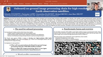
ONBOARD/ON-GROUND IMAGE PROCESSING CHAIN FOR HIGH-RESOLUTION EARTH OBSERVATION SATELLITES
Corresponding paper: ONBOARD/ON-GROUND IMAGE PROCESSING CHAIN FOR HIGH-RESOLUTION EARTH OBSERVATION SATELLITES
Auhor(s): E. Cucchetti, C. Latry, G. Blanchet, J.-M. Delvit, and M. Bruno
Volume: XLIII-B3-2021 / 2021
https://doi.org/10.5194/isprs-archives-XLIII-B3-2021-755-2021
UPSCALING AND VALIDATION OF RTK-DIRECT GEOREFERENCED UAV-BASED RGB IMAGE DATA WITH PLANET IMAGERY USING POLYGON GRIDS FOR PASTURE MONITORING
Corresponding paper: UPSCALING AND VALIDATION OF RTK-DIRECT GEOREFERENCED UAV-BASED RGB IMAGE DATA WITH PLANET IMAGERY USING POLYGON GRIDS FOR PASTURE MONITORING
Auhor(s): G. Bareth and C. Hütt
Volume: XLIII-B3-2021 / 2021
https://doi.org/10.5194/isprs-archives-XLIII-B3-2021-533-2021
Use of very high spatial resolution imagery for mapping wood energy potential from tropical managed forest stands, Reunion Island
Corresponding paper: USE OF VERY HIGH SPATIAL RESOLUTION IMAGERY FOR MAPPING WOOD ENERGY POTENTIAL FROM TROPICAL MANAGED FOREST STANDS, REUNION ISLAND
Auhor(s): H. Bley-Dalouman, F. Broust, J. Prevost, and A. Tran
Volume: XLIII-B3-2021 / 2021
https://doi.org/10.5194/isprs-archives-XLIII-B3-2021-189-2021
Landslide Detection in Central America using the Differential Bare Soil Index
Corresponding paper: LANDSLIDE DETECTION IN CENTRAL AMERICA USING THE DIFFERENTIAL BARE SOIL INDEX
Auhor(s): A. Ariza, N. A. Davila, H. Kemper, and G. Kemper
Volume: XLIII-B3-2021 / 2021
https://doi.org/10.5194/isprs-archives-XLIII-B3-2021-679-2021
Post-disaster assessment of mangrove forest recovery in Lawaan-Balangiga, Eastern Samar using NDVI Time Series Analysis
Corresponding paper: POST-DISASTER ASSESSMENT OF MANGROVE FOREST RECOVERY IN LAWAAN-BALANGIGA, EASTERN SAMAR USING NDVI TIME SERIES ANALYSIS
Auhor(s): K. E. Cabello, M. Q. Germentil, A. C. Blanco, E. G. Macatulad, and S. G. Salmo III
Volume: V-3-2021 / 2021
https://doi.org/10.5194/isprs-annals-V-3-2021-243-2021
Forest cover mapping and Pinus species classification using very high-resolution satelite images and random forest
Corresponding paper: FOREST COVER MAPPING AND PINUS SPECIES CLASSIFICATION USING VERY HIGH-RESOLUTION SATELLITE IMAGES AND RANDOM FOREST
Auhor(s): L. Alonso, J. Picos, and J. Armesto
Volume: V-3-2021 / 2021
https://doi.org/10.5194/isprs-annals-V-3-2021-203-2021
Surface urban heat island effects on bio-productive rural land covers surrounding a low density urban center
Corresponding paper: URBAN HEAT ISLAND FOOTPRINT EFFECTS ON BIO-PRODUCTIVE RURAL LAND COVERS SURROUNDING A LOW DENSITY URBAN CENTER
Auhor(s): M. Burnett and D. Chen
Volume: XLIII-B3-2021 / 2021
https://doi.org/10.5194/isprs-archives-XLIII-B3-2021-539-2021
Deep learning based roof type classification using very high resolution aerial imagery
Corresponding paper: DEEP LEARNING BASED ROOF TYPE CLASSIFICATION USING VERY HIGH RESOLUTION AERIAL IMAGERY
Auhor(s): M. Buyukdemircioglu, R. Can, and S. Kocaman
Volume: XLIII-B3-2021 / 2021
https://doi.org/10.5194/isprs-archives-XLIII-B3-2021-55-2021
Investigation of the changes of lake surface temperatures and areas: case study of burdur and egirdir lakes, turkey
Corresponding paper: INVESTIGATION OF THE CHANGES OF LAKE SURFACE TEMPERATURES AND AREAS: CASE STUDY OF BURDUR AND EGIRDIR LAKES, TURKEY
Auhor(s): N. Aslan and D. Koc-San
Volume: XLIII-B3-2021 / 2021
https://doi.org/10.5194/isprs-archives-XLIII-B3-2021-299-2021
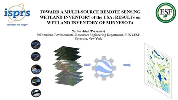
TOWARD A MULTI-SOURCE REMOTE SENSING WETLAND INVENTORY OF THE US: PRELIMINARY RESULTS ON WETLAND INVENTORY OF MINNESOTA
Corresponding paper: TOWARD A MULTI-SOURCE REMOTE SENSING WETLAND INVENTORY OF THE USA: PRELIMINARY RESULTS ON WETLAND INVENTORY OF MINNESOTA
Auhor(s): S. Adeli, B. Salehi, M. Mahidanpari, and L. J. Quackenbush
Volume: V-3-2021 / 2021
https://doi.org/10.5194/isprs-annals-V-3-2021-97-2021

Estimating contribution of water flow components to kameng river basin using hydrological modelling
Corresponding paper: ESTIMATING CONTRIBUTION OF WATER FLOW COMPONENTS TO KAMENG RIVER BASIN USING HYDROLOGICAL MODELLING
Auhor(s): S. Arora, A. V. Kulkarni, P. Ghosh, and S. K. Satheesh
Volume: XLIII-B3-2021 / 2021
https://doi.org/10.5194/isprs-archives-XLIII-B3-2021-431-2021
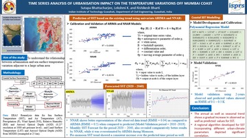
TIME SERIES ANALYSIS OF URBANIZATION IMPACT ON THE TEMPERATURE VARIATIONS OFF MUMBAI COAST
Corresponding paper: TIME SERIES ANALYSIS OF URBANISATION IMPACT ON THE TEMPERATURE VARIATIONS OFF MUMBAI COAST
Auhor(s): S. Bhattacharjee, K. Lekshmi, and R. Bharti
Volume: XLIII-B3-2021 / 2021
https://doi.org/10.5194/isprs-archives-XLIII-B3-2021-31-2021
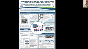
Rocky shoreline extraction using a Deep Learning model and Object-Based Image Analysis
Corresponding paper: ROCKY SHORELINE EXTRACTION USING A DEEP LEARNING MODEL AND OBJECT-BASED IMAGE ANALYSIS
Auhor(s): S. Bengoufa, S. Niculescu, M. K. Mihoubi, R. Belkessa, and K. Abbad
Volume: XLIII-B3-2021 / 2021
https://doi.org/10.5194/isprs-archives-XLIII-B3-2021-23-2021

Analysis on process quality control technology of geographical national conditions monitoring
Corresponding paper: ANALYSIS ON PROCESS QUALITY CONTROL TECHNOLOGY OF GEOGRAPHICAL NATIONAL CONDITIONS MONITORING
Auhor(s): S. Yin, H. T. Zhao, C. X. Chen, B. Q. Yao, and J. Zhou
Volume: XLIII-B3-2021 / 2021
https://doi.org/10.5194/isprs-archives-XLIII-B3-2021-805-2021
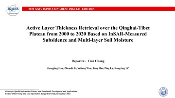
Active layer thickness retrieval over the Qinghai-Tibet plateau from 2000 to 2020 based on inSAR-measured subsidence and multi-layer soil moisture
Corresponding paper: ACTIVE LAYER THICKNESS RETRIEVAL OVER THE QINGHAI-TIBET PLATEAU FROM 2000 TO 2020 BASED ON INSAR-MEASURED SUBSIDENCE AND MULTI-LAYER SOIL MOISTURE
Auhor(s): T. Chang, J. Han, Z. Li, Y. Wen, T. Hao, P. Lu, and R. Li
Volume: XLIII-B3-2021 / 2021
https://doi.org/10.5194/isprs-archives-XLIII-B3-2021-437-2021