
XXIV ISPRS Congress
2021 Digital Edition
Nice, France, 05.07.2021 - 09.07.2021
Organizer: Société Française de Photogrammétrie et de Télédétection / Nicolas Paparoditis
Type of Event: Congress
Multi Media Type: Remote
Session: IPS.MO.2.III
Interactive Poster Session - 5th July
Single Presentations
Multi-temporal analysis of land use and vegetation cover in Sí£o Francisco do Sul and Itapoá, Santa Catarina State - Brazil: implications to groundwater contamination
Corresponding paper: MULTI-TEMPORAL ANALYSIS OF LAND USE AND VEGETATION COVER IN SÃO FRANCISCO DO SUL AND ITAPOÁ, SANTA CATARINA STATE - BRAZIL: IMPLICATIONS TO GROUNDWATER CONTAMINATION
Auhor(s): A. C. S. J. V. Ferreira and L. S. Osako
Volume: XLIII-B3-2021 / 2021
https://doi.org/10.5194/isprs-archives-XLIII-B3-2021-305-2021
Eelgrass Mapping with Sentinel-2 and UAV Data in Prince Edward Island (Canada)
Corresponding paper: EELGRASS MAPPING WITH SENTINEL-2 AND UAV DATA IN PRINCE EDWARD ISLAND (CANADA)
Auhor(s): E. Gallant, A. LaRocque, B. Leblon, and A. Douglas
Volume: V-3-2021 / 2021
https://doi.org/10.5194/isprs-annals-V-3-2021-125-2021

Machine learning techniques for knowledge extraction from satellite images: application to specific area types
Corresponding paper: MACHINE LEARNING TECHNIQUES FOR KNOWLEDGE EXTRACTION FROM SATELLITE IMAGES: APPLICATION TO SPECIFIC AREA TYPES
Auhor(s): C. O. Dumitru, G. Schwarz, and M. Datcu
Volume: XLIII-B3-2021 / 2021
https://doi.org/10.5194/isprs-archives-XLIII-B3-2021-455-2021
ZONATION OF SUBALPINE LAKES BASED ON REMOTELY SENSED WATER QUALITY PARAMETERS
Corresponding paper: ZONATION OF SUBALPINE LAKES BASED ON REMOTELY SENSED WATER QUALITY PARAMETERS
Auhor(s): C. Gerosa, M. Bresciani, G. Luciani, C. A. Biraghi, D. Carrion, M. Rogora, and M. A. Brovelli
Volume: XLIII-B3-2021 / 2021
https://doi.org/10.5194/isprs-archives-XLIII-B3-2021-551-2021
Monitoring and assessment of agri-urban land conversion using multi-sensor remote sensing and GIS techniques
Corresponding paper: MONITORING AND ASSESSMENT OF AGRI-URBAN LAND CONVERSION USING MULTI-SENSOR REMOTE SENSING AND GIS TECHNIQUES
Auhor(s): D. C. Fargas Jr., G. A. M. Narciso, and A. C. Blanco
Volume: V-3-2021 / 2021
https://doi.org/10.5194/isprs-annals-V-3-2021-117-2021
Field validation of ICESat-2 data along CHINARE route in East Antarctica
Corresponding paper: FIELD VALIDATION OF ICESAT-2 DATA ALONG CHINARE ROUTE IN EAST ANTARCTICA
Auhor(s): H. Cui, R. Li, H. Li, T. Hao, G. Qiao, Y. He, G. Hai, H. Xie, Y. Cheng, and B. Li
Volume: XLIII-B3-2021 / 2021
https://doi.org/10.5194/isprs-archives-XLIII-B3-2021-443-2021
Horizontal accuracy assessment of google earth data over typical regions of australia using worldview
Corresponding paper: HORIZONTAL ACCURACY ASSESSMENT OF GOOGLE EARTH DATA OVER
Auhor(s): J. Guo, H. J. Tu, H. Li, Y. Zhao, and J. Zhou
Volume: XLIII-B3-2021 / 2021
https://doi.org/10.5194/isprs-archives-XLIII-B3-2021-763-2021
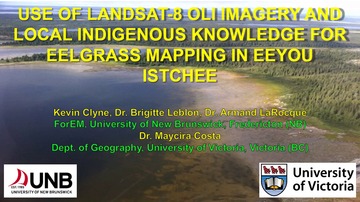
USE OF LANDSAT-8 OLI IMAGERY AND LOCAL INDIGENOUS KNOWLEDGE FOR EELGRASS MAPPING IN EEYOU ISTCHEE
Corresponding paper: USE OF LANDSAT-8 OLI IMAGERY AND LOCAL INDIGENOUS KNOWLEDGE FOR EELGRASS MAPPING IN EEYOU ISTCHEE
Auhor(s): K. Clyne, B. Leblon, A. LaRocque, M. Costa, M. Leblanc, E. Rabbitskin, and M. Dunn
Volume: V-3-2021 / 2021
https://doi.org/10.5194/isprs-annals-V-3-2021-15-2021
DEFORMATION MONITORING AT EUROPEAN SCALE: THE COPERNICUS GROUND MOTION SERVICE
Corresponding paper: DEFORMATION MONITORING AT EUROPEAN SCALE: THE COPERNICUS GROUND MOTION SERVICE
Auhor(s): M. Crosetto, L. Solari, J. Balasis-Levinsen, L. Bateson, N. Casagli, M. Frei, A. Oyen, D. A. Moldestad, and M. Mróz
Volume: XLIII-B3-2021 / 2021
https://doi.org/10.5194/isprs-archives-XLIII-B3-2021-141-2021

Concept to Analyze the Displacement Time Series of Individual Persistent Scatterers
Corresponding paper: CONCEPT TO ANALYZE THE DISPLACEMENT TIME SERIES OF INDIVIDUAL PERSISTENT SCATTERERS
Auhor(s): M. Evers, A. Thiele, H. Hammer, E. Cadario, K. Schulz, and S. Hinz
Volume: XLIII-B3-2021 / 2021
https://doi.org/10.5194/isprs-archives-XLIII-B3-2021-147-2021
Land subsidence hazard in Iran revealed by country-scale analysis of Sentinel-1 InSAR
Corresponding paper: LAND SUBSIDENCE HAZARD IN IRAN REVEALED BY COUNTRY-SCALE ANALYSIS OF SENTINEL-1 INSAR
Auhor(s): M. Haghshenas Haghighi and M. Motagh
Volume: XLIII-B3-2021 / 2021
https://doi.org/10.5194/isprs-archives-XLIII-B3-2021-155-2021
Automated Detectıon of Collapsed Buıldıngs wıth Use of Optıcal and SAR Images, Case Study: Izmir Earthquake On October 30th,2020
Corresponding paper: AUTOMATED DETECTION OF COLLAPSED BUILDINGS WITH USE OF OPTICAL AND SAR IMAGES, CASE STUDY: IZMIR EARTHQUAKE ON OCTOBER 30TH, 2020
Auhor(s): O. Ekmekcioglu and N. Demir
Volume: XLIII-B3-2021 / 2021
https://doi.org/10.5194/isprs-archives-XLIII-B3-2021-707-2021
Exploitation of spectral and temporal information for mapping plant species in a former industrial site
Corresponding paper: EXPLOITATION OF SPECTRAL AND TEMPORAL INFORMATION FOR MAPPING PLANT SPECIES IN A FORMER INDUSTRIAL SITE
Auhor(s): R. Gimenez, G. Lassalle, R. Hédacq, A. Elger, D. Dubucq, A. Credoz, C. Jennet, and S. Fabre
Volume: XLIII-B3-2021 / 2021
https://doi.org/10.5194/isprs-archives-XLIII-B3-2021-559-2021

Evaluation of the seasonal nighttime lst-air temperature discrepancies and their relation to local climate zones (lcz) in strasbourg
Corresponding paper: EVALUATION OF THE SEASONAL NIGHTTIME LST-AIR TEMPERATURE DISCREPANCIES AND THEIR RELATION TO LOCAL CLIMATE ZONES (LCZ) IN STRASBOURG
Auhor(s): S. Del Pozo, T. Landes, F. Nerry, P. Kastendeuch, G. Najjar, N. Philipps, and S. Lagüela
Volume: XLIII-B3-2021 / 2021
https://doi.org/10.5194/isprs-archives-XLIII-B3-2021-391-2021
A calculation method of ecosystem service value based on product of national geographic conditions monitoring in China
Corresponding paper: A CALCULATION METHOD OF ECOSYSTEM SERVICE VALUE BASED ON PRODUCT OF NATIONAL GEOGRAPHIC CONDITIONS MONITORING IN CHINA
Auhor(s): T. Cheng, X. Zheng, H. Chen, J. Liu, X. Gao, and W. Zhang
Volume: V-3-2021 / 2021
https://doi.org/10.5194/isprs-annals-V-3-2021-43-2021
Analysis on the area changes and its influencing factors of the lakes in Wuhan city based on Google Earth Engine
Corresponding paper: ANALYSIS ON THE AREA CHANGES AND ITS INFLUENCING FACTORS OF THE LAKES IN WUHAN CITY BASED ON GOOGLE EARTH ENGINE
Auhor(s): T. Gong, S. Xie, and H. Zhao
Volume: XLIII-B3-2021 / 2021
https://doi.org/10.5194/isprs-archives-XLIII-B3-2021-251-2021

Unmanned aerial vehicle derived 3D model evaluation based on ICESat-2 for ice surface micro-topography analysis in east antarctica
Corresponding paper: UNMANNED AERIAL VEHICLE DERIVED 3D MODEL EVALUATION BASED ON ICESAT-2 FOR ICE SURFACE MICRO-TOPOGRAPHY ANALYSIS IN EAST ANTARCTICA
Auhor(s): Y. He, G. Qiao, H. Li, X. Yuan, and Y. Li
Volume: XLIII-B3-2021 / 2021
https://doi.org/10.5194/isprs-archives-XLIII-B3-2021-463-2021