
XXIV ISPRS Congress
Nice, France, 06.06.2022 - 11.06.2022
Organizer: Société Française de Photogrammétrie et de Télédétection / Nicolas Paparoditis
Type of Event: Congress
Multi Media Type: Hybrid
Session: P_15
Poster Session 15 - 9th June - Invited Poster
Single Presentations

Detection of visible boundaries from uav imagery using u-net
Self-Supervised Deep Learning Methods For Updating The CORINE Land Cover Product
Calibrating A Lens With A Local Distortion Model

Millimetre Moon Measurements - 50 Plus Years Of Measuring To The Moon

Refinements And Introduction Of Photogrammetric Elements To An Experimental Trilateration Based Optical Metrology System
A Requirement Survey Of 3D Maps For Seamless Outdoor And Indoor Navigation
Probabilistic Biomass Estimation With Conditional Generative Adversarial Networks
Building Detection By Fine-Tuning Of Pre-Trained Deep Learning Models In Skysat Images
Potential Of Remote Sensing Data Fusion For Peatland Monitoring
A Single Satellite Image Is What You Need: Multi-Source Land-Cover Mapping Through Image And Map Fusion

Similarity Learning With A Convolutional Neural Network Applied To Dense Image Matching
TAIGA: A Novel Hyperspectral Dataset For Multitask Learning Of Continuous And Categorical Forest Variables
APPLICATION OF TEMPORAL CONVOLUTIONAL NEURAL NETWORK FOR THE CLASSIFICATION OF CROPS ON SENTINEL-2 TIME SERIES
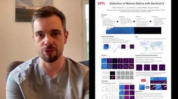
Detection of Marine Debris on with Sentinel-2
Earth Observation Training, Education, And Capacity Development Network
Optimising The Spatial Distribution Of Fire Stations In The Urban Sphere, A Case Study Of Greater Accra Metropolitan Area, Ghana
Simulation-Based Sensitivity Analysis Of Visual Localization In Challenging Environments
Online Segmentation Of LiDAR Sequences: Dataset And Algorithm
The Potential Of Employing Smartphones' Videos For The 3D Reconstruction Of Urban Trees

A 3D Data Dashboard For Supporting Smart Campus Digital Twin

The Fusion Of External And Internal 3D Photogrammetric Models As A Tool To Investigate The Ancient Human/Cave Interaction: The La Sassa Case Study
Initial investigation of active and low-cost hyperspectral imaging and analysis for subsurface sensing