
XXIV ISPRS Congress
Nice, France, 06.06.2022 - 11.06.2022
Organizer: Société Française de Photogrammétrie et de Télédétection / Nicolas Paparoditis
Type of Event: Congress
Multi Media Type: Hybrid
Session: P_16
Poster Session 16 - 9th June - TCIII-Remote Sensing
Single Presentations
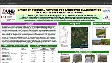
Classification Accuracy In A Salt Marsh Restoration Site Is Improved After Incorporating Textural Features
Corresponding paper: EFFECT OF TEXTURAL FEATURES FOR LANDCOVER CLASSIFICATION OF UAV MULTISPECTRAL IMAGERY OF A SALT MARSH RESTORATION SITE
Auhor(s): G. S. Norris, B. Leblon, A. LaRocque, M. A. Barbeau, and A. R. Hanson
Volume: XLIII-B3-2022 / 2022
https://doi.org/10.5194/isprs-archives-XLIII-B3-2022-951-2022
Updating Strategies For Distance Based Classification Model With Recursive Least Squares
Corresponding paper: UPDATING STRATEGIES FOR DISTANCE BASED CLASSIFICATION MODEL WITH RECURSIVE LEAST SQUARES
Auhor(s): A.-M. Raita-Hakola and I. Pölönen
Volume: V-3-2022 / 2022
https://doi.org/10.5194/isprs-annals-V-3-2022-163-2022
Evaluation Of Feature Selection Methods For Vegetation Mapping Using Multitemporal Sentinel Imagery
Corresponding paper: EVALUATION OF FEATURE SELECTION METHODS FOR VEGETATION MAPPING USING MULTITEMPORAL SENTINEL IMAGERY
Auhor(s): D. Dobrinić, M. Gašparović, and D. Medak
Volume: XLIII-B3-2022 / 2022
https://doi.org/10.5194/isprs-archives-XLIII-B3-2022-485-2022
BRDF Laboratory Measurements Using A Camera-Aided Spectroradiometer
Corresponding paper: BRDF LABORATORY MEASUREMENTS USING A CAMERA-AIDED SPECTRORADIOMETER
Auhor(s): E. Roitberg, I. Malgeac, S. Weil-Zattelman, and F. Kizel
Volume: XLIII-B3-2022 / 2022
https://doi.org/10.5194/isprs-archives-XLIII-B3-2022-417-2022
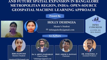
Decadal Transformation Of Land Use - Land Cover And Future Spatial Expansion In Bangalore Metropolitan Region, India: Open-Source Geospatial Machine Learning Approach
Corresponding paper: DECADAL TRANSFORMATION OF LAND USE - LAND COVER AND FUTURE SPATIAL EXPANSION IN BANGALORE METROPOLITAN REGION, INDIA: OPEN-SOURCE GEOSPATIAL MACHINE LEARNING APPROACH
Auhor(s): H. Dehingia, R. R. Das, S. Abdul Rahaman, P. Surendra, and A. D. Hanjagi
Volume: XLIII-B3-2022 / 2022
https://doi.org/10.5194/isprs-archives-XLIII-B3-2022-589-2022
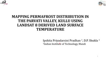
Mapping Permafrost Distribution In The Parvati Valley, Kullu Using Landsat 8 Derived Land Surface Temperature
Corresponding paper: MAPPING PERMAFROST DISTRIBUTION IN THE PARVATI VALLEY, KULLU USING LANDSAT 8 DERIVED LAND SURFACE TEMPERATURE
Auhor(s): I. P. Pradhan and D. P. Shukla
Volume: XLIII-B3-2022 / 2022
https://doi.org/10.5194/isprs-archives-XLIII-B3-2022-779-2022
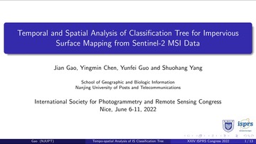
Temporal And Spatial Analysis Of Classification Tree For Impervious Surface Mapping From Sentinel-2 MSI Data
Corresponding paper: TEMPORAL AND SPATIAL ANALYSIS OF CLASSIFICATION TREE FOR IMPERVIOUS SURFACE MAPPING FROM SENTINEL-2 MSI DATA
Auhor(s): J. Gao, Y. Chen, Y. Guo, and S. Yang
Volume: XLIII-B3-2022 / 2022
https://doi.org/10.5194/isprs-archives-XLIII-B3-2022-85-2022

Multispectral and Hyperspectral Geospatial Analysis to Characterize Urban Seismic Vulnerability
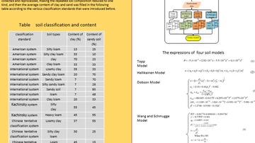
The Study On The Semi-Empirical Soil Models For Improving The GNSS-R SM Retrieval
Corresponding paper: THE STUDY ON THE SEMI-EMPIRICAL SOIL MODELS FOR IMPROVING THE GNSS-R SM RETRIEVAL
Auhor(s): Y. Jia, H. Chen, K. Wu, J. Zou, and Q. Liu
Volume: XLIII-B3-2022 / 2022
https://doi.org/10.5194/isprs-archives-XLIII-B3-2022-249-2022
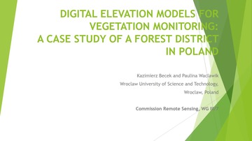
Digital Elevation Models For Vegetation Monitoring: A Case Study Of A Forest District In Poland
Corresponding paper: DIGITAL ELEVATION MODELS FOR VEGETATION MONITORING: A CASE STUDY OF A FOREST DISTRICT IN POLAND
Auhor(s): K. Becek and P. Waclawik
Volume: XLIII-B3-2022 / 2022
https://doi.org/10.5194/isprs-archives-XLIII-B3-2022-577-2022
Analysis Of The Products Of The Copernicus Ground Motion Service
Corresponding paper: ANALYSIS OF THE PRODUCTS OF THE COPERNICUS GROUND MOTION SERVICE
Auhor(s): M. Crosetto, L. Solari, A. Barra, O. Monserrat, M. Cuevas-González, R. Palamà, Y. Wassie, S. Shahbazi, S. M. Mirmazloumi, B. Crippa, and M. Mróz
Volume: XLIII-B3-2022 / 2022
https://doi.org/10.5194/isprs-archives-XLIII-B3-2022-257-2022
Few Shot Crop Mapping Using Transformers And Transfer Learning With Sentinel-2 Time Series: Case Of Kairouan Tunisia
Corresponding paper: FEW SHOT CROP MAPPING USING TRANSFORMERS AND TRANSFER LEARNING WITH SENTINEL-2 TIME SERIES: CASE OF KAIROUAN TUNISIA
Auhor(s): M. K. Keraani, K. Mansour, B. Khlaifia, and N. Chehata
Volume: XLIII-B3-2022 / 2022
https://doi.org/10.5194/isprs-archives-XLIII-B3-2022-899-2022
Interferometric SAR Deformation Monitoring Using Ascending And Descending Passive Reflectors
Corresponding paper: INTERFEROMETRIC SAR DEFORMATION MONITORING USING PASSIVE REFLECTORS AND ASCENDING AND DESCENDING PASSES
Auhor(s): N. Kotulak, M. Mleczko, M. Crosetto, R. Palamà, and M. Mróz
Volume: XLIII-B3-2022 / 2022
https://doi.org/10.5194/isprs-archives-XLIII-B3-2022-285-2022
Drone Remote Sensing For The Controlled Capture Of Sika Deer (Cervus Nippon): Case Study In Village Of Yamanakako
Corresponding paper: DRONE REMOTE SENSING FOR THE CONTROLLED CAPTURE OF SIKA DEER (CERVUS NIPPON): CASE STUDY IN VILLAGE OF YAMANAKAKO
Auhor(s): N. Miura, H. Saito, and T. Hada
Volume: XLIII-B3-2022 / 2022
https://doi.org/10.5194/isprs-archives-XLIII-B3-2022-927-2022
Google Earth Engine Based Temporal Analysis Of Indices Used For Forest Fire Study In Mizoram, India
Corresponding paper: GOOGLE EARTH ENGINE BASED TEMPORAL ANALYSIS OF INDICES USED FOR FOREST FIRE STUDY IN MIZORAM, INDIA
Auhor(s): P. Gupta and D. P. Shukla
Volume: XLIII-B3-2022 / 2022
https://doi.org/10.5194/isprs-archives-XLIII-B3-2022-493-2022

Transfer Learning With Limited Samples For Same Source Hyperspectral Remote Sensing Images Classification
The Importance Of Seasonal Textural Features For Object-Based Classification Of Wetlands: New York State Case Study
Corresponding paper: THE IMPORTANCE OF SEASONAL TEXTURAL FEATURES FOR OBJECT-BASED CLASSIFICATION OF WETLANDS: NEW YORK STATE CASE STUDY
Auhor(s): S. Adeli, L. J. Quackenbush, B. Salehi, and M. Mahdianpari
Volume: XLIII-B3-2022 / 2022
https://doi.org/10.5194/isprs-archives-XLIII-B3-2022-471-2022
Mapping Vegetation And Measuring The Performance Of Machine Learning Algorithm In Lulc Classification In The Large Area Using Sentinel-2 And Landsat-8 Data: Dehradun As A Test Case
Corresponding paper: MAPPING VEGETATION AND MEASURING THE PERFORMANCE OF MACHINE LEARNING ALGORITHM IN LULC CLASSIFICATION IN THE LARGE AREA USING SENTINEL-2 AND LANDSAT-8 DATASETS OF DEHRADUN AS A TEST CASE
Auhor(s): A. Srivastava, S. Bharadwaj, R. Dubey, V. B. Sharma, and S. Biswas
Volume: XLIII-B3-2022 / 2022
https://doi.org/10.5194/isprs-archives-XLIII-B3-2022-529-2022
Spectral-Spatial Multiscale Residual Network For Hyperspectral Image Classification
Corresponding paper: SPECTRAL-SPATIAL MULTISCALE RESIDUAL NETWORK FOR HYPERSPECTRAL IMAGE CLASSIFICATION
Auhor(s): S. He, H. Jing, and H. Xue
Volume: XLIII-B3-2022 / 2022
https://doi.org/10.5194/isprs-archives-XLIII-B3-2022-389-2022
Evaluation of Zy1-02d Hyperspectral Satellite Surface Reflectance Products
Corresponding paper: EVALUATION OF ZY1-02D HYPERSPECTRAL SATELLITE SURFACE REFLECTANCE PRODUCTS
Auhor(s): S. Liu, L. Guo, B. Xue, X. Wang, H. Zhang, and H. Zhang
Volume: XLIII-B3-2022 / 2022
https://doi.org/10.5194/isprs-archives-XLIII-B3-2022-411-2022
Rapid Mapping And Assessment Of Damages Due To Typhoon Rai Using Sentinel-1 Synthetic Aperture Radar Data
Corresponding paper: RAPID MAPPING AND ASSESSMENT OF DAMAGES DUE TO TYPHOON RAI USING SENTINEL-1 SYNTHETIC APERTURE RADAR DATA
Auhor(s): S. F. Meneses III and A. C. Blanco
Volume: XLIII-B3-2022 / 2022
https://doi.org/10.5194/isprs-archives-XLIII-B3-2022-1139-2022

Quality Assessment And Analysis For The One Status Map (Core Area) Of Housing Thematic Data
Corresponding paper: QUALITY ASSESSMENT AND ANALYSIS FOR THE ONE STATUS MAP (CORE AREA) OF HOUSING THEMATIC DATA
Auhor(s): S. Yin, H. Li, C. Chen, J. Zhou, and B. Yao
Volume: XLIII-B3-2022 / 2022
https://doi.org/10.5194/isprs-archives-XLIII-B3-2022-1255-2022
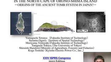
Survey Of Ancient Tomb-Like Topography In The North Cape Of Orono-Shima Island
Corresponding paper: SURVEY OF ANCIENT TOMB-LIKE TOPOGRAPHY IN THE NORTH CAPE OF ORONO-SHIMA ISLAND -ORIGINS OF THE ANCIENT TOMB SYSTEM IN JAPAN?-
Auhor(s): T. Yamaguchi, S. Ogawa, T. Moriyama, Y. Taniguchi, H. Shiraishi, and T. Koga
Volume: XLIII-B3-2022 / 2022
https://doi.org/10.5194/isprs-archives-XLIII-B3-2022-229-2022
Application Of SAR Time-Series And Deep Learning For Estimating Landslide Occurrence Time
Corresponding paper: APPLICATION OF SAR TIME-SERIES AND DEEP LEARNING FOR ESTIMATING LANDSLIDE OCCURRENCE TIME
Auhor(s): W. Wang, M. Motagh, S. Plank, A. Orynbaikyzy, and S. Roessner
Volume: XLIII-B3-2022 / 2022
https://doi.org/10.5194/isprs-archives-XLIII-B3-2022-1181-2022
Multiview Analysis Of Mixed Pixels At Fractional Abundance Vs. Reflectance Domains For Understanding Their Sub-Pixel Topographic Structure
Corresponding paper: MULTIVIEW ANALYSIS OF MIXED PIXELS IN THE FRACTION AND REFLECTANCE DOMAINS FOR UNDERSTANDING SUB-PIXEL TOPOGRAPHIC STRUCTURE
Auhor(s): Y. Vidro and F. Kizel
Volume: XLIII-B3-2022 / 2022
https://doi.org/10.5194/isprs-archives-XLIII-B3-2022-443-2022
Interpreting Changes In Albedo And Mass Balance At White Glacier, Canadian Arctic Archipelago
Corresponding paper: INTERPRETING CHANGES IN ALBEDO AND MASS BALANCE AT WHITE GLACIER, CANADIAN ARCTIC ARCHIPELAGO
Auhor(s): Y. Ye and Y. Tian
Volume: XLIII-B3-2022 / 2022
https://doi.org/10.5194/isprs-archives-XLIII-B3-2022-793-2022