
XXIV ISPRS Congress
Nice, France, 06.06.2022 - 11.06.2022
Organizer: Société Française de Photogrammétrie et de Télédétection / Nicolas Paparoditis
Type of Event: Congress
Multi Media Type: Hybrid
Session: P_22
Poster Session 22 - 10th June - TCII-Photogrammetry
Single Presentations
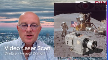
A Combination Of Advanced Photogrammetry And Laser Triangulation Techniques (Video Laser Scan T) For The Free-Flying 3D Inspection Of Subsea Assets
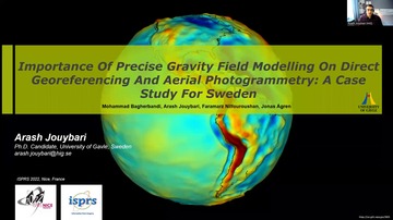
Importance Of Precise Gravity Field Modeling On Direct Georeferencing And Aerial Photogrammetry: A Case Study For Sweden
Corresponding paper: IMPORTANCE OF PRECISE GRAVITY FIELD MODELING IN DIRECT GEOREFERENCING AND AERIAL PHOTOGRAMMETRY: A CASE STUDY FOR SWEDEN
Auhor(s): M. Bagherbandi, A. Jouybari, F. Nilfouroushan, and J. Ågren
Volume: XLIII-B2-2022 / 2022
https://doi.org/10.5194/isprs-archives-XLIII-B2-2022-15-2022
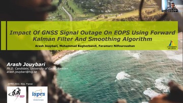
Impact Of GNSS Signal Outage On EOPS Using Forward Kalman Filter And Smoothing Algorithm
Corresponding paper: IMPACT OF GNSS SIGNAL OUTAGE ON EOPS USING FORWARD KALMAN FILTER AND SMOOTHING ALGORITHM
Auhor(s): A. Jouybari, M. Bagherbandi, and F. Nilfouroushan
Volume: XLIII-B2-2022 / 2022
https://doi.org/10.5194/isprs-archives-XLIII-B2-2022-59-2022
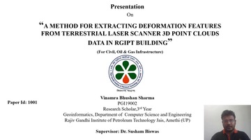
A Method For Extracting Deformation Features From Terrestrial Laser Scanner 3D Point Clouds Data In RGIPT Building
Corresponding paper: A METHOD FOR EXTRACTING DEFORMATION FEATURES FROM TERRESTRIAL LASER SCANNER 3D POINT CLOUDS DATA IN RGIPT BUILDING
Auhor(s): V. B. Sharma, R. Dubey, A. Bhatt, S. Bharadwaj, A. Srivastava, and S. Biswas
Volume: XLIII-B2-2022 / 2022
https://doi.org/10.5194/isprs-archives-XLIII-B2-2022-267-2022

Point Cloud Acquisition Techniques By Using Scanning LiDAR For 3D Modelling And Mobile Measurement
Corresponding paper: POINT CLOUD ACQUISITION TECHNIQUES BY USING SCANNING LIDAR FOR 3D MODELLING AND MOBILE MEASUREMENT
Auhor(s): C. Altuntas
Volume: XLIII-B2-2022 / 2022
https://doi.org/10.5194/isprs-archives-XLIII-B2-2022-967-2022

Evaluation Of Azure Kinect Derived Point Clouds To Determine The Presence Of Microhabitats On Single Trees Based On The Swiss Standard Parameters
Corresponding paper: EVALUATION OF AZURE KINECT DERIVED POINT CLOUDS TO DETERMINE THE PRESENCE OF MICROHABITATS ON SINGLE TREES BASED ON THE SWISS STANDARD PARAMETERS
Auhor(s): C. R. Fol, A. Murtiyoso, and V. C. Griess
Volume: XLIII-B2-2022 / 2022
https://doi.org/10.5194/isprs-archives-XLIII-B2-2022-989-2022
High Precision Automatic Extraction Of Cultural Relic Diseases Based On Improved Slic And Ap Clustering
Corresponding paper: HIGH PRECISION AUTOMATIC EXTRACTION OF CULTURAL RELIC DISEASES BASED ON IMPROVED SLIC AND AP CLUSTERING
Auhor(s): C. Hu, X. Huang, G. Xia, Y. Wang, X. Liu, and X. Ma
Volume: XLIII-B2-2022 / 2022
https://doi.org/10.5194/isprs-archives-XLIII-B2-2022-801-2022
Analysis Of Ground Sampling Distance Of Convergent Images For Keypoints Detection For Close-Range Photogrammetry
Corresponding paper: ANALYSIS OF GROUND SAMPLING DISTANCE OF CONVERGENT IMAGES FOR KEYPOINTS DETECTION FOR CLOSE-RANGE PHOTOGRAMMETRY
Auhor(s): C. S. Utla, A. Dashora, L. Chandrasekhar Reddy, and A. V. Kulkarni
Volume: XLIII-B2-2022 / 2022
https://doi.org/10.5194/isprs-archives-XLIII-B2-2022-93-2022
Integration Of UAV-LiDAR And UAV-Photogrammetry For Infrastructure Monitoring And Bridge Assessment
Corresponding paper: INTEGRATION OF UAV-LIDAR AND UAV-PHOTOGRAMMETRY FOR INFRASTRUCTURE MONITORING AND BRIDGE ASSESSMENT
Auhor(s): F. Gaspari, F. Ioli, F. Barbieri, E. Belcore, and L. Pinto
Volume: XLIII-B2-2022 / 2022
https://doi.org/10.5194/isprs-archives-XLIII-B2-2022-995-2022
Accurate Calculation Of Tree Stem Traits In Forest By Local Correction Of Point Cloud Registration
Corresponding paper: ACCURATE CALCULATION OF TREE STEM TRAITS IN FORESTS BY LOCAL CORRECTION OF POINT CLOUD REGISTRATION
Auhor(s): H. Kawasaki and H. Masuda
Volume: XLIII-B2-2022 / 2022
https://doi.org/10.5194/isprs-archives-XLIII-B2-2022-209-2022
Soil Erosion Calculation Using Aerial Images Based DTM In A Cross Border Vinery Region
Corresponding paper: SOIL EROSION CALCULATION USING AERIAL IMAGES BASED DTM IN A CROSS BORDER VINERY REGION
Auhor(s): H. Kemper, G. Kemper, and T. Klaumuenzner
Volume: XLIII-B2-2022 / 2022
https://doi.org/10.5194/isprs-archives-XLIII-B2-2022-1041-2022
Uncertainty Modeling For Point-Cloud Based Automatic Indoor Scene Reconstruction By Strict Error Propagation Analysis.
Corresponding paper: UNCERTAINTY MODELING FOR POINT CLOUD-BASED AUTOMATIC INDOOR SCENE RECONSTRUCTION BY STRICT ERROR PROPAGATION ANALYSIS
Auhor(s): M. Jarzabek-Rychard and H.-G. Maas
Volume: XLIII-B2-2022 / 2022
https://doi.org/10.5194/isprs-archives-XLIII-B2-2022-395-2022

Trimming And Road Ortho Imaging For Night Images By Onboard High Sensitivity Consumer Grade Digital Cameras
Corresponding paper: TRIMMING AND ROAD ORTHO IMAGING FOR NIGHT IMAGES BY ONBOARD HIGH SENSITIVITY CONSUMER GRADE DIGITAL CAMERAS
Auhor(s): J. Sugimori and H. Chikatsu
Volume: XLIII-B2-2022 / 2022
https://doi.org/10.5194/isprs-archives-XLIII-B2-2022-85-2022
Circular Target Observation Of Point Cloud Using Laser Reflection Intensity By An Unmanned Aerial Vehicle Equipped With A Laser Scanner
Corresponding paper: CIRCULAR TARGET OBSERVATION OF POINT CLOUD USING LASER REFLECTION INTENSITY BY AN UNMANNED AERIAL VEHICLE EQUIPPED WITH A LASER SCANNER
Auhor(s): K. Nakano
Volume: XLIII-B2-2022 / 2022
https://doi.org/10.5194/isprs-archives-XLIII-B2-2022-245-2022
Portable Multi-Camera System: From Fast Tunnel Mapping To Semi-Automatic Space Decomposition And Cross-Section Extraction
Corresponding paper: PORTABLE MULTI-CAMERA SYSTEM: FROM FAST TUNNEL MAPPING TO SEMI-AUTOMATIC SPACE DECOMPOSITION AND CROSS-SECTION EXTRACTION
Auhor(s): L. Perfetti, A. Elalailyi, and F. Fassi
Volume: XLIII-B2-2022 / 2022
https://doi.org/10.5194/isprs-archives-XLIII-B2-2022-259-2022

Active Reinforcement Learning For The Semantic Segmentation Of Images Captured By Mobile Sensors
Corresponding paper: ACTIVE REINFORCEMENT LEARNING FOR THE SEMANTIC SEGMENTATION OF IMAGES CAPTURED BY MOBILE SENSORS
Auhor(s): M. Jodeiri Rad and C. Armenakis
Volume: XLIII-B2-2022 / 2022
https://doi.org/10.5194/isprs-archives-XLIII-B2-2022-593-2022
3D Modelling Of Tram Tunnel From TLS Point Clouds For Technical Documentation And Extraction Of Charasteritic Lines
Corresponding paper: 3D MODELLING OF TRAM TUNNEL FROM TLS POINT CLOUDS FOR TECHNICAL DOCUMENTATION AND EXTRACTION OF CHARACTERISTIC LINES
Auhor(s): M. Koehl, D. Schueller, O. Barrot, and S. Guillemin
Volume: XLIII-B2-2022 / 2022
https://doi.org/10.5194/isprs-archives-XLIII-B2-2022-1047-2022

Landslide Evolution Pattern Revealed By Multi-Temporal DSMs Obtained From Historical Aerial Images
Corresponding paper: LANDSLIDE EVOLUTION PATTERN REVEALED BY MULTI-TEMPORAL DSMS OBTAINED FROM HISTORICAL AERIAL IMAGES
Auhor(s): M. Santangelo, L. Zhang, E. Rupnik, M. P. Deseilligny, and M. Cardinali
Volume: XLIII-B2-2022 / 2022
https://doi.org/10.5194/isprs-archives-XLIII-B2-2022-1085-2022
Deep Learning-Based Road Segmentation Of 3D Point Clouds For Assisting Road Alignment Parameterization
Corresponding paper: DEEP LEARNING-BASED ROAD SEGMENTATION OF 3D POINT CLOUDS FOR ASSISTING ROAD ALIGNMENT PARAMETERIZATION
Auhor(s): M. Soilán, H. Tardy, and D. González-Aguilera
Volume: XLIII-B2-2022 / 2022
https://doi.org/10.5194/isprs-archives-XLIII-B2-2022-283-2022
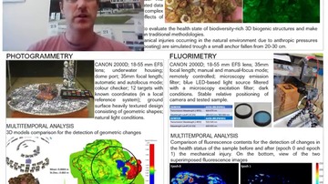
Photogrammetric And Fluorescence Solutions For Monitoring Of Habitat Forming Organisms
Corresponding paper: PHOTOGRAMMETRIC AND FLUORESCENCE SOLUTIONS FOR MONITORING OF HABITAT FORMING ORGANISMS
Auhor(s): P. Rossi, S. Righi, L. Parente, C. Castagnetti, S. Cattini, G. Di Loro, E. Falvo, F. Grassi, F. Mancini, L. Rovati, R. Simonini, and A. Capra
Volume: XLIII-B2-2022 / 2022
https://doi.org/10.5194/isprs-archives-XLIII-B2-2022-877-2022
Post-Eruption Lava Dome Emplacement Measured By UAV Photogrammetry: An Investigation One Year After The 2017-2019 Mt. Agung Eruptions
Corresponding paper: POST-ERUPTION LAVA DOME EMPLACEMENT MEASURED BY UAV PHOTOGRAMMETRY: AN INVESTIGATION ONE YEAR AFTER THE 2017–2019 MT. AGUNG ERUPTIONS
Auhor(s): R. Andaru, J.-Y. Rau, D. K. Syahbana, and H. D. Purnamasari
Volume: XLIII-B2-2022 / 2022
https://doi.org/10.5194/isprs-archives-XLIII-B2-2022-517-2022

Integration Of Depth Maps From Arcore To Process Point Clouds In Real Time On A Smartphone
Corresponding paper: INTEGRATION OF DEPTH MAPS FROM ARCORE TO PROCESS POINT CLOUDS IN REAL TIME ON A SMARTPHONE
Auhor(s): R. Haenel, Q. Semler, E. Semin, P. Grussenmeyer, and E. Alby
Volume: XLIII-B2-2022 / 2022
https://doi.org/10.5194/isprs-archives-XLIII-B2-2022-201-2022
Automated Generation Of High-Quality 3D Point Clouds Of Antlers Using Low-Cost Range Cameras
Corresponding paper: AUTOMATED GENERATION OF HIGH-QUALITY 3D POINT CLOUDS OF ANTLERS USING LOW-COST RANGE CAMERAS
Auhor(s): S. Cheng, D. D. Lichti, and J. Matyas
Volume: XLIII-B2-2022 / 2022
https://doi.org/10.5194/isprs-archives-XLIII-B2-2022-531-2022

Evaluation Of Self-Supervised Learning Approaches For Semantic Segmentation Of Industrial Burner Flames
Corresponding paper: EVALUATION OF SELF-SUPERVISED LEARNING APPROACHES FOR SEMANTIC SEGMENTATION OF INDUSTRIAL BURNER FLAMES
Auhor(s): S. Landgraf, L. Kühnlein, M. Hillemann, M. Hoyer, S. Keller, and M. Ulrich
Volume: XLIII-B2-2022 / 2022
https://doi.org/10.5194/isprs-archives-XLIII-B2-2022-601-2022

Application Of RGB-D SLAM In 3D Tunnel Reconstruction Based On Superpixel Aided Feature Tracking
Corresponding paper: APPLICATION OF RGB-D SLAM IN 3D TUNNEL RECONSTRUCTION BASED ON SUPERPIXEL AIDED FEATURE TRACKING
Auhor(s): R. Zhang, S. Shi, X. Yi, and M. Jing
Volume: XLIII-B2-2022 / 2022
https://doi.org/10.5194/isprs-archives-XLIII-B2-2022-559-2022

Very High-Resolution 3D Surveying And Modelling Experiences In Civil Engineering Applications
Corresponding paper: VERY HIGH-RESOLUTION 3D SURVEYING AND MODELLING EXPERIENCES IN CIVIL ENGINEERING APPLICATIONS
Auhor(s): V. A. Girelli, M. A. Tini, and G. Bitelli
Volume: XLIII-B2-2022 / 2022
https://doi.org/10.5194/isprs-archives-XLIII-B2-2022-673-2022
3D Change Detection Of Point Cloud Based On Density Adaptive Local Euclidean Distance
Corresponding paper: 3D CHANGE DETECTION OF POINT CLOUDS BASED ON DENSITY ADAPTIVE LOCAL EUCLIDEAN DISTANCE
Auhor(s): J. X. Chai, Y. S. Zhang, Z. Yang, and J. Wu
Volume: XLIII-B2-2022 / 2022
https://doi.org/10.5194/isprs-archives-XLIII-B2-2022-523-2022

An Efficient Hierarchical Image Retrieval Method For Large Set Of Images Using Learning-Based Global And Local Image Features
Corresponding paper: AN EFFICIENT HIERARCHICAL IMAGE RETRIEVAL METHOD FOR LARGE SET OF IMAGES USING LEARNING-BASED GLOBAL AND LOCAL IMAGE FEATURES
Auhor(s): Z. Wang, Z. Zhan, G. Zhou, and X. Wang
Volume: XLIII-B2-2022 / 2022
https://doi.org/10.5194/isprs-archives-XLIII-B2-2022-649-2022