
XXIV ISPRS Congress
Nice, France, 06.06.2022 - 11.06.2022
Organizer: Société Française de Photogrammétrie et de Télédétection / Nicolas Paparoditis
Type of Event: Congress
Multi Media Type: Hybrid
Session: P_01
Poster Session 1 - 7th June - TCIII-Remote Sensing
Single Presentations
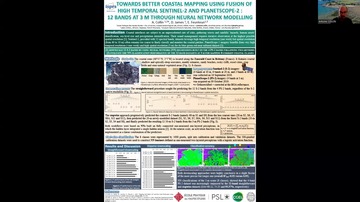
Towards Better Coastal Mapping Using Fusion Of High Temporal Sentinel-2 And Planetscope-2 Imageries : 12 Bands At 3m Through Neural Network Modelling
Corresponding paper: TOWARDS BETTER COASTAL MAPPING USING FUSION OF HIGH TEMPORAL SENTINEL-2 AND PLANETSCOPE-2 IMAGERIES: 12 BANDS AT 3 M THROUGH NEURAL NETWORK MODELLING
Auhor(s): A. Collin, D. James, and E. Feunteun
Volume: XLIII-B3-2022 / 2022
https://doi.org/10.5194/isprs-archives-XLIII-B3-2022-479-2022
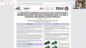
A Comparative Assessment Of Land Use-Land Cover Dynamics Between Bangladesh And Indian Sundarbans From 1975-2020: A Geospatial And Statistical-Based Approach
Corresponding paper: A COMPARATIVE ASSESSMENT OF LAND USE-LAND COVER DYNAMICS BETWEEN BANGLADESH AND INDIAN SUNDARBANS FROM 1975–2020: A GEOSPATIAL AND STATISTICAL-BASED APPROACH
Auhor(s): A. H. Kanan and F. Pirotti
Volume: XLIII-B3-2022 / 2022
https://doi.org/10.5194/isprs-archives-XLIII-B3-2022-625-2022
Deformation Extraction And Analysis Of Coseismic Deformation Field Based On D-InSAR Technology
Corresponding paper: DEFORMATION EXTRACTION AND ANALYSIS OF COSEISMIC DEFORMATION FIELD BASED ON D-INSAR TECHNOLOGY
Auhor(s): A. Shi, L. Jiang, L. Zhou, H. Tang, B. Wei, and J. Li
Volume: XLIII-B3-2022 / 2022
https://doi.org/10.5194/isprs-archives-XLIII-B3-2022-1161-2022
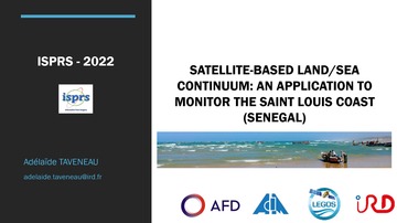
Satellite-Based Land/Sea Spatial Continuum: An Application To Monitor Saint Louis Coast (Senegal, West Africa)
Corresponding paper: SATELLITE-BASED LAND/SEA CONTINUUM: AN APPLICATION TO MONITOR THE SAINT LOUIS COAST (SENEGAL, WEST AFRICA)
Auhor(s): A. Taveneau, R. Almar, E. W. J. Bergsma, B. Sy, and A. Ndour
Volume: XLIII-B3-2022 / 2022
https://doi.org/10.5194/isprs-archives-XLIII-B3-2022-1005-2022
Fire Severity Assessment Of An Alpine Forest Fire With Sentinel-2 Imagery
Corresponding paper: FIRE SEVERITY ASSESSMENT OF AN ALPINE FOREST FIRE WITH SENTINEL-2 IMAGERY
Auhor(s): B. Leblon, F. Ogunjobi Oluwamuyiwa, E. Lingua, and A. LaRocque
Volume: XLIII-B3-2022 / 2022
https://doi.org/10.5194/isprs-archives-XLIII-B3-2022-1115-2022
Multi-Temporal Data Augmentation For High Frequency Satellite Imagery: A Case Study In Sentinel-1 And Sentinel-2 Building And Road Segmentation
Corresponding paper: MULTI-TEMPORAL DATA AUGMENTATION FOR HIGH FREQUENCY SATELLITE IMAGERY: A CASE STUDY IN SENTINEL-1 AND SENTINEL-2 BUILDING AND ROAD SEGMENTATION
Auhor(s): C. Ayala, C. Aranda, and M. Galar
Volume: XLIII-B3-2022 / 2022
https://doi.org/10.5194/isprs-archives-XLIII-B3-2022-25-2022
Deep View Aggregation In The Wild
Detecting And Evaluating Disturbance In Temperate Rainforest In Chile With Sentinel-2: Machine Learning And Forest Parameters
Corresponding paper: DETECTING AND EVALUATING DISTURBANCE IN TEMPERATE RAINFOREST WITH SENTINEL-2, MACHINE LEARNING AND FOREST PARAMETERS
Auhor(s): E. Kutchartt, J. Hernández, P. Corvalán, Á. Promis, and F. Pirotti
Volume: XLIII-B3-2022 / 2022
https://doi.org/10.5194/isprs-archives-XLIII-B3-2022-913-2022
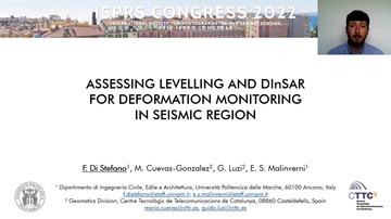
Assessing Levelling And Dinsar For Deformation Monitoring In Seismic Region
Corresponding paper: ASSESSING LEVELLING AND DINSAR FOR DEFORMATION MONITORING IN SEISMIC REGION
Auhor(s): F. Di Stefano, M. Cuevas-Gonzalez, G. Luzi, and E. S. Malinverni
Volume: XLIII-B3-2022 / 2022
https://doi.org/10.5194/isprs-archives-XLIII-B3-2022-263-2022
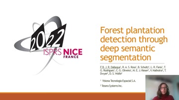
Forest Plantation Detection Through Deep Semantic Segmentation
Corresponding paper: FOREST PLANTATION DETECTION THROUGH DEEP SEMANTIC SEGMENTATION
Auhor(s): F. B. J. R. Dallaqua, R. A. S. Rosa, B. Schultz, L. R. Faria, T. G. Rodrigues, C. G. Oliveira, M. E. J. Kieser, V. Malhotra, T. Dwyer, and D. S. Wolfe
Volume: XLIII-B3-2022 / 2022
https://doi.org/10.5194/isprs-archives-XLIII-B3-2022-77-2022
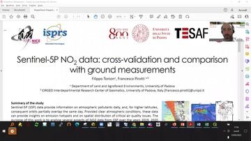
Tropospheric NO2 From Sentinel-5P: Cross-Validation And Comparison With Ground Measurements
Corresponding paper: SENTINEL-5P NO2 DATA: CROSS-VALIDATION AND COMPARISON WITH GROUND MEASUREMENTS
Auhor(s): F. Tonion and F. Pirotti
Volume: XLIII-B3-2022 / 2022
https://doi.org/10.5194/isprs-archives-XLIII-B3-2022-749-2022
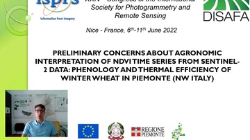
Preliminary Concerns About Agronomic Interpretation Of NDVI Time Series From Sentinel-2 Data: Phenology And Thermal Efficiency Of Winter Wheat In Piemonte (Nw Italy)
Corresponding paper: PRELIMINARY CONCERNS ABOUT AGRONOMIC INTERPRETATION OF NDVI TIME SERIES FROM SENTINEL-2 DATA: PHENOLOGY AND THERMAL EFFICIENCY OF WINTER WHEAT IN PIEMONTE (NW ITALY)
Auhor(s): A. Farbo, F. Sarvia, S. De Petris, and E. Borgogno-Mondino
Volume: XLIII-B3-2022 / 2022
https://doi.org/10.5194/isprs-archives-XLIII-B3-2022-863-2022
Using Long Short-Term Memory Model For Cloud Forest Vegetation Growth Status Prediction - A Case Study In Shei-Pa National Park
Corresponding paper: USING LONG SHORT-TERM MEMORY MODEL FOR CLOUD FOREST VEGETATION GROWTH STATUS PREDICTION – A CASE STUDY IN SHEI-PA NATIONAL PARK
Auhor(s): G. G. Wang and H. P. Tsai
Volume: XLIII-B3-2022 / 2022
https://doi.org/10.5194/isprs-archives-XLIII-B3-2022-1033-2022
Performance Evaluation Of Fusion Techniques For Cross-Domain Building Rooftop Segmentation
Corresponding paper: PERFORMANCE EVALUATION OF FUSION TECHNIQUES FOR CROSS-DOMAIN BUILDING ROOFTOP SEGMENTATION
Auhor(s): H. Li, J. Tian, Y. Xie, C. Li, and P. Reinartz
Volume: XLIII-B3-2022 / 2022
https://doi.org/10.5194/isprs-archives-XLIII-B3-2022-501-2022
Spatial Downscaling Of SMAP Soil Moisture Using The MODIS And SRTM Observations
Corresponding paper: SPATIAL DOWNSCALING OF SMAP SOIL MOISTURE USING THE MODIS AND SRTM OBSERVATIONS
Auhor(s): J. D. Mohite, S. A. Sawant, A. Pandit, and S. Pappula
Volume: XLIII-B3-2022 / 2022
https://doi.org/10.5194/isprs-archives-XLIII-B3-2022-933-2022
Predicting Vegetation Attributes With Neural Networks And Sentinel-1 And 2
Corresponding paper: PREDICTING VEGETATION ATTRIBUTES WITH NEURAL NETWORKS AND SENTINEL-1 &
Auhor(s): J. Muro, A. Linstädter, F. A. Männer, L.-M. Schwarz, J. Hoffmann, and O. Dubovyk
Volume: XLIII-B3-2022 / 2022
https://doi.org/10.5194/isprs-archives-XLIII-B3-2022-945-2022

Processing And Publishing The Active Deformation Areas Of All Europe - Concept And First Implementation Steps For A Low-Cost Solution
Corresponding paper: PROCESSING AND PUBLISHING THE ACTIVE DEFORMATION AREAS OF ALL EUROPE – CONCEPT AND FIRST IMPLEMENTATION STEPS FOR A LOW-COST SOLUTION
Auhor(s): J. A. Navarro, D. García, M. Crosetto, and O. Monserrat
Volume: XLIII-B3-2022 / 2022
https://doi.org/10.5194/isprs-archives-XLIII-B3-2022-313-2022

A 3D CNN Approach For Change Detection In Hr Satellite Image Time Series Based On A Pretrained 2D CNN
Corresponding paper: A 3D CNN APPROACH FOR CHANGE DETECTION IN HR SATELLITE IMAGE TIME SERIES BASED ON A PRETRAINED 2D CNN
Auhor(s): K. Meshkini, F. Bovolo, and L. Bruzzone
Volume: XLIII-B3-2022 / 2022
https://doi.org/10.5194/isprs-archives-XLIII-B3-2022-143-2022
HyperBlend: Simulating Spectral Reflectance And Transmittance Of Leaf Tissue With Blender
Corresponding paper: HYPERBLEND: SIMULATING SPECTRAL REFLECTANCE AND TRANSMITTANCE OF LEAF TISSUE WITH BLENDER
Auhor(s): K. A. Riihiaho, T. Rossi, and I. Pölönen
Volume: V-3-2022 / 2022
https://doi.org/10.5194/isprs-annals-V-3-2022-471-2022
Automatic Identification Method Of Construction And Demolition Waste Based On Deep Learning And Gaofen-2 Data
Corresponding paper: AUTOMATIC IDENTIFICATION METHOD OF CONSTRUCTION AND DEMOLITION WASTE BASED ON DEEP LEARNING AND GAOFEN-2 DATA
Auhor(s): K. Yang, C. Zhang, T. Luo, and L. Hu
Volume: XLIII-B3-2022 / 2022
https://doi.org/10.5194/isprs-archives-XLIII-B3-2022-1293-2022
Determination Of Chlorophyll Content In Selected Grass Communities Of Krkonose Mts. Tundra Based On Laboratory Spectroscopy And Aerial Hyperspectral Data
Corresponding paper: DETERMINATION OF CHLOROPHYLL CONTENT IN SELECTED GRASS COMMUNITIES OF KRKONOŠE MTS. TUNDRA BASED ON LABORATORY SPECTROSCOPY AND AERIAL HYPERSPECTRAL DATA
Auhor(s): L. Červená, G. Pinlová, Z. Lhotáková, E. Neuwirthová, L. Kupková, M. Potůčková, J. Lysák, P. Campbell, and J. Albrechtová
Volume: XLIII-B3-2022 / 2022
https://doi.org/10.5194/isprs-archives-XLIII-B3-2022-381-2022
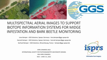
Multispectral Aerial Images To Support Biotope Information Systems For Midge Infestation And And Bark Beetle Monitoring
Corresponding paper: MULTISPECTRAL AERIAL IMAGES TO SUPPORT BIOTOPE INFORMATION SYSTEMS FOR MIDGE INFESTATION AND BARK BEETLE MONITORING
Auhor(s): L. Kemper, H. Kemper, and G. Kemper
Volume: XLIII-B3-2022 / 2022
https://doi.org/10.5194/isprs-archives-XLIII-B3-2022-893-2022
An Optimized Remote Sensing Recognition Approach For Straw Burning In Henan Province, China
Corresponding paper: AN OPTIMIZED REMOTE SENSING RECOGNITION APPROACH FOR STRAW BURNING IN HENAN PROVINCE, CHINA
Auhor(s): Y. Lin, Y. Rong, J. Yu, H. C. Zhang, and L. Li
Volume: XLIII-B3-2022 / 2022
https://doi.org/10.5194/isprs-archives-XLIII-B3-2022-127-2022
Improvement Of The Techniques For The Computation Of Evapotranspiration Maps
Corresponding paper: IMPROVEMENT OF THE TECHNIQUES FOR THE COMPUTATION OF EVAPOTRANSPIRATION MAPS
Auhor(s): L. Stucchi, M. Aiello, A. Gargiulo, and M. A. Brovelli
Volume: XLIII-B3-2022 / 2022
https://doi.org/10.5194/isprs-archives-XLIII-B3-2022-997-2022
Integration Of Geomatic Techniques For The 3D Representation And Monitoring Of A Veteran Chestnut Tree
Corresponding paper: INTEGRATION OF GEOMATIC TECHNIQUES FOR THE 3D REPRESENTATION AND MONITORING OF A VETERAN CHESTNUT TREE
Auhor(s): M. Balestra, S. Chiappini, A. Vitali, E. Tonelli, F. Malandra, A. Galli, C. Urbinati, E. S. Malinverni, and R. Pierdicca
Volume: XLIII-B3-2022 / 2022
https://doi.org/10.5194/isprs-archives-XLIII-B3-2022-833-2022
Infrastructure Monitoring Using the Interferometric Synthetic Aperture Radar (InSAR) Technique
Corresponding paper: INFRASTRUCTURE MONITORING USING THE INTERFEROMETRIC SYNTHETIC APERTURE RADAR (INSAR) TECHNIQUE
Auhor(s): Q. Gao, M. Crosetto, O. Monserrat, R. Palama, and A. Barra
Volume: XLIII-B3-2022 / 2022
https://doi.org/10.5194/isprs-archives-XLIII-B3-2022-271-2022
Active Learning On Large Hyperspectral Datasets: A Preprocessing Method
Corresponding paper: ACTIVE LEARNING ON LARGE HYPERSPECTRAL DATASETS: A PREPROCESSING METHOD
Auhor(s): R. Thoreau, V. Achard, L. Risser, B. Berthelot, and X. Briottet
Volume: XLIII-B3-2022 / 2022
https://doi.org/10.5194/isprs-archives-XLIII-B3-2022-435-2022

Urban Classification Based On Top-View Point Cloud And Sar Image Fusion With Swin Transformer
Corresponding paper: URBAN CLASSIFICATION BASED ON TOP-VIEW POINT CLOUD AND SAR IMAGE FUSION WITH SWIN TRANSFORMER
Auhor(s): R. Xue, X. Zhang, and U. Soergel
Volume: XLIII-B3-2022 / 2022
https://doi.org/10.5194/isprs-archives-XLIII-B3-2022-559-2022
InSAR Deformation Time Series Classification Using A Convolutional Neural Network
Corresponding paper: INSAR DEFORMATION TIME SERIES CLASSIFICATION USING A CONVOLUTIONAL NEURAL NETWORK
Auhor(s): S. M. Mirmazloumi, Á. F. Gambin, Y. Wassie, A. Barra, R. Palamà, M. Crosetto, O. Monserrat, and B. Crippa
Volume: XLIII-B3-2022 / 2022
https://doi.org/10.5194/isprs-archives-XLIII-B3-2022-307-2022
Ground Deformation Analysis Using Basic Products Of The Copernicus Ground Motion Service
Corresponding paper: GROUND DEFORMATION ANALYSIS USING BASIC PRODUCTS OF THE COPERNICUS GROUND MOTION SERVICE
Auhor(s): S. Shahbazi, M. Crosetto, and A. Barra
Volume: XLIII-B3-2022 / 2022
https://doi.org/10.5194/isprs-archives-XLIII-B3-2022-349-2022
Research On Quality Status Quo And Quality Evaluation Theory Of Natural Resources Remote Sensing Data And Common Products
Corresponding paper: RESEARCH ON QUALITY STATUS QUO AND QUALITY EVALUATION THEORY OF NATURAL RESOURCES REMOTE SENSING DATA AND COMMON PRODUCTS
Auhor(s): S. Yin, J. Zhang, H. Zhao, W. Gao, and K. Jia
Volume: XLIII-B3-2022 / 2022
https://doi.org/10.5194/isprs-archives-XLIII-B3-2022-1261-2022
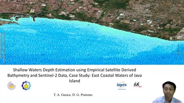
Shallow Waters Depth Estimation Using Empirical Satellite Derived Bathymetry And Sentinel-2 Data, Case Study: East Coastal Waters Of Java Island
Corresponding paper: SHALLOW WATERS DEPTH ESTIMATION USING EMPIRICAL SATELLITE DERIVED BATHYMETRY AND SENTINEL-2 DATA, CASE STUDY: EAST COASTAL WATERS OF JAVA ISLAND
Auhor(s): T. A. Gasica and D. G. Pratomo
Volume: XLIII-B3-2022 / 2022
https://doi.org/10.5194/isprs-archives-XLIII-B3-2022-93-2022

Application Of Pre-Trained Real World Super Resolution Models To Optical Satellite Image
Corresponding paper: APPLICATION OF PRE-TRAINED REAL-WORLD SUPER RESOLUTION MODELS TO OPTICAL SATELLITE IMAGE
Auhor(s): T. Shinohara, R. Ito, Y. Kobayashi, T. Satoh, Y. Shimazaki, and S. Nakamura
Volume: XLIII-B3-2022 / 2022
https://doi.org/10.5194/isprs-archives-XLIII-B3-2022-167-2022
Using Open Data Cube On The Cloud To Investigate Food Security By Means Of Cropland Changes In Djibouti
Corresponding paper: USING OPEN DATA CUBE ON THE CLOUD TO INVESTIGATE FOOD SECURITY BY MEANS OF CROPLAND CHANGES IN DJIBOUTI
Auhor(s): J. A. Wardle, V. Sagan, and F. Mohammed
Volume: XLIII-B3-2022 / 2022
https://doi.org/10.5194/isprs-archives-XLIII-B3-2022-1039-2022
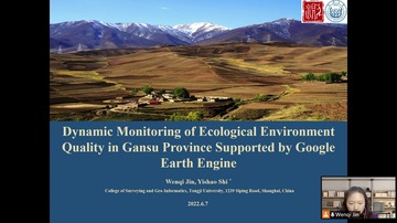
Dynamic Monitoring Of Ecological Environment Quality In Gansu Province Supported By Google Earth Engine
Corresponding paper: DYNAMIC MONITORING OF ECOLOGICAL ENVIRONMENT QUALITY IN GANSU PROVINCE SUPPORTED BY GOOGLE EARTH ENGINE
Auhor(s): W. Jin and Y. Shi
Volume: XLIII-B3-2022 / 2022
https://doi.org/10.5194/isprs-archives-XLIII-B3-2022-887-2022

An Adaptive Superpixels For Vegetation Detection On High Resolution Images Based On Mlp
Corresponding paper: AN ADAPTIVE SUPERPIXELS FOR VEGETATION DETECTION ON HIGH RESOLUTION IMAGES BASED ON MLP
Auhor(s): X. Tang, X. Huang, Z. Xiong, X. Wang, and Z. Zhan
Volume: XLIII-B3-2022 / 2022
https://doi.org/10.5194/isprs-archives-XLIII-B3-2022-187-2022
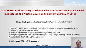
Spatiotemporal Recovery Of Himawari-8 Hourly Aerosol Optical Depth (AOD) Products Via The Nested Bayesian Maximum Entropy Method
Corresponding paper: SPATIOTEMPORAL RECOVERY OF HIMAWARI-8 HOURLY AEROSOL OPTICAL DEPTH PRODUCTS VIA THE NESTED BAYESIAN MAXIMUM ENTROPY METHOD
Auhor(s): X. Xia, Z. Zhu, T. Zhang, G. Wei, and Y. Ji
Volume: XLIII-B3-2022 / 2022
https://doi.org/10.5194/isprs-archives-XLIII-B3-2022-545-2022
Characteristics Of Human Activity In China's Coastal Zone Based On Multi-Source Spatio-Temporal Data
Corresponding paper: CHARACTERISTICS OF HUMAN ACTIVITY IN CHINA’S COASTAL ZONE BASED ON MULTI-SOURCE SPATIO-TEMPORAL DATA
Auhor(s): Y. Gao, J. Liu, W. Li, Y. Lei, Y. Zou, and L. Cui
Volume: V-3-2022 / 2022
https://doi.org/10.5194/isprs-annals-V-3-2022-397-2022
A Remote Sensing Satellite Lightning Detection System With High Detection Rate And Low Complexity
Corresponding paper: A REMOTE SENSING SATELLITE LIGHTING DETECTION SYSTEM WITH HIGH DETECTION RATE AND LOW COMPLEXITY
Auhor(s): Y. Guo, N. Yin, W. Wu, J. Huang, and Q. Wang
Volume: XLIII-B3-2022 / 2022
https://doi.org/10.5194/isprs-archives-XLIII-B3-2022-101-2022
Comparison Of Machine Learning Classifiers For Multitemporal And Multisensor Mapping Of Urban Lulc Features
Corresponding paper: COMPARISON OF MACHINE LEARNING CLASSIFIERS FOR MULTITEMPORAL AND MULTISENSOR MAPPING OF URBAN LULC FEATURES
Auhor(s): Y. Ouma, B. Nkwae, D. Moalafhi, P. Odirile, B. Parida, G. Anderson, and J. Qi
Volume: XLIII-B3-2022 / 2022
https://doi.org/10.5194/isprs-archives-XLIII-B3-2022-681-2022

Advances In Optical Polarization Remote Sensing For Marine Observation: A Case Study In Nanchang River Park
Corresponding paper: ADVANCES IN OPTICAL POLARIZATION REMOTE SENSING FOR MARINE OBSERVATION: A CASE STUDY IN NANCHANG RIVER PARK
Auhor(s): F. Zhang, Z. Zhang, L. Yan, J. Ding, K. Jiang, Y. Zhang, and Z. Cui
Volume: V-3-2022 / 2022
https://doi.org/10.5194/isprs-annals-V-3-2022-101-2022