New Webinar Series by ISPRS TC IV
ISPRS TC IV will offer a webinar series 'State-of-the-art in Spatial Information Science' until the 2022 Congress, which will be presented by a different working group each month. More information on the series can be found here. The first webinar in this series is:
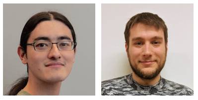
Ken Arroyo Ohori and Stelios Vitalis
CityJSON, a JSON-based encoding for storing 3D city models
Thursday, 01.07.2021 at 16:00 UTC
ABSTRACT
3D models (or digital twins) of cities are more and more common for urban management and development of smart cities. They rely on standard models for efficient data storage and processing. This webinar will introduce CityJSON, a JSON-based encoding for storing 3D city models. It is a user- and developer friendly standard that is ready for the web. The webinar will present the basic structure of CityJSON and simple tools for creating and processing models.
BIOGRAPHY
Ken Arroyo Ohori is a postdoc researcher at the 3D geoinformation group at TU Delft. He is a contributor to CityJSON and a developer of some tools that work with it.
Stelios Vitalis is a GIS software engineer who has developed GIS solutions related to the Greek Cadastre for 10 years and has worked as a short term consultant for the World Bank. He is currently a PhD candidate in the 3D Geoinformation group at TU Delft, working on the 4D representation of multi-scale 3D city models. He is the author of the CityJSON loader plugin for QGIS, ninja (the official CityJSON viewer) and has been involved in the development of the Blender CityJSON plugin. He is actively involved in the formulation of the CityJSON specification and working on the incorporation of versioning in 3D city models.
MODERATOR
Umit Isikdag is a Professor in the Department of Informatics and the coordinator of MSc. Program on Architectural and Urban Informatics in Mimar Sinan Fine Arts University. His key research interests are BIM,3D GIS, BIM-GIS Integration, City Modeling, Machine and Deep Learning for AEC/ GIS, Indoor Modeling, Internet of Things, Service-Oriented Architectures He is involved in the organization of 3D GeoInfo, GeoAdvances and Eurasian BIM Forum Conferences.