Resource and Environmental Monitoring
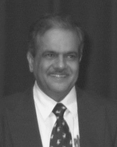
President | |
 | Rangnath Navalgund
|
Secretary | |
 | Shailesh Nayak
|
Terms of Reference
- Spectral, spatial, and temporal radiation properties of objects
- Methodology of computer-aided interpretation and analysis of sensor data
- Environmental studies, resource inventories, and interpretative aspects of thematic mapping as applied in studies of vegetation,forestry, agriculture, soils, land and water use, geology, geomorphology, hydrology, oceanography, coastal zones, snow and ice, atmospheric sciences, archaeology, human settlements and engineering
- Integration of remote sensing and GIS techniques for spectral, spatial, temporal, and process modeling, and monitoring of resources and the environment
- Applications of remotely sensed data for disaster monitoring, mitigation and assessment
- Use of remotely sensed data and global databases to support sustainable development and application in determination of indices of change to support global modeling and monitoring
WORKING GROUPS of ISPRS COMMISSION VII
WG VII/1 - Fundamental Physics and Modelling
WG VII/1 Terms of Reference
- Study of spectral, spatial and temporal signatures of various earth surface features (land and ocean) with special reference to hyper spectral and microwave aspects
- Studies to understand view angle effects on spectral signatures
- System studies to define a set of sensors / constellation of satellites for a theme application and radiometric and geometric calibration requirements; in conjunction with WG I / 2
- Investigations in the area of retrieval of geophysical parameters
- Cooperation with WG III/5 on advance information extraction techniques : classifiers, data fusion techniques
- Cooperation with institutions maintaining data bases on spectral signatures, CEOS Cal / Val group and SIG on Imaging Spectrometry
WG VII/2 - Sustainable Agriculture & Eco-system Approach
WG VII/2 Terms of Reference
- Improve crop monitoring and yield modelling methodology with synergistic use of space, agrometeorology and in-situ observations in GIS environment
- Investigate the interaction of agriculture with ecosystems, especially management that reduces agricultural impacts on the environment
- Geo-information and management requirements for the ecosystem approach
- Optimal use of agriculture inputs for precision farming employing high spatial and spectral resolution and other data
- Improving models for assessment, efficient utilisation and conservation of water resources for agriculture using optical, thermal and microwave data with other data
- Integrated studies for cropping systems in various regional set-ups for attaining sustainable agriculture
WG VII/3 - Integrated Monitoring Systems for Resource Management
WG VII/3 Terms of Reference
- Modelling and management of natural resources using integration of RS, in-situ measurements and other data in GIS environment
- Use of spatial information systems for generating alternate scenarios to facilitate monitoring and optimal management: forestry, geology, hydrology, coastal zones, snow and ice
- Integrated services involving economic, technical and political aspects
- Contribute to the establishment of reliable indicators of sustainability
- Cooperation with international environmental programmes such as IGBP for development of process-based models to sustainability
WG VII/4 - Human Settlement and Impact Analysis
Chair
Gabor Remetey-Fulopp
Co-Chair
Carsten Juergens
WG VII/4 Terms of Reference
- Data analysis for studying urban land use for better urban planning using aerial and high spatial resolution space borne data
- Remote observations for monitoring urban environment and change detection
- Use of Remote Sensing & GIS for infrastructure development for rural settlements
- Study impact of urbanization, industrial growth, mega engineering structures on ecological and social environment, urban sustainability; tracking of disease vectors
- Documentation, conservation and management of natural heritage and cultural landscapes in co-operation with UNESCO/ICOMOS/CIPA
- Interface with IHDP
WG VII/5 - Disaster Monitoring, Mitigation and Damage Assessment
WG VII/5 Terms of Reference
- Identification of potential risk zones for different type of disasters such as forest fire, cyclone, floods, volcanoes, earthquake, land slides etc.
- Integrated observation and communication strategies for disaster detection, monitoring and damage assessment in co-operation with CEOS and IGOS
- Enhance predictive modelling capabilities
- Development of disaster management plans for pre, during and post disaster situations
- Foster the creation of more effective information systems to support disaster management activities
WG VII/6 - Monitoring and Modelling Global Change
WG VII/6 Terms of Reference
- Use of long term regional and global data bases using historical and satellite data over terrestrial eco-systems, snow and glaciers, atmosphere, oceans to monitor and model global change in cooperation with WG IV/8
- Evolve standards for data exchange and quality evaluation of satellite derived bio-geophysical parameters
- Develop strategies and algorithms for assimilating remotely sensed data in global change models
- Co-operation with international programmes to support implementation of international policies and treaties