Photogrammetric Computer Vision and Image Analysis
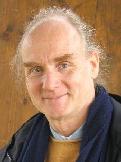
President | |
 | Wolfgang Förstner
|
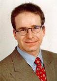
Vice President | |
 | Helmut Mayer
|
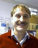
Secretary | |
 | Karl-Heiko Ellenbeck
|
Terms of Reference
The goal of the work in Commission III is to design, develop and evaluate mathematical models and methods for automatic
- orientation and calibration of images,
- surface reconstruction,
- fusion of multi-model data,
- processing and interpretation of laser range data,
- interpretation of images and
- image sequence analysis
with emphasis on
- integration of geometry, statistics and semantics,
- modeling of spatial objects and temporal events,
- modeling context,
- scale behaviour of appearance models,
- use of graphical models, especially Markov random fields and Bayesian networks.
WORKING GROUPS of ISPRS COMMISSION III
INTERCOMMISSION WGs of ISPRS COMMISSION III
ICWG III/V - Image Sequence
ICWG III/V Terms of Reference
- To research in the following topics: tracking single and multiple objects, ego-motion determination for navigation, object and event reconstruction from single and multiple video streams, camera and camera network calibration from video sequences including cameras with non-standard geometry, object identification from video sequences.
WG III/1 - Automatic Calibration and Orientation of Optical Sensors
Secretary
Johannes Otepka
WG III/1 Terms of Reference
- Promote within ISPRS more or less fully automatic methods for calibration and orientation without requiring markers. Current state-of-the-art methods are to be tested with respect to general applicability and robustness. Thereby, a further refinement and robustification of these methods is to be fostered
- WG III/1 will therefore provide various test data sets for image calibration/orientation tasks and invite researchers to evaluate their algorithms against known ground truth data with respect to general applicability and robustness.
WG III/2 - Surface Reconstruction
Co-Chair
Daniel Scharstein
Secretary
Volker Rodehorst
WG III/2 Terms of Reference
- Promote more or less fully automatic methods for surface reconstruction. Current state-of-the-art methods with respect to general applicability, reliability and performance are to be tested.
- WG III/2 will therefore provide various synthetic and real test data sets for surface reconstruction tasks and invite researchers to evaluate their algorithms against known ground truth data.
WG III/3 - Processing of Point Clouds from Laser Scanners and Other Sensors
WG III/3 Terms of Reference
- Analyse point clouds from laser range finders, but also from multiple view image matching as basis for surface and object reconstruction as well as interpretation. Special problems to be addressed are segmentation and filtering, generation of digital surface models and digital elevation models, earth surface characterization, and automated as well as semi-automated extraction of objects from multiple sources (close range and aerial scans, RGB, NIR and others). There is a close cooperation with the WG V/3 on 'Surface and object reconstruction from terrestrial laser scanners'.
WG III/4 - Automatic Image Interpretation for City-modelling
Chair
Franz Rottensteiner
WG III/4 Terms of Reference
- Develop and analyse various methods for automatically and efficiently generating high resolution 3D-city models, integrating all types of topographic features, especially buildings and vegetation. Problems addressed are the interpretation of the aerial, space borne and terrestrial image, laser, and (In)SAR data possibly together with information from traditional cartographic products, CAD models, and urban GIS, automatic as well as semi-automatic generation of urban models with level-of-detail (LOD) and inferred attribution including analysis of the trade-off between geometry and radiometry / texture for visualization and the assessment of efficiency and quality of techniques for extraction of buildings and vegetation and their dependence on the quality of the input data.
WG III/5 - Models and Algorithms for Road Extraction and Traffic Monitoring
WG III/5 Terms of Reference
- Develop, implement, and test models and strategies for automated 2 1/2 D and 3 D road extraction from optical, radar, and laser data. Particular areas of interest are the modelling of to model road crossings for data interpretation, the extraction of road attributes, to develop and test algorithms for detection and velocity estimation of methods for micro- and macro-scale traffic monitoring.