
XXIV ISPRS Congress
Nice, France, 06.06.2022 - 11.06.2022
Organizer: Société Française de Photogrammétrie et de Télédétection / Nicolas Paparoditis
Type of Event: Congress
Multi Media Type: Hybrid
Session: P_05
Poster Session 5 - 8th June - Poster 2020/2021
Single Presentations

Spatio Temporal Data Cube Applied To Ais Containerships Trend Analysis In The Early Years Of The Belt And Road Initiative - From Global To Local Scale
A Review Of The One Parameter Division Undistortion Model
Relative Radiometric Normalization Using Several Automatically Chosen Reference Images for Multi-sensor, Multi-temporal Series

Building Outline Extraction From Aerial Imagery And Digital Surface Model With A Frame Field Learning Framework
Drone Data Atmospheric Correction Concept For Multi- And Hyperspectral Imagery - The Droacor Model
Towards Detection Of Thermal Anomalies In Large Urban Areas Using Simulation
Fusion Of Photo With Airborne Laser Scanning
A Terrestrial Laser Scanning Measurement Station To Monitor Long-Term Structural Dynamics In A Boreal Forest
DTM Correction In Areas Of Steep Slopes
DISIR: Deep Interactive Segmentation With Interactive Refinements

Strategies To Integrate Imu And LiDAR SLAM For Indoor Mapping
LOD3 Building Reconstructon From Multi-Source Images
Towards more efficient UAS data acquisition: camera auto mount pivoting oblique survey
Deriving Exclusion Maps From C-Band SAR Time-Series: An Additional Information Layer For SAR-Based Flood Extent Mapping
Indoor 3D Point Clouds Semantic Segmentation Bases On Modified Pointnet Network
Scan Angle Impact On LiDAR-Derived Metrics Used In Aba Models For Prediction Of Forest Stand Characteristics: A Grid Based Analysis
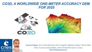
CO3D, A Worldwide One Meter Accuracy Dem For 2025
Virtual Terrestrial Laser Scanner Simulator For Digitalization Of Teaching Environments: Concepts And First Results.
Body Of Knowledge For The Earth Observation And Geoinformation Sector - A Basis For Innovative Skills Development

Bidirectional Multi-Scale Attention Networks For Semantic Segmentation Of Oblique UAV Imagery
Estimation Of Soil Losses By The Improved Tillage Homogenization Model And Rusle Model

Valuation Of 3D UAs Flight Path Planning Algorithms
Live Extraction Of Curvilinear Structures From LiDAR Raw Data
Estimation Of Soil Bulk Density And Carbon Using Multi-Source Remotely Sensed Data
Smart Fusion Of Mobile Laser Scanner Data With Large Scale Topographic Maps

A New Stereo Dense Matching Benchmark Dataset For Deep Learning

Behaviour Control With Augmented Reality Systems For Shared Spaces

Building Outline Delineation: From Very High Resolution Remote Sensing Imagery To Polygons With An Improved End-To-End Learning Framework