Submission name:
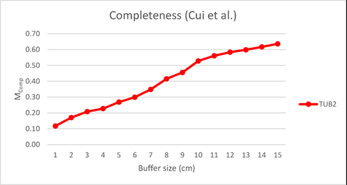
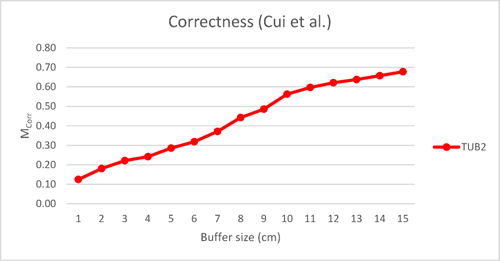
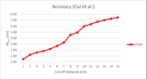
Cui et al.
Short description of the method:
According to the histogram of Z coordinates, the point cloud is divided into multiple floors. Then, plane segmentation is applied and the points are given initial labels. The detected planes divide the scene into many polygons. The label of each polygon is determined by using multi-label graph cut. Vector segmentation and reconstruction of rooms are done by the energy minimization of multi-label graph cut. The reconstructed model includes ceilings, floors, windows, doors, walls.
Reference:
Not provided
URL:
Not provided.
Submission date:
16 Jul. 2018
Last update:
16 Jul. 2018


