Data description
The data set contains 33 patches (of different sizes), each consisting of a true orthophoto (TOP) extracted from a larger TOP mosaic, see Figure below and a DSM. For further information about the original input data, please refer to the data description of the object detection and 3d reconstruction benchmark.
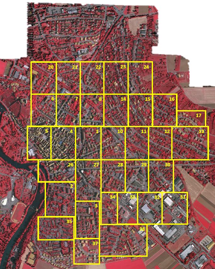
Outlines of all patches given in Tab.1 overlaid with the true orthophoto mosaic. Numbers refer to the individual patch numbers as written at the filename endings
The ground sampling distance of both, the TOP and the DSM, is 9 cm. The DSM was generated via dense image matching with Trimble INPHO 5.3 software and Trimble INPHO OrthoVista was used to generate the TOP mosaic. In order to avoid areas without data (“holes”) in the TOP and the DSM, the patches were selected from the central part of the TOP mosaic and none at the boundaries. Remaining (very small) holes in the TOP and the DSM were interpolated.
The TOP are 8 bit TIFF files with three bands; the three RGB bands of the TIFF files correspond to the near infrared, red and green bands delivered by the camera. The DSM are TIFF files with one band; the grey levels (corresponding to the DSM heights) are encoded as 32 bit float values. The TOP and the DSM are defined on the same grid, so that it is not necessary to consider the geocoding information in the processing.
Labelled ground truth is provided for only one part of the data (example patch below). The ground truth of the remaining scenes will remain unreleased and stays with the benchmark test organizers to be used for evaluation of submitted results. Participants shall use all data with ground truth for training (see Table) or internal evaluation of their method.
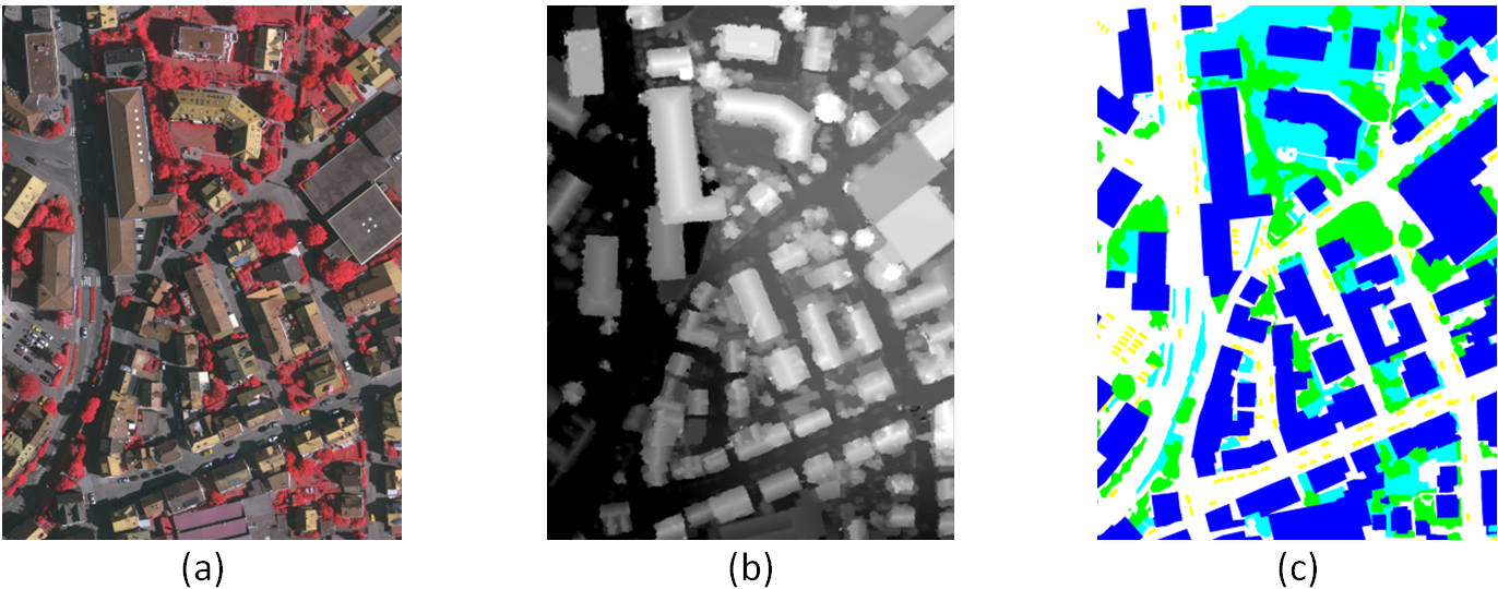
Example patches of the semantic object classification contest with (a) true orthophoto, (b) DSM, and (c) ground truth
Participants are requested to submit labelled images in exactly the same format as the provided ground truth (8bit RGB tif-files with exactly the same colours per category, see list below) for the part without ground truth (patches without filenames in column GT in the Table). These results will be used for checking against ground truth by the benchmark organizers. See below for some more details about result submission.
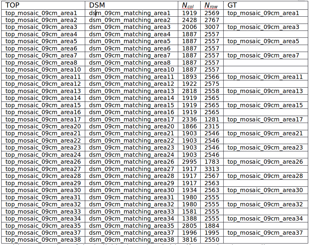
Overview of the individual patches (with .tif extensions). TOP: Filename of true orthophoto. DSM: Filename of DSM. Ncol, Nrow: number of columns and rows. GT: Filename containing the ground truth (empty if not made available to participants and used by the benchmark organizers for evaluation of the results)