
ISPRS Technical Commission IV Symposium
Perth, Australia, 22.10.2024 - 25.10.2024
Organizer: Geospatial Council of Australia / Sisi Zlatanova
Type of Event: Symposium, Multi Media Type: In-person
WG1
Spatial Data Representation and Interoperability
Predicting building characteristics at urban scale using graph neural networks and street-eve context
An improved test for the accuracy of spatial point pattern tests-application to road networks
WG2
Artificial Intelligence and Uncertainty Modeling in Spatial Analysis
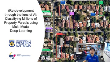
(Re)development through the lens of Al: Classifying Millions of Property Parcels using Multi-Modal Deep Learning
Deep Learning for Vegetation Segmentation from MLS point cloud in Urban Setup
A world imagined by Al with generated spatial data
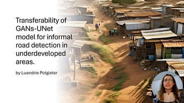
Transferability of GANs-UNet model for informal road detection in underdeveloped areas
Cross-domain Super-Resolution Reconstruction of Urban Hyperspectral Remote Sensing Images Based on Conditional Diffusion Models
Exploring Hydro-Meteorological Changes in the East Asia: A Semi-Hidden Markov Model Approach to ENSO Dynamics
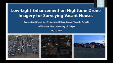
Low-Light Enhancement on Nighttime Drone Imagery for Surveying Vacant Houses
WG3
Geo-computation and Geo-simulation
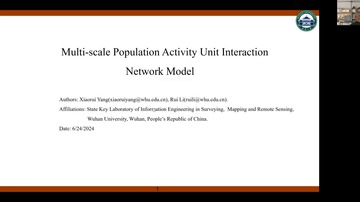
Multi-scale Population Activity Unit Interaction Network Model
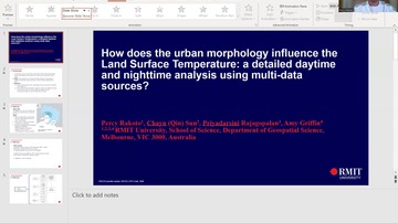
How does the urban morphology influence the Land Surface Temperature: a detailed daytime and nighttime analysis using multi-data sources?
WG4
Data Management for Spatial Scenarios
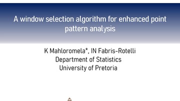
A window selection algorithm for enhanced point pattern analysis
WG5
Extended Reality and Visual Analytics
Global Streetscapes: A comprehensive dataset of 10 million street-level images across 688 cities for urban science and analytics
WG6
Human Behaviour and Spatial Interactions
Impacts of the built environment on traffic congestion: A case study of New York City
Identifying geographical flow clusters by detecting spatial partitioning flow for origin-destination data with scale heterogeneity
WG7
Intelligent Systems in Sensor Web and IoT

Integration Between the Internet of Things and Extended Reality Technologies
Smart Water Management and the Power of Collaboration
WG9
Spatially Enabled Urban and Regional Digital Twins
A Study on Digital Twin-Driven Governance Framework for Urban Public Service Facilities
Urban Point cloud Semantic Segmentation via Scale-Aware Feature Enhance and Long-context fusion
City-Scale Spatial Digital Twins for Rooftop PV Energy Analysis: A Proof-of-Concept Framework
WG10
Applied Spatial Science for Public Health
Machine Learning-Based Dengue Risk Assessment using Climate and Environmental Satellite Data
ICWG IV/III
Global Mapping for SDGs
Hyperspectral inversion of soil heavy metal content in the lead-zinc mining collection area
Quantified Evaluation of Historic District Landscape Characteristics: A Case Study of Beishan Street in Hangzhou, China
Efficacy of the SDGSAT-1 Glimmer Imagery in Measuring Sustainable Development Goal Indicators
An Automatic Updating Method for Complex Polygons Based on Topological Relationships
ICWG IV/III/II
Openness in Geospatial Science and Remote Sensing
Introduction of LiDAR range equation to improve radiometric uncertainty of terrestrial laser scanning (TLS)
Assessing the Availability of Public Domain Datasets for Monitoring Mine Rehabilitation Performance in Australia Using Remote Sensing
UPINLBS
Ubiquitous Positioning, Indoor Navigation and Location-based Service
Enhanced Anti-Jamming performance in GNSS Receivers: An Adaptive Method
A robust algorithm for low-cost MEMS IMU vehicle integrated navigation based on motion constraint and BP neural network

The State-of-the-Art in Smartphone Positioning