XXIV ISPRS Congress
Nice, France, 06.06.2022 - 11.06.2022
Organizer: Société Française de Photogrammétrie et de Télédétection / Nicolas Paparoditis
Type of Event: Congress, Multi Media Type: Hybrid
Plenary 2
Chair(s): HALOUNOVA Lena
Plenary 3
Chair(s): TOTH Charles

Plenary 4
Chair(s): LI Songnian
Plenary 5
Chair(s): HEIPKE Christian
Plenary 6 - Closing Ceremony
Chair(s): PAPARODITIS Nicolas
Plenary 1 - Opening Ceremony
Chair(s): PAPARODITIS Nicolas
Poster Session 1 - 7th June - TCIII-Remote Sensing
Poster Session 2 - 7th June - TCII-Photogrammetry
Poster Session 3 - 7th June - TS-LULC Change Detection and Updating
Poster Session 4 - 8th June - Invited Poster
Poster Session 5 - 8th June - Poster 2020/2021
Poster Session 7 - 8th June - TCI-Sensor Systems
Poster Session 8 - 8th June - TCIV-Spatial Information Science
Poster Session 9 - 8th June - TCV-Education and Outreach
Poster Session 11 - 8th June - TS-Scientific and Educational & Capacity Building Initiatives
Poster Session 15 - 9th June - Invited Poster
Poster Session 16 - 9th June - TCIII-Remote Sensing
Poster Session 18 - 9th June - TCIV-Spatial Information Science
Poster Session 19 - 9th June - TS-Cultural Heritage Documentation
Poster Session 20 - 10th June - Poster 2020/2021
Poster Session 21 - 10th June - Student Poster
Poster Session 22 - 10th June - TCII-Photogrammetry
Poster Session 23 - 10th June - TCI-Sensor Systems
Disaster Assessment, Monitoring and Management (ICWG III/IVa-2)
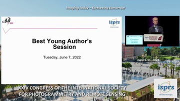
Best Young Author Paper Award Session
Chair(s): HEIPKE Christian, PAPARODITIS Nicolas
3D mapping for infrastructure monitoring
Environment and Health (ICWG III/IVc)
Geovisualization and extended reality
Capacity development for geoinformation science
Chair(s): KUMAR Senthil
Cryosphere and Hydrosphere(WG III/9)
Landuse and Landcover Change Detection (WG III/7-1)
Chair(s): LANDRIEU Loic, RUPNIK Ewelina
Point cloud processing_18
Planetary Remote Sensing and Mapping (ICWG III/II)
Image Orientation, Point Cloud Generation/Processing
Point cloud processing_22
Chair(s): NOCERINO Erica, ROTTENSTEINER Franz
Hyperspectral Image Processing(WG III/4)
Spaceborne Optical Sensing
Open data and crowd sourcing
Agriculture and Natural Ecosystems Modelling and Monitoring (WG III/10-1)
Chair(s): PIROTTI Francesco, YOSHIMURA Mitsunori
Indoor applications and mobility
Mobile Mapping (Technology, Methods, Applications)
Chair(s): CHENG Kai-Wei, EL-SHEIMY Naser
SAR-based Surface Generation and Deformation Monitoring (WG III/3)
Integrated Sensor Orientation, Navigation and Mapping
Chair(s): COLOMINA Ismael, CRAMER Michael
Surface reconstruction, SFM
Remote Sensing Data Fusion (WG III/6)
Spatial applications based on urban and regional Digital Twins Part 1

Orientation and Calibration, Surface reconstruction and buildings_35
Chair(s): ROSCHER Ribana, WEGNER Jan Dirk
Landuse and Landcover Change Detection (WG III/7-2)
Microwave Remote Sensing (WG III/2 + III/5)
Spatial applications based on urban and regional Digital Twins Part 2
Chair(s): AGUGIARO Giorgio, BOGUSLAWSKI Pawel
Thematic Information Extraction from RS images(WG III/1-2)
Remote Sensing Data Quality(ICWG III/IVb-2)
Orientation and Calibration, Surface reconstruction and buildings_40
Uncertainty and spatial analysis
Chair(s): DELAVAR Mahmoud Reza, MOSTAFAVI Mir Abolfazl
Agriculture and Natural Ecosystems Modelling and Monitoring (WG III/10-2)
Semantic information extraction, deep learning_43
Chair(s): QIN Rongjun, ROSCHER Ribana
Remote Sensing of Atmospheric Environment (WG III/8)

Disaster Assessment, Monitoring and Management (ICWG III/IVa-1)
Chair(s): CHANDRA Madhu, TANZI Joseph
Semantic information extraction, deep learning_46
New sensor technologies, benchmarking and validation
Spatial analysis and data management
Remote Sensing Data Quality(ICWG III/IVb-1)
Chair(s): BARSI Árpád, BLASCHKE Thomas
Semantic information extraction, deep learning_50
UAS Applications and Robotics
Agriculture and Natural Ecosystems Modelling and Monitoring (WG III/10-3)
Thematic Information Extraction from RS images(WG III/1-1)
Chair(s): LEBLON Brigitte, MELIS Maria Teresa
Active Sensing with LIDAR and RADAR
Semantic approaches for processing data and SDSS
Cultural Heritage Documentation
SAM: Simultaneous Adjustment And Mapping Using SLAM & ISO_12
SAM: Simultaneous Adjustment And Mapping Using SLAM & ISO_13
ISPRS Scientific and Educational & Capacity Building Initiatives
Towards Resilient and Ubiquitous Navigation
Towards Resilient and Ubiquitous Navigation
Unsupervised And Weakly Supervised Deep Learning For Eo
Deep Learning For Satellite Image Time Series Analysis
Digital twins I: Vision papers
Digital twins II: Case studies
EuroSDR theme session for National Mapping and Cadastral Agencies
LULC Change Detection And Updating
News Approaches in Radio Sciences for Disaster Management and Remote Sensing
Reality Capture And Quality Inspection In Digital Construction_9