Data Sets Sainte-Maxime & Hong Kong
Since its launch on 9th, January 2012, China’s first civilian high resolution stereo mapping satellite ZY-3 has provided a reliable stream of high resolution stereo image data. ZY-3 produces three line-array stereo panchromatic images (2.1-meter for nadir,3.5-meter for forward and backward) and 5.8-meter multispectral (red, blue, green, near infrared) imagery that can be combined in a variety of ways to accommodate a wide range of high-resolution imagery applications.
View more info on SASMAC (Satellite surveying and mapping application center, NASG). And the website is http://www.sasmac.cn/portal_space/ (In English)
The experimental data is covering the Sainte-Maxime of France and Hong Kong of China, respectively. Every region contains four folders, which means four camera of ZY-3 (Nadir, Forward, Backward and Multispectral imagery). Every folder contains the SC imagery (sensor corrected imagery) and standard RPC file, and the shape file is put in the sub-folder named as ”GeoRange”.
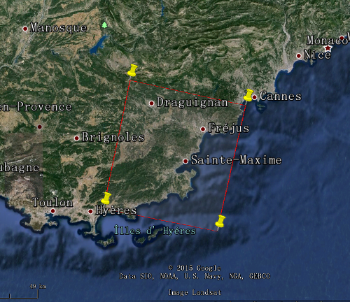
The four corners of the imagery covering the Sainte-Maxime are Left-Upper: 6.349°E and 43.628°N, Right-Upper: 6.968°E and 43.523°N, Left-Bottom: 6.196°E and 43.132°N, Right-Bottom: 6.811°and 43.031°N for, which is illustrated on Figure. 1. And the preview of ZY-3 multispectral imagery is showed on Figure.2.
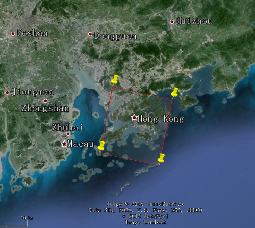
The four corners of the imagery covering the Hong Kong are Left-Upper: 113.935°and 22.625°N , Right-Upper: 114.419°E and 22.531°, Left-Bottom: 113.828°E and 22.129°, Right-Bottom: 114.309°E and 22.037°N, which is illustrated on Figure.3. And the preview of ZY-3 multispectral imagery is showed on Figure.4.
If you are planning to use this dataset, please send a short E-mail to ff@sasmac.cn or ligy@sasmac.cn, from which you can get help about the dataset.
Data set 1: Sainte-Maxime
|
| Figure 1. The illustration of ZY-3 images covering Sainte-Maxime of France,
on GoogleEarth.
|
Extent:
| 6.349°E | 43.628°N | 6.968°E | 43.523°N |
| 6.196°E | 43.132°N | 6.811°E | 43.031°N |
| Captured Time: 27th,Aug 2014. |
Data:
|
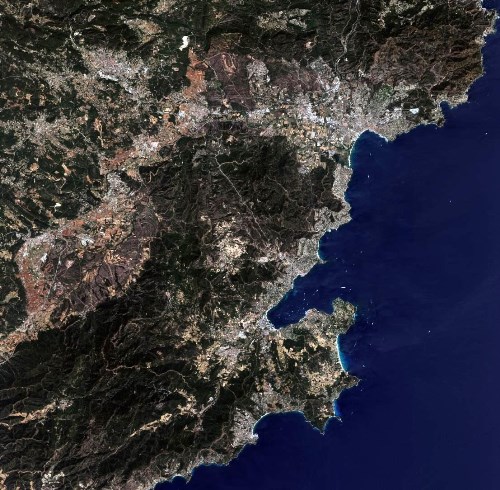
| Figure 2. The preview of ZY-3 multispectral imagery covering Sainte-Maxime of France
|
For this test data set reference data have been provided by IGN - DRE
Nicolas Paparoditis
Directeur Scientifique
Data set 2: Hong Kong
|
| Figure 3. The illustration of ZY-3 images covering Hong Kong of China, on GoogleEarth.
|
Extent:
| 113.935°E | 22.625°N | 114.419°E | 22.531°N |
| 113.828°E | 22.129°N | 114.309°E | 22.037°N |
| Captured Time: 8th,March 2013. |
Data:
|
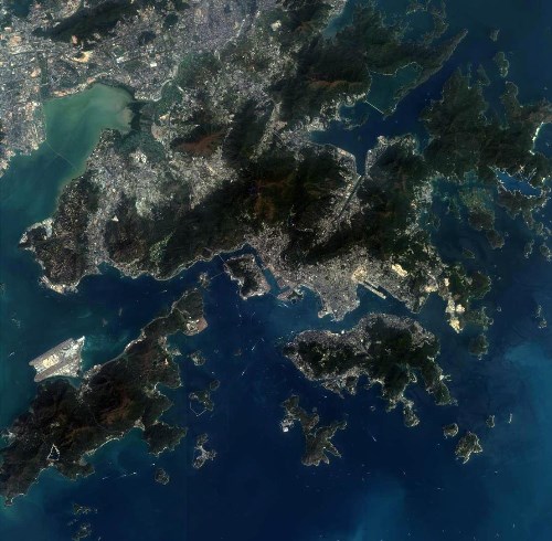
| Figure 4. The preview of ZY-3 multispectral imagery covering HongKong of China
|
© Sasmac
